Cancel

    Open app

    Search

    Lorain/Stonycreek Hiking Trails

    5.0 (1 review)

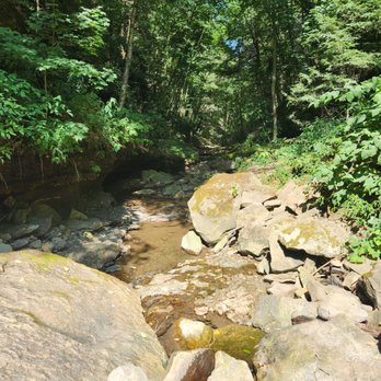
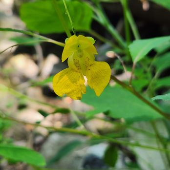
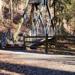
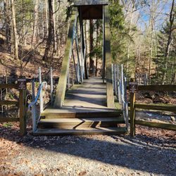
    Lorain/Stonycreek Hiking Trails Photos

    Recommended Reviews - Lorain/Stonycreek Hiking Trails

    Your trust is our priority, so businesses can't pay to alter or remove their reviews. Learn more about reviews.
    Yelp app icon
    Browse more easily on the app
    Review Feed Illustration

    2 years ago

    Helpful 0
    Thanks 0
    Love this 0
    Oh no 0

    Verify this business for free

    People searched for Hiking 184 times last month within 15 miles of this business.

    Verify this business

    Prince Gallitzin State Park

    Prince Gallitzin State Park

    4.9
    (11 reviews)
    30.8 mi

    Growing up in an area, you never really understand what you have until you move away. You may have…read morethought that this was so boring to come here. You may think why are we going here. But when you move away, and come back for a visit, you want to revisit the area. First and foremost, nobody from this area ('locals' as the out-of-towners say) refers to this as Prince Gallitzin, Prince Gallitzin State Park, or PGSP. So stop it, it's not cute. We simply refer to it as Glendale. Yes, that is the name of the lake, but it is so much more simply to say Glendale than any form/combination you can come up with. The 'locals' here have it right, and you will not win an argument about it. What is appealing about this place is the many things you can do. Camping, swimming, boating, fishing, hiking, feed the deer, playgrounds, grilling, I could keep going. I spent many weekends here camping (to note: I am not a camper). With that, it was like I memorized a good portion of this park. When you camp, you hike, when you hike, you stumble upon a lot of the park. But, it is nearly impossible to see the whole park by foot, you will need a vehicle of some sort. The shoreline of the lake is 26 miles long. But there are so many more things to do in this area. Headache Hill is a favorite. Nothing more than a water tank tower on top of a highpoint. When open, you can climb the water tower and view the park in every direction. Uninterrupted views. The marina is a highlight. The "beach" is another highpoint. There can technically be a lot of beaches here. Be sure to check out the Killbuck Boat Ramp area. You can rent boats here to go out on the lake. You can also launch your boat here (one of very many places to do so). This is also where you can feed the deer. It is almost like clockwork. But be very aware of your surroundings. Feeding deer can draw other wildlife and a bear or two have been spotted here. If geocaching is your thing. There area a ton in the area. Hungry, check out Pirates Cove for sure, whether you want a meal or sweet treat. There are tons to do here. Not far from towns to grab items, it can serve as a nice little getaway. And please remember, it's Glendale.

    (To show how much Yelping means to me, our visit here was in January of '21 and I'm just getting…read morearound to thinking about this now.  Obviously I forget way more than I remember.) Who was Prince Gallitzin and why does he have a state park named after him? If you're so inclined feel free to skim this wiki on the Apostle of the Alleghenies. en.wikipedia.org/wiki/Demetrius_Augustine_Gallitzin PGSP is another creation of the late great Dr. Maurice Goddard who aspired to have a state park within 25 miles of every PA resident. He never reached that goal but he did add 45 parks during his decades long stint in state government including PGSP which was formally dedicated in 1965. So what's here? In the trademark of a lot of western PA state parks, not much and that's the beauty of it. I mean sure you can camp, glamp, hunt, fish, boat, hike, fart, etc. but there is also a loooooooooooot of quiet. elibrary.dcnr.pa.gov/GetDocument?docId=1737338&DocName=PRGA_ParkGuide.pdf What else do I remember: - We stayed in one of the ten cabins by the marina. Three of them allow dogs and obviously those book fairly far in advance especially on weekends. We stayed over a cold as hell weekend in January but I still needed to make the reservation two months out or else there would have been no availability. On the other side of Glendale Lake there are tons of spaces for camping year round but I don't camp so I can't testify about that. - If you need to pick up your cabin keys after the park office closes, head to the office and inside the foyer there are ten cubbies where they put the keys and a welcome/rules/map packet. Note that unless the process has changed, the email you get after you make a reservation does not mention this. Either you know, you guess or you'll have no clue. - IME, there is zero Internet capabilities in the cabins. Maybe that depends on the carrier but at the time, on T-Mobile, it was zip. - There are tons of houses selling firewood all around the area. I'm sure the park sells it somewhere but we bought a good bit from a stand a few miles away. - If you need provisions, there isn't much in the area. The town of Patton is ten minutes away and it has a Sheetz and one small store but past that you're probably going 30 minutes to Altoona for something more substantive. - The cabins are very, very nice. Full kitchens, good heating, nice enough bathrooms and it's usually a full bed with sets of bunks. - It snowed a few inches overnight and the park had their maintenance staff out salting and plowing the entrance roads very early in the morning which is good as most are narrow and winding. Overall the park is very nice. Lots of space/trails to spread out and explore on and the peaceful quiet is intoxicating. This one is definitely on our radar for a visit in the near future.

    Photos
    Just walking right in the water.
    Just walking right in the water.
    View from Headache Hill Water Tower
    View from Headache Hill Water Tower
    View from Headache Hill Water Tower

    See all

    View from Headache Hill Water Tower
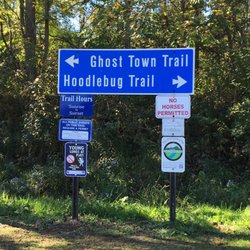
    Ghost Town Trail

    Ghost Town Trail

    4.7
    (3 reviews)
    20.1 mi

    This is a gorgeous trail. It is very easy and you can walk as far as you want. The trail is well…read moremaintained (mostly crushed gravel) and a fun place to go for a walk, run, or bike ride. You will see beautiful forest areas along the way.

    Well another biking milestone for yours truly and her husband Rick. We did the entire 60+ mile…read moreround trip between Black Lick and Ebensburg on the Ghost Town Trail! It took all day, I'm still saddle sore and my leg muscles ache a little, but it was totally worth it. Besides, we're building up our strengths so we can do the 120+ miles of the Great Allegheny Passage Trail between McKeesport and Cumberland, MD. There's not too much more I can write about the trail. Last year we rode the Black Lick to Nanty Glo segment of the trail and most points of interest are between those two towns. Still, the remaining segment between Nanty Glo and Ebensburg makes for a pleasant ride. I did find out a few other things about the trail since the last time we rode it. Just east of Black Lick, the trail passes a salvage yard of discarded rail cars. These almost seamlessly blend into the scenery and they're altogether appropriate because this is a rails-to-trails conversion. Between Dilltown and Vintondale the creek has a bright red color because of the acid drainage from the coal mines. At several points you will exit the cool green forested surroundings and experience an "ecological disaster area", a legacy of the mining era. You'll see the remains of some slag dumps, which have an eerie beauty to them. Keep an eye out for the AMD & Art Park (AMD stands for Acid Mine Damage). One other thing to consider. This trail goes through some state game lands. During hunting season, you should wear brightly colored clothing. Riding the Ghost Town Trail can be very rewarding. Plan to take the whole day and be sure to enjoy the sights along the way.

    Photos
    Ghost Town Trail
    The trail is maintained enough to bring a tricycle
    The trail is maintained enough to bring a tricycle
    Ghost Town Trail

    See all

    Laurel Highlands Hiking Trail

    Laurel Highlands Hiking Trail

    4.7
    (3 reviews)
    10.0 mi

    I spent 3.5 days and 3 nights on this trail this past memorial day weekend, my first venture back…read moreinto the backpacking world. This trail begins in Ohiopyle or Johnstown and ends whichever way you choose. If I were to try to pack the entire length I would start at the North end in Johnstown and hike South, to ease up the ankle pain and knee pain :) That comes with packing 20lbs + pack weight and hiking 18-19 miles in one day. Throw in the elevation gain and you will see what I mean. I hiked the South end starting in Ohiopyle and going out to about 26 miles over my time there, then I turned around and came back over two days. Things to note for overnight campers: You can call ranger station at trailhead to make your camping reservation, by credit card it is 4$ a night. Water: there is non drinking water at each campsite, bring a water filter or boil that water as it is not tested. I filtered stream water the whole time and it was fine. Ohiopyle about 6 miles in has the nicest camping ground with access to a large stream, but not all the sites have that. You might want to filter water for night hiking into camp. To save hiking a mile extra back out to get some as I had to do. Firewood, there are fire pits in the shelters if you want to skip the tent but bring something to lock your food up, mice are common in the shelters. I slept in a tent kept my back in the tent with me. There are portapotty type johns at the campsites. Weather: if you check local forecast plan on temps on the trail and at camp at night being around 10 degrees colder because of the elevation change, and storms. Bring rain gear if you're out for more than a day hike! Now for the trail, it is blazed yellow on the trees hard to get lost but a map would have been nice to have. However no maps available in Ohiopyle you have to pay for one at the Laurel State Park office. I did not do that would rather buy a hiking book with the trail in it at a later time. In most places its wide very rocky, lot of tree roots its murder on the soles of your feet, wear boots or stiff soled shoes if hiking for more than one day. Poles could come in handy, I don't use hiking poles but I got caught in little thunderstorm and had to grab a forest walking stick. Some places it looked like they barely blazed a trail at all it was very narrow hard to hike on. Hike with caution. Beautiful river runs stream runs, skyline views, and rock formations. In the first 26 miles views are at mile 6 ish and 24ish, rocks b between 15-20. Lots of birds, and small wildlife I only saw one deer. There is a shooting range at mile 25, just outside the park you will hear lots of gunshots. I would not recommend taking a break or relax day at the Grindle ridge campground out there as I did. Also the campgrounds that have broken water pumps currently are Grindle Ridge and Route 653 shelters campground. This is a lovely hiking trail but steep, be prepared for a challenge in the beginning. Happy Trails!

    How can you not LOVE the LHHT? Its a trail I've frequented quite often in the last 15 years, and…read morehope to explore the entire 70 miles. This picture was taken during the Laurel Highlands Ultra race in June 2017. This race can be run as a relay or individually. They also sponsor a 50k race, which is approx. 30 of the 70 miles. There are many trail heads and shelter areas. The trail is great for day hikes, as well as multiple overnight stays. There are also many ambitious people who hike the entire thing. Its always fun to pass fellow hikers on the trail. Trail stories are always fun to hear, and there are people from all over that you'll meet. Running the trail is quite a challenge, as there's drastic elevation changes at some points and many technical areas. I suggest if you've never run the trail, and expect to run the race, you must do at least 1-2 runs on the trail.

    Photos
    Rte. 271 trailhead during LHHT Ultra marathon 2017
    Rte. 271 trailhead during LHHT Ultra marathon 2017
    Finish for 2017 LHHT Ultra Marathon, Rte. 56, Seward, PA
    Finish for 2017 LHHT Ultra Marathon, Rte. 56, Seward, PA
    Laurel Highlands Hiking Trail

    See all

    Laurel Hill State Park

    Laurel Hill State Park

    4.6
    (14 reviews)
    26.1 mi

    As if there wasn't enough parks in the Laurel Highlands, there is Laurel Hill State Park a 3,935…read moreacre natural area of beautiful forest, overlooks, ponds and streams. My recent visit was promising at first, but the rain just kept coming all day long and it "dampened" my spirits completely. I stopped by the main office and got directions to the Jones Mill Dam. Since it was raining so much I gave it some time to clear up, but to no avail. This park is certainly worth checking out and it will be super beautiful later on in the Spring. The wood frogs, spring peepers and other animals will be active. On the same road that this park lies on is two other parks: Kooser State Park and Laurel Ridge State Park, so it is possible to hit those up while in the area. I will certainly make the trip out here later on towards May.

    I was staying at Hidden Valley recently and I was looking for a cool place to hike in the area that…read moreI hadn't been to before and I happen to discover this gem. What a great spot for a hike, but an even better place for a swim, relaxing, a picnic on the grass or some sun on the sand by the water. So after we arrived we hit the trail that ran along the water while taking in the small but beautiful lake. We then proceeded to head into the woods. It was a great little hike and the trails were very easy. After we were done hiking we got the huge blanket and the cooler with snacks and drinks in it out of the car and headed over to a shaded spot under the trees. We sat in the grass area in the left corner of the parking lot and listened to music, ate, drank and enjoyed each other's company for a good while. Then after that we packed up our stuff in the car and headed down to the water and enjoyed the lake which is very clean and refreshing and the scenery is absolutely beautiful. I love that they have sand and everyone looked so happy. They also have an area where you can purchase food and beverages but they also have many other great amenities which I am sure can be discovered on here or on their website. I am so glad I discovered this place. I will most definitely be stopping by again when I am in the area. Enjoy :)

    Photos
    A wood frog in their vernal pool near the stream.
    A wood frog in their vernal pool near the stream.
    Laurel Hill State Park
    Three pic panorama of the Jones Mill Dam on this cloudy, rainy afternoon.

    See all

    Three pic panorama of the Jones Mill Dam on this cloudy, rainy afternoon.

    Lorain/Stonycreek Hiking Trails - hiking - Updated July 2026

    Loading...
    Loading...
    Loading...