Marshall Canyon Regional Park Photos


You might also consider


More like Marshall Canyon Regional Park
Recommended Reviews - Marshall Canyon Regional Park
Start your review...


Reviews With Photos


This hike has different trails options. Lots of shade. I recently added hiking to my fitness journey and I like exploring various trails. This trail was a great workout and would highly recommend.

Just a quick update.... Trails are very busy on holidays and weekends with new hikers and mountain bikers. Trails are also heavily overgrown with poison oak and stinging nettles.... Watch for rattle snakes sunning themselves on sunny trails. I've spotted several coyotes, bobcats but haven't spotted any black bears in over a year, but that doesn't mean they aren't out there, so be cautious...


So many trails here! Great little spot for enduro riders, like me. You can find easy climbs up fire trails, or a little more technical up their single tracks. My man, Danny noticed me and my girl lost, looking at the map trying to figure out where to go, and said, "hey, you lost?" Haha. I said "yeah!, where's the best route?" Danny ended up tour guiding us throughout the canyon all thanksgiving morning. What an absolute boss! He would point me down the quicker, trickier downhill routes, and guide my gal down the easier trails til we merged back up. We ended up riding Marshall every morning while we visited family in Claremont. Lots of riders on the trail, and many walkers, and everyone is friendly and seems to understand space and etiquette. I'll be bringing my bike to ride Marshall every time I visit town!


Very shady trail. Great for little kids to hike in but tough for biking. Very fun to mountain bike without the kids. You have to park at a school and then ride/walk to the trail entrance which is very lame. Try out the trail, you'll like it.
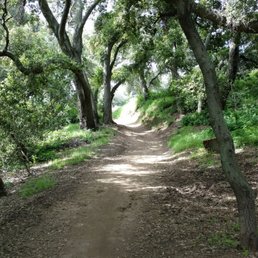

"May your trails be crooked, winding, lonesome, dangerous, leading to the most amazing view. May your mountains rise into and above the clouds." --Edward Abbey Marshall Canyon has two different hikes. My hiking buddy, Ida, who introduced me to this area, took me on a sampler of both trails. The upper canyon is open, less shady, and winds through the hills. The clouds were low that morning and clung snugly to the rolling landscape and gave it a beautiful glow. The inclines were a good workout, but not terribly challenging. Bring a hat and sunscreen though, as there are not many shade trees along the way. The lower canyon is very shady, and meanders along an intermittent creek. It is lush, green, and tangibly cooler than the upper canyon. This was my favorite part of the hike, and a great place to take photos! Watch out for bees though... we had to reroute ourselves when we heard ominous buzzing sounds coming from all around. Parking is plentiful and easy to find. The trails and mile markers are clearly displayed and in good condition. Bring plenty of water, your SPF9000, and your camera; and have yourselves a wonderful adventure! .


Our 1st visit was great - we completed a trail run along the trail. Be sure to bring water and a good pair of shoes. Beware of the mountain bikers that ride along the trail. There are horse riders using the trail - beware of the horse droppings. You will cross small water streams while hiking / running on the trail. The overall experience was great.


This hike is a 5.2 mile roundtrip loop with 1,200' elevation gain/loss. It is a pretty easy hike. The trail is a wide, smooth, dirt fire road with minimal rock under foot. On the ascent, the hike has areas where it is a bit steep, especially closer to the peak, but it is not difficult. There is some shade offered by trees early on, but you will be exposed to the elements the latter part of the route. I would avoid this hike during the height of the summer. Once you arrive at the peak, there is a landing and a wooden structure with seating and overhead shade. I'm not sure what views are offered, as the day we were there it was quite overcast and I could not see in the distance. It does have some interesting scenery on the way up, though. tip - this trail connects with the Potato Mountain hike, which is about 3 miles further each way, if you wish to make your hike longer and more challenging parking - free lot


The Drucker Hiking Society did the Middle Marshall Canyon Hike today, March 23, 2011 from 9:30-10:30. What a beautiful hike! It was pretty muddy (probably due to the rain last night) but we trudged through. No horses, no bikers, but a couple of birds and lots of gorgeous plant life on either side of the trail. It's a great, short hike that was slightly challenging at times. I'm still not sure whether it was challenging because of the mud or because of the terrain so we'll probably be back sometime. :D We used the directions on this awesome blog: http://nobodyhikesinla.com/2010/08/28/middle-marshall-canyon/#comment-892 You can check out our photos here: http://www.facebook.com/pages/Drucker-Hiking-Society/137815196263126 Some of them are breathtaking!


Amazing park with spread out trails of tons of hiking variations. Free parking lot before equestrian center. Use a map so you don't backtrack or get lost. Did about a 5 mile round trip in under 2 hours. Great views of the Claremont/La Verne Area. Bring water lots of hills.


The Marshall Canyon loop is one of my favorite local hikes. I usually go during the week when it is pretty empty. Every sunset I've experienced here is absolutely gorgeous. If you follow the loop up to where it intersects with the Claremont loop you get a great workout. I never get tired of this place. It is so green and beautiful this time of the year.


1 year ago
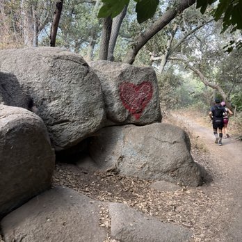
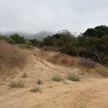
Yesterday was my second time running/hiking through Marshall Canyon. I park at Oak Mesa park and walk towards the back you'll see and entrance and go right on Los Robles, right on via de Mansion and a left on Orangewood st you'll see the entrance to the trail to your left. This trail has a lot of shade, a few water crossing that can easily be jumped since there's not a lot of water. We share the trail with bikes and horses to be sure to keep an ear out. I would say this hike is moderate to hard depending on experience. This trail will connect you to the Claremont Loop, out and back is about 11 miles. Definitely a good trail to train in. read more


3 years ago
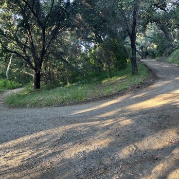
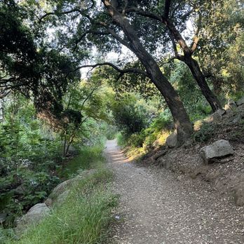
initially, we came from Via De Mansion and made a right on Orangewood St. As I drove down on Orangewood, I was unsure of where the trail was because there was no clear sign of the trail, only a dam/corridor below us. I asked a lady walking where it was, and she told us we were at the right spot. But we are not supposed to park on the street, and there were also signs not to she pointed out. She suggested parking my car up the street, either to the left or right on Via De Mansion or at an elementary school that's nearby. However, I did not know what school she was referring to. So I went back up Orangewood, made a right on Via De Mansion, and parked there. Later I saw she was the owner of the corner house of Via De Mansion. Unfortunately, we didn't complete the trial. But we did see "a lot" of bicyclists and one who made a joke with us saying we forgot our bikes lol Overall, it was a pretty shady trail for the hour that we hiked. We had to cross paths with the water stream in order to get to the other side twice I believe. We were at a crossroads of one path going left, one going straight and the other to the right, going uphill. We chose to go right, to the one going uphill which took us to a residential block within 5-10 minutes or so. Once we arrived at the top we decided to just go back down the way we came and go eat at Firehouse Subs. Hence, don't go right unless you want to up the residential street. Stay straight (where the all bicyclist) went, or try left. On the way back down, we met a couple who also it was their first time and they asked where we parked? We told them up the hill, to the right and they said they did the same because they heard people can't park on the street. I told them, we heard the same. Overall, it seemed like a nice trail, and would like to return to do the full trail which is 10.4 miles round trip. read more




3 years ago
Just a quick update.... Trails are very busy on holidays and weekends with new hikers and mountain bikers. Trails are also heavily overgrown with poison oak and stinging nettles.... Watch for rattle snakes sunning themselves on sunny trails. I've spotted several coyotes, bobcats but haven't spotted any black bears in over a year, but that doesn't mean they aren't out there, so be cautious... read more




6 years ago
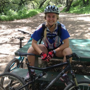
So many trails here! Great little spot for enduro riders, like me. You can find easy climbs up fire trails, or a little more technical up their single tracks. My man, Danny noticed me and my girl lost, looking at the map trying to figure out where to go, and said, "hey, you lost?" Haha. I said "yeah!, where's the best route?" Danny ended up tour guiding us throughout the canyon all thanksgiving morning. What an absolute boss! He would point me down the quicker, trickier downhill routes, and guide my gal down the easier trails til we merged back up. We ended up riding Marshall every morning while we visited family in Claremont. Lots of riders on the trail, and many walkers, and everyone is friendly and seems to understand space and etiquette. I'll be bringing my bike to ride Marshall every time I visit town! read more


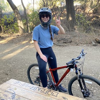

Very shady trail. Great for little kids to hike in but tough for biking. Very fun to mountain bike without the kids. You have to park at a school and then ride/walk to the trail entrance which is very lame. Try out the trail, you'll like it. read more


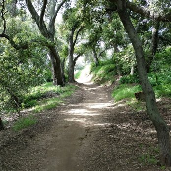
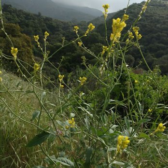
"May your trails be crooked, winding, lonesome, dangerous, leading to the most amazing view. May your mountains rise into and above the clouds." --Edward Abbey Marshall Canyon has two different hikes. My hiking buddy, Ida, who introduced me to this area, took me on a sampler of both trails. The upper canyon is open, less shady, and winds through the hills. The clouds were low that morning and clung snugly to the rolling landscape and gave it a beautiful glow. The inclines were a good workout, but not terribly challenging. Bring a hat and sunscreen though, as there are not many shade trees along the way. The lower canyon is very shady, and meanders along an intermittent creek. It is lush, green, and tangibly cooler than the upper canyon. This was my favorite part of the hike, and a great place to take photos! Watch out for bees though... we had to reroute ourselves when we heard ominous buzzing sounds coming from all around. Parking is plentiful and easy to find. The trails and mile markers are clearly displayed and in good condition. Bring plenty of water, your SPF9000, and your camera; and have yourselves a wonderful adventure! . read more




7 years ago
Our 1st visit was great - we completed a trail run along the trail. Be sure to bring water and a good pair of shoes. Beware of the mountain bikers that ride along the trail. There are horse riders using the trail - beware of the horse droppings. You will cross small water streams while hiking / running on the trail. The overall experience was great. read more


11 years ago
This hike is a 5.2 mile roundtrip loop with 1,200' elevation gain/loss. It is a pretty easy hike. The trail is a wide, smooth, dirt fire road with minimal rock under foot. On the ascent, the hike has areas where it is a bit steep, especially closer to the peak, but it is not difficult. There is some shade offered by trees early on, but you will be exposed to the elements the latter part of the route. I would avoid this hike during the height of the summer. Once you arrive at the peak, there is a landing and a wooden structure with seating and overhead shade. I'm not sure what views are offered, as the day we were there it was quite overcast and I could not see in the distance. It does have some interesting scenery on the way up, though. tip - this trail connects with the Potato Mountain hike, which is about 3 miles further each way, if you wish to make your hike longer and more challenging parking - free lot read more


16 years ago
The Drucker Hiking Society did the Middle Marshall Canyon Hike today, March 23, 2011 from 9:30-10:30. What a beautiful hike! It was pretty muddy (probably due to the rain last night) but we trudged through. No horses, no bikers, but a couple of birds and lots of gorgeous plant life on either side of the trail. It's a great, short hike that was slightly challenging at times. I'm still not sure whether it was challenging because of the mud or because of the terrain so we'll probably be back sometime. :D We used the directions on this awesome blog: http://nobodyhikesinla.com/2010/08/28/middle-marshall-canyon/#comment-892 You can check out our photos here: http://www.facebook.com/pages/Drucker-Hiking-Society/137815196263126 Some of them are breathtaking! read more


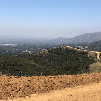
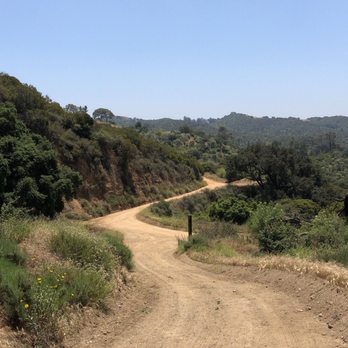
Amazing park with spread out trails of tons of hiking variations. Free parking lot before equestrian center. Use a map so you don't backtrack or get lost. Did about a 5 mile round trip in under 2 hours. Great views of the Claremont/La Verne Area. Bring water lots of hills. read more



4 years ago

9 years ago
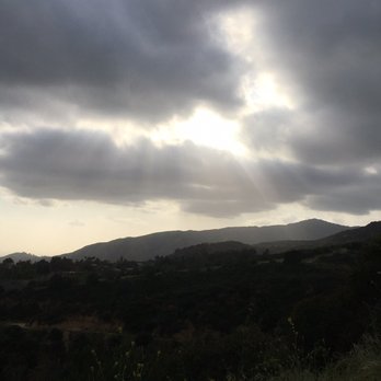
The Marshall Canyon loop is one of my favorite local hikes. I usually go during the week when it is pretty empty. Every sunset I've experienced here is absolutely gorgeous. If you follow the loop up to where it intersects with the Claremont loop you get a great workout. I never get tired of this place. It is so green and beautiful this time of the year. read more




13 years ago

14 years ago


12 years ago
Awesome place for biking and hiking! Moderate trails for biking and the views are amazing. Highly Recommended! Trails go on and on. read more


8 years ago

8 years ago

7 years ago

8 years ago

11 years ago
Went this morning after some light rain yesterday and heavy rain the days prior, so some parts of the trail were really soft and muddy. My shoes are a mess, but that's ok. It was a beautiful trail with some really nice views. We parked way up on high point on Firemen circle (this is what my GPS called it). It was only 3.something miles total, but we were climbing most of the way and worked up a sweat, despite the cool weather. I liked it and will come again! read more


15 years ago
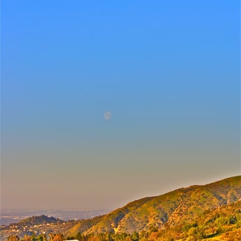
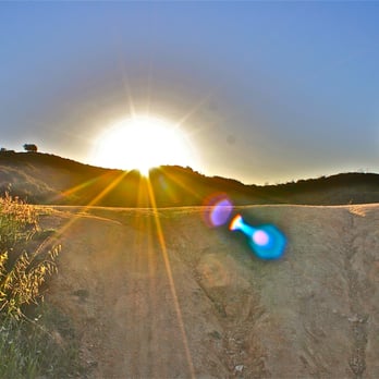
There are so many trails, but watch out for the persons riding bikes. They are often times out of control and going way too fast! North Eastern trails lead to the loop of Claremont off Mills. read more




8 years ago

9 years ago


13 years ago

11 years ago


15 years ago


11 years ago

15 years ago
10 years ago
11 years ago

14 years ago
15 years ago
9 years ago
More info about Marshall Canyon Regional Park
Ask the Community - Marshall Canyon Regional Park
Is this park good for flat, easy, cemented terrain biking? I don't want to do mountain biking up into the mountains on dirt paths nor biking where cars are driving.
No it's a dirt trail with inclines, and riding several times over a creek among hikers & runners. Once you get through the canyon it's a steady uphill incline on a wider path depending on which route taken. It's definitely for mountain biking not…
Anyone know if it is closed due to the Coronavirus restrictions? Claremont loop was closed yesterday when I went.
It's closed ....
Is the trail dog safe?
The trail is 5 miles in length with some inclines. Bring water for your pet.
Review Highlights - Marshall Canyon Regional Park
You might also consider

















Why does Yelp recommend reviews?


Marshall Canyon Regional Park - hiking - Updated September 2026
Best of La Verne
People found Marshall Canyon Regional Park by searching for…
Places to Take Pictures in La Verne, CA
Beautiful Views in La Verne, CA
Walking Trails in La Verne, CA
Scenic Night View in La Verne, CA
Waterfall Hike in La Verne, CA
Running Trails in La Verne, CA
Secluded Spots in La Verne, CA
Off Road Trails in La Verne, CA
Free Things to Do in La Verne, CA
Trending Searches in La Verne, CA
Apple Orchards near Marshall Canyon Regional Park
Apple Picking near Marshall Canyon Regional Park
Archery near Marshall Canyon Regional Park
Barbershop near Marshall Canyon Regional Park
Blow Dry Bar near Marshall Canyon Regional Park
Cliff Jumping near Marshall Canyon Regional Park
Consignment Shops near Marshall Canyon Regional Park
Corn Maze near Marshall Canyon Regional Park
Dog Friendly Things To Do near Marshall Canyon Regional Park
Dog Swimming near Marshall Canyon Regional Park
Eyelash Extensions near Marshall Canyon Regional Park
Formal Wear near Marshall Canyon Regional Park
Hiking Trails near Marshall Canyon Regional Park
Kids Birthday Party near Marshall Canyon Regional Park
Makeup Artists near Marshall Canyon Regional Park
Mens Suits near Marshall Canyon Regional Park
Off Road Trails near Marshall Canyon Regional Park
Parks near Marshall Canyon Regional Park
Photo Spots near Marshall Canyon Regional Park
Picnic Areas near Marshall Canyon Regional Park
Places To Take Pictures near Marshall Canyon Regional Park
Private Schools near Marshall Canyon Regional Park
Public Shower near Marshall Canyon Regional Park
Pumpkin Patches near Marshall Canyon Regional Park
Rock Quarry near Marshall Canyon Regional Park
Scenic Night View near Marshall Canyon Regional Park
Scenic Overlook near Marshall Canyon Regional Park
Browse Articles
Browse Nearby
BEST of La Verne, California Coffee near Marshall Canyon Regional Park
BEST of La Verne, California Things to Do near Marshall Canyon Regional Park
BEST of La Verne, California Parks near Marshall Canyon Regional Park
BEST of La Verne, California Restaurants near Marshall Canyon Regional Park
BEST of La Verne, California Breakfast near Marshall Canyon Regional Park
BEST of La Verne, California Horseback Riding near Marshall Canyon Regional Park
BEST of La Verne, California Campgrounds near Marshall Canyon Regional Park
Browse Brands
Related Searches in La Verne, CA
Best Dog Hiking Trails Around La Verne, California
Best Fishing Locations and Guides in La Verne, California
Best Nature Trails for Hiking in La Verne, California
Best Places for Horseback Riding in La Verne, California
Check Out Off Road Trails in La Verne, California
Discover Dog Friendly Trails to Explore in La Verne, California
Discover Easy Hiking Trails Near La Verne, California
Discover Kid Friendly Hiking Trails in La Verne, California
Discover Popular Bike Trails in La Verne, California
Discover Scenic Mountain Bike Trails Near La Verne, California
Discover Walking Parks in La Verne, California Near You
Discover a Hiking Trail in La Verne, California
Discover the Best Night Hike Trails in La Verne, California
Dog-Friendly Hikes With Dogs in La Verne, California
Enjoy Camping Adventures Around La Verne, California
Enjoy Kayaking Adventures in La Verne, California
Enjoy Off Leash Dog Hikes in La Verne, California
Enjoy Scenic Places to Walk in La Verne, California
Enjoy Tent Camping Spots Around La Verne, California
Enjoy a Beautiful Waterfall Hike in La Verne, California
Enjoy the Best Walking Path in La Verne, California
Enjoy the Best Walking Trails in La Verne, California
Explore Beautiful Parks and Green Spaces in La Verne, California
Explore Easy Hikes Perfect for All in La Verne, California
Explore Fun Activities to Do in La Verne, California
Explore Popular Campgrounds Near La Verne, California
Explore Popular Dog Walking Trails in La Verne, California
Explore Popular State Park Destinations in La Verne, California
Explore Top Dog Parks in La Verne, California Near You
Family Friendly Hiking With Kids in La Verne, California
Find Beautiful Views in La Verne, California
Find Parks and Recreation Activities in La Verne, California
Find Top Dog Friendly Parks to Visit in La Verne, California
Find Top-Rated Waterfalls in La Verne, California Now
Find the Best Parks for Picnics in La Verne, California
Hiking Trails With Waterfalls in La Verne, California
Off Leash Dog Hiking Trails in La Verne, California
Popular Outdoor Activities to Try in La Verne, California
Popular Picnic Spots to Visit in La Verne, California
Popular Waterfall Hiking Trails in La Verne, California
Safe River Swimming Areas in La Verne, California
Safe and Fun Parks for Kids in La Verne, California
Top Hiking Trails to Explore in La Verne, California
Top Playgrounds for Kids to Enjoy in La Verne, California
Top Running Trails to Explore in La Verne, California
Top Swimming Lakes to Enjoy in La Verne, California
Top Swimming Spots and Pools in La Verne, California
Top-Rated Camping Sites in La Verne, California


