Mystic Canyon Hiking Trail Photos


You might also consider


More like Mystic Canyon Hiking Trail
Recommended Reviews - Mystic Canyon Hiking Trail
Start your review...


Reviews With Photos


Mystic canyon is a linkage to multiple other trails (poop out, top of mystic, or behind the back way for easy downhill biking or walking. It's one of my favorites because it's a good pump and you can decide how much exercise you want to get. Can be between 1.2 hours to 4 hour hike depending if you go all the way up/ around.


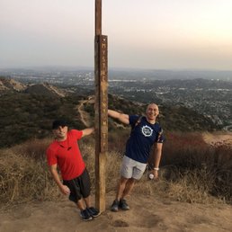
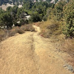
Lovely morning hike to avoid the heat! This trail is connected to the Poopout Trail, Upper Monroe Trail, and Big Dalton Trail. With plenty of space to park as not many people hike here, it is definitely worth a trip! At the beginning of the trail, you should expect to see a steep incline going up a slippery slope. IMPORTANT NOTE: Wear hiking shoes! I can not issue this warning enough! My sister and I had hiked this trail a couple times and there are lots of loose rocks and up hill battles. Going up isn't as bad as coming down! You will definitely feel your quads burning as you hike up these treacherous slopes as a beginner. I'm fairly use to this hike so I was okay. There are lots up hill hikes that lead to flat ground then you'll encounter major hills again. It's definitely not for beginners. I would say it's medium-hard unless you like to run up these hills which (for me) would make it easier to overcome these obstacles. Once you get to the top, there's a wooden post with a flag on top that says "Mystic Canyon" on it. You've made it! Be careful though! There are LOTS of bikers coming down from the Upper Monroe Trail so don't get in their way! On the way down, you will know why I warned you about wearing hiking shoes! My sister did not have any so stepping on some loose rocks while going down these hills caused her to eat sh-t a couple times! LOL I love this trail as it isn't long and dreadful. Roundtrip was about an hour and 15 minutes max or less depending on every ones endurance/stamina level. I would definitely recommend this trail to all! Bring your dogs too!
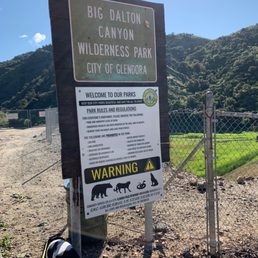

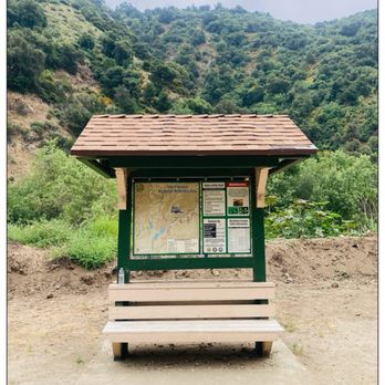
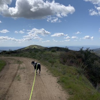
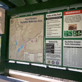
I feel like cities are closing off all of the hikes around here thanks to COVID-19. I get it. Stay away from large crowds, but I need to move and I need to be outside. Walking up a mountain with my trusty adventure buddy shouldn't hurt anybody. Please don't hate on me if you think I'm anywhere near as bad as the Spring Breakers spreading the virus at the beach. Anyways I'll be damned if I can't at least hike while I'm Quarantine 2020. After stopping by Cosco for gas I looked at local hikes near Azusa. I scrolled looking for hikes that would be considered roads less crosses. The descriptors: hard, 8 miles, Glendora, and Mystic scrolled past and caught my eye. Sounded magical and like an adventure. So the pup and I set forth for the short 15 min drive to the beginning of Big Dalton Natural Park. I parked father back and walked a bit to the entrance, assuming there wouldn't be parking close by. I was wrong. You can park right at the beginning of the hike! From there you can see a map with the different trails there are to offer. Mystic canyon started off taking my breath away. Between the Rocky high incline for the first mile and the view of the city below I was huffing and puffing but in awe. There was a couple taking pictures but I kept exploring. The path was pretty well maintained. Going from rocky and dirt to more muddy as we kept climbing. The terrain started off dry but got lush and beautiful as we got higher. At the very top you get a beautiful 360 view of the other side of the mountains, all snow capped, and the opposite side the city from the ocean all the way past Pomona. It was about 6 miles up and another 6 miles down. I loved this hike so much. It was hard but doable and not scary at all as far as having to barge your own trails. It was very well maintained. I'd definitely recommend this one to those looking for beautiful views and a peaceful path.


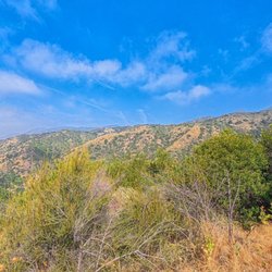
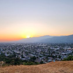
A moderate hiking trail, about 3 miles round-trip, with some steeper inclines, especially right at the beginning. Offers a great cardio workout and spectacular ciews of the Dalton dam and Glendora suburban area, as well as some of the foothills. Not a ton of shade, so if it's hot, make sure to bring water and maybe a hat or sun screen. Also..loose terrain, so make sure you've got proper foot attites..flip flop just won't cut it here. This trail connects up with Monroe trail and poopout and then just keeps going all the way to punk out, so you've got lots of options to continue futher up as well.


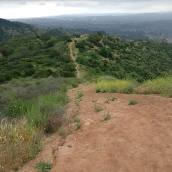
The hike to Mystic Canyon is 9.6 miles roundtrip with 2,217' elevation gain/loss. It is not a difficult hike in general, but there are a few areas that are fairly steep. The trail is wide at points and also single file with loose rocks under foot. The entire trail is without shade. At the start of the hike for about a mile, the ascension is pretty steep. But after this portion, the climb is pretty steady. Unless you choose to take Punk out Trail. Punk out Trail is clearly marked and is a detour to the right of the main path. If you want a better and more difficult workout, this is the way to go. It will also shave about 1 mile off the total trip. Once you climb the steep ridge and arrive at the landing/trail above, go right and continue up the trail to your destination. Views of the mountains and city are nice. Mt Baldy and Iron Mountain are easily seen from this vantage point. parking - free lot across from the trail head


1st time doing this hike... I will definitely frequent this trail. Its not far from home & the scenery is beautiful. Its a great workout can be intense . Many trails in the area that can make it as short or long as you would like. We did a total of 7 miles

A fun little trail thats not too hard and good views! We came across a rattlesnake so be careful! Just a couple of steep spots with loose gravel so trail shoes are recommended. When you get to the top you can go down poop out trail which is harder I've heard.

Hiked this trail with a group of my friends this morning. We arrived around 8:30 am. The hike started out pretty steady. The overall hike wasn't bad, just some parts that are more steep and strenuous. My group decided to take the punk-out trail. Towards the end part of the first peak, the hill became steeper and actually pretty dangerous. I would suggest wearing hiking boots because I wore my Nike running shoes and didn't feel I had much grip. I found it difficult during the cross of the first peak because there were some bigger rocks, where I had to actually push myself up because of how steep it was. There were also a lot of unsteady rocks in the steep parts that made the hikmore strenuous. I didn't feel the hike was that difficult, just mainly dangerous. Distance wise, the hike was around 9 miles, round trip. I had a really fun time today and would definitely come back again!


Super steep in the beginning and in the middle of the hike up. My dogs did great and are nice and tired now haha. Will be doing This hike and other local ones more often


The harder the climb, the better the view. Now let's begin this hiking adventure review. Mystic Canyon Trail is short trailhead with a steady elevation gain of 700 ft that reaches 1,908 feet (hoisted flag point). This trail's degree of difficulty is considered Moderate albeit challenging. The trail is well kept and easy to navigate with little pockets of tree shades along the way. Hence, a hat and sunscreen and plenty of water are recommended. Furthermore, this M.C. trail interconnects with Lower Monroe and Punk Out trails. I proceeded further to 2,069 ft of the Punk Out trail. Views are amazing! Going back to the parking lot was a breeze. Parking lot is not big but can hold ~25 vehicles. Overall, this hiking trail is great for experienced hikers, family and dogs. read more




11 months ago

3 years ago
Easy parking Several trails Bathrooms and picnic areas before trails start Dog friendly and safe read more

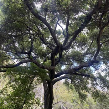
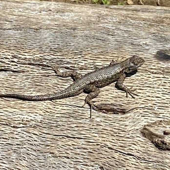
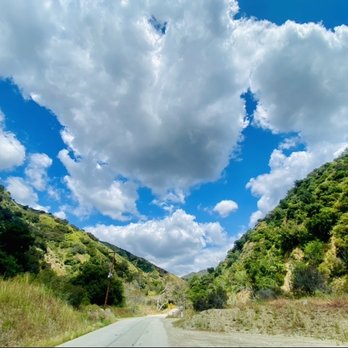


Mystic canyon is a linkage to multiple other trails (poop out, top of mystic, or behind the back way for easy downhill biking or walking. It's one of my favorites because it's a good pump and you can decide how much exercise you want to get. Can be between 1.2 hours to 4 hour hike depending if you go all the way up/ around. read more


6 years ago
Lovely morning hike to avoid the heat! This trail is connected to the Poopout Trail, Upper Monroe Trail, and Big Dalton Trail. With plenty of space to park as not many people hike here, it is definitely worth a trip! At the beginning of the trail, you should expect to see a steep incline going up a slippery slope. IMPORTANT NOTE: Wear hiking shoes! I can not issue this warning enough! My sister and I had hiked this trail a couple times and there are lots of loose rocks and up hill battles. Going up isn't as bad as coming down! You will definitely feel your quads burning as you hike up these treacherous slopes as a beginner. I'm fairly use to this hike so I was okay. There are lots up hill hikes that lead to flat ground then you'll encounter major hills again. It's definitely not for beginners. I would say it's medium-hard unless you like to run up these hills which (for me) would make it easier to overcome these obstacles. Once you get to the top, there's a wooden post with a flag on top that says "Mystic Canyon" on it. You've made it! Be careful though! There are LOTS of bikers coming down from the Upper Monroe Trail so don't get in their way! On the way down, you will know why I warned you about wearing hiking shoes! My sister did not have any so stepping on some loose rocks while going down these hills caused her to eat sh-t a couple times! LOL I love this trail as it isn't long and dreadful. Roundtrip was about an hour and 15 minutes max or less depending on every ones endurance/stamina level. I would definitely recommend this trail to all! Bring your dogs too! read more


2 years ago

2 years ago

I feel like cities are closing off all of the hikes around here thanks to COVID-19. I get it. Stay away from large crowds, but I need to move and I need to be outside. Walking up a mountain with my trusty adventure buddy shouldn't hurt anybody. Please don't hate on me if you think I'm anywhere near as bad as the Spring Breakers spreading the virus at the beach. Anyways I'll be damned if I can't at least hike while I'm Quarantine 2020. After stopping by Cosco for gas I looked at local hikes near Azusa. I scrolled looking for hikes that would be considered roads less crosses. The descriptors: hard, 8 miles, Glendora, and Mystic scrolled past and caught my eye. Sounded magical and like an adventure. So the pup and I set forth for the short 15 min drive to the beginning of Big Dalton Natural Park. I parked father back and walked a bit to the entrance, assuming there wouldn't be parking close by. I was wrong. You can park right at the beginning of the hike! From there you can see a map with the different trails there are to offer. Mystic canyon started off taking my breath away. Between the Rocky high incline for the first mile and the view of the city below I was huffing and puffing but in awe. There was a couple taking pictures but I kept exploring. The path was pretty well maintained. Going from rocky and dirt to more muddy as we kept climbing. The terrain started off dry but got lush and beautiful as we got higher. At the very top you get a beautiful 360 view of the other side of the mountains, all snow capped, and the opposite side the city from the ocean all the way past Pomona. It was about 6 miles up and another 6 miles down. I loved this hike so much. It was hard but doable and not scary at all as far as having to barge your own trails. It was very well maintained. I'd definitely recommend this one to those looking for beautiful views and a peaceful path. read more



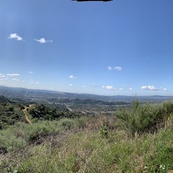


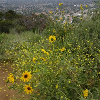
A moderate hiking trail, about 3 miles round-trip, with some steeper inclines, especially right at the beginning. Offers a great cardio workout and spectacular ciews of the Dalton dam and Glendora suburban area, as well as some of the foothills. Not a ton of shade, so if it's hot, make sure to bring water and maybe a hat or sun screen. Also..loose terrain, so make sure you've got proper foot attites..flip flop just won't cut it here. This trail connects up with Monroe trail and poopout and then just keeps going all the way to punk out, so you've got lots of options to continue futher up as well. read more



9 years ago

11 years ago
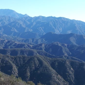
The hike to Mystic Canyon is 9.6 miles roundtrip with 2,217' elevation gain/loss. It is not a difficult hike in general, but there are a few areas that are fairly steep. The trail is wide at points and also single file with loose rocks under foot. The entire trail is without shade. At the start of the hike for about a mile, the ascension is pretty steep. But after this portion, the climb is pretty steady. Unless you choose to take Punk out Trail. Punk out Trail is clearly marked and is a detour to the right of the main path. If you want a better and more difficult workout, this is the way to go. It will also shave about 1 mile off the total trip. Once you climb the steep ridge and arrive at the landing/trail above, go right and continue up the trail to your destination. Views of the mountains and city are nice. Mt Baldy and Iron Mountain are easily seen from this vantage point. parking - free lot across from the trail head read more




10 years ago
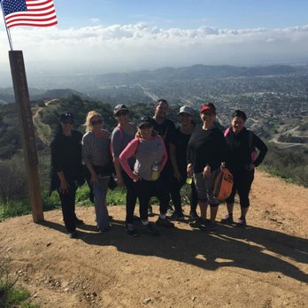
1st time doing this hike... I will definitely frequent this trail. Its not far from home & the scenery is beautiful. Its a great workout can be intense . Many trails in the area that can make it as short or long as you would like. We did a total of 7 miles read more


8 years ago
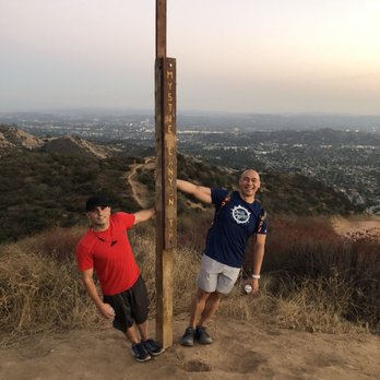
A fun little trail thats not too hard and good views! We came across a rattlesnake so be careful! Just a couple of steep spots with loose gravel so trail shoes are recommended. When you get to the top you can go down poop out trail which is harder I've heard. read more

6 years ago

9 years ago
10 years ago
Hiked this trail with a group of my friends this morning. We arrived around 8:30 am. The hike started out pretty steady. The overall hike wasn't bad, just some parts that are more steep and strenuous. My group decided to take the punk-out trail. Towards the end part of the first peak, the hill became steeper and actually pretty dangerous. I would suggest wearing hiking boots because I wore my Nike running shoes and didn't feel I had much grip. I found it difficult during the cross of the first peak because there were some bigger rocks, where I had to actually push myself up because of how steep it was. There were also a lot of unsteady rocks in the steep parts that made the hikmore strenuous. I didn't feel the hike was that difficult, just mainly dangerous. Distance wise, the hike was around 9 miles, round trip. I had a really fun time today and would definitely come back again! read more



10 years ago
Super steep in the beginning and in the middle of the hike up. My dogs did great and are nice and tired now haha. Will be doing This hike and other local ones more often read more


10 years ago
Awesome trail ! There's a tire swing at the beginning it's somewhat scary but pretty cool . This trail is a 4.5 mile trail read more


5 years ago

10 years ago
7 years ago
7 years ago

10 years ago
More info about Mystic Canyon Hiking Trail
2324 Big Dalton Canyon Rd
Glendora, CA 91741
Directions
Hours
Outdoor Amenities
Ask the Community - Mystic Canyon Hiking Trail
Is this trail open on sundays during covid lockdown?
Review Highlights - Mystic Canyon Hiking Trail
You might also consider






















Why does Yelp recommend reviews?
1 review that is not currently recommended
The reviews below are not factored into the business's overall star rating.

4 months ago


