Stoddard Peak Hike Photos


You might also consider


More like Stoddard Peak Hike
Recommended Reviews - Stoddard Peak Hike
Start your review...


Reviews With Photos


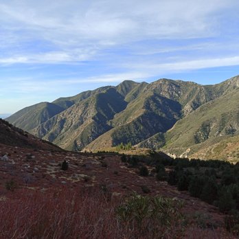
Very nice ~6 mile hike! Went with my sister and bro in law early in the morning at 8am. There were a few cars already parked at the small parking lot but none of them were for the Stoddard Peak Hike. The first 1/4 of the trail was walking through private road and passing by a few houses along the way. The trail was a mix of rocks and dirt so wear proper shoes. Overall, the trail was a steady incline until you hit the turn off which becomes a steep uphill climb (see picture). We didn't encounter anyone until we were almost at the peak so that was good. The view was really nice at the top!


This is the first trail I've hiked where I had doubts about my safety and actually had to turn back halfway. I recommend going with a partner or two. Jason's review with directions is accurate, so take a screenshot of that because there is no cell reception. A hat and sunscreen are a must because there isn't much shade. A mile into the trail we came across a group of men that were drunk, disrespectful, and shooting branches with their pellet guns. Shortly after that, there was a man who was moving metal and branches; it looked like he was maybe piling them up to build something. He was talking to himself and just seemed 'off'. Maybe I went on a bad day. But I have seen recent reviews on AllTrails that mention cars being broken into. Be careful and stay alert.


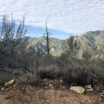
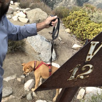
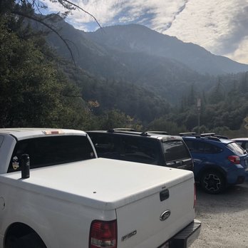
Parking- small lot on the right side of Mt. Baldy Rd at Mountain Ave. make a right...there is also an open dirt area across the Baldy Rd to park (make sure to display your Adventure Pass) *I have read online about quite a few broken windows in this area so make sure to take valuables with you or hide them out of plain view Trail- starts off as a wide fire road that will lead you to a residential area with cabins and at about .7 miles (not .5) take the private road to the right with a sign that says foot travel is allowed; at a little less than a mile you will reach a white metal road closed sign that you will need to pass to continue the rest of the hike; the next 1.5 miles are relatively easy on a wide path; at about 2.5 miles in keep your eyes to the right of the path to look for the small trail that you will need to take to the peak...this trail is about .5 miles and it is narrow, rocky and steep at times...you will reach what feels like the peak but continue on to the next peak and that is where you will find the trail marker with the "V" and "12" (this is the peak); the views are decent *dogs are allowed and my mutt loved it Distance- 6 miles RT Duration- probably between 2-4 hrs (for us it was 1:20 up and 50 mins. down which included some jogging) Difficulty- on the easy side of moderate just because of the .5 miles to the peak and the .5 miles from the peak but the other 5 miles are pretty easy Elevation Peak- 4,620 ft Elevation Gain- 1,200 ft


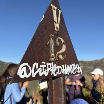
It's a little drive up Mt Baldy Rd, passing through a couple of tunnels, and a turn off where you see the Barrett-Stoddard sign. You will pass a very unique house shortly after starting the hike. As you get closer to the peak, you can easily miss the right turn where the trail goes up and the workout begins. I hope I remember to wear pants next time. There is overgrowth of brush on the single track and the possibility of getting a few scratches. Don't stop at the false summits. Keep going, sticking to the right around the boulders, till you reach the triangular post. You can find a register in a can under a rock.


This is a wonderful and less crowded approximately six mile hike in the LA area! I did this hike in late November and it was seriously gorgeous. The hike itself is pretty moderate. The most difficult part was finding the turn off to the peak, as it not well marked (we hiked right past it!), and finding our way through the brush after the turn off until we found the peak. I would suggest using the All Trails app to make sure that you don't get lost! The hike is beautiful, with some fall colors, cute cabins, some beautiful areas filled with pine trees, and of course, views! Some of my girlfriends were surprised by the pines, saying that it didn't even feel like we were in LA anymore. If you have a chance, check this hike out! Don't forget your Adventure Pass for parking.


A moderate six mile hike. Park off Mt. Baldy Rd. Not the first small lot you see as there is another small parking lot in there. Walk towards the fire road and stay to the right, pass the small houses. The climb up is gradual but nice. I actually passed the peak, as it is not obvious. Little to no signs guiding you. I stayed on the main road and ended up on the Stoddard/Barrett canyon which takes you in!!! Super quiet and peaceful. It leads you to the Cucamonga Truck Trail. I ended up heading back to the trail head and found Stoddard peak on the way back. Plenty to explore out there, the wood packers were out, highly recommended.


Really great hike. Parking was really easy and leads you straight to the path. Lots of false peaks but we made it to the top. Definitely wear hiking shoes and pants. My ankles got cut on some of the sharp plants going up.


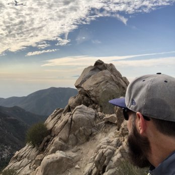
This hike is about 6 miles roundtrip. There is a small parking lot at the start of the trail. It is a fairly easy hike with a mild incline up most of the way. Within the first 1/2 mile, you will pass by a cute little 'cottage' house. The trail is a dirt fireroad which is easy to maneuver. However, at the end, just before hitting Stoddard Peak, the road disappears and the trail becomes narrow and surrounded by thick, high brush with a very steep incline. Once you reach the first peak, you will think this is The Peak - it's not. You see another peak beyond the rock formations -this is The Peak. To reach it, you will need to descend the first peak and climb the next. It's a little tricky getting there. Once you reach this peak, you will see a rusty tin can with a ledger inside by the rocks for you to make a note that you were there (cute!). Views are nice but not breathtaking, but overall it's pleasant hike. tip - go early in the morning, before the sun comes up over the mountains. You will get mostly shade on the way up if you do (but probably not back down).


Came back to barrett stoddard road again this time to reach its peak. It took me almost 3 hours there and back and ended up hiking almost 9 miles great hike and views of all the surrounding mountains. Theres an ammo box with a notebook at the peak so you can sign in and write a note that you've made it to the top.
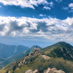

I completed this hike on January 1st and I really enjoyed it. It's a quiet hike, not crowded at all. It's a moderate hike and hiking poles are helpful on the way down. I would recommend wearing long sleeves and pants due to some parts of the trail requiring some "bush whacking" at some parts. Highly recommended!


Stoddard peak is a mountain summit located near Mount Baldy that provides a great trail for first timers looking to challenge themselves to a peak. Roundtrip the hike is just about 6 miles. Most of the hike is along a grated road/trail which provides easy walking. The last part of the trail to the peak presents some challenges as you meander your way to the peak, dealing with some edge drop offs and rock scrambling. The hike starts right after a small power station off the Mt Baldy road- just after a couple of tunnels. There is an upper and lower parking lot. If parking at the lower lot, at night time watch out for the big pot holes- best for high profile cars. If both lots are full, there are additional lots- but watch for signs designating no parking. Make sure you display your adventure pass or national park pass, otherwise you may get a ticket. Once you start your hike, you have the opportunity to enjoy some sights of cute cabins- there is one that looks like a Hansel and Grettle house. The trailhead starts beyond the cabins, past a gate. The route to the peak is pretty straight forward till the end. The route will provide a gradual hill climb with approximately 1145 feet elevation gain. As of September 2025, there was an arrow made out of rocks on the ground that pointed to the climb for the peak- don't miss this turnoff. At this point you will be going uphill through some low bushes. As you proceed on, you will pass by some false peaks, make sure you continue on until you reach the peak with the sign with triangle and a number. You will also see some signs for pictures. Best to start early during warmer months- as the hike has very limited shade. Also the parking lots on the weekends get busy early- we arrived at 6am and the parking lots were near full. Download trail map- as there is not reception near the peak. read more




9 months ago
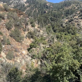
It's not a business. First part of trail very easy. Drop off to canyon very scary looking! read more


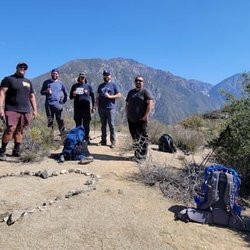
If you're looking for a moderate/easy-ish hiking trail with beautiful views this is your trail! This 5.9mi hike is located in the Angeles National park off the side of Mt Baldy Rd. The parking lot off Barret Stoddard Rd. You'll see a small power station off the right off Mt Baldy Rd, don't miss the sharp turn! There's are three small lots, one in the upper, lower and one across the street of mt baldy rd as overflow if all two inside lots are full. The inside lots are both pretty small with probably 10 cars max per lot. You will need to display your Adventure Pass parking permit! Buy them at your local Big5, Dicks, Walmart before coming up the mountain or risk a parking ticket. The trailhead itself is located about 1/2mi in from the parking lot. Follow the dirt path up the hill till you reach the cabin houses. Make sure to take the left path at the split that continues up hill! You will see many cabins and you walk all the way to the very end of the road. The trailhead is beyond the metal gate with the "no weapons beyond this point" sign. The hike itself is pretty straight forward all the way to the peak if you just follow the path. It has a slight up hill climb with 1145ft elevation gain. The hardest part is the very last 0.25mi finding the tiny path to get up to the peak. After the 5.25mi mark you will see these rocks in the pathway with another cross road. Go about 20 ft on the right side of that path and you'll again see another rock marker with 2 sticks. This is the entrance to the path for the summit! Do not miss this little path that looks like your going into the bushes. Yes you are literally going into a very narrow path directly up hill so the hardest part of the hike. Its highly recommended to wear long pants and long sleeve or be prepared to get scratched by all the random brush and poky agave trees on the side! They are super sharp, yes i got stabbed ouch. Reaching the peak continue as there are two peaks to see! You'll get a view of the entire mt baldy mountain with snow caps. Continue to the next path the reach the main summit with the large rocks people take pics on. Overall a great hike for the family or those just looking to get some exercise. Also note there is ZERO reception on the entire trail so download your GPS map offline or memorize/screenshot the trailmap if you need it. You won't be able to call or use any data even before getting to the parking lot. This is for both Verizon, Tmobile, Google Fi. read more


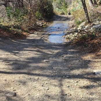


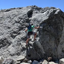
Very nice ~6 mile hike! Went with my sister and bro in law early in the morning at 8am. There were a few cars already parked at the small parking lot but none of them were for the Stoddard Peak Hike. The first 1/4 of the trail was walking through private road and passing by a few houses along the way. The trail was a mix of rocks and dirt so wear proper shoes. Overall, the trail was a steady incline until you hit the turn off which becomes a steep uphill climb (see picture). We didn't encounter anyone until we were almost at the peak so that was good. The view was really nice at the top! read more


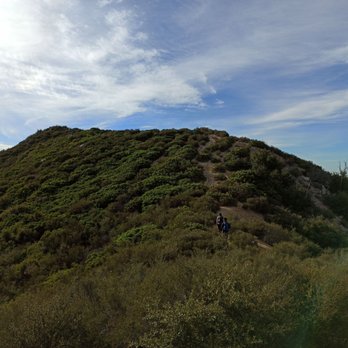



This is the first trail I've hiked where I had doubts about my safety and actually had to turn back halfway. I recommend going with a partner or two. Jason's review with directions is accurate, so take a screenshot of that because there is no cell reception. A hat and sunscreen are a must because there isn't much shade. A mile into the trail we came across a group of men that were drunk, disrespectful, and shooting branches with their pellet guns. Shortly after that, there was a man who was moving metal and branches; it looked like he was maybe piling them up to build something. He was talking to himself and just seemed 'off'. Maybe I went on a bad day. But I have seen recent reviews on AllTrails that mention cars being broken into. Be careful and stay alert. read more




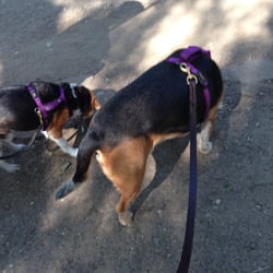
Parking- small lot on the right side of Mt. Baldy Rd at Mountain Ave. make a right...there is also an open dirt area across the Baldy Rd to park (make sure to display your Adventure Pass) *I have read online about quite a few broken windows in this area so make sure to take valuables with you or hide them out of plain view Trail- starts off as a wide fire road that will lead you to a residential area with cabins and at about .7 miles (not .5) take the private road to the right with a sign that says foot travel is allowed; at a little less than a mile you will reach a white metal road closed sign that you will need to pass to continue the rest of the hike; the next 1.5 miles are relatively easy on a wide path; at about 2.5 miles in keep your eyes to the right of the path to look for the small trail that you will need to take to the peak...this trail is about .5 miles and it is narrow, rocky and steep at times...you will reach what feels like the peak but continue on to the next peak and that is where you will find the trail marker with the "V" and "12" (this is the peak); the views are decent *dogs are allowed and my mutt loved it Distance- 6 miles RT Duration- probably between 2-4 hrs (for us it was 1:20 up and 50 mins. down which included some jogging) Difficulty- on the easy side of moderate just because of the .5 miles to the peak and the .5 miles from the peak but the other 5 miles are pretty easy Elevation Peak- 4,620 ft Elevation Gain- 1,200 ft read more






8 years ago
It's a little drive up Mt Baldy Rd, passing through a couple of tunnels, and a turn off where you see the Barrett-Stoddard sign. You will pass a very unique house shortly after starting the hike. As you get closer to the peak, you can easily miss the right turn where the trail goes up and the workout begins. I hope I remember to wear pants next time. There is overgrowth of brush on the single track and the possibility of getting a few scratches. Don't stop at the false summits. Keep going, sticking to the right around the boulders, till you reach the triangular post. You can find a register in a can under a rock. read more


8 years ago
This is a wonderful and less crowded approximately six mile hike in the LA area! I did this hike in late November and it was seriously gorgeous. The hike itself is pretty moderate. The most difficult part was finding the turn off to the peak, as it not well marked (we hiked right past it!), and finding our way through the brush after the turn off until we found the peak. I would suggest using the All Trails app to make sure that you don't get lost! The hike is beautiful, with some fall colors, cute cabins, some beautiful areas filled with pine trees, and of course, views! Some of my girlfriends were surprised by the pines, saying that it didn't even feel like we were in LA anymore. If you have a chance, check this hike out! Don't forget your Adventure Pass for parking. read more


6 years ago
A moderate six mile hike. Park off Mt. Baldy Rd. Not the first small lot you see as there is another small parking lot in there. Walk towards the fire road and stay to the right, pass the small houses. The climb up is gradual but nice. I actually passed the peak, as it is not obvious. Little to no signs guiding you. I stayed on the main road and ended up on the Stoddard/Barrett canyon which takes you in!!! Super quiet and peaceful. It leads you to the Cucamonga Truck Trail. I ended up heading back to the trail head and found Stoddard peak on the way back. Plenty to explore out there, the wood packers were out, highly recommended. read more


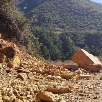


Really great hike. Parking was really easy and leads you straight to the path. Lots of false peaks but we made it to the top. Definitely wear hiking shoes and pants. My ankles got cut on some of the sharp plants going up. read more


12 years ago
This hike is about 6 miles roundtrip. There is a small parking lot at the start of the trail. It is a fairly easy hike with a mild incline up most of the way. Within the first 1/2 mile, you will pass by a cute little 'cottage' house. The trail is a dirt fireroad which is easy to maneuver. However, at the end, just before hitting Stoddard Peak, the road disappears and the trail becomes narrow and surrounded by thick, high brush with a very steep incline. Once you reach the first peak, you will think this is The Peak - it's not. You see another peak beyond the rock formations -this is The Peak. To reach it, you will need to descend the first peak and climb the next. It's a little tricky getting there. Once you reach this peak, you will see a rusty tin can with a ledger inside by the rocks for you to make a note that you were there (cute!). Views are nice but not breathtaking, but overall it's pleasant hike. tip - go early in the morning, before the sun comes up over the mountains. You will get mostly shade on the way up if you do (but probably not back down). read more


7 years ago

7 years ago
Came back to barrett stoddard road again this time to reach its peak. It took me almost 3 hours there and back and ended up hiking almost 9 miles great hike and views of all the surrounding mountains. Theres an ammo box with a notebook at the peak so you can sign in and write a note that you've made it to the top. read more





8 years ago
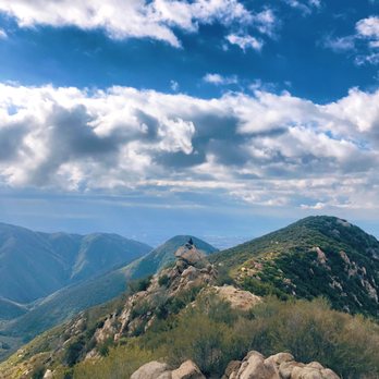
I completed this hike on January 1st and I really enjoyed it. It's a quiet hike, not crowded at all. It's a moderate hike and hiking poles are helpful on the way down. I would recommend wearing long sleeves and pants due to some parts of the trail requiring some "bush whacking" at some parts. Highly recommended! read more

5 years ago


10 years ago
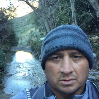
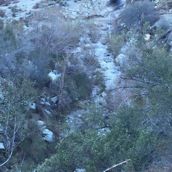
Started at 545 am and you have to be ready for the cold. Dress accordingly and also have a headlamp. It's dark! The gradual incline to the cutoff to both peaks is a good incline. Climb to the first peak is challenging. Second climb to the stoddard peak is also challenging. A little over 6 miles round trip! read more



10 years ago
More info about Stoddard Peak Hike
Barrett-Stoddard Rd
Upland, CA 91784
Directions
Hours
Indoor Amenities
Outdoor Amenities
Stoddard Peak Hike Reviews in Other Languages
Ask the Community - Stoddard Peak Hike
Review Highlights - Stoddard Peak Hike
You might also consider





















Why does Yelp recommend reviews?
1 review that is not currently recommended
The reviews below are not factored into the business's overall star rating.

9 years ago
Stoddard Peak Hike - hiking - Updated August 2026
Best of Upland
People found Stoddard Peak Hike by searching for…
Trending Searches in Upland, CA
Barbers near Stoddard Peak Hike
Bike Shop near Stoddard Peak Hike
Cliff Jumping near Stoddard Peak Hike
Consignment Shops near Stoddard Peak Hike
Cruising Spots near Stoddard Peak Hike
Dog Friendly Things To Do near Stoddard Peak Hike
Ear Piercing near Stoddard Peak Hike
Eyebrow Threading near Stoddard Peak Hike
Flower Fields near Stoddard Peak Hike
Hair Braiding near Stoddard Peak Hike
Kids Haircut near Stoddard Peak Hike
Mini Golf near Stoddard Peak Hike
Pedicure near Stoddard Peak Hike
Permanent Makeup near Stoddard Peak Hike
Picnic Areas near Stoddard Peak Hike
Preschools near Stoddard Peak Hike
Public Golf Courses near Stoddard Peak Hike
Rock Quarry near Stoddard Peak Hike
Running Trails near Stoddard Peak Hike
Scenic Night View near Stoddard Peak Hike
Scenic Overlook near Stoddard Peak Hike
Sunrise View near Stoddard Peak Hike
Swimming Holes near Stoddard Peak Hike
Trading Card Shops near Stoddard Peak Hike
Uniforms near Stoddard Peak Hike
Used Furniture Stores near Stoddard Peak Hike
Browse Articles
Browse Nearby
BEST of Upland, California Coffee near Stoddard Peak Hike
BEST of Upland, California Restaurants near Stoddard Peak Hike
BEST of Upland, California Things to Do near Stoddard Peak Hike
BEST of Upland, California Parks near Stoddard Peak Hike
BEST of Upland, California Breakfast near Stoddard Peak Hike
BEST of Upland, California Lakes near Stoddard Peak Hike
BEST of Upland, California Campgrounds near Stoddard Peak Hike
BEST of Upland, California Ski Resorts near Stoddard Peak Hike
Browse Brands
Related Searches in Upland, CA
Best Dog Hiking Trails Around Upland, California
Best Fishing Locations and Guides in Upland, California
Best Nature Trails for Hiking in Upland, California
Best Places for Horseback Riding in Upland, California
Check Out Off Road Trails in Upland, California
Discover Dog Friendly Trails to Explore in Upland, California
Discover Easy Hiking Trails Near Upland, California
Discover Kid Friendly Hiking Trails in Upland, California
Discover Popular Bike Trails in Upland, California
Discover Scenic Mountain Bike Trails Near Upland, California
Discover Walking Parks in Upland, California Near You
Discover a Hiking Trail in Upland, California
Discover the Best Night Hike Trails in Upland, California
Dog-Friendly Hikes With Dogs in Upland, California
Enjoy Camping Adventures Around Upland, California
Enjoy Kayaking Adventures in Upland, California
Enjoy Off Leash Dog Hikes in Upland, California
Enjoy Scenic Places to Walk in Upland, California
Enjoy Tent Camping Spots Around Upland, California
Enjoy a Beautiful Waterfall Hike in Upland, California
Enjoy the Best Walking Path in Upland, California
Enjoy the Best Walking Trails in Upland, California
Explore Beautiful Parks and Green Spaces in Upland, California
Explore Easy Hikes Perfect for All in Upland, California
Explore Fun Activities to Do in Upland, California
Explore Popular Campgrounds Near Upland, California
Explore Popular Dog Walking Trails in Upland, California
Explore Top Dog Parks in Upland, California Near You
Family Friendly Hiking With Kids in Upland, California
Find Top Dog Friendly Parks to Visit in Upland, California
Find Top-Rated Waterfalls in Upland, California Now
Find the Best Parks for Picnics in Upland, California
Hiking Trails With Waterfalls in Upland, California
Off Leash Dog Hiking Trails in Upland, California
Perfect Spots to Watch Sunset in Upland, California
Picnic Areas With BBQ Pits Available in Upland, California
Popular Outdoor Activities to Try in Upland, California
Popular Picnic Spots to Visit in Upland, California
Popular Waterfall Hiking Trails in Upland, California
Safe River Swimming Areas in Upland, California
Safe and Fun Parks for Kids in Upland, California
Top Hiking Trails to Explore in Upland, California
Top Playgrounds for Kids to Enjoy in Upland, California
Top Running Trails to Explore in Upland, California
Top Swimming Lakes to Enjoy in Upland, California
Top Swimming Spots and Pools in Upland, California
Top-Rated Camping Sites in Upland, California


