May Lake Photos


More like May Lake
Recommended Reviews - May Lake
Start your review...


Reviews With Photos


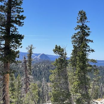
An easy hike to a beautiful lake. There are some inclines but definitely worth the "stairmaster" feel. You can glimpse half dome on your way up. Once there, enjoy scenic views and quiet spaces!


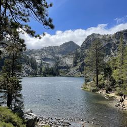
It's a short 1.2 mile hike from the parking lot up to the lake. Take your time and enjoy the views as you climb. The lake was worth it! The water was so clear but cold. The view of the mountains and lake was so beautiful. It wasn't crowded and very peaceful there. There is a nice display with info on the old Great Sierra Wagon road at the end of the parking lot. I didn't know that there were Chinese immigrants who worked on it in the 1880s. It was nice to learn that their contributions were acknowledged. There is a flushing toilet up at May Lake and pit toilets at the parking lot.
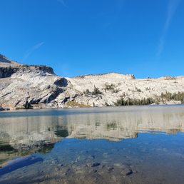

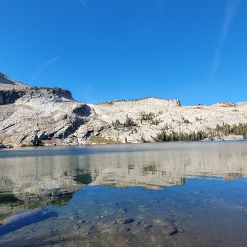
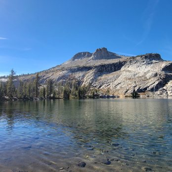
This review is for May Lake which was a ~2.3 miles round trip that took ~1.25 hours to complete. Another great hike located away from the busy and crowded hikes of Yosemite. Beautiful views of the lake! Chilly; ~20 degree temperature difference from Wapama Falls. Steady inclines up towards the lake! Required to drive ~2 miles on dirt road to trailhead. Short video of the hike for those interested! https://youtu.be/tQ6PF1YIAjw


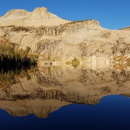
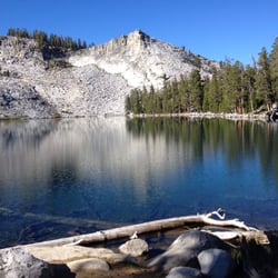
This is a pretty good hike in Yosemite. I'm definitely glad we checked out the Toulumne Meadows area. It was a lot less crowded than the rest of Yosemite when we visited (October time frame). This hike was fairly easy. It's about two miles round trip if you stop at the lake. It's uphill, but fairly gradual and not too steep. The lake is pretty with a mountain in the background. I wouldn't say the views are outstanding on this portion of the hike. I highly recommend continuing past the lake to Mount Hoffmann (continue to the left of the lake). This is a very difficult hike, but you get amazing views. Even if you don't make it to the summit, the views are amazing along the way. Overall, I would definitely recommend finding a hike in this area somewhere!

14 days ago
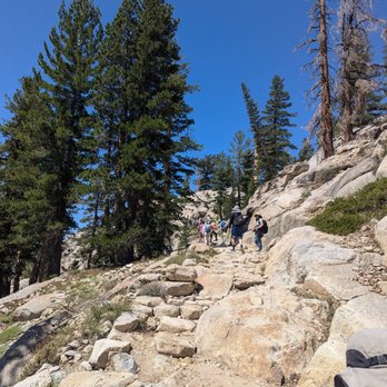
This was my first official hike in Yosemite after coming here for years. Usually, my friends or Hubs just want to do the usual sights around Yosemite Village, maybe walk to a waterfall or marvel at El Capitan, but not try a proper hiking trail. This trip, I am with a friend who came from France to REALLY see Yosemite. We chose this hike based on location, convenience and the "easy" rating it was given. The third was an exaggeration, but we didn't know. From the parking lot, it took us about 2 hours just to get to the lake, over terrain that was rocky and mostly sunny. My friend needed to stop frequently to monitor and slow her heart rate during the 1.2 mile ascent, which climbs about 500 feet above the approximate 8,710 ft elevation of the trailhead entrance in the parking lot. Speaking of the parking lot.... On this day, the Wednesday after Labor Day Weekend, the lot wasn't full and we easily found a spot. Wear sturdy shoes, have plenty of water, a hat and take your time. You'll be rewarded with a stunning lake and a cool dip before your descent, which took us less than 25 mins. Cheers! "CC" read more




2 months ago
This was a beautiful, short hike that's located off Tioga Road. If you're driving east towards Tuolumne Meadows, the turn off to the trailhead is before Olmsted Point and Tenaya Lake. The road leading to the trail is narrow and riddled with potholes. You'll need to take it slow and yield to cars coming the opposite direction. The lot was rather full on a Friday afternoon, but I snagged a spot of someone leaving. The hike itself is 2.4 round trip with a steady, but not too steep climb to the lake. Beautiful views of Mt Hoffman on the way up, along with Yosemite's high country. The lake itself is magical and serene. No swimming allowed, as it's labeled as a public water source. It's a popular spot not only because it's a relatively short and easier trail to access a Sierra lake, but it also has one of the High Sierra Camps for back packers. Still, winding away from the camp along the shore, there was solitude to be found with a few nice rocks to relax on and and enjoy a snack before heading down. Well kept trail to a beautiful lake, in less hectic, quieter part of Yosemite (relatively speaking.) read more


1 month ago

1 year ago
An easy hike to a beautiful lake. There are some inclines but definitely worth the "stairmaster" feel. You can glimpse half dome on your way up. Once there, enjoy scenic views and quiet spaces! read more


It's a short 1.2 mile hike from the parking lot up to the lake. Take your time and enjoy the views as you climb. The lake was worth it! The water was so clear but cold. The view of the mountains and lake was so beautiful. It wasn't crowded and very peaceful there. There is a nice display with info on the old Great Sierra Wagon road at the end of the parking lot. I didn't know that there were Chinese immigrants who worked on it in the 1880s. It was nice to learn that their contributions were acknowledged. There is a flushing toilet up at May Lake and pit toilets at the parking lot. read more



This review is for May Lake which was a ~2.3 miles round trip that took ~1.25 hours to complete. Another great hike located away from the busy and crowded hikes of Yosemite. Beautiful views of the lake! Chilly; ~20 degree temperature difference from Wapama Falls. Steady inclines up towards the lake! Required to drive ~2 miles on dirt road to trailhead. Short video of the hike for those interested! https://youtu.be/tQ6PF1YIAjw read more


1 year ago

7 years ago
This is a pretty good hike in Yosemite. I'm definitely glad we checked out the Toulumne Meadows area. It was a lot less crowded than the rest of Yosemite when we visited (October time frame). This hike was fairly easy. It's about two miles round trip if you stop at the lake. It's uphill, but fairly gradual and not too steep. The lake is pretty with a mountain in the background. I wouldn't say the views are outstanding on this portion of the hike. I highly recommend continuing past the lake to Mount Hoffmann (continue to the left of the lake). This is a very difficult hike, but you get amazing views. Even if you don't make it to the summit, the views are amazing along the way. Overall, I would definitely recommend finding a hike in this area somewhere! read more


9 years ago
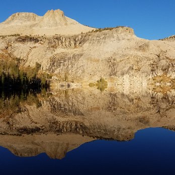
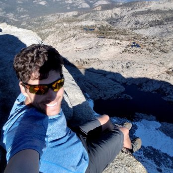
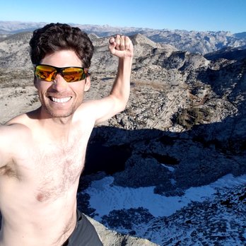
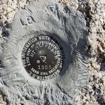
Easy hike to May Lake then to Mt. Hoffmann from Highway 120. If you want you can drive to a dirt road just off Highway 120 then proceed for about 2 miles that puts you very close to the lake (parking lot area) maybe parking for 20 cars. I chose to park on Highway 120 and start my hike there. I'm not looking for a short/easy hike, especially since I left my home in Elk Grove at 4 am and arrived at 7:15 am; this is going to be solid day of hiking :). The trail is 1.2 miles or so to the parking lot for May Lake. The lake is beautiful, no swimming allowed though. You can get some awesome mirror photos of the lake - see my photos! Take a left at the lake and your heading to Mt. Hoffmann. The hike up to Mt. Hoffmann can be a bit tricky as the trail disappears, save for some cairns, and the ground is screet. It can be hard at times to walk up the mountain because of the screet so try to stop now and again to search for cairns to make sure you're heading in the right direction. If you don't find any cairns continue moving forward uphill and to the left. Up top you'll want to scramble to the top where the antenna is. This is actually Mt. Hoffmann. It's beautiful up there. It took me 2 hours to hike to the top (Antenna) from Highway 120, so its a quick hike. The last 1 mile can be tough due to elevation gain and screet. You can take some cool photos up top, just know that in the morning the sun is not in the ideal place for photos so a later morning or early afternoon might yield better photos. After spending 30 minutes at the summit I decided to scramble down the other side of the mountain and complete a full circle of May Lake. I do not recommend this if you're not comfortable or strong enough to work your way down large boulders or have grippy shoes. Nonetheless, I imagine very few people who summit Mt. Hoffman actually go full circle around the lake, the other 99% most likely head back down the way they came up. On the other side there were numerous streams from the snow runoff just behind the mountain. There isn't much on the other side to see or do, but you can take some great photos of the lake and scenery which not many people get a chance to do. Also you will not see anyone :) If you complete the circle around May Lake and start from Highway 120 you will have hiked approximately just over 7 miles, according to my phones gps and step app, which showed I hiked 7.6 miles. I imagine a lot of this was hiking down and back and forth scrambling trying to find solid rocks to make my way. Overall this was a fun hike, average - below average hikers will do fine on this hike even if you don't start from the dirt road parking lot trailhead which saves just over 2 miles total. Bring water, I recommend 2 liters as there is not water once you get past May Lake. You may run into a very small stream so fill up your bottles and body at the lake. See my attached photos of my hike to May Lake and Mt. Hoffmann. Check out my other reviews of trail hikes in Yosemite National Park. read more



10 years ago

More info about May Lake
Ask the Community - May Lake
Review Highlights - May Lake


















May Lake - hiking - Updated September 2026
Best of Yosemite National Park
People found May Lake by searching for…
Swimming Holes in Yosemite National Park, CA
Parks in Yosemite National Park, CA
Swimming Lakes in Yosemite National Park, CA
Off Road Trails in Yosemite National Park, CA
Campgrounds in Yosemite National Park, CA
Things to Do in Yosemite National Park, CA
Hiking Trails in Yosemite National Park, CA
Kayak Rental in Yosemite National Park, CA
Places to Swim in Yosemite National Park, CA
Easy Hikes in Yosemite National Park, CA
Beautiful Views in Yosemite National Park, CA
Swimming in Yosemite National Park, CA
Camping With Showers in Yosemite National Park, CA
Fishing Ponds in Yosemite National Park, CA
Hikes With Waterfalls in Yosemite National Park, CA
Tent Camping in Yosemite National Park, CA
Off Leash Dog Hikes in Yosemite National Park, CA
National Parks in Yosemite National Park, CA
Things to See in Yosemite National Park, CA
Trails in Yosemite National Park, CA
Kid Friendly in Yosemite National Park, CA
Lookout Points in Yosemite National Park, CA


