Eagle Lake Photos


You might also consider


More like Eagle Lake
Recommended Reviews - Eagle Lake
Start your review...


Reviews With Photos


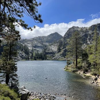
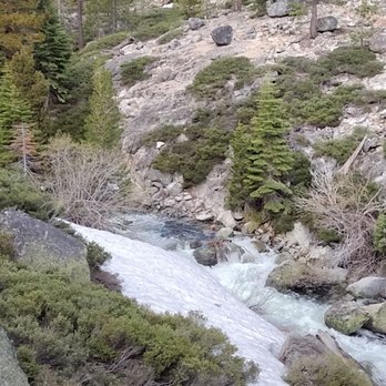
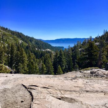
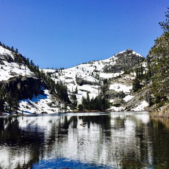
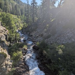
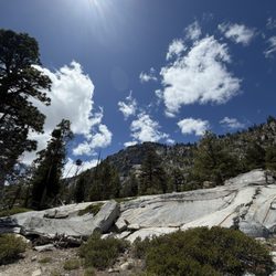
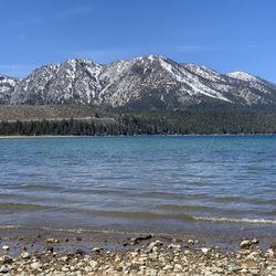
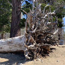
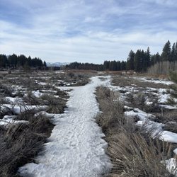
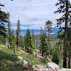
Hiking through running streams of water, flooded trails, fallen trees, and fields of snow on June 6, 2023. Got to the trailhead parking lot Tuesday at 8:20am, with plenty of open parking spaces. The $5 parking fee is waived. The pit toilets are open, as you can smell from a distance. One dog lifts its leg right next to the buildings, knowing from the smell that this is the place to relieve itself. From the start of the trail there is water streaming down the stairs, and puddles on the areas above each stair. Cross the bridge over the raging water falls and through the first of several fields of snow. Slippery going through the snow. Encounter two giant trees with trunks 2 feet in diameter, toppled over each other by storms over the trail. Tough time climbing over the fallen trees, so crawl under it. Able to do this only because my waist size is 35. Rocks everywhere on the trail, doing boulder jumping and climbing, requiring heavy duty hiking boots with ankle support. Those wearing sneakers risk turning an ankle, and bruised foot soles at the end of the day. Open expanses of granite with views of Emerald Bay in the background. Forested areas with large areas of the trail covered in running water from melting snow. Parts of the trail are completely submerged under running water. Saw many folks with soaked sneakers and socks. My Big 5 Sporting Goods Hi Tech Yosemite high top hiking boots are waterproof, and unaffected by the water. The farther we go toward the lake, the more snow appears, until the entire trail is covered a hundred yards of snow. You can follow the trail only by the footprints in the snow. Reach the lake by 9:30am with snow covering all the mountains all the way to lake level. Deep blue colored lake due to heavy snow runoff. Cold with high winds. Not a time to wear shorts. Going back to the trailhead is no easier than going up. Afraid of slipping on my behind going down through the snow fields. Helps to have hiking poles. Surprised at the number of people with brand new hiking boots. Saw last week's $29 Denali Outback Hiking at Big 5 sporting goods on more than one person. My 3 year old $49 High Tech Yosemite boots from Big 5 show tiny gaps in the glued bottoms from the beating on the trails. It's life expectancy is limited, but at least water proof, unlike the Denalis. At the full parking lot encounter a lady wearing decorative flip flops. Got to show those expensive pedicures with painted toenails. She's in for a rude awakening after her bare feet get soaked in the extensive puddles, running streams of water, and frost bite on her toes in the fields of snow.
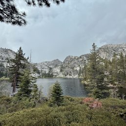

This is a relatively short and easy-to-moderate hike that begins at a paid parking lot. Not far into the trail, you'll come across a beautiful waterfall before starting the uphill climb to Eagle Lake. Since we're not very active, we took a few breaks on the way up, but the trail became much easier about halfway through. There were a few muddy spots, but no snow this time. When we tried the hike last May, snow had blocked the trail past the waterfall, so we were excited to finally complete it. The lake was incredibly peaceful, and we had it all to ourselves since we started later in the evening. An amazing hike with stunning views--definitely a 10/10 experience!

One of the best of hikes nature has to offer. Like I always tell people, we have to work with what we have. This weekend I took a trip to South Lake Tahoe to get away from the smoke. Feeling blessed the wind blew away and was in great conditions to compare with the bay. NOTE: Go early, there is barely no parking and can get packed fast. We arrived at 830a and people were already leaving. Eagle trailhead is a short hike but has stunning views.


Great view in Tahoe! We hiked at 3pm at the end of September and the weather was perfect the whole time. Good uphill hike, you have to navigate the rocks a little bit but it's pretty straightforward. It's private and I think you can wander further once at the hike to get more privacy and better swim access. We parked a little far since parking was still crowded at 3pm but at 5pm when we finished, a lot of the spots had cleared up. We hiked about an hour each way from parking spot to the lake. We kept at a moderate to slow pace. Cold water but I'd say swimmable!


Eagle Lake is definitely worth the visit! Finding parking was difficult, but my family got lucky and found one on the lot. The hike was about 1.5-2 miles according to my google maps (when there was service). There was a good amount of rocks and uphill/downhill, so be careful. Would also recommend hiking shoes; I wore boost running shoes and but still would have preferred hiking shoes. Getting to the lake may be tiring, but was well worth it for the beautiful view. Lots of kind hikers gave words of motivation that helped with that.


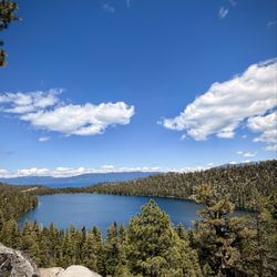
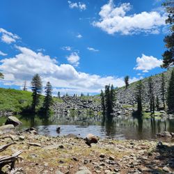
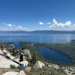
One of the best hiking trails in Lake Tahoe. Parking situation - Since the park's parking is super small (max 6-8 cars) so its mainly street parking. We had to wait by the main road for about 10 minutes for some car to leave to score a parking spot. Covid situation - We went on a Saturday, the trail was pretty crowded and we felt quite uncomfortable. Parts of the trail is narrow, so you will be in close proximity with others. Please take extra precaution and wear your masks for safety. However, best would be to avoid weekend crowd altogether and do this trail on a week day. Trail Difficulty level - Hike to the Eagle Falls is a 10 minute short uphill. We visited in the last weekend of September and Eagle Falls was completely dried up, which was pretty disappointing. The trail itself keeps your interest going. Walk through stone stairways and pine woods, waterfalls and the bridge, dramatic boulders, great view of lake Tahoe, and the finale - the very picturesque Eagle Lake itself.. there's no time to get bored in this trail. However from the falls continue your hike up to Eagle Lake. This hike is of moderate mid-level strenuous. It's an approx 1.5 miles incline on rocky stairs and takes about 45 minutes to the lake. Highly recommend to wear your hiking shoes for better stability and grip on those rocky stairs as it can get tough on your knees and ankle. The view - On the top, suddenly a deep blue lake emerges in front of you, nestled in between the green pines and peaks surrounding it. The sight is jaw-dropping. The lake has pristine water, but the water is cold as its snow melted straight from the peaks. We walked around the lake further from the entry and chose a serene shaded spot for lunch. It felt like we were on our own little island. Definitely pack a picnic to enjoy by the lake, take a dip in the water and make a day out of it. Overall a great workout hike with majestic view of Lake Tahoe and Eagle Lake. Happy adventure!


Eagle lake is one of the many trails at Desolation Wilderness in South Lake Tahoe. Parking is mainly street parking since the tiny parking lot usually gets packed very quickly. We hiked a total of 3.6 miles. It's about a 2 mile hike of incline to get to the lake. It's definitely a very moderate hike. *FYI: 50% of people are wearing masks and are following the notion of social distancing while some aren't. So again, use extra precautions wear a mask for your safety and the safety of others and remember to social distance. *Also, Eagle Lake Falls - Is just across from the trail to the Lake. It's a bit of a rock climb down to get a better view of the waterfall and up top isn't so bad. You'll also find a mini-waterfall along the bridge trail to the lake. Oh, and before I forget... Remember to wear your hiking shoes. The rocks can be a little steep and slippery! Any who, Happy Hiking!


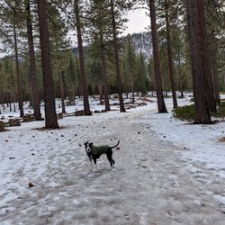
The lake was absolutely stunning! The trail is dog friendly but definitely not easy for smaller dogs, we brought our 10 pounds terrier with us and had to put her in her backpack for the last 3rd of the hike. Need to be careful of unstable rocks and slippery snow on the trail but the view was absolutely worth it! So glad we came here, 5/5 would recommend!!


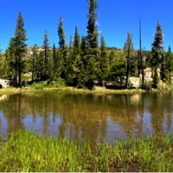
Eagle Lake is the perfect shorter hike if you're looking to get a taste of Desolation Wilderness without going too far in to the backcountry. Parking is $5 at the Eagle Falls trailhead if you're lucky enough to score a spot-otherwise park (carefully) alongside the road where it's permissible. Follow the trail up to the left and you'll approach Upper Eagle Falls (which were still flowing nicely in August.) Cross the bridge and you'll start to head up to the lake. It's a bit of an incline with a rocky path and exposed tree roots-not to be done in flip flops or sneakers without traction. It's steep in some areas but manageable. Once you arrive, you'll realize how worth the short trek is. The lake is beautiful, set within the granite peaks surrounding it and framed in pines. There are plenty of spots to sit and enjoy the scenery. This was my second time visiting this lake. Last year it was over Memorial Day weekend and the trail and lake were packed. This time, it was a random Friday in August and I stopped at Eagle Lake after a long arduous day hike up to Velma Lakes. This was my last stop of the day and I enjoyed the cool breeze as I rested my legs before heading back to my car. Eagle Lake is so peaceful and lovely that I hope to make it a must stop any time in Tahoe. Know if you go: -trail is 2 miles round trip -rocky and steep in spots -decent hike for families (I've seen plenty of kids and families up there) -if you're adventurous and an experienced hiker, this is a great gateway to Desolation Wilderness


After a short trek on the Eagle Falls Trailhead, we made it to the lake! It was quite stunning but best of all, the water wasn't freezing cold where you couldn't get in. Therefore, the husband and I decided to take a dip along with a couple other people who trekked up there. If you're going to make the trek to the lake, do yourself a favor and get in! You might as well enjoy it. You'll dry off on the hike down anyway and it's super refreshing.


Beautiful and dog friendly! The view is definitely worth it and breathtaking. I recommend going really early to find parking. I went around 10 am and finished around 1 pm and beat the rush of people. Please wear your masks. There were way too many ppl on the trail not wearing face coverings.
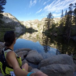

Wow wow wow!! This is a must stop point if you like waterfalls, creeks, rock formations, mountains and scrambling. Brought my kids 5 & 8 and they can do most of it. Views are incredible. We went to the waterfall (10 mins on the trail) and bridge and then to the vista point. Wanted to do more but the 5 y/o got tired. You can scramble this whole mountain! read more



11 months ago
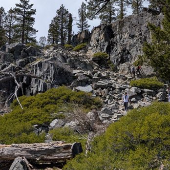
The hike was just the right amount of challenging to really appreciate the top and sit and look over the lake. It took us about 4 hours round trip. Nice clean trail, no bikers. It was great. Would do it again. read more


1 year ago

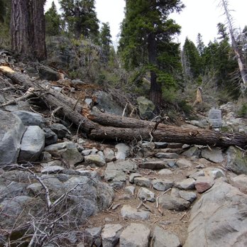
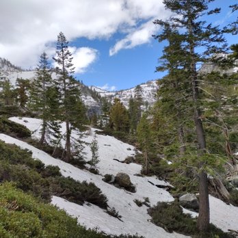
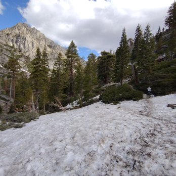
Hiking through running streams of water, flooded trails, fallen trees, and fields of snow on June 6, 2023. Got to the trailhead parking lot Tuesday at 8:20am, with plenty of open parking spaces. The $5 parking fee is waived. The pit toilets are open, as you can smell from a distance. One dog lifts its leg right next to the buildings, knowing from the smell that this is the place to relieve itself. From the start of the trail there is water streaming down the stairs, and puddles on the areas above each stair. Cross the bridge over the raging water falls and through the first of several fields of snow. Slippery going through the snow. Encounter two giant trees with trunks 2 feet in diameter, toppled over each other by storms over the trail. Tough time climbing over the fallen trees, so crawl under it. Able to do this only because my waist size is 35. Rocks everywhere on the trail, doing boulder jumping and climbing, requiring heavy duty hiking boots with ankle support. Those wearing sneakers risk turning an ankle, and bruised foot soles at the end of the day. Open expanses of granite with views of Emerald Bay in the background. Forested areas with large areas of the trail covered in running water from melting snow. Parts of the trail are completely submerged under running water. Saw many folks with soaked sneakers and socks. My Big 5 Sporting Goods Hi Tech Yosemite high top hiking boots are waterproof, and unaffected by the water. The farther we go toward the lake, the more snow appears, until the entire trail is covered a hundred yards of snow. You can follow the trail only by the footprints in the snow. Reach the lake by 9:30am with snow covering all the mountains all the way to lake level. Deep blue colored lake due to heavy snow runoff. Cold with high winds. Not a time to wear shorts. Going back to the trailhead is no easier than going up. Afraid of slipping on my behind going down through the snow fields. Helps to have hiking poles. Surprised at the number of people with brand new hiking boots. Saw last week's $29 Denali Outback Hiking at Big 5 sporting goods on more than one person. My 3 year old $49 High Tech Yosemite boots from Big 5 show tiny gaps in the glued bottoms from the beating on the trails. It's life expectancy is limited, but at least water proof, unlike the Denalis. At the full parking lot encounter a lady wearing decorative flip flops. Got to show those expensive pedicures with painted toenails. She's in for a rude awakening after her bare feet get soaked in the extensive puddles, running streams of water, and frost bite on her toes in the fields of snow. read more





1 year ago
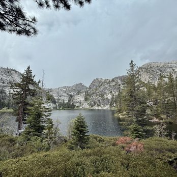
This is a relatively short and easy-to-moderate hike that begins at a paid parking lot. Not far into the trail, you'll come across a beautiful waterfall before starting the uphill climb to Eagle Lake. Since we're not very active, we took a few breaks on the way up, but the trail became much easier about halfway through. There were a few muddy spots, but no snow this time. When we tried the hike last May, snow had blocked the trail past the waterfall, so we were excited to finally complete it. The lake was incredibly peaceful, and we had it all to ourselves since we started later in the evening. An amazing hike with stunning views--definitely a 10/10 experience! read more


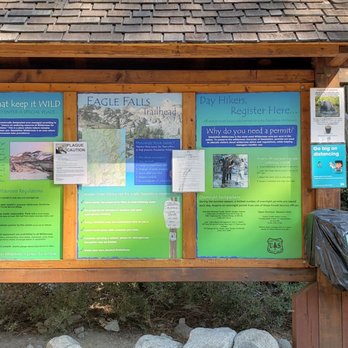
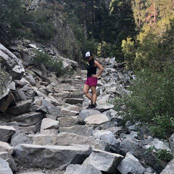
One of the best of hikes nature has to offer. Like I always tell people, we have to work with what we have. This weekend I took a trip to South Lake Tahoe to get away from the smoke. Feeling blessed the wind blew away and was in great conditions to compare with the bay. NOTE: Go early, there is barely no parking and can get packed fast. We arrived at 830a and people were already leaving. Eagle trailhead is a short hike but has stunning views. read more




4 years ago
Great view in Tahoe! We hiked at 3pm at the end of September and the weather was perfect the whole time. Good uphill hike, you have to navigate the rocks a little bit but it's pretty straightforward. It's private and I think you can wander further once at the hike to get more privacy and better swim access. We parked a little far since parking was still crowded at 3pm but at 5pm when we finished, a lot of the spots had cleared up. We hiked about an hour each way from parking spot to the lake. We kept at a moderate to slow pace. Cold water but I'd say swimmable! read more




Eagle Lake is definitely worth the visit! Finding parking was difficult, but my family got lucky and found one on the lot. The hike was about 1.5-2 miles according to my google maps (when there was service). There was a good amount of rocks and uphill/downhill, so be careful. Would also recommend hiking shoes; I wore boost running shoes and but still would have preferred hiking shoes. Getting to the lake may be tiring, but was well worth it for the beautiful view. Lots of kind hikers gave words of motivation that helped with that. read more

6 years ago
One of the best hiking trails in Lake Tahoe. Parking situation - Since the park's parking is super small (max 6-8 cars) so its mainly street parking. We had to wait by the main road for about 10 minutes for some car to leave to score a parking spot. Covid situation - We went on a Saturday, the trail was pretty crowded and we felt quite uncomfortable. Parts of the trail is narrow, so you will be in close proximity with others. Please take extra precaution and wear your masks for safety. However, best would be to avoid weekend crowd altogether and do this trail on a week day. Trail Difficulty level - Hike to the Eagle Falls is a 10 minute short uphill. We visited in the last weekend of September and Eagle Falls was completely dried up, which was pretty disappointing. The trail itself keeps your interest going. Walk through stone stairways and pine woods, waterfalls and the bridge, dramatic boulders, great view of lake Tahoe, and the finale - the very picturesque Eagle Lake itself.. there's no time to get bored in this trail. However from the falls continue your hike up to Eagle Lake. This hike is of moderate mid-level strenuous. It's an approx 1.5 miles incline on rocky stairs and takes about 45 minutes to the lake. Highly recommend to wear your hiking shoes for better stability and grip on those rocky stairs as it can get tough on your knees and ankle. The view - On the top, suddenly a deep blue lake emerges in front of you, nestled in between the green pines and peaks surrounding it. The sight is jaw-dropping. The lake has pristine water, but the water is cold as its snow melted straight from the peaks. We walked around the lake further from the entry and chose a serene shaded spot for lunch. It felt like we were on our own little island. Definitely pack a picnic to enjoy by the lake, take a dip in the water and make a day out of it. Overall a great workout hike with majestic view of Lake Tahoe and Eagle Lake. Happy adventure! read more
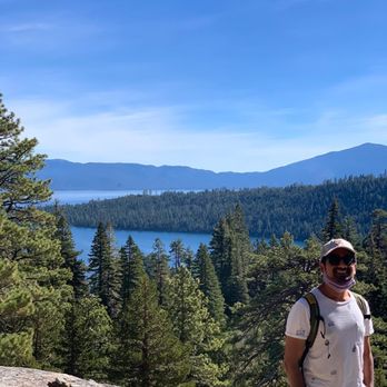


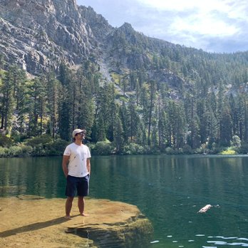


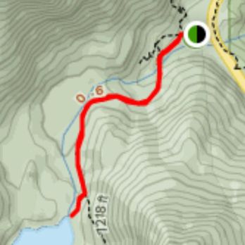


Eagle lake is one of the many trails at Desolation Wilderness in South Lake Tahoe. Parking is mainly street parking since the tiny parking lot usually gets packed very quickly. We hiked a total of 3.6 miles. It's about a 2 mile hike of incline to get to the lake. It's definitely a very moderate hike. *FYI: 50% of people are wearing masks and are following the notion of social distancing while some aren't. So again, use extra precautions wear a mask for your safety and the safety of others and remember to social distance. *Also, Eagle Lake Falls - Is just across from the trail to the Lake. It's a bit of a rock climb down to get a better view of the waterfall and up top isn't so bad. You'll also find a mini-waterfall along the bridge trail to the lake. Oh, and before I forget... Remember to wear your hiking shoes. The rocks can be a little steep and slippery! Any who, Happy Hiking! read more


The lake was absolutely stunning! The trail is dog friendly but definitely not easy for smaller dogs, we brought our 10 pounds terrier with us and had to put her in her backpack for the last 3rd of the hike. Need to be careful of unstable rocks and slippery snow on the trail but the view was absolutely worth it! So glad we came here, 5/5 would recommend!! read more


4 years ago
Go early. Parking is full by 10:30am. Family and dog friendly to the waterfall, more difficult to Eagle Lake. At the beginning of the trail head, take the right (uphill) trail the the vista point. Great view of the lake. read more


9 years ago
Eagle Lake is the perfect shorter hike if you're looking to get a taste of Desolation Wilderness without going too far in to the backcountry. Parking is $5 at the Eagle Falls trailhead if you're lucky enough to score a spot-otherwise park (carefully) alongside the road where it's permissible. Follow the trail up to the left and you'll approach Upper Eagle Falls (which were still flowing nicely in August.) Cross the bridge and you'll start to head up to the lake. It's a bit of an incline with a rocky path and exposed tree roots-not to be done in flip flops or sneakers without traction. It's steep in some areas but manageable. Once you arrive, you'll realize how worth the short trek is. The lake is beautiful, set within the granite peaks surrounding it and framed in pines. There are plenty of spots to sit and enjoy the scenery. This was my second time visiting this lake. Last year it was over Memorial Day weekend and the trail and lake were packed. This time, it was a random Friday in August and I stopped at Eagle Lake after a long arduous day hike up to Velma Lakes. This was my last stop of the day and I enjoyed the cool breeze as I rested my legs before heading back to my car. Eagle Lake is so peaceful and lovely that I hope to make it a must stop any time in Tahoe. Know if you go: -trail is 2 miles round trip -rocky and steep in spots -decent hike for families (I've seen plenty of kids and families up there) -if you're adventurous and an experienced hiker, this is a great gateway to Desolation Wilderness read more


After a short trek on the Eagle Falls Trailhead, we made it to the lake! It was quite stunning but best of all, the water wasn't freezing cold where you couldn't get in. Therefore, the husband and I decided to take a dip along with a couple other people who trekked up there. If you're going to make the trek to the lake, do yourself a favor and get in! You might as well enjoy it. You'll dry off on the hike down anyway and it's super refreshing. read more


6 years ago
Hiking the Eagle Falls to the top for Eagle Lake. It takes about 45 minutes to the top but worth the view and the water is refreshing when you get in. The eagle fall is disappointing but the trail to the lake makes up for it. read more


6 years ago
Beautiful and dog friendly! The view is definitely worth it and breathtaking. I recommend going really early to find parking. I went around 10 am and finished around 1 pm and beat the rush of people. Please wear your masks. There were way too many ppl on the trail not wearing face coverings. read more


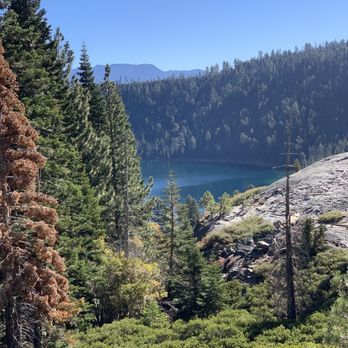


I think i reviewed eagle lake under the eagle falls yelp. Oops. Let's just say this is a really easy short hike perfect for kids, dogs and tourists haha -- or if you don't have a lot of time. Took my sister n law today for an early morning pre wedding hike -- I'm getting married this evening and wanted to allow my fiancé to sleep in. My SIL works Out but isn't used to the whole hiking thing or the elevation. She was a bit winded but that's probably because she was trying to keep up with me. I enjoyed the peaceful morning before the wedding craziness. It gets too busy here though. Parking fills up quick. Get here early. Pack it in . Pack it out. read more
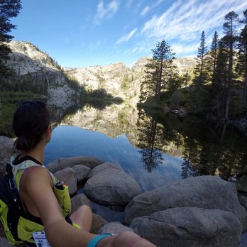
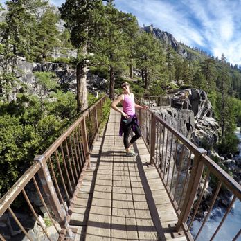

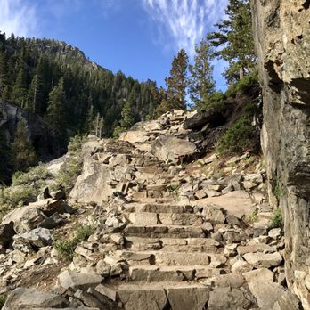


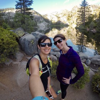
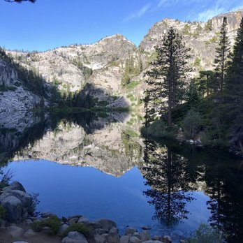
Wow! It was quite a climb from the bridge at Upper Eagle Falls to get to this lake. It was well worth the effort. A lot of people made their way down to the shoreline. We elected to head back. The hike downhill took nearly as long as the hike up. Either the elevation gain or the irregular spaced steps wore me out! Be sure to get a permit if you're going to the lake. You just need one for your party. read more


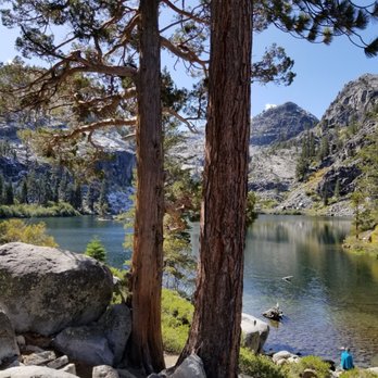


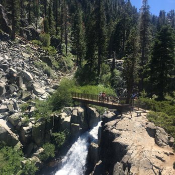





15 years ago
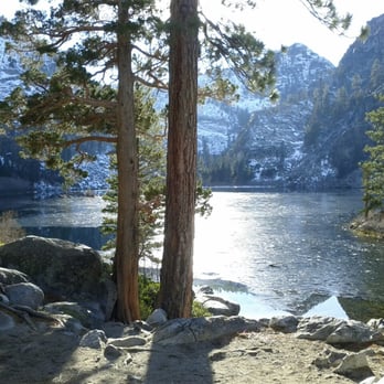
Quick tips first: In late Fall, Winter and Spring you will probably encounter icy/snowy conditions on the Eagle Falls trail after the bridge. After the bridge, the first 2/3 of the trail to Eagle Lake is on the North face and in the shade of the mountain. To be safe, particularly for a treacherous decent in icy conditions bring poles and snow/ice shoe tracks/chains/soles. You will feel so much more comfortable if you do. At least grab a wood stick, it helps a lot. You need to fill the wilderness permit form at the beginning of the trail (parking lot). Some numbers given by my Android Nexus S phone: From the parking lot of Eagle Falls Trailhead to Eagle Lake: 2.1km hike (1.3mi) 450m elevation (1500ft) Gorgeous hike, a bit strenuous (we have just done it in icy conditions during Thanksgiving WE). But my 3.5 and 6yo daughters managed to do it (with our help on the icy parts of the trail). I saw several people sliding on ice. My wife and I were always holding our kids hands and they would have found themselves on their bottom more than 8 times each. Eagle Lake is beautiful and is a nice place to rest, to snack and for the kids to play around before the descent. The view is superb when you reach the end of the trail to discover the lake. End of November more than half the lake was frozen (check my photo). read more

12 years ago
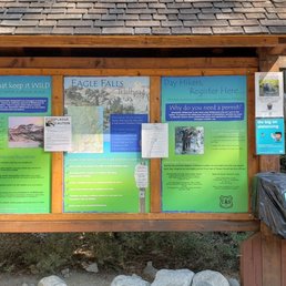
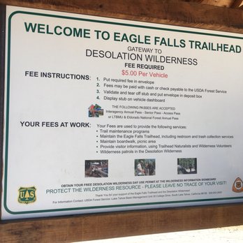
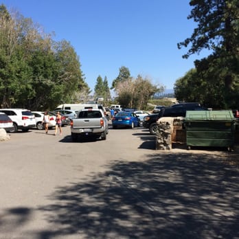
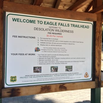
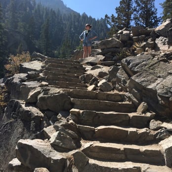
Hiked this yesterday, second week in September, with my wife & 20 yr old daughter. Skies were clear. Temps in the mid 70's. The parking lot was a zoo, but we lucked out and scored a prime spot at just the right moment. $5 fee to park. You'll be entering a wilderness area, so be sure and fill out the FREE permit. I doubt with the heavy use this area gets, you'd only get a warning from a ranger out on the trail, but hey...it's not worth the fine and it's the right thing to do. It's free and takes only a minute or two to complete. Hitting the trail, you have to make a choice: Eagle Lake Loop or Eagle Lake. We chose Eagle Lake....the "loop" appeared to go up and up and up. So keep left. Soon you'll be at Eagle Falls. This time of year it's rather a bust with barely any water flowing, but there is a nice bench to rest upon and a bridge across that you'll need to take in your journey to Eagle Lake. The trail is very well maintained and my hats off to the work crews that placed all those granite steps. I've done a few hikes in my time and this one never ceased to amaze me with the effort put in by those guys to maintain the trail all the way to Eagle Lake. The hike itself is moderately strenuous but not a killer. Anyone with bad hips or knees might be overly challenged. Definitely need to watch your step in a few places or a twisted ankle is sure to follow. It's up hill most of the way to Eagle Lake but with all the marvelous views to stop and take pics, we didn't find it overly taxing. By the time we reached our destination, I was ready for a dip in the crystal clear....read: COLD....water. So refreshing. Others did the same, with a few exercising a "clothing optional" approach. If that bothers you, don't look to closely at those going for a swim. You might see more than you wanted to see. After about an hour at the lake, we packed up and headed back. Eyes were more focused on trail as we watched our step, but again, it was in no way treacherous. Just didn't want to slip or fall. It's by no means a lightly used trail and we saw several other hikers, but we never felt crowded or rushed. Back at the parking lot, it was still full and we gladly signaled to someone we were ready to pull out. They were very appreciative. We'll be back. Definitely want to see this lake & the falls other times during the year. read more




7 years ago

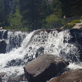
Hiked this with my girlfriend last Saturday. Let me just say I fell in love! The hike itself wasn't too bad... easy to moderate depending on your fitness level. There is some incline on the way up to the lower falls and a bit more on the way up to the lake but it won't kill you. The path is lined with rocks and some area is dirt. Easy. The lake was beautiful. With the mountains as its backdrop, you almost feel like you're on your own little island! The water was crystal clear and cool. So pretty. It can get crowded due to the easiness of the hike but go, it's worth it. The view of Emerald bay along with the waterfalls and the lake you can't go wrong. This is now added to my list of favorites! Bring your swimming gear, water shoes, pack a little picnic and you're going to have a fabulous day! There is camping and fishing allowed by the lake! Happy hiking and exploring. Get there early for a good free parking spot! read more




8 years ago
Get here before 9 am if you want to beat the heat and the crowds. $5 to park in the lot (free on 89), and don't forget to fill out your free permit at the trailhead (basically just a was for the USFS to maintain accountability on the trail). This hike is about 2 miles to Eagle Lake, but it is all uphill. I would consider this a moderate trail once you get passed the bridge over the falls. Stick with the never ending stone steps, the lake is worth it! read more


9 years ago

3 years ago


9 years ago
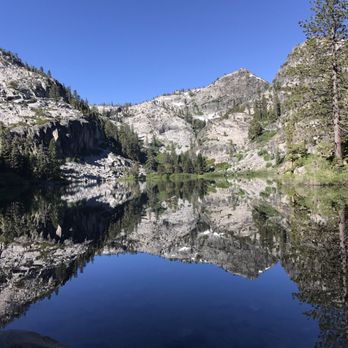
Go early in the morning to avoid the crowds. The view of Eagle Lake will be worth the hike. I couldn't get enough of the peace and tranquility it offers. read more

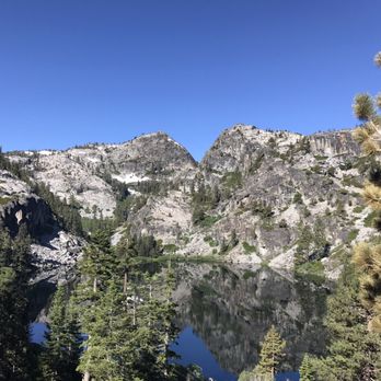

12 years ago
The hike was amazing, and my only regret was that we were here in January, rather than the summer time. The weekend was unseasonably warm, so we decided to try a little hiking. This trail would be a moderately challenging one in good conditions... on the weekend we attempted it, the top half was at least ice and at most, hip-deep snow. To me, this hike can be broken into 3 parts: The first two overlooks, the lake, and the peak. At the time of our hike, it was fairly easy to get to the first two overlooks. A short portion of the path was completely ice, making it hard to walk on the area, but we were able to march through the thin woods to arrive at the first overlook. The views of the lake from here were amazing, and it was a great place to stop for a picture! A short walk further, you'll reach another cliff, which overlooks the smaller bay and island... truly, a very beautiful view, and a great spot to stop for a snack. Beyond this area, the trail got far more treacherous. It was almost entirely ice, which was hard to get around, as the woods became snowy. We reached an ice lake, which was frozen-through, but must be -unbelievable- in the summer time. I can just imagine bringing a picnic up here, swimming and then continuing the hike up! (Fantastic!) The next part is the hardest... the steep, uphill climb to the peak. This would be challenging on a regular day, and for us, the bulk of it was knee-deep snow (possibly hip-deep if you hit an air pocket). The trail was too icy to walk on, so we were forced to keep to the banks. In retrospect, some crampons would have REALLY been helpful here. My boyfriend and I were hiking together, and while we're not ritual hikers, we're both young and in pretty good shape. It took us about 2hrs to go from the base to the peak, which was around 3 miles away. an hour of that (easily) must've been the last portion of this hike. Each step was taken carefully after testing our footing, and when we finally reached the top, the whole thing was worth it. The views were breathtaking!!! I'll add some pictures later, as I know that I have some... but wow - just truly unbelievable 360-degree views of the mountains and lake. It took us about an hour to get back down (sitting and sliding on the ice a lot), making our entire 5.5-6mi endeavor about 3hrs long. On a normal day, I'm sure this would be doable in 1.5-2hrs, depending on how long you choose to linger at the overlooks. I wish the weather had been better, but as wonderful as the view was, I would definitely go again! read more


9 years ago
Awesome hike!!! Must get there before 830ish or good luck finding a parking space. The hike can be tough. It's mostly up hill climbing stairs. Approx 4 miles round trip. Great views of the falls, stream, both Lake Tahoe and the end which is Eagle lake. read more
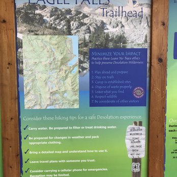

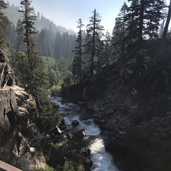


9 years ago
Absolutely Beautiful Lake. The hike up there is not as easy has I had read before. I went with my kids and It got a little hard at times. But even if I would of gone without them it would still be moderately difficult since it's up hill all the way basically. Lots of amazing trees and river rushing by. Pet friendly. Great views of Emerald Bay from half way mark. Definitely worth the hike up to see the Lake where the snowy mountains reflect on the clear water. Get there before 8am if possible and avoid the crowds. On our way back down from the hike at 1030 am there were so many people starting the hike up it took us longer to get back down than it did to go up. The falls are rushing right now. They are so beautiful. read more


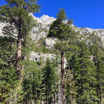




10 years ago
Do you like awesome views of mountains and water? Do you want to feel amazed at the beauty of nature? Do you have 60-90 minutes? If you said yes to any of those questions, go do this hike. Just go do it. Parking gets crowded at the trailhead, especially on the weekend, so get there early. This is a fee site ($5/vehicle) and there are bathrooms at the parking lot. There are two routes at the trailhead but it's a loop, so you can't go wrong choosing one path over the other. If you do only the loop at a walking pace you'll probably be done within 20-30 minutes, but you'd also have missed out on a great opportunity to see some amazing scenery. At the far end of the loop and after a slight ascent, you'll come across a bridge and Eagle Falls. It wasn't anything special in October, but probably looks great when the snow melt increases the amount of water coming down. Cross the bride and continue ascending up the trail another 20-30 minutes, following the signs towards Eagle Lake. The trail opens up into a rocky ascent and the trail isn't very clearly defined, but just keep heading up and you'll see it again. Arrive, picnic, swim, take pictures, then head on down and stop at the top of the rocky portion to gaze at Emerald Bay and Lake Tahoe. Total distance is ~2 miles round trip from parking lot to the lake and back. Terrain is mainly ascending/descending (can be tough on knees) Overall a mild/moderate hike (mild if you just stick to the loop up to the bridge) read more


9 years ago

11 years ago
Page 1 of 2
More info about Eagle Lake
South Lake Tahoe, CA 96150
Directions
Hours
Outdoor Amenities
Ask the Community - Eagle Lake
Review Highlights - Eagle Lake
You might also consider





























Eagle Lake - hiking - Updated August 2026
Best of South Lake Tahoe
People found Eagle Lake by searching for…
Things to Do in South Lake Tahoe, CA
Swimming Holes in South Lake Tahoe, CA
Hiking Trails With Waterfalls in South Lake Tahoe, CA
Fishing in South Lake Tahoe, CA
Fishing Spots in South Lake Tahoe, CA
Watch Sunset in South Lake Tahoe, CA
Scenic View in South Lake Tahoe, CA
Free Snow Play in South Lake Tahoe, CA
Places to Take Pictures in South Lake Tahoe, CA
River Swimming in South Lake Tahoe, CA
Swimming Lakes in South Lake Tahoe, CA
Natural Hot Springs in South Lake Tahoe, CA
Dog Friendly Hiking Trails in South Lake Tahoe, CA
Picnic Spots in South Lake Tahoe, CA
Rock Climbing in South Lake Tahoe, CA
Easy Hikes in South Lake Tahoe, CA
Picnic Areas in South Lake Tahoe, CA
Scenic Drive in South Lake Tahoe, CA
Off Road Trails in South Lake Tahoe, CA
Dog Swimming in South Lake Tahoe, CA
Playgrounds in South Lake Tahoe, CA
Trending Searches in South Lake Tahoe, CA
Dog Friendly Things To Do near Eagle Lake
Dog Friendly Trails near Eagle Lake
Fishing With Kids near Eagle Lake
Indoor Mini Golf near Eagle Lake
Jet Ski Rental near Eagle Lake
Kids Activities Indoor near Eagle Lake
Lookout Points near Eagle Lake
Movie Theater With Recliners near Eagle Lake
Outdoor Activities near Eagle Lake
Rainy Day Activities near Eagle Lake
River Swimming near Eagle Lake
Scenic Overlook near Eagle Lake
Shopping Malls near Eagle Lake
Sports Card Shops near Eagle Lake
Things To Do On A Rainy Day near Eagle Lake
Trading Card Shops near Eagle Lake
Used Book Stores near Eagle Lake
Browse Articles
Browse Nearby
BEST of South Lake Tahoe, California Restaurants near Eagle Lake
BEST of South Lake Tahoe, California Coffee near Eagle Lake
BEST of South Lake Tahoe, California Things to Do near Eagle Lake
BEST of South Lake Tahoe, California Breakfast near Eagle Lake
BEST of South Lake Tahoe, California Beaches near Eagle Lake
BEST of South Lake Tahoe, California Campgrounds near Eagle Lake
Browse Brands
Related Searches in South Lake Tahoe, CA
Affordable Kayak Rental Services in South Lake Tahoe, California
Best Dog Hiking Trails Around South Lake Tahoe, California
Best Fishing Locations and Guides in South Lake Tahoe, California
Best Places for Horseback Riding in South Lake Tahoe, California
Best Pontoon Boat Rentals Near South Lake Tahoe, California
Best Sightseeing Experiences Available in South Lake Tahoe, California
Best Waterfalls and Swimming Holes in South Lake Tahoe, California
Check Out Off Road Trails in South Lake Tahoe, California
Discover Dog Friendly Trails to Explore in South Lake Tahoe, California
Discover Easy Hiking Trails Near South Lake Tahoe, California
Discover Kid Friendly Hiking Trails in South Lake Tahoe, California
Discover Lakes & Ponds to Explore in South Lake Tahoe, California
Discover Popular Bike Trails in South Lake Tahoe, California
Discover Public Beaches to Visit in South Lake Tahoe, California
Discover a Hiking Trail in South Lake Tahoe, California
Discover the Best Beaches in South Lake Tahoe, California
Discover the Best Night Hike Trails in South Lake Tahoe, California
Dog-Friendly Hikes With Dogs in South Lake Tahoe, California
Enjoy Camping Adventures Around South Lake Tahoe, California
Enjoy Kayaking Adventures in South Lake Tahoe, California
Enjoy Off Leash Dog Hikes in South Lake Tahoe, California
Enjoy Tent Camping Spots Around South Lake Tahoe, California
Enjoy Water Activities and Fun in South Lake Tahoe, California
Enjoy a Beautiful Waterfall Hike in South Lake Tahoe, California
Enjoy the Best Picnic Spots and Ideas in South Lake Tahoe, California
Enjoy the Best Tubing Experiences in South Lake Tahoe, California
Enjoy the Best Walking Path in South Lake Tahoe, California
Enjoy the Best Walking Trails in South Lake Tahoe, California
Experience Thrilling White Water Rafting in South Lake Tahoe, California
Explore Beautiful Parks and Green Spaces in South Lake Tahoe, California
Explore Boat Rentals for Every Need in South Lake Tahoe, California
Explore Easy Hikes Perfect for All in South Lake Tahoe, California
Explore Fun Activities to Do in South Lake Tahoe, California
Explore Parks With Lakes to Visit in South Lake Tahoe, California
Explore Popular Campgrounds Near South Lake Tahoe, California
Explore Popular Picnic Areas Around South Lake Tahoe, California
Explore Popular RV Parks Around South Lake Tahoe, California
Explore Popular State Park Destinations in South Lake Tahoe, California
Explore Top Dog Parks in South Lake Tahoe, California Near You
Explore Top Marinas Near South Lake Tahoe, California
Explore Top Water Parks in South Lake Tahoe, California Today
Explore the Best Beach Spots in South Lake Tahoe, California
Explore the Best Swimming Holes Around South Lake Tahoe, California
Explore the Scenic River in South Lake Tahoe, California
Family Friendly Hiking With Kids in South Lake Tahoe, California
Find Beautiful Views in South Lake Tahoe, California
Find Fun Kids Activities Outdoor in South Lake Tahoe, California
Find Parks and Recreation Activities in South Lake Tahoe, California
Find Popular Ziplining Spots Around South Lake Tahoe, California


