Merchants Mill Pond State Park Photos


More like Merchants Mill Pond State Park
Recommended Reviews - Merchants Mill Pond State Park
Start your review...



1 year ago
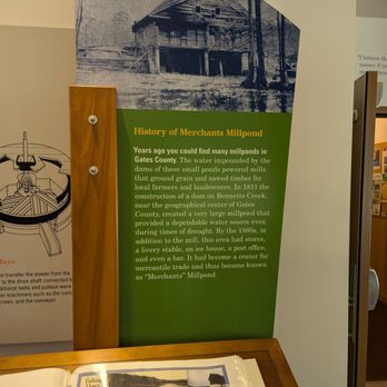
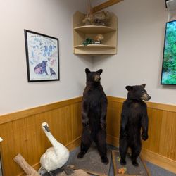
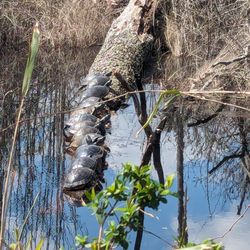
Merchants Millpond State Park is located in Gates County. The park was created in 1973. The park is 3250 acres. The Visitor's Center has restrooms, a small gift shop and picnic tables outside. The area was originally home to gristmills and a sawmill, and a farm supply store, where the trading happened. When the mills closed around World War II, the land was sold to developers. The land was donated to the state and became the park. The pond has a unique ecosystem. Some artifacts from the old mill are displayed in the visitor center. The exhibits cover the history of the area and the wildlife there. Who knew that alligators are this far north? You will also find beavers, otters, bobcats, birds and fish. read more




9 months ago

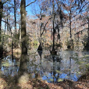
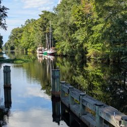
Another place that's completely different from my daily life, this black water mill pond boasts a cypress swamp atmosphere, but with deep water, and even a few alligators! It's actually the northern most location for gators, although seeing them is rare, but hey, why not try?! You can rent a canoe or kayak and paddle some of the paddle trails, or if you're really up for an adventure, there's boat in camp sites down Bennett's creek, starting point at the spillway, which looks so neat it's definitely worth a stop!! The boardwalk trail is short and sweet and really shows off the beauty of the pond, or for a longer trek, the Lassiter trail by the Visitor's Center has all sorts of things to see! read more




7 years ago
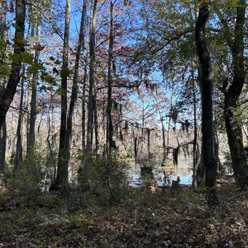
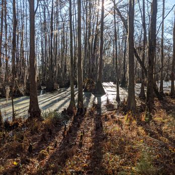
When I came upon this park it was like the realization hit me rather instantly that I had arrived to a different part of the state. North Carolina stretches from mountains to foot hills (Piedmont) to coastal plains. Merchants Mill Pond was my welcome to the swampy lowlands of the coast. A sign that I had surely exited the foot hills. As such, the green murk of the stagnant waters both beckoned me to come closer while keeping me at bay with the unknown. On a very cold morning with my breath visible in the sunlight's rays cutting through the trees I took a pleasant, short hike on the boardwalk with views of the swamp. My walk took me on the shortest trail: Cypress Point, which is fully wheelchair accessible. Had it been warmer out I might have been assured of seeing a gator out here. Park staff assured me this would be the best hike on a limited time frame as I had. It being a late-autumn cold day I was the only person out. If I'd had more time, the longer trails were all marked easy and the area very enticing for a more in-depth hike and exploration. The history of this pond and swamp was also quite interesting. It appeared to me just as nature intended it but turns out a significant portion was flooded by humans to hold water for running mills in the area. Therefore the name. As water powered milling is a thing of the past, we now get to enjoy the splendid views of nature taking back over. read more



3 years ago

5 years ago
3 years ago

5 years ago
5 years ago
5 years ago

11 years ago
More info about Merchants Mill Pond State Park

Ask the Community - Merchants Mill Pond State Park
Review Highlights - Merchants Mill Pond State Park













Merchants Mill Pond State Park - parks - Updated August 2026
Best of Gatesville
People found Merchants Mill Pond State Park by searching for…
Things to Do in Gatesville, NC
Hiking Trails in Gatesville, NC
Walking Trails in Gatesville, NC
Tent Camping in Gatesville, NC
Places to Take Pictures in Gatesville, NC
Long Term Rv Parking in Gatesville, NC
Camping Sites in Gatesville, NC
Visitor Centers in Gatesville, NC
Running Trails in Gatesville, NC
Watch Sunset in Gatesville, NC
Off Road Trails in Gatesville, NC
Fishing Spots in Gatesville, NC
Trending Searches in Gatesville, NC
Browse Articles
Browse Nearby
BEST of Gatesville, North Carolina Things to Do near Merchants Mill Pond State Park
BEST of Gatesville, North Carolina Playgrounds near Merchants Mill Pond State Park
BEST of Gatesville, North Carolina Fishing near Merchants Mill Pond State Park
BEST of Gatesville, North Carolina Restaurants near Merchants Mill Pond State Park
BEST of Gatesville, North Carolina Campgrounds near Merchants Mill Pond State Park
BEST of Gatesville, North Carolina Farmers Market near Merchants Mill Pond State Park
Browse Brands
Related Cost Guides
Related Searches in Gatesville, NC
Affordable Long Term RV Parking in Gatesville, North Carolina
Best Dog Hiking Trails Around Gatesville, North Carolina
Best Lookout Points to Visit in Gatesville, North Carolina
Best Nature Trails for Hiking in Gatesville, North Carolina
Best Off Leash Dog Parks in Gatesville, North Carolina
Best Parks for Parties and Events in Gatesville, North Carolina
Best Spots for Star Gazing in Gatesville, North Carolina
Best Water Parks for Kids in Gatesville, North Carolina
Best Waterfalls and Swimming Holes in Gatesville, North Carolina
Browse Top Hotels in Gatesville, North Carolina for Your Stay
Check Out Great Playgrounds in Gatesville, North Carolina
Check Out Off Road Trails in Gatesville, North Carolina
Discover Baseball Fields Around Gatesville, North Carolina
Discover Dog Friendly Beaches Near Gatesville, North Carolina
Discover Dog Friendly Trails to Explore in Gatesville, North Carolina
Discover Free Campgrounds in Gatesville, North Carolina Area
Discover Fun Toddler Parks in Gatesville, North Carolina for Your Little One
Discover Lakes & Ponds to Explore in Gatesville, North Carolina
Discover Popular Bike Trails in Gatesville, North Carolina
Discover Popular Photo Spots in Gatesville, North Carolina
Discover Scenic Beach Camping Sites in Gatesville, North Carolina
Discover Scenic Mountain Bike Trails Near Gatesville, North Carolina
Discover Soccer Fields in Gatesville, North Carolina Near You
Discover Top Nature Parks to Visit in Gatesville, North Carolina
Discover a Hiking Trail in Gatesville, North Carolina
Discover the Best Beaches in Gatesville, North Carolina
Discover the Best Night Hike Trails in Gatesville, North Carolina
Dog-Friendly Hikes With Dogs in Gatesville, North Carolina
Enjoy Camping Adventures Around Gatesville, North Carolina
Enjoy Hiking Adventures in Gatesville, North Carolina
Enjoy Off Leash Dog Hikes in Gatesville, North Carolina
Enjoy Tent Camping Spots Around Gatesville, North Carolina
Enjoy a Relaxing Bed & Breakfast Experience in Gatesville, North Carolina
Enjoy the Best Picnic Spots and Ideas in Gatesville, North Carolina
Enjoy the Best Walking Trails in Gatesville, North Carolina
Experience Stunning Sunset Views in Gatesville, North Carolina
Explore Beautiful Parks and Green Spaces in Gatesville, North Carolina
Explore Easy Hikes Perfect for All in Gatesville, North Carolina
Explore Free Picnic Areas Around Gatesville, North Carolina
Explore Parks With Pull Up Bars in Gatesville, North Carolina
Explore Picnic Parks Near Gatesville, North Carolina
Explore Popular Campgrounds Near Gatesville, North Carolina
Explore Popular Picnic Areas Around Gatesville, North Carolina
Explore Popular RV Parks Around Gatesville, North Carolina
Explore Popular Scenic Overlook Points in Gatesville, North Carolina
Explore Popular Scenic Views Near Gatesville, North Carolina
Explore Popular State Park Destinations in Gatesville, North Carolina
Explore Popular View Points Around Gatesville, North Carolina
Explore Scenic Lakes to Visit in Gatesville, North Carolina
Explore Summer Camps for All Ages in Gatesville, North Carolina





