
Middle Ridge Trail Photos


You might also consider


More like Middle Ridge Trail
Recommended Reviews - Middle Ridge Trail
Start your review...



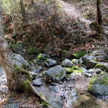
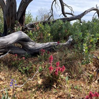
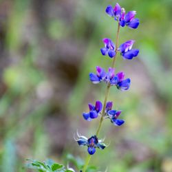
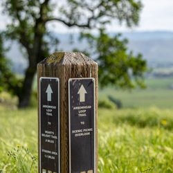
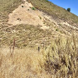
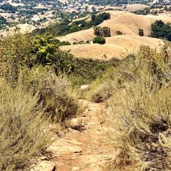
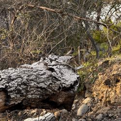
REVIEW OF MIDDLE RIDGE TRAIL. The areas of Henry Coe Park nearest the headquarters (elevation 2,800 feet) include Flat Frog Trail, a valley with Coyote Creek (elevation 2,100 feet) running down the middle, Middle Ridge (elevation 2,900 feet), and another valley (elevation 1,640 feet). Beyond this other valley is Mt. Sizer and Blue Ridge Road (elevation 3,274 feet). Middle Ridge is flanked by these two valleys. This info from topo map available from hikingproject dot com. Our hike of March 7, 2021 took us from park headquarters, north along Flat Frog Trail, north along the short Frog Lake Trail, and towards the southeast on Middle Ridge Trail. Then, we took Fish Trail and descended into the valley with Coyote Creek, crossed the creek, and ascended the opposite side of the valley on Fish Trail. Coyote Creek can easily be crossed by stepping from stone to stone. Our starting and ending point was a trail marker located near park headquarters, where this trail marker has arrows pointing to Flat Frog Trail, to Fish Trail, and to Forest Trail. The length of this hiking loop, consisting of Flat Frog Trail, Frog Lake Trail, Middle Ridge Trail, and Fish Trail, was 6 1/2 miles. Most of Middle Ridge Trail is on a 100 foot wide, fairly flat meadow, situated at the very top of Middle Ridge. The meadow is peppered with many trees, and many areas are free of impenetrable tangles of bushes, vines, and weeds. Along the trail are many patches of Indian Warrior plants. Indian Warrior is related to Indian Paintbrush. Indian Warrior is a parasitic plant that thrives by attaching itself ot the roots of manzanita, including the bigberry manzanita found at Henry Coe State Park. PHOTOGRAPHS of MIDDLE RIDGE TRAIL, FISH TRAIL (return route), and COYOTE CREEK (needs to be crossed during return route). ( 1 ) Trail marker pointing to Middle Ridge Trail. The marker states that Middle Ridge Trail is 0.8 miles ahead. ( 2 ) Many large pine cones are found near Middle Ridge Trail. I placed it in a tree and took a photo of it. ( 3 ) Weirdly shaped dead tree and nearby Indian Warrior. The wood is entirely gray colored. ( 4 ) Bird's eye view of an Indian Warrior plant. ( 5 ) Field of about 50 Indian Warriors near Middle Ridge Trail. ( 6 ) Y-Shaped part of a dead tree. Each branch of the Y has a crevice that is long and narrow, where each crevice is surrounded by sinuous streaks of white-colored wood and light brown-colored wood. Obviously, this Y-shaped object is a space alien, and likely a distant relative of E.T. ( 7 ) Another weirdly-shaped dead tree near Middle Ridge Trail. ( 8 ) Typical view of Middle Ridge Trail, showing a well-worn dirt path surrounded by grassy areas that are flat and free of bushes. ( 9 ) Photo of trail marker on Middle Ridge Trail that identifies Fish Trail. You need to take Fish Trail in order to return to Park Headquarters. Fish Trail leads you down the slope of Middle Ridge and to Coyote Creek. Once you have crossed this creek, you will find another trail, and this is also called, Fish Trail. ( 10 ) Photograph of a gruesome-looking pumpkin growing on a manzanita. This is next to the descending part of Fish Trail. ( 11 ) Photo of a manzanita next to Fish Trail, where half of the tree-trunk is covered with orange bark, where the other half is gray-colored and is free of orange bark. The photo also shows part of the trail decorated with a pattern of shadows created by the sunrays passing through branches of nearby trees. ( 12 ) Hiker crossing Coyote Creek. ( 13 ) Photo showing Coyote Creek and of the ascending part of Fish Trail on the far side of Coyote Creek. ( 14 ) Mossy stones sitting in Coyote Creek. REFERENCES ( 1 ) Teddy Goodrich (2005) Names on the Land. A History of Henry W. Coe State Park. ( 2 ) Robert J. Keiffer (2012) Indian Warriors Welcome Spring at HREC. University of California Hopland Research and Extension Center. ( 3 ) Michele Driggs (2013) The Record Searchlight. Redding, CA. ( 4 ) Toni Corelli (Botanist, Curator Emeritus of the Carl Sharsmith Herbarium) Plants That Like Hosts. read more




5 years ago
Nice trail to combine with other trails if you are visiting the park. Beautiful, peaceful and moderately trafficked on a Saturday afternoon. read more


More info about Middle Ridge Trail
9000 E Dunne Ave
Morgan Hill, CA 95037
Directions
Hours
Outdoor Amenities
You might also consider


















Middle Ridge Trail - hiking - Updated September 2026
Best of Morgan Hill
People found Middle Ridge Trail by searching for…
Things to Do in Morgan Hill, CA
Hiking Trails in Morgan Hill, CA
Beautiful Views in Morgan Hill, CA
Fishing Lake in Morgan Hill, CA
Fishing Spots in Morgan Hill, CA
Parks With Lakes in Morgan Hill, CA
View Points in Morgan Hill, CA
Scenic View in Morgan Hill, CA
Redwood Forest in Morgan Hill, CA
Natural Hot Springs in Morgan Hill, CA
Shaded Hike in Morgan Hill, CA
Off Road Trails in Morgan Hill, CA
Running Trails in Morgan Hill, CA
Walking Trails in Morgan Hill, CA
Fall Foliage in Morgan Hill, CA
Lakes & Ponds in Morgan Hill, CA
Places to Take Pictures in Morgan Hill, CA
Trending Searches in Morgan Hill, CA
Antiques near Middle Ridge Trail
Apple Orchards near Middle Ridge Trail
Apple Picking near Middle Ridge Trail
Barbershop near Middle Ridge Trail
Bike Shop near Middle Ridge Trail
Bird Sanctuary near Middle Ridge Trail
Casinos near Middle Ridge Trail
Cliff Jumping near Middle Ridge Trail
Consignment Shops near Middle Ridge Trail
Cruising Spots near Middle Ridge Trail
Dog Friendly Things To Do near Middle Ridge Trail
Dog Swimming near Middle Ridge Trail
Ear Piercing near Middle Ridge Trail
Eyebrow Threading near Middle Ridge Trail
Eyelash Extensions near Middle Ridge Trail
Furniture Stores near Middle Ridge Trail
Hiking near Middle Ridge Trail
Kids Haircut near Middle Ridge Trail
Mattresses near Middle Ridge Trail
Picnic Areas near Middle Ridge Trail
Private Schools near Middle Ridge Trail
Public Shower near Middle Ridge Trail
Rock Quarry near Middle Ridge Trail
Scenic Night View near Middle Ridge Trail
Scenic Overlook near Middle Ridge Trail
Star Gazing near Middle Ridge Trail
Sunrise View near Middle Ridge Trail
Browse Nearby
Browse Brands
Related Searches in Morgan Hill, CA
Affordable Kayak Rental Services in Morgan Hill, California
Best Dog Hiking Trails Around Morgan Hill, California
Best Fishing Locations and Guides in Morgan Hill, California
Best Nature Trails for Hiking in Morgan Hill, California
Best Places for Horseback Riding in Morgan Hill, California
Best Sightseeing Experiences Available in Morgan Hill, California
Check Out Off Road Trails in Morgan Hill, California
Discover Dog Friendly Trails to Explore in Morgan Hill, California
Discover Easy Hiking Trails Near Morgan Hill, California
Discover Kid Friendly Hiking Trails in Morgan Hill, California
Discover Popular Bike Trails in Morgan Hill, California
Discover Walking Parks in Morgan Hill, California Near You
Discover a Hiking Trail in Morgan Hill, California
Discover the Best Night Hike Trails in Morgan Hill, California
Dog-Friendly Hikes With Dogs in Morgan Hill, California
Enjoy Camping Adventures Around Morgan Hill, California
Enjoy Kayaking Adventures in Morgan Hill, California
Enjoy Off Leash Dog Hikes in Morgan Hill, California
Enjoy Scenic Places to Walk in Morgan Hill, California
Enjoy Tent Camping Spots Around Morgan Hill, California
Enjoy a Beautiful Waterfall Hike in Morgan Hill, California
Enjoy the Best Walking Path in Morgan Hill, California
Enjoy the Best Walking Trails in Morgan Hill, California
Explore Beautiful Parks and Green Spaces in Morgan Hill, California
Explore Easy Hikes Perfect for All in Morgan Hill, California
Explore Fun Activities to Do in Morgan Hill, California
Explore Popular Campgrounds Near Morgan Hill, California
Explore Popular Dog Walking Trails in Morgan Hill, California
Explore Top Dog Parks in Morgan Hill, California Near You
Explore the Best Beach Spots in Morgan Hill, California
Family Friendly Hiking With Kids in Morgan Hill, California
Find Parks and Recreation Activities in Morgan Hill, California
Find Top Dog Friendly Parks to Visit in Morgan Hill, California
Find Top-Rated Waterfalls in Morgan Hill, California Now
Find the Best Parks for Picnics in Morgan Hill, California
Hiking Trails With Waterfalls in Morgan Hill, California
Off Leash Dog Hiking Trails in Morgan Hill, California
Popular Outdoor Activities to Try in Morgan Hill, California
Popular Picnic Spots to Visit in Morgan Hill, California
Popular Waterfall Hiking Trails in Morgan Hill, California
Safe River Swimming Areas in Morgan Hill, California
Safe and Fun Parks for Kids in Morgan Hill, California
Top Hiking Trails to Explore in Morgan Hill, California
Top Playgrounds for Kids to Enjoy in Morgan Hill, California
Top Running Trails to Explore in Morgan Hill, California
Top Swimming Lakes to Enjoy in Morgan Hill, California
Top Swimming Spots and Pools in Morgan Hill, California
Top-Rated Camping Sites in Morgan Hill, California
Walk Dog Friendly Hiking Trails in Morgan Hill, California
Walk the Best Paved Walking Trails in Morgan Hill, California


