Coyote Valley Open Space Preserve Photos


You might also consider


More like Coyote Valley Open Space Preserve
Recommended Reviews - Coyote Valley Open Space Preserve
Start your review...


Reviews With Photos


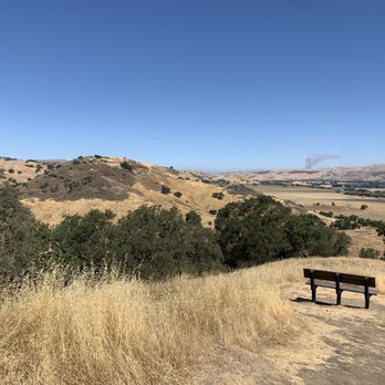
Coyote Valley was a fun hike, probably not a five star hike but I'm very resistant to give OSPs bad reviews because they're truly great and so much is dependent on weather and time of day. That being said... This place is hot, hot, hot! Don't be like me and go too late in the day or on a day where the temps are high. I was warned, but I figured since it's a pretty short distance (only about 4 miles), I could handle it. I did handle it, but it was pretty dang hot. Not super scenic in the summer either unless you enjoy the browns, but I'd love to go back in the winter or spring. Loop isn't too bad, though parts of it were pretty steep. I saw people hiking with children so perhaps I was just being a bit of a wimp. Trail was very well maintained, and since there's only one loop, it's not hard to find your way. Parking was also plentiful! We also saw two rangers there and both greeted us and were very pleasant.


California Trip #3 On my second trip, I stopped by one evening and ate my dinner in the parking lot. The day was getting late and I was exhausted after traveling all day. I was disappointed that I didn't get a chance to hike Coyote Valley Open Space Preserve (CVOSP). But as a good friend always says, "Next time, Gadget." Well, this past March, a spontaneous but short trip came my way. First stop? CVOSP, of course! I was blessed with the surprising and rare green rolling hills in my view as I walked the trail. Here's some info for you: * 348-acre nature preserve * FREE! So many places in California make you pay for parking or an entrance fee but this place is completely free. * There is basically a 4-mile loop. * No dogs allowed. * Lots of wildlife to see so bring your binoculars and cameras. Not to mention there's a couple of gorgeous scenic overlooks. * Clean restrooms at the parking lot and some picnic tables as well. Located just 20 miles from downtown San Jose, CVOSP is a peaceful place to enjoy nature especially this time of year. I didn't get a chance to hike the entire 4-mile loop. I was took busy taking photos and stopping to see the view. But I will definitely return next time. Go check it out if you haven't already.


This is a great trail. It's serene, sparsely populated (by humans), and beautiful. When I was at home for Christmas break, I did this trail 3 times and it was the most "packed" when 4-5 other people were there. There is so much animal activity here! I've seen a boar-looking animal, a family of deer, beautiful birds I'd never seen before, squirrels, and cows (of course). You really get up close and personal with them, especially when they're in the middle of the path and you're staring at each other waiting for a move to be made. I've never had issues with the animals, though. I wish I could post the videos I've taken. To me, the trail isn't really intense. There are short inclined areas, but they are super doable. It has taken from 60-90 minutes depending on the pace. Check this place out!


One of my favorite local trails. It recently opened up in 2016 and not many people know about it yet so it's never crowded - and as others mentioned, free parking! But watch out for the sunset closing, the rangers will ticket you if you're not out by the time they close! I've only ever hiked here in the summer and it's the typical views of golden, dry grass dotted by clusters of trees. There's a few overlook spots with benches to sit on, which provide a nice view. Lots of cows grazing, so watch out for the cow paddies on the trail! I'm not a wildlife expert, but I've seen bunnies, field mice, snakes, a variety of birds, eagles and insects (beetles, large ants etc) There's only one trail that loops around the entire park, and it usually only takes me about 1.5 hours to hike the whole thing. I love how quiet and serene this park is! If you're looking for a moderate/easy hike this is the place to go!

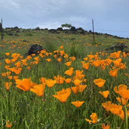

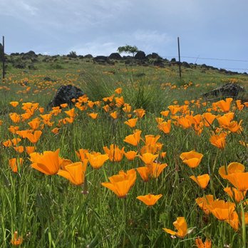
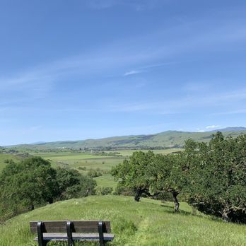
Beautiful hike, took us about two hours with two kids and both kids age 8 & 12 were able to do it. My son actually went way far ahead and finished way before we did. There are inclines, declines, shaded areas, sunny areas, areas to sit and rest. The poppy's were beautiful and they are mostly on the hill at the beginning of the hike.


We hike often in Joseph Grant and Alum Rock, and have hiked or mountain biked in most of the other parks and open spaces around San Jose, so we're familiar with some of the more beautiful trails in the area. My hopes were not too high therefore when we decided to head down to Coyote Valley Open Space Preserve which sits on the low foothills overlooking the valley. We picked one of the cooler summer evenings since I figured it would be a slog along some barren hillsides. Boy, was I wrong. I liked the almost 4 mile Arrowhead Loop Trail as much as any of my faves in Joseph Grant. The trail offers wonderful views of the valley along much of its length, and there are several benches along the way to pause and enjoy the vistas from Mission Peak to Henry Coe SP across the valley. The trail climbs, so you get in some cardio, but the grade is never too steep. It's well-maintained; I like how they keep the grasses cut on each side so you can spend more time enjoying the views and less time scanning the trail ahead for rattlesnakes (Joseph Grant personnel, please note!). And there is shade--lots of it! This is a thoroughly enjoyable hike and close by San Jose. There was ample free parking and a restroom at the trailhead.


Great 4 mile loop trail. NO Dogs!! Don't bring your pets unless your pet is a horse... lol. Amazing view of Morgan hill. Nice trail. About 25 parking spots. Lovely place for an intermediate hike.


The Coyote Valley Open Space Preserve is like no other hiking spot in the South Bay. A short drive south of the developed portion of San Jose will transport you beyond metropolitan Silicon Valley into a world where agriculture and open space still exists as if it was still the Valley of the Heart's Delight. The preserve is open daily from 7:00 a.m. to sunset. There is only one trail called Arrowhead, which consists of three portions. The first leg is 1.7 miles of easy level. The second leg is 3.3 miles (including first leg) at moderate level. The last leg is 4 miles (including first and second leg) at a challenging level. By no means am I athletic or in shape, but I found the hike to be moderate and not challenging at any point. The area can get hot and dry during the summer so things could feel challenging if you go during the warmest part of the day or forget to bring a hat or water. Fortunately, there are trees scattered about to shade some parts of the trail. The trail is multi-use for hikers, mountain bikers, and horseback riding; no dogs are allowed. There are two areas with tables and benches for picnicking, one by the entrance parking lot and another along the trail. The trail includes two scenic overlooks with benches to view the hillsides and Coyote Valley floor, including farmland and IBM's Silicon Valley lab tucked in a bucolic setting. 3.5 stars for a unique hike where you can view the South Bay's agricultural past in the present.


We love this open space. FREE parking and there is a clean restroom with toilet paper and hand sanitizer. We were there in March after a heavy storm and the trails is a little muddy but you can still hike. It is a short 4 miles loop and we did anti-clockwise which took us 2.5 hrs with few stops and lots of photos. There are many benches at the rest stop and view are breathtaking. Enjoy the hike and ride. Please don't ride after a rain since it will damage the trail :-)


This park currently consists of a single 4 mile loop with some moderate upgrades and downgrades. About half of the trail is shaded by trees or the hillside (morning). There are some nice scenic outlooks of the valley near IBM. The only problem is that this morning there was a really intense, overpowering smell of manure permeating the trail. You could still smell it even after the nose fatigue kicked in. It eventually went away by the end of our hike, but it was extremely distracting. Plus there was cow dung all over (it appears that the entire trail is in a cow grazing area). They do try to keep the trail clear though. Overall it's similar in terrain and viewpoints as Almaden Quicksilver but probably less difficult. I would recommend Quicksilver over this park; it isn't next to farmland so no chance of the weird smell, plus it has way more trails.


This place just rocked to the top of my favorite hiking trail list. I came here in the morning, around 8, the morning sun painted the land with its golden color, it was beautiful. The trail is very well maintained, about 4 miles round loops, with some ascending, but not too bad. It is a giant loop, so as long as you stay on the trail, you will not be lost. Parking lot was mainly empty when I arrived, and it is free No dogs allowed on the trail. Wonderful trail to hike on.


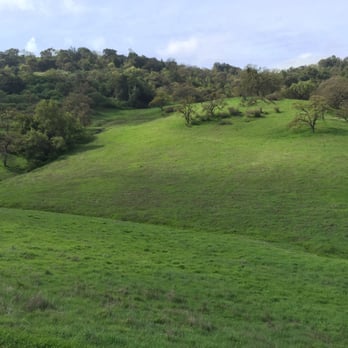
From afar, this place looks like somewhere in Ireland. Honestly, the luscious, emerald green grass with lone trees and rocks make this place a special sight to behold. The trail itself is also wonderful, about 4 miles in total and can be finished in about 2 hours total. What is amazing is the wildlife here, which features coyote and deers sometimes. The walk is quite smooth and easy although part of the hike has a slight inclination to it. Beware that there is only one bathroom at the beginning of the trail, so use it before you go on this hike. Parking is free and quite plentiful even during weekends. I highly recommend this and Mount Montalvo for my faovrite hikes thus far near West San Jose!


Back Valley Located between San José and Morgan Hill is a gorgeous ±348-acre park that offers a no-frills hiking experience and superlative views of The Valley. This is one of OSP's smallest parks, but what it lacks in size it more than makes up for in quality. The Good: * Free to visit! * Mountain biking on certain trails (check map & signage) * Horseback riding on certain trails (check map & signage) * Restrooms in the parking lot * Picnic tables along the trails * The Arrowhead Trail Loop (±4 miles) is fairly easy, but does have a few decent uphills. However, we did it with three young children of varying ages, so it really wasn't an issue. * Great place for wildflower viewing--especially one year we barely had to leave the parking lot to be ensconced in Poppies! The Meh: * No dogs allowed * No trash cans, so pack it in and pack it out The Ugly: * The parking lot seems to have doubled since the last time we were here, which is a good thing because it used to fill up fast. It is still fairly small and only holds 27 cars--assuming no horse trailers are parked. There is also NO parking on Palm Ave. Conclusion: Small but mighty! read more


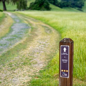

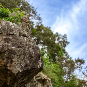


I hiked Sat 4/17/21 at Coyote Valley OSP, Morgan Hill. It's a 40min drive from North Fremont, Free parking, but on Saturdays have to be there before 8am. Park opens 7am-Sunset. Only 1 unisex vault toilet, it had tp and hand sanitizer. We did the 4mile loop hike: Heart's Delight Trail and Arrowhead Loop Trai, it's a One-Way trail due to Covid19. Gentle hills so there is climbing, they call it challenging, but it's really just moderate. Some views. Nice short hike in Morgan Hill. read more


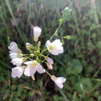
04.02.22 | Sat 5.57 miles Arrowhead Loop 2 hrs 15 minutes 41 flights 575 feet elev. change Did a quick solo hike before heading back home. Was expecting dried hills with no wildflowers but still pretty green and quite a bit of flowers. Large patches of winter vetches , California Poppies, ithuriel's spears , a few mules ears , orange monkey flowers, popcorn flowers, blue eyed grass, purple lupines ,lysimachias, pink checker mallows, buttercups , owls clovers , etc. This is one of my favorite hiking place cuz it's hard to get lost , the one and only trail ( Arrowhead Loop Trail ) is pretty straightforward. Easy to get to , no twisty roads, free parking, a pit toilet at the trailhead. No wildlife sightings today except birds and squirrels. read more




6 years ago

Coyote Valley was a fun hike, probably not a five star hike but I'm very resistant to give OSPs bad reviews because they're truly great and so much is dependent on weather and time of day. That being said... This place is hot, hot, hot! Don't be like me and go too late in the day or on a day where the temps are high. I was warned, but I figured since it's a pretty short distance (only about 4 miles), I could handle it. I did handle it, but it was pretty dang hot. Not super scenic in the summer either unless you enjoy the browns, but I'd love to go back in the winter or spring. Loop isn't too bad, though parts of it were pretty steep. I saw people hiking with children so perhaps I was just being a bit of a wimp. Trail was very well maintained, and since there's only one loop, it's not hard to find your way. Parking was also plentiful! We also saw two rangers there and both greeted us and were very pleasant. read more



9 years ago
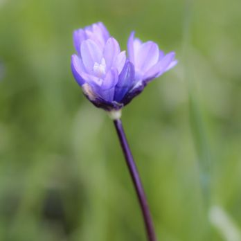
California Trip #3 On my second trip, I stopped by one evening and ate my dinner in the parking lot. The day was getting late and I was exhausted after traveling all day. I was disappointed that I didn't get a chance to hike Coyote Valley Open Space Preserve (CVOSP). But as a good friend always says, "Next time, Gadget." Well, this past March, a spontaneous but short trip came my way. First stop? CVOSP, of course! I was blessed with the surprising and rare green rolling hills in my view as I walked the trail. Here's some info for you: * 348-acre nature preserve * FREE! So many places in California make you pay for parking or an entrance fee but this place is completely free. * There is basically a 4-mile loop. * No dogs allowed. * Lots of wildlife to see so bring your binoculars and cameras. Not to mention there's a couple of gorgeous scenic overlooks. * Clean restrooms at the parking lot and some picnic tables as well. Located just 20 miles from downtown San Jose, CVOSP is a peaceful place to enjoy nature especially this time of year. I didn't get a chance to hike the entire 4-mile loop. I was took busy taking photos and stopping to see the view. But I will definitely return next time. Go check it out if you haven't already. read more




This is a great trail. It's serene, sparsely populated (by humans), and beautiful. When I was at home for Christmas break, I did this trail 3 times and it was the most "packed" when 4-5 other people were there. There is so much animal activity here! I've seen a boar-looking animal, a family of deer, beautiful birds I'd never seen before, squirrels, and cows (of course). You really get up close and personal with them, especially when they're in the middle of the path and you're staring at each other waiting for a move to be made. I've never had issues with the animals, though. I wish I could post the videos I've taken. To me, the trail isn't really intense. There are short inclined areas, but they are super doable. It has taken from 60-90 minutes depending on the pace. Check this place out! read more


9 years ago
One of my favorite local trails. It recently opened up in 2016 and not many people know about it yet so it's never crowded - and as others mentioned, free parking! But watch out for the sunset closing, the rangers will ticket you if you're not out by the time they close! I've only ever hiked here in the summer and it's the typical views of golden, dry grass dotted by clusters of trees. There's a few overlook spots with benches to sit on, which provide a nice view. Lots of cows grazing, so watch out for the cow paddies on the trail! I'm not a wildlife expert, but I've seen bunnies, field mice, snakes, a variety of birds, eagles and insects (beetles, large ants etc) There's only one trail that loops around the entire park, and it usually only takes me about 1.5 hours to hike the whole thing. I love how quiet and serene this park is! If you're looking for a moderate/easy hike this is the place to go! read more


3 years ago
Great place to feel open, and very in tune with nature it's a great place to spend time with one's family or even just going out and about read more


7 years ago
Beautiful hike, took us about two hours with two kids and both kids age 8 & 12 were able to do it. My son actually went way far ahead and finished way before we did. There are inclines, declines, shaded areas, sunny areas, areas to sit and rest. The poppy's were beautiful and they are mostly on the hill at the beginning of the hike. read more


7 years ago
We hike often in Joseph Grant and Alum Rock, and have hiked or mountain biked in most of the other parks and open spaces around San Jose, so we're familiar with some of the more beautiful trails in the area. My hopes were not too high therefore when we decided to head down to Coyote Valley Open Space Preserve which sits on the low foothills overlooking the valley. We picked one of the cooler summer evenings since I figured it would be a slog along some barren hillsides. Boy, was I wrong. I liked the almost 4 mile Arrowhead Loop Trail as much as any of my faves in Joseph Grant. The trail offers wonderful views of the valley along much of its length, and there are several benches along the way to pause and enjoy the vistas from Mission Peak to Henry Coe SP across the valley. The trail climbs, so you get in some cardio, but the grade is never too steep. It's well-maintained; I like how they keep the grasses cut on each side so you can spend more time enjoying the views and less time scanning the trail ahead for rattlesnakes (Joseph Grant personnel, please note!). And there is shade--lots of it! This is a thoroughly enjoyable hike and close by San Jose. There was ample free parking and a restroom at the trailhead. read more


6 years ago
Great 4 mile loop trail. NO Dogs!! Don't bring your pets unless your pet is a horse... lol. Amazing view of Morgan hill. Nice trail. About 25 parking spots. Lovely place for an intermediate hike. read more


4 years ago

The Coyote Valley Open Space Preserve is like no other hiking spot in the South Bay. A short drive south of the developed portion of San Jose will transport you beyond metropolitan Silicon Valley into a world where agriculture and open space still exists as if it was still the Valley of the Heart's Delight. The preserve is open daily from 7:00 a.m. to sunset. There is only one trail called Arrowhead, which consists of three portions. The first leg is 1.7 miles of easy level. The second leg is 3.3 miles (including first leg) at moderate level. The last leg is 4 miles (including first and second leg) at a challenging level. By no means am I athletic or in shape, but I found the hike to be moderate and not challenging at any point. The area can get hot and dry during the summer so things could feel challenging if you go during the warmest part of the day or forget to bring a hat or water. Fortunately, there are trees scattered about to shade some parts of the trail. The trail is multi-use for hikers, mountain bikers, and horseback riding; no dogs are allowed. There are two areas with tables and benches for picnicking, one by the entrance parking lot and another along the trail. The trail includes two scenic overlooks with benches to view the hillsides and Coyote Valley floor, including farmland and IBM's Silicon Valley lab tucked in a bucolic setting. 3.5 stars for a unique hike where you can view the South Bay's agricultural past in the present. read more


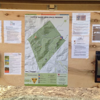


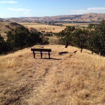


We love this open space. FREE parking and there is a clean restroom with toilet paper and hand sanitizer. We were there in March after a heavy storm and the trails is a little muddy but you can still hike. It is a short 4 miles loop and we did anti-clockwise which took us 2.5 hrs with few stops and lots of photos. There are many benches at the rest stop and view are breathtaking. Enjoy the hike and ride. Please don't ride after a rain since it will damage the trail :-) read more


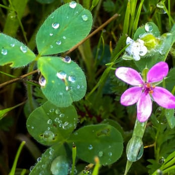


This park currently consists of a single 4 mile loop with some moderate upgrades and downgrades. About half of the trail is shaded by trees or the hillside (morning). There are some nice scenic outlooks of the valley near IBM. The only problem is that this morning there was a really intense, overpowering smell of manure permeating the trail. You could still smell it even after the nose fatigue kicked in. It eventually went away by the end of our hike, but it was extremely distracting. Plus there was cow dung all over (it appears that the entire trail is in a cow grazing area). They do try to keep the trail clear though. Overall it's similar in terrain and viewpoints as Almaden Quicksilver but probably less difficult. I would recommend Quicksilver over this park; it isn't next to farmland so no chance of the weird smell, plus it has way more trails. read more


10 years ago
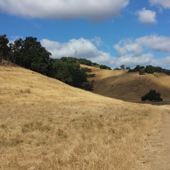
This place just rocked to the top of my favorite hiking trail list. I came here in the morning, around 8, the morning sun painted the land with its golden color, it was beautiful. The trail is very well maintained, about 4 miles round loops, with some ascending, but not too bad. It is a giant loop, so as long as you stay on the trail, you will not be lost. Parking lot was mainly empty when I arrived, and it is free No dogs allowed on the trail. Wonderful trail to hike on. read more


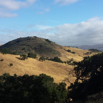


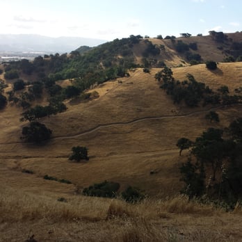
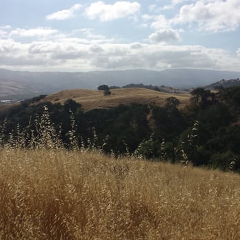
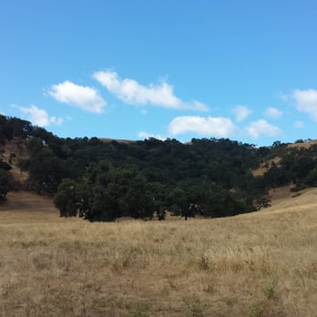

7 years ago


6 years ago

From afar, this place looks like somewhere in Ireland. Honestly, the luscious, emerald green grass with lone trees and rocks make this place a special sight to behold. The trail itself is also wonderful, about 4 miles in total and can be finished in about 2 hours total. What is amazing is the wildlife here, which features coyote and deers sometimes. The walk is quite smooth and easy although part of the hike has a slight inclination to it. Beware that there is only one bathroom at the beginning of the trail, so use it before you go on this hike. Parking is free and quite plentiful even during weekends. I highly recommend this and Mount Montalvo for my faovrite hikes thus far near West San Jose! read more



11 years ago
It's a work in progress and trails are being maintained. Looks like they are putting in more picnic tables. Took a short hike around the easy Arrow loop to the look out, it's a little strenuous if not in shape . Heard a wood pecker and saw a squirrel, was hoping for more wildlife. Nice big area for horse trailers, restroom, and paths well marked. I plan to go back. read more

6 years ago

8 years ago
6 years ago
7 years ago

11 years ago
11 years ago
More info about Coyote Valley Open Space Preserve
550 Palm Ave
Morgan Hill, CA 95037
Directions
(408) 224-7476
Call Now
Visit Website
https://www.openspaceauthority.org
Hours
Indoor Amenities
Outdoor Amenities
Other Amenities
From the Business
Ask the Community - Coyote Valley Open Space Preserve
Review Highlights - Coyote Valley Open Space Preserve
You might also consider






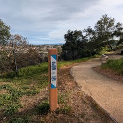


















Why does Yelp recommend reviews?
1 review that is not currently recommended
The reviews below are not factored into the business's overall star rating.

2 years ago
Coyote Valley Open Space Preserve - hiking - Updated August 2026
Best of Morgan Hill
People found Coyote Valley Open Space Preserve by searching for…
Photo Spots in Morgan Hill, CA
Watch Sunset in Morgan Hill, CA
Places to Take Pictures in Morgan Hill, CA
Things to Do in Morgan Hill, CA
Hiking Trails in Morgan Hill, CA
Flower Fields in Morgan Hill, CA
Beautiful Views in Morgan Hill, CA
Picnic Areas in Morgan Hill, CA
Wildflowers in Morgan Hill, CA
River Swimming in Morgan Hill, CA
Scenic View in Morgan Hill, CA
Off Road Trails in Morgan Hill, CA
Sunset View in Morgan Hill, CA
Walking Trails in Morgan Hill, CA
State Parks in Morgan Hill, CA
Great View Points for Sunset in Morgan Hill, CA
Scenic Drive in Morgan Hill, CA
Fishing Spots in Morgan Hill, CA
Fall Foliage in Morgan Hill, CA
Trending Searches in Morgan Hill, CA
Antiques near Coyote Valley Open Space Preserve
Barbershop For Men near Coyote Valley Open Space Preserve
Bike Shop near Coyote Valley Open Space Preserve
Bird Sanctuary near Coyote Valley Open Space Preserve
Cliff Jumping near Coyote Valley Open Space Preserve
Consignment Shops near Coyote Valley Open Space Preserve
Cruising Spots near Coyote Valley Open Space Preserve
Dog Friendly Beaches near Coyote Valley Open Space Preserve
Dog Friendly Things To Do near Coyote Valley Open Space Preserve
Ear Piercing near Coyote Valley Open Space Preserve
Eyebrow Threading near Coyote Valley Open Space Preserve
Fishing Spots near Coyote Valley Open Space Preserve
Flower Fields near Coyote Valley Open Space Preserve
Hair Braiding near Coyote Valley Open Space Preserve
Kids Haircut near Coyote Valley Open Space Preserve
Lakes near Coyote Valley Open Space Preserve
Mini Golf near Coyote Valley Open Space Preserve
Parks near Coyote Valley Open Space Preserve
Pedicure near Coyote Valley Open Space Preserve
Permanent Makeup near Coyote Valley Open Space Preserve
Picnic Areas near Coyote Valley Open Space Preserve
Playgrounds near Coyote Valley Open Space Preserve
Public Golf Courses near Coyote Valley Open Space Preserve
Public Pools near Coyote Valley Open Space Preserve
Public Running Track near Coyote Valley Open Space Preserve
Rock Quarry near Coyote Valley Open Space Preserve
Scenic Night View near Coyote Valley Open Space Preserve
Scenic Overlook near Coyote Valley Open Space Preserve
Sunrise View near Coyote Valley Open Space Preserve
Swimming Holes near Coyote Valley Open Space Preserve
Things To Do With Kids near Coyote Valley Open Space Preserve
Trading Card Shops near Coyote Valley Open Space Preserve
Used Furniture Stores near Coyote Valley Open Space Preserve
Volleyball Courts near Coyote Valley Open Space Preserve
Browse Nearby
BEST of Morgan Hill, California Restaurants near Coyote Valley Open Space Preserve
BEST of Morgan Hill, California Things to Do near Coyote Valley Open Space Preserve
BEST of Morgan Hill, California Coffee near Coyote Valley Open Space Preserve
BEST of Morgan Hill, California Parks near Coyote Valley Open Space Preserve
BEST of Morgan Hill, California Breakfast near Coyote Valley Open Space Preserve
BEST of Morgan Hill, California Shopping near Coyote Valley Open Space Preserve
BEST of Morgan Hill, California Campgrounds near Coyote Valley Open Space Preserve
Browse Brands
Related Searches in Morgan Hill, CA
Affordable Kayak Rental Services in Morgan Hill, California
Best Dog Hiking Trails Around Morgan Hill, California
Best Fishing Locations and Guides in Morgan Hill, California
Best Nature Trails for Hiking in Morgan Hill, California
Best Off Leash Dog Parks in Morgan Hill, California
Best Parks for Parties and Events in Morgan Hill, California
Best Places for Horseback Riding in Morgan Hill, California
Best Sightseeing Experiences Available in Morgan Hill, California
Best Water Parks for Kids in Morgan Hill, California
Check Out Great Playgrounds in Morgan Hill, California
Check Out Off Road Trails in Morgan Hill, California
Discover Baseball Fields Around Morgan Hill, California
Discover Dog Friendly Trails to Explore in Morgan Hill, California
Discover Easy Hiking Trails Near Morgan Hill, California
Discover Fun Toddler Parks in Morgan Hill, California for Your Little One
Discover Kid Friendly Hiking Trails in Morgan Hill, California
Discover Popular Bike Trails in Morgan Hill, California
Discover Popular Photo Spots in Morgan Hill, California
Discover Soccer Fields in Morgan Hill, California Near You
Discover Top Nature Parks to Visit in Morgan Hill, California
Discover Top State Parks to Visit in Morgan Hill, California
Discover Walking Parks in Morgan Hill, California Near You
Discover a Hiking Trail in Morgan Hill, California
Discover the Best Beaches in Morgan Hill, California
Discover the Best Kids Park Spots in Morgan Hill, California
Discover the Best Night Hike Trails in Morgan Hill, California
Dog-Friendly Hikes With Dogs in Morgan Hill, California
Enjoy Camping Adventures Around Morgan Hill, California
Enjoy Kayaking Adventures in Morgan Hill, California
Enjoy Off Leash Dog Hikes in Morgan Hill, California
Enjoy Scenic Places to Walk in Morgan Hill, California
Enjoy Tent Camping Spots Around Morgan Hill, California
Enjoy a Beautiful Waterfall Hike in Morgan Hill, California
Enjoy the Best Picnic Spots and Ideas in Morgan Hill, California
Enjoy the Best Walking Path in Morgan Hill, California
Enjoy the Best Walking Trails in Morgan Hill, California
Explore Beautiful Parks and Green Spaces in Morgan Hill, California
Explore Easy Hikes Perfect for All in Morgan Hill, California
Explore Free Picnic Areas Around Morgan Hill, California
Explore Fun Activities to Do in Morgan Hill, California
Explore Parks With Pull Up Bars in Morgan Hill, California
Explore Picnic Parks Near Morgan Hill, California
Explore Popular Campgrounds Near Morgan Hill, California
Explore Popular Dog Walking Trails in Morgan Hill, California
Explore Popular Kids Parks Throughout Morgan Hill, California
Explore Popular Picnic Areas Around Morgan Hill, California
Explore Popular RV Parks Around Morgan Hill, California
Explore Scenic Lakes to Visit in Morgan Hill, California


