Millie Mine Bat Viewing Site Photos


More like Millie Mine Bat Viewing Site
Recommended Reviews - Millie Mine Bat Viewing Site
Start your review...

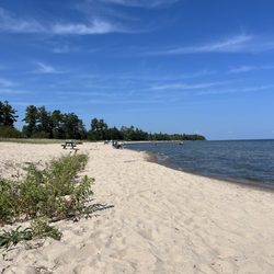
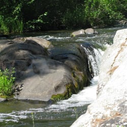
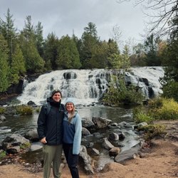
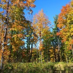
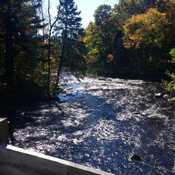
Decided to do a hike and heard great things about it here so we gave it a go. Fun hiking trails and a cool look over spot where you could see the city. I loved that when you got deeper into the hike we saw loads of deer, and they didn't seem super shy either so was fun to get up close and personal with them. I do recommend having big spray, there's a lot of bugs. Other than that though was fun to experience and although we didn't see any bats we did see a lot of wildlife! read more
3 years ago
10 years ago
11 years ago
More info about Millie Mine Bat Viewing Site
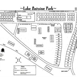
Park Ave
Iron Mountain, MI 49801
Directions
(906) 774-8530
Call Now
Hours
Outdoor Amenities


Millie Mine Bat Viewing Site - parks - Updated July 2026
Best of Iron Mountain
People found Millie Mine Bat Viewing Site by searching for…
Things to Do in Iron Mountain, MI
Fun Things to Do With Kids in Iron Mountain, MI
Hiking Trails in Iron Mountain, MI
Attractions in Iron Mountain, MI
Waterfalls in Iron Mountain, MI
Places to Take Pictures in Iron Mountain, MI
Walking Trails in Iron Mountain, MI
Tourist Attractions in Iron Mountain, MI
Dog Swimming in Iron Mountain, MI
Things to See in Iron Mountain, MI
Beautiful Views in Iron Mountain, MI
Scenic Overlook in Iron Mountain, MI
Dog Friendly Trails in Iron Mountain, MI
Running Trails in Iron Mountain, MI
Animal Farm in Iron Mountain, MI
Scenic View in Iron Mountain, MI
Scenic Drive in Iron Mountain, MI
Places to Run in Iron Mountain, MI
Trending Searches in Iron Mountain, MI
Browse Articles
Browse Nearby
BEST of Iron Mountain, Michigan Things to Do near Millie Mine Bat Viewing Site
BEST of Iron Mountain, Michigan Coffee near Millie Mine Bat Viewing Site
BEST of Iron Mountain, Michigan Restaurants near Millie Mine Bat Viewing Site
BEST of Iron Mountain, Michigan Playgrounds near Millie Mine Bat Viewing Site
BEST of Iron Mountain, Michigan Hiking near Millie Mine Bat Viewing Site
BEST of Iron Mountain, Michigan Campgrounds near Millie Mine Bat Viewing Site
BEST of Iron Mountain, Michigan Breakfast near Millie Mine Bat Viewing Site
BEST of Iron Mountain, Michigan Sledding near Millie Mine Bat Viewing Site
BEST of Iron Mountain, Michigan Day Trips near Millie Mine Bat Viewing Site
Browse Brands
Related Searches in Iron Mountain, MI
Best Fishing Locations and Guides in Iron Mountain, Michigan
Best Places for Horseback Riding in Iron Mountain, Michigan
Best Places for Stunning Views in Iron Mountain, Michigan
Best Things to Do on a Rainy Day in Iron Mountain, Michigan
Best Water Parks for Kids in Iron Mountain, Michigan
Check Out Great Playgrounds in Iron Mountain, Michigan
Discover Fun Farms for Kids in Iron Mountain, Michigan
Discover Fun Kid Activities to Enjoy in Iron Mountain, Michigan
Discover Local Goat Farms Near Iron Mountain, Michigan
Discover Popular Photo Spots in Iron Mountain, Michigan
Discover Top Nature Parks to Visit in Iron Mountain, Michigan
Discover the Best Beaches in Iron Mountain, Michigan
Enjoy Hiking Adventures in Iron Mountain, Michigan
Enjoy the Best Family Activities in Iron Mountain, Michigan
Enjoy the Best Picnic Spots and Ideas in Iron Mountain, Michigan
Enjoy the Best Walking Trails in Iron Mountain, Michigan
Experience the Best Family Fun in Iron Mountain, Michigan for All
Explore Beautiful Parks and Green Spaces in Iron Mountain, Michigan
Explore Free Things to Do Around Iron Mountain, Michigan
Explore Landmarks & Historical Buildings in Iron Mountain, Michigan
Explore Local Farms in Iron Mountain, Michigan
Explore Picnic Parks Near Iron Mountain, Michigan
Explore Popular Boat Charters Near Iron Mountain, Michigan
Explore Popular Campgrounds Near Iron Mountain, Michigan
Explore Popular Picnic Areas Around Iron Mountain, Michigan
Explore Popular RV Parks Around Iron Mountain, Michigan
Explore Popular Scenic Views Near Iron Mountain, Michigan
Explore Scenic Lakes to Visit in Iron Mountain, Michigan
Explore Secret Spots Worth Visiting in Iron Mountain, Michigan
Explore Summer Camps for All Ages in Iron Mountain, Michigan
Explore Sunday Fun Things to Do in Iron Mountain, Michigan
Explore Top Gyms in Iron Mountain, Michigan Now
Explore Venues & Event Spaces in Iron Mountain, Michigan
Explore the Best Wildlife Park Options in Iron Mountain, Michigan
Find Exciting Tours to Take in Iron Mountain, Michigan
Find Fun Kids Activities Outdoor in Iron Mountain, Michigan
Find Parks and Recreation Activities in Iron Mountain, Michigan
Find Popular Ziplining Spots Around Iron Mountain, Michigan
Find Top Art Museums in Iron Mountain, Michigan
Find Top-Rated Waterfalls in Iron Mountain, Michigan Now
Find the Best Parks for Picnics in Iron Mountain, Michigan
Find the Best Playgrounds to Visit in Iron Mountain, Michigan
Fun Indoor Activities to Try in Iron Mountain, Michigan
Locate a Public Shower Facility in Iron Mountain, Michigan
Must-See Tourist Attractions Around Iron Mountain, Michigan
Picnic Areas With BBQ Pits Available in Iron Mountain, Michigan


