
Mount Hollywood Photos


You might also consider


More like Mount Hollywood
Recommended Reviews - Mount Hollywood
Start your review...


Reviews With Photos


I conquered Mount Hollywood! One of the best hike I've done in LA! You can start either at the Observatory in Griffith Park, a lot of hikers where coming from that direction. I started at Mineral Waters Picnic area (and parking) and went up via Amir's Garden, North Trail, Dante's View. It's longer, but worth it! Not grueling, a moderate hike that gets better and better. We ran into many horses on the way and it's a quiet, nice trail, not too many folks on it. The panoramic views of the city are some of the best, you can see the Observatory below and the Hollywood sign to the right. This kinda of view takes your breath away! From here you can return to your trail or go down on some other ones, there are so many trails and hiking options. It seems like Griffith Park offers an endless array. It's about a 3 mile hike (maybe a tad more), it feels great hiking it, taking breaks to admire the city views of Glendale, DTLA in the distance and take the nature in. There are more folks up at the the summit (along with a few benches), so wear your mask and social distance. People are mostly good about it. There's also a memorial dedicated to Tom LaBonge who passed away this year and loved and served our city. Beautiful hike, one of a kind, even for LA that has a lot to offer trails wise. Great if you live in LA and want a cool adventure in the city. If you visit LA, this could be a cool off the beaten path activity and you get to see cool landmarks! Bring water, a jacket, a snack, wear comfy shoes, and sun protective lotion (there is some shade on the trail). Hiking the Hollywood could be a fun weekend treat, it was for me!


This a great hike with many different trails. I parked at one of the parking lots and it has tons of parking. In total hikes 6 miles I'm about 3 hours. There is a lot of incline so bring water and proper shoes!


Sunday, January 26, 2014, was a slightly overcast day which was perfect for hiking. We had a great group of really nice Yelp hikers, along with a few of their friends, meet up at 8:30 a.m. at the bear statue. Thanks so much for joining me on my first Unofficial Yelp Event-Hike for 2014. We all started our hike near the intersection of Los Feliz and Fern Dell by the bear statue and Griffith Park sign. This first trail is called the Griffith Observatory Trail, and you can find it on Yelp. Follow this trail to the right of the road and eventually it turns into a fire road. You'll be able to see the Griffith Observatory looming overhead in no time at all. Once you arrive on top then just walk across the parking lot and continue on the Charlie Turner Trail. You will be able to get a great view of the Hollywood sign to the west. Keep going on this fire road and eventually you'll make it to the summit of Mount Hollywood. There are many other ways to get to the top of Mount Hollywood, but this route is my favorite. Mount Hollywood is only one of the summits within Griffith Park. To hike to the top from Los Feliz and Fern Dell and back down is approximately 6 1/2 miles. The elevation at the summit is 1,619 feet above sea level. It is not the tallest peak in Griffith Park because that distinction belongs to Cahuenga Peak. Back in May 2007 a wildfire burned 800 acres within Griffith Park, but the plants are coming back as is evidenced by Dante's View Garden. At the top of the mountain you'll be able to see all over L.A. and to the ocean when it's clear. You can see Glendale, Burbank, the Verdugo Mountains and the San Gabriel Mountains too. These are all the cool Yelpers and their friends who hiked with our group today: Wan L. Tony L. Tim C. Bic T. Nahid D. Ruth T. Rosemarie Y. & her friend Melissa Samantha C. Craig F. & his friend Mitsuko Mandi T. & her friend Fan Kris A. Thank you so much to Tony L. for taking all the great group photos. I hope I get to see you all on another hike this year or Yelp event. Get out and go hiking in the new year! Here's a happy song to help you get moving: http://www.youtube.com/watch?v=y6Sxv-sUYtM&sns=em


Celebrated Memorial day with a hike at Mt Hollywood, a prominent peak in Griffith Park, located above and behind Griffith Observatory. While it isn't the park's tallest peak at 1,625 feet, the summit offers excellent 360-degree views of Hollywood Sign and Griffith Observatory, plus a pulchritudinous views of downtown Los Angeles and the San Gabriel Mountains. Moreover, its level of difficulty is easy to moderate with some steep short elevations. I began my hike at Western Canyon, accessible via Fern Dell Drive. This entrance to Griffith Park is located right off Los Feliz Boulevard, and it's famous for the bear statue. The path trails are well kept and wide enough to distance yourself with other hikers. Getting to the observatory was relatively easy but once you go further up north to Dante's view/peak is where you see a good bird's eye view of Los Angeles. I headed further north of the trail deeper into Griffith towards the Hollywood sign via Vista Del Valle drive where you can see the Hollywood sign from a distance on left side and the Valley, on right side (see photos). Hiking Mt Hollywood will definitely take your entire day and I suggest bring plenty of water, sunscreen and music. Overall I love hiking trails and it has become one of my favorite trail in LA and highly recommend it.


The Mount Hollywood Trail at Griffith Park is the best easy hiking trail in Los Angeles. Nope, we didn't enounter any rattlesnakes or mountain lions when we hiked it, but we did encounter an awesome pre-dawn view of Downtown Los Angeles. In fact, as we hiked higher and higher, the views were more stunning at various different spots on the trail. We started our hike shortly after the Vermont Avenue gate opened at 5:00am. It was nice to start this hiking trail before the mid-morning crowd poured in at 9:00am. It's always best to start the hike early to avoid having to pay for parking at around Noon and before the Observatory opens to the public or you'll otherwise never find a convenient parking spot. The trailhead for Mount Hollywood starts at the Griffith Park Observatory next to the parking lot. The trail stickiest part of the trail is the slightly steep incline at the start of the trailhead and after you cross the bridge. From there, it's pretty much flat walking for most of the trail. I'd say that it's an easy hiking trail to push a baby in a stroller. Note there are three trails that branch off from the bridge. Go towards the left to stay on the easy trail towards Mount Hollywood. Speaking of distance, the Mount Hollywood Trail is about 3.5 miles one way, which is about 45-minute walking. The entire trail is switchback or of a zig zag pattern, which means you're actually walking zip zag up the side of a mountain. You'll see the same views of Griffith Park Observatory, you then notice the addition of the Greek Theater, and eventually (as you get higher) you will see Downtown Los Angeles with the Greek Theater, and The Griffith Park Observatory. You know that you're close to the vista point of Mount Hollywood when you pass Dante's Garden. Dante's Garden is this little oasis along side the trail. It has a few benches and a garden of mixed trees and shrubbery. It also has its own unique views of the Los Angeles area. Just past Dante's Garden is the vista point of what I believe are the Los Angeles neighborhoods of Echo Park, Atwater Village, and Glendale and the 5 Freeway. Stunning views! Eventually, the trail leads into a grand "side view" of the Hollywood sign. It was nice to watch the moon disappear from behind the sign. In an instant, you'll find that the trail forks into two paths that leads to the top of Mount Hollywood. The left path is the longer route and the one the right is shorter. The top of Mount Hollywood has the best views of the greater Los Angeles area. I love that there are plenty of picnic tables and benches around to sit and relax. It's just as convenient to lay a small blanket on the ground to sit. My favorite moment at Mount Hollywood is on a cloudy early morning, because one can catch the sun and it's glorious rays of colorful light peering down onto Downtown Los Angeles. It's surreal.


ONE WAY OR ANOTHER... Griffith Park is packed with over 50 miles of hiking trails and Mt. Hollywood, the second tallest peak sits at 1,625ft with an amazing 360 degree view, including the Griffith Park Observatory, downtown LA, Hollywood, and the Hollywood Sign and so much more. There is more than one path to the summit of Mt. Hollywood. STATS: Distance 6.5 miles Elevation Gain: a bit over 1600ft. Time - 3.5-4 hours Trek: Loop Trail Trail: Single Track and Fire Road Rating: Intermediate/Advanced WARNING: Snakes, bobcats, mountain lions OUR ROUTE: There are many trails that lead to Mt. Hollywood, but for this review, the trail starts out near the Ferndell Nature Area, at "The Bear." The origin of this trek winds through the cool canopy California sycamores accompanied by over 50 fern species, tropical plants and blooms, a restroom, and child's play areas with picnic tables. Enjoy the shadiness of the sycamores, because they do come to an end and the repose of the hike to Mt. Hollywood you will be fully exposed to the elements. Best to do this hike in the cooler months, or early morning/evening in the warmer months. Keeping up-trail, out from under the shade trees, eventually a view of Mt. Lee, most famous for the Hollywood Sign, as well as the Griffith Park Observatory were in our sights. At the three-prong fork in the road, we took the one on the right, which leads to the Griffith Park Observatory. At the far end of the Observatory parking lot is a street sign for Charlie Turner Trailhead, a nice shady patch in the Berlin forest. We proceeded on our dirty, dusty hike on a fire road to Dante's View, where we made a pit stop to refuel water bottles and enjoy the grand view of the city below, as well as Dante's Garden. The final stretch to the peak of Mt. Hollywood is a steep uphill climb on hard, yet, slippery fire road. Place with good traction are always necessary, but especially along this type of terrain. Once at the top of Mt. Hollywood, packs were dropped on the picnic tables, and we maneuvered to the far end of the picnic area to soak in the far and wide 180+ degree view. From Dodger Stadium, to downtown LA, to Hollywood, to Century City. If you like cityscapes, you're certain to enjoy this scene. It was downhill from there. While we double backed in some areas, our trek down took us past the Greek Theater, a whole other side of the park. JUST ONE WAY Parking near this trailhead, to start at "The Bear" is a bear. No parking on the main drag, and residential parking sparse. The best parking is on the residential side streets south of Los Feliz Blvd. N. Oxford Ave., N. Serrano Ave, or N. Hobart Blvd. This hike is best after a good rain or Santa Ana winds, in other words when the air is clear. The views can be quite amazing without the LA Haze. DISCLAIMER: Hiking is not something that can be taken lightly. It can be life-threatening as you see and hear on the news, people die or get lost all time. Please, if you are going to hike, never go alone and prepare for the worst, hope for the best. Remember when going for a hike, no matter how short you think it may be, always be prepared. Carry at least two liters of water for every five miles (more if the weather is warm), protein bar, nuts, and electrolytes. Wear sturdy lug sole shoes and protective clothing. Some areas the weather can change quicker than a firefighter can put on his gear. It is also very important, always always always let a family member or friend know where you are going and when you expect to be back. Lastly, have fun when you hike it up.


Some reviewers remark that this is the same hiking trail as Charlie Turner's Trail and Griffith Observatory Hike. Technically, this trail starts near the zoo area. This hike to the Hollywood sign starts at the Griffith Park parking lot west of the merry go round off of Fire Road.. It is ~6.7 miles roundtrip with ~2,400' elevation gain/loss. The workout is pretty decent for a shorter hike if you choose to take some steeper trails up. The trail is mostly single file with few loose rocks under foot. There are a few areas that are a pretty steep ascension, but for the most part, the trail is at a steady incline. Once you reach the fire road, it is a paved, wide road and a short climb up to the Hollywood sign. Views are beautiful of LA including Hollywood Lake on a clear day. parking - free lot


High upon Mount Hollywood is this AMAZING tourist attraction known as the HOLLYWOOD sign. You can see it everywhere in Hollywood if you know the right places to look (& also go to). I've always wanted to see the legendary HOLLYWOOD sign & got to on a recent California trip that took us first to Los Angeles, stayed 2 nights in Oceanside, went to San Diego, & back to Los Angeles. On the last day of the trip, we made the drive up to the Griffith Observatory (which was so amazing!) & while there, I got to see the sign in all its full-blown magical glory! Just so you know, we did not do the hike this time, only because I have issues with my knee but I did see where the hiking trails are. Maybe next time we can do the hike to the sign. There are many good places to check out this marvelous wonder, but I do believe the lookout points of the observatory offer the BEST views & opportunities to capture it on camera. If you're a nostalgic person like me, you will absolutely love Mount Hollywood & the sign! Trivia tip: Did you know that ORIGINALLY the sign read HOLLYWOODLAND & was constructed atop of Mount Hollywood in 1923? read more


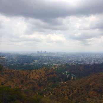


I conquered Mount Hollywood! One of the best hike I've done in LA! You can start either at the Observatory in Griffith Park, a lot of hikers where coming from that direction. I started at Mineral Waters Picnic area (and parking) and went up via Amir's Garden, North Trail, Dante's View. It's longer, but worth it! Not grueling, a moderate hike that gets better and better. We ran into many horses on the way and it's a quiet, nice trail, not too many folks on it. The panoramic views of the city are some of the best, you can see the Observatory below and the Hollywood sign to the right. This kinda of view takes your breath away! From here you can return to your trail or go down on some other ones, there are so many trails and hiking options. It seems like Griffith Park offers an endless array. It's about a 3 mile hike (maybe a tad more), it feels great hiking it, taking breaks to admire the city views of Glendale, DTLA in the distance and take the nature in. There are more folks up at the the summit (along with a few benches), so wear your mask and social distance. People are mostly good about it. There's also a memorial dedicated to Tom LaBonge who passed away this year and loved and served our city. Beautiful hike, one of a kind, even for LA that has a lot to offer trails wise. Great if you live in LA and want a cool adventure in the city. If you visit LA, this could be a cool off the beaten path activity and you get to see cool landmarks! Bring water, a jacket, a snack, wear comfy shoes, and sun protective lotion (there is some shade on the trail). Hiking the Hollywood could be a fun weekend treat, it was for me! read more


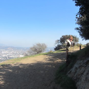


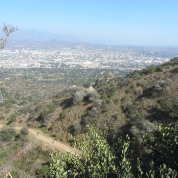

This a great hike with many different trails. I parked at one of the parking lots and it has tons of parking. In total hikes 6 miles I'm about 3 hours. There is a lot of incline so bring water and proper shoes! read more


Sunday, January 26, 2014, was a slightly overcast day which was perfect for hiking. We had a great group of really nice Yelp hikers, along with a few of their friends, meet up at 8:30 a.m. at the bear statue. Thanks so much for joining me on my first Unofficial Yelp Event-Hike for 2014. We all started our hike near the intersection of Los Feliz and Fern Dell by the bear statue and Griffith Park sign. This first trail is called the Griffith Observatory Trail, and you can find it on Yelp. Follow this trail to the right of the road and eventually it turns into a fire road. You'll be able to see the Griffith Observatory looming overhead in no time at all. Once you arrive on top then just walk across the parking lot and continue on the Charlie Turner Trail. You will be able to get a great view of the Hollywood sign to the west. Keep going on this fire road and eventually you'll make it to the summit of Mount Hollywood. There are many other ways to get to the top of Mount Hollywood, but this route is my favorite. Mount Hollywood is only one of the summits within Griffith Park. To hike to the top from Los Feliz and Fern Dell and back down is approximately 6 1/2 miles. The elevation at the summit is 1,619 feet above sea level. It is not the tallest peak in Griffith Park because that distinction belongs to Cahuenga Peak. Back in May 2007 a wildfire burned 800 acres within Griffith Park, but the plants are coming back as is evidenced by Dante's View Garden. At the top of the mountain you'll be able to see all over L.A. and to the ocean when it's clear. You can see Glendale, Burbank, the Verdugo Mountains and the San Gabriel Mountains too. These are all the cool Yelpers and their friends who hiked with our group today: Wan L. Tony L. Tim C. Bic T. Nahid D. Ruth T. Rosemarie Y. & her friend Melissa Samantha C. Craig F. & his friend Mitsuko Mandi T. & her friend Fan Kris A. Thank you so much to Tony L. for taking all the great group photos. I hope I get to see you all on another hike this year or Yelp event. Get out and go hiking in the new year! Here's a happy song to help you get moving: http://www.youtube.com/watch?v=y6Sxv-sUYtM&sns=em read more


3 years ago

Celebrated Memorial day with a hike at Mt Hollywood, a prominent peak in Griffith Park, located above and behind Griffith Observatory. While it isn't the park's tallest peak at 1,625 feet, the summit offers excellent 360-degree views of Hollywood Sign and Griffith Observatory, plus a pulchritudinous views of downtown Los Angeles and the San Gabriel Mountains. Moreover, its level of difficulty is easy to moderate with some steep short elevations. I began my hike at Western Canyon, accessible via Fern Dell Drive. This entrance to Griffith Park is located right off Los Feliz Boulevard, and it's famous for the bear statue. The path trails are well kept and wide enough to distance yourself with other hikers. Getting to the observatory was relatively easy but once you go further up north to Dante's view/peak is where you see a good bird's eye view of Los Angeles. I headed further north of the trail deeper into Griffith towards the Hollywood sign via Vista Del Valle drive where you can see the Hollywood sign from a distance on left side and the Valley, on right side (see photos). Hiking Mt Hollywood will definitely take your entire day and I suggest bring plenty of water, sunscreen and music. Overall I love hiking trails and it has become one of my favorite trail in LA and highly recommend it. read more


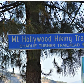


The Mount Hollywood Trail at Griffith Park is the best easy hiking trail in Los Angeles. Nope, we didn't enounter any rattlesnakes or mountain lions when we hiked it, but we did encounter an awesome pre-dawn view of Downtown Los Angeles. In fact, as we hiked higher and higher, the views were more stunning at various different spots on the trail. We started our hike shortly after the Vermont Avenue gate opened at 5:00am. It was nice to start this hiking trail before the mid-morning crowd poured in at 9:00am. It's always best to start the hike early to avoid having to pay for parking at around Noon and before the Observatory opens to the public or you'll otherwise never find a convenient parking spot. The trailhead for Mount Hollywood starts at the Griffith Park Observatory next to the parking lot. The trail stickiest part of the trail is the slightly steep incline at the start of the trailhead and after you cross the bridge. From there, it's pretty much flat walking for most of the trail. I'd say that it's an easy hiking trail to push a baby in a stroller. Note there are three trails that branch off from the bridge. Go towards the left to stay on the easy trail towards Mount Hollywood. Speaking of distance, the Mount Hollywood Trail is about 3.5 miles one way, which is about 45-minute walking. The entire trail is switchback or of a zig zag pattern, which means you're actually walking zip zag up the side of a mountain. You'll see the same views of Griffith Park Observatory, you then notice the addition of the Greek Theater, and eventually (as you get higher) you will see Downtown Los Angeles with the Greek Theater, and The Griffith Park Observatory. You know that you're close to the vista point of Mount Hollywood when you pass Dante's Garden. Dante's Garden is this little oasis along side the trail. It has a few benches and a garden of mixed trees and shrubbery. It also has its own unique views of the Los Angeles area. Just past Dante's Garden is the vista point of what I believe are the Los Angeles neighborhoods of Echo Park, Atwater Village, and Glendale and the 5 Freeway. Stunning views! Eventually, the trail leads into a grand "side view" of the Hollywood sign. It was nice to watch the moon disappear from behind the sign. In an instant, you'll find that the trail forks into two paths that leads to the top of Mount Hollywood. The left path is the longer route and the one the right is shorter. The top of Mount Hollywood has the best views of the greater Los Angeles area. I love that there are plenty of picnic tables and benches around to sit and relax. It's just as convenient to lay a small blanket on the ground to sit. My favorite moment at Mount Hollywood is on a cloudy early morning, because one can catch the sun and it's glorious rays of colorful light peering down onto Downtown Los Angeles. It's surreal. read more


10 years ago
ONE WAY OR ANOTHER... Griffith Park is packed with over 50 miles of hiking trails and Mt. Hollywood, the second tallest peak sits at 1,625ft with an amazing 360 degree view, including the Griffith Park Observatory, downtown LA, Hollywood, and the Hollywood Sign and so much more. There is more than one path to the summit of Mt. Hollywood. STATS: Distance 6.5 miles Elevation Gain: a bit over 1600ft. Time - 3.5-4 hours Trek: Loop Trail Trail: Single Track and Fire Road Rating: Intermediate/Advanced WARNING: Snakes, bobcats, mountain lions OUR ROUTE: There are many trails that lead to Mt. Hollywood, but for this review, the trail starts out near the Ferndell Nature Area, at "The Bear." The origin of this trek winds through the cool canopy California sycamores accompanied by over 50 fern species, tropical plants and blooms, a restroom, and child's play areas with picnic tables. Enjoy the shadiness of the sycamores, because they do come to an end and the repose of the hike to Mt. Hollywood you will be fully exposed to the elements. Best to do this hike in the cooler months, or early morning/evening in the warmer months. Keeping up-trail, out from under the shade trees, eventually a view of Mt. Lee, most famous for the Hollywood Sign, as well as the Griffith Park Observatory were in our sights. At the three-prong fork in the road, we took the one on the right, which leads to the Griffith Park Observatory. At the far end of the Observatory parking lot is a street sign for Charlie Turner Trailhead, a nice shady patch in the Berlin forest. We proceeded on our dirty, dusty hike on a fire road to Dante's View, where we made a pit stop to refuel water bottles and enjoy the grand view of the city below, as well as Dante's Garden. The final stretch to the peak of Mt. Hollywood is a steep uphill climb on hard, yet, slippery fire road. Place with good traction are always necessary, but especially along this type of terrain. Once at the top of Mt. Hollywood, packs were dropped on the picnic tables, and we maneuvered to the far end of the picnic area to soak in the far and wide 180+ degree view. From Dodger Stadium, to downtown LA, to Hollywood, to Century City. If you like cityscapes, you're certain to enjoy this scene. It was downhill from there. While we double backed in some areas, our trek down took us past the Greek Theater, a whole other side of the park. JUST ONE WAY Parking near this trailhead, to start at "The Bear" is a bear. No parking on the main drag, and residential parking sparse. The best parking is on the residential side streets south of Los Feliz Blvd. N. Oxford Ave., N. Serrano Ave, or N. Hobart Blvd. This hike is best after a good rain or Santa Ana winds, in other words when the air is clear. The views can be quite amazing without the LA Haze. DISCLAIMER: Hiking is not something that can be taken lightly. It can be life-threatening as you see and hear on the news, people die or get lost all time. Please, if you are going to hike, never go alone and prepare for the worst, hope for the best. Remember when going for a hike, no matter how short you think it may be, always be prepared. Carry at least two liters of water for every five miles (more if the weather is warm), protein bar, nuts, and electrolytes. Wear sturdy lug sole shoes and protective clothing. Some areas the weather can change quicker than a firefighter can put on his gear. It is also very important, always always always let a family member or friend know where you are going and when you expect to be back. Lastly, have fun when you hike it up. read more


11 years ago
Some reviewers remark that this is the same hiking trail as Charlie Turner's Trail and Griffith Observatory Hike. Technically, this trail starts near the zoo area. This hike to the Hollywood sign starts at the Griffith Park parking lot west of the merry go round off of Fire Road.. It is ~6.7 miles roundtrip with ~2,400' elevation gain/loss. The workout is pretty decent for a shorter hike if you choose to take some steeper trails up. The trail is mostly single file with few loose rocks under foot. There are a few areas that are a pretty steep ascension, but for the most part, the trail is at a steady incline. Once you reach the fire road, it is a paved, wide road and a short climb up to the Hollywood sign. Views are beautiful of LA including Hollywood Lake on a clear day. parking - free lot read more


11 years ago
Love my hiking spot :) it's abt 3 miles up & down starting from the Griffith observatory parking to the very top of the view area...60 minutes or less depending on how fast you walk or jog or run...best short hike if you don't have lots of time but if you have lots then there are lots of trails around the mountain. Go for it! read more




9 years ago

More info about Mount Hollywood
Fire Rd
Los Angeles, CA 90027
Griffith Park
Directions
Hours
Payment methods
Outdoor Amenities
Ask the Community - Mount Hollywood
Review Highlights - Mount Hollywood
You might also consider















Mount Hollywood - hiking - Updated September 2026
Best of Los Angeles
People found Mount Hollywood by searching for…
Lookout Points in Los Angeles, CA
View Points in Los Angeles, CA
Sunrise Hike in Los Angeles, CA
Full Moon Hike in Los Angeles, CA
Stroller Walk in Los Angeles, CA
Horse Rental in Los Angeles, CA
Watch Sunset in Los Angeles, CA
Beach Hiking Trails in Los Angeles, CA
Secret Spots in Los Angeles, CA
Sunrise View in Los Angeles, CA
Horse Ranch in Los Angeles, CA
Scenic View in Los Angeles, CA
Places to Walk at Night in Los Angeles, CA
Horseback Riding on Beach in Los Angeles, CA
Horse Riding Lessons for Kids in Los Angeles, CA
Hiking Groups in Los Angeles, CA
Stroller Friendly Hikes in Los Angeles, CA
Public Shower in Los Angeles, CA
Places to Run in Los Angeles, CA
Horse Stables in Los Angeles, CA
Equestrian Center in Los Angeles, CA
Trending Searches in Los Angeles, CA
Apple Orchards near Mount Hollywood
Apple Picking near Mount Hollywood
Barbershop near Mount Hollywood
Bike Shop near Mount Hollywood
Bird Sanctuary near Mount Hollywood
Cliff Jumping near Mount Hollywood
Consignment Shops near Mount Hollywood
Cruising Spots near Mount Hollywood
Dog Friendly Things To Do near Mount Hollywood
Dog Swimming near Mount Hollywood
Ear Piercing near Mount Hollywood
Estheticians near Mount Hollywood
Eyebrow Threading near Mount Hollywood
Eyelash Extensions near Mount Hollywood
Hair Braiding near Mount Hollywood
Kids Haircut near Mount Hollywood
Picnic Areas near Mount Hollywood
Private Schools near Mount Hollywood
Public Shower near Mount Hollywood
Rock Quarry near Mount Hollywood
Scenic Night View near Mount Hollywood
Scenic Overlook near Mount Hollywood
Star Gazing near Mount Hollywood
Sunrise View near Mount Hollywood
Trading Card Shops near Mount Hollywood
Browse Articles
Browse Nearby
BEST of Los Angeles, California Coffee near Mount Hollywood
BEST of Los Angeles, California Restaurants near Mount Hollywood
BEST of Los Angeles, California Things to Do near Mount Hollywood
BEST of Los Angeles, California Breakfast near Mount Hollywood
BEST of Los Angeles, California Walking Trails near Mount Hollywood
BEST of Los Angeles, California Parks near Mount Hollywood
BEST of Los Angeles, California Campgrounds near Mount Hollywood
BEST of Los Angeles, California Sightseeing near Mount Hollywood
BEST of Los Angeles, California Airport near Mount Hollywood
Browse Brands
Related Searches in Los Angeles, CA
Affordable Horse Boarding Services in Los Angeles, California
Affordable Horse Rental Options in Los Angeles, California
Affordable Pony Rental Services Available in Los Angeles, California
Best Dog Hiking Trails Around Los Angeles, California
Best Fishing Locations and Guides in Los Angeles, California
Best Nature Trails for Hiking in Los Angeles, California
Best Places for Horseback Riding in Los Angeles, California
Book English Riding Lessons Near You in Los Angeles, California
Book Equestrian Lessons With Experts in Los Angeles, California
Book Exciting Pony Rides in Los Angeles, California for All Ages
Book Expert Dressage Lessons in Los Angeles, California
Check Out Off Road Trails in Los Angeles, California
Discover Dog Friendly Trails to Explore in Los Angeles, California
Discover Easy Hiking Trails Near Los Angeles, California
Discover Horseback Riding Tours in Los Angeles, California
Discover Kid Friendly Hiking Trails in Los Angeles, California
Discover Popular Bike Trails in Los Angeles, California
Discover Scenic Mountain Bike Trails Near Los Angeles, California
Discover Top-Rated Dude Ranch Experiences in Los Angeles, California
Discover Walking Parks in Los Angeles, California Near You
Discover a Hiking Trail in Los Angeles, California
Discover the Best Night Hike Trails in Los Angeles, California
Dog-Friendly Hikes With Dogs in Los Angeles, California
Enjoy Camping Adventures Around Los Angeles, California
Enjoy Hiking Adventures in Los Angeles, California
Enjoy Horseback Riding on Beach in Los Angeles, California
Enjoy Ice Skating in Los Angeles, California
Enjoy Kayaking Adventures in Los Angeles, California
Enjoy Off Leash Dog Hikes in Los Angeles, California
Enjoy Scenic Places to Walk in Los Angeles, California
Enjoy Scenic Trail Rides Around Los Angeles, California
Enjoy Stables and Horse Riding Experiences in Los Angeles, California
Enjoy Tent Camping Spots Around Los Angeles, California
Enjoy Thrilling Atv Riding Experiences in Los Angeles, California
Enjoy a Beautiful Waterfall Hike in Los Angeles, California
Enjoy a Memorable Pony Ride in Los Angeles, California Today
Enjoy the Best Walking Path in Los Angeles, California
Enjoy the Best Walking Trails in Los Angeles, California
Experience Top Dressage Events in Los Angeles, California
Explore Beautiful Parks and Green Spaces in Los Angeles, California
Explore Easy Hikes Perfect for All in Los Angeles, California
Explore Equestrian Activities and Services in Los Angeles, California
Explore Family-Friendly Petting Zoos in Los Angeles, California
Explore Fun Activities to Do in Los Angeles, California
Explore Horse Stables and Boarding in Los Angeles, California
Explore Horseback Riding Trails in Los Angeles, California
Explore Kids Horseback Riding Lessons in Los Angeles, California
Explore Popular Campgrounds Near Los Angeles, California
Explore Popular Dog Walking Trails in Los Angeles, California


