Cancel

    Open app

    Search

    Mt Jefferson

    5.0 (1 review)

    Mt Jefferson Photos

    Recommended Reviews - Mt Jefferson

    Your trust is our priority, so businesses can't pay to alter or remove their reviews. Learn more about reviews.
    Yelp app icon
    Browse more easily on the app
    Review Feed Illustration
    Photo of Andrew H.
    2614
    3069
    13118

    9 years ago

    Helpful 2
    Thanks 0
    Love this 2
    Oh no 0

    Verify this business for free

    Get access to customer & competitor insights.

    Verify this business

    Stahlman Point Trail

    Stahlman Point Trail

    5.0(1 review)
    28.9 km

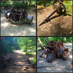
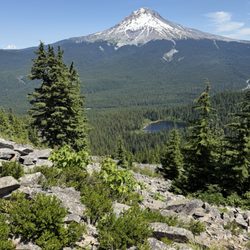
    I've done this hike several times over the decades. It used to be a very well kept secret and I…read moreonly found out about it by talking to a Ranger at the Ranger station in Detroit. Seems like the word has gotten out in recent years so the chances of you being alone on the trail or at the summit are now pretty slim. This is not a difficult hike but you do need to be in shape to do it. Pretty much impossible to get lost as you are always hiking on a ridge line but it's always wise to carry a map and compass (or GPS) all the same. It's a somewhat steep, 3 mile, several thousand feet of elevation gain stroll and no drinkable water along the trail most of the year. So bring sufficient water and also a headlamp if you're starting out late in the day. Figure three hours to do the round trip and you will be under a thick forest canopy so it does get dark on the trail early. The trail is narrow and you are on a ridge so there is some exposure. Poles can be helpful although I've never needed them here. This trail is not ADA accessible. The final 100' scramble to the summit reveals a concrete slab where a fire watch station once sat. Great views of Mount Jefferson and Detroit. There has always been a few big downed trees blocking the narrow trail. But since the fire you'll start seeing felled trees about a mile up the trail. In one location you'll have to bushwhack around a half dozen or so massive fallen trees. The trailhead is easy enough to find although there are several roads to the the left before you get there that are NOT trailheads. The true trailhead parking area is marked and has space for about four cars. The left turn into the parking area is about 5+ miles from Highway 22. Turn right at the Pacific Pride filling station and follow the road for about 5 miles. Maybe a bit more.

    Photos
    Stahlman Point Trail

    See all

    Clear Lake - Drinks and fishing stuff

    Clear Lake

    4.5(12 reviews)
    47.9 km

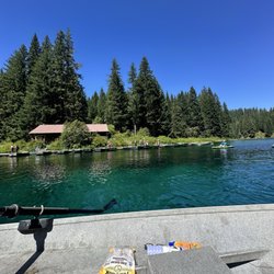
    Here is my review of clear lake for row boat use!…read more We got here at 930 am. Found the pay box at the entrance $9, no cash. There is an option to pay at the bottom which we should have done because they take the national park passes there (see picture). We were able to find parking in the main lot and there were a few people there. We weren't sure how the process of renting the boats or availability of life jackets. There is a shop that sells food, snacks, drinks, ice cream , and desserts. They also have a selection of fishing items, shirts, jackets. We paid for the boat - $60 for the large boat all day. The life jackets were plentiful and available. My husband rowed most of the time because I am not a good rower. We made it from the dock to the start of the river that you can't go past which is good since you could hear the rapids. The way to the left was a lot calmer and clear. We had a blast out on the lake. You could see down near the shallows but not in the middle of the lake. Make sure to bring sunscreen because there isn't much shade. The facilities are great!! Two bathrooms in the shop. Large tables to sit and enjoy a hot cooked meal or ice cream. I am so glad we were able to make a morning on the lake super easy and stress free! Next time I'm thinking of renting a kayak or a stand up paddle board. That would be fun! If you are in the area make sure to stop by early. As we were leaving, the parking lot was filled up so make sure to get there early! I hope my review and pictures help you plan for a successful visit to Clear Lake!

    A beautiful setting for the perfect romantic getaway or family weekend escape. The cabins are…read morecozy with gas stoves and heaters and the boat rentals are very affordable is you want to connect with the water. We enjoyed a wonderful hike around the lake which took us through forests, lava fields, and springs with wooden bridges. The views were amazing!

    Photos
    Clear Lake - Coffee and tea bar

    Coffee and tea bar

    Clear Lake - Bathroom

    Bathroom

    Clear Lake - View of the boat dock

    See all

    View of the boat dock

    Mirror Lake Trail - This bridge on the way to the viewpoint is actually quite sturdy and stable

    Mirror Lake Trail

    4.3(39 reviews)
    69.3 km

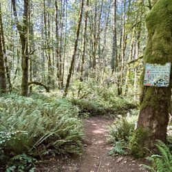
    This review is for Mirror Lake Loop which was a ~4.3 miles round trip that took ~2 hours to…read morecomplete. Located 22 minutes away from Tamanawas Falls, Mirror Lake Loop was a dense forest trail that was ~90% shaded in Mt Hood, Oregon. The first ~5 minutes of the trail was paved and becomes a dirt trail filled with rocks and roots. The last stretch towards the lake was an incline alongside the mountain. There were only a few openings around the lake to view the water and the surroundings. The best view would be the Mirror Lake with Mt Hood in the distance! Limited parking area at the trailhead. Restroom available at the parking lot. Short video of the hike for those interested! https://youtu.be/8WsTe72wDP4

    8.1 miles, 1509 ft elevation gain, 2 hrs 33 minutes…read more The hike all the way to Tom, Dick, and Harry Mountain is definitely longer than the stated 8 miles on AllTrails. We did not have enough water and had to turn around a bit early at mile 4 (for a grand total of 8). Tom, Dick, and Harry Mountain was visible but I didn't want to risk my poor pup overheating on such a warm day. Not many other folks go past mirror lake or the initial mountain viewpoint so you might find you'll have this to yourself. The trail is very well maintained to mirror lake, and even has a few cute little bridges and stream crossings. After that, it can be quite narrow and bouldery though there are many beautiful wildflowers lining the trail. There were also a few mosquitos just after the lake so come prepared with bug spray. All I can speak for is the mountain viewpoint (since that's as far as we got) but it was worth the trek up there to see Mt. Hood, Mirror Lake, and Government Camp from that point of view.

    Photos
    Mirror Lake Trail - The trail

    The trail

    Mirror Lake Trail
    Mirror Lake Trail - Mt. Hood and Mirror Lake

    See all

    Mt. Hood and Mirror Lake

    Little Zigzag Falls - Fast moving Zigzag River. Sept 2024.

    Little Zigzag Falls

    4.7(19 reviews)
    71.2 km

    Little Zigzag Falls, Welches, Oregon. Sept, 2024…read more What a great little hike! Located in the Mt. Hood National Forest, this is an easy-to-access trail a few paved miles off OR-26. The parking area, with space for maybe 20 or so cars, is at the end of the road. There are trail signs, as well as a porta-potty. You need a Northwest Forest Pass, or NPS pass, to park here but they are not sold on-site. (You can purchase at the Zigzag Ranger District @ 70220 E. Highway 26 in Zigzag). The Forest Service (FS) describes the trail as a "gentle uphill trail located in a narrow canyon next to the Little Zigzag River." The shaded and mostly smooth trail ends at the falls. There are some rocks and roots but overall it's quite smooth. Also, per the Forest Service, it's a great hike for kids, but supervision along the riverside is a must. We note that the stream was exceptionally fast-moving and the falls he a lot of water in mid-September The FS describes the trail as having a distance of 0.5 miles (one way), but All Trails lists it as 0.6 for BOTH ways and my watch recorded 0.7 for both. The trail is at an elevation of around 3,250 feet, and is snow-free from June to November. There's a nice shaded picnic table near the start of the trail. There's also a wooden bench near the falls. The trail is not wheelchair accessible.

    Nice, easy hike with an awesome payoff at the end. The parking lot is pretty spacious. The hike is…read morevery short itself so perfect for families. Great views at the end.

    Photos
    Little Zigzag Falls - Me at the falls!

    Me at the falls!

    Little Zigzag Falls - Zigzag Falls.

    Zigzag Falls.

    Little Zigzag Falls - Top of the falls

    See all

    Top of the falls

    Mt Jefferson - hiking - Updated August 2026

    Loading...
    Loading...
    Loading...