Cancel

    Open app

    Search

    Oconee State Park

    4.0 (13 reviews)

    Oconee State Park Photos

    Recommended Reviews - Oconee State Park

    Your trust is our priority, so businesses can't pay to alter or remove their reviews. Learn more about reviews.
    Yelp app icon
    Browse more easily on the app
    Review Feed Illustration

    Reviews With Photos

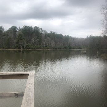
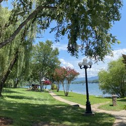
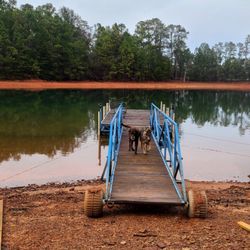
    Lake view
    Rob P.

    Park was very clean, staff was extremely friendly and helpful. Park has a lot of RV sites, cabins and primitive campsites. Large lake for fishing or you can rent paddle boats. A lot of trails to hike as well as the trail head for the 77 mile Foothills trail. Park store for your basic needs if you forget something, playground for kids. WiFi is available, but who needs WiFi when enjoying nature! Well worth the visit.

    See all

    3 months ago

    Helpful 2
    Thanks 0
    Love this 3
    Oh no 0

    3 years ago

    Helpful 31
    Thanks 2
    Love this 27
    Oh no 0

    2 years ago

    Helpful 0
    Thanks 0
    Love this 1
    Oh no 0

    5 years ago

    Helpful 1
    Thanks 0
    Love this 1
    Oh no 0

    2 years ago

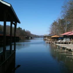
    Great camping experience very quiet, and family friendly. Very nice views of the lake.

    Helpful 0
    Thanks 0
    Love this 0
    Oh no 0
    Photo of Bill C.
    4
    12
    28

    5 years ago

    Helpful 0
    Thanks 0
    Love this 0
    Oh no 0

    4 years ago

    Large campground with beautiful scenery, lakes, hiking trails, general store, and clean bathrooms.

    Helpful 0
    Thanks 0
    Love this 0
    Oh no 0

    7 years ago

    Helpful 1
    Thanks 0
    Love this 1
    Oh no 0

    8 years ago

    Helpful 0
    Thanks 0
    Love this 0
    Oh no 0

    13 years ago

    Helpful 1
    Thanks 0
    Love this 0
    Oh no 0

    5 years ago

    Helpful 0
    Thanks 0
    Love this 0
    Oh no 0

    8 years ago

    Helpful 1
    Thanks 0
    Love this 1
    Oh no 0

    12 years ago

    Helpful 1
    Thanks 0
    Love this 0
    Oh no 0

    Ask the Community - Oconee State Park

    Review Highlights - Oconee State Park

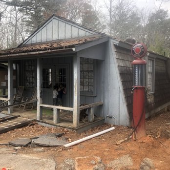
    Cabin 4 has a beautiful sitting area with Adirondack chairs and a fire pit which made for relaxing evenings.

    Mentioned in 5 reviews

    Read more highlights

    Verify this business for free

    People searched for Parks 317 times last month within 15 miles of this business.

    Verify this business

    Fairfield Lake

    Fairfield Lake

    4.2(5 reviews)
    18.0 mi

    My husband and I are staying (late Sept, 2023) at the Club Wyndham-Sapphire Valley, and we were…read moregiven a "Sapphire Valley Master Association Amenity Card" for use of amenities while staying on-site. One of the amenities is access to Fairfield Lake, an 80 acre lake at 3,160' elevation in Sapphire, NC. The lake's length is 1 mile, and it is 35' at its deepest point. The amenity card also allows us to use the private beach, picnic tables, a grill, rest room, and to rent motor boats, canoes, kayaks, paddle boards, fishing poles, etc. at the boat house. There is also a Lake Trail around the lake, which is the private property of Camp Merrie-Woode. However, the trail is open to the public (at your own risk) for hiking purposes only during daylight hours from August 15th to May 15th, when camp is not in session. Dogs are allowed but must be on leashes. We saw two brochures, one of which stated that the trail is a 3.3 mile loop while another said that it's 3.8; my Fitbit recorded 3.55 miles. The trail is mostly flat, with an occasional incline or descent, and has a variety of trail surfaces (gravel, pine needles, small rocks, tree limbs, etc.). Besides the lake, there are a few highlights on the trail -- (1) Fairfield Falls. With a height of 25', the waterfall is created by the stream of the Trays Island Creek, a tributary of the Horsepasture River, which runs along the western side of the all Bald directly into Lake Fairfield. (2) Presley Pass. The Iron Bridge across the stream above the waterfall was built by Camp Merrie-Woode caretaker, James Presley, in the mid-1950s. (3) Intersection with the trailhead for the Old Bald Trail, a more strenuous 3 mile hike. The trail is mostly well-marked with small green-white tags. We walked clockwise, and got a bit confused relatively close to our ending point (after a paved road when the signs seemed to disappear).

    We did the walk while in Sapphire for the week, and it was beautiful! Luckily, the camp was closed,…read moreso we are able to do the entire loop around the lake. It ends up being about 3.5 miles from end to end. There are some steep areas, and some areas are challenging to navigate due to the rocks, but it was worth it. There is even a waterfall you pass if you need another reason to check this out. The photos do not do justice to the beauty.

    Photos
    Fairfield Lake - Fall

    Fall

    Fairfield Lake - Shelters and campfire on Lake Trail. (For use by Camp Merrie-Woode campers only).

    Shelters and campfire on Lake Trail. (For use by Camp Merrie-Woode campers only).

    Fairfield Lake - Fall

    See all

    Fall

    Lake Sidney Lanier

    Lake Sidney Lanier

    4.3(26 reviews)
    73.4 mi

    A hidden staycation opportunity that flies under the radar. Known for their boating and lake…read moreactivities but the other side offers a relaxed environment. Lodge/hotel lodging with spacious rooms with the treat of a Keurig in each room. A truly heated pool with poolside service or indoor or patio eating. Onsite restaurant with outdoor lake views offering buffet breakfast and menu dinners. A coffee nook offering fresh coffee/lattes along with patries. The topper is an onsite spa. Plenty of options on the property with golf, pickle ball, game room and water park.

    I'm very surprised Lake Lanier has so few reviews. After all, it was one of the water sport venues…read moreof the 1996 Olympics, one of the most popular summertime destinations in the state. Most any warm season holiday is celebrated at Lake Lanier making it a popular place for vacation rental homes. Here you can go boating, fishing, swimming, hiking, golfing, as well as experience a fabulous fireworks show in the summer or Christmas lights and snow sleds in the winter. There is a spa, a beach, a waterpark, a luxury resort and good times @ Margaritaville. You can rent jet skis, go horseback riding, charter a fishing boat, rent a house boat, go camping or take a hot air balloon ride nearby. It was created by the completion of Buford Dam on the Chattahoochee River in 1956, and named for Confederate Army poet Sidney Lanier. Its primary purpose was for flood control and water supplies and has a water volume of about 1,049,400 acre-ft. The narrative will tell you its construction destroyed more than 50,000 acres of farmland and displaced more than 250 families, 15 businesses, and relocated 20 cemeteries along with their corpses in the process. But I want to pause here and dive a little deeper under the surface of its waters and introduce you to: [ OSCARVILLE, GEORGIA ] "The truth is rarely pure and never simple." ― Oscar Wilde Lake Lanier is partially located in Forsyth county. It is a county that prided itself on not having black residence so much that Oprah came to film an episode of her Emmy Award-winning talk show here in 1987 (trigger warning): https://www.youtube.com/watch?v=WErjPmFulQ0 The show makes mention that "no black person had lived in the county for 75 years", which was a direct reference to a predominantly African-American community known as Oscarville. It was home to 1,100 black people prior to a racial conflict in 1912 which was so brutally violent that it caused blacks to flee the county... even those who were landowners. "According to Elliot Jaspin, a historian and journalist quoted by the Digital Library of Georgia and the New Georgia Encyclopedia, only about 24 of the nearly 40 Black landowners in Forsyth County at the time were able to sell their land. The other properties have no record of sale, and some believe the abandoned land was simply taken by White residents." - The Times Oscarville began as a small farming town around 1870, but after so many fled the county in 1912, it was practically a ghost town. Those still claiming ownership of their land either had it seized or were "asked" to to forfeit their land to build the Buford Dam by Newport Dam Development according to an article published on April 6, 2021 by The Signal. Prior to the violence, Oscarville was actually known for its agricultural prowess in fighting off the boll weevil infestation that hindered many farm crops and enriching the soil with chicken feces. A technique that has been duplicated to this day to revive poor farming/gardening soil. "Facts do not cease to exist because they are ignored." ― Aldous Huxley [ MUST WATCH ] Link to Oscarville | The Town Submerged by Lake Lanier (Intrigued Mind): https://www.youtube.com/watch?v=ifMKfBO_R6s [ FINAL THOUGHTS ] Lake Lanier is a beautiful lake and a rich resource for Atlanta. It provides approx. 70% of the drinking water for Metro Atlanta as well as power, recreation and businesses. But there is more than what meets the eye as you look across its glistening surface. An entire town is buried by its waters and has been nearly forgotten, and the hard truth is this is not an isolated story. There are several other towns across the country who suffered the same fate. They include: Kowaliga (Benson), Alabama Seneca Village In New York City Susannah, Alabama and Vanport, Oregon The story of Lake Lanier and Oscarville will be featured in an upcoming TV series called Oscarville - Below the Surface. Here is the link to the trailer: https://www.youtube.com/watch?v=yVux8Y96cok Thanks for reading. 2022 / 59 #BlackHistorySeries

    Photos
    Lake Sidney Lanier
    Lake Sidney Lanier
    Lake Sidney Lanier - Game room

    See all

    Game room

    Riley Moore Falls

    Riley Moore Falls

    4.2(5 reviews)
    9.8 mi

    I just wanted to update my 3/15/20 review below to add I've now done this hike several times, but…read moreTHIS time I had the chance to hike it with a friend who is directly related to the namesake of the waterfall... Riley Moore. Sandie is a church friend of mine and Riley Moore was her Great Great Uncle (I believe that's right). He once upon a time operated a grist mill here at the top of the falls. She's been trying to get here to see the waterfall, but couldn't find it and wanted to join us (along with her family) since I knew the way. Upon further research I discovered there are actually still remnants of the mill including visible drill holes, spikes and bolts. Thought that was pretty cool info to share! [ [ [ PREVIOUS REVIEW ] ] ] Riley Moore Falls is small in height but HUGE in personality. It's located off State Road S37-748, which is a nicely maintained gravel road where cars and trucks alike can comfortably traverse. ~~~ DIRECTIONS From Westminster, SC - DO NOT turn onto Cobb Bridge Road from Long Creek Hwy (Hwy 76) where you will see the brown & white sign pointing you in the direction of Riley Moore Falls. Our GPS had us go this way, then left onto State Road S37-748, but the road was CLOSED during our visit! INSTEAD, turn onto PU-32 also known as Rocky Fork Road. Turn left onto a gravel road near Rocky Fork Baptist Church and follow that until it dead ends @ State Road S37-748 (also known as Spy Rock Road). Turn right and drive approx. 1.4 miles (4 minutes) to 748c (aka Riley Moore Shoals Road). Park at the intersection of State Road S37-748 and 748c. DO NOT ATTEMPT TO DRIVE 748c in a car or minivan. Low clearance vehicles will find the terrain on this road to be VERY difficult to navigate without bottoming out or getting stuck. I'd also recommend 4x4 capability on wet days! There can be several deep-pocketed muddy areas after heavy rains. ~~~ THE TRAIL Once you reach the intersection of Spy Rock Rd (S37-748) and 748c, park roadside on Spy Rock, secure your vehicle and begin your hike approx. 1/2 mile down the "primitive road." IF you have a high ground clearance SUV or truck, you can drive the primitive road another half mile or so to a second parking area near the trailhead. The primitive road is VERY BUMPY  and can be muddy in spots after heavy rains, so a 4x4 is best. After reaching the second parking area, follow the marked trail on the left!!! The trail is a little over a 1/2 mile to the falls from here. The trail is fairly straightforward and easy to follow. ~~~ THE FALLS Once you reach the Chauga River, you will notice a large sandy area with plenty of room for an entire horde of hikers!!! Riley Moore Falls is not very tall (only about 12 feet), but it is very wide and has a deep base pool. PRO TIP - Bring swimwear, towels and a picnic, but be sure to pack it in and pack it out. ~~~ THINGS TO KNOW Hiking Distance: 2 miles (round trip to falls from S37-748) Difficulty of hiking 748c: All downhill to trailhead (moderate return) Difficulty of hiking trail to falls: EASY Creek Crossings: NO Elevation Gain: 357 feet Waterfall Height: Approx 12 feet Access to top of falls: NO - not without getting wet Access to base of falls: YES Pool of water @ base of Falls: YES Sitting areas @ base: YES + sandy beach RESTROOMS: NO PARKING: YES (along road) + secondary parking area closer to trailhead for trucks and high ground clearance vehicles with room for about 6 cars. ~~~ [ FINAL THOUGHTS ] A lovely waterfall in any season, but also a great spot for a summer swim. While we had the waterfall practically to ourselves during our Mid-March expedition, be advised other trail website reviews say it gets trashy & crowded in summer months. What a shame if that is true because it truly is a treasure. ENJOY! 2022 / 74 #UPDATE 178

    Don't know haven't been yet. I cannot tell you something why I have not been seen. So I cannot say…read moreanything about the place

    Photos
    Riley Moore Falls
    Riley Moore Falls - CREATED FROM GOOGLE MAPS

    CREATED FROM GOOGLE MAPS

    Riley Moore Falls

    See all

    Oconee State Park - parks - Updated July 2026

    Loading...
    Loading...
    Loading...