
Old Baldy Photos


You might also consider


More like Old Baldy
Recommended Reviews - Old Baldy
Start your review...



19 years ago
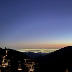
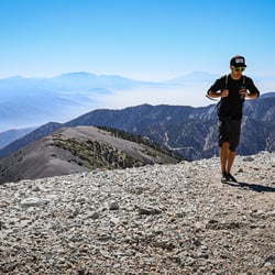
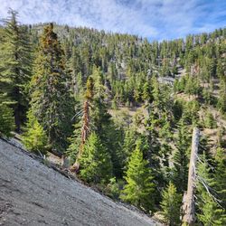
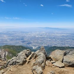
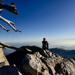
THIS is a real hike. Exceptional views, crisp clean air, strenuous trail, Baldy has it all. I've done this twice. If it wasn't as much of a drive, I'd do it a whole lot more. This hike I'm describing is about 11 miles roundtrip, 4000 ft elevation gain. But the ascent is 4 miles up, so it is steep! You are starting at 6000 ft, and going up to just over 10000 ft. Important: It is important to stay hydrated during this hike, it is easy to get altitude sickness if you go too fast, and this also dehydrates you. Please take caution. Follow Mt Baldy Rd. up to Manker Flats. You'll see a couple of port a potties on the left side & a fire road - this is where you'll begin. You'll stay on this fire road for maybe half a mile, and then you'll have to look out for the beginning of the trail on your left. It's hard to find, just builds out of the dirt ridge with an immediate incline. Once you're on the trail, it gets pretty steep right away. At the beginning you can look up at see a green hut in the distance - this is the Sierra Club ski hut for which the trail is named. It is about 2.5 miles away from where you are. Once you get to the Ski Hut, take a break, enjoy the scenery, then head out for the last 1.5 miles, which are even steeper. You'll cross over some rocks briefly, then begin ascent to the ridge. Once you get up here, you'll notice the amount of green has diminished, and the air has gotten thinner. The last portion up along the ridge is the toughest, it is steep, and you are at altitudes over 9000 ft, so you are simply not breathing in as much oxygen, and so your body has to work harder. But once you get to the peak, it is worth it. Grand views of the Angeles National Forest, & the surrounding area are yours. After sometime at the top, take the loop down Devil's Backbone. The first 3 miles down are filled with great views and some rocky trail. You'll take this until you get to a ski lift 3 miles away where there is some bathrooms and water to replenish. Finally you'll take the fire road down another 3.5 miles, which isn't as scenic, but not horrible. This road meets is really the fire road you first started on, and will take you back to your car. Quality read more


This really is a great hike. Though... I must admit ... we did the shorter route. We took the ski lifts up part of the way, took the devils backbone up to the summit, and went back the way we came. This was by no means easy. It is still a 6 or 7 mile hike. Though it is much longer and harder to start from the falls. I think Mt Baldy is under appreciated. It is absolutely beautiful. It is so nice to get away up there. The hike up is steep, take lots of water and snacks. The view up top is great. Enjoy. read more


17 years ago
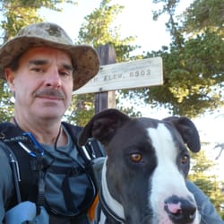
This is a review for hiking Baldy in the winter. I've hiked Baldy quite a few times using a variety of routes during the summer, but I hadn't tried it during the winter when it's covered in snow. I took the Ski Hut Trail, as described in other reviews, both up and back down. During the winter when the trail is covered in snow, people generally take a more direct line up the mountain. As a result, the mileage is decreased a bit, and the route is steeper. Roundtrip was about 8.5 miles with 4000' gain, and it took about 5 hours 30 minutes. I brought my dog, and he made it to the summit without any problems. Saw another dog at the summit too. One option that is available during the winter is to ascend directly up the Baldy Bowl after passing the Ski Hut, which many people were using as a staging area or rest stop. Looked really cool, but I stuck to the regular route. Might give it a try later this season. It's advisable to bring crampons and ice ax when the mountain is covered in snow. Please don't try this in sneakers after reading my review. read more


12 years ago
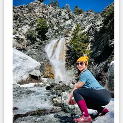
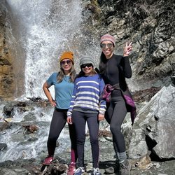
oh my... this place is a cool place to hike.. but the elevation is killer!!! the trails are NEVER ENDING... never really been to the top, but somewhere close to the top.. who knows.. There is a waterfall here, but very small.. Make sure to bring sandwiches, water, and more water!! even though the season right now is winter/spring... it still gets pretty warm and hot as you get closer to the top. Go here in the mornings, it's alot nicer and not alot of people go in the morning! i dont suggest coming later than 4 pm because then it gets dark and you wont know your way down or up.. it is impossible to see!!! Go with a big group because that's more fun and safe because if it's just two people then that could be a little scary.. going up and down without any sense of direction is not good!!! so big groups = better!!!! read more


16 years ago

14 years ago


13 years ago

16 years ago


15 years ago
14 years ago
More info about Old Baldy
Mt Baldy Rd & Falls Rd
via Ski Hut Trail, Devil's Backbone
Mount Baldy, CA 91759
Directions
Hours
Outdoor Amenities
Ask the Community - Old Baldy
Review Highlights - Old Baldy
You might also consider

















Old Baldy - parks - Updated September 2026
Best of Mount Baldy
People found Old Baldy by searching for…
Hiking Trails With Waterfalls in Mount Baldy, CA
Hot Springs in Mount Baldy, CA
Scenic Drive in Mount Baldy, CA
Photo Spots in Mount Baldy, CA
Scenic Night View in Mount Baldy, CA
Places to Take Pictures in Mount Baldy, CA
Free Snow Play in Mount Baldy, CA
Visitor Centers in Mount Baldy, CA
Playgrounds in Mount Baldy, CA
Parks for Kids in Mount Baldy, CA
Campgrounds in Mount Baldy, CA
Waterfalls and Swimming Holes in Mount Baldy, CA
Lookout Points in Mount Baldy, CA
Secret Spots in Mount Baldy, CA
Nature Parks in Mount Baldy, CA
Hiking Trails Kid Friendly in Mount Baldy, CA
Free Campgrounds in Mount Baldy, CA
Scenic Overlook in Mount Baldy, CA
Hiking With Kids in Mount Baldy, CA
Redwood Forest in Mount Baldy, CA
Empty Parking Lot in Mount Baldy, CA
Browse Nearby
BEST of Mount Baldy, California Restaurants near Old Baldy
BEST of Mount Baldy, California Coffee near Old Baldy
BEST of Mount Baldy, California Things to Do near Old Baldy
BEST of Mount Baldy, California Hiking near Old Baldy
BEST of Mount Baldy, California Breakfast near Old Baldy
BEST of Mount Baldy, California Shopping near Old Baldy


