Oregon California Border Photos


More like Oregon California Border
Recommended Reviews - Oregon California Border
Start your review...

Reviews With Photos


Crossing the Oregon-California border was one of those simple moments that made our road trip even more memorable. The last town you pass through is Ashland, then you climb up to the summit, and as you start coming back down boom there's the Oregon/California border sign. There's a nice, spacious parking area where it's easy to pull over. We popped the trunk on the car, toasted a couple of bagels with cream cheese, brewed a fresh pot of coffee, and shot a fun little video together. It turned into one of those unexpected moments that ended up being a highlight of the trip. If you're traveling up or down the West Coast, I definitely recommend stopping here. It's a great place to stretch your legs, grab a photo with the state sign, and make a memory. Five stars! read more

Driving south from Oregon into California on I-5, I think I heard my wallet cry as I crossed the border. Yes, fuel is more expensive in the Golden State than it is in the Beaver State. So fill up if you can before you cross over. There is not a good place to stop here. It looked too dangerous to me. There is an Agricultural Checkpoint in Hornbrook. They might or might not be checking passenger vehicles. My Sprinter van was waved through without being stopped. [Review 20951 overall - 484 in California - 1936 of 2023.] read more

3 years ago
Just entered into the state of Oregon. Just the beginning and already seeing the beautiful greenery and mountain tops read more


11 years ago


7 years ago
Had to stop and take a pic, not sure if it was legal lol special stop for my son's bday 7/11!! Yayy Happy 15th Nicky!! :) read more


11 years ago
More info about Oregon California Border
Ask the Community - Oregon California Border


Why does Yelp recommend reviews?
1 review that is not currently recommended
The reviews below are not factored into the business's overall star rating.
8 years ago
Oregon California Border - landmarks - Updated July 2026
Best of Hornbrook
People found Oregon California Border by searching for…
Places to Take Pictures in Hornbrook, CA
Public Services & Government in Hornbrook, CA
Police Departments in Hornbrook, CA
Scenic Overlook in Hornbrook, CA
Tourist Attractions in Hornbrook, CA
Things to Do at Night in Hornbrook, CA
Historical Tours in Hornbrook, CA
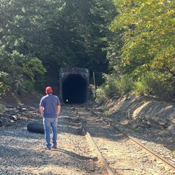
Historical Sites in Hornbrook, CA
Police Station in Hornbrook, CA
Public Parking in Hornbrook, CA
Trending Searches in Hornbrook, CA
Day Trips near Oregon California Border
Fruit Picking near Oregon California Border
Hiking near Oregon California Border
Kayak Rental near Oregon California Border
Landmarks & Historical Buildings near Oregon California Border
Photo Spots near Oregon California Border
Picnic Spots near Oregon California Border
Places To Swim near Oregon California Border
Public Services & Government near Oregon California Border
Scenic Drive near Oregon California Border
Swimming Holes near Oregon California Border
Swimming Lakes near Oregon California Border
Browse Articles
Browse Nearby
BEST of Hornbrook, California Restaurants near Oregon California Border
BEST of Hornbrook, California Things to Do near Oregon California Border
BEST of Hornbrook, California Coffee near Oregon California Border
BEST of Hornbrook, California Attractions near Oregon California Border
BEST of Hornbrook, California Breakfast near Oregon California Border
BEST of Hornbrook, California Hotels near Oregon California Border
BEST of Hornbrook, California Shopping near Oregon California Border
BEST of Hornbrook, California Campgrounds near Oregon California Border
Browse Brands
Related Searches in Hornbrook, CA
Best Fun Things to Do in Hornbrook, California
Best Things to Do on a Rainy Day in Hornbrook, California
Book Engaging Historical Tours in Hornbrook, California
Discover Charming Historic Homes in Hornbrook, California
Discover Historic Sites and Places in Hornbrook, California
Discover Popular Landmarks in Hornbrook, California
Discover Popular Photo Spots in Hornbrook, California
Discover the Best Beaches in Hornbrook, California
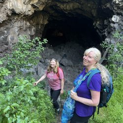
Discover the Best Caves to Explore in Hornbrook, California
Enjoy Hiking Adventures in Hornbrook, California
Explore Beautiful Parks and Green Spaces in Hornbrook, California
Explore Children's Museums Near Hornbrook, California
Explore Free Things to Do Around Hornbrook, California
Explore Fun Activities to Do in Hornbrook, California
Explore Fun Field Trips in Hornbrook, California
Explore Popular Day Trips From Hornbrook, California
Explore Popular Scenic Overlook Points in Hornbrook, California
Explore Popular Scenic Views Near Hornbrook, California
Explore Popular View Points Around Hornbrook, California
Explore Scenic Lakes to Visit in Hornbrook, California
Explore Secret Spots Worth Visiting in Hornbrook, California
Explore Top Art Galleries Located in Hornbrook, California
Explore Top Things to Do at Night in Hornbrook, California
Explore Venues & Event Spaces in Hornbrook, California
Explore the Best Swimming Holes Around Hornbrook, California
Explore the Top Car Museum in Hornbrook, California
Find Beautiful Views in Hornbrook, California
Find Exciting Tours to Take in Hornbrook, California
Find Fun Things to Do With Kids in Hornbrook, California
Find Top-Rated Waterfalls in Hornbrook, California Now
Find the Best Bridge Spots in Hornbrook, California
Find the Best Playgrounds to Visit in Hornbrook, California
Fun Teen Activities to Do in Hornbrook, California
Fun Things for Kids in Hornbrook, California
Hiking Trails With Waterfalls in Hornbrook, California
Plan a Scenic Drive Route Near Hornbrook, California
Popular Kids Activities in Hornbrook, California
Popular Outdoor Activities to Try in Hornbrook, California
Popular Picnic Spots to Visit in Hornbrook, California
Popular Places to Take Pictures in Hornbrook, California
Popular Things to Do in Hornbrook, California
Relax at Natural Hot Springs Near Hornbrook, California
Secure Convenient Parking Options in Hornbrook, California
Top Entertainment Options in Hornbrook, California
Top Hiking Trails to Explore in Hornbrook, California
Top Things to Do With Kids in Hornbrook, California
People who viewed Oregon California Border also viewed
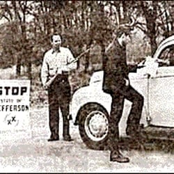
State of Jefferson
2 reviews
Department Of Motor Vehicles
14 reviews
Yreka VA Clinic
1 review
Rogue Valley Metaphysical Library
6 reviews
California Dept Of Food & Agriculture Inspection Station
18 reviews
Franco-American Hotel Building Museum
1 review
Social Security
1 review
Genealogical Society of Siskiyou County
1 review
Yreka Police Department
1 review