Cancel

    Open app

    Search

    Pack Monadnock

    5.0 (5 reviews)

    Pack Monadnock Photos

    You might also consider

    Recommended Reviews - Pack Monadnock

    Your trust is our priority, so businesses can't pay to alter or remove their reviews. Learn more about reviews.
    Yelp app icon
    Browse more easily on the app
    Review Feed Illustration

    24 days ago

    Helpful 1
    Thanks 0
    Love this 1
    Oh no 0

    1 year ago

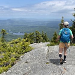
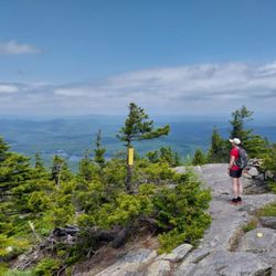
    It is a mountain not a restaurant. Amazing views from the raptor sanctuary and you can see Boston on a clear day

    Helpful 0
    Thanks 0
    Love this 0
    Oh no 0

    15 years ago

    Helpful 4
    Thanks 1
    Love this 1
    Oh no 0

    9 years ago

    Helpful 1
    Thanks 0
    Love this 2
    Oh no 0

    10 years ago

    Helpful 0
    Thanks 1
    Love this 0
    Oh no 0

    Verify this business for free

    People searched for Hiking 276 times last month within 15 miles of this business.

    Verify this business

    Monadnock State Park - White Dot trail

    Monadnock State Park

    4.7(42 reviews)
    13.7 mi

    Great day hike and not for those with weak ankles! Took the white dot trail up and used the white…read morecross trail to come down. Forgot the bug spray which would have kept the critters at bay with much of the trail having slow or puddled water. Parking wasn't too crowded, $15 for access to park. Snack and gift shop in the lot and the headquarters building just up the trail. Great restroom facility to use prior to starting the hike as well. Very rocky terrain all the way up, clearly marked with white dots (crosses as well for the return). Enjoyed the fact there were multiple volunteer guides hiking or positioned at locations (one steady at fork for dot/cross) if needed. Had low reception all through the hike for emergencies as well. Beautiful views towards the top and of course 360 once on the summit. Definitely worth the time spent. Pack in pack out, bring water and snacks along with the spray (both bug and sun)! Enjoyed a quick snack on the top with the views and a quick tsp of the marker before heading back down. Time to get up to the peak, what are you waiting for?!

    For a mere $15 cash you can access some pristine hiking opportunities. I have trekked these grounds…read morein all 4 seasons. Each has its own unique set of challenges and joys. Whether it is ice and snow with trax on or wet leaves on a steep incline, you can bet on a challenge. The most commonly used trail up the mountain is the 2 mile (one way), White Dot trail. It is well marked and easily followed. The elevation gain is rapid, as this is a shorter hike. The views are absolutely stellar from the summit. There is a small shop at the base and you receive a map upon entry with basic guidelines and trails. If you are into the outdoors, I highly recommend this spot! Laces up!

    Photos
    Monadnock State Park - Trail head

    Trail head

    Monadnock State Park
    Monadnock State Park - Along or near the White Dot Trail

    See all

    Along or near the White Dot Trail

    Table Rock Trail

    Table Rock Trail

    5.0(2 reviews)
    37.3 mi

    Anytime of the year is perfect for the rewarding view. Maybe a little tough during snow and mud…read moreseason, but still doable. Table Rock faces the Bellows Falls are from New Hampshire, just across the Connecticut River. We're in our 60s and needed to stop a few times on the way up, but it was never too steep or treacherous, just a long steady hike. You want bring good hiking shoes with serious treads. No fees. Dogs allowed.

    Phenomenal trail!! Definitely in my top 5 fave hikes - especially for the fall colors (my visit was…read morein early October)!! And it's a killer workout too! The view from the top is breathtaking- but not for the faint of heart - I have a fear of heights and it took me a while to work up the nerve to go sit on the edge lol! AllTrails has this trail labeled as "moderate" - but it was insanely muddy and very wet when I hiked it - took me ages and totally wore me out - so in those conditions I'd call it moderate-hard. And also with the rock scrambling at the top - it can be quite difficult. Very steep and especially narrow at the top - can be dangerous if you're not careful. I did a total of 2 miles round trip - it's an out and back trail. In those 2 miles, my tracker showed an 800 foot elevation gain so it's definitely a butt burner. And along the trail there are numerous areas of rock scrambling (some are very steep) and stream crossings during the wet season - get ready to be covered in mud lol! You will definitely need decent hiking shoes - and poles would've been so helpful I think! There were quite a few other hikers around. The trails are very well marked with colorful tree badges - but in some spots between the markers, I needed my trail map bc the ground was covered in leaves and mud and it wasn't as obvious. Once you get to the top of Table Rock, the stunning view will absolutely take your breath away! It's a sweeping vista of the entire forest area with the lake and resort below to the left and the long stretch of road through the park to the right - perfect for taking in all the colorful autumn splendor!! The top is a long, very narrow and flat tableau. It seems pretty stable - but has extremely steep (and deadly!) drop offs either side and no safety rails or fencing or anything so be aware. Drones aren't allowed in the park (according to the State Park website) but someone was flying one and buzzing us closely at the top which made it very distracting and scary unfortunately. Dogs are allowed - there were many on the trail and at the top. Parking is a small dirt lot pull out on the side of the road at the trailhead - Google maps took me right to it (just put in Table Rock Trailhead). It's located in Dixville Notch State Park (you can see my review of that for more detailed info). The park doesn't have bathrooms that I could find. And I think it's free. I didn't see any fee areas and their website doesn't list it as a fee area.

    Photos
    Table Rock Trail
    Table Rock Trail - Another stream crossings along the trail

    Another stream crossings along the trail

    Table Rock Trail - Gorgeous fall colors all along the trail (early October)!

    See all

    Gorgeous fall colors all along the trail (early October)!

    Mount Kearsarge

    Mount Kearsarge

    4.7(3 reviews)
    33.6 mi

    Beautiful hike up in the White Mountains of NH that leads you to the summit of a fire tower with…read morebeautiful vistas of the range up at the top. The hike will take someone a few hours, give or take the same few hours based on your hiking experience, pace preference, desire to stop, snack, take in the sights and explore. Get ready for a nice time out in nature when you start the trail. Parking is scarce, you'll likely just park on the side of the road (it's free though) and hope you don't get sideswiped as you start the hike. There's some definite elevation, but it's not super steep or overwhelming like some of the more challenging peaks in NH (Mt Washington for instance!). In the winter, be sure to have snow shoes and spikes. This hike is unique in the firetower at the top which you can access! Everyone I met on the trail was super COVID conscious and put masks on as I passed, which was so appreciated as well. If you're staying in the beautiful town of North Conway, this hike is only a few minutes away - so be sure to check it out! At the top, you'll see views of the tallest peak of the northeast (Mt Washington) on a clear day! I wish this trail was more of a loop, but the out and back was nice too!

    Four bucks pays for the ride up then a great hike awaits you. Took the easier of the two trails…read more(stay to the right.) Make it to the top for a view that makes everyday life seem ridiculous. Bugs weren't terrible so you could probably get away with some lemon/lavender oil. Enjoy!

    Photos
    Mount Kearsarge
    Mount Kearsarge
    Mount Kearsarge

    See all

    Pack Monadnock - hiking - Updated May 2026

    Loading...
    Loading...
    Loading...