Mount Watatic Photos


You might also consider


More like Mount Watatic
Recommended Reviews - Mount Watatic
Start your review...


Reviews With Photos


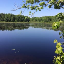
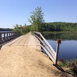
Absolutely loved hiking this mountain! We went up the back side- where the old ski area used to be. You park off of the road and walk up a path that takes you by a lake and up the back side of the mountain. This is the shorter side- but still long enough of a hike. It took about an hour each way. Beautiful at the top and we had a 360 of New Hampshire and Massachusetts. It was kept SO clean that it was just so beautiful. When hiking, we saw wildlife, so just be prepared. Recommendation: bring a lunch with you and go mid day. It's beautiful to sit at the top of the mountain and eat!


This is a great easy 1.5 hour up and down hike just an hour or so from where we live in Hudson, MA. We like it better than Wachusett as it is a bit longer and more difficult. We hiked up the Yellow Arrow Trail but decided to take the logging road back down. BIG MISTAKE. It goes down the backside of the mountain. So with that, we had to hike back up the backside and back down the front-side (Yellow Arrow Trail). With this said, it was a great 3-hour hike, which now I know I can do there if I want do a longer hike, the downfall is we had 3 Kids with us, not enough water and our elder-dog. It should have been marked that the logging trail leads to the back-side of the mountain and also the trail should be marked on the way back up. So the good part is I now know I can make Watatic more difficult with a 3 hour hike!! The bad part is that this could happen to families with smaller children and later in the day could be dangerous because the backside up is actually a bit more difficult. If you do take the logging road or backside down, there is a nice lake at the bottom and it's a nice place to hang, rest and picnic.


Great, short hike with very rewarding summit views! Easy hike for winter too, just bring spikes / traction. Entire summit covered in blueberry bushes - good picking in mid-late July! :)


3 years ago

I really enjoyed the view at the top, even enough to nap up there. The one downside I saw were these Boy Scouts who were chasing each other near the end of the top. This is how "accidents/tragedies" happen! The path up was pretty straight forward...I went straight until I hit the top. There are on markers, that I could see. But you can follow other hikers up and back down if you get lost. Love the workout, but next time I'm bring BottleS of bug sprays because they just refuse to leave you alone! read more


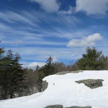
Only 1.1 mile from trailhead to the first view point: Mount Watatic. In March 2018, we used microspikes. The view from top was really good. We continued further to NH and beyond but not much better view. I want to come back here when it gets green and in fall. read more



8 years ago
Absolutely loved hiking this mountain! We went up the back side- where the old ski area used to be. You park off of the road and walk up a path that takes you by a lake and up the back side of the mountain. This is the shorter side- but still long enough of a hike. It took about an hour each way. Beautiful at the top and we had a 360 of New Hampshire and Massachusetts. It was kept SO clean that it was just so beautiful. When hiking, we saw wildlife, so just be prepared. Recommendation: bring a lunch with you and go mid day. It's beautiful to sit at the top of the mountain and eat! read more


4 years ago

5 years ago

4 years ago

6 years ago

8 years ago
This is a great easy 1.5 hour up and down hike just an hour or so from where we live in Hudson, MA. We like it better than Wachusett as it is a bit longer and more difficult. We hiked up the Yellow Arrow Trail but decided to take the logging road back down. BIG MISTAKE. It goes down the backside of the mountain. So with that, we had to hike back up the backside and back down the front-side (Yellow Arrow Trail). With this said, it was a great 3-hour hike, which now I know I can do there if I want do a longer hike, the downfall is we had 3 Kids with us, not enough water and our elder-dog. It should have been marked that the logging trail leads to the back-side of the mountain and also the trail should be marked on the way back up. So the good part is I now know I can make Watatic more difficult with a 3 hour hike!! The bad part is that this could happen to families with smaller children and later in the day could be dangerous because the backside up is actually a bit more difficult. If you do take the logging road or backside down, there is a nice lake at the bottom and it's a nice place to hang, rest and picnic. read more

4 years ago
5 years ago
6 years ago

12 years ago
Great, short hike with very rewarding summit views! Easy hike for winter too, just bring spikes / traction. Entire summit covered in blueberry bushes - good picking in mid-late July! :) read more


13 years ago
I hiked Watatic on a gorgeous October day and came away wondering why it took so long to visit. The view from the top is amazing and we could see Boston many miles in the distance. There is almost a 360 degree panorama from two treeless summits. The only downer were the condition of the trails to the top. They were in poor shape with roots and evidence of erosion. Watch your step. I think the average hiker can handle the trails without a problem. Allow 2 hours minimum for a round trip hike. Parking is in a lot or along Route 119. read more

10 years ago
7 years ago
9 years ago
More info about Mount Watatic
Rindge State Rd
Route 119
Ashburnham, MA 01430
Directions
Hours
Outdoor Amenities
Ask the Community - Mount Watatic
You might also consider






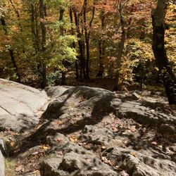
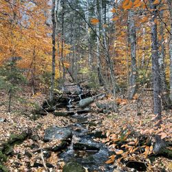


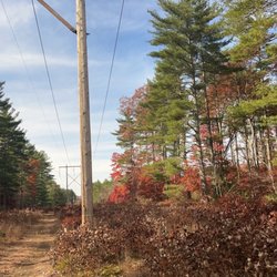


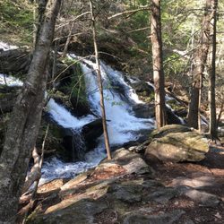




Mount Watatic - hiking - Updated August 2026
Best of Ashburnham
People found Mount Watatic by searching for…
Things to Do in Ashburnham, MA
Hiking Trails in Ashburnham, MA
Picnic Areas in Ashburnham, MA
Walking Trails in Ashburnham, MA
Off Road Trails in Ashburnham, MA
Dog Friendly Trails in Ashburnham, MA
Lakes & Ponds in Ashburnham, MA
Hikes With Dogs in Ashburnham, MA
Beautiful Views in Ashburnham, MA
Hiking With Kids in Ashburnham, MA
Lookout Points in Ashburnham, MA
Scenic Views in Ashburnham, MA
Waterfall Hike in Ashburnham, MA
Running Trails in Ashburnham, MA
Hiking Boots in Ashburnham, MA
Lakes for Swimming in Ashburnham, MA


