Cancel

    Open app

    Search

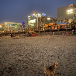
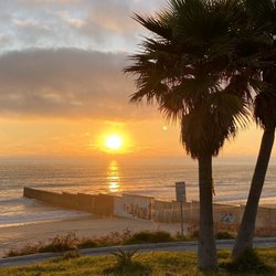
    Parque Scouts Playas de Tijuana

    5.0 (1 review)

    Parque Scouts Playas de Tijuana Photos

    Parque Scouts Playas de Tijuana Reviews in Other Languages

    Verify this business for free

    Get access to customer & competitor insights.

    Verify this business

    Cedar Creek Falls - Cedar Creek Falls

    Cedar Creek Falls

    4.4(358 reviews)
    66.5 km

    If you are a San Diego hiker and haven't done this hike- WHAT ARE YOU WAITING FOR???…read more And for those of you who see these photos and think damn I need to go do that, please be aware of the temperature because it is dangerously hot down there at lower temperatures than in other areas. The hike goes down into a canyon and the heat settles down there. Even if it's not as hot as you think coming up can be extremely dangerous. Every year I hear about somebody dying from heat stroke on that hike so don't take it lightly. I always check the weather on the actual trail using the AllTrails app. I saw that the weather out there was max 65° that day and I was like hell yeah. The hike really isn't that difficult, 3 miles down and then 3 miles back up. Lots of nice switchbacks, and there are a few sun shelters for shade. The views are gorgeous all along the trail. I've done this hike, probably 20 times over the years. It's the best in the spring and in the fall. In the winter it's way too cold. The reward for this hike is the gorgeous rock bowl and waterfall that the locals call Devils Punchbowl. This past Thursday when we did this hike, there were a lot of young folks at the Punchbowl when we got there. Some of the guys were climbing up and jumping into the water. I would not recommend it, even if the waterfall is still flowing that water is not safe to swim in. In the fall, the waterfall doesn't flow anymore after being dried out over the brutal summer, but the trees at the bottom of the canyon turn a beautiful gold color. One of the few places in San Diego you can actually experience fall.

    Great trail! Well-marked path down to and back up from the falls. Gorgeous water feature!read more

    Photos
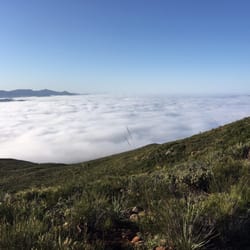
    Cedar Creek Falls - Cloud porn in the beginning of our hike!

    Cloud porn in the beginning of our hike!

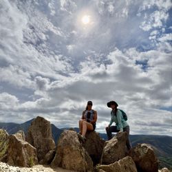
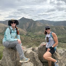
    Cedar Creek Falls - Awesome day with one of my best girlfriends

    Awesome day with one of my best girlfriends

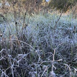
    Cedar Creek Falls - Morning frost

    See all

    Morning frost

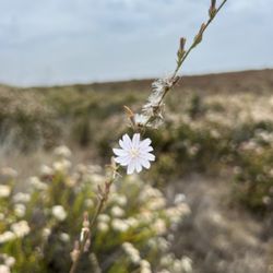
    Secret Canyon Trail - Wildflowers in January!

    Secret Canyon Trail

    4.5(6 reviews)
    48.3 km

    Alltrails lists this as 'Horse thief Canyon', then I saw that I had this listing bookmarked on Yelp…read morefor sometime and noticed that they were the same thing! Distance: ~3.3mi., reverse out-and-back (you will be going uphill on the return trip) Difficulty: easy-intermediate-ish (~0.5mi ascent on your way out which can get the heart pumping!) Time: 1.5-2 hours Permit required?: No (according to permit site - https://www.fs.usda.gov/detailfull/r5/passes-permits/?cid=stelprdb5208699&width=full) Sights of Interest: Mini waterfall and pool Parking is in a big dirt lot just off of Japatul Lyons Valley Rd.. Turn in at Forest Rt 16S04. No bathrooms, so bring some T.P.! There are three gates as you approach - two smaller ones and a large one leading to a service road. Take the gate with a sign marking the 'Epinosa Trail to Secret Canyon Trail'. You'll end up on the service road either way. Continue on the service road until you see a sign off to the right that says 'Trail'. This is where you'll begin the descent into Horse thief Canyon. Eventually it evens out into a nice shady area alongside a stream. Lots of vegetation and growth everywhere, so make sure to *bring the bug spray*! There's a stream crossing after which you'll come upon the pool! Lots of great places to hang out on and relax on boulders. Water is pretty clean for swimming too. Awesome place to bring your dogs to cool off after the dusty trail. Just remember to pack your trash out if you plan on picnic-ing down at the pool! Most of your journey is on the Epinosa Trail and supposedly the Secret Canyon Trail is just beyond the pool, but the trail doesn't seem to continue anywhere beyond it. Great trail either way that experiences very little foot traffic so the area is very well preserved and wild! FYI, apparently this area experiences an influx of illegal immigrants and smugglers, but I think that was in earlier years. It was pretty safe when I went and I only had my dog in tow. But, I like to live life on the edge, so if you are wary come with a group!

    If you go during the week during normal business hours this trail is dead! It was our 2nd time here…read moreand there was only 1 car in the parking lot and we never even ran into the people. This is nice but also kind of scary especially since it's kind of in the middle of nowhere and you don't have great service but luckily I am alive today to write this review. The first time we went on this hike we missed the path and ended up just heading straight through on a dirt road so pay attention on your right hand side for a sign marked trail. This trail would have gotten more stars if it wasn't for the ridiculous amount of flies. I almost turned back because I couldn't stand them constantly flying in my face and in my ears. Maybe I am not an outdoorsy person if I cant handle that but it was hard to enjoy this hike when I was having to smack flies away the whole time. This is also one of those hikes that is fairly easy on the way down but tough on the way back because you have to go back up. I will say though that it was a really pretty hike and there is a creek at the bottom. We didn't go the whole way but did about a little over 3 miles of it. It's about a mile and a half to see the beginning of the creek. Maybe wearing bug spray might help with the flies?

    Photos
    Secret Canyon Trail - Trail is pretty well marked

    Trail is pretty well marked

    Secret Canyon Trail - Awesome sign.

    Awesome sign.

    Secret Canyon Trail

    See all

    Cottonwood Creek - Swimming in the river, before it got very crowded

    Cottonwood Creek

    4.7(7 reviews)
    67.3 km

    It's a great river swim with the family…read more However be very careful.. I feel in a whole in Sept 5th,2022 and twisted both ankles. Which I'm still suffering pain from Two month in my injury. My family had lots of fun( I didn't since I was in pain but since it was 2hr drive I suck it up for them). My toddler love it.. we went when LA hit over 100* heat... it very nice in the water!! Many ppl with floating I do suggest to make sure everyone know how to swim as its now drag ppl down the stream..

    I could see this being a 3 or 4 star hike depending on the season and weather conditions you do the…read morehike in. I hiked it on 2/24/19 and found the conditions to be ideal for my enjoyment! Location- it was only about a 30 minute drive for me since I spent the night after attending a party at a family member's house in El Cajon (suburb of San Diego); I jumped on the 8 East and as the elevation reached 3,000 ft I could begin seeing snow on the hills near the fwy and I got even more excited for this hike- took Exit 47 for Sunrise Hwy and the trailhead parking was about 2 miles away from the fwy and there was a large lot on the side of the hwy to park Trail- you access the trail by walking across the road and going to the right of the metal barrier...the snow was the deepest on this portion of the hike for about half a mile and the first part of the hike is where the trail is the narrowest with portions where you have to bend over and get low to continue past low branches; at about 3/4 of a mile you will get down to creek level and make a left to get to the waterfalls...I carefully climbed up to reach about 4 parts of the waterfall and it was flowing really well with all of the recent precipitation of this winter and it was a pleasant surprise to find this so close to the city of San Diego; it is about 2 miles RT and not anything too extreme in the way of incline and I loved having the trail/falls all to myself for the nearly 2 hrs I was there *I used microspikes just to be safe but I could see it being fine with just hiking shoes

    Photos
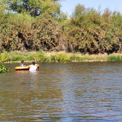
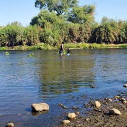
    Cottonwood Creek - Watching from the bank since I was injured I would walk my ankles were beyond swallowed...

    Watching from the bank since I was injured I would walk my ankles were beyond swallowed...

    Cottonwood Creek - Seeing the lake before getting to the river

    Seeing the lake before getting to the river

    Cottonwood Creek - Cows on our way to the river.. leaving LA behind us

    See all

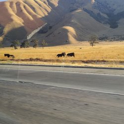
    Cows on our way to the river.. leaving LA behind us

    Goat Canyon Trestle - Hiking frens

    Goat Canyon Trestle

    4.6(34 reviews)
    87.7 km

    Goat Canyon Trestle is near Jacumba California. It is the world's largest all-wooden train trestle…read more It is probably one of the most adrenaline pumping difficult hikes I have ever had the pleasure of experiencing! IMPORTANT: there are two trails to the trestle. The shorter route, Mortero Palms, is a 6 mile hike that includes strenuous rock climbing, steep descents and route finding. Do not take this shorter route as it brings you to a cliff that requires rope rappelling. The longer route about 16 miles is the easier of the two, with abandoned train cars and tunnels. However it is on private property that is trespassing. In summer temperatures can exceed 100 degrees with little to no shade. I recommend bringing 3-4 gallons of water and electrolyte replacement. You also need to be aware of hidden rattlesnakes in the rocks and brush. It is suggested to have an offline gps for navigation. The shorter route requires a high profile vehicle to the trailhead and the longer route you can pay to park at the nearby nudist camp (no joke lol). The nudists charge a nominal fee to park there. It is important to research this trail and be prepared.

    IF YOU ARE NOT PREPARED I DO NOT RECOMMEND HIKING THIS 16 MILE TRAIL. Goat Canyon Trestle is very…read moredeep in the Anza Borrego desert and far from any outside help with a strenuous walk (or bike) trail being bordered by either cliffs, cholla cacti, broken wood and caved in tunnels. No shade on top of a possible TRESPASSING FINE either from parking incorrectly or getting caught walking on the rails, I do not recommend it. This is not an easy hike, but oh man it was BEAUTIFUL AND AN AMAZING EXPERIENCE. Mountain bikes can go through fairly quickly, just don't fall off the cliffs (Especially around tunnel 8). Goat Canyon Trestle is the WORLD'S LARGEST wooden trestle (basically a bridge but held up by toothpicks) and its hike in Carrizo Gorge makes it a seldom visited spot. You'll see abandoned train cars, rattlesnake nests, cholla cactus along the way, and it's a wonderful trip for the brave and adventurous. Apart from 2 bypasses, getting to Goat Canyon is pretty flat. Parking is possible before the sign, or you can enter the gated Jacumba nudist colony office for $5 (they open at 9) You'll want the following to travel to Goat Canyon: -3L of water -Alltrails offline map (you can seriously get lost before the first tunnel) -Sunscreen (apart from the tunnels and cars there's literally no shade the whole way) - pliers to remove the cholla cactus sticking in you -Start early in the day and in the spring/fall as temps aren't too bad -Steel balls and no fear of heights -walk 6/8 hours on fairly flat terrain There are some mini trestles along the way that look like the wood is severely decayed. Tunnels 5 and 8 are blocked, so follow the well worn trail with a lot of man made debris. The hikingguy.com dude probably has the best picture step by step on how to navigate the tunnel bypasses. Overall, the payoff is great. It's more of an endurance test with how long the trail runs.

    Photos
    Goat Canyon Trestle - Go in!!!

    Go in!!!

    Goat Canyon Trestle - We're still not sure why some of the trains were abandoned out on the tracks?Seems like they could have been brought to one end when closed?

    We're still not sure why some of the trains were abandoned out on the tracks?Seems like they could have been brought to one end when closed?

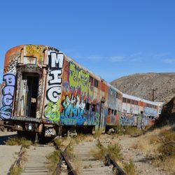
    Goat Canyon Trestle - Abandoned rail cars.

    See all

    Abandoned rail cars.

    Viejas Mountain - The stone wind shelter at the summit; find the guestbook here!

    Viejas Mountain

    4.6(14 reviews)
    51.2 km

    Native San Diegan, but never been here. From the start this trail is all incline, rocky, dirt, some…read morenative plants/shrubs and yucca but no shade. I saw no animals or even bugs... came December 2020. It's about 1.5 miles uphill with descent elevation and 2.5 down. I had to take a couple breaks due to the elevation I think...as I live near sea level and I'm fairly in shape, but more of a Hiit workout, sprints, weightlifting type, so endurance isn't my strong suite... but the top is worth the struggle. On a clear day you can see the ocean and such a beautiful sunset. Note the top is very windy and cold. I'd say it's great for moderate hiker, and I wouldn't bring a pet but I've seen dogs up there. Pros: - nature!! -free workout -some parking but limited - steep but not crazy difficult - more of a locals only location Cons: - rough dirt/rocky rode to get there -limited parking - no bathroom, trash or water stations

    Spectacular views at the summit especially when facing North. Easy to access from Tavern Rd exit on…read morethe I-8. It's about 3 miles RT on red-clay dirt and very loose rocks. Although Alltrails lists it as intermediate, I was breathless climbing this thing. I would describe it as intermediate-difficult. I mean, the doughnut holes in the morning probably didn't help and it was after Christmas Day indulgences, but the terrain was still very rocky and the incline was CONSTANT, making the ascent a little more difficult than normal. It was the ultimate thigh burner! A great workout! I took about 2 hours to finish, but did spend a lot of time at the top. Had the summit all to myself! Breath-taking! Parking is on a truck trail and the trail head is only marked by a simple metal gate. According to Afoot and Afield a **Wilderness Pass is technically required**, however I got away without one (didn't realize I needed one). Again, the terrain is quite rocky on the clay dirt ascent, so do not bring your kids! They'll likely fall flat on their faces trying to navigate over the rocks. As a note-- the truck road is a dirt one, but well graded with some humps every so often to prevent speeding. Parking near the trailhead is still quite secluded and a draw for thieves, so make sure to hide your belongings before you head out!

    Photos
    Viejas Mountain - The view from the peak!

    The view from the peak!

    Viejas Mountain
    Viejas Mountain - Yay!

    See all

    Yay!

    Kumeyaay Trail

    Kumeyaay Trail

    4.0(1 review)
    73.6 km

    The Kumeyaay Trail is a trail that hugs Lake Wohlford's North shore…read more Parking is free at the Lake Wohlford Ranger Station so just park and walk East to find the trail entrance. Note that the trail isn't marked very well, and you'll have to use trail intuition to find your way in the overgrown areas. The trail is mostly dirt, small boulders, and large flat smooth rocks. Expect mud and sand in some areas next to the lake. Not the best hike if you have bad knees. The actual hike was fun ( early spring after many large rainstorms). You'll walk by several Oak Trees and many wildflowers blooming. This is a birders paradise as many waterfowl make their homes here. It's about 4.5 miles there and back unless you are foolish and decided to walk around the ENTIRE LAKE.. That will make your hike 5.5 total. Note there is NO TRAIL to connect Kumeyaay to the South trails on the other side of the lake. Foolishness - So, once you walk to the end of the Kumeyaay Trail ( there is a private property gate) you might get the harebrained idea to cut through the swamp to get to the south side of the lake.. Okay, we did it ( with three kids).. There are a few things to know before deciding to cut across the mash to the other side.. Much of your hike will be through a large stinging nettle forest. If you're wearing shorts forget about going to the other side of the lake. If you have long pants / jeans you should be okay. Next you'll have to go through various reeds and muck. Then you'll have to cross a small stream about ten feet wide, a few feet deep.. You're going to get your shoes wet unless you're one hell of a long jumper. Finally, you'll have to ascend up a vertical cliff to get up to a road..One you're on the South Side of Lake Wohlford you still have a long way to hike to get back to your car. There is no shortcut and you'll have to walk along the busy Lake Wholford Rd for over a mile. Worth it?? Yeah it was pretty adventurous. - Tips I wouldn't kike this trail in the summer. There are soooo many places for rattlesnakes to hide.

    Photos
    Kumeyaay Trail - River to cross if you want to get to the other side of lake.

    River to cross if you want to get to the other side of lake.

    Kumeyaay Trail
    Kumeyaay Trail

    See all

    Parque Scouts Playas de Tijuana - hiking - Updated July 2026

    Loading...
    Loading...
    Loading...