Petroglyph National Monument
Petroglyph National Monument Photos



You might also consider

More like Petroglyph National Monument
Recommended Reviews - Petroglyph National Monument
Start your review...


Reviews With Photos


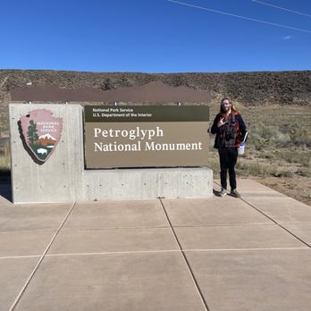
This spot is the visitor information center, featuring a short introductory video and a small gift shop. Here, you can get maps, park details, and directions to the three main petroglyph viewing areas: Boca Negra, Rinconada, and Piedras Marcadas Canyons. The friendly staff member gave us a map, and we decided to drive a few miles to Boca Negra Canyon, which is the closest site to the visitor center. The Boca Negra trail was short, easy, and took us less than an hour to complete. It was a great introduction to the petroglyphs and a nice way to start exploring the natural and cultural history of New Mexico.


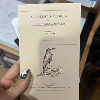
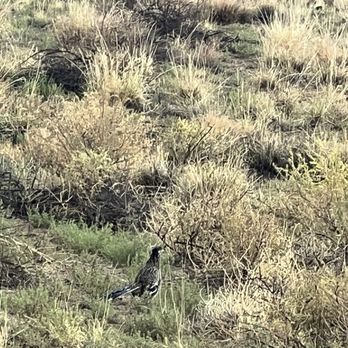
Do not come here expecting to hike trails or see petroglyphs!! If you get dropped off by ride share here you will have to order another unless you want to add a 2 mile walk to the start of the nearest trail at Boca Negra Canyon. This only has the visitor center / gift shop (may or may not be open during current gov shutdown!) and an informational movie. They do have free maps and information regarding hikes nearby that do contain petroglyphs. The shop was open when I went and the workers were very kind. I spotted my first roadrunner here.


It was amazing! The petroglyphs kind of looked like things in the modern world! The five minute trail took only two minutes though, and the fifteen minute one took like seven minutes. But other than that it was great!
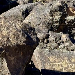

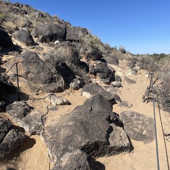
We had an enjoyable afternoon experiencing two of the three canyon trails. It was helpful to stop at the Visitor Center first to receive a map, including the address for one of the parking lots, and use the restrooms. It is odd that the start of the Piedras Marcadas trail is basically a parking lot behind a gas station. Boca Negra is the shortest trail, but it also went up, up, up a rock formation. It was a clear trail, but you will do some mild bouldering. There were nice views towards Albuquerque at the top. Piedras Marcadas was a wide open dirt walking trail with several loops. Really neither would be great if you have physical limitations, since these aren't paved trails. You see a good number of petroglyphs on both trails, but are closer to them at Boca Negra. We skipped Rinconada Canyon since it is the longest trail and we ran out of time. You can bring pets, but they must remain on leash. Make sure to bring your own water and use the restrooms at the Visitor Center since there aren't facilities at the trail heads. We saw petroglyphs in some other parks and historic sites in New Mexico, but these were the largest collection and in the best condition.
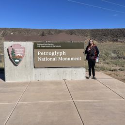

Petroglyphs NM was a blast! I went in October for the solar eclipse, and really loved this area. It's a bit different than other parks in that the visitor center is removed from the actual drawings. So get some maps, info, and head back in your car for more! There are three locations to view the petroglyphs. I loved the winding sandy trails, but they can be very hot and barren. The drawings are easy to see along the paths, and some have unique designs! This is an excellent and free area to explore, close to ABQ, and definitely worth a stop!


What an experience! An easy walk and over 400 petroglyphs! Bring water and sunscreen. Be sure to scan and follow the audio...it's a wealth of information.


Rule of Draw Petroglyphs National Monument is an interesting park, as it's not all centrally located in one area but broken up into five disparate areas (including the Visitors Center) scattered around Albuquerque and the striving area. 1) Visitors Center is a must-stop to get some swag, your NPS Passport Stamp, and some good info from the friendly Rangers. 2) Piedras Mercadas Canyon is the most bang for your buck as far as Petroglyphs go, as you'll get over 400 in a 1.8-mile round-trip trail Please see the separate Yelp page for a more detailed review. 3) Boca Negra Canyon has fewer Petroglyphs (±100) but is a lot of fun for those who like to climb and live spectacular views. Please see the separate Yelp page for a more detailed review. 4) Rinconada Canyon has 300 petroglyphs on a short 2.2-mile hike. I didn't visit, so I can't really comment, but see the separate Yelp page for more information. 5) Volcanoes Day Use Area has zero petroglyphs, but some nice views and bikes friendly trail which loops around several volcanoes. I didn't visit, so I can't really comment, but see the separate Yelp page for more information. TLDR: Fantastic park with five totally unique experiences that take longer to drive to-and-from them than to actually take them all in.


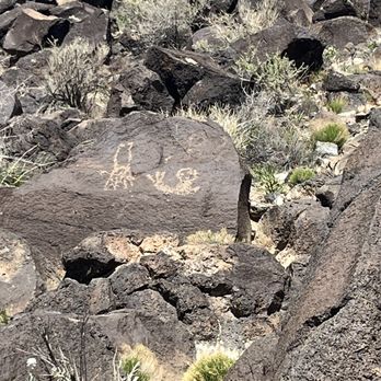
We loved Petroglyph National Monument. We were leaving Albuquerque on Easter when not much was open, so we came here just to kill time, but we ended up really enjoying it. We stopped at the visitor center first and talked to a person there about what the best hike would be for us. She recommend one at the far Northeast (about a 6 mile drive away). After checking out the gift shop (really nice assortment of stuff at decent prices) and picking up some sunscreen there, we headed over. It was a beautiful sunny day in the 70s, so it wasn't hot at all, and the walk of mostly flat and not difficult at all, and maybe... 3 miles? But when they say "bring water" they mean it. We didn't bring water and I was dying of thirst by the time we got back. Remember that the very dry climate and the higher elevation make a difference. Bring water! So we took the trail and it was well marked. As you walk, you will see petroglyphs scattered throughout, but the trail has little markers at places where, if you stop and look right there, you will see a lot of petroglyphs. So it's very easy to find them. We really loved seeing the pictures of art, and also wondering what the significance was (because no one knows). Definitely worth the time!


I was amazed at the changes and improvements in 30 years. I my family came here in the 80's on a family vacation. The walking trials are labeled and have hand rails as well as steps in many places. I was disappointed to see how the rocks were splitting and some of the petroglyphs were disappearing. In a few generations they will probably be gone for good. Great park and easy trails but not ADA so wear proper shoes and be ready for a little hike up to see some of them.
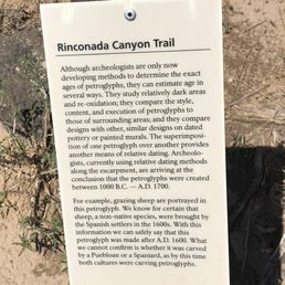

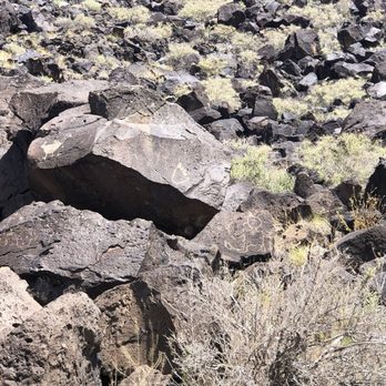
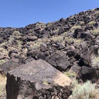
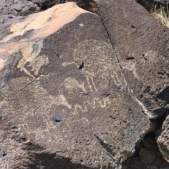
The hike starts at a different parking lot than the visitor center ( had to get back in the car and drive down the road). This is an easy hike but there is no shade along the way. Seeing the petroglyphs was very cool. We did not see 300 or so that was mentioned, so it would have been nice to have a bit more signage or a reference map for where to look. Got some great pics of the ones we could find though.


With over 700 petroglyphs on one mellow hike, I can't even say enough. Literally pictures can't even do it justice. We stopped at the visitor center first to learn about the different trails and check out the shops swag. The rangers were very helpful at gauging what level of hike we should do and best routes. Once we picked our destination, they gave us a map that has marker numbers and explained how to drive there and where to park for free. Our hike was about 3 miles but included lava, valley views, lizards and squirrels, and the trippiest rock petroglyphs I'd ever seen. Who knew!?!? I can only imagine the views when there were no houses but just volcanoes and more volcanoes.


Petroglyph is a good place to take visitors to go see, especially if they are new to NM. The visitor center itself is nice..and they do play videos so you can just sit and watch. The actual center also smells wonderful like a spa...which is different from their public restrooms next to a parking space that are so full of flies. Yuck. You can't actually hike from the visitor center..but get to choose from 2 places (that are just 5 min drive away): 1) Boca Negra Canyon or ) Riconada Canyon. I personally had gone to both and enjoyed Riconada Canyon more. The Riconada Canyon trail is flat, dog friendly, has more Petroglyph to see and perhaps takes around 1.5 hrs walking in a loop (go in the morning/late evening to avoid the heat, especially during the summer please!). Boca Negra Canyon's trail isn't super long..doesn't seem to have as many petroglyphs to see..but the trail has inclines..so it's probably not suitable if someone in your group isn't comfortable with inclined hikes. Overall, quite ok places to visit. It costs just $1/car to go on a weekday and $2/car on weekends...such a good deal. The other negative thing may just be...sometimes the trail doesn't have clear directions...so you kindda have to guess where to go along the trails.


2 years ago


What a cool find. We stopped off at the visitor center, which did not actually have petroglyphs at it. We were instructed on which way to go to find the shortest trails as we were in a bit of a hurry. We did take a pretty rocky hike and got to see lots of cool petroglyph and a beautiful view. I recommend taking the visit. We didn't get a lot of great advice from the visitor center. We were instructed to find instructions online to the canyon we needed to go to. Easy to get to. Take water! read more


This spot is the visitor information center, featuring a short introductory video and a small gift shop. Here, you can get maps, park details, and directions to the three main petroglyph viewing areas: Boca Negra, Rinconada, and Piedras Marcadas Canyons. The friendly staff member gave us a map, and we decided to drive a few miles to Boca Negra Canyon, which is the closest site to the visitor center. The Boca Negra trail was short, easy, and took us less than an hour to complete. It was a great introduction to the petroglyphs and a nice way to start exploring the natural and cultural history of New Mexico. read more

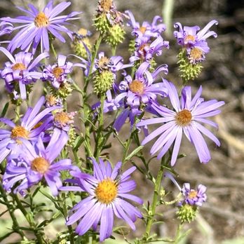

11 months ago
Do not come here expecting to hike trails or see petroglyphs!! If you get dropped off by ride share here you will have to order another unless you want to add a 2 mile walk to the start of the nearest trail at Boca Negra Canyon. This only has the visitor center / gift shop (may or may not be open during current gov shutdown!) and an informational movie. They do have free maps and information regarding hikes nearby that do contain petroglyphs. The shop was open when I went and the workers were very kind. I spotted my first roadrunner here. read more



4 months ago
It was amazing! The petroglyphs kind of looked like things in the modern world! The five minute trail took only two minutes though, and the fifteen minute one took like seven minutes. But other than that it was great! read more


We had an enjoyable afternoon experiencing two of the three canyon trails. It was helpful to stop at the Visitor Center first to receive a map, including the address for one of the parking lots, and use the restrooms. It is odd that the start of the Piedras Marcadas trail is basically a parking lot behind a gas station. Boca Negra is the shortest trail, but it also went up, up, up a rock formation. It was a clear trail, but you will do some mild bouldering. There were nice views towards Albuquerque at the top. Piedras Marcadas was a wide open dirt walking trail with several loops. Really neither would be great if you have physical limitations, since these aren't paved trails. You see a good number of petroglyphs on both trails, but are closer to them at Boca Negra. We skipped Rinconada Canyon since it is the longest trail and we ran out of time. You can bring pets, but they must remain on leash. Make sure to bring your own water and use the restrooms at the Visitor Center since there aren't facilities at the trail heads. We saw petroglyphs in some other parks and historic sites in New Mexico, but these were the largest collection and in the best condition. read more
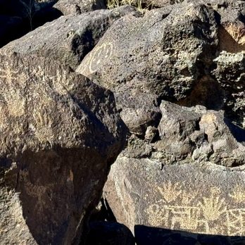


Petroglyphs NM was a blast! I went in October for the solar eclipse, and really loved this area. It's a bit different than other parks in that the visitor center is removed from the actual drawings. So get some maps, info, and head back in your car for more! There are three locations to view the petroglyphs. I loved the winding sandy trails, but they can be very hot and barren. The drawings are easy to see along the paths, and some have unique designs! This is an excellent and free area to explore, close to ABQ, and definitely worth a stop! read more




2 years ago


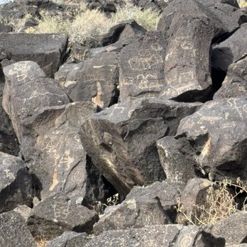


Rule of Draw Petroglyphs National Monument is an interesting park, as it's not all centrally located in one area but broken up into five disparate areas (including the Visitors Center) scattered around Albuquerque and the striving area. 1) Visitors Center is a must-stop to get some swag, your NPS Passport Stamp, and some good info from the friendly Rangers. 2) Piedras Mercadas Canyon is the most bang for your buck as far as Petroglyphs go, as you'll get over 400 in a 1.8-mile round-trip trail Please see the separate Yelp page for a more detailed review. 3) Boca Negra Canyon has fewer Petroglyphs (±100) but is a lot of fun for those who like to climb and live spectacular views. Please see the separate Yelp page for a more detailed review. 4) Rinconada Canyon has 300 petroglyphs on a short 2.2-mile hike. I didn't visit, so I can't really comment, but see the separate Yelp page for more information. 5) Volcanoes Day Use Area has zero petroglyphs, but some nice views and bikes friendly trail which loops around several volcanoes. I didn't visit, so I can't really comment, but see the separate Yelp page for more information. TLDR: Fantastic park with five totally unique experiences that take longer to drive to-and-from them than to actually take them all in. read more
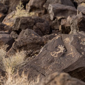
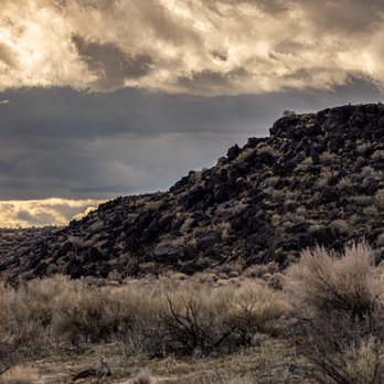
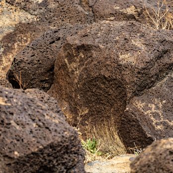


11 months ago

3 years ago
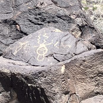
We loved Petroglyph National Monument. We were leaving Albuquerque on Easter when not much was open, so we came here just to kill time, but we ended up really enjoying it. We stopped at the visitor center first and talked to a person there about what the best hike would be for us. She recommend one at the far Northeast (about a 6 mile drive away). After checking out the gift shop (really nice assortment of stuff at decent prices) and picking up some sunscreen there, we headed over. It was a beautiful sunny day in the 70s, so it wasn't hot at all, and the walk of mostly flat and not difficult at all, and maybe... 3 miles? But when they say "bring water" they mean it. We didn't bring water and I was dying of thirst by the time we got back. Remember that the very dry climate and the higher elevation make a difference. Bring water! So we took the trail and it was well marked. As you walk, you will see petroglyphs scattered throughout, but the trail has little markers at places where, if you stop and look right there, you will see a lot of petroglyphs. So it's very easy to find them. We really loved seeing the pictures of art, and also wondering what the significance was (because no one knows). Definitely worth the time! read more



2 years ago
I was amazed at the changes and improvements in 30 years. I my family came here in the 80's on a family vacation. The walking trials are labeled and have hand rails as well as steps in many places. I was disappointed to see how the rocks were splitting and some of the petroglyphs were disappearing. In a few generations they will probably be gone for good. Great park and easy trails but not ADA so wear proper shoes and be ready for a little hike up to see some of them. read more


The hike starts at a different parking lot than the visitor center ( had to get back in the car and drive down the road). This is an easy hike but there is no shade along the way. Seeing the petroglyphs was very cool. We did not see 300 or so that was mentioned, so it would have been nice to have a bit more signage or a reference map for where to look. Got some great pics of the ones we could find though. read more







3 years ago
With over 700 petroglyphs on one mellow hike, I can't even say enough. Literally pictures can't even do it justice. We stopped at the visitor center first to learn about the different trails and check out the shops swag. The rangers were very helpful at gauging what level of hike we should do and best routes. Once we picked our destination, they gave us a map that has marker numbers and explained how to drive there and where to park for free. Our hike was about 3 miles but included lava, valley views, lizards and squirrels, and the trippiest rock petroglyphs I'd ever seen. Who knew!?!? I can only imagine the views when there were no houses but just volcanoes and more volcanoes. read more


2 years ago

1 year ago
I was here in 1998 and again today. It's still as enjoyable hiking and seeing the petroglyphs as it was then. Did less hiking this time because of the heat. read more


Petroglyph is a good place to take visitors to go see, especially if they are new to NM. The visitor center itself is nice..and they do play videos so you can just sit and watch. The actual center also smells wonderful like a spa...which is different from their public restrooms next to a parking space that are so full of flies. Yuck. You can't actually hike from the visitor center..but get to choose from 2 places (that are just 5 min drive away): 1) Boca Negra Canyon or ) Riconada Canyon. I personally had gone to both and enjoyed Riconada Canyon more. The Riconada Canyon trail is flat, dog friendly, has more Petroglyph to see and perhaps takes around 1.5 hrs walking in a loop (go in the morning/late evening to avoid the heat, especially during the summer please!). Boca Negra Canyon's trail isn't super long..doesn't seem to have as many petroglyphs to see..but the trail has inclines..so it's probably not suitable if someone in your group isn't comfortable with inclined hikes. Overall, quite ok places to visit. It costs just $1/car to go on a weekday and $2/car on weekends...such a good deal. The other negative thing may just be...sometimes the trail doesn't have clear directions...so you kindda have to guess where to go along the trails. read more


4 years ago
Offering three points of entry this park is exceptionally large and would cater to whatever you're looking for. Hiking paths in the open area allow you to see the dormant volcanoes. At an alternative entrance you can walk for 1 1/2 to 3 miles depending on which path you take and see the awesome petroglyphs in the canyon. My only comment is that the paths could've been marked just a little bit better, particularly if you take the one less traveled. Highly recommended opportunity to get out, stretch your legs and see some amazing archaeology. read more

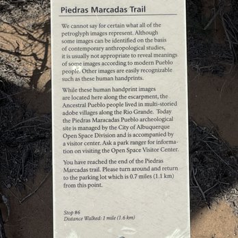
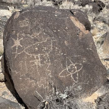


The parking and drop off area are close together. It's about 1/4 mile hike to the Piedras Marcadas canyon and 3/4 to Rinconada canyon. You either have to walk or bike to the trails. No shading at all either. Sounds fun, right on a warm and sunny day? Parking fee is $1 for weekdays and $2 for the weekend. read more

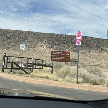



2 years ago
My husband wanted to come here and see this in person. Super cool to see all the drawings on the rocks. These carvings have been here over 1200 years. Super cool experience. read more




Only have 15-30min? Head to the Boca Negra Canyon. The trails are tricky for footing but very short and very close to the parking lot and restroom. You'll spot maybe 10 petroglyphs in a short period of time. This is the busiest location and doesn't allow for much distancing on the trail as the trails are narrow, tricky, and short. Want to stretch your legs but not do any climbing? Take 40-60min to walk the sandy trail at Piedras Marcadas Canyon which is entered through a suburb cement sidewalk but then opens up to sandy wild canyon area with large trails and tons of petroglyphs. read more
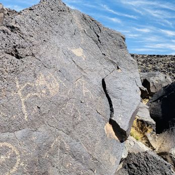


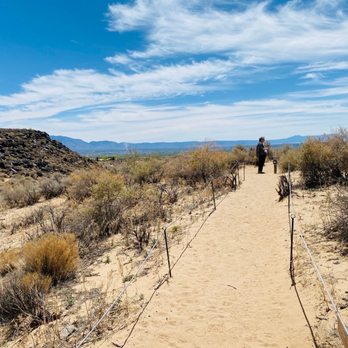


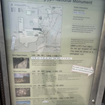
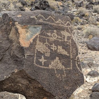
Petroglyph National Monument is a place to come to if you are interested in seeing petroglyphic drawings that are carved on rocks typically by a stone chisel and hammerstone. At this national park, there are over 24,000 carved images that were left by New Mexico's first settles. If you stop by the visitor center (which you can pick up a map), it is only open from 8:30 am- 4:30 pm (or 10 am- 4 pm during winter hours). There are no trails here though and you must drive to the other 3 locations for the trails, which are free except Boca Negra Canyon which requires $1 for parking free during the week day and $2 on Saturday and Sunday. This trail is NOT dog friendly but seems to be a fairly easy trail but is primarily all uphill and very rocky. The parking lot here closes at 4:30 pm and is strictly enforced so do plan your time accordingly. Rinconada Canyon is a trail that allows dogs on the trail but only on the non petroglyph section of the trail. This is the longest trail of the 3 locations, round trip is about 2.2 miles. The parking lot is closed at 5 pm. Peedras Marcadas Canyon is also a dog friendly trail. This is also the furthest away from the visitor center. The trail here is under developed and is about a 1.5 mile round trip. According to the map, there are about 300- 500 petroglyphs here. The Volcanoes Day Use area is dog friendly and is a place you can drive and see scenic overlooks of the valley. But please note that there are no petroglyphs here. My husband and I drove to the Boca Negra Canyon (after picking up a map at the visitor center) on a very windy Tuesday around 3:30 pm last month. We did end up bringing our little girl dog with us but placed her in our special K9 dog backpack so that she could be part of our hike (and not walk on the trail since dogs are allowed but technically there are no rules about her being in our backpack). I would not recommend coming here on a cold and windy day. The wind was incredibly strong and actually caused me to lose my balance and ended up with a few bruises on my knees (the wind also blew my glasses off my face which freaked me out for the quick moment since I can't really see that well without them or contacts). It was not crowded on the day we came (what crazy people would want to come on a really windy day?). If you do not want to go for an uphill hike, then you can walk over to the picnic area (there are also restrooms available here) where you can see and walk over to so more petroglyphs. read more

1 year ago

A great place to do some casual walking and spotting petroglyphs. The trail we did wasn't strenuous at all and is a great place to go if you're looking to get out of the house. Forewarning, there is little to no shade so be prepared with sunscreen and whatever else you think you'll need. It can get pretty hot and although it is a shorter trail, water is a must. I enjoyed scouring the rocks and finding all the petroglyphs. Some are pretty well hidden and you really have to look in order to find them. Overall, I enjoyed this trail and liked that it wasn't as crowded as some more popular ones. read more


Make sure you go to info location first before going to any of 3 location. This is run by the the us parks. We went to shorter one since our time was limited. Easy trails. Strenuous one isnt bad. Not as many petroglyphs as the claimed. read more




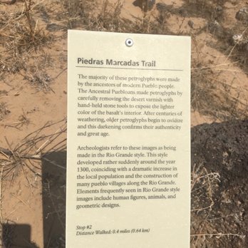
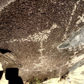
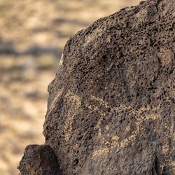
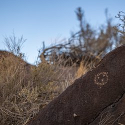
Piedras Mercadas Canyon is one of several viewing areas in the entire park. It has the densest concentration of 20,000 petroglyphs. You MAY see 400 from this one, 1.5 mile loop! Or you can see the coolest monster and spacecraft petroglyphs in my 20 photos! read more




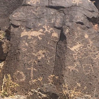

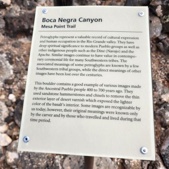
My friend and I were spending a few days in Albuquerque and decided to visit Petroglyph National Monument. Both of us had been to sites with petroglyphs that were difficult to locate or far from the trailhead, so we were extremely happy to discover that the National Monument has detailed information about all the trails open to the public and what a hiker might expect to encounter. There are three areas where the petroglyphs are most concentrated; we chose Boca Negra Canyon, as we had limited time and it was the shortest trail (less than 1 mile). We were delighted and surprised to find out that, despite its brevity, the trail passes by dozens and dozens of petroglyphs, right from the start! The glyphs have been well-preserved and not disturbed by visitors; virtually all of them were clearly seen. The trail itself is of moderate intensity; there were areas with railings, steps, and a boardwalk but many areas where the hiker must climb over rocks to ascend the hill (total elevation gain less than 120 feet). However, we were able to hike to the summit and back down in under an hour, and viewed so many petroglyphs along the way, that we considered it time well spent! A bonus at Boca Negra is the availability of restrooms, water fountains, shaded seating area, and picnic tables. The other two trails do not have these amenities, so plan accordingly. Many thanks to the National Parks Service for its highly informative trail information! We obtained the leaflet at the Information Center, and strongly recommend any visitor to the monument stop there first to chat with the rangers and pick up the trail leaflet. We thoroughly enjoyed our time at Petroglyph National Monument, and highly recommend it to any visitor to the Albuquerque area. No matter what your hiking ability is, you will be able to see and enjoy these images that are records of the ancient civilization in this region. read more


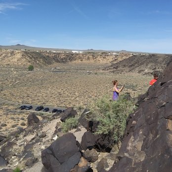
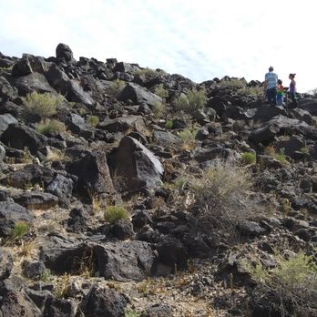


Really cool place to hike and walk and look at ancient scribbles on rocks. Came here for a quick visit and it was interesting place to hike and walk for a little bit. Unlike some of the other national parks and monuments, this place is located right next to a residential area which was very unusual. It's very small and consists of only a few small trials to hike and look at the art carvings. The walking paths are well maintained very clean and I like all the educational signs that explain what you should be looking for. Small place to kill a few hours, would not go out of my way to come here. read more


We checked out the far side with the 3 sisters volcanoes. It was a quick half mile walk to the first one from the parking lot, but note that you can't climb the volcanoes. You get some pretty good views of the mountains and the city though. read more

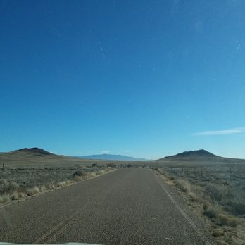


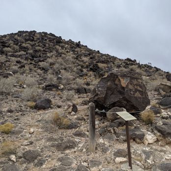
I went to Boca Negra Canyon for a quick sunrise hike. It was empty on a Sunday morning and I had the place to myself. I'm not sure if you normally have to pay to park there but no one was there to collect the fee and there weren't any envelopes to pay. You can drive right up to the trail head which is nice. The trail is quite short but steep and rocky. It is easy enough for an adult but it might be hard for a young child to scramble up the sharp rocks. There are petroglyphs all along the trail so keep an eye out! read more


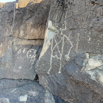

What a beautiful day to clear the mind and take in a relaxed one mile hike amidst volcanic rock *make sure to bring stable shoes and keep an eye out for typical desert critters & slithering things* featuring a display of historical petroglyphs (ancient rock carvings) in their original state. I constantly marvel at how amazing it is to live here in NM and have access to so much beauty. It's estimated there may be well over 25,000 petroglyph images over the 17 mile stretch of monument area and that appx 90% of the monument's petroglyphs were created by the ancestors of today's Pueblo people. Today we explored the Boca Negra Canyon Trail, looking forward to hiking the other two (Piedras Marcardas & Rinconada Canyon). $1 parking during the week, $2 parking on weekends. read more


3 miles is plenty and long enough to see the well preserved petroglyphs. Trail is well marked just follow the arrows on your right going and heading back. I recommend to go when it is cool. Almost 60 degrees in February and slight breeze was nice, keeping the sand cool for my dogs paws. It's a good workout with the distance, sand, length and time. At the top it opens up and there is a nice pine tree to take a break before heading back. read more


The Petroglyph National Monument is a short drive from Albuquerque, New Mexico's City Center and consists of three different entry points across a five mile distance. My husband and I visited during the government shutdown and were able to double park and squeeze through the fence to walk along the Rinconada Canyon Trail - which was allowed, but not recommended. But it was WELL worth it. Along the trail we were able to see some cool petroglyphs along the quarter mile and half mile markers. My favorite petroglyph was the deer, which can be found at the half mile marker. It seemed a little daunting at first to try to find the petroglyphs, but once we found some, my husband and I started treating it like a game. Who could find the most petroglyphs?! Obviously, I won! The coolest thing about the petroglyphs though is standing near a space that was meaningful (and may still be) to our nation's first citizens, so many centuries ago. read more


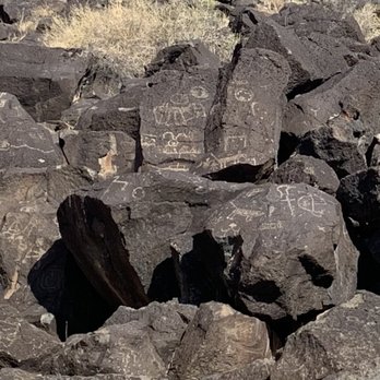


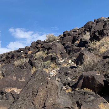

Page 1 of 5
More info about Petroglyph National Monument
6001 Unser Blvd NW
Albuquerque, NM 87120
Westside
Directions
(505) 899-0205
Call Now
Visit Website
http://www.nps.gov/petr/index.htm
Hours
Indoor Amenities
Outdoor Amenities
Ask the Community - Petroglyph National Monument
How much to enter the park? Parking fees?
It depends; some are free, and some are just a few dollars.
Review Highlights - Petroglyph National Monument






















Why does Yelp recommend reviews?
3 reviews that are not currently recommended
The reviews below are not factored into the business's overall star rating.

8 years ago
6 years ago
2 years ago
Petroglyph National Monument - landmarks - Updated September 2026
Best of Albuquerque
People found Petroglyph National Monument by searching for…
Attractions in Albuquerque, NM
Things to Do in Albuquerque, NM
Photo Spots in Albuquerque, NM
Sunset View in Albuquerque, NM
Scenic View in Albuquerque, NM
Places to Take Pictures in Albuquerque, NM
Scenic Drive in Albuquerque, NM
Fishing Spots in Albuquerque, NM
Hiking Trails With Waterfalls in Albuquerque, NM
Swimming Lakes in Albuquerque, NM
Sunrise Hike in Albuquerque, NM
National Parks in Albuquerque, NM
Places to Visit in Albuquerque, NM
Historical Sites in Albuquerque, NM
Canyoneering in Albuquerque, NM
Trending Searches in Albuquerque, NM
Apple Picking near Petroglyph National Monument
Archery near Petroglyph National Monument
Barbershop near Petroglyph National Monument
Blow Dry Bar near Petroglyph National Monument
Caves near Petroglyph National Monument
Cliff Jumping near Petroglyph National Monument
Consignment Shops near Petroglyph National Monument
Corn Maze near Petroglyph National Monument
Dog Friendly Things To Do near Petroglyph National Monument
Dog Swimming near Petroglyph National Monument
Eyebrow Threading near Petroglyph National Monument
Eyelash Extensions near Petroglyph National Monument
Formal Wear near Petroglyph National Monument
Hidden Gems near Petroglyph National Monument
Hiking near Petroglyph National Monument
Kids Birthday Party near Petroglyph National Monument
Landmarks & Historical Buildings near Petroglyph National Monument
Makeup Artists near Petroglyph National Monument
Mens Suits near Petroglyph National Monument
Off Road Trails near Petroglyph National Monument
Parks near Petroglyph National Monument
Photo Spots near Petroglyph National Monument
Picnic Areas near Petroglyph National Monument
Places To Take Pictures near Petroglyph National Monument
Places To Walk near Petroglyph National Monument
Private Schools near Petroglyph National Monument
Public Art near Petroglyph National Monument
Public Shower near Petroglyph National Monument
Rock Quarry near Petroglyph National Monument
Scenic Night View near Petroglyph National Monument
Scenic Overlook near Petroglyph National Monument
Secluded Spots near Petroglyph National Monument
Small Venues & Event Spaces near Petroglyph National Monument
Sunrise View near Petroglyph National Monument
Browse Nearby
BEST of Albuquerque, New Mexico Restaurants near Petroglyph National Monument
BEST of Albuquerque, New Mexico Coffee near Petroglyph National Monument
BEST of Albuquerque, New Mexico Things to Do near Petroglyph National Monument
BEST of Albuquerque, New Mexico Parks near Petroglyph National Monument
BEST of Albuquerque, New Mexico Museums near Petroglyph National Monument
BEST of Albuquerque, New Mexico Breakfast near Petroglyph National Monument
BEST of Albuquerque, New Mexico Hotels near Petroglyph National Monument
Browse Brands
Related Searches in Albuquerque, NM
Affordable Kayak Rental Services in Albuquerque, New Mexico
Best Dog Hiking Trails Around Albuquerque, New Mexico
Best Fishing Locations and Guides in Albuquerque, New Mexico
Best Fun Things to Do in Albuquerque, New Mexico
Best Places for Horseback Riding in Albuquerque, New Mexico
Best Sightseeing Experiences Available in Albuquerque, New Mexico
Book Engaging Historical Tours in Albuquerque, New Mexico
Check Out Off Road Trails in Albuquerque, New Mexico
Discover Charming Historic Homes in Albuquerque, New Mexico
Discover Dog Friendly Trails to Explore in Albuquerque, New Mexico
Discover Easy Hiking Trails Near Albuquerque, New Mexico
Discover Famous Monuments in Albuquerque, New Mexico
Discover Historic Sites and Places in Albuquerque, New Mexico
Discover Lakes & Ponds to Explore in Albuquerque, New Mexico
Discover Popular Bike Trails in Albuquerque, New Mexico
Discover Popular Landmarks in Albuquerque, New Mexico
Discover Popular Photo Spots in Albuquerque, New Mexico
Discover Top Points of Interest in Albuquerque, New Mexico
Discover Top Scenic Spots to Visit in Albuquerque, New Mexico
Discover a Hiking Trail in Albuquerque, New Mexico
Discover the Best Caves to Explore in Albuquerque, New Mexico
Discover the Best Night Hike Trails in Albuquerque, New Mexico
Dog-Friendly Hikes With Dogs in Albuquerque, New Mexico
Enjoy Camping Adventures Around Albuquerque, New Mexico
Enjoy Kayaking Adventures in Albuquerque, New Mexico
Enjoy Off Leash Dog Hikes in Albuquerque, New Mexico
Enjoy Scenic Places to Walk in Albuquerque, New Mexico
Enjoy Tent Camping Spots Around Albuquerque, New Mexico
Enjoy the Best Walking Trails in Albuquerque, New Mexico
Experience Stunning Sunset Views in Albuquerque, New Mexico
Explore Beautiful Botanical Gardens in Albuquerque, New Mexico
Explore Beautiful Castles and Landmarks in Albuquerque, New Mexico
Explore Beautiful Parks and Green Spaces in Albuquerque, New Mexico
Explore Children's Museums Near Albuquerque, New Mexico
Explore Easy Hikes Perfect for All in Albuquerque, New Mexico
Explore Free Things to Do Around Albuquerque, New Mexico
Explore Fun Activities to Do in Albuquerque, New Mexico
Explore Fun Field Trips in Albuquerque, New Mexico
Explore Popular Campgrounds Near Albuquerque, New Mexico
Explore Popular Scenic Overlook Points in Albuquerque, New Mexico
Explore Scenic Lakes to Visit in Albuquerque, New Mexico
Explore Secret Spots Worth Visiting in Albuquerque, New Mexico
Explore Top Dog Parks in Albuquerque, New Mexico Near You
Explore Venues & Event Spaces in Albuquerque, New Mexico
Explore the Top Car Museum in Albuquerque, New Mexico
Family Friendly Hiking With Kids in Albuquerque, New Mexico
Find Beautiful Views in Albuquerque, New Mexico
Find Cozy Camping Cabins in Albuquerque, New Mexico
Find Parks and Recreation Activities in Albuquerque, New Mexico


