Rainbow Point Photos


More like Rainbow Point
Recommended Reviews - Rainbow Point
Start your review...


Reviews With Photos


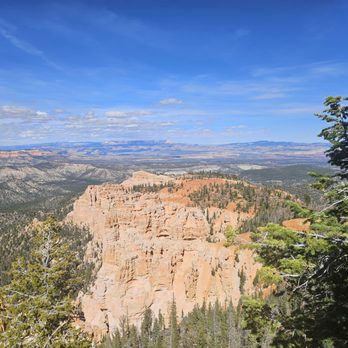
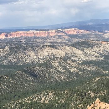
Rainbow Point, Milepost 18 At 9,115-ft elevation, Rainbow Point is the highest part of the park and is also the farthest located at the southern end of the 18-mile scenic drive on highway 63. It's actually encouraged to start your tour here first and work your way back to the park entrance as most visitors will take on the viewpoints towards the beginning first (like us) and we found them to be crowded. There are two viewpoints here -- Rainbow and Yovimpa, so make sure you visit both. They are not far from each other. There are interpretive signs explaining the geology of Bryce Canyon. They are an interesting read. Educate yourselves. We spent about an hour at these viewpoints but if you decide to do some hiking at Bristlecone Loop expect to spend more time, maybe an hour additional. The hike is 1.0 mile. Pay close attention to the details in the rocks as you view the scenery. The sequence of rock layers are called the Grand Staircase and they are named by the dominant color of the rocks. I forgot the many different names except for one -- Molly's Nipple, which is part of the White Cliffs. LoL There is a picnic area here and restrooms are also available at this viewpoint. Review #1814


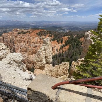
Last, but not least! Rainbow Point is at the very end of the drive at Bryce Canyon National Park. If I am not mistaken, there are 18 stops on the map and Rainbow Point is the very last one. The view there is amazing, but parking spots are hard to come by during the busy season. So plan to get there at the "right" time, whenever that may be, but do not miss it! It is one of the better view points in the Park.


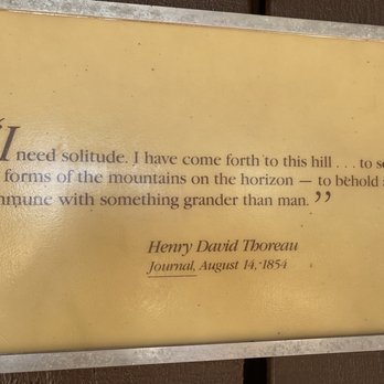
Make your way form to the end and do the one mile loop for breathtaking views. I love our national parks. One of the big 5 in S.Utah
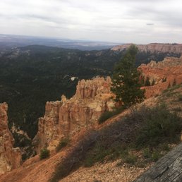

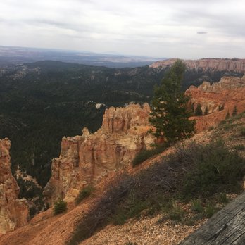
If you have time, the 17 mile drive to Rainbow Point is a nice but not a must thing to do. It is another gorgeous part of the park. On the other hand, it is not as spectacular if you viewed the Amphitheater first. There are hoodoos at Rainbow Point but not nearly as many as Bryce Canyon. For the most part, you will be driving through a forest on top of a ridge on route to Rainbow Point. However, there are multiple lookout points along the way. Here are the three I thought were worth stopping at: 1) Fairview Point It is a good spot to view the back of the canyon and south of it. 2) Natural Bridge It is a very pretty arch carved by nature. Of course, it is probably no big deal if you have visited Arches National Park. 3) Ponderosa It has good views of Agua Canyon and its hoodoos. If you are visiting and planning a trip to Bryce Canyon and looking for recommendations, feel free to message me for my itinerary. You can also find the electronic copy through the link my profile.


At the end of a 18 miles scenic drive, this is the highest point of Bryce Canyon National Park at over 9000 feet. The vista is breathtaking, just like the rest of the park. No shuttle service to this site, so must be self driven or peddling on bike. Sadly this is also the last viewing of Bryce Canyon for our party of four. No words can describe the beauty of this natural wonder. You have to see it for yourself.


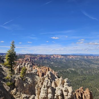
Rainbow Point is one of the highest viewpoints in the park, and it is absolutely stunning. It's at the southern end of the main park road, and you pass by multiple viewpoints and pullouts on the way there. I recommend driving first to Rainbow Point and if interested, hiking one of the hikes there (there are three: 1.0 mi Bristlecone Loop, 8.8 mi Riggs Spring Loop and 23 mi Under-the-Rim Trail), and then traveling back to the center of the park and looking at the views on the way down. It can get crowded at the parking lot, so try to beat the crowds by going early. If you time it to be early morning with sunrise, the colors pop out even more! You can easily see why it's called Rainbow Point. There are vault toilets and benches here, but no running water. Plan accordingly read more


1 year ago
Worth going to the end of the park road for the views: Family friendly place to take photos. There is also a shaded seating area set back from the railing where you can still get some views. read more


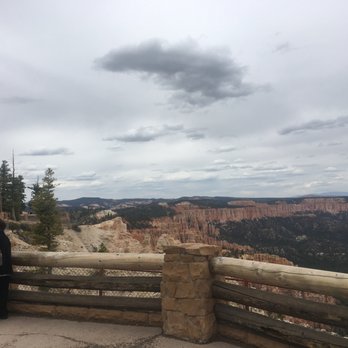
One of the most stunning vista points within Bryce Canyon National Park! 360-degree views of some of the most colorful hoodoos in the park! Yep... they don't call it Rainbow Point for nothin'! It's also the highest point within the park with an elevation of over 9,000 feet. You can only imagine how gorgeous the landscape it. The views are truly breathtaking here. It's a bit of a drive from the entrance and visitor center and the last big viewpoint that you'll reach along the scenic drive throughout the park. It's almost like saving the best for last really. However, it might make more sense to drive all the way to this viewpoint first and then make your way back down to the entrance. This will allow you to enjoy this vista without most of the crowds since most people will make this viewpoint their last stop. There are a few connecting trails that lead and pass through Rainbow Point as well, but you don't have to hike here to experience the views. It's a simple walk up a paved path with plenty of areas to admire the scenic panorama. The parking lot is fairly large and it wasn't too crowded on an early summer evening. The colorful hoodoos set amongst the vibrant blue skies and mountainous backdrop are totally worth the stop here. read more


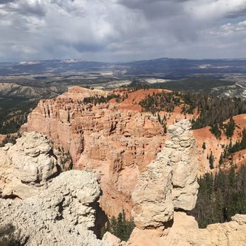

Rainbow Point, Milepost 18 At 9,115-ft elevation, Rainbow Point is the highest part of the park and is also the farthest located at the southern end of the 18-mile scenic drive on highway 63. It's actually encouraged to start your tour here first and work your way back to the park entrance as most visitors will take on the viewpoints towards the beginning first (like us) and we found them to be crowded. There are two viewpoints here -- Rainbow and Yovimpa, so make sure you visit both. They are not far from each other. There are interpretive signs explaining the geology of Bryce Canyon. They are an interesting read. Educate yourselves. We spent about an hour at these viewpoints but if you decide to do some hiking at Bristlecone Loop expect to spend more time, maybe an hour additional. The hike is 1.0 mile. Pay close attention to the details in the rocks as you view the scenery. The sequence of rock layers are called the Grand Staircase and they are named by the dominant color of the rocks. I forgot the many different names except for one -- Molly's Nipple, which is part of the White Cliffs. LoL There is a picnic area here and restrooms are also available at this viewpoint. Review #1814 read more



Last, but not least! Rainbow Point is at the very end of the drive at Bryce Canyon National Park. If I am not mistaken, there are 18 stops on the map and Rainbow Point is the very last one. The view there is amazing, but parking spots are hard to come by during the busy season. So plan to get there at the "right" time, whenever that may be, but do not miss it! It is one of the better view points in the Park. read more


6 years ago
Make your way form to the end and do the one mile loop for breathtaking views. I love our national parks. One of the big 5 in S.Utah read more





8 years ago
If you have time, the 17 mile drive to Rainbow Point is a nice but not a must thing to do. It is another gorgeous part of the park. On the other hand, it is not as spectacular if you viewed the Amphitheater first. There are hoodoos at Rainbow Point but not nearly as many as Bryce Canyon. For the most part, you will be driving through a forest on top of a ridge on route to Rainbow Point. However, there are multiple lookout points along the way. Here are the three I thought were worth stopping at: 1) Fairview Point It is a good spot to view the back of the canyon and south of it. 2) Natural Bridge It is a very pretty arch carved by nature. Of course, it is probably no big deal if you have visited Arches National Park. 3) Ponderosa It has good views of Agua Canyon and its hoodoos. If you are visiting and planning a trip to Bryce Canyon and looking for recommendations, feel free to message me for my itinerary. You can also find the electronic copy through the link my profile. read more



7 years ago
At the end of a 18 miles scenic drive, this is the highest point of Bryce Canyon National Park at over 9000 feet. The vista is breathtaking, just like the rest of the park. No shuttle service to this site, so must be self driven or peddling on bike. Sadly this is also the last viewing of Bryce Canyon for our party of four. No words can describe the beauty of this natural wonder. You have to see it for yourself. read more


Rainbow Point is the furthest south you can drive in Bryce Canyon. When we were there the trails and picnic area were closed, so all you could do was use the restrooms and go out to the view point. It was worth it, the view is wonderful. read more


8 years ago

9 years ago


5 years ago


