Cancel

Open app

Search

Reddish Knob

4.7 (3 reviews)

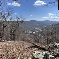
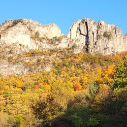
Reddish Knob Photos

Recommended Reviews - Reddish Knob

Your trust is our priority, so businesses can't pay to alter or remove their reviews. Learn more about reviews.
Yelp app icon
Browse more easily on the app
Review Feed Illustration

3 years ago

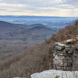
One of the best views in Virginia and one of the easier places to get too. Would definitely go again

Helpful 0
Thanks 0
Love this 0
Oh no 0

3 years ago

Amazing view for sunrise or sunset to enjoy. With breathtaking view recommend to visit.

Helpful 0
Thanks 0
Love this 0
Oh no 0
Photo of Heather H.
17
43
809

7 years ago

Helpful 2
Thanks 0
Love this 0
Oh no 0

Verify this business for free

Get access to customer & competitor insights.

Verify this business

Woodstock Tower

Woodstock Tower

4.9(15 reviews)
51.4 mi

Great place with great views!…read more Pop "Woodstock Tower" into Google Maps, and it will take you to the right spot (Apple Maps only took me to the trailhead a distance away). This will put you near a little overlook off the dirt road or if you keep going, a small gravel parking lot. Be prepared to drive on dirt and gravel roads for over a mile to get here; you are going the right way! This end of the trail has a clearly marked sign saying it is the Woodstock Tower. From either of those parking lots it's only about ¼ mile walk to get to the tower. The path varies from rocky to flat dirt. Loads of hickory nuts line the path. You could also come from the other end of the trail, which is over a mile away in the other direction. The climb up is steep but manageable (I'd recommend being more careful descending!) with metal steps. Considering she's still standing 90 years after her construction, I'd say the tower is stable. Hats off to the Civilian Conservation Corps for building this lasting landmark! The views from the top are great and worth the short walk and short climb. I met a local man at the top who shoots a lot of videos from up there. He did warn that sometimes there are black bears in the area; I never saw one my whole time, but just keep alert. It was a little cold on the mid-October day we were there and the top of the mountain did mean lots of cross wind, so dress appropriately. Unless you're weird about heights (apologies to my wife; thanks for walking out to it with us, Baby), this is a worthwhile visit. Definitely recommend!

What a pleasant surprise! We drove up the mountain on Christmas Eve and simply enjoyed the views…read more Our goal of finding the tower wasn't easy being that my bf hadn't been up there since he was a kid. Nevertheless we found it :-) I was a bit apprehensive of climbing it at first but took baby steps lol. What a beautiful scenery once you reach the top. Great experience!

Photos
Woodstock Tower - It's quite a way down - don't fall!

It's quite a way down - don't fall!

Woodstock Tower - My wife's scared of heights, so she waited at the bottom for us.

My wife's scared of heights, so she waited at the bottom for us.

Woodstock Tower

See all

Spruce Knob

Spruce Knob

4.8(12 reviews)
22.7 mi

I stopped by recently for a little adventure :)…read more I've been here more times than I can count and at all times of the day and the night, but I never get tired of this place. The peace and tranquility here is off the charts. It was a beautiful day, the temperature was about 68, and the sky was perfect. Every time I leave here I go a different way out to try and get lost, but after about two hours of exploring and finding some cool new roads and places, I made it back onto US-33 off of Glady Fork Rd by The Lodge in Alpena. What a great place to relax and unwind and learn news roads in and out. I have always loved this whole area and I always will. I'll be seeing you again very soon Spruce Knob :D

Road was super curving and some was gravel . We stopped at a overlook and even though the light…read morewas going away it was a great view. I def wish we had more time and better light to appreciate it. We saw so many deer which i loved seeing. in the end light was going too fast we made it to the lake but didn't make it to the top because sun was going down. driving those roads in low light was a bit scary. I know my husband really had wanted to be heading home much earlier and not be driving those roads in the dark. But once he realized I was wanting more exploring he went with it. I really would like to return. I wish we had spent more time in WV and skipped skyline drive. I have fell in love with WV. He kept wanting to move on to SKyline drive and down to Gatlinburg. I was wanting all WV.

Photos
Spruce Knob
Spruce Knob
Spruce Knob

See all

Crabtree Falls - Just absolutely beautiful

Crabtree Falls

4.7(71 reviews)
42.9 mi

This is a moderate level hike, 3.6 miles UP and Back. Elevation 1,135 ft. Some very steep inclines…read more So steep the path is switch back trails. Absolute great hike but challenging. Kid friendly, dogs on leash, and some paved walk ways BUT I don't think it would be for wheelchairs or strollers because it's such a steep incline. VIEWS-Waterfalls, forest, mountain, mushrooms, wildflowers, and berries. Such a busy trail that you really don't see to much wildlife or birds. Lots and Lots of stairs. This trail has been kept in great condition. There is a bit of scrambling and if there has been rain or snow it can be a bit slippery. Rocks and moss. So beautiful. This trail is part of George Washington and Jefferson National Forest. Absolutely beautiful at the top for me. It has an area that opens up at he top and benches so you can sit and admire the surrounding mountains. The first waterfall you come to is the easiest paved area to get to . Also the best waterfall view. It also has benches. This is from the parking lot and there is a fee. It is was 3 dollars so bring cash. There is no running water so bring your own water, Pack a smart backpack. Keep all areas clean and don't leave garbage behind. They have a bathroom area but with no running water. It is a dry toilet. Bring some hand sanitizer is my best advice.

This is a really good hike worth the incline on the way up to see the views! Definitely high…read moreincline on the way up, but there's benches and rocks along the way to take a break. The falls are really pretty, but be careful not to get too close. There's lots of signs to stay on the path which I recommend! It can get muddy after rain so wear good hiking boots for sure. It's dog friendly, I went when it wasn't too crowded and with the narrow pathways I had her off the leash but would put her back on the leash when I saw people ahead. About halfway up, there's an area of body of water that's safe for dogs to get water and to take a break at which is nice. It took about 3hrs total (up and down), 1.7 mi up and down.

Photos
Crabtree Falls - Great signs

Great signs

Crabtree Falls - One of the waterfall areas

One of the waterfall areas

Crabtree Falls - This is a great view from the top

See all

This is a great view from the top

Spruce Knob - Seneca Rocks National Recreation Area

Spruce Knob - Seneca Rocks National Recreation Area

4.6(33 reviews)
27.1 mi

Seneca Rocks Trail. A number of years ago, my husband and I visited the educational Discovery…read moreCenter for the Seneca Rocks National Recreation Area, and got a great view of the Seneca Rocks from the parking lot. But, it was late in the day on a Sunday and we had a long drive ahead of us, so we decided not to attempt to hike up the trail, but we put it as yet another item on our bucket list. We returned to the area in Sept, 2025, specifically to attempt to do the hike. No concerns as to whether my husband would be able to do it, but I have to admit that I was apprehensive as to whether I could! The brochures say that it's 1.5 miles each way (up, and then back down) and you gain almost 850' in elevation. And, did I mention that I'm in my 60s, NOT a regular hiker, and with a medical condition that affects my balance? Nonetheless, my husband and I donned our hiking boots, put on some sunscreen, packed a picnic lunch, snacks, and water, and my hiking stick -- and we were on our way! The trail is wide and well-maintained and, as others have mentioned, has steep sections, especially in the switchbacks towards the top. It's a steady climb up, and my Fitbit registered some intense exercise, but my heart rate never reached its peak category. Given my balance issues, having my walking stick and an occasional hand from my husband, especially on the descent in steep areas with roots or stones, were helpful. I tried not to be discouraged by the two very fit runners who raced by us, recognizing that the majority of hikers and dogs on leash were panting at least to some degree! There are occasional benches, especially towards the bottom, and signs pointing out ecological features. There's an observation deck at the top, with gorgeous views of the valley below, as well as shaded benches to enjoy our picnic lunch. You can't see the rocks from the observation deck. However, some hikers scramble over some additional rocks for more views though signage warns that this can be dangerous. I'm happy to report that my husband and I both completed the hike, and we are now able to cross that item off of our joint bucket list. We celebrated our accomplishment by getting some ice cream at Yokum's, just down the street! Admission to the Seneca Rocks National Recreation Area and parking is free. Staff in the Discovery Center are exceptionally helpful. There are picnic tables and restrooms at the base, and the Seneca Shadows Campground is about a mile down the street.

Literally a quick trip ( sadly), recommended by a friend, en route from Cass to Elkins…read more Absolutely beautiful and would have loved to have hiked this beauty. Hope to return one day ( Florida resident), preferably again in the fall to see the colors. Nature center sadly closed because of the government shut down.

Photos
Spruce Knob - Seneca Rocks National Recreation Area
Spruce Knob - Seneca Rocks National Recreation Area - Another view of the top.

Another view of the top.

Spruce Knob - Seneca Rocks National Recreation Area

See all

Reddish Knob - hiking - Updated May 2026

Loading...
Loading...
Loading...