River Mountains Loop Trail Photos


You might also consider

More like River Mountains Loop Trail
Recommended Reviews - River Mountains Loop Trail
Start your review...


Reviews With Photos


Many years ago, I really tested my physical fitness on this trail and was nearly broken. I first arrived by getting off of the freeway and driving through an old Henderson neighborhood. The parking lot was plentiful and there seemed to be a vast amount of people using this trail. I started my journey on my mountain bike from this parking lot at 9am. I rode to the Mountain Pass Casino and it wasn't feeling like a tough ride. Loved seeing all the people on the train tour passing by. From here I rode to the Bootleg Canyon Park. This portion was a bit of a grind! The park was a great spot to take a breather. I sat under a gazebo and watched the prairie dogs play for about 30 minutes. This part was nice. Very tranquil! The rest of the ride to Lake Mead was a gradual downhill ride. It was long, but beautiful scenery. Just seeing that lake was worth it! At Lake Mead, I was looking at the map and I found out that I wasn't even halfway done with the 30+ mile loop. At this point it was 1pm and I was feeling exhausted. Did I mention that I was carrying a 50 pound backpack. Water was down to about 20 fluid ounces. I decided to turn around and go back the way I came in from. This is where the true torture began. Shit got real! I found myself pedaling uphill the entire way back. It was getting hot and I slammed the rest of my water when I got to the first edge of Boulder City. Plus, I took a weird way back through some neighborhoods. I found myself walking my bike at this point. After walking about two miles, I decided to power through the rest of the trail back to my car. I arrived in the parking lot at about 5pm. My rear window had been smashed in. Nothing was taken, but it did cost me a bit of money to replace the window. I was beat down from the trail ride and then I had to deal with cleaning up the broken glass in my backseat. This was a one time deal for me. Been there and done that! A police camera system is needed in that parking lot.


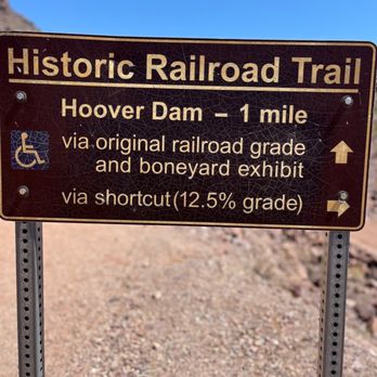
I really enjoyed this trail. This trail is very easy. Well maintained and fun informational panels along the walk. I started at parking area near the Bible Allen Rec entrance (use that for a GPS route). I walked to the Hoover Damn and back. Temp was 94°. So please prepare. There is a rest area along the route by the state hwy dept facility with a water fountain and picnic table. Very enjoyable. Close June-Sept
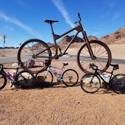

I have done this trail twice now. The first time in October 2017 and the most recent this past weekend. The first time I knew nothing about the trail. My friend Jennifer L. and I were still fairly new to biking and not comfortable outside of group rides. October was also my first time clipping in and so a trail behind her boyfriend's house seemed like the perfect option. We entered off Ithaca Avenue so I can't speak to where one would park or where the trail officially begins. Knowing nothing we started off clockwise. This direction starting out with lots of downhills - - the three sisters I would later learn - - curves and some blind spots. On this maiden voyage we only got about 12 miles in and it dead ended at a tunnel and was blocked off. At this point the option was a street detour, which we weren't comfortable with or to turn around, so we turned around. What goes down must come up! I would describe the route back as rolling hills until the end, which I learned later is the three sisters. These are three consecutive steep climbs. The bonus about entering where we did is that we ended our ride with this climb so you know it's over and you made it. This second trip we started off counter clockwise and the trail was open the entire way. It started off fairly flat and much like the other direction there were downhills and curves but the blind spots weren't as bad. There is beautiful views of the Lake and mountains, the huge bike sculpture and a bathroom break if needed at one of the parking areas. During our ride we saw other bikers, walkers, runners and horses. No wildlife sightings for us. Definitely go prepared with plenty of water, nutrition and bike repair kit. They do have one bike repair station that I saw but if you are no where near it it won't help you. Given my experience level with cycling I consider this a challenging trail and a great workout.


We went on an afternoon hike today. This trail is located in Boulder City, just outside the border of Lake Mead NRA. Nice views of all the mountain ranges within the River Mountain Range (Black Mountain and Overlook, Hawk Peak, Scramblers Peak, Bootleg Mountain, Red Mountain and River Mountain Peak), Lake Mead/Colorado River area, California, Arizona. Once you are at the saddle the trail leads to the either to the east summit of Red Mountain or right to the south summit of Black Mountain. We did both. There is a nice bench on the summit where hikers can sit and enjoy the view. Distance: est 6.5 miles Time: 4-5 hours if you go slower but we did it in 3 hours Elevation Gain: 1,550ft. Rating: 2.5 Difficulty: 2.5 of 5 Elevation peak: 3,654 & 3,460ft. scrambling: level 2 I would suggest taking 2 liters + of water, snacks, wear a hat/sunscreen. No Bathroom. Lots of loose rocks, and switch backs. Some faint trails may be missed so becareful. Hiking poles recommended.


If you are a fan of the great outdoors and have never been on the River Mountains Trail Loop, you should run, walk, or cycle there soon. Consisting of 35 miles, the RMTL connects Lake Mead National Recreation Area, Lake Las Vegas, Hoover Dam, Henderson, and Boulder City. My friends and I use it all the time for biking and running, but there are plenty of people who walk their dogs or themselves. Depending on where you are on the Loop, you can see awesome views of downtown Vegas, Boulder City, and Lake Mead--many photo ops, which Yelpers love, right? If you don't want to pay the entrance fee to get into Lake Mead, there are parking lots located outside of the two toll booths that go into Lake Mead. The other parking/entrance spots are Equestrian Park, Railroad Pass Hotel, and Bootleg Canyon in Boulder City. TIPS FOR WALKERS/RUNNERS/HIKERS: Bring plenty of hydration and fuel (food, snacks) and a cellphone if you're going to be out for a while. You are out in nature and there are no 7-11s on the Loop. Look out for wildlife; I have encountered both coyotes and snakes, but these are few and far between and usually in the early morning, when most sane people are still sleeping (I have seen many sunrises at the lake due to training). There are public bathrooms at Equestrian Park and the Lake Mead Park entrances. TIPS FOR CYCLISTS: Same tips for hydration and fuel as above. The whole loop is great training, but by no means flat (there's really no place in Vegas that's super flat). Most local cyclists who train out here know about the Three Sisters (a.k.a. the Three B*%@&es, the Three Witches, etc.): three hills that will kick your butt if you're not expecting them and have made even seasoned triathletes and cyclists walk their bikes up the third sister if they're not expecting it, are in the wrong gear, or don't have the training. I've seen it (and done it) myself. Likewise, there are some tight turns downhill, so look out for those and bike traffic coming the other way--your brake pads will get a workout. Pack extra tubes and Co2 so you're ready for a flat tire because it can be a long walk back to your car or wherever you started. All in all, one of the best things Vegas has to offer. Bring your friends and family for a walk, run, or ride and take advantage of this local gem. http://www.rivermountainstrail.com/


Bring Water! Don't come out here during the middle of summer heat. But when you can come out you will be rewarded with views and bike paths for miles! More to vegas and henderson than casinos. Get on your bike and ride!


Black top trail in the Lake Mead National Park. The path is wide but offers no shade or water fountains. The trail does offer gorgeous scenery and various elevations.
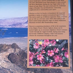

Get out and enjoy the day on this trail! We drove east on Lake Mead Parkway until right before you enter the park area. There is a parking right off of the parkway for an easy access point to the trail. The parking lot is paved with a restroom as well. There is a warning sign to not hike from June through September. Since there isn't much shade I would have to agree to avoid during the hot months. We took our bikes out for some exercise. We saw many others biking and walking. The River Mountains Loop Trail has beautiful views to take in while on your journey. It has fun up and downhill paths with off shoot dirt paths for hikers. I certainly enjoyed this trail. It's a great motivation to getting off the couch. Enjoy!


Get out to explore more .... This walking trail tours both sides of Henderson and Boulder City. It's a great hike that has been sculpted for the individual to walk through a path and even venture out into a little off roading too. Are you looking to bike and explore? The biking experience here is great? Lots of great terrain! Be careful and take it easy. The cliff faces will just keep going with you sliding down if you're not careful. When walking make sure and be prepared. Come and enjoy the views of nature. At this point observe the seasons . For some moments even in summer it's cold enough to need a light jacket. Bring water, this is the outdoors . Take the path and walk a little. Clear your mind and seek the light that comes with going out side. Shall we begin. read more


I've not hiked nor ridden the full 34 miles of the River Mountains Loop Trail and probably never will. I simply don't have that kind of stamina. But I have walked a couple of different portions of it covering several miles. Most recently I walked from around mile 11 to roughly mile 13. This section has some steep grades that I struggled to get back up. What can I say? I'm out of shape. A few weeks earlier I walked a bit of the section from Rail Road pass towards Henderson. This was more flat and a fairly easy walk. Not the most scenic. The nearby rail line is cool. The path close to and behind a hotel tower is not so great. And the parking lot was full of people living in vans. All that was misisng was the river. That wasn't so nice. Next I would like to walk a portion through or near Boulder City. The area around Bootleg Canyon should be nice. I look forward to checking it out in the weeks to come. read more


7 months ago
Great place to ride with friends and family and do your training for cycling. Bring plenty of water & food. read more


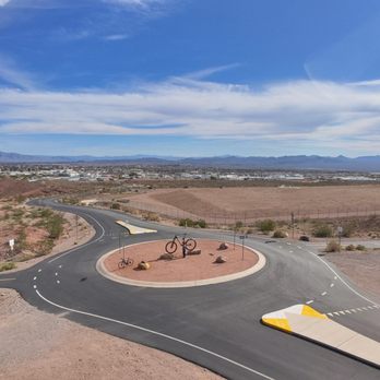


Many years ago, I really tested my physical fitness on this trail and was nearly broken. I first arrived by getting off of the freeway and driving through an old Henderson neighborhood. The parking lot was plentiful and there seemed to be a vast amount of people using this trail. I started my journey on my mountain bike from this parking lot at 9am. I rode to the Mountain Pass Casino and it wasn't feeling like a tough ride. Loved seeing all the people on the train tour passing by. From here I rode to the Bootleg Canyon Park. This portion was a bit of a grind! The park was a great spot to take a breather. I sat under a gazebo and watched the prairie dogs play for about 30 minutes. This part was nice. Very tranquil! The rest of the ride to Lake Mead was a gradual downhill ride. It was long, but beautiful scenery. Just seeing that lake was worth it! At Lake Mead, I was looking at the map and I found out that I wasn't even halfway done with the 30+ mile loop. At this point it was 1pm and I was feeling exhausted. Did I mention that I was carrying a 50 pound backpack. Water was down to about 20 fluid ounces. I decided to turn around and go back the way I came in from. This is where the true torture began. Shit got real! I found myself pedaling uphill the entire way back. It was getting hot and I slammed the rest of my water when I got to the first edge of Boulder City. Plus, I took a weird way back through some neighborhoods. I found myself walking my bike at this point. After walking about two miles, I decided to power through the rest of the trail back to my car. I arrived in the parking lot at about 5pm. My rear window had been smashed in. Nothing was taken, but it did cost me a bit of money to replace the window. I was beat down from the trail ride and then I had to deal with cleaning up the broken glass in my backseat. This was a one time deal for me. Been there and done that! A police camera system is needed in that parking lot. read more


I really enjoyed this trail. This trail is very easy. Well maintained and fun informational panels along the walk. I started at parking area near the Bible Allen Rec entrance (use that for a GPS route). I walked to the Hoover Damn and back. Temp was 94°. So please prepare. There is a rest area along the route by the state hwy dept facility with a water fountain and picnic table. Very enjoyable. Close June-Sept read more


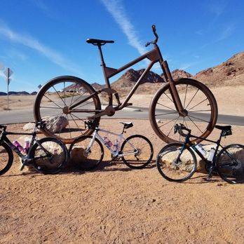
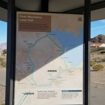
I have done this trail twice now. The first time in October 2017 and the most recent this past weekend. The first time I knew nothing about the trail. My friend Jennifer L. and I were still fairly new to biking and not comfortable outside of group rides. October was also my first time clipping in and so a trail behind her boyfriend's house seemed like the perfect option. We entered off Ithaca Avenue so I can't speak to where one would park or where the trail officially begins. Knowing nothing we started off clockwise. This direction starting out with lots of downhills - - the three sisters I would later learn - - curves and some blind spots. On this maiden voyage we only got about 12 miles in and it dead ended at a tunnel and was blocked off. At this point the option was a street detour, which we weren't comfortable with or to turn around, so we turned around. What goes down must come up! I would describe the route back as rolling hills until the end, which I learned later is the three sisters. These are three consecutive steep climbs. The bonus about entering where we did is that we ended our ride with this climb so you know it's over and you made it. This second trip we started off counter clockwise and the trail was open the entire way. It started off fairly flat and much like the other direction there were downhills and curves but the blind spots weren't as bad. There is beautiful views of the Lake and mountains, the huge bike sculpture and a bathroom break if needed at one of the parking areas. During our ride we saw other bikers, walkers, runners and horses. No wildlife sightings for us. Definitely go prepared with plenty of water, nutrition and bike repair kit. They do have one bike repair station that I saw but if you are no where near it it won't help you. Given my experience level with cycling I consider this a challenging trail and a great workout. read more



8 years ago

We went on an afternoon hike today. This trail is located in Boulder City, just outside the border of Lake Mead NRA. Nice views of all the mountain ranges within the River Mountain Range (Black Mountain and Overlook, Hawk Peak, Scramblers Peak, Bootleg Mountain, Red Mountain and River Mountain Peak), Lake Mead/Colorado River area, California, Arizona. Once you are at the saddle the trail leads to the either to the east summit of Red Mountain or right to the south summit of Black Mountain. We did both. There is a nice bench on the summit where hikers can sit and enjoy the view. Distance: est 6.5 miles Time: 4-5 hours if you go slower but we did it in 3 hours Elevation Gain: 1,550ft. Rating: 2.5 Difficulty: 2.5 of 5 Elevation peak: 3,654 & 3,460ft. scrambling: level 2 I would suggest taking 2 liters + of water, snacks, wear a hat/sunscreen. No Bathroom. Lots of loose rocks, and switch backs. Some faint trails may be missed so becareful. Hiking poles recommended. read more
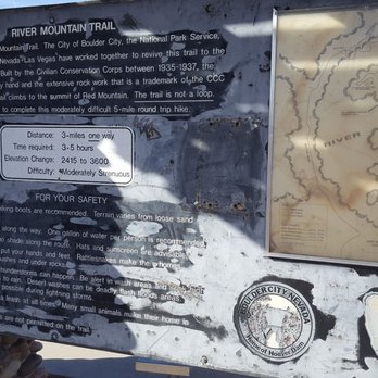
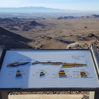


If you are a fan of the great outdoors and have never been on the River Mountains Trail Loop, you should run, walk, or cycle there soon. Consisting of 35 miles, the RMTL connects Lake Mead National Recreation Area, Lake Las Vegas, Hoover Dam, Henderson, and Boulder City. My friends and I use it all the time for biking and running, but there are plenty of people who walk their dogs or themselves. Depending on where you are on the Loop, you can see awesome views of downtown Vegas, Boulder City, and Lake Mead--many photo ops, which Yelpers love, right? If you don't want to pay the entrance fee to get into Lake Mead, there are parking lots located outside of the two toll booths that go into Lake Mead. The other parking/entrance spots are Equestrian Park, Railroad Pass Hotel, and Bootleg Canyon in Boulder City. TIPS FOR WALKERS/RUNNERS/HIKERS: Bring plenty of hydration and fuel (food, snacks) and a cellphone if you're going to be out for a while. You are out in nature and there are no 7-11s on the Loop. Look out for wildlife; I have encountered both coyotes and snakes, but these are few and far between and usually in the early morning, when most sane people are still sleeping (I have seen many sunrises at the lake due to training). There are public bathrooms at Equestrian Park and the Lake Mead Park entrances. TIPS FOR CYCLISTS: Same tips for hydration and fuel as above. The whole loop is great training, but by no means flat (there's really no place in Vegas that's super flat). Most local cyclists who train out here know about the Three Sisters (a.k.a. the Three B*%@&es, the Three Witches, etc.): three hills that will kick your butt if you're not expecting them and have made even seasoned triathletes and cyclists walk their bikes up the third sister if they're not expecting it, are in the wrong gear, or don't have the training. I've seen it (and done it) myself. Likewise, there are some tight turns downhill, so look out for those and bike traffic coming the other way--your brake pads will get a workout. Pack extra tubes and Co2 so you're ready for a flat tire because it can be a long walk back to your car or wherever you started. All in all, one of the best things Vegas has to offer. Bring your friends and family for a walk, run, or ride and take advantage of this local gem. http://www.rivermountainstrail.com/ read more
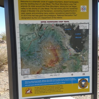


6 years ago

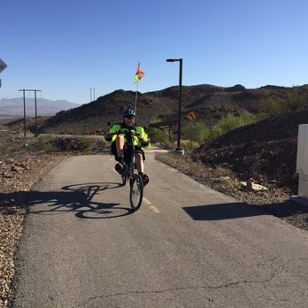


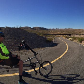

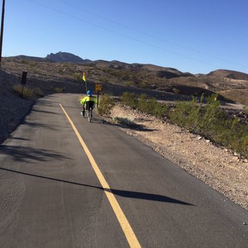


10 years ago
Get out and enjoy the day on this trail! We drove east on Lake Mead Parkway until right before you enter the park area. There is a parking right off of the parkway for an easy access point to the trail. The parking lot is paved with a restroom as well. There is a warning sign to not hike from June through September. Since there isn't much shade I would have to agree to avoid during the hot months. We took our bikes out for some exercise. We saw many others biking and walking. The River Mountains Loop Trail has beautiful views to take in while on your journey. It has fun up and downhill paths with off shoot dirt paths for hikers. I certainly enjoyed this trail. It's a great motivation to getting off the couch. Enjoy! read more
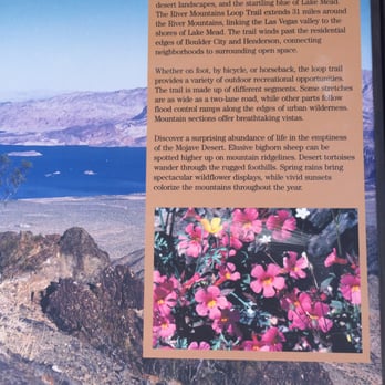
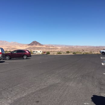


6 years ago

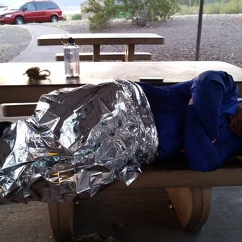
APRIL 4th, 2015- This was the day the Boy, Zac M., and myself were going to walk the almost 36 miles of the River Mountains Loop Trail! Much thought had gone into the weather and ambient light..this was to be a cool, calm night complimented by a full moon! We met up at Rail Road Pass. We then headed out to stash our cache points along the way. Cache #1was 11 miles into the journey. This was just outside the entrance of Lake Mead. Cache #2 was almost another 11 miles off of Lakeshore Drive just north of the pump station. The third cache was aways from there on the presuppose of Boot Leg Canyon. After stashing our provisions, we headed back to Rail Road Pass for a high calorie meal at the Iron Rail Cafe (See review). After a short pep talk, along with putting GLIDE and powder on parts of the body that will remain nameless, at approximately 1900 hours, we stepped off into the beautiful moon light. Be sure that technology had it's little fingers in every aspect of this adventure. There were cell phone with tracking apps and a Garmin Oregon and Foretrek involved with with every aspect of keeping the pace count honest, as were headed off in the clockwise rotation of the trail. Mile 7...into the trail, I began to experience a hot spot on my left foot. What!! How could this be? With the help of my partner, Nelita U., we would deduce...I had not broken in my socks. But the view of the valley was off the chart, as was the company, and so was the random bodies we would came across on the trail. Spooky that anyone would be out on a trail after dark. Comforting non the less. After trucking through the darkness, we hit Lake Mead Pkwy (LMP). Prior to crossing underneath, we swapped socks and did some preventive maintenance. I threw a blister bandage on the previously named hot spot and again..applied powder to that area and my other regions. As we made our way under LMP, we now cruised along the north side. The lights along this amazing stretch light up while sensing our presence and would turn off after our passing. We would eventually hit our first cache. Stocks were replenished and I revealed in Zack M smoking a stick and enjoying the nectar flowing from a flask he was wise enough to bring. Under the LMP we went and into the abyss that is this section of the trail. Words cannot define this portion of the trail. I will say that it was filled with thoughts illuminated by the moon and many a micro temperature. Perhaps the words of Zac M., will do it justice. Eventually we would find our way out onto Lakeshore Drive. This is where the mind F&*% would begin as he made our way around and through the pump station. With GPS technology playing hell with our mind, had we known different we would have cut some serious corners, but we didn't. Once we made the Lakeshore Road again. We drifted...lame and almost lifeless to our second cache site. While filling up on h2o and previously stashed snacks, I took a look at the previously mentioned now blister, I discovered it had grown even larger and was now consuming the blister bandage. This was NOT fun as I applied self aid to the area in question. The second cache site began to take on the appearance of a causality collection point. Our three bodies strewn about in need of various forms of medical attention. BUT ALAS.....we pressed on. Filled with a mix of emotions we deviated from the trail and decided to walk along Lakeshore Drive. Like the now crippled herd that we were we continued on our way. The Boy had now assumed the form of Quasimodo and I..being a responsible parent after asking many questions pitched it to expedition about the prospect of calling an exfiltration and thus ending the adventure. And so it would end at Boulder Beach. Our "Ride for Life" would arrive while I was unconscious and wrapped in a mylar blanket. Months would pass and the completion of the trial would haunt me.... After much planning, on Nov 29, 2015, Zack M., and I returned to finish what had been previously started. With a vehicle stashed at Railroad Pass and the other taken to our start point at Boulder Beach, we stepped off... Shortly in to our journey, we encountered a weirdo walking the trail. We sent out pleasantries only to be met with something alongs the line of "go f&*$ our mother." This sparked some conversation between Zack M. & myself, but nothing was going to damper the positive joy of finishing the trek. The trail is savage. It inserts it's self into your mind at times and a weaker mind could be possibly be crushed. Not so...when you can share the experience with someone else. Never underestimate the power of two similar minds. Following the flood canal, we pushed forward one step in front of the other. At the trailhead before St. Judes, we swapped out socks and applied powder and lubricants to the nether regions. I just noticed yelp puts the kibosh on long winded yelps. WTF? This is a great hike/walk. read more

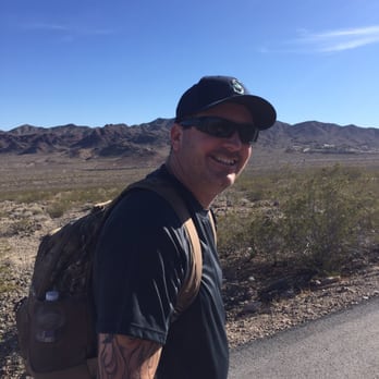



9 years ago


7 years ago

5 years ago


8 years ago

12 years ago

12 years ago

12 years ago

10 years ago
What a gem! We love to walk and this loop offers everything. You can walk on the 35 mile paved loop or wander onto the miles of dirt trails. Check out the website and print the map to see where there is water, restrooms, park ranger stations, parking lots etc. for the section you choose to walk. You'll see hikers, bikers and horseback riders and everyone is nice and respect each others hobby. There are amazing views of the valley and Lake Mead. And there is lots of wildlife to look out for. We were lucky to see coyote and quail on our last walk and have seen big horn sheep and mule deer. There are some very easy walking sections and some challenging sections. Please do not attempt any long walks in the hot summer months (go to Mt. Charleston!) Wear a hat and bring sunscreen and lots of water, if you think you'll need 2 bottles of water bring 4 and I like to freeze my water the night before so it gradually melts and is ice cold. And don't assume the weather will be warm, know that it does get quite cold and windy in the desert so check the weather before you go. Have a great time! read more


14 years ago

12 years ago

12 years ago

11 years ago
More info about River Mountains Loop Trail
Equestrian Dr
Henderson, NV 89015
Directions
Visit Website
http://www.rivermountainstrail.com
Hours
Payment methods
Indoor Amenities
Outdoor Amenities
From the Business
Ask the Community - River Mountains Loop Trail
Review Highlights - River Mountains Loop Trail











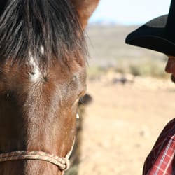

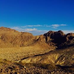


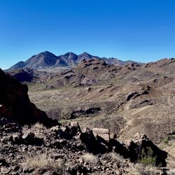


River Mountains Loop Trail - hiking - Updated August 2026
Best of Henderson
People found River Mountains Loop Trail by searching for…
Abandoned Places in Henderson, NV
Beautiful Views in Henderson, NV
Lookout Points in Henderson, NV
Scenic Overlook in Henderson, NV
River Swimming in Henderson, NV
Walking Trails in Henderson, NV
Dog Friendly Things to Do in Henderson, NV
Dog Friendly Beaches in Henderson, NV
Off Road Trails in Henderson, NV
Hiking Trails in Henderson, NV
Running Trails in Henderson, NV
Full Moon Hike in Henderson, NV
Walking Groups in Henderson, NV
Trending Searches in Henderson, NV
Barbershop For Men near River Mountains Loop Trail
Bike Shop near River Mountains Loop Trail
Bird Sanctuary near River Mountains Loop Trail
Casinos near River Mountains Loop Trail
Cliff Jumping near River Mountains Loop Trail
Consignment Shops near River Mountains Loop Trail
Cruising Spots near River Mountains Loop Trail
Dog Friendly Things To Do near River Mountains Loop Trail
Ear Piercing near River Mountains Loop Trail
Elementary Schools near River Mountains Loop Trail
Eyebrow Threading near River Mountains Loop Trail
Flower Fields near River Mountains Loop Trail
Hair Braiding near River Mountains Loop Trail
Kids Haircut near River Mountains Loop Trail
Lakes near River Mountains Loop Trail
Outdoor Activities near River Mountains Loop Trail
Parks near River Mountains Loop Trail
Pedicure near River Mountains Loop Trail
Picnic Areas near River Mountains Loop Trail
Public Golf Courses near River Mountains Loop Trail
Public Pools near River Mountains Loop Trail
Rock Quarry near River Mountains Loop Trail
Scenic Night View near River Mountains Loop Trail
Scenic Overlook near River Mountains Loop Trail
Sunrise View near River Mountains Loop Trail
Swimming Holes near River Mountains Loop Trail
Trading Card Shops near River Mountains Loop Trail
Uniforms near River Mountains Loop Trail
Browse Articles
Browse Nearby
BEST of Henderson, Nevada Coffee near River Mountains Loop Trail
BEST of Henderson, Nevada Restaurants near River Mountains Loop Trail
BEST of Henderson, Nevada Things to Do near River Mountains Loop Trail
BEST of Henderson, Nevada Breakfast near River Mountains Loop Trail
BEST of Henderson, Nevada Parks near River Mountains Loop Trail
BEST of Henderson, Nevada Lakes near River Mountains Loop Trail
BEST of Henderson, Nevada Campgrounds near River Mountains Loop Trail
BEST of Henderson, Nevada Airport near River Mountains Loop Trail
BEST of Henderson, Nevada Motel near River Mountains Loop Trail
Browse Brands
Related Searches in Henderson, NV
Affordable Horse Boarding Services in Henderson, Nevada
Affordable Horse Rental Options in Henderson, Nevada
Affordable Jet Ski Rental Options in Henderson, Nevada
Affordable Kayak Rental Services in Henderson, Nevada
Affordable Pony Rental Services Available in Henderson, Nevada
Best Dog Hiking Trails Around Henderson, Nevada
Best Fishing Locations and Guides in Henderson, Nevada
Best Places for Horseback Riding in Henderson, Nevada
Best Sightseeing Experiences Available in Henderson, Nevada
Book Equestrian Lessons With Experts in Henderson, Nevada
Book Exciting Pony Rides in Henderson, Nevada for All Ages
Book Expert Dressage Lessons in Henderson, Nevada
Check Out Off Road Trails in Henderson, Nevada
Discover Dog Friendly Trails to Explore in Henderson, Nevada
Discover Fun Activities to Do in Henderson, Nevada
Discover Horseback Riding Tours in Henderson, Nevada
Discover Popular Bike Trails in Henderson, Nevada
Discover Scenic Mountain Bike Trails Near Henderson, Nevada
Discover Top-Rated Dude Ranch Experiences in Henderson, Nevada
Discover Walking Parks in Henderson, Nevada Near You
Discover a Hiking Trail in Henderson, Nevada
Discover the Best Night Hike Trails in Henderson, Nevada
Dog-Friendly Hikes With Dogs in Henderson, Nevada
Enjoy Camping Adventures Around Henderson, Nevada
Enjoy Exciting Mountain Biking Adventures in Henderson, Nevada
Enjoy Hiking Adventures in Henderson, Nevada
Enjoy Ice Skating in Henderson, Nevada
Enjoy Kayaking Adventures in Henderson, Nevada
Enjoy Off Leash Dog Hikes in Henderson, Nevada
Enjoy Scenic Places to Walk in Henderson, Nevada
Enjoy Stables and Horse Riding Experiences in Henderson, Nevada
Enjoy Tent Camping Spots Around Henderson, Nevada
Enjoy Thrilling Atv Riding Experiences in Henderson, Nevada
Enjoy a Beautiful Waterfall Hike in Henderson, Nevada
Enjoy the Best Walking Path in Henderson, Nevada
Enjoy the Best Walking Trails in Henderson, Nevada
Experience Thrilling Snowmobiling in Henderson, Nevada
Experience Top Dressage Events in Henderson, Nevada
Experienced Horse Trainers Near Henderson, Nevada
Explore Beautiful Parks and Green Spaces in Henderson, Nevada
Explore Bike Rentals Throughout Henderson, Nevada
Explore Easy Hikes Perfect for All in Henderson, Nevada
Explore Equestrian Activities and Services in Henderson, Nevada
Explore Family-Friendly Petting Zoos in Henderson, Nevada
Explore Fun Activities to Do in Henderson, Nevada
Explore Horse Farms Around Henderson, Nevada
Explore Horse Stables and Boarding in Henderson, Nevada


