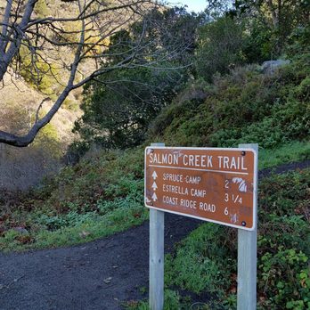
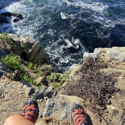
1. Salmon Creek Trail

    1. Salmon Creek Trail

    0

    ,

    Cancel

    Open app

    Search

    Salmon Creek Trail

    4.5 (2 reviews)

    Salmon Creek Trail Photos

    You might also consider

    Recommended Reviews - Salmon Creek Trail

    Your trust is our priority, so businesses can't pay to alter or remove their reviews. Learn more about reviews.
    Yelp app icon
    Browse more easily on the app
    Review Feed Illustration

    9 years ago

    Helpful 10
    Thanks 0
    Love this 6
    Oh no 0

    4 years ago

    Helpful 1
    Thanks 0
    Love this 0
    Oh no 0

    You might also consider

    Verify this business for free

    Get access to customer & competitor insights.

    Verify this business

    Partington Cove - You can get to this part of the mountain and see an uninterrupted view of the ocean

    Partington Cove

    4.8(54 reviews)
    4.2 km

    Our twelfth stop (09:42) on the Cabrillo Highway on our southbound trip through Big Sur, this dirt…read moreturn off provides unmarked parking to get clear views of the Partington Cove trail that will take you down to see the cove. We couldn't take the hike down but there were already cars parked on the side of the road to allow easy entry onto the trailhead. No cell reception in this area.

    We came here 10 years ago and it was a hidden gem at the time, we drove by around 8:30am on the way…read moreto McWay Falls and there were already 2 cars there so I knew it was no longer a secret. This is by far one of our favorite Big Sur spots. The entire beginning of the hike is all downhill so you'll have an easy time going down and be panting on the way back up, you'll see it in other people's faces as you are going down. At the very bottom split I would take the time to go both directions, if you take the bridge it'll lead to a view of the ocean that narrows and then broadens. There is a nice wood tunnel you'll pass through and at the very end of the trail you can do a small rock scrambles to get an amazing view of the turquoise blue water and seaweed gently swaying in the water. If you are lucky you'll spot some sea otters diving in the kelp. If you take the other path it leads to a rocky cove with fun boulders for kids and adults to climb on, if you come in a wet season or after rain there will be a stream with many mini waterfalls on the left side. The wave splashes here are epic and it is dangerous so I would always be mindful of the water and avoid rocks that are wet when visiting.

    Photos
    Partington Cove - Right side trail, big waves here so be careful

    Right side trail, big waves here so be careful

    Partington Cove - Rock scramble at the end of the cove trail

    Rock scramble at the end of the cove trail

    Partington Cove - Gorgeous morning hike

    See all

    Gorgeous morning hike

    Limekiln State Park

    Limekiln State Park

    4.4(143 reviews)
    4.7 km

    I fell I love with this beach many years ago. The drive here is INCREDIBLE! I literally have dreams…read moreabout driving under the bridge! You go under to get to this secluded beach off of Hwy 1. I had no idea that you could choose between 3 different campsites until I decided I HAD to be under the moonlight at the beach on 2.22.22 at 2:22 pm. And the views are BREATH TAKING from the beach campsite. They were also freezing, windy, and WET in February! And all of the trails were closed when we visited due to the fire, but it was like a little slice of Heaven to disconnect and spend 2 nights off the grid with great folks. The rangers who serve this place are BEYOND friendly, and they do an awesome job of keeping the bathrooms clean. I believe they were cleaned 3 times a day. And the campsites were so self contained, you really had no idea there were up to 29 sites there. Camping on the beach meant you heard the crash of waves all night long. It was so very peaceful! And while the view looked almost warm, there was NOTHING warm about being there in February. But if you had a camper, and the right gear, the rain and wind would be worth it just to burn that image eternally into your mind! I hope I can snag this location during the warmer months. I'm just in love with everything about LimeKiln.
    This review is for the Limekiln campground. We camped at…read moresite #17. The Redwood campground (sites #17-#29) is basically a big dirt parking lot divided into tiny "campsites." There's a creek running behind the big dirt parking lot and lots of big trees on the perimeter of the big dirt parking lot. But there's no trees or plants in the tiny "campsites." So forget hanging a hammock or having any sense of privacy. We could barely fit a 6-person tent in site #17. The creek was pretty. The bathrooms were decent and have flush toilets. Our campsite was, at most, a 2-minute walk to the ocean, which was pretty cool.

    Photos
    Limekiln State Park
    Limekiln State Park
    Limekiln State Park - Flocks of birds and otters hang out just offshore

    See all

    Flocks of birds and otters hang out just offshore

    Mill Creek Trail

    Mill Creek Trail

    4.5(2 reviews)
    7.7 km

    Great trail with an opportunity for an epic view of the coastline…read more With many of the State Parks in the area closing down their hiking trails (Spring 2019) I was lucky to find the Mill Creek trail. This hike exceeded my expectations. The Yelp page directions were spot on and we arrived at the dirt parking lot. The trailhead is right along the road. This is a family-friendly trail, and I think I booked about 3.5 miles total. There are some small ups and downs but overall not too bad.. There was a lot of green during our hike and many tall redwoods.. Tips - My top tip is that after you've hiked just drive up the road from the parking lot for about a mile. There will be amazing views when you get to highest point facing the coastline. - Make sure you have Google maps installed on your phone (for the gps)... just in case you accidentally go off trail. - Tons of poison oak. Long pants required. - If you have kids, there will be a fork in the trail not too far from the trailhead. Right side path goes straight down the steap side of the hill. You can take this and check out the creek if you don't want to do the full hike. - Basic rule is to stay along the main creek trail until you get to a point to cross it.. This is confusing because when you reach the point that the creek is in your way there are multiple paths you can take. The few people we saw on this hike all went different directions from here. We crossed the creek and we were okay.

    We decided to do this hike on our way back to the Bay Area. It was amazing and we are so glad we…read moredid. We were the only ones in the parking lot that morning and it felt like we had the whole hike to ourselves. Coming in the spring was great since everything was growing, lush, green, and the water was roaring. So serene.

    Photos
    Mill Creek Trail
    Mill Creek Trail
    Mill Creek Trail - So green..

    See all

    So green..

    Pinnacles National Park - West Pinnacles National Park

    Pinnacles National Park

    4.5(452 reviews)
    56.3 km

    A beautiful CA national park. We did 2 short hikes in one day…read more The pinnacle rocks and the caves are SO cool! Parking was really easy for the trails we wanted to access. National Park pass is required.

    As part of our quest to visit all 63 U.S. national parks, we set off on a six-week road trip. I…read morehave a personal rule: I only count a national park as "visited" if I actually spend time there, hike or walk through it, and truly experience it. On this trip, we visited 14 national parks, and Pinnacles National Park turned out to be one of the most enjoyable surprises. Pinnacles may not be as famous as Yosemite or Sequoia, but it is well worth a visit. It offers dramatic rock formations, beautiful scenery, excellent hiking, and one especially memorable feature: its talus caves. The landscape feels rugged and distinctive, with spectacular views around nearly every bend. We especially appreciated the variety of hiking options. There are trails for every ability level, including gentle paths that are accessible for visitors with mobility limitations, so many people can enjoy the park's beauty. For me, the highlight was exploring the caves. These are not traditional limestone caves but talus caves, formed when enormous boulders fell into narrow canyons and created natural tunnels. Walking through them was a real adventure. Some sections were very dark, and while a flashlight or headlamp is definitely recommended, I managed with my phone's flashlight, and a little optimism. It made the experience even more memorable. Pinnacles is also one of the best places in California to spot the magnificent California condor. We weren't lucky enough to see one soaring overhead, but knowing these endangered birds have been successfully reintroduced here adds another layer of appreciation for the park. Spring is especially beautiful, with wildflowers covering the hillsides, and the park is full of interesting rock formations, oak woodlands, chaparral, and abundant wildlife. Pinnacles National Park offers a little bit of everything: beautiful scenery, excellent hiking, unique geology, and genuine adventure. It may be one of the smaller national parks, but it delivers an impressive amount of beauty and fun in one visit. If you go, don't miss the caves, and bring a flashlight. Or, if you're like me, your phone and a sense of adventure might just do the trick.

    Photos
    Pinnacles National Park - West Pinnacles National Park

    West Pinnacles National Park

    Pinnacles National Park - West Pinnacles National Park

    West Pinnacles National Park

    Pinnacles National Park - West Pinnacles National Park

    See all

    West Pinnacles National Park

    Pfeiffer Big Sur State Park

    Pfeiffer Big Sur State Park

    4.4(407 reviews)
    32.9 km

    Great campground with the Big Sur river running right through it. Loved the quick hike up to the…read morewaterfall through the redwoods. Lots of great shady sites and some really nice sites right on the river. Showers were nice and reasonably priced. If you are feeling lazy and don't want to cook, you can check out the restaurant/ coffee shop, also a nice little gift shop. There is also a store at the back of the campground that has ice , snacks , firewood and a small laundry facility which was super convenient !! Great woodsy campground with great amenities!!

    BEST SPOT TO SEE RED WOODS. Pfeiffer Big Sur State Park is a sprawling, 1,000-acre sanctuary…read morecentered around the pristine Big Sur River. Often nicknamed "mini Yosemite," it trades direct beach access for dramatic inland scenery, boasting spectacular valleys, forested peaks, and dense groves of ancient coast redwoods. Ancient Redwood Groves: The park is famous for its majestic coast redwoods, with some trees measuring over 1,000 years old. Accessible walkways, like the Redwood Deck, allow visitors to stand among these towering giants. Diverse Hiking Trails: Trails cater to all skill levels, ranging from the flat and easy Nature Trail loop to the challenging, steep ascent up the Buzzards Roost Trail, which rewards hikers with panoramic views of the ocean and mountains. On-Site Lodging and Camping: Unlike many rugged coastal stops, this park features developed accommodations, including a large campground alongside the river and the historic Big Sur Lodge, which provides comfortable cabins and a restaurant. The redwoods you see growing in Pfeiffer Big Sur State Park (as well as nearby Julia Pfeiffer Burns State Park are Coast Redwoods (Sequoia sempervirens), the tallest living species of tree on Earth. The groves found throughout the park are particularly special because they mark the southernmost boundary of where the coast redwood species naturally thrives in significant numbers. Because they are located at the southern edge of their natural geographic range, the climate here is slightly drier and warmer than the dense, misty rainforests of Northern California. While they generally do not reach the record-shattering heights of their northern cousins in Humboldt or Redwood National Park, they are incredibly impressive, with many individual trees in the park towering well over 200 feet tall and thriving for upwards of 800 to 1,000 years. They rely heavily on the marine fog flowing through the Big Sur River gorge to stay hydrated during the dry summer months

    Photos
    Pfeiffer Big Sur State Park - Family Camping September 12-14, 2025

    Family Camping September 12-14, 2025

    Pfeiffer Big Sur State Park - Family Camping September 12-14, 2025

    Family Camping September 12-14, 2025

    Pfeiffer Big Sur State Park - Family Camping September 12-14, 2025  THE JOY LUCK CLUB

    See all

    Family Camping September 12-14, 2025 THE JOY LUCK CLUB

    McWay Falls - Tunnel that takes you underneath the highway to McWay Falls

    McWay Falls

    4.6(192 reviews)
    18.5 km

    McWay Falls is one of the most iconic and photographed landmarks along the Big Sur coast, famous…read morefor its ethereal, postcard-perfect scenery. Located within Julia Pfeiffer Burns State Park, it is one of the few waterfalls in California that empties directly into the ocean. Unique Tide Falls: The stunning 80-foot waterfall flows year-round from McWay Creek, dropping over a jagged granite cliff directly onto the pristine sands of a picturesque, turquoise cove, or into the waves at high tide. Effortless Viewpoint Trail: The falls are reached via an exceptionally short and accessible 0.5-mile round-trip trail, making it a quick and highly rewarding stop right off Highway 1. This trail was unfortunately closed during my visit, but we could still see the falls

    Located within the Julia Pfeffer Burns State Park, the McWays Falls (named after an early settler…read moreof Big Sur) Vista Point was the fourteenth (09:53) and furthest south stop of our southbound scenic car tour through Big Sur. The trail down to get a close up view of the falls continues to be closed (there is no estimated reopen date). However there is a vista point off the highway that you can walk to (need to hop over a railing) from a safer parking spot, that provides a clear aerial view of the waterfall (one of the few in the world that dumps directly into the ocean...learned that those are called a tidefalls [another one in California is Alamere Falls near SF]).

    Photos
    McWay Falls - Parking is $10 at the trailhead across the highway

    Parking is $10 at the trailhead across the highway

    McWay Falls
    McWay Falls

    See all

    Ewoldsen Trail

    Ewoldsen Trail

    4.7(29 reviews)
    18.5 km

    The hike kicked our ass, a lot to adventure and see. I think in total we had almost 15,000 steps…read moreand climbed about 109 stairs.

    Come here if you want to feel like katniss, the part before she volunteered as a tribute and spent…read moremost of her days hunting in the woods. This hike is no joke. Beware of bringing noobs on this hike because Ewoldsen will work you so hard and so good. In addition to being steep as hell, the trail is also narrow af. You have to basically hug the wall of the mountain to let the opposite traffic go. Sharing is caring! But be very careful because doing that stunt gets even scarier the higher you go up. The trail starts off only one path in the beginning. Right at the beginning, it's okay to take it a little bit easy. It's very chill at this point. And then suddenly, you face this "almost vertical looking" path and you're thinking to yourself "aw shit. What did I get myself into." But it's too late to turn back. I mean, you can but you traveled so far just to conquer this monster Ewoldsen. You might as well finish it and show off what you achieved! Anyway, somewhere along the trail, a wild fork appears. Which one to take? Left or right?? Choose wisely because one leads you to a never ending path! Just kidding. (Although, you may start thinking that about the entire hike). Per advice from people in the opposite traffic, My friends and I chose left. We really should have went right so that we went counter clockwise because then we would be climbing up less. I don't know if that made sense. We went left. And we ended up going up steep hills so if we had went right, we would be actually going down those hills instead of up. It's actually a loop so technically it doesn't matter if you choose left or right. You will end up at the same fork after completing the loop. The view on the top was stunning. Although, the McWay falls trail produced a prettier picture, you will feel more accomplished once you see the small waterfall from all the way on top of the ewoldsen loop.

    Photos
    Ewoldsen Trail
    Ewoldsen Trail
    Ewoldsen Trail

    See all

    Prewitt Ridge - Please be careful with fire

    Prewitt Ridge

    3.3(18 reviews)
    0.0 km

    I did an overnight motorcycle ride with a buddy, from the SF Bay Area to Prewitt Ridge and WOW! The…read moreride south along Hwy 1 heading there is spectacular, but the views from the ridge are next level! The 5+ miles of silty, rough dirt road heading up to the ridge was a little challenging on street bikes, but we managed just fine. The views from the ridge are breathtaking in every direction, and it was very pleasant to see very little trash laying about. Clearly, this is a campground area that is mainly used by seasoned, "Pack Your Trash" campers, which is awesome. Hope it stays that way. We went in mid Fall during a very brief heat wave, and the small flies were annoying, but they don't bite. We just covered our faces with buffs and slept under netting. That was literally the only drawback. PROS: Awesome Panoramic Views FREE to camp! Many flat camping areas to choose from No Trash lying around Weather is usually comfortable Many trees to find shade under CONS: Some seasons have annoying, small flies. They don't bite though TIPS: If you're heading there from the North and you need provisions, stop at the Big Sur Lodge Store. They have EVERYTHING you may need Dirt road leading up to the ridge is not maintained (much) and may be tough to navigate for novice drivers. If muddy, may need 4WD and off road tires Bring a mosquito net No water access, so you have to bring your own No bathrooms - Bury your #2! *No open campfires allowed during the warm months (but you won't need it for warmth anyway) Jet boils and contained flame are OK PACK YOUR TRASH!

    Wow, wow wow! Amazing spot! We went there during 4th of…read moreJuly this year and I have to say, it was packed! I am glad that we arrived early and found a spot. It is an amazing spot to watch the sunset, however, it is tough to get up there. Once off the paved road its another 20-30 min to get to where all those pictures are taken Whoever said 15 min was either not in a Prius (unlike us) or was speeding quite fast. It's a one-way road with a lot of potholes and curves where you can not see any other car coming around the corner which makes it very hard to drive safely. When we first got there, there were not too many people there but once we got out of the car, bees were flying around, bugging us quite a bit so we went back to find a better spot away from the bees and in the shade. Unfortunately, there is no shade on the top of the ridge. Throughout the mid afternoon we decided to go back to the bees since the other spot was covered in gnats which were 5x more annoying than the bees were. We brought mosquito repellant and a candle, but nothing worked :/ In the end, I was glad we went back to the highest spot right by the cliff/ridge. Directions: 1. Its hard to see but take a sharp right (coming from Los Angeles) onto Nacimiento-Fergusson Road ( over a rain gutter) and just continue going up the hill for about 20-30 min depending on speed and other people coming down the hill. 2. Once you see a sign and a road going downhill TURN RIGHT! We almost missed it since you don't pay attention to your right. It states "Prewitt ridge road" 5. Take it and be cautious of other cars coming your way! I recommend NOT to drive it at night, but it's up to you. 3. There is a little intersection where you have to take a sharp right to get where you want to get, there is no sign, but you can see that the road splits. 4. From there on, you will see multiple spots where you can camp if you want to. Continue going straight and then up to the main spot. You made it. We have seen any variety of cars going up. We were in a Prius and made it :) Tips: There are no bathrooms but plenty of bushes where you can go. There are firepits but I am not sure if they are allowed. You need a permit for a portable stove ( according to signs along the way). Bring games, guitars, food, beer etc to keep you entertained up there. But make sure to take back home what you bring up and don't leave anything up there. Anyways, enjoy!

    Photos
    Prewitt Ridge - View at sunset.

    View at sunset.

    Prewitt Ridge
    Prewitt Ridge

    See all

    Jade Cove Beach - Base of Jade cove

    Jade Cove Beach

    4.4(28 reviews)
    15.3 km

    What an amazing hidden treasure. Hard to find and if you know you know. Not easy to find no markers…read moreits about 800 feet south of sand dollar beach. Hike through some poison ivy into a cool meadow over looking the beautiful cove. Now finding your way down is no joke adventurous people only. Need to find the cliff with the ropes and hold on tight as you cascade the cliff. Once at the bottom you feel amazing like you conquered a hidden secret Now climbing back up I thought would be tough however climbing back up is much easier than going down. This is not for the weak but totally worth it. Highly recommend. Jade well thats the color of the water and if thats what you're searching for I suggest diving for it.

    Fun, but getting there can be tricky. I used the AllTrails app to find Jade Cove. I then opened up…read morethe Jade Cove map and looked for the blue dot (my car) going along highway 1. I pulled over at the trail marker.. It worked perfectly. The best part of this experience was the short but precarious hike down to the cove. You'll be required to use a rope to hike down to the beach and back up again. The rope is a permanent fixture. Kids seven and over could do it without any assistance. When at the beach you'll see a lot of green rocks, mostly serpentine. The rule is that you can take anything you like as long as the "tide" ocean is able to touch it. The tidal range goes all the way to the cliffside. - There is no highway sign for jade cove anymore. That was taken down many years ago. - Check the tides and try to come here at low tide. - If you can, when you're at the bottom of the rope hike southward to the next cove. Better rocks over there.

    Photos
    Jade Cove Beach - Rope leading up to trail

    Rope leading up to trail

    Jade Cove Beach - Jade cove. Color of the water

    Jade cove. Color of the water

    Jade Cove Beach - At he bottom

    See all

    At he bottom

    Salmon Creek Trail - hiking - Updated July 2026

    Loading...
    Loading...
    Loading...