Cancel

    Open app

    Search

    Prewitt Ridge

    3.3 (18 reviews)

    Prewitt Ridge Photos
    You might also consider

    Recommended Reviews - Prewitt Ridge

    Your trust is our priority, so businesses can't pay to alter or remove their reviews. Learn more about reviews.
    Yelp app icon
    Browse more easily on the app
    Review Feed Illustration

    Reviews With Photos

    Instagram: @bruhbruh_jacob

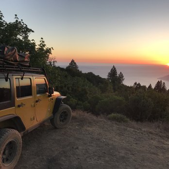
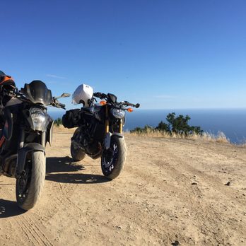
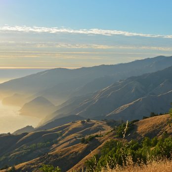
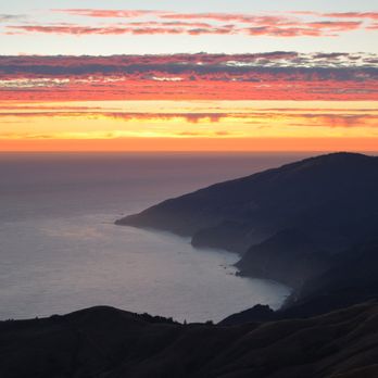
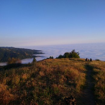
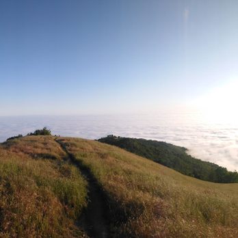
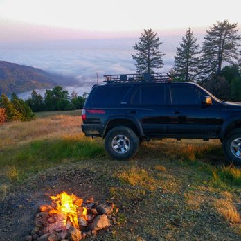
    Beautiful place! Beautiful views! In order to keep this place enjoyable please review the message below! "For new people who are trying to go here 4X4 recommended and please clean up after your self. Last thing we want is for them to shut this place down and ruining it for other new adventure seekers and locals. " "For the regulars that do enjoy and respect this place, Keep preaching to the newbies the PACK and GO rule!" "For the jack asses that leave your poop and TP everywhere. Walmart sells Ozark out door toilets that also come with disposable bags that are seal-able to throw in your garbage with you (very strong wont break or smell) FYI these bags are not biodegradable so please if you do decide to get one please do not leave any surprise time capsules (Not cool).

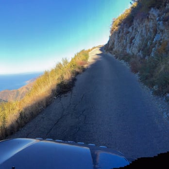
    Picture of the road on the way back down the mountain.
    Dana C.

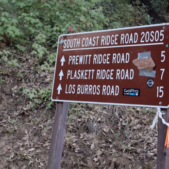
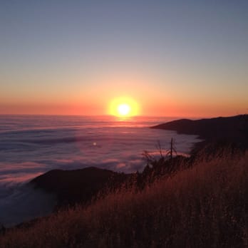
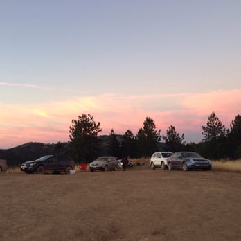
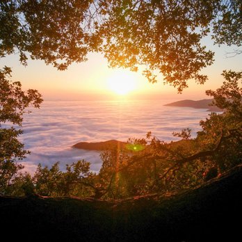
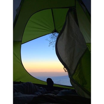
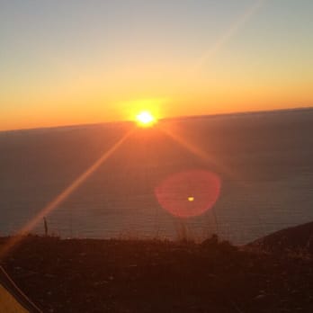
    one word: AMAZING!!! We camped here last week (October 19, 2015) and the view was incredible. The sunset was one for the books, we went passed the big open field at the end and found a more secluded area with a tree and sat on the edge of the mountain, i am so happy that we didn't settle for the area at the top where it looks like most people post up. I was so bummed we only stayed one night instead of two. We even had a owl visit with us throughout the night which was awesome! For the road up, i read some reviews saying it was scary but its not at all. Yes, the road is tiny the majority of the way but as long as your cautious when going around the corners then everything is dandy. I do recommend day time driving though, as there is no cell phone service and it could get confusing.

    See all

    7 years ago

    Helpful 2
    Thanks 0
    Love this 1
    Oh no 0
    Photo of Nina S.
    3
    28
    69

    11 years ago

    Helpful 7
    Thanks 0
    Love this 1
    Oh no 0
    Photo of David S.
    132
    52
    19

    7 years ago

    Helpful 2
    Thanks 0
    Love this 1
    Oh no 0

    7 years ago

    Helpful 1
    Thanks 0
    Love this 0
    Oh no 0
    Photo of Dana C.
    1
    16
    28

    11 years ago

    Helpful 0
    Thanks 0
    Love this 1
    Oh no 0

    8 years ago

    Helpful 2
    Thanks 0
    Love this 0
    Oh no 0

    7 years ago

    Helpful 7
    Thanks 0
    Love this 7
    Oh no 0
    Photo of M. G.
    0
    28
    0

    10 years ago

    Helpful 12
    Thanks 0
    Love this 1
    Oh no 0

    7 years ago

    Helpful 0
    Thanks 0
    Love this 0
    Oh no 0

    7 years ago

    Helpful 0
    Thanks 0
    Love this 0
    Oh no 0

    7 years ago

    Helpful 0
    Thanks 0
    Love this 0
    Oh no 0
    Photo of Bob S.
    0
    26
    2

    10 years ago

    Helpful 4
    Thanks 0
    Love this 1
    Oh no 0

    6 years ago

    Helpful 5
    Thanks 0
    Love this 3
    Oh no 0

    9 years ago

    Helpful 1
    Thanks 0
    Love this 0
    Oh no 0

    9 years ago

    Helpful 0
    Thanks 0
    Love this 0
    Oh no 0
    Photo of J N.
    48
    8
    0

    9 years ago

    Helpful 1
    Thanks 0
    Love this 0
    Oh no 0

    10 years ago

    Helpful 0
    Thanks 0
    Love this 0
    Oh no 0

    11 years ago

    Helpful 0
    Thanks 0
    Love this 0
    Oh no 0

    Ask the Community - Prewitt Ridge

    Review Highlights - Prewitt Ridge

    On my last trip, the 4th through 6th of July, I saw way too much toilet paper sitting around.

    Mentioned in 2 reviews

    Read more highlights

    Verify this business for free

    Get access to customer & competitor insights.

    Verify this business

    Partington Cove - You can get to this part of the mountain and see an uninterrupted view of the ocean

    Partington Cove

    4.8(53 reviews)
    4.2 km

    We came here 10 years ago and it was a hidden gem at the time, we drove by around 8:30am on the way…read moreto McWay Falls and there were already 2 cars there so I knew it was no longer a secret. This is by far one of our favorite Big Sur spots. The entire beginning of the hike is all downhill so you'll have an easy time going down and be panting on the way back up, you'll see it in other people's faces as you are going down. At the very bottom split I would take the time to go both directions, if you take the bridge it'll lead to a view of the ocean that narrows and then broadens. There is a nice wood tunnel you'll pass through and at the very end of the trail you can do a small rock scrambles to get an amazing view of the turquoise blue water and seaweed gently swaying in the water. If you are lucky you'll spot some sea otters diving in the kelp. If you take the other path it leads to a rocky cove with fun boulders for kids and adults to climb on, if you come in a wet season or after rain there will be a stream with many mini waterfalls on the left side. The wave splashes here are epic and it is dangerous so I would always be mindful of the water and avoid rocks that are wet when visiting.

    this is a hidden gem for the Californians. Enjoy the quietness next to the ocean. we also spotted…read moresea ottar in water.

    Photos
    Partington Cove - Right side trail, big waves here so be careful

    Right side trail, big waves here so be careful

    Partington Cove - Rock scramble at the end of the cove trail

    Rock scramble at the end of the cove trail

    Partington Cove - Gorgeous morning hike

    See all

    Gorgeous morning hike

    Limekiln State Park

    Limekiln State Park

    4.4(142 reviews)
    4.7 km

    I fell I love with this beach many years ago. The drive here is INCREDIBLE! I literally have dreams…read moreabout driving under the bridge! You go under to get to this secluded beach off of Hwy 1. I had no idea that you could choose between 3 different campsites until I decided I HAD to be under the moonlight at the beach on 2.22.22 at 2:22 pm. And the views are BREATH TAKING from the beach campsite. They were also freezing, windy, and WET in February! And all of the trails were closed when we visited due to the fire, but it was like a little slice of Heaven to disconnect and spend 2 nights off the grid with great folks. The rangers who serve this place are BEYOND friendly, and they do an awesome job of keeping the bathrooms clean. I believe they were cleaned 3 times a day. And the campsites were so self contained, you really had no idea there were up to 29 sites there. Camping on the beach meant you heard the crash of waves all night long. It was so very peaceful! And while the view looked almost warm, there was NOTHING warm about being there in February. But if you had a camper, and the right gear, the rain and wind would be worth it just to burn that image eternally into your mind! I hope I can snag this location during the warmer months. I'm just in love with everything about LimeKiln.
    Heads up a number of trails are still closed from the fire so it's not possible to access the falls…read moreand other trails as in the past. We had site #6 near the beach. The sites are very close to each other. Our first night before our immediate neighbors arrived was amazing - incredible views of the beach/ocean from the campsite and very peaceful. Restrooms including shower were nearby and cleaned every morning. Next night, we were surrounded by big groups on both sides and it felt like a parking lot tent city and it did not seem like car parking restrictions were enforced. The sites are so close we could hear intense snoring on both sides. Neighboring kids would come and smack/kick at our dogs - they were young but still not cool and I was annoyed their parents stood by and watched. We will try Kirk Creek instead next time to get more space. Pros - we loved the incredible access to the beach. Amenities seemed to work well (until inconsiderate folks started to ignore basic human decency like flushing!). Cons - no access to internet (despite it being available but it is locked), some beach sites are very close together, trails closed.

    Photos
    Limekiln State Park
    Limekiln State Park
    Limekiln State Park - Flocks of birds and otters hang out just offshore

    See all

    Flocks of birds and otters hang out just offshore

    Mill Creek Trail

    Mill Creek Trail

    4.5(2 reviews)
    7.7 km

    Great trail with an opportunity for an epic view of the coastline…read more With many of the State Parks in the area closing down their hiking trails (Spring 2019) I was lucky to find the Mill Creek trail. This hike exceeded my expectations. The Yelp page directions were spot on and we arrived at the dirt parking lot. The trailhead is right along the road. This is a family-friendly trail, and I think I booked about 3.5 miles total. There are some small ups and downs but overall not too bad.. There was a lot of green during our hike and many tall redwoods.. Tips - My top tip is that after you've hiked just drive up the road from the parking lot for about a mile. There will be amazing views when you get to highest point facing the coastline. - Make sure you have Google maps installed on your phone (for the gps)... just in case you accidentally go off trail. - Tons of poison oak. Long pants required. - If you have kids, there will be a fork in the trail not too far from the trailhead. Right side path goes straight down the steap side of the hill. You can take this and check out the creek if you don't want to do the full hike. - Basic rule is to stay along the main creek trail until you get to a point to cross it.. This is confusing because when you reach the point that the creek is in your way there are multiple paths you can take. The few people we saw on this hike all went different directions from here. We crossed the creek and we were okay.

    We decided to do this hike on our way back to the Bay Area. It was amazing and we are so glad we…read moredid. We were the only ones in the parking lot that morning and it felt like we had the whole hike to ourselves. Coming in the spring was great since everything was growing, lush, green, and the water was roaring. So serene.

    Photos
    Mill Creek Trail
    Mill Creek Trail
    Mill Creek Trail - So green..

    See all

    So green..

    Pinnacles National Park - West Pinnacles National Park

    Pinnacles National Park

    4.5(448 reviews)
    56.3 km

    This was such a fun park. A little out of the way but way worth the trip!…read more A small fee to enter. It's worth it because it goes to take care of upkeep and in the summer, there's a lot of people so this little bit helps. You will want to have a flashlight on hand to go through the caves here as there are long spots you are in the dark climbing up and down stairs or down or up through boulders. Headlamps are best but a flashlight will work too. I started out day 1 on one side and had so much fun hiking through the park and crawling through the rock caves. I spent a little time talking to the Park Rangers to find the best place for me to hike that wasn't too long. Reaching the top of the mountain and walking back down with the amazing views, all the Turkey Vultures and other birds and wildlife was spectacular. The trails, though not necessarily well marked which way is which were well traveled so you knew you weren't going to get lost going off trail. The second day I hit the other side of the park to do Bear Gulch Caves. Excellent cave! Parking at the foot is limited even about 1/4 mile down next to info shop and restrooms is limited so be patient. You may have to park further down as summer comes. This is the only bathroom but very well maintained. There is water running down through this cave and when you reach the top, there a tight squeeze through the rocks and then an amazing payoff with the reservoir. Great spot to watch the birds, Dragon Flies, walk around some of the reservoir before hiking back out down along the very well traveled path past rock climbers to the parking lot again. I highly recommend this fantastic park not just for the excellent caves but for all the good hiking trails. There is some camping and even a pool further down towards the entrance on one side. The Rangers here are full of knowledge and very friendly and professional. Excellent experience!!

    For the first time, we were able to hike at Pinnacles National Park--specifically the Bear Gulch…read morearea--and it was truly an amazing experience, definitely one for the books! We absolutely loved the variety this hike offers. The caves were such a fun and unique highlight, and the reservoir added a peaceful, scenic touch to the whole trail. The views of the rock walls and dramatic formations were stunning from start to finish. It felt like a perfect mix of adventure and nature. What made it even more special is that we did it together with our 3-year-old, and he absolutely loved it too! It's such a memorable family-friendly experience, though of course some parts require a bit of extra attention with little ones. One thing to keep in mind--parking can be quite challenging. During our visit on April 2, it was very hard to find a spot. We ended up parking quite far and had to walk about a mile just to reach the entrance to the Sycamore Trail. Next time, we'll definitely plan to arrive as early as possible to avoid that hassle. Overall, it was an unforgettable hike, and we're already looking forward to coming back and exploring more trails in the area!

    Photos
    Pinnacles National Park - West Pinnacles National Park

    West Pinnacles National Park

    Pinnacles National Park - West Pinnacles National Park

    West Pinnacles National Park

    Pinnacles National Park - West Pinnacles National Park

    See all

    West Pinnacles National Park

    Pfeiffer Big Sur State Park

    Pfeiffer Big Sur State Park

    4.4(405 reviews)
    32.9 km

    Great campground with the Big Sur river running right through it. Loved the quick hike up to the…read morewaterfall through the redwoods. Lots of great shady sites and some really nice sites right on the river. Showers were nice and reasonably priced. If you are feeling lazy and don't want to cook, you can check out the restaurant/ coffee shop, also a nice little gift shop. There is also a store at the back of the campground that has ice , snacks , firewood and a small laundry facility which was super convenient !! Great woodsy campground with great amenities!!

    We stayed two nights at Pfeiffer Big Sur State Park and while the scenery is absolutely stunning…read more(as expected for Big Sur), the experience was seriously impacted by poor enforcement and lack of oversight from staff. Right off the bat, our check-in experience was frustrating. We had reserved and paid for an ADA campsite, only to arrive and find someone else already occupying it. Apparently, there is no system in place to verify IDs against reservations, which seems like a huge oversight--especially for ADA-designated spots. After spending time sorting that out, things settled temporarily. Our first night at the Weyland campground quickly went downhill once "quiet hours" (10pm-6am) began. Instead of quiet, the majority of the campground was loud, playing music, and talking well into the night--until nearly 4am. There was zero enforcement of quiet hours, and no visible presence from a camp host or ranger to address it. It honestly felt more like a free-for-all than a state park campground. Hoping for a better experience, we moved to the South campground for our second night. Unfortunately, things got worse. The bathroom across from Site 45 was in unacceptable condition. The ADA shower stall took three of my paid shower tokens without working, and to make matters even worse, there was literal human feces on the floor. Not just dirty--completely unsanitary and clearly not being maintained. We attempted multiple times to contact the camp host about both the bathroom situation and earlier noise issues, knocking several times with no response. It was incredibly frustrating to have no support or accountability when problems came up. It's really disappointing because this park is naturally beautiful and has so much potential. But the lack of basic management--no ID checks for reservations, no quiet hour enforcement, and poorly maintained facilities--completely takes away from the experience. It honestly feels like the park is being let down by the very people responsible for running it. Would love to return someday, but until there are major improvements in oversight and maintenance, it's hard to justify coming back.

    Photos
    Pfeiffer Big Sur State Park - Family Camping September 12-14, 2025

    Family Camping September 12-14, 2025

    Pfeiffer Big Sur State Park - Family Camping September 12-14, 2025

    Family Camping September 12-14, 2025

    Pfeiffer Big Sur State Park - Family Camping September 12-14, 2025  THE JOY LUCK CLUB

    See all

    Family Camping September 12-14, 2025 THE JOY LUCK CLUB

    Salmon Creek Trail - Behind the falls

    Salmon Creek Trail

    4.5(2 reviews)
    0.0 km

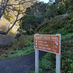
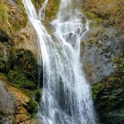
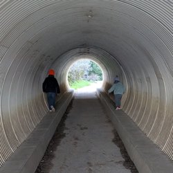
    The Salmon Creek Trail and Waterfall is one of the funner places to take the family along Highway 1…read morein lower Monterey County. This trail is located about 3.5 miles north of the Ragged Point Inn along the middle of large bend in the road. There's a pull-off just north of the trailhead. You have to walk across the bridge to get to the actually trail. After a short walk down the trail you will come to a fork in the road. Follow the arrow to the "Balls".. It used to say Falls but someone changed it to "Balls"... This is a review of the Waterfall Trail that is a split off from the Salmon Creek Trail. The waterfall is less than a quarter mile so most families can make it to the waterfall. Those seeking to access the actual water pool will have to do some hiking over slippery rocks and cold rushing water. That's not advisable unless you're a crafty hiker. Your reward is to stand below, or even behind a 120-foot waterfall. The best pictures have to be earned the hard way on this hike. There's also a cave in this same area. Tips - The rocks here are slippery!! If you want to get to the base of the waterfall I recommend water shoes or just using you bare feet. - Check out the tunnel and graffiti under the bridge.. The trail is just off area where you park, don't cross the bridge, rather just walk down the tiny trail to the base of the bridge ( see my picture).

    Short hike from the turn out. Definitely a good pit stop on the drive to big sur. The trail can be…read morea little bit confusing when you're trying to get to the upper falls. Will definitely have to climb some rocks but worth it. We didn't climb to the upper falls because there was quite a few people.

    Photos
    Salmon Creek Trail - Secret tunnel under highway

    Secret tunnel under highway

    Salmon Creek Trail
    Salmon Creek Trail - Salmon creek waterfall

    See all

    Salmon creek waterfall

    Ewoldsen Trail

    Ewoldsen Trail

    4.7(29 reviews)
    18.5 km

    The hike kicked our ass, a lot to adventure and see. I think in total we had almost 15,000 steps…read moreand climbed about 109 stairs.

    Come here if you want to feel like katniss, the part before she volunteered as a tribute and spent…read moremost of her days hunting in the woods. This hike is no joke. Beware of bringing noobs on this hike because Ewoldsen will work you so hard and so good. In addition to being steep as hell, the trail is also narrow af. You have to basically hug the wall of the mountain to let the opposite traffic go. Sharing is caring! But be very careful because doing that stunt gets even scarier the higher you go up. The trail starts off only one path in the beginning. Right at the beginning, it's okay to take it a little bit easy. It's very chill at this point. And then suddenly, you face this "almost vertical looking" path and you're thinking to yourself "aw shit. What did I get myself into." But it's too late to turn back. I mean, you can but you traveled so far just to conquer this monster Ewoldsen. You might as well finish it and show off what you achieved! Anyway, somewhere along the trail, a wild fork appears. Which one to take? Left or right?? Choose wisely because one leads you to a never ending path! Just kidding. (Although, you may start thinking that about the entire hike). Per advice from people in the opposite traffic, My friends and I chose left. We really should have went right so that we went counter clockwise because then we would be climbing up less. I don't know if that made sense. We went left. And we ended up going up steep hills so if we had went right, we would be actually going down those hills instead of up. It's actually a loop so technically it doesn't matter if you choose left or right. You will end up at the same fork after completing the loop. The view on the top was stunning. Although, the McWay falls trail produced a prettier picture, you will feel more accomplished once you see the small waterfall from all the way on top of the ewoldsen loop.

    Photos
    Ewoldsen Trail
    Ewoldsen Trail
    Ewoldsen Trail

    See all

    Jade Cove Beach - Jade?  Nope.  Serpentine.  See why people may think they've found Jade when they haven't?  They look awfully similar.

    Jade Cove Beach

    4.3(27 reviews)
    15.3 km

    Fun, but getting there can be tricky. I used the AllTrails app to find Jade Cove. I then opened up…read morethe Jade Cove map and looked for the blue dot (my car) going along highway 1. I pulled over at the trail marker.. It worked perfectly. The best part of this experience was the short but precarious hike down to the cove. You'll be required to use a rope to hike down to the beach and back up again. The rope is a permanent fixture. Kids seven and over could do it without any assistance. When at the beach you'll see a lot of green rocks, mostly serpentine. The rule is that you can take anything you like as long as the "tide" ocean is able to touch it. The tidal range goes all the way to the cliffside. - There is no highway sign for jade cove anymore. That was taken down many years ago. - Check the tides and try to come here at low tide. - If you can, when you're at the bottom of the rope hike southward to the next cove. Better rocks over there.

    1 2 3 not it. Finding the spot is kind of a game. Quite frankly the bluff is a great place to have…read morea picnic if nothing else on a nice day. The whole area is breathtaking, I'm fairly sure there isn't any jade at the beach, there's also a sign that tells you not too take anything from the beach. When you find that sign I'm relatively sure you have found jade cove. It's not a long walk down from the parking area (just south of the entrance to the nearby campground on the east side of the road). The sign gets taken down by locals? I really count on locals to protect their interests unnecessarily, i should do that more often. Unfortunately I never went to the jerk academy so I never leaned how to selfishly conduct myself in such a manner. I would love to camp at the nearby campsite, the bluff above jade cove would be a great place to star gaze on a clear night.

    Photos
    Jade Cove Beach - Jade cove from above

    Jade cove from above

    Jade Cove Beach - A trail above jade cove. if you find yourself here you have gone too far north. The rope heading down is about 100 feet south of this trail

    A trail above jade cove. if you find yourself here you have gone too far north. The rope heading down is about 100 feet south of this trail

    Jade Cove Beach

    See all

    Prewitt Ridge - hiking - Updated May 2026

    Loading...
    Loading...
    Loading...