
Limekiln State Park Photos


More like Limekiln State Park
Recommended Reviews - Limekiln State Park
Start your review...


Reviews With Photos


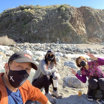
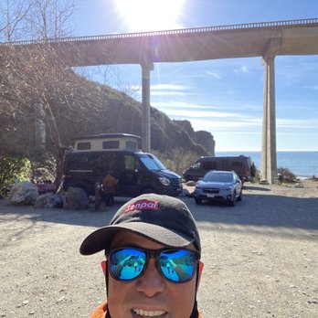
I fell I love with this beach many years ago. The drive here is INCREDIBLE! I literally have dreams about driving under the bridge! You go under to get to this secluded beach off of Hwy 1. I had no idea that you could choose between 3 different campsites until I decided I HAD to be under the moonlight at the beach on 2.22.22 at 2:22 pm. And the views are BREATH TAKING from the beach campsite. They were also freezing, windy, and WET in February! And all of the trails were closed when we visited due to the fire, but it was like a little slice of Heaven to disconnect and spend 2 nights off the grid with great folks. The rangers who serve this place are BEYOND friendly, and they do an awesome job of keeping the bathrooms clean. I believe they were cleaned 3 times a day. And the campsites were so self contained, you really had no idea there were up to 29 sites there. Camping on the beach meant you heard the crash of waves all night long. It was so very peaceful! And while the view looked almost warm, there was NOTHING warm about being there in February. But if you had a camper, and the right gear, the rain and wind would be worth it just to burn that image eternally into your mind! I hope I can snag this location during the warmer months. I'm just in love with everything about LimeKiln.


Heads up a number of trails are still closed from the fire so it's not possible to access the falls and other trails as in the past. We had site #6 near the beach. The sites are very close to each other. Our first night before our immediate neighbors arrived was amazing - incredible views of the beach/ocean from the campsite and very peaceful. Restrooms including shower were nearby and cleaned every morning. Next night, we were surrounded by big groups on both sides and it felt like a parking lot tent city and it did not seem like car parking restrictions were enforced. The sites are so close we could hear intense snoring on both sides. Neighboring kids would come and smack/kick at our dogs - they were young but still not cool and I was annoyed their parents stood by and watched. We will try Kirk Creek instead next time to get more space. Pros - we loved the incredible access to the beach. Amenities seemed to work well (until inconsiderate folks started to ignore basic human decency like flushing!). Cons - no access to internet (despite it being available but it is locked), some beach sites are very close together, trails closed.


Limekiln has a great walking trail. For the most part, it is clean and clear of trash. At times the path has places you need to step over holes and gets quite narrow. Along the way there are ample opportunities to take in the scenery and snap pictures. If you are planning to do the whole trail, make sure to bring water and comfortable shoes. Happy walking Yelpers! IG: @FeedYo_Self


Note this is a review from a pre-COVID visit that I'm finally getting around to. Please keep in mind that the trails are currently CLOSED as of the remainder of 2020 through April 2021 due to fire damage. Make sure to keep an eye on the latest info from the official parks page here: https://www.parks.ca.gov/?page_id=577 I hope the trails will re-open, as it's an awesome hidden gem for those making their way out to Big Sur (plus there's bathrooms if you need a pit stop for your drive). The park itself is big enough to where it should still be a great place to be out in nature while social distancing with family. However, there was very limited parking as others said, and I got lucky with getting the last parking spot. It only took me about 30 minutes to an hour speed walking through the main Limekiln and Falls Trails, including the 10 or so minutes I spent taking a break by the falls. The trails are easy as long as you're comfortable crossing streams and staying on the trail. At the end of the Falls Trail, there is a small amount of scrambling in order to get closer to the base of the falls, but you can still see a good portion of it from afar if you're unable to climb. Nothing crazy like rock climbing, but you'll have to get your footing right to lift yourself up through some rocks and trees to get up close to the falls. There's a small map on the park brochure here (last page): https://www.parks.ca.gov/pages/577/files/LimekilnSPWeb2016.pdf I came in late around 4pm and was trying to make it before the sun went down, but I highly recommend coming in earlier rather than rushing through it all. If you time it right though, you'll be able to see the sunset come through between the trees close to the beginning of the trails and the lighting around the forest becomes pretty surreal (you can see my picture of the sunset).


Limekiln Beach state park is Big Sur's hidden gem - green, cool, historic, and most of all, an excellent place to take young families for a hike. This park is about an hour south of Monterey and the drive along route 1 to get there is iconic, gorgeous, and finally open after the landslides of a couple of years ago. We left the east bay around 5:30 am and arrived around 9 am, after stopping by for breakfast at the Big Sur bakery about 25 miles away (separate review to follow). Parking and entrance fee was $10 and the small lot was only half full. We parked and set off right away on the first of three trails - the Hare Creek Trail. Hare Creek was the easiest and shortest trail, with only one log crossing, right towards the end. We had the most fun here because the experience was so new, with lots of stops to touch the water, chase squirrels, and examine the flora - flowering clover, mossy logs, poison oak, ferns, and so on. Then we headed back to the parking lot for a bathroom break and snacks. Refreshed, we decided to tackle the second and third trails. The Lime Kiln trail was first - this leads to four limekiln furnaces from which the park derives its name. This is another easy trail, but the final destination was a little boring for the kids. While my wife and I enjoyed checking out the massive furnaces and learning about the history of why they're here in the middle of the coastal redwood forest, the kids were soon ready to head back downhill to "see the waterfall!" The third and final trail - the Waterfall trail - was easily the most treacherous of the three trails, with several stream crossings over slippery rocks and wobbly logs! I dare you to navigate this without getting your feet wet!! As expected, the kids had a blast, my wife and I less so. But the gorgeous waterfall - cascading over a sheer limestone cliff - made the journey worthwhile. Afterwards, we took another break and then headed to the beach, which is just minutes away. We spent a couple of hours here playing on the waters edge (it is too dangerous to swim), making sand castles, and spotting mermaids and dolphins! It was a lovely way to end a glorious day at Limekiln Beach state park, Big Sur's hidden gem.


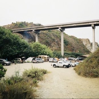
I loved camping here. We rolled in late Wednesday night close to 6pm but the campground hosts were located just past the entry kiosk. Lisa and her husband were able to find us a overflow campsites we had a choose of 2 we chose site #25 because we were worried about the chill from the beach and the noise from the cars on the over head highway 1 bridge. They had wood available for purchase but it was only about 6 slices for $15. We saw other campers with bundles twice that size and they also go for $15 so late arrivals get the scraps. Most of the wooded areas were closed off for rehabilitation. We didn't hike anyways because check out was by noon and we were heading to San Francisco. I would of loved to stay a second day and explored more of the site surroundings. We didn't use the showers because they were quarter operated and we knew we needed to save the quarters for San Francisco parking near fisherman's wharf so I cannot say how cold, wam or hot the water was. Toilets were clean and well kept, only TP but no hand towels or blowdryer. Would definitely say here again


Easy trails with beautiful views! During my visit, there were 3 trails open to the public. All of them can be considered easy-going walks since they under a few miles each. The terrain isn't too steep, but the trail does get interesting at various points where you have to cross creeks by going over thick logs and stones. At the end of the Lime Kiln Trail you'll find 5 large kilns used back in the day to fire up limestone. Be sure to take some time to walk around them and get a good look at the metal/stone structures that are now exposed. It's cool being able to take a look at the architecture and construction. At the end of the Falls Trail is a thin waterfall spouting from the side of a rocky cliff. There's a platformed area where you can trek closer to the falls, but it's difficult to actually get within touching-distance. It's not the grandest of waterfalls, but the creeks trickling down are beautiful (especially in the morning light)! I highly recommend staying at the Limekiln Campgrounds too! Most spots hug the edge of the creek and you're within a few minutes walk to the beach. Lots of squirrels in the area, so be sure to toss any litter or trash into appropriately covered rubbish bins.


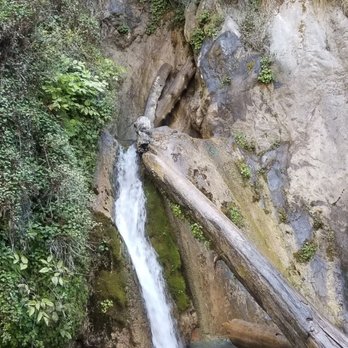
Limekiln is a total Big Sur hidden gem. When searching for hikes in the area, I kept finding that those at celebrated Julia Pfieffer State Park were closed, but (thankfully) somehow stumbled across Limekiln as an alternative means to redwoods. A small sign for the park resides off Highway 1, but it does not appear to be anything special, and we would have never stopped if I had not previously researched the area. After driving down a poorly maintained and quite steep road, you will arrive at the ranger station. Though this is a state park, they do not reciprocate fees paid for day use at their sibling parks (a minor annoyance), but the fee is $10, so no big deal. If you are not camping, they will direct you to drive up a hill and park near the restrooms (there are showers, too!). There is space for less than ten vehicles here, and we seized the last one as we'd arrived early on a Saturday. If it is the weekend and later in the day, you will likely have to park along the highway. We laced up our sneakers, and got to it! To reach the trail, you must walk through the campground, and while the scenery is stunning, the spaces are SO near each other that it held no interest for me as a potential future camping spot. If you don't mind pitching your tent within ten feet of your neighbors then check it out. It is convenient for less adventurous people as you park right at your spot, and again - it's certainly a gorgeous area! Of note, they were completely full (including A YELP CAMPING GROUP! Be still my heart!), so making prior reservations is a must. Shortly after reaching the trailhead, we had the option of the Limekiln or Hare trail, opting for the former. The creek danced along our way, giant redwoods appeared around every corner, and with nearly no elevation gain, it is an easy, but still rewarding hike. About halfway along, the trail forks, and we continued straight on the Limekiln trail to its terminus: the four still standing kilns. Built in the late 1880's, they blazed nearly continuously, purifying lime found in the area, and depleting it's sources within just a few years. Considering they are well over a century old, the kilns are in decent condition, and while a sign warns of the danger should you be tempted to sneak in or climb them, you are otherwise free to get up close and personal. I love historical structures, but as these were of the destructive sort, I reveled in the verdant foliage growing in, on, and over the furnaces, bricks crumbling and giving way to the land where they had caused so much damage, Mother Earth reclaiming what is rightfully hers. We walked back to the junction, this time veering to our left, onto the Falls trail. It is not rugged, exactly, but it involves several creek crossings, none of which offer a bridge, or even a wooden planked path. You must maneuver your way over rocks, tiptoe along trunks, and at one point, even crawl under a felled tree to make your way. This is certainly doable for most skill levels, but care must be taken with kids, and I would not include any truly small children, or those with limited mobility. Otherwise, it is a short hike to your destination, and absolutely worth all those crossings. Limekiln Falls drops an impressive 100 feet, roaring and splashing it's way down. I do a lot of hiking, and have seen waterfalls of greater magnitude, but never been that close to such a large one (with not one other soul around to distract!). It was breathtaking. We spent a little under three hours here, traversing about 5 miles when all was said and done. We could have (and would have liked to) stay longer, but had several impending adventures to embark on, so headed out. As we exited, I realized this awesome little park also has beach access! For fans of nature, Limekiln features all the coastal CA hits, and is an ideal spot to spend a day or weekend.


I'm kind of surprised that, even if there was a non-preferential campsite or a service snafu, anyone would rate this natural wonder anything but 5 stars. There's a reason people wait months and months for campsites here. Limekiln, it's beach and surrounding beauty are a breathtaking slice of semi-isolated stunning coastline. It just goes to highlight the diversity and beauty of our wonderful state. Our stay was amazing in every way. Wee secured two campsites in the quiet back area under the tree canopy, with the kilns and waterfall just a short hike away and the sound of the creek to soothe us to sleep at night. Everything here is so green and lush. If you're lucky enough, you'll find that perfect day where the sun is out too, although I'd definitely plan for cool, overcast weather. The beach is a great spot to play with the kids, view the sunset, or, in our case, see a baby seal sunning in the sand while it waited for its mother. these are the spectacles you can't plan and truly feel lucky to experience. I can relate to anyone camping on the lower half below the bridge who thought they had a less preferential campsite, but then again, that's why you book the more preferential ones. The rangers at the station were very nice for the most part. I saw them having a conflict with a couple people who were parking in day parking when they shouldn't, but that seemed like they were just doing their job.


Absolutely stunning! I stayed there about a week into 40+ day camp across Canada trip that started in Iowa & went to the Grand Canyon & up the Cali coast! I lucked out, didn't have a reservation & snagged the last or 2nd to last campsite they had. It was beautiful, the water was frigid & delightful, the sky was epic at night & my campsite neighbors were very friendly. I doubt I'll be back because Commiefornia & all, but it's a wonderful place to visit if you can forego your rights for a minute


If your up to wild wasps, crazy squirrels and mischievous racoons with some of the best views of the Big Sur coastline then this campground is for you. The most amazing well kept area called Big Sur in itself is worth preserving and respecting. I've been going there for over 30 years and i'm always in awe! Limekiln trails were closed this year and the next but it's a great place for the day or camping. The host is totally cool and accommodating too!

I recommend this camp if you like being able to go in and out of your site, because you'd be pretty close to everything that's super gorgeous in Big Sur. It is a bit on the south side of Big Sur so you'll see all the busy areas you would want to visit and it is only 1 hour from Carmel. For those "peak" times, this place is perfect and we had a good time; the kids liked the "not so busy" beach; the camp area had enough space to play and roam around.


A very obscure, obnoxiously noisy traffic zooming overhead, strangely abnormal, poorly constructed State Park I have visited besides Emma Woods State Park http://www.parks.ca.gov/default.asp?page_id=604 in Ventura! You must reserve your campsite at Limekiln several weeks via www.reserveamerica.com in advance to stay at this campground because the campground is always full. Why? I dunno! It would be safe to assume that Limekiln is an overnight "road warriors' " campground heading towards San Simeon and Morro Bay State Park Campgrounds. Highway 1 is such a l-o-n-g, lonely, stretch of scenic, cliff hanging, hairpin, sharp left, and sharp right turns for miles upon miles, a typical, fatigued driver will find Limekiln as a tranquil resting spot and fougeddaboud driving the rest of the way down! After turning left from Highway 1 heading South entering Limekiln's main road entrance, make a safe, steep, sharp left turn down the steep embankment, paying State Park Ranger Rick at kiosk, you will be given specific instructions to drive up the steep slope to parking lot on right side and park your car. You cannot park your car anywhere else at this State Park Campground because there is nowhere else to park! Next to parking lot are the bathrooms with showers. To the left of the bathroom/showers are the tree/canyon, shady side campsites. It looks like you can drive into the tree/canyon side campsites, but the road appears quite narrow! The river runs to the left of the tree/canyon campsites. Down the hill and towards the ocean are the dumpy, rocky, ocean campsites with a small, dingy bathroom with one dirty shower stall across from the campsites with Highway 1's bridge looming large over the oceanside campsites. The oceanside campsites are specifically for RVs and trailers-I guess . . . You must hike with all your beach crap down the hill from the parking lot in order to get to the beach. Most inconvenient, you find yourself passing through the oceanside campsites and a running river flowing split into two flowing, small streams towards the ocean shoreline. To get to the beach, you begin hopping over the river and two small streams to get to the sandy beach area. Incidentally, the beach is not much of a beach because it is about 150 feet in length. However, I found interesting rocks while playing in the river and two flowing streams, i.e. large jade boulders. I found a rose-colored jade boulder worth thousands of dollars! Please do not stay at Limekiln, not unless you are falling asleep at the wheel! Still, do find yourself a jade boulder to keep while exploring Limekiln. But whatever you do, please make sure the State Park Ranger Rick does not see you taking the jade boulders to your car . . . please carry an empty, heavy-duty backpack when you do go to the beach and put the jade boulders in your backpack. Pee-Esss . . . If you want to gather the true jade vein, please drive down the coast until you get to Jade Cove! Jade Cove is 59 miles SOUTH from Big Sur Campground. Check out these URLs: http://www.norcaljade.com/ http://jrabold.net/bigsur/roadpt1300.htm http://geoffhutchison.net/gallery/bigsur04/BigSur2.jpg.html http://www.shorediving.com/Earth/USA_West/CalM/Jade_Cove/index.htm


23 days ago


2 months ago

I fell I love with this beach many years ago. The drive here is INCREDIBLE! I literally have dreams about driving under the bridge! You go under to get to this secluded beach off of Hwy 1. I had no idea that you could choose between 3 different campsites until I decided I HAD to be under the moonlight at the beach on 2.22.22 at 2:22 pm. And the views are BREATH TAKING from the beach campsite. They were also freezing, windy, and WET in February! And all of the trails were closed when we visited due to the fire, but it was like a little slice of Heaven to disconnect and spend 2 nights off the grid with great folks. The rangers who serve this place are BEYOND friendly, and they do an awesome job of keeping the bathrooms clean. I believe they were cleaned 3 times a day. And the campsites were so self contained, you really had no idea there were up to 29 sites there. Camping on the beach meant you heard the crash of waves all night long. It was so very peaceful! And while the view looked almost warm, there was NOTHING warm about being there in February. But if you had a camper, and the right gear, the rain and wind would be worth it just to burn that image eternally into your mind! I hope I can snag this location during the warmer months. I'm just in love with everything about LimeKiln. read more


Heads up a number of trails are still closed from the fire so it's not possible to access the falls and other trails as in the past. We had site #6 near the beach. The sites are very close to each other. Our first night before our immediate neighbors arrived was amazing - incredible views of the beach/ocean from the campsite and very peaceful. Restrooms including shower were nearby and cleaned every morning. Next night, we were surrounded by big groups on both sides and it felt like a parking lot tent city and it did not seem like car parking restrictions were enforced. The sites are so close we could hear intense snoring on both sides. Neighboring kids would come and smack/kick at our dogs - they were young but still not cool and I was annoyed their parents stood by and watched. We will try Kirk Creek instead next time to get more space. Pros - we loved the incredible access to the beach. Amenities seemed to work well (until inconsiderate folks started to ignore basic human decency like flushing!). Cons - no access to internet (despite it being available but it is locked), some beach sites are very close together, trails closed. read more


Limekiln has a great walking trail. For the most part, it is clean and clear of trash. At times the path has places you need to step over holes and gets quite narrow. Along the way there are ample opportunities to take in the scenery and snap pictures. If you are planning to do the whole trail, make sure to bring water and comfortable shoes. Happy walking Yelpers! IG: @FeedYo_Self read more




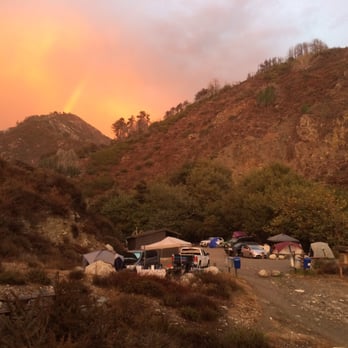
Note this is a review from a pre-COVID visit that I'm finally getting around to. Please keep in mind that the trails are currently CLOSED as of the remainder of 2020 through April 2021 due to fire damage. Make sure to keep an eye on the latest info from the official parks page here: https://www.parks.ca.gov/?page_id=577 I hope the trails will re-open, as it's an awesome hidden gem for those making their way out to Big Sur (plus there's bathrooms if you need a pit stop for your drive). The park itself is big enough to where it should still be a great place to be out in nature while social distancing with family. However, there was very limited parking as others said, and I got lucky with getting the last parking spot. It only took me about 30 minutes to an hour speed walking through the main Limekiln and Falls Trails, including the 10 or so minutes I spent taking a break by the falls. The trails are easy as long as you're comfortable crossing streams and staying on the trail. At the end of the Falls Trail, there is a small amount of scrambling in order to get closer to the base of the falls, but you can still see a good portion of it from afar if you're unable to climb. Nothing crazy like rock climbing, but you'll have to get your footing right to lift yourself up through some rocks and trees to get up close to the falls. There's a small map on the park brochure here (last page): https://www.parks.ca.gov/pages/577/files/LimekilnSPWeb2016.pdf I came in late around 4pm and was trying to make it before the sun went down, but I highly recommend coming in earlier rather than rushing through it all. If you time it right though, you'll be able to see the sunset come through between the trees close to the beginning of the trails and the lighting around the forest becomes pretty surreal (you can see my picture of the sunset). read more


Limekiln Beach state park is Big Sur's hidden gem - green, cool, historic, and most of all, an excellent place to take young families for a hike. This park is about an hour south of Monterey and the drive along route 1 to get there is iconic, gorgeous, and finally open after the landslides of a couple of years ago. We left the east bay around 5:30 am and arrived around 9 am, after stopping by for breakfast at the Big Sur bakery about 25 miles away (separate review to follow). Parking and entrance fee was $10 and the small lot was only half full. We parked and set off right away on the first of three trails - the Hare Creek Trail. Hare Creek was the easiest and shortest trail, with only one log crossing, right towards the end. We had the most fun here because the experience was so new, with lots of stops to touch the water, chase squirrels, and examine the flora - flowering clover, mossy logs, poison oak, ferns, and so on. Then we headed back to the parking lot for a bathroom break and snacks. Refreshed, we decided to tackle the second and third trails. The Lime Kiln trail was first - this leads to four limekiln furnaces from which the park derives its name. This is another easy trail, but the final destination was a little boring for the kids. While my wife and I enjoyed checking out the massive furnaces and learning about the history of why they're here in the middle of the coastal redwood forest, the kids were soon ready to head back downhill to "see the waterfall!" The third and final trail - the Waterfall trail - was easily the most treacherous of the three trails, with several stream crossings over slippery rocks and wobbly logs! I dare you to navigate this without getting your feet wet!! As expected, the kids had a blast, my wife and I less so. But the gorgeous waterfall - cascading over a sheer limestone cliff - made the journey worthwhile. Afterwards, we took another break and then headed to the beach, which is just minutes away. We spent a couple of hours here playing on the waters edge (it is too dangerous to swim), making sand castles, and spotting mermaids and dolphins! It was a lovely way to end a glorious day at Limekiln Beach state park, Big Sur's hidden gem. read more




5 years ago
I loved camping here. We rolled in late Wednesday night close to 6pm but the campground hosts were located just past the entry kiosk. Lisa and her husband were able to find us a overflow campsites we had a choose of 2 we chose site #25 because we were worried about the chill from the beach and the noise from the cars on the over head highway 1 bridge. They had wood available for purchase but it was only about 6 slices for $15. We saw other campers with bundles twice that size and they also go for $15 so late arrivals get the scraps. Most of the wooded areas were closed off for rehabilitation. We didn't hike anyways because check out was by noon and we were heading to San Francisco. I would of loved to stay a second day and explored more of the site surroundings. We didn't use the showers because they were quarter operated and we knew we needed to save the quarters for San Francisco parking near fisherman's wharf so I cannot say how cold, wam or hot the water was. Toilets were clean and well kept, only TP but no hand towels or blowdryer. Would definitely say here again read more



8 years ago
Easy trails with beautiful views! During my visit, there were 3 trails open to the public. All of them can be considered easy-going walks since they under a few miles each. The terrain isn't too steep, but the trail does get interesting at various points where you have to cross creeks by going over thick logs and stones. At the end of the Lime Kiln Trail you'll find 5 large kilns used back in the day to fire up limestone. Be sure to take some time to walk around them and get a good look at the metal/stone structures that are now exposed. It's cool being able to take a look at the architecture and construction. At the end of the Falls Trail is a thin waterfall spouting from the side of a rocky cliff. There's a platformed area where you can trek closer to the falls, but it's difficult to actually get within touching-distance. It's not the grandest of waterfalls, but the creeks trickling down are beautiful (especially in the morning light)! I highly recommend staying at the Limekiln Campgrounds too! Most spots hug the edge of the creek and you're within a few minutes walk to the beach. Lots of squirrels in the area, so be sure to toss any litter or trash into appropriately covered rubbish bins. read more


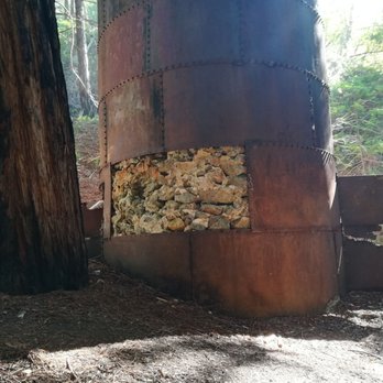


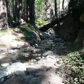

Limekiln is a total Big Sur hidden gem. When searching for hikes in the area, I kept finding that those at celebrated Julia Pfieffer State Park were closed, but (thankfully) somehow stumbled across Limekiln as an alternative means to redwoods. A small sign for the park resides off Highway 1, but it does not appear to be anything special, and we would have never stopped if I had not previously researched the area. After driving down a poorly maintained and quite steep road, you will arrive at the ranger station. Though this is a state park, they do not reciprocate fees paid for day use at their sibling parks (a minor annoyance), but the fee is $10, so no big deal. If you are not camping, they will direct you to drive up a hill and park near the restrooms (there are showers, too!). There is space for less than ten vehicles here, and we seized the last one as we'd arrived early on a Saturday. If it is the weekend and later in the day, you will likely have to park along the highway. We laced up our sneakers, and got to it! To reach the trail, you must walk through the campground, and while the scenery is stunning, the spaces are SO near each other that it held no interest for me as a potential future camping spot. If you don't mind pitching your tent within ten feet of your neighbors then check it out. It is convenient for less adventurous people as you park right at your spot, and again - it's certainly a gorgeous area! Of note, they were completely full (including A YELP CAMPING GROUP! Be still my heart!), so making prior reservations is a must. Shortly after reaching the trailhead, we had the option of the Limekiln or Hare trail, opting for the former. The creek danced along our way, giant redwoods appeared around every corner, and with nearly no elevation gain, it is an easy, but still rewarding hike. About halfway along, the trail forks, and we continued straight on the Limekiln trail to its terminus: the four still standing kilns. Built in the late 1880's, they blazed nearly continuously, purifying lime found in the area, and depleting it's sources within just a few years. Considering they are well over a century old, the kilns are in decent condition, and while a sign warns of the danger should you be tempted to sneak in or climb them, you are otherwise free to get up close and personal. I love historical structures, but as these were of the destructive sort, I reveled in the verdant foliage growing in, on, and over the furnaces, bricks crumbling and giving way to the land where they had caused so much damage, Mother Earth reclaiming what is rightfully hers. We walked back to the junction, this time veering to our left, onto the Falls trail. It is not rugged, exactly, but it involves several creek crossings, none of which offer a bridge, or even a wooden planked path. You must maneuver your way over rocks, tiptoe along trunks, and at one point, even crawl under a felled tree to make your way. This is certainly doable for most skill levels, but care must be taken with kids, and I would not include any truly small children, or those with limited mobility. Otherwise, it is a short hike to your destination, and absolutely worth all those crossings. Limekiln Falls drops an impressive 100 feet, roaring and splashing it's way down. I do a lot of hiking, and have seen waterfalls of greater magnitude, but never been that close to such a large one (with not one other soul around to distract!). It was breathtaking. We spent a little under three hours here, traversing about 5 miles when all was said and done. We could have (and would have liked to) stay longer, but had several impending adventures to embark on, so headed out. As we exited, I realized this awesome little park also has beach access! For fans of nature, Limekiln features all the coastal CA hits, and is an ideal spot to spend a day or weekend. read more


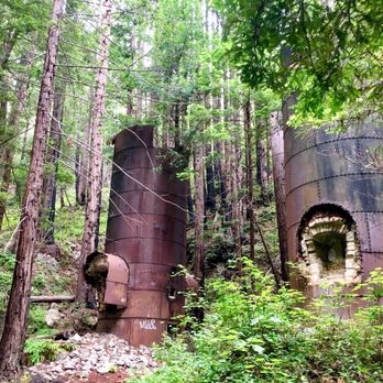


I'm kind of surprised that, even if there was a non-preferential campsite or a service snafu, anyone would rate this natural wonder anything but 5 stars. There's a reason people wait months and months for campsites here. Limekiln, it's beach and surrounding beauty are a breathtaking slice of semi-isolated stunning coastline. It just goes to highlight the diversity and beauty of our wonderful state. Our stay was amazing in every way. Wee secured two campsites in the quiet back area under the tree canopy, with the kilns and waterfall just a short hike away and the sound of the creek to soothe us to sleep at night. Everything here is so green and lush. If you're lucky enough, you'll find that perfect day where the sun is out too, although I'd definitely plan for cool, overcast weather. The beach is a great spot to play with the kids, view the sunset, or, in our case, see a baby seal sunning in the sand while it waited for its mother. these are the spectacles you can't plan and truly feel lucky to experience. I can relate to anyone camping on the lower half below the bridge who thought they had a less preferential campsite, but then again, that's why you book the more preferential ones. The rangers at the station were very nice for the most part. I saw them having a conflict with a couple people who were parking in day parking when they shouldn't, but that seemed like they were just doing their job. read more


Absolutely stunning! I stayed there about a week into 40+ day camp across Canada trip that started in Iowa & went to the Grand Canyon & up the Cali coast! I lucked out, didn't have a reservation & snagged the last or 2nd to last campsite they had. It was beautiful, the water was frigid & delightful, the sky was epic at night & my campsite neighbors were very friendly. I doubt I'll be back because Commiefornia & all, but it's a wonderful place to visit if you can forego your rights for a minute read more




4 years ago
If your up to wild wasps, crazy squirrels and mischievous racoons with some of the best views of the Big Sur coastline then this campground is for you. The most amazing well kept area called Big Sur in itself is worth preserving and respecting. I've been going there for over 30 years and i'm always in awe! Limekiln trails were closed this year and the next but it's a great place for the day or camping. The host is totally cool and accommodating too! read more


5 years ago
I recommend this camp if you like being able to go in and out of your site, because you'd be pretty close to everything that's super gorgeous in Big Sur. It is a bit on the south side of Big Sur so you'll see all the busy areas you would want to visit and it is only 1 hour from Carmel. For those "peak" times, this place is perfect and we had a good time; the kids liked the "not so busy" beach; the camp area had enough space to play and roam around. read more





19 years ago
A very obscure, obnoxiously noisy traffic zooming overhead, strangely abnormal, poorly constructed State Park I have visited besides Emma Woods State Park http://www.parks.ca.gov/default.asp?page_id=604 in Ventura! You must reserve your campsite at Limekiln several weeks via www.reserveamerica.com in advance to stay at this campground because the campground is always full. Why? I dunno! It would be safe to assume that Limekiln is an overnight "road warriors' " campground heading towards San Simeon and Morro Bay State Park Campgrounds. Highway 1 is such a l-o-n-g, lonely, stretch of scenic, cliff hanging, hairpin, sharp left, and sharp right turns for miles upon miles, a typical, fatigued driver will find Limekiln as a tranquil resting spot and fougeddaboud driving the rest of the way down! After turning left from Highway 1 heading South entering Limekiln's main road entrance, make a safe, steep, sharp left turn down the steep embankment, paying State Park Ranger Rick at kiosk, you will be given specific instructions to drive up the steep slope to parking lot on right side and park your car. You cannot park your car anywhere else at this State Park Campground because there is nowhere else to park! Next to parking lot are the bathrooms with showers. To the left of the bathroom/showers are the tree/canyon, shady side campsites. It looks like you can drive into the tree/canyon side campsites, but the road appears quite narrow! The river runs to the left of the tree/canyon campsites. Down the hill and towards the ocean are the dumpy, rocky, ocean campsites with a small, dingy bathroom with one dirty shower stall across from the campsites with Highway 1's bridge looming large over the oceanside campsites. The oceanside campsites are specifically for RVs and trailers-I guess . . . You must hike with all your beach crap down the hill from the parking lot in order to get to the beach. Most inconvenient, you find yourself passing through the oceanside campsites and a running river flowing split into two flowing, small streams towards the ocean shoreline. To get to the beach, you begin hopping over the river and two small streams to get to the sandy beach area. Incidentally, the beach is not much of a beach because it is about 150 feet in length. However, I found interesting rocks while playing in the river and two flowing streams, i.e. large jade boulders. I found a rose-colored jade boulder worth thousands of dollars! Please do not stay at Limekiln, not unless you are falling asleep at the wheel! Still, do find yourself a jade boulder to keep while exploring Limekiln. But whatever you do, please make sure the State Park Ranger Rick does not see you taking the jade boulders to your car . . . please carry an empty, heavy-duty backpack when you do go to the beach and put the jade boulders in your backpack. Pee-Esss . . . If you want to gather the true jade vein, please drive down the coast until you get to Jade Cove! Jade Cove is 59 miles SOUTH from Big Sur Campground. Check out these URLs: http://www.norcaljade.com/ http://jrabold.net/bigsur/roadpt1300.htm http://geoffhutchison.net/gallery/bigsur04/BigSur2.jpg.html http://www.shorediving.com/Earth/USA_West/CalM/Jade_Cove/index.htm read more


Great spot to Camp! You see baby deer, and feel so connected to nature. Everyone there is so helpful and friendly as well. I had a great first experience. One thing I love about this campsite is that you are right by a creek and it's super peaceful to fall asleep to the peaceful sounds of natural running water. Bathrooms have no soap so bring sanitizer. There's a small beach that you have access to as well which was beautiful! Best to go in the morning to eat breakfast -- there's also picnic tables as well. There's also a cute little bridge you can look at the little creek from. It runs directly into the ocean as well which is so beautiful. I've posted some views on that are close as well on the drive up to the campground. It's $43 a night! Make sure to reserve in advance. read more


6 years ago
This is during COVID. This is one of my favorite places on Earth. Its so untouched and charming. And to TBH it was nice to have limits on how many people can come in...it felt like my husband and I had the park to ourselves! Its an easy walk and you're going through a path tucked in with redwoods and ferns. We never did reach the waterfall, mainly because we couldn't find it but thats okay because the trail itself was enough to be mesmerized by. Its so gorgeous and I can't wait to camp here. There is $10 entry fee, very small parking lot. I almost want to say its like 12 to 15 spaces only. So timing and luck has alot to do with it. Closes at 5pm. How has COVID affected the trails pace? Space is limited however esp during COVID. You cannot walk in and you cannot park outside the park. Must wear a mask. Open bathrooms. If you are asked to return due to space, drive down the road to Lucia Lodge for a drink with a view. Read my review on that as well! read more


6 years ago

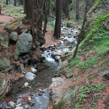
BOO YAH, BIG SUR IS OFFICIALLY BACK IN BUSINESS BABY!!! A week ago, I probably would not have uttered such an exclamation. To be honest, I never really thought much about exploring Big Sur. Sure, I found it to be quite beautiful when I drove by last year on the way to Berkeley. But, back then I wouldn't have considered it a place you HAD TO visit before dying. That all changed last weekend when I decided to take my girlfriend to Big Sur for the first time since the area had finally reopened after months of construction. OMGEE I have never been so wrong in my life. Big Sur - from the gorgeous coastline views of the ocean to the windy and rewarding trails of its massive state parks - actually offers one of THE BEST escapes for people living in the Bay Area. If you had just one day and only one day to visit Big Sur, you HAVE to visit Limekiln Beach State Park! My girlfriend and I took a chance with this park because it was listed as one of the must-do activities in Big Sur (https://www.tripadvisor.com/Attractions-g240329-Activities-Big_Sur_California.html). Even though it was further down south, Limekiln was HANDS DOWN BAR NONE probably the best part of our trip. Here's why I think it needs to be on everyone's radar: -- GORGEOUS SCENERY -- Breathtaking, jaw-dropping, and serene. These were just a few words out of hundreds that described the emotions running through our heads as we traversed through Limekiln. Immediately as you step foot into the park, you will be greeted by a massive forest of trees. Green and everlasting, they will envelope you in tranquility and purity - far away from all the stresses of life (cough Trump). Venture further inwards and you'll encounter the beautiful Limekiln Creek; thanks to unrelenting rainstorms, the creek is flowing endlessly with pristine water. Definitely take a pause and glance at your reflection in the creek; it's that clear! Follow the Creek Falls Trail and you will end up at one of the TALLEST and most AWE-INSPIRING waterfalls near the Bay Area. SO MAJESTIC. Or, go on the Lime Kiln Trail and explore the mystifying limestone structures. -- ADVENTUROUS, YET ACCESSIBLE TERRAIN -- Usually, amazing hikes require a strenuous amount of effort before one can truly look back to enjoy the experience. NOPE, you won't need to do that here because Limekiln's trails are very short (around 1-2 miles roundtrip at most), fairly well-paved, and there's markers everywhere. But even though the trails are easy, you won't be shortchanged; the trails are diverse and each one will take you through both brush and water. Tread slowly or you'll take a dip! -- OPEN TRAILS -- One of the biggest reasons why you should visit Limekiln is that all of the trails here - well there's only like 3 - are open (https://www.parks.ca.gov/?page_id=570). In contrast, many of the ones in other Big Sur state parks are closed due to unsafe hiking conditions (e.g. Ewoldsen Trail at Julia Pfeiffer Burns State Park). -- FRIENDLY STAFF + LARGE CAMPSITE -- Two other major plusses about this park are that 1. The staffers are SUPER APPROACHABLE and ready to answer any of your questions, and 2. This is a really great place to camp because the site is both huge and open. When driving here, note that Limekiln is about 2.5-3 hours from South Bay Area and 1 hour south of Bixby Creek Bridge. You shouldn't have too much trouble spotting the park even without GPS as there's a clear sign along Highway 1 that directs you when to turn. You'll know that you've gone too far if you start seeing lots of signs for Gorda. Entrance fee is $10 and it DOES NOT grant you access to other state parks. Totally worth it though! Even though Limekiln Beach State Park doesn't provide the awe-inspiring views of the coast you'd expect from Big Sur, this park has something just as good: Amazing trails + 10/10 waterfall. I'm so glad Big Sur reopened because I otherwise wouldn't have experienced this gem with my girlfriend. If you're looking for a life-changing experience in the outdoors, Limekiln is truly one for the ages. This park is definitely worth an "Omg, I'd drive two no FOUR HOURS for this" rating. This is it...the real deal - the place you have to visit before you die. Have fun and prosper, read more



7 years ago
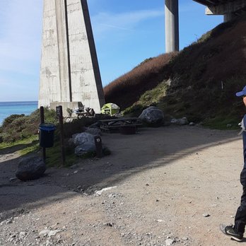
We stayed at this Campground during Valentine's Day weekend/Presidents Day. Our reservations were for campsite #21, the best site according to the host who checked us in. But there is a few other sites that I would want to try next time that are closer to the bathroom as this one is pretty far especially on cold days or even rainy days; I can't imagine making that trek in a cold muddy day. Sites 13-16 are next to the creek and ideal for a large group if you can book them together; otherwise they're pretty close to one other. This section is separate from 17-29 loop. Site #29 is the closest to the bathroom but it has an odd layout with the tent pad being on top of the hill ~10 yards from your fire ring. If the layout doesn't bother you this would be a great site. This the current campers also mentioned that it would be tough to fit 2nd or 3rd tent in the pad but if they were backpacking tents it would be no problem. Cons: not next to the creek but you can still hear it. read more



4 years ago

8 years ago
We just finished our second camping trip to Limekiln and loved it. While it is small it is very enjoyable and offers amazing hiking, its own creek and waterfall, a nice campground and its own beach. Not a lot of cars driving around. Large bathrooms with showers. Proximity to some of the nicest coast in all of California. There are 30 or so sites and it cannot accommodate large RVs which is a plus for sure. Book in advance as it gets full in the summer. A great alternative to the larger more chaotic BiG Sur camping areas. read more


Best short hikes in the area - worth the drive all the way down the coast to take them. You get to see redwoods, a gorgeous creek, a 100 foot waterfall, an ocean view, and then a cove beach. Oh yeah and there are the lime kilns that are weird. Would love to camp there one day! read more


11 years ago
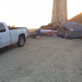
CAMPERS BEWARE!! CAMPERS BEWARE!! I've camped all over the country and this is the WORST CAMPGROUND IN AMERICA. I had the great misfortune of staying in the ocean front "campground." I use quotes because this is not a campground. This is a parking lot under a bridge, with some trees on the periphery, where each "campsite" is feet away from the other separated by some boulders, nothing else. Our table was 5 feet from our neighbors, meaning I could hear every word they said and see everything they did. I sat with my back to them, staring at a ditch, the only "nature" around, trying to block them out of my mind. We were so close when I had to borrow his lighter he just leaned over and gave it to me. At night, I heard him putting his kids away then snoring. It was the same scene on the other side of our campsite, but fortunately I was able to put my car in between them as a barrier. That helped visually, but I could still hear every word. The ground is a gravel parking lot. 50 feet away is the restroom. There are 10-15 sites and they are all like this, essentially on the rim of a huge parking lot. We decided we could not call this camping. This was akin to tailgating overnight or just parking. The campsites in the redwood forest section are designed the exact same way. The forest is beautiful but they are all side by side, just feet apart. With the exception of one campsite, you are not isolated or have any privacy or quiet. The trail to the limekilns looked beautiful, and probably where all the 5 stars come from, but it was closed for repair. We cancelled our second night and stayed at the Big Sur State Park campground which was beautiful and what we hoped for. Here are some pictures, which are worth 1000 words. read more


9 years ago
Great camping experience. You just can't beat this location! Campsites are close together and the ground was rocky (made it challenging to stake our tent) but loved that we were right on a clear water creek (site 16). The trails in the park are well maintained and were great for a nice morning walk. Unfortunately, the trails are not dog friendly (but we didn't encounter anyone else on our morning hike!) Camp hosts were friendly. Would definitely go back! read more

7 years ago
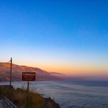
So beautiful and peaceful. Who knew you could cross the street and have the ocean and forest so close by. Amazingly beautiful, so refreshing to see untouched nature. read more


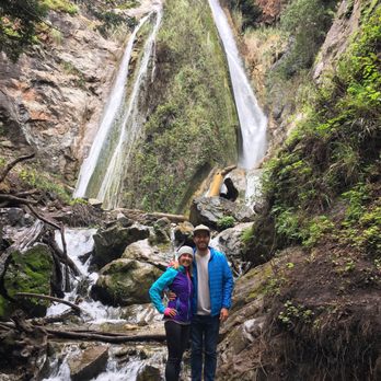
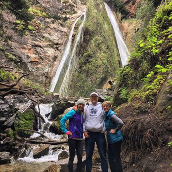
The last time the hubby and I were in Big Sur we had stayed a couple nights at the campground and really enjoyed hiking around on the trails so took my parents. The daily fee was $10, but it was well worth it in our opinion. The weather was your typical misty, rainy, somewhat chilly day, but the tree canopy gave us some shelter from the storm. We hiked to the kilns and on the way we went to the falls. I was sure my parents would not want to trek to see the waterfalls because there were quite a few river crossings, but they ROCKED it (Ryan and my dad made a railing out of a long stick for my mom to hold onto when she crossed on stones and logs)! read more



9 years ago
Had a wonderful camping trip here. Did a couple of hikes. The limekiln waterfall hike is a must do. This possibly has been my favourite camping trip so far. Hot water in the loos!! read more


7 years ago
I loved camping here right next to the beach. Both the waterfall trail and Old Limekiln trails are great hikes, with the waterfall hike being a little more dangerous due to makeshift log bridges over the water, just remain vigilant and careful and you'll get through just fine. Only problem is the place is overrun with squirrels, so keep the food stored away. What are you gunna do though, squirrels gotta eat too read more




This is a great location to go camping during the summer. We visited in late August and we couldn't have asked for better weather. The hiking trails are beautiful. The go through the woods so there's plenty of shade from the trees. It's a very comfortable walk that can be done fairly easily by young children and even more elderly hikers. There only three trails in the park. One leads to the lime kilns and another leads to a small waterfall. The trails are really short; you can hike all of them in 2-3 hours. We had a beachside campsite, so we always had a great view of the ocean. It got pretty windy in the afternoon but calmed down at night. My biggest problem with the campsite was that the ground was too hard to nail down our tents. We had to grab rocks to weigh down the corners of our tent. The facilities of the campsites are good too. The restrooms were pretty clean and had plenty of toilet paper. There are showers that cost a quarter for 2 minutes. One thing I loved about Limekiln was the super friendly park rangers. We had a huge group and the checkin lady was really helpful about finding us campsites close together. She also regularly checked up on us to see how things were going. I definitely recommend this campsite if you're looking to visit the Big Sur area! read more


5 years ago

We stayed here for 4 days recently on a beach campsite. We had spot #4. This spot was amazing, semi private just because it is up against a cliff on one side, and it has an amazing view of the ocean. We checked out spots 1 & 2, and they looked large, but had very little to no shade. The other beach spots seemed crammed together, right on top if each other. (We walked past the Redwood sites on the way to trails, but I didn't really check them out... However #24 looked great). The host here are great! Very personal & friendly. They always helped out with trail and weather info. Wood bundles are $8, sold at the host station. The beach is rocky and not very swimmable...we went to Sand Dollar Beach for that. They have the normal quiet hours as most parks, but it seemed alot if the campers near us were alseep not long after sundown. The sunsets are amazing here. The waves crashing on the rocks can be very loud! You might need earplugs if your not accustomed to this. Make sure you have everything you need for here, any stores are far away and pricey. (Lucia is 2 miles, but not well stocked) Overall an amazing campsite!! read more



12 years ago
Perfect hike even during rainy day. Trees cover the trails so we stayed pretty dry. The waterfall was beautiful! Great 45-60 minute moderate hike. A little muddy so don't wear your favorite running shoes! read more


10 years ago
Limekiln Camprground could make non-campers, campers!! I am not a huge fan of camping. However, my kids wanted to go camping for their Spring Break so we reserved a spot at Limekiln State Park campground and let me tell you, I LOVED IT. We had the CreekSide campsites and it was amazing falling asleep to the rushing sound of the creek, which thank to recent rains sounded and looked more like a river. The campground is very clean and well kept. The hiking trails are amazingly beautiful. You feel like you stepped into a forest in LOTR or something. The campground host (Debbie) was super friendly, informative, helpful and so nice. The bathrooms were super clean and never low on TP. Showers were hot ($1.00 for 8 minutes), clean and ample room to change. I would highly recommend this campground to anyone. However, if you are in a camper/trailer, etc. you are confined to only the beach spots, which is not nearly as nice & beautiful as the creek campsites. So get that tent out and enjoy!! read more


This is a great trail, especially for children (we brought our kids, 1 and 4) and non-outdoorsy-people. It's shaded, has several streams running through it, and you can get to the lime kilns and waterfall quickly. We spent several hours here (slowly) hiking around, surrounded by tall trees and lots of greenery; it was peaceful and beautiful. We ate our sandwiches on the way back down from seeing the waterfall. There's a little bit of elevation and a few stream crossings, but it's all easy - our 4 year old made it through nearly unscathed, only ended up with some wet shoes. read more


11 years ago
Enter the state park right off of highway 1. Parking gets filled up fast, so you can park off of the side of the highway, but be careful of signs that have parking restrictions. You're able to camp on the beach or within the forest. I did not camp at Limkiln, but I know that the campgrounds on the beach are extremely close to each other. Reservation costs money online, so make a phone call to the station instead. There are showers in the restrooms, but you need to bring quarters to pay for them. The restrooms are very clean. I hiked to the Limekiln Falls, which was an easy 15 minute hike. Trails are well-maintained and labelled. There are planks set across river crossings, making it easy to cross. The falls are HUGE! (100ft.) and flowing. During the winter, the falls are huge. There are many fallen redwood trees, making for great photographs. I was unable to see the limekilns, but will be coming back to this state park to camp by the beach and explore another side of Big Sur. read more

Page 1 of 4
More info about Limekiln State Park
63025 Hwy 1
Big Sur, CA 93920
Directions
(805) 434-1996
Call Now
Visit Website
https://www.parks.ca.gov/?page_id=577
Hours
Outdoor Amenities
Other Amenities

Ask the Community - Limekiln State Park
Is it possible to obtain a campsite limekiln as a walk-in? Trying to figure out what my odds are to find a site mid-week for one night during off season.
Yes, they have several overflow sites including one without a table and firepit. It is nice and near the creek. Also several other campgrounds just down the road that should have availability such as Kirk Creek and another just outside of Sand…
Does anyone knows if there is any electrical outlet to charge my portable power generator anywhere in the park? Thank you.
No, there are no outlets.
If we live in san jose ca. what is the best route to get there because the road is closed?
Unless another part of Route one has closed since we were there in October, you can access Lime Kiln by going Route One South (the road closes about 10 miles south of Lime Kiln).
Is site 5 loud as it's right next to the highway?
Sites 4-10 are actually below the highway. While you do hear some traffic noise (greatly reduced due to Highway one closure about 10 miles south), the benefit of being so close to the ocean (and hearing this "noise") greatly outweighs any road noise…
Are there grills at th campsite for cooking?
There are fire rings with a small grill section that can be used for limited cooking.
Review Highlights - Limekiln State Park















Why does Yelp recommend reviews?


Limekiln State Park - campgrounds - Updated September 2026
Best of Big Sur
Browse Nearby
BEST of Big Sur, California Hiking near Limekiln State Park
BEST of Big Sur, California Restaurants near Limekiln State Park
BEST of Big Sur, California Hotels near Limekiln State Park
BEST of Big Sur, California Things to Do near Limekiln State Park
BEST of Big Sur, California Lodging near Limekiln State Park
BEST of Big Sur, California Coffee near Limekiln State Park
BEST of Big Sur, California Attractions near Limekiln State Park


