Cancel

    Open app

    Search

    Sykes Hot Springs

    5.0 (1 review)

    Sykes Hot Springs Photos

    You might also consider

    Recommended Reviews - Sykes Hot Springs

    Your trust is our priority, so businesses can't pay to alter or remove their reviews. Learn more about reviews.
    Yelp app icon
    Browse more easily on the app
    Review Feed Illustration

    2 years ago

    Helpful 4
    Thanks 4
    Love this 6
    Oh no 1

    You might also consider

    Verify this business for free

    People searched for Campgrounds 1,136 times last month within 15 miles of this business.

    Verify this business

    Pfeiffer Big Sur State Park

    Pfeiffer Big Sur State Park

    4.4(411 reviews)
    1.3 mi

    One of our favorite SP throughout CA - beautiful location along the Monterey coast, tucked away in…read morethe redwoods, with a beautiful and well-designed campground with plenty of sites near the river as well as away from civilization. Campsites are notoriously difficult to obtain due to popularity and bad-actors utilizing bots to book sites, but if you're lucky enough to get a reservation, spending a few days in the wilderness here is as good as it gets. Bathrooms are clean and showers are hot (coin operated). Day use parking is small, but there is plenty of room on the river for your family to post up, have something to eat/drink, and stay cool in the hot summer weather. Best recommendation.

    Great Stop in Big Sur -- Beautiful Trails, Swimming Spots, & Scenic Views!…read moreThe drive along CA-1 to get here is reason enough to visit--absolutely stunning coastal views the entire way! Pfeiffer Big Sur State Park itself has a lot to offer. There are tons of trails to explore, though keep in mind that there isn't a whole lot of signage. The good news is that if you start from a central area, most paths naturally end up bringing you around in a loop at some point, so it's pretty easy to find your way back. A few takeaways from our visit: Water & Swimming: There are plenty of great spots along the rocks to dip in and swim, which is perfect on a warm day. Accommodations: Great setup whether you like roughing it or prefer comfort. Plenty of campsite options, plus the Lodge if you'd rather stay in a room. Pfeiffer Falls Trail: Honestly, this hike was pretty underwhelming. The falls were down to just a trickle when we went, but at least it was a decent walk to log some good steps! Overall, it's a lovely park with plenty to do. Just keep your expectations low for the waterfall if it hasn't rained recently, and enjoy the river, trees, and incredible coastal drive!

    Photos
    Pfeiffer Big Sur State Park - Family Camping September 12-14, 2025

    Family Camping September 12-14, 2025

    Pfeiffer Big Sur State Park - Family Camping September 12-14, 2025

    Family Camping September 12-14, 2025

    Pfeiffer Big Sur State Park - Family Camping September 12-14, 2025  THE JOY LUCK CLUB

    See all

    Family Camping September 12-14, 2025 THE JOY LUCK CLUB

    McWay Falls - Tunnel that takes you underneath the highway to McWay Falls

    McWay Falls

    4.6(192 reviews)
    10.3 mi

    McWay Falls is one of the most iconic and photographed landmarks along the Big Sur coast, famous…read morefor its ethereal, postcard-perfect scenery. Located within Julia Pfeiffer Burns State Park, it is one of the few waterfalls in California that empties directly into the ocean. Unique Tide Falls: The stunning 80-foot waterfall flows year-round from McWay Creek, dropping over a jagged granite cliff directly onto the pristine sands of a picturesque, turquoise cove, or into the waves at high tide. Effortless Viewpoint Trail: The falls are reached via an exceptionally short and accessible 0.5-mile round-trip trail, making it a quick and highly rewarding stop right off Highway 1. This trail was unfortunately closed during my visit, but we could still see the falls

    Located within the Julia Pfeffer Burns State Park, the McWays Falls (named after an early settler…read moreof Big Sur) Vista Point was the fourteenth (09:53) and furthest south stop of our southbound scenic car tour through Big Sur. The trail down to get a close up view of the falls continues to be closed (there is no estimated reopen date). However there is a vista point off the highway that you can walk to (need to hop over a railing) from a safer parking spot, that provides a clear aerial view of the waterfall (one of the few in the world that dumps directly into the ocean...learned that those are called a tidefalls [another one in California is Alamere Falls near SF]).

    Photos
    McWay Falls - Parking is $10 at the trailhead across the highway

    Parking is $10 at the trailhead across the highway

    McWay Falls
    McWay Falls

    See all

    Pfeiffer Beach - Outhouses

    Pfeiffer Beach

    4.5(344 reviews)
    2.0 mi

    The most famous beach with purple sand, Pfeiffer Beach is located in BIg Sur, requiring a 2 mile…read moredrive down a one-lane road to reach. It also costs $15 to park here. Our family thought it was worth it. Pfeiffer Beach was our eighth and longest stop during our southbound journey on the Cabrillo highway through Big Sur. Access is through Sycamore Canyon Road (one lane) which is extremely easy to miss from the highway. It is a one lane road but has many areas where one can turn off to let oncoming cars pass, though I can imagine when it gets busy how much more difficult it would become. We had left Carmel early in the morning, so it was about 07:48 when we reached the bottom. As we drove down, my wife noticed a lone, empty chair about halfway down. Later we realized that that is where a ranger would sit to tell cars to go back up, once the limited parking lot near the beach got full. The car entrance had yet to be manned, so we paid per vehicle fee via cash in an envelope deposited in a fee drop box. The tear off stub is then displayed on your dash. Later when we were leaving, there were employees manning the area, accepting payment, with credit cards being accepted. The parking is administered by a private company so our America the Beautiful National Park pass did not work here. We were the 2nd car in the lot. There are angled handicap spots, motorcycle parking, and bathrooms (outhouse style) in the parking area. There is definitely more beach space than there are parking spots, so if you are able to get to the beach, one can easily find a secluded spot. Though as the no refund sign warned, there is high winds and blowing sand on the beach so not the best place for a warm, sunny beach day. There are streaks of purple sand along the beach (learned that the purple is caused by garnet powder that washes down from surrounding areas). It made the white sand look like it had dirt spots. I did have time to walk to both ends of the beach, and discovered that at the north end, there are pockets of sand further away from the ocean where the garnet sand is a lot more prevalent. The beach is named after the pioneer, Michael Pfeiffer. Many other places in the area (Pfeiffer Big Sur State Park, Julia Pfeiffer Burns State Park) are named after his descendants. The beach is for day use only, and is open from sunrise to sunset. What's interesting about this is how many reviews are on Yelp for this beach, even though there was no cell service when we went. It clearly shows a lot of Yelpers are coming to this beach, and taking the effort to write about it once they get back to an area that has internet. But there are no reviews for any of the vista points in the surrounding areas. Maybe they aren't being approved by Yelp to be searchable?
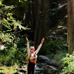
    super windy (our hat flew off!).. and curiously purple patterned sand. This beach is a must see in…read morethe Big Sur exploration. Pfeiffer Beach is one of the most famous and visually striking beaches in Big Sur, known for its dramatic rock formations and unique landscape. Here is a summary of what makes it special: Key Highlights The Purple Sand: The beach is globally famous for patches of violet and deep purple sand. This unusual coloring comes from manganese garnet washed down from the surrounding hillsides after it rains. Keyhole Rock: This massive, iconic rock formation sits just off the shore. It features a natural archway carved out by the ocean. During sunset, the evening light beams directly through the "keyhole," creating a spectacular glow that attracts photographers from all over. Rugged Scenery: Surrounded by towering cliffs and sea stacks, the beach offers a raw, wild, and incredibly photogenic slice of the California coast. What to Know Before You Go The Road Down: The beach is located down Sycamore Canyon Road, which is a narrow, winding, one-lane road with sharp turns. It is not recommended for RVs or large trailers. Hidden Entrance: The turnoff from Highway 1 is unmarked and easy to miss--it is located just south of the Big Sur Ranger Station. Parking & Fees: There is a standard vehicle day-use fee. Because it is highly popular and the parking lot is quite small, it can fill up quickly on weekends and nice days. If the lot is full, staff will turn vehicles away at the highway, so arriving early or late in the afternoon is ideal. Conditions: It is notoriously windy, so packing a jacket is wise. The water features incredibly strong rip currents and hidden rocks, making it great for beachcombing and photography, but unsafe for swimming.

    Photos
    Pfeiffer Beach - Velella velella

    Velella velella

    Pfeiffer Beach
    Pfeiffer Beach

    See all

    Partington Cove - You can get to this part of the mountain and see an uninterrupted view of the ocean

    Partington Cove

    4.8(54 reviews)
    23.8 mi

    Our twelfth stop (09:42) on the Cabrillo Highway on our southbound trip through Big Sur, this dirt…read moreturn off provides unmarked parking to get clear views of the Partington Cove trail that will take you down to see the cove. We couldn't take the hike down but there were already cars parked on the side of the road to allow easy entry onto the trailhead. No cell reception in this area.

    We came here 10 years ago and it was a hidden gem at the time, we drove by around 8:30am on the way…read moreto McWay Falls and there were already 2 cars there so I knew it was no longer a secret. This is by far one of our favorite Big Sur spots. The entire beginning of the hike is all downhill so you'll have an easy time going down and be panting on the way back up, you'll see it in other people's faces as you are going down. At the very bottom split I would take the time to go both directions, if you take the bridge it'll lead to a view of the ocean that narrows and then broadens. There is a nice wood tunnel you'll pass through and at the very end of the trail you can do a small rock scrambles to get an amazing view of the turquoise blue water and seaweed gently swaying in the water. If you are lucky you'll spot some sea otters diving in the kelp. If you take the other path it leads to a rocky cove with fun boulders for kids and adults to climb on, if you come in a wet season or after rain there will be a stream with many mini waterfalls on the left side. The wave splashes here are epic and it is dangerous so I would always be mindful of the water and avoid rocks that are wet when visiting.

    Photos
    Partington Cove - Right side trail, big waves here so be careful

    Right side trail, big waves here so be careful

    Partington Cove - Rock scramble at the end of the cove trail

    Rock scramble at the end of the cove trail

    Partington Cove - Gorgeous morning hike

    See all

    Gorgeous morning hike

    Point Lobos State Natural Reserve - Point Lobos State Natural Reserve

    Point Lobos State Natural Reserve

    4.9(1.1k reviews)
    21.2 mi

    One of our favorite places in the world and a place I'm certainly glad is in our proverbial…read more"backyard." Ok, so it's like 3-4 hours away, but wow, really pretty here. The natural landscape is just phenomenal. God's fingerprints all over this place. Pros: - not a bad drive down here from the touristy parts of Monterey and Seaside where we usually reside for the weekend - a bit windy, but a truly lovely and incredibly scenic twisty, turn-y road that keeps me on my toes - once you're here it's just breathtaking. - trail walk/stroll is pretty easy, nothing real rigorous as long as you're still in decent health. - more challenging "hikes" available for those who are looking for more, I've not stepped up to that (huffing and puffing doesn't sound fun), so I'm not sure where those trails are, but easy to find online. - so much fauna and flora to look at. - the coast here is just so rugged and ridiculously jawpdropping. - kids love this place too. There's a ranger station/little nature stop/house of sorts, not quite a "museum", but it's got the history, the nature, the strange facts you'd not otherwise know about unless you stopped by. - very kind and dedicated volunteers that will tell you all you want to know about Point Lobos - the nature, the creatures of sky, sea, and land, the past, present and future, whatever you want. - Plus they often have binoculars they will let you use to look out at the coast for seals and sealions and otters and more galore, oh my! Cons: - parking is the suck here. It's not too expensive to get in, but most people seem to park along the main road/highway that leads to Point Lobos which is kind of dangerous and a good trek to get to the State Reserve, so you've got your exercise before you even start exploring. That could be a plus? All in all, a magnificent and marvelous natural state reserve, well preserved, more than maintained, must see to appreciate.

    Views, trails, tide pools, ocean waves, shells, and lots of poison oak!…read more Parking is limited and we arrived later than we wanted. We were able to park on the side of the road like a lot of others, but other than that it's a worthwhile stop. Gorgeous state park, easy walking trails, there was even a park volunteer at the trailhead with maps answering questions and giving good advice (both when we got there and a different volunteer posted there when we left!)

    Photos
    Point Lobos State Natural Reserve - Point Lobos State Natural Reserve

    Point Lobos State Natural Reserve

    Point Lobos State Natural Reserve - Point Lobos State Natural Reserve

    Point Lobos State Natural Reserve

    Point Lobos State Natural Reserve - Point Lobos State Natural Reserve

    See all

    Point Lobos State Natural Reserve

    Ewoldsen Trail

    Ewoldsen Trail

    4.7(29 reviews)
    10.3 mi

    The hike kicked our ass, a lot to adventure and see. I think in total we had almost 15,000 steps…read moreand climbed about 109 stairs.

    Come here if you want to feel like katniss, the part before she volunteered as a tribute and spent…read moremost of her days hunting in the woods. This hike is no joke. Beware of bringing noobs on this hike because Ewoldsen will work you so hard and so good. In addition to being steep as hell, the trail is also narrow af. You have to basically hug the wall of the mountain to let the opposite traffic go. Sharing is caring! But be very careful because doing that stunt gets even scarier the higher you go up. The trail starts off only one path in the beginning. Right at the beginning, it's okay to take it a little bit easy. It's very chill at this point. And then suddenly, you face this "almost vertical looking" path and you're thinking to yourself "aw shit. What did I get myself into." But it's too late to turn back. I mean, you can but you traveled so far just to conquer this monster Ewoldsen. You might as well finish it and show off what you achieved! Anyway, somewhere along the trail, a wild fork appears. Which one to take? Left or right?? Choose wisely because one leads you to a never ending path! Just kidding. (Although, you may start thinking that about the entire hike). Per advice from people in the opposite traffic, My friends and I chose left. We really should have went right so that we went counter clockwise because then we would be climbing up less. I don't know if that made sense. We went left. And we ended up going up steep hills so if we had went right, we would be actually going down those hills instead of up. It's actually a loop so technically it doesn't matter if you choose left or right. You will end up at the same fork after completing the loop. The view on the top was stunning. Although, the McWay falls trail produced a prettier picture, you will feel more accomplished once you see the small waterfall from all the way on top of the ewoldsen loop.

    Photos
    Ewoldsen Trail
    Ewoldsen Trail
    Ewoldsen Trail

    See all

    Limekiln State Park

    Limekiln State Park

    4.4(145 reviews)
    23.7 mi

    This place is terrible, stay away (so I will have less issues trying to book for next time)…read more Joking aside, this place is gorgeous. On the RV side they have two bathrooms and a shower, and it's a short walk to the ocean where a natural stream creates a lagoon on the sand before pouring out into the ocean. I would come here every year if I could get a spot!

    I love camping here. It's been years and coming back recently was as magical as always…read more I've only camped in the ocean sites due to having a VW camper van. The other sites are tent camping only. I must say, the ocean sites are very snug and limited in space. If you're looking for a spacious camping site with privacy, you're not going to get here. And not all of the sites are the same size so if you have a trailer and a truck, you're gonna have to really be choosy at which is a site to book. This is right underneath the underpass so you're going to hear road noise. But to be honest, a lot of the sound was drowned out by the nearby stream and the ocean. It was walking distance to what felt like a private beach. Since the last time I've been here it looks like they made a mini dam with the running stream creating a mini swimming cove with crystal clear water. There are no electrical hook ups but the bathroom has running water and hot showers available. The bathrooms can get freaking disgusting from the day use visitors, but they do clean it every morning. And let's not forget the beautiful drive to get here. Magical.

    Photos
    Limekiln State Park
    Limekiln State Park
    Limekiln State Park - Flocks of birds and otters hang out just offshore

    See all

    Flocks of birds and otters hang out just offshore

    Sykes Hot Springs - campgrounds - Updated August 2026

    Loading...
    Loading...
    Loading...