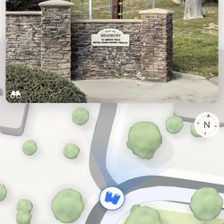
Santa Anita Canyon Photos


You might also consider
More like Santa Anita Canyon
Recommended Reviews - Santa Anita Canyon
Start your review...

Reviews With Photos

As good as it gets (in SoCal) is right!! If you have ever tried to hike in the LA/OC area, you know that finding a shady trail is near impossible. Santa Anita Canyon however offers many trails that are 70-80% shaded. To date, I have hiked the following trails: * Hermit Falls ~ 3 miles RT *Sturtevant Falls ~ 4 miles RT *Upper Falls Trail ~ 5.5 miles RT All of these trails offer a mix of incline/downhill but nothing extreme. Do-able for beginners, not boring for avid hikers and great for dogs! Tips: - buy an annual Adventure Pass from REI! There are so many great trails here and can also be used elsewhere in SoCal - bring water! - wear a hat! - come early or be prepared to parallel park Address to get to the parking lot (or close enough): Big Santa Anita Canyon Chantry Flat Rd. Arcadia, CA 91006 Highly recommend.

Fees weird that Yelp allows me to review nature. But oh well here goes My best buddy Alex and I both had a day off on Monday (life of jazz musicians) so we decided to take a hike, literally! We heard good things about this one so we made the drive from Long Beach. The 15-20 windy drive up the mountain from the residential area was a bit scary. There was plenty of parking when we went. I had to use the bathroom and the stall didn't have toilet paper, but luckily I always bring some with me when I hike. We ended up parking next to the lady we bought parking passes from who said she'd use our money to feed her donkeys or something. Pretty cool! Anyway, we hike up through the campgrounds and get to the start of the Winter Creek Trail, which branches off from the fire road. We hike for a good 45 minutes or so and it's great. It was a hot and sunny day but the majority of the trail was shaded. Even passed right by a small stream. Gorgeous views all the way through too! So after about 45 minutes we hear some rustling in the brush around us. "What's that?" says Alex. "Oh probably just a squirrel or lizard," I say. We keep walking a few more seconds and the rustling persists and gets even louder. "I don't think that's a squirrel," says Alex. He looks left and up into the shrubbery and I crane my head forward and right. As Alex sees a bear cub to our left maybe 20 feet above us in the bushes, I see 2 medium sized bears 20-30 feet in front of us in a clearing just right of the trail. I lock eyes with one of them. "Nope, bears," I say. "Run. RUN" Now at this point you may be thinking, "I thought you're not supposed to run if you encounter a bear." And you'd be absolutely right! I knew this fact full well. But y'all let me tell you, fight or flight is REAL. In the moment, we couldn't think of anything else besides putting as much distance as humanly possible between us and the bears. We're definitely lucky to be alive. I think the bears were as surprised to see us as we were them, rather than pissed. Plus, the trail was maybe a foot or 2 wide. We ran as fast as we could without tripping and falling to our deaths to the left. But I think even if the bears wanted to give chase, the trail was too narrow for them to follow. Whatever the case, I'm going to purchase some dang bear spray Needless to say, we rapidly (and blessedly uneventfully) hiked back to the start of the trail, making sure the only other guy behind us turned back too. Less than an hour later, as we're doing the twisty drive back down the mountain, we almost get killed, AGAIN. I drive us around a bend and we suddenly see some idiot Jeep who's halfway in our lane and closing fast. I honk, brake hard as I can and veer to the right. We came within inches of getting slammed by this fool. So all in all, beautiful hike, but 2 near-death experiences in less than an hour. I think I'm going to stay away from bear territory for a while

Purchase your parking pass at the shop! Always hike with somebody with you when you are hiking! Safety first and bring extra water Intense drive! Thanks to my co-worker, I was the passenger and he drove. I would have been a turtle driving up there. Haha... Santa Anita Canyon is located in Arcadia, not too far from Monrovia. It was such an awesome experience because our co-worker certainly did his homework before we hiked. Santa Anita Canyon has a history. Gold was found here! Cabins were bulit for those who digged for gold. We were still able see some and apparently there are at least 81 of them still in good shape, however, we only discovered at least 7 on our trail. http://www.yelp.com/biz_photos/santa-anita-canyon-arcadia?select=v3MgbrH9mni2g2DgiHwpDg#PdQpc66hoKf8oyhBd7c9Mg What to expect? Crazy parking! People would park however they want, but still have room for others to fit, however, be careful. We saw some people parked their car against the mountain rocks, which looked like their car was about to tip over. (serious!) Get your parking permits because it's only $5 compare to a ticket. Where to hike? As you reach to the top, you'll see a bunch of people just sitting around on the bottom of the restroom trail, that's the start. Check out the map. There's two trail and both have a waterfall. We ended up hiking the short one, which took us about 40 minutes to get to the Sturtevant Falls. about 2 hour round trip. Work those calves and booty! ;) Totally worth the hike. http://www.yelp.com/biz_photos/santa-anita-canyon-arcadia?select=v3MgbrH9mni2g2DgiHwpDg#8OVbCLl8yS0Sjg2CVbWquw Tips: - Get there early - Have someone drive up there to get parking permit - bring a lot of water including snacks and food (please don't litter, forest is our nature) - prepare to sweat so bring a towel - bring sunscreen! - bring extra trunks/swimsuit/sandals and dip your feel in the water :) - ah yes, dog friendly! - most importantly, be safe! Definitely coming back for the long trail! :) Keep hydrated!

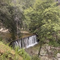
We did the Big Santa Anita Loop =) This is a great scenic loop trip form Chantry flat, we climbed the Gabrielino Trail to Sturtevant Camp, and returned by the Mt. Zion and Upper Winter Creek trails. We started down a paved road. There are a number of small cabins along the way. The trail is in the middle of a beautiful oak woodland, and there's a 4 way junction of trails. We then went to see the 50-foot-high Sturtevant Falls, a worthy trip. =) FYI, take the middle (lower) trail -the more scenic and exciting alternative. This trail slices across a sheer wall above the falls and continues through miniature cascades and pools. About 2 miles into the hike you will reach Cascade Picnic where ther are restrooms. Another a mile, you will reach Spruce Grove trail Camp. This is a nice place to stop for a snack or you can continue to Sturtevant Camp which is less than 1 mile where you can relax and have a swing. Cross a dam and take the MT. Zion trail to upper Winter trail. The trip back up can be a PAIN =) so be ready! Overall, a great fun enjoyable afternoon of hiking. =) http://www.everytrail.com/guide/big-santa-anita-canyon-loop-with-upper-trail http://www.greeneadventures.com/2011/03/26/hiking-big-santa-anita-canyon-via-the-winter-creek-loop/

One of my favorite hikes! Need adventure pass. U can pay for it at the general store driving deep into the Parkin lots, even when the store is closed, u can still pay for it, just go there and take an envelope, stuff $5 inside and write the license plate on the envelope n drop it in the box. Abt 40 min each way. Going the the waterfall is a breeze but coming back up is a real challenge because of the steep climb. First 1/4 of the hike is hot and sunny, when u get down to the bottom then it's shaded and cool.

Santa Anita Canyon! First off, my friend and I took Lyft to get there because we do not have a car. Anywho, going up was a zig zag. Once we get up, we were in awe of the view. I feel free. I definitely suggest to hike early in morning, not only the good scenery but the temperature would be perfect 50-70. I really enjoyed this long hike. I didn't had time to explore those other routes. I will come back and check them out later when I get more time

WATERFALL WATERFALL WATERFALL!!! BACKGROUND: Big Santa Anita Canyon, with over forty miles of trails weaving through the region, many leading to spectacular vistas, beautiful streams, cascading waterfalls, and situations of quiet solitude, is one of the most beautiful canyons in the San Gabriel Mountains. Although it is just twenty miles from downtown Los Angeles, it appears far removed from the bustle and hustle of our everyday lives. It provides a refreshing retreat to a green, peaceful, streamed woodland. STATS: Distance: ~11 miles Elevation Gain: 2,200ft Trail: Looped, on mostly rocky and regular trails. ESSENTIALS: At least 3 liters of water Know your limits Hiking boots that can withstand water Layered Clothing Gloves High protein food/snacks Electrolytes Camera Hat (optional) Sunscreen OUR ROUTE: Me and The Crew started out this hike at Chantry Flat, with a descend down a paved road to First Water Trail and going along down into the canyon. At one time in the canyon, we headed south along the Big Santa Anita Creek, through the retreat cabin Hamlet of Roberts Camp, to reach Hermit Falls. Our route involved a few creek water crossings and a bit of rock hopping along the way, but that's pretty typical of our hikes. It adds to the fun of it all. Due to the drought, the water level was so low, it wasn't even ankle deep. Afterwards a few ooohs, ahhhs, and pictures of Hermit Falls, we backtracked a little and headed upstream for a span of miles on the Gabrielino Trail to visit Sturtevant Falls. Sturtevant Falls is one of the prettiest waterfalls in the San Gabriels and, with a fall of roughly sixty feet, surely one of the most telling. Later on a break at Sturtevant Falls, we doubled back again for about a quarter mile and got our way further upstream using the scenic Upper Falls Trail. The Upper Falls Trail has a short segment with some significant drop offs so care was needed. We eventually rejoined the Gabrielino Trail and followed its route through Spruce Grove on our way to Sturtevant's Camp, where we stopped for a ride on the big swing, lunch, and fresh water. Later on a luncheon break at Sturtevant's Camp, we merged onto Zion Trail and got down a brief climb to the top of Mount Zion (3,575'), where we enjoyed some outstanding vistas of the surrounding canyon and peaks. After admitting in the scene, we descended down the Zion Trail to Hogee's Campground, where we then connected the Upper Winter Creek Trail as it wraps itself along the pretty wooded canyon side on our way back to our beginning point at Chantry Flat. The most challenging component of this hike, in my view, is the trek back up the paved road out of the canyon. It seems to go on forevea!! A big sigh of relief once we reached the top. Especially since we had a semi-impromptu sausage, roast, adult beverages included. Woo Hoo!!! Disclaimer: Hiking is not something that can be taken lightly. It can be life-threatening as you see and hear on the news, people die or get lost all time. Please, if you are going to hike, never go alone and prepare for the worst, hope for the best. Remember when going for a hike, no matter how short you think it may be, always be prepared. Carry at least two liters of water for every five miles (more if the weather is warm), protein bar, nuts, and electrolytes. Wear sturdy lug sole shoes and protective clothing. Some areas the weather can change quicker than a fireman can put on his gear. It is also very important, always always always let a family member or friend know where you are going and when you expect to be back. Lastly, have fun when you hike it up. Review 64 Yelp 100+ Challenge 2015 #HIKINGINARCADIA #WATERCROSSING #WATERFALL #ROCKHOPPING #PEAKSANDVISTAS

Santa Anita Canyon is only 15 minutes away from like Santa Anita Park. This is good get away from the cities. Enjoy a nice hiking in the Canyon. You could hike as far as Mount Wilson but most people come here to see the Sturtevant Falls which it would take up to 1 hour to get there and 2 hours round trip. Parking can be nightmare here especially if you don't come early, expect like 10-15 minutes walk, car with all wheel or 4x4 is idea to park near the mountain. There's pinic area in the entrance. There wasn't a information center or I can't find one if there were one. Few of the sign need to be repainted. Just aware with the governmetn cuts this canyon and other might be understaffed and maintenance, the restroom is awful. TIPS - Parking price had raise from $5 to $10, get the annual pass $30. - Hiking Pole is recommended. - Cellular coverage doesn't work most area of the park, bring walking talkie would be good choice if you plant to do long hike like to Mount Wilson. You can get a nice view of SGV on the way to the canyon. http://www.yelp.com/biz_photos/santa-anita-canyon-arcadia?select=2DYyM2_xhf1zTNujXUoI9A#A2PU0IEUjNeHD64S7CBlDQ Interesting looing Rock. http://www.yelp.com/biz_photos/santa-anita-canyon-arcadia?select=2DYyM2_xhf1zTNujXUoI9A#YzvbxIJKbLYQOjLAI1NMhg

Sweating is sexy!!!! If ya like seeing a bunch of sweaty peeps, head over to the Santa Anita Canyon. There are loads of trails here. Some are easy. Some are tough. Some take you to waterfalls (2 of them). Some are uphill. Some are shaded. http://www.yelp.com/biz_photos/GL0F2Iw6rAGAIuyjgpoOOA?userid=YWFbTcVnun8i03XnEU7kVg#4GpRUXUUQ3BUAu-mKWC_tQ Some provide no shade at all so wear your sunscreen. My uncle and I did the 11 mile loop. It wasn't too difficult for us to complete. We jogged a lot of the way. The view at the top would have been spectacular if it weren't for the thick layer of smog over So Cal. We even got to see a baby rattle snake, which was cool and frightening at the same time http://www.yelp.com/biz_photos/GL0F2Iw6rAGAIuyjgpoOOA?select=Y3xSIp7YReMDzCIn2MT9kA#nLybutQea4lM-xGTyq5hJQ If you want to hike the trails here arrive early. We got here at 6:45am and we still had to park almost a half mile from the entrance. By the time we left people were parking a mile away from the trails entrance. They have a tiny store here that sells drinks, snacks, maps and even adventure passes for your car so you can park up in the mountains. Great place to hike. Highly recommended.

On Sunday afternoon, I hiked the Santa Anita Canyon Loop: almost 10 miles, 2100' elevation gain, 3576' total elevation, approximately 5 hours. Believe me, on a Sunday afternoon, Chantry Flats is chock full of families, dogs, and teenagers. I had read the reviews below prior to going, and thought "a lot of people" wouldn't be that bad....but I was wrong. Parking will be a nightmare unless you arrive early in the morning or late in the evening. Key things to know before you go: 1) PACK STATION = Call the Adams Pack Station @ (626) 447-7356 to verify trail conditions and Adventure Pass availability ($5 for a day pass). It's open only Friday to Sunday, 8 AM - 5 PM, though Chantry Flats Rd. itself is open from 6 AM - 8 PM. They have food, drinks, and maps (which don't detail all the junctions, so I provided turn-by-turns below). More info here: http://www.adamspackstation.com/ 2) PARKING = If the parking lot is full and you need a day pass, you can stop your car temporarily in the lot to go buy one at the station. Afterwards, you'll have to drive back down Chantry Flats Rd. until you find an open spot by the side of the road. Be sure your car is fully parked behind the white line, or the rangers have a right to tow it. 3) BRING WATER & GEAR = I cannot stress how important this is, especially this time of year. Holy gods, I saw people carrying empty bottles who looked like they were going to die of exhaustion, and all they did was go to Sturtevant Falls and back. The reason for this is that much of the path is exposed to the sun, and the way back is all uphill. So bring sunscreen + cap + breathable clothing, and stay hydrated! Bring 2 - 3 liters of water per person, and carry them in a backpack since you'll have to cross the stream several times on slippery logs and rocks. On that note, bring comfortable hiking shoes with good tread! Trust me, I passed by teens wearing Vans and flip-flops, and they were complaining of sore feet not even halfway to the Falls. 4) FLIES = There are lots of them. If you loathe them with every fiber of your being, you will not enjoy this hike. There are parts of the trail that are somewhat fly-free, but as you get closer to the summit of Mt. Zion, it is like fly-topia up there. The only thing I can think of is bringing a hat with ear flaps to prevent them from buzzing too close to your ears. Onto the Santa Anita Canyon Loop: 1) Next to the parking lot, you'll see a gated paved road with a sign pointing to all the trails. This is where Gabrielino Trail begins. (This is also where the only bathrooms are located.) Keep following the paved road until you see a green bridge on your right. Cross it and follow the signs to Sturtevant Falls. You will have to cross the stream several times (no bridges), so be careful of your footing. 2) After enjoying Sturtevant Falls, backtrack until you reach the junction in the trail with signs on both sides. (There are several small houses with fences here.) On your right, you'll see a sign that points to Upper Trail (Horse Trail) and Lower Trail (to the top of the Falls). To get to Mt. Zion, follow the Upper Trail on the left. 3) For the first portion, the Upper Trail is exposed to the sun, so stay hydrated. You'll get wonderful views of the surrounding mountains along the way, as well as many wildflowers and butterflies. Later in the trail, it will be much cooler with all the shade. 4) You'll reach a sign that points to Spruce Group Camp (which is the same as Spruce Grove Camp) and Upper Horse Trail. Stay on the left towards Spruce Grove. Once you reach the Camp, go straight through it to resume the trail on the other side. (You'll see a large bisected log, which marks the continuation of the trail.) 5) Keep going on the trail until you reach the first sign that points you to Mt. Zion. Continue until you reach another sign that points to Mt. Zion summit and Mt. Wilson. Keep left towards Mt. Zion summit. You'll eventually reach a fork in the road with a posted map that says, "You are here." Take the trail on the left to get to the summit. The path becomes very narrow and a bit sandy, so be sure your shoes can handle it. 6) After enjoying the view (somewhat obscured by high undergrowth), backtrack to the fork in the road and take the trail on the right, which heads back down the mountain. Parts of the trail are quite rocky, so be careful. 7) You'll reach a junction with a sign that points to Upper Winter Creek Trail and Lower Winter Creek Trail. Either one will take you back to Chantry Flats. The Lower is shorter but - like another reviewer mentioned - this means the last part is all uphill. (I took the Lower and it's beautiful -- lots of lush shaded greenery, babbling brooks, and interesting rock formations.) You'll reach Hoegees Camp along the way -- just pass straight through and onwards until you're back where you began.

This is like baby big bear with less people and it's green!! In summer I trade hikes for the gym because most hikes become desert-like, but this reminded me of the east coast and even in summer this would be shady and gorgeous. Also, I felt safe here, it's a very well watched and maintained area but still it wasn't crowded (left Eaton Canyon and yelped around to find a road less traveled: post holiday and weekend that should have been difficult) and there is parking. We were a little confused on where to park because all along the drive up were people randomly stopped and parking. However we came to a parking lot, which had three levels to it and for five dollars we could park there until 8 pm (or be locked inside) and they do take credit cards. An annual pass is 30 bucks and let's you park anywhere in the Los Angeles National Forest. Also, they had a burger joint (more like a burger bbq pit) and cold drinks and horses...which I have to figure out if you can rent these guys because the trails were perfect for horses as well as hiking. Come here if you want a green, wild hike with also a lot of safety nearby.

I LOVED THIS HIKE. That is all. No that's actually not all! I'll tell you what I loved... It's challenging! I consider myself to be in pretty good shape: cardio wise and weight wise. This place had me huffing and puffing - especially on a hot summer day - whew! Took a side route (sorry, can't remember the name) to a small little cliff diving spot = awesome! Cliff dived of a 20-footer which was so refreshing. The water was clear, cold as fuck and gorgeous! There was another spot that was at least 40 ft. tall! I did not dare take the plunge but my friends did and it was awesome. Sturtevant Falls: what we really came for, a nice short hike, not as impressive as I'd thought it would be but it was a nice place to picnic after a good hike. If you hike behind the falls, you can actually look down the waterfall from the top of it and pound your chest like the beast that you are. My and my friends found a nice, perfect private spot at the top of the waterfall where the breeze would perfectly flow through and let me tell you it was the most relaxing and satisfying thing I've done in a while!

GORGEOUS! Simply, absolutely, positively and without a doubt one of the most beautiful trails in this area. Challenging enough yet pleasant and not too crazy of a hike that you can't soak in the beautiful surroundings. I came here while it was drizzling and parking wasn't even an issue and there was practically nobody on the trail - except when my friend decided to pee behind a rock on the main trail and ended up mooning a group of boys behind us. Pretty exciting stuff.

3 years ago
For a first hike in California, this turned out to be a really great one! The trail isn't too long and doesn't take too much skill to hike, which makes it a great afternoon trip out. There are a few nice views at the start but the rest of the trail was largely in the woods. And honestly? That's totally fine! It had great shade cover and helped make the whole thing feel peaceful. read more


2 years ago
7 years ago
How fortunate we are to live close to truly a magical and extraordinary place! The moment you set foot on the trail, it's an eye awakening experience and you'll momentarily forget you're still in the Los Angeles County. Yes, the parking is a nightmare but it should be expected on a weekend so your best bet is to arrive early. We wanted to avoid the hassle of fighting over a parking spot so we paid $20 at the deli shop area. If it was anywhere else I wouldn't have paid that much but you guys should've seen the road. Carmageddon '19. There's two waterfalls within the canyon, the Hermit and Sturtevant. The Hermit falls is fairly the smaller one while the Sturtevant is more packed with people hanging around for an afternoon delight of packed lunches. The hike to both falls is enjoyable and tons of greenery to see, you'll also come across mild creeks in between the trails. But the absolute brutal part of this hike is the return back to your car. We're talking about a true form of evil inclining up a hill, vicious steps that seem to make no progress, but just as hard as it is .. the outcome is rewarding when you reach the top. read more

9 years ago
As good as it gets (in SoCal) is right!! If you have ever tried to hike in the LA/OC area, you know that finding a shady trail is near impossible. Santa Anita Canyon however offers many trails that are 70-80% shaded. To date, I have hiked the following trails: * Hermit Falls ~ 3 miles RT *Sturtevant Falls ~ 4 miles RT *Upper Falls Trail ~ 5.5 miles RT All of these trails offer a mix of incline/downhill but nothing extreme. Do-able for beginners, not boring for avid hikers and great for dogs! Tips: - buy an annual Adventure Pass from REI! There are so many great trails here and can also be used elsewhere in SoCal - bring water! - wear a hat! - come early or be prepared to parallel park Address to get to the parking lot (or close enough): Big Santa Anita Canyon Chantry Flat Rd. Arcadia, CA 91006 Highly recommend. read more

Fees weird that Yelp allows me to review nature. But oh well here goes My best buddy Alex and I both had a day off on Monday (life of jazz musicians) so we decided to take a hike, literally! We heard good things about this one so we made the drive from Long Beach. The 15-20 windy drive up the mountain from the residential area was a bit scary. There was plenty of parking when we went. I had to use the bathroom and the stall didn't have toilet paper, but luckily I always bring some with me when I hike. We ended up parking next to the lady we bought parking passes from who said she'd use our money to feed her donkeys or something. Pretty cool! Anyway, we hike up through the campgrounds and get to the start of the Winter Creek Trail, which branches off from the fire road. We hike for a good 45 minutes or so and it's great. It was a hot and sunny day but the majority of the trail was shaded. Even passed right by a small stream. Gorgeous views all the way through too! So after about 45 minutes we hear some rustling in the brush around us. "What's that?" says Alex. "Oh probably just a squirrel or lizard," I say. We keep walking a few more seconds and the rustling persists and gets even louder. "I don't think that's a squirrel," says Alex. He looks left and up into the shrubbery and I crane my head forward and right. As Alex sees a bear cub to our left maybe 20 feet above us in the bushes, I see 2 medium sized bears 20-30 feet in front of us in a clearing just right of the trail. I lock eyes with one of them. "Nope, bears," I say. "Run. RUN" Now at this point you may be thinking, "I thought you're not supposed to run if you encounter a bear." And you'd be absolutely right! I knew this fact full well. But y'all let me tell you, fight or flight is REAL. In the moment, we couldn't think of anything else besides putting as much distance as humanly possible between us and the bears. We're definitely lucky to be alive. I think the bears were as surprised to see us as we were them, rather than pissed. Plus, the trail was maybe a foot or 2 wide. We ran as fast as we could without tripping and falling to our deaths to the left. But I think even if the bears wanted to give chase, the trail was too narrow for them to follow. Whatever the case, I'm going to purchase some dang bear spray Needless to say, we rapidly (and blessedly uneventfully) hiked back to the start of the trail, making sure the only other guy behind us turned back too. Less than an hour later, as we're doing the twisty drive back down the mountain, we almost get killed, AGAIN. I drive us around a bend and we suddenly see some idiot Jeep who's halfway in our lane and closing fast. I honk, brake hard as I can and veer to the right. We came within inches of getting slammed by this fool. So all in all, beautiful hike, but 2 near-death experiences in less than an hour. I think I'm going to stay away from bear territory for a while read more


13 years ago
Purchase your parking pass at the shop! Always hike with somebody with you when you are hiking! Safety first and bring extra water Intense drive! Thanks to my co-worker, I was the passenger and he drove. I would have been a turtle driving up there. Haha... Santa Anita Canyon is located in Arcadia, not too far from Monrovia. It was such an awesome experience because our co-worker certainly did his homework before we hiked. Santa Anita Canyon has a history. Gold was found here! Cabins were bulit for those who digged for gold. We were still able see some and apparently there are at least 81 of them still in good shape, however, we only discovered at least 7 on our trail. http://www.yelp.com/biz_photos/santa-anita-canyon-arcadia?select=v3MgbrH9mni2g2DgiHwpDg#PdQpc66hoKf8oyhBd7c9Mg What to expect? Crazy parking! People would park however they want, but still have room for others to fit, however, be careful. We saw some people parked their car against the mountain rocks, which looked like their car was about to tip over. (serious!) Get your parking permits because it's only $5 compare to a ticket. Where to hike? As you reach to the top, you'll see a bunch of people just sitting around on the bottom of the restroom trail, that's the start. Check out the map. There's two trail and both have a waterfall. We ended up hiking the short one, which took us about 40 minutes to get to the Sturtevant Falls. about 2 hour round trip. Work those calves and booty! ;) Totally worth the hike. http://www.yelp.com/biz_photos/santa-anita-canyon-arcadia?select=v3MgbrH9mni2g2DgiHwpDg#8OVbCLl8yS0Sjg2CVbWquw Tips: - Get there early - Have someone drive up there to get parking permit - bring a lot of water including snacks and food (please don't litter, forest is our nature) - prepare to sweat so bring a towel - bring sunscreen! - bring extra trunks/swimsuit/sandals and dip your feel in the water :) - ah yes, dog friendly! - most importantly, be safe! Definitely coming back for the long trail! :) Keep hydrated! read more


15 years ago
We did the Big Santa Anita Loop =) This is a great scenic loop trip form Chantry flat, we climbed the Gabrielino Trail to Sturtevant Camp, and returned by the Mt. Zion and Upper Winter Creek trails. We started down a paved road. There are a number of small cabins along the way. The trail is in the middle of a beautiful oak woodland, and there's a 4 way junction of trails. We then went to see the 50-foot-high Sturtevant Falls, a worthy trip. =) FYI, take the middle (lower) trail -the more scenic and exciting alternative. This trail slices across a sheer wall above the falls and continues through miniature cascades and pools. About 2 miles into the hike you will reach Cascade Picnic where ther are restrooms. Another a mile, you will reach Spruce Grove trail Camp. This is a nice place to stop for a snack or you can continue to Sturtevant Camp which is less than 1 mile where you can relax and have a swing. Cross a dam and take the MT. Zion trail to upper Winter trail. The trip back up can be a PAIN =) so be ready! Overall, a great fun enjoyable afternoon of hiking. =) http://www.everytrail.com/guide/big-santa-anita-canyon-loop-with-upper-trail http://www.greeneadventures.com/2011/03/26/hiking-big-santa-anita-canyon-via-the-winter-creek-loop/ read more


 - Hiking Near Me")


9 years ago
One of my favorite hikes! Need adventure pass. U can pay for it at the general store driving deep into the Parkin lots, even when the store is closed, u can still pay for it, just go there and take an envelope, stuff $5 inside and write the license plate on the envelope n drop it in the box. Abt 40 min each way. Going the the waterfall is a breeze but coming back up is a real challenge because of the steep climb. First 1/4 of the hike is hot and sunny, when u get down to the bottom then it's shaded and cool. read more


7 years ago
Santa Anita Canyon! First off, my friend and I took Lyft to get there because we do not have a car. Anywho, going up was a zig zag. Once we get up, we were in awe of the view. I feel free. I definitely suggest to hike early in morning, not only the good scenery but the temperature would be perfect 50-70. I really enjoyed this long hike. I didn't had time to explore those other routes. I will come back and check them out later when I get more time read more

11 years ago
WATERFALL WATERFALL WATERFALL!!! BACKGROUND: Big Santa Anita Canyon, with over forty miles of trails weaving through the region, many leading to spectacular vistas, beautiful streams, cascading waterfalls, and situations of quiet solitude, is one of the most beautiful canyons in the San Gabriel Mountains. Although it is just twenty miles from downtown Los Angeles, it appears far removed from the bustle and hustle of our everyday lives. It provides a refreshing retreat to a green, peaceful, streamed woodland. STATS: Distance: ~11 miles Elevation Gain: 2,200ft Trail: Looped, on mostly rocky and regular trails. ESSENTIALS: At least 3 liters of water Know your limits Hiking boots that can withstand water Layered Clothing Gloves High protein food/snacks Electrolytes Camera Hat (optional) Sunscreen OUR ROUTE: Me and The Crew started out this hike at Chantry Flat, with a descend down a paved road to First Water Trail and going along down into the canyon. At one time in the canyon, we headed south along the Big Santa Anita Creek, through the retreat cabin Hamlet of Roberts Camp, to reach Hermit Falls. Our route involved a few creek water crossings and a bit of rock hopping along the way, but that's pretty typical of our hikes. It adds to the fun of it all. Due to the drought, the water level was so low, it wasn't even ankle deep. Afterwards a few ooohs, ahhhs, and pictures of Hermit Falls, we backtracked a little and headed upstream for a span of miles on the Gabrielino Trail to visit Sturtevant Falls. Sturtevant Falls is one of the prettiest waterfalls in the San Gabriels and, with a fall of roughly sixty feet, surely one of the most telling. Later on a break at Sturtevant Falls, we doubled back again for about a quarter mile and got our way further upstream using the scenic Upper Falls Trail. The Upper Falls Trail has a short segment with some significant drop offs so care was needed. We eventually rejoined the Gabrielino Trail and followed its route through Spruce Grove on our way to Sturtevant's Camp, where we stopped for a ride on the big swing, lunch, and fresh water. Later on a luncheon break at Sturtevant's Camp, we merged onto Zion Trail and got down a brief climb to the top of Mount Zion (3,575'), where we enjoyed some outstanding vistas of the surrounding canyon and peaks. After admitting in the scene, we descended down the Zion Trail to Hogee's Campground, where we then connected the Upper Winter Creek Trail as it wraps itself along the pretty wooded canyon side on our way back to our beginning point at Chantry Flat. The most challenging component of this hike, in my view, is the trek back up the paved road out of the canyon. It seems to go on forevea!! A big sigh of relief once we reached the top. Especially since we had a semi-impromptu sausage, roast, adult beverages included. Woo Hoo!!! Disclaimer: Hiking is not something that can be taken lightly. It can be life-threatening as you see and hear on the news, people die or get lost all time. Please, if you are going to hike, never go alone and prepare for the worst, hope for the best. Remember when going for a hike, no matter how short you think it may be, always be prepared. Carry at least two liters of water for every five miles (more if the weather is warm), protein bar, nuts, and electrolytes. Wear sturdy lug sole shoes and protective clothing. Some areas the weather can change quicker than a fireman can put on his gear. It is also very important, always always always let a family member or friend know where you are going and when you expect to be back. Lastly, have fun when you hike it up. Review 64 Yelp 100+ Challenge 2015 #HIKINGINARCADIA #WATERCROSSING #WATERFALL #ROCKHOPPING #PEAKSANDVISTAS read more


13 years ago
Santa Anita Canyon is only 15 minutes away from like Santa Anita Park. This is good get away from the cities. Enjoy a nice hiking in the Canyon. You could hike as far as Mount Wilson but most people come here to see the Sturtevant Falls which it would take up to 1 hour to get there and 2 hours round trip. Parking can be nightmare here especially if you don't come early, expect like 10-15 minutes walk, car with all wheel or 4x4 is idea to park near the mountain. There's pinic area in the entrance. There wasn't a information center or I can't find one if there were one. Few of the sign need to be repainted. Just aware with the governmetn cuts this canyon and other might be understaffed and maintenance, the restroom is awful. TIPS - Parking price had raise from $5 to $10, get the annual pass $30. - Hiking Pole is recommended. - Cellular coverage doesn't work most area of the park, bring walking talkie would be good choice if you plant to do long hike like to Mount Wilson. You can get a nice view of SGV on the way to the canyon. http://www.yelp.com/biz_photos/santa-anita-canyon-arcadia?select=2DYyM2_xhf1zTNujXUoI9A#A2PU0IEUjNeHD64S7CBlDQ Interesting looing Rock. http://www.yelp.com/biz_photos/santa-anita-canyon-arcadia?select=2DYyM2_xhf1zTNujXUoI9A#YzvbxIJKbLYQOjLAI1NMhg read more


Sweating is sexy!!!! If ya like seeing a bunch of sweaty peeps, head over to the Santa Anita Canyon. There are loads of trails here. Some are easy. Some are tough. Some take you to waterfalls (2 of them). Some are uphill. Some are shaded. http://www.yelp.com/biz_photos/GL0F2Iw6rAGAIuyjgpoOOA?userid=YWFbTcVnun8i03XnEU7kVg#4GpRUXUUQ3BUAu-mKWC_tQ Some provide no shade at all so wear your sunscreen. My uncle and I did the 11 mile loop. It wasn't too difficult for us to complete. We jogged a lot of the way. The view at the top would have been spectacular if it weren't for the thick layer of smog over So Cal. We even got to see a baby rattle snake, which was cool and frightening at the same time http://www.yelp.com/biz_photos/GL0F2Iw6rAGAIuyjgpoOOA?select=Y3xSIp7YReMDzCIn2MT9kA#nLybutQea4lM-xGTyq5hJQ If you want to hike the trails here arrive early. We got here at 6:45am and we still had to park almost a half mile from the entrance. By the time we left people were parking a mile away from the trails entrance. They have a tiny store here that sells drinks, snacks, maps and even adventure passes for your car so you can park up in the mountains. Great place to hike. Highly recommended. read more


 - Hiking Near Me")
14 years ago
On Sunday afternoon, I hiked the Santa Anita Canyon Loop: almost 10 miles, 2100' elevation gain, 3576' total elevation, approximately 5 hours. Believe me, on a Sunday afternoon, Chantry Flats is chock full of families, dogs, and teenagers. I had read the reviews below prior to going, and thought "a lot of people" wouldn't be that bad....but I was wrong. Parking will be a nightmare unless you arrive early in the morning or late in the evening. Key things to know before you go: 1) PACK STATION = Call the Adams Pack Station @ (626) 447-7356 to verify trail conditions and Adventure Pass availability ($5 for a day pass). It's open only Friday to Sunday, 8 AM - 5 PM, though Chantry Flats Rd. itself is open from 6 AM - 8 PM. They have food, drinks, and maps (which don't detail all the junctions, so I provided turn-by-turns below). More info here: http://www.adamspackstation.com/ 2) PARKING = If the parking lot is full and you need a day pass, you can stop your car temporarily in the lot to go buy one at the station. Afterwards, you'll have to drive back down Chantry Flats Rd. until you find an open spot by the side of the road. Be sure your car is fully parked behind the white line, or the rangers have a right to tow it. 3) BRING WATER & GEAR = I cannot stress how important this is, especially this time of year. Holy gods, I saw people carrying empty bottles who looked like they were going to die of exhaustion, and all they did was go to Sturtevant Falls and back. The reason for this is that much of the path is exposed to the sun, and the way back is all uphill. So bring sunscreen + cap + breathable clothing, and stay hydrated! Bring 2 - 3 liters of water per person, and carry them in a backpack since you'll have to cross the stream several times on slippery logs and rocks. On that note, bring comfortable hiking shoes with good tread! Trust me, I passed by teens wearing Vans and flip-flops, and they were complaining of sore feet not even halfway to the Falls. 4) FLIES = There are lots of them. If you loathe them with every fiber of your being, you will not enjoy this hike. There are parts of the trail that are somewhat fly-free, but as you get closer to the summit of Mt. Zion, it is like fly-topia up there. The only thing I can think of is bringing a hat with ear flaps to prevent them from buzzing too close to your ears. Onto the Santa Anita Canyon Loop: 1) Next to the parking lot, you'll see a gated paved road with a sign pointing to all the trails. This is where Gabrielino Trail begins. (This is also where the only bathrooms are located.) Keep following the paved road until you see a green bridge on your right. Cross it and follow the signs to Sturtevant Falls. You will have to cross the stream several times (no bridges), so be careful of your footing. 2) After enjoying Sturtevant Falls, backtrack until you reach the junction in the trail with signs on both sides. (There are several small houses with fences here.) On your right, you'll see a sign that points to Upper Trail (Horse Trail) and Lower Trail (to the top of the Falls). To get to Mt. Zion, follow the Upper Trail on the left. 3) For the first portion, the Upper Trail is exposed to the sun, so stay hydrated. You'll get wonderful views of the surrounding mountains along the way, as well as many wildflowers and butterflies. Later in the trail, it will be much cooler with all the shade. 4) You'll reach a sign that points to Spruce Group Camp (which is the same as Spruce Grove Camp) and Upper Horse Trail. Stay on the left towards Spruce Grove. Once you reach the Camp, go straight through it to resume the trail on the other side. (You'll see a large bisected log, which marks the continuation of the trail.) 5) Keep going on the trail until you reach the first sign that points you to Mt. Zion. Continue until you reach another sign that points to Mt. Zion summit and Mt. Wilson. Keep left towards Mt. Zion summit. You'll eventually reach a fork in the road with a posted map that says, "You are here." Take the trail on the left to get to the summit. The path becomes very narrow and a bit sandy, so be sure your shoes can handle it. 6) After enjoying the view (somewhat obscured by high undergrowth), backtrack to the fork in the road and take the trail on the right, which heads back down the mountain. Parts of the trail are quite rocky, so be careful. 7) You'll reach a junction with a sign that points to Upper Winter Creek Trail and Lower Winter Creek Trail. Either one will take you back to Chantry Flats. The Lower is shorter but - like another reviewer mentioned - this means the last part is all uphill. (I took the Lower and it's beautiful -- lots of lush shaded greenery, babbling brooks, and interesting rock formations.) You'll reach Hoegees Camp along the way -- just pass straight through and onwards until you're back where you began. read more


This is like baby big bear with less people and it's green!! In summer I trade hikes for the gym because most hikes become desert-like, but this reminded me of the east coast and even in summer this would be shady and gorgeous. Also, I felt safe here, it's a very well watched and maintained area but still it wasn't crowded (left Eaton Canyon and yelped around to find a road less traveled: post holiday and weekend that should have been difficult) and there is parking. We were a little confused on where to park because all along the drive up were people randomly stopped and parking. However we came to a parking lot, which had three levels to it and for five dollars we could park there until 8 pm (or be locked inside) and they do take credit cards. An annual pass is 30 bucks and let's you park anywhere in the Los Angeles National Forest. Also, they had a burger joint (more like a burger bbq pit) and cold drinks and horses...which I have to figure out if you can rent these guys because the trails were perfect for horses as well as hiking. Come here if you want a green, wild hike with also a lot of safety nearby. read more


16 years ago
I LOVED THIS HIKE. That is all. No that's actually not all! I'll tell you what I loved... It's challenging! I consider myself to be in pretty good shape: cardio wise and weight wise. This place had me huffing and puffing - especially on a hot summer day - whew! Took a side route (sorry, can't remember the name) to a small little cliff diving spot = awesome! Cliff dived of a 20-footer which was so refreshing. The water was clear, cold as fuck and gorgeous! There was another spot that was at least 40 ft. tall! I did not dare take the plunge but my friends did and it was awesome. Sturtevant Falls: what we really came for, a nice short hike, not as impressive as I'd thought it would be but it was a nice place to picnic after a good hike. If you hike behind the falls, you can actually look down the waterfall from the top of it and pound your chest like the beast that you are. My and my friends found a nice, perfect private spot at the top of the waterfall where the breeze would perfectly flow through and let me tell you it was the most relaxing and satisfying thing I've done in a while! read more


GORGEOUS! Simply, absolutely, positively and without a doubt one of the most beautiful trails in this area. Challenging enough yet pleasant and not too crazy of a hike that you can't soak in the beautiful surroundings. I came here while it was drizzling and parking wasn't even an issue and there was practically nobody on the trail - except when my friend decided to pee behind a rock on the main trail and ended up mooning a group of boys behind us. Pretty exciting stuff. read more

10 years ago
Besides the fact that the waterfall was practically dried up, there were flies EVERYWHERE & that I twisted my ankle hiking back (2 miles out)... This was a pleasant hike. We came on a Friday morning and there was no problem parking. We bought our 1 day adventure pass from Big 5. It was much easier than buying it there. We met a friendly couple who had been hiking there years ago and directed us in the right direction. We saw them later at the waterfall and they were telling us how much water used to be there. It was so hard to imagine. The CA drought is real guys! We hiked up to the Strutevant cabins and explored some there then decided to head back to the parking lot. Little did we know we hiked 4 miles out already! From the Strutevant cabins it's a 4 mile hike back to the parking lot. On the way down it becomes narrow and a little steep. That's where I twisted my ankle. Stay away from the edges! Some dirt may looked packed but looks can fool you! Overall the canyons were nice, quiet & clean. Bring bug repellent because the guys won't leave you alone otherwise! It's interesting seeing the cabins and outhouses that may or may not be preoccupied by tenants. Interesting hike to say the least! Will probably be back to conclude the entire trail unhurt! read more


8 years ago
11 years ago
Its a great trek but we took a longer one and man it really gets tough. The starting mile is cold and you need your jackets put in. Later comes the waterfall (which is another 7min diversion from your main trek) I love the quietness, the shade and the entire experience. It might get a bit scary when you start hiking after the waterfall as its valley at one side and need to be a bit careful. The best part is its so famous and even if you don't see the signs for a really long time, you meet other hikers all along your way at every detour you take. Take ample water.. It took us more than 5hrs to complete the hike. read more

7 years ago
9 years ago
I have a German Shepherd/Husky puppy who is finally old enough to go on outings. As I'm sure most people know, both breeds are very active and are considered a "working breed" so they need to get tons of exercise and both physical and mental stimulation. That being said, I have been trying to find a good hiking spot to take my pup. I live in Studio City in the San Fernando Valley and I know there are some really popular trails right around the corner (Runyon, Fryman, Franklin, Cahuenga Ranch, Westridge-Canyonback, etc) but they are mostly known for their city views and I wanted somewhere I could relax and get away from the city. After doing tons of research, I found Chantry Flats and I am so glad I gave this place a shot! It is about a 30 min drive away from me, but it is so dang worth it. I work during the week which makes morning hikes difficult on weekdays so I decided to go on a Sunday, heeding the advice of many and arriving to the trailhead as early as possible to get parking. The gates to the road that leads to the trailhead opens at 6am and I got there at 6:15. You drive up a very windy road up the mountain and the view is awesome. I actually saw a bear cub run across the road maybe 15 yards in front of me and leap onto the side of the cliff! I was already so excited. Anyway, by the time I reached Adam's Pack Station, the parking lot was already almost completely full. Yeesh. I decided to start out on the Hoegee's Campground Loop (about 4.7 miles total) but I don't recommend this trail for doggies. I turned back after the first mile due to A) It's a very narrow dirt trail with a steep and long drop-off directly to your right, so there wasn't much room at all. and B) My little Millie started acting very strange, anxious and whining and pulling me backwards away from where we were heading. After seeing the bear cub so close to the trailhead, I decided to err on the safe side and turn back. We took a little break, had some snacks and water and decided to go on the more popular Sturtevant Falls Trail. Man oh man, this trail is AMAZING! It's rated moderate, but I would call it easy. It's 3.1 miles out and back and you are pretty much always under the cool canopy of the trees, so heat isn't even much of an issue. There are always quite a few people on the trail, so if you are looking for pure quiet, I wouldn't recommend this trail but it isn't overly loud or anything. I saw many young children, even as young as 3 or 4 years old, doing this trail. Lots of other dogs too, so if you have a pup who's good with others then this is a great spot! I met tons of super nice people and Millie made a bunch of new friends. You also pass through some little creeks and streams about 3 times (although there are several more opportunities to go down a small hill on the edge of the trail to play in the creek) until you reach the falls, which is nice for the dogs to get their paws wet and cool down for a couple minutes while you rehydrate. Now, Sturtevant Falls isn't a crazy huge gorgeous waterfall, but it is very pretty. There were some nice little shallow areas surrounded by rocks in the small pond as well, so very good if you want to get your feet wet and chill out for a while. The water seems fairly clean and was very clear, you could see the bottom extremely easily and some people were swimming around in it. The only downside to this trail is the first/last 1/2 mile. The very beginning of the trail is going downhill on asphalt which is fine, but it sucks having to lug yourself and your gear uphill in the sun after already hiking for 2.5 miles haha. Overall though that last stretch is 100% worth such a beautiful hike. Millie had a ball and we are going to make this our weekly Sunday hike! I didn't see too many bugs, only a couple here and there and I only remember them irritating me once for about 2 minutes. Bugspray isn't necessary but I still brought some with me. Doesn't hurt when some other folks who are having a hard time need to borrow some! If you live somewhere in LA County and want a fun, fairly easy hike with your family or fur babies, then definitely check out Sturtevant Falls. Oh and getting to the trailhead can be a little difficult since there isn't an actual address. All you have to do is head north on Santa Anita Canyon and just keep driving. You'll see the signs. Or if you're like me who needs to have google maps directing you lol download the AllTrails app. You can search for different trails with breakdowns and lots of info and they will open up the location on Google Maps for directions. Super helpful. read more


9 years ago
Cool hike trail, thought the waterfall would be bigger or have more water flowing in it... maybe during spring? read more


Want to hike to the top of Mt. Wilson but: Don't feel like going on a long 18 mile hike on the wide Mt. Wilson Toll Road from Eaton Canyon in Pasadena? Or intimidated by the strenuous and often exposed 15+ mile hike on the Mt. Wilson Trail from Sierra Madre? Then you might want to hike to Mt. Wilson via Big Santa Anita Canyon from Chantry Flat, which is probably the easiest route to the summit. It's about a 14 mile hike that hits Mt. Wilson from the east side unlike the other routes, allowing you to summit at the Mt. Wilson Observatory. Cool, huh? And because it starts further up the mountain (meaning less elevation to climb) and because most of the hike is in the shade, I highly recommend this route for hikers trying to summit Mt. Wilson for the first time. You start this hike at Chantry Flat, the same place you start hikes for Sturtevant Falls, Hermit Falls, and Big Santa Anita Canyon Loop. The actual hike to Mt. Wilson is identical to almost half of the Big Santa Anita Canyon loop that I reviewed here: http://www.yelp.com/biz/santa-anita-canyon-arcadia#hrid:J0Jxhrl3dO6JTYwHhMtxxA and I would actually recommend that you do the 10 mile loop first before taking on this hike. The preferred route goes counterclockwise, going down the paved road at the start, heading towards Sturtevant Falls. When you reach the Falls/Gabrielino Trail junction, you can go on either the Lower Trail (Top of the Falls) or Upper Trail (Horse Trail) as they will merge later. I would recommend the Lower Trail for the better scenery and shade. You can even take a mile round trip detour to see the 50ft Sturtevant Falls if you have never seen it. You will soon reach the Cascade picnic area, and shortly after that you will hit the Spruce Grove Campground. You can take a break and use the toilet at either of these locations. Keep going further, past the Sturtevant Camp to the right (which seem to be all cabins BTW) and at around 4 miles into the hike, you should come across the Upper Zion Trail Junction http://www.yelp.com/biz_photos/mt-wilson-via-big-santa-anita-canyon-arcadia?select=Dczj4KVcKZ9O-zs7w7ClGQ#4bgDkAkZyGDKefSxefgB_A which is where you would get on the Sturtevant Trail. From there, it's about 3 miles to the summit and you should see this halfway rest sign http://www.yelp.com/biz_photos/mt-wilson-via-big-santa-anita-canyon-arcadia?select=Dczj4KVcKZ9O-zs7w7ClGQ#iTjjNmUkbDwXeAffCBh2Ow along the way. This climb up on Sturtevant Trail is probably the most difficult stretch of this entire hike but it will all pay off shortly! Once you summit, you will see the first of the many white domed observatory structures. You will continue to hike on the paved Rim Trail through the Observatory-Skyline Park past the Cosmic Cafe down to the parking lot (BTW this whole area is closed from 12/1-3/31 so don't expect to tour the observatory or eat at the cafe during the winter) where you will find a sign and the start of the Mt. Wilson Trail http://www.yelp.com/biz_photos/mt-wilson-via-big-santa-anita-canyon-arcadia?select=N4cznTKg3p78-o3fqCtndA#N4cznTKg3p78-o3fqCtndA to begin your descent. Hike down a couple miles, and make sure you STAY ON the Mt. Wilson Trail; even though you'll be on the wide Mt. Wilson Toll Road for a little after a mile into your descent, you have to switch back on the Mt. Wilson Trail (otherwise you'll end up in Pasadena like I once did...). Once you reach Manzanita Ridge - where you will find a sign and a wooden bench, you will end your hike on the Mt. Wilson Trail and transfer on to the Winter Creek Trail which can be found just left (east) and downwards from the bench. From here, it's a long 5 mile descent on the Winter Creek Trail. Well, it goes down and near Hoegee's Camp it goes uphill for a little so there is a little bit of a climb out of the canyons towards the end. Make sure you stay on the Upper Winter Creek Trail and not the Lower one to avoid the paved climb at the end that you did in the beginning and instead end your hike right at Chantry Flat picnic area. I printed this map and found it pretty helpful during my hike. I highly recommend you take it as well: http://www.adamspackstation.com/docs/big-sac-map.pdf Also, remember that good parking is very hard to find at Chantry Flat so try to get out there early! read more


 and CHARA array (front) - Hiking Near Me")
12 years ago
Santa Anita canyon loop is in my opinion, the nicest hike in southern california. Yes, I said that. Here is why. First you get to Chantry Flats. If on a weekend, COME EARLY. Im talking get here at 6:45am the latest! The parking lot fills up and parking a mile down the road really sucks. Make sure to have your adventure pass or you will be cited. To begin your hike, I take the long paved trail that leads down to the trailhead. Cross the bridge and walk along the river. Those cabins next to you, have no electricity. What an awesome way to live, and I'm not being sarcastic. Anyhoo, you will come to a sign where the trail splits. To the right will take you to the base of Sturtevant falls. To the left is the Gabrielino trail that takes you above the falls. Go left. You will get a birds eye view of the falls and the big crowd of people down there. You will see them all wondering how you got up there. Here is what makes it the best hike in SoCal for me. As soon as you pass the waterfall, its like you are out of SoCal. Everyone just goes to see the waterfall then turn around and go back. They will never see how pretty and amazing things are beyond it. I would say about 75% of the trail from here on is shaded and runs next to a babbling creek. I have gone when it is 100 degrees in the city, and about 65 and shaded in the canyon. There is a little elevation gain and plenty of things to look at. The creek has etched out this canyon for centuries and there are all kinds of odd and neat ways the rock is sculpted. You will see mini waterfalls and even some super smooth water slide looking plarts like you see only in the sierra nevada. About 6miles in, you will get to Sprucegrove camp. There are firepits for backpackers, and picnic benches for dayhikers. There are some nasty pit toilets so if ya gotta go, go now. Be respectful of them and clean as possible as I once saw that it is Boy Scouts who clean these toilets. This is a Great place to stop and have a lunch break! Once again this is all shaded and next to the creek. Once your up again, just a few feet ahead you will get to Sturtevant Camp. This place holds A LOT of history as it is over 100years old. There is that one stand alone cabin that is the oldest Forest Service cabin in the nation. What is most impressive about it is to think that John Muir himself stayed there one time or another. If you are lucky, the door will be open so you can experience it. There is also the "swiss dinning hall" where people used to get their party on. The rest of the cabins are owned and operated by the Methodest church. I met a man who maintains everything there and he was incredibly nice and took time to show us around and explained the history. Next you continue through the camp on your way to Mt. Zion. This whole entire path, like the path before it, is shaded. This is the hardest part of the hike. The elevation gain isn't difficult at all but it does not let up. I consider myself an experienced hiker, and find this part fairly easy, but a few friends who are novice had to stop and take a few breathers. No shame in that since it just allows you to take in the scenery a bit. You will finally arrive at a sign. The view off of Mt. Zion isn't very impressive, but worth the short walk out of way to get to it. Once your back on trial, its all downhill from there. Literally. This portion is the only unshaded part of the hike. It doesn't last that long, and its all downhill so it's all good. As soon as you duck into the treeline again, you're almost at Hoagees camp.You have the option of upper winter creek or Lower winter creek. I take Lower winter creek since I like being next to the creek. The only trade of is on the way back I have to hike that long paved trail I first come down, and its killer. You can hike upper winter creek and you will sacrifice some nice scenery, but end up at the parking lot. At Hoagees camp, take another break and relax a little. Picnic benches, the creek, boulders, and lots of shade for a last break. After that your almost back. You will end up at the bridge and base of that paved trail. All in all, this hike is the easiest 10 mile hike ever. I have gone with experienced hikers and novice. They all enjoy it the same. Hope this helps, and have fun. read more


4 years ago
5 years ago
15 years ago
Fun/Cost: (5/5) The Santa Anita Canyon Loop runs about 9.5 miles and what an enjoyable 9.5 miles it is! What I particularly enjoyed about this hike is the lush vegetation and how it's shaded about 80% of the way. The version of the Loop that my friend and I took went like this: (1) From Chantry Flats, we took the Gabrielino Trail to Sturtevant Falls; (2) From Sturtevant Fllas, we backtracked a bit back the Fallen Sign Junction to take the Upper Zion Trail; (2) Upper Zion Trail all the way to Mt. Zion Summit, passing Spruce Grove Camp on the way; (3) From Mt. Zion Summit, we took the Lower Zion Tail back down to Chantry Flats, passing Hoegees Camp on the way. All in all, the entire trip took a bit under 5 hours, with plenty of rest and picture stops along the way. Most of the trail is at a slight but steady incline so even though the trail is relatively long, it's manageable. And of course you get that awesome feeling of accomplishment after the entire, near 10-mile journey. Ambiance: (5/5) The trailhead and the first, most popular section of the hike to Sturtevant Falls are usually very busy and full of people. However, once you get past that, it's quiet and peaceful. Not counting the people we saw at the campgrounds, we only passed about 8 other parties on the the Upper and Lower Zion Trials -- and this was on a long weekend! I like that though -- you get some of the hustle and bustle of other hikers in the beginning, which then fades into the sounds of birds, water, and the crunch of your own footsteps as you progress along the loop. Location: (4/5) Super easy to get to. Near the 210 Fwy. You just go all the way up Santa Anita Avenue for 5-6 miles until you hit the dead end where the pack station, trailhead, and parking lot are located. I wish the parking lot was larger though as finding parking on a long weekend or some of the more popular weekends is nearly impossible. I came here yesterday (the Saturday of Memorial Day Weekend) to hike and we had to park 3/4 miles down from the parking lot due to space constraints. Overall: (5/5) What a lovely hike. There's a waterfall, a creek, campgrounds, cabins majestically tall trees, short shrubs, lush ferns, views, flowers -- everything! read more


11 years ago
11 years ago
13 years ago
12 years ago
Page 1 of 3
More info about Santa Anita Canyon
Arcadia, CA 91006
Directions
Hours
Indoor Amenities
Outdoor Amenities
Santa Anita Canyon Reviews in Other Languages
Ask the Community - Santa Anita Canyon
Review Highlights - Santa Anita Canyon
You might also consider


Why does Yelp recommend reviews?
1 review that is not currently recommended
The reviews below are not factored into the business's overall star rating.
14 years ago
Santa Anita Canyon - hiking - Updated July 2026
Best of Arcadia
People found Santa Anita Canyon by searching for…
Hiking Trails in Arcadia, California
Waterfall Hike in Arcadia, California
River Swimming in Arcadia, California
Beaches in Arcadia, California
Beautiful Views in Arcadia, California
Campgrounds in Arcadia, California
Swimming Lakes in Arcadia, California
Places to Take Pictures in Arcadia, California
Easy Hikes in Arcadia, California
Running Trails in Arcadia, California
Hiking Groups in Arcadia, California
Dog Friendly Lakes and Parks in Arcadia, California
Sunrise Hike in Arcadia, California
Walking Trails in Arcadia, California
Free Things to Do in Arcadia, California
Scenic Drive in Arcadia, California
Hiking Trails Kid Friendly in Arcadia, California
Lakes & Ponds in Arcadia, California
Scenic View in Arcadia, California
Full Moon Hike in Arcadia, California
Trending Searches in Arcadia, CA
Black Owned Nail Salons near Santa Anita Canyon
Boat Rental near Santa Anita Canyon
Cliff Jumping near Santa Anita Canyon
Day Trips near Santa Anita Canyon
Fishing Spots near Santa Anita Canyon
Jet Ski Rental near Santa Anita Canyon
Kayak Rental near Santa Anita Canyon
Off Road Trails near Santa Anita Canyon
Outdoor Activities near Santa Anita Canyon
Places To Walk Around near Santa Anita Canyon
Pool Day Pass near Santa Anita Canyon
Public Pools near Santa Anita Canyon
Public Shower near Santa Anita Canyon
River Swimming near Santa Anita Canyon
Rock Quarry near Santa Anita Canyon
Running Trails near Santa Anita Canyon
Scenic Night View near Santa Anita Canyon
Scenic Overlook near Santa Anita Canyon
Secluded Spots near Santa Anita Canyon
Soccer Store near Santa Anita Canyon
Splash Pad near Santa Anita Canyon
Strawberry Picking near Santa Anita Canyon
Sunrise View near Santa Anita Canyon
Swimming Holes near Santa Anita Canyon
Swimming Lakes near Santa Anita Canyon
Watch Sunset near Santa Anita Canyon
Browse Articles
Browse Nearby
BEST of Arcadia, California Coffee near Santa Anita Canyon
BEST of Arcadia, California Restaurants near Santa Anita Canyon
BEST of Arcadia, California Things to Do near Santa Anita Canyon
BEST of Arcadia, California Breakfast near Santa Anita Canyon
BEST of Arcadia, California Walking Trails near Santa Anita Canyon
BEST of Arcadia, California Parks near Santa Anita Canyon
BEST of Arcadia, California Hot Springs near Santa Anita Canyon
BEST of Arcadia, California Campgrounds near Santa Anita Canyon
BEST of Arcadia, California Sightseeing near Santa Anita Canyon
Browse Brands
Related Searches in Arcadia, CA
Affordable Kayak Rental Services in Arcadia, California
Best Fishing Locations and Guides in Arcadia, California
Best Nature Trails for Hiking in Arcadia, California
Best Places for Horseback Riding in Arcadia, California
Check Out Off Road Trails in Arcadia, California
Discover Dog Friendly Trails to Explore in Arcadia, California
Discover Kid Friendly Hiking Trails in Arcadia, California
Discover Scenic Hiking Trails in Arcadia, California
Discover Scenic Mountain Bike Trails Near Arcadia, California
Discover Scenic Waterfall Spots in Arcadia, California
Discover Walking Parks in Arcadia, California Near You
Discover a Hiking Trail in Arcadia, California
Discover the Best Night Hike Trails in Arcadia, California
Discover the Best Running Track in Arcadia, California
Dog-Friendly Hikes With Dogs in Arcadia, California
Enjoy Camping Adventures Around Arcadia, California
Enjoy Exciting Mountain Biking Adventures in Arcadia, California
Enjoy Kayaking Adventures in Arcadia, California
Enjoy Tent Camping Spots Around Arcadia, California
Enjoy a Beautiful Waterfall Hike in Arcadia, California
Enjoy a Peaceful Nature Walk in Arcadia, California
Enjoy the Best Walking Path in Arcadia, California
Enjoy the Best Walking Trails in Arcadia, California
Exciting Cliff Jumping Spots in Arcadia, California
Explore Beautiful Parks and Green Spaces in Arcadia, California
Explore Easy Hikes Perfect for All in Arcadia, California
Explore Fun Activities to Do in Arcadia, California
Explore Popular Campgrounds Near Arcadia, California
Explore the Best Beach Spots in Arcadia, California
Explore the Best Trail Options in Arcadia, California
Family Friendly Hiking With Kids in Arcadia, California
Find Beautiful Views in Arcadia, California
Find the Best Parks for Picnics in Arcadia, California
Find the Best Scenic View Locations in Arcadia, California
Great Places to Walk in Arcadia, California
Hike the Popular Waterfall Trail in Arcadia, California
Hiking Trails With Waterfalls in Arcadia, California
Off Leash Dog Hiking Trails in Arcadia, California
Plan a Scenic Drive Route Near Arcadia, California
Popular Outdoor Activities to Try in Arcadia, California
Popular Picnic Spots to Visit in Arcadia, California
Safe River Swimming Areas in Arcadia, California
Safe and Fun Parks for Kids in Arcadia, California
Top Climbing Spots and Gyms in Arcadia, California
Top Paddleboarding Activities in Arcadia, California
Top Running Trails to Explore in Arcadia, California
Top Swimming Lakes to Enjoy in Arcadia, California
Top Swimming Spots and Pools in Arcadia, California
People who viewed Santa Anita Canyon also viewed
Monrovia Canyon Park
329 reviews
Hoegee's Loop Trail
20 reviews
Eaton Canyon Natural Area
1330 reviews
Sturtevant Falls
721 reviews
Ben Overturff Trail
24 reviews
Bailey Canyon To Hastings Peak
54 reviews
Hillside Wilderness Preserve Trail
5 reviews
Mount Zion Trail
24 reviews
Tad Williams Trail
7 reviews
Monrovia Hillside Preserve
7 reviews