Inspiration Point via Castle Canyon Photos

You might also consider


More like Inspiration Point via Castle Canyon
Recommended Reviews - Inspiration Point via Castle Canyon
Start your review...


Reviews With Photos


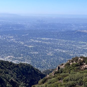
This was a hard hike but so worth it! We got lost and tried to get back on trail so we took some steep inclines. I do this hike every year, and I feel it's always hard no matter how in shape or out of shape I am! Bring lots of water and snacks! You'll need it! It took us 4 hours round trip!


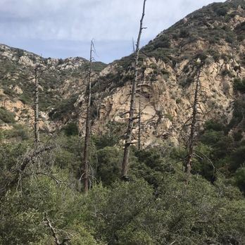
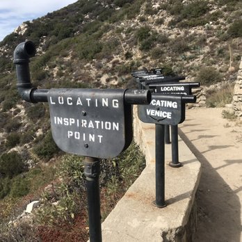
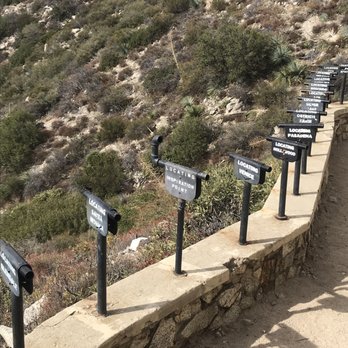
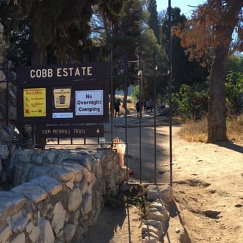
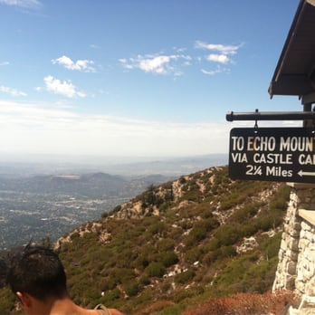
*BRING FOOD/SNACKS, WATER, PREPARE FOR A LONG AND EXHAUSTING HIKE* Wow, this is likely the longest hike I have done so far. It was a 6 hour round trip for us, including breaks in between. Bring snacks, a couple bottles of water, and any other hiking necessities. First, we started at Cobb Estate, where street parking is available. We got a bit lost and took a wrong path, but a nice lady showed us the right path to Echo Mountain, which is the half-way mark. We took a break at Echo Mountain to enjoy the scenery and to rest. The historic ruins make up the surrounding area. It is crazy to think that there used to be a hotel and railway up here in the early 20th century. The final stretch to Inspiration Point via Castle Canyon is 2.5 miles from Echo Mountain. The Castle Canyon trail is even more incline intensive and with an increasingly narrow path. It gets more and more steep, so take breaks as needed, because we certainly did. The path up was empty, however, we did run into people who were on the way down. The hike was so tiring that I felt so much happiness when Inspiration Point was in my sight. I did a final sprint to it because I was so glad to finally reach our destination and end the torturous hike. Needless to say, I was completely burned out. The views at Inspiration Point are breathtaking! You can clearly see the Los Angeles skyline and the telescopes also point to the direction of the other cities such as Santa Monica, Glendale, and Torrance to name a few. We took the Sam Merrill trail back down at the suggestion of a local. The path was wide and much more easier. However, it felt much longer, but I guess that's the trade for a much safer path down. It would seem that going back down on the Castle Canyon trial would have been much more dangerous and challenging. The long hike definitely burned me out, I was so glad it was finally over when I returned to Cobb Estate lol. It is extremely challenging and difficult. The steep incline is no joke and is extremely tiring on the legs. We were famished by the end of the hike, I couldn't wait to finally get some food into my belly. I thought the first path to Echo Mountain was difficult, but the Castle Canyon trail really took it up a notch. I would hike it again, but not for a while, I think I need more time to rest. I'd also like to give a shout out to the locals, they were very friendly and were happy to help guide us to Inspiration Point!


Awesome 4 hour hike if you have a steady pace. 10.5 miles round trip. Castle Canyon pretty steep. But the view at the end totally with it. Be careful as it heats up the snakes come out. Saw a baby rattle snake coming down Sam Merrill Trail on the way back.


This is one of my favorite hikes in SoCal. The distance and difficulty is beyond a stroll in nature and the destination is unique. The hike is 9.6 miles round trip (same trail going in and coming out) with approximately 4,000 ft elevation gain. Tips for a successful hike: - park in the neighborhoods after 6am - start early! my group started at 6:15am and finished around 10:40am missing the blistering SoCal heat - bring 1L of water per person (1/2L for medium size dog) - bring snacks Enjoy!


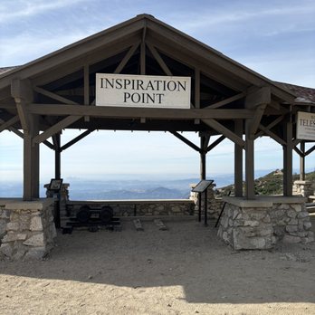
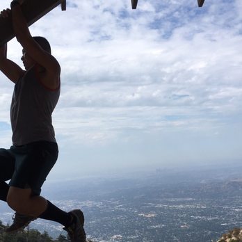
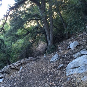
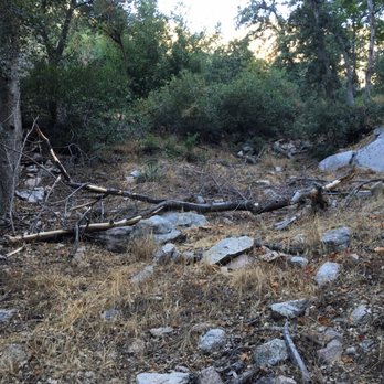
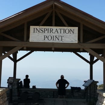
Would I come back? Definitely! Level of difficulty: Depending on your fitness level. To me this trail was moderate. Length and time of completion: 14 miles, finished in 4 hours. My friend and I came on Sunday morning and there was plenty of parking outside the gate. We started at the Cobb Estate gate and made our way up the junction before going to the old hotel that used to be there. After taking a short break at the hotel we made our way back to the junction before entering this ambiguous path that leads you to inspiration point. The first thing I noticed about the trail was that it was pretty narrow and had a lot of loose rocks. I would recommend bringing trail/hiking shoes to avoid any injuries. The trail is not clearly marked but as long as you keep on going up you should be fine. Once you reach the top you will see the lookout and a sigh that says Inspiration Point. There are a couple of benches and telescope looking things that you can take pictures with. Once we were done admiring the scenery and taking in the fresh air, we made our way down the mountain. We decided to take the fire road/bike trail back down because we did not want to deal with the loose rocks. The descend back down was pretty shaded and runnable if you want to do some trail running. Took us 1.5 hours to get back down since we ran parts of the trail. I give this a moderate level of difficulty since it is a long trail. Other than the loose rocks and the 4000 ft elevation I saw quite a few people running up and down this trail. I will definitely come back to run this trail when I get a chance to. This would be a good trail to run as I train for my other Spartan and OCR events.


What a neat hike! Parking in the neighborhood, there's no paid parking. Be respectful of the residents. Apparently there was a resort here so there are plenty of old ruins to check out. I recommend starting early, it gets pretty hot throughout the day. At least 2 L of water. Bring some snacks for the inspiration point. Castle canyon route is very steep, it's difficult. It hasn't been well maintained. It's a pretty difficult hike, 10 miles altogether but well worth it. I recommend this hike, I would come back in early spring before it gets too hot.


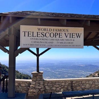
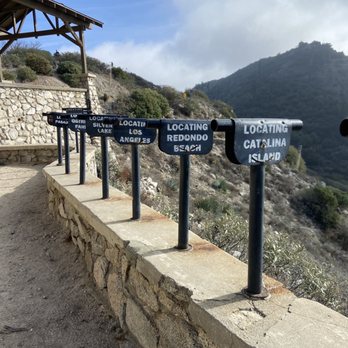
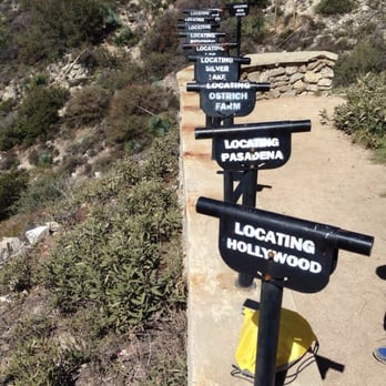
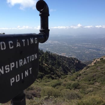
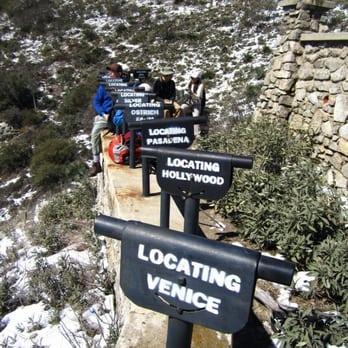
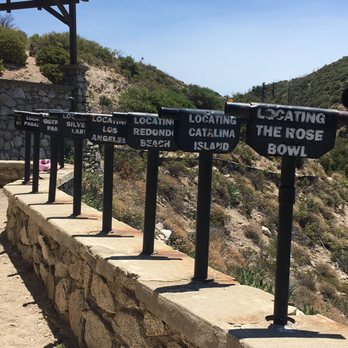
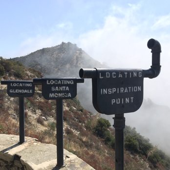
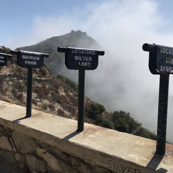
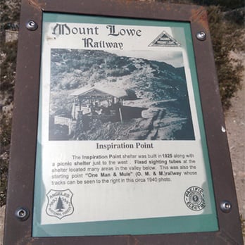
First hike and review of 2014!! Yay, 10+ miles COMPLETED! This was the longest and toughest hike I've been on. My legs were in PAIN. It's been 3 days and I'm still aching... It took us 5.5 hrs to complete =X Gotta take breaks here and there to snap pics to post on Yelp =P Trail: Switchbacks Galore! There's two trails that takes you up to Inspiration Point- Castle Canyon or Sam Merrill Trail. Take your pick: *Castle Canyon Trail: shorter, steep and rocky. *Sam Merrill Trail: longer and sandy. Both trails are NARROW...Don't look down! =/ We took the Castle Canyon trail on the hike up and Sam Merrill trail on the hike down. If you take the Sam Merrill trail, you will be able to see ruins of an observatory (or what's left of it). Inspiration Point is BEAUTIFUL! They have the "World Famous Telescope View"- stationary hollow pipes pointed at various locations (San Pedro, Rose Bowl, Catalina Island, Redondo Beach, LA, Silver lake, Pasadena, Ostrich Farm, Hollywood & Venice). There was also a curved pipe that located "Inspiration Point"...I thought that was funny =) Tables and benches are available for you to enjoy your light snack or take a quick nap...that's what I wanted to do because I was TIRED! Here's a little history for you: From 1917 to 1935, there was a little tourist tramway that connected Inspiration Point to Panorama Point overlooking Eaton Canyon called the "One Man and Mule Railway". In order to keep the dust off the passengers, Herbert the mule pushed the car rather than pulled it...Interesting! =) Tip #1: Stay on the trails! I decided to take a shortcut and got poked by a thorny plant, OUCH! Tip #2: Go in the AM (preferably before 8) Tip #3: Bring plenty of water and wear sunscreen. Tip #4: No restrooms so either HOLD it or squat/stand =P Parking: Street After this hike, I think I'm ready for Mt. Wilson. I can't wait!


This hike had been on my list of hikes to do for the past few months, and we finally did it! Directions to trail: take the 210 freeway and get off at Lake Ave, and drive towards the mountains. It also pulls up on Google maps if you type in Cobb Estate Altadena, CA. Trail head is on the left, people just park on the street. Trails: You start up the paved driveway of the estate, then shortly you come to the beginning of San Merrill Trail on the right hand side, you don't go all the way to the end of the drive. San Merrill is a 2.5 mile trail that leads you up to Echo Mtn, once there you can go to the right and see the old hotel ruins. As for getting to Inspiration Point: There are two trails you can take, they both lead up to Inspiration Point. The entrance to both trails are near each other. We went up Castle Canyon Trail and came down San Merrill Trail. I'm glad we chose this route because going up Castle Canyon, you can spot Inspiration Point from a distance eventually, giving you motivation to keep hiking. You can do a full loop and go back down using the Merrill trail. If you are staring at the Inspiration Point sign, you go right down the road and a lil ways down you will spot the trail head to San Merrill, it's a bit forest-y looking. If you go back down San Merrill you will past a look out with a giant rock. Good spot for picture taking. So the trails we took were: 1) Sam Merrill Trail Head 2) Mt Lowe Railway Trail (aka Echo Mountain) 3) Castle Canyon Trail 4) Inspiration Point 5) San Merrill Trail Round trip roughly 10 miles. Fun urban hike!


One of my favorite hikes in LA for its strenuous trail and the beautiful sight at the top! Depending on which trail you choose, it can be 10 miles or 12.6 miles. At the midpoint stop at Echo Mountain, you can choose two ways to get to Inspiration Point - continue on Sam Merrell to hike 12.6 miles roundtrip or hike on Castle Canyon trail for 10 miles roundtrip to and from Inspiration Point. I've done both and the Castle Canyon trail is much easier and shorter than the Sam Merrell trail. The difference between the two trails is that Castle Canyon is a bit more steep and shorter in mileage compared to Sam Merrell. Castle Canyon trail is also more narrow than Sam Merrell where you can only one person in front of another. Sam Merrell trail is pretty wide enough for a car to drive on it. Last time I remember seeing a lot of bikers on Sam Merrell! For me personally, I preferred Castle Canyon because there was more tree shade and it felt more like a hike since it was rocky and steep whereas the Sam Merrell trail is a road for trucks to drive through and is a bit more exposed. There is parking on the street but just to let you know, if you plan on coming before 6am, try to park behind cars that are already parked. The street signs say that there isn't parking before 6am, so I don't know if you want to risk getting a parking ticket! Also, the trailhead is a little hard to tell (especially in the dark!) so when you get to a fork from the gate entrance, do not go to the left! It goes to a reservoir! Instead continue straight even though it looks like it's going downhill. It actually starts off a little down and then you start on your switchbacks! I missed this, TWICE. Just a little bit of advice for all you hikers! So if you haven't hiked this trail yet, I would definitely recommend it! My brother and I started hiking at 5am, stopped by Echo Mountain for some yodeling, got to Inspiration Point by 7am, and back to the car by 8:30am. Of course we were running downhill which is how we cut time off and workout pretty often (he's 6'1" and works out everyday and I love running marathons). In the summer where it gets pretty hot up there, bring lots of water and start early! Happy hiking yelpers!


Second visit to Inspiration Point and from experience, the weather makes a HUGE difference. The hike ranges from 10-12 miles depending on the trails you take. It's 12.6 miles when you take Sam Merrill to castle canyon to Inspiration Point; and down from inspiration point using the Sam Merrill Trail. That's the best route to & from Inspiration Point. Castle canyon trail is roughly over 2 miles. However, the trail is steep. I don't recommend coming down it from Inspiration Point. What a beautiful trail, and considering it's 10-12 miles to complete; the trail can be taxing if it's hot. It's a 4-6 hour hike depending on breaks. This trail is do-able for newbie hikers. It can be mentally challenging, but worth every huff up. The paths up to Inspiration Point are isolated with less foot traffic. Venturing alone or at night can be scary. It's an eerie feeling going down at night, but it sure is beautiful. It's a fun day hike to go on with friends! Bring snacks, lunch/protein bar. It's 10-12 miles. You'll be hungry. Bring at least 2-4 liters of water depending on the weather. 3-4 liters in warmer temperatures and 1-2 liters in cooler temps. Stay safe, have fun, and be responsible!


Once we got to Echo Mountain, we were determined to go further to get to Inspiration Point. Apparently, there are two paths to take, the long way (which takes you on the Sam Merril Trail), or the shorter and steeper way which is Castle Canyon. We thought we were on the short trail, but almost found ourselves lost by going the Sam Merril trail. We hiked what seemed to be forever, and almost turned back because we thought we were lost. Thank God we didn't because we were only 1/4 mile from Inspiration Point without even knowing it. The trail is not welll marked once you are far up, but there is no other way to go, so it would be hard to get lost. We passed a sign for Sunset Point, which was a bonus and surprise for us. A lot of hiking reviews rate this as an easy hike, it is not. It is definitely moderate. My group of friends have been going out weekly for hikes, working up to this one. I'm glad we did. We left the trail head at 6am and made our way up to Echo Mountain. I would have been happy leaving at 5am because it gets HOT. Bring ample water, apples, nuts, a decent snack. We stopped at Echo Mountain and had our first unveiling of layers of clothing. We were already sweating. Hiking shoes or boots are a must. They grip the trail much better and don't slide like sneakers. Be prepared for lots of sun, so sunblock is an absolute must. Bring your phone or camera because the views are spectacular. The trail is clean and beautiful. A must for all locals to experience this hike.
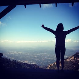

What a great hike! Definitely one of my favorites in LA. Let me be clear about the difficulty of this hike. From the beginning of the trial to Echo Mountain (about 2.2 miles in, halfway to Inspirational Point), the difficulty is easy. You won't break too much sweat from it if you've been semi-active. Don't be fool and think that Echo Mountain is Inspirational Point because my friends and I almost did... from Echo Mountain, you can either take: 1) Sam Merrill (the left trial): sandier, barely any shades 2) Castle Canyon (the right trial): a lot steeper, shadier, more greens, cooler, more narrow Both trials will take you up to Inspirational Point as well as take you back down. I took Castle Canyon up and boy was it a great workout! I don't recommend it for beginners. One of my friends was having a hard time. But we all agreed the view from the top was worth it! We sat and ate our snacks, taking in the view of LA.. with its beauty and imperfections. Smog or not, I still love this city! We hiked the Sam Merrill (the wider trial with no sign to your left) back down. It was kind of hurting my knees though. 10 miles is a lot of hiking! I'm still a little sore after a few days. Reminders: - bring at least one large water bottle! - wear a jacket, it gets super cold in the shady area and at the top. - bring snacks to eat at the very top to enjoy the amazing view. - the hike will take at least 4-5 hours (10 miles) depending on your pace.

Date of hike: 2.27.2011 After resting a bit at Echo Mountain (http://www.yelp.com/biz/echo-mountain-via-the-sam-merrill-trail-altadena#hrid:f1g548F0gmmZJtaURSqwPg) we decided to hike up the *measly* extra two miles to Inspiration Point. With some of the trail being blocked by trees early on, I knew this trail was going to be an adventure. The temperature dropped even more and I was freezing because I didn't dress properly. Next time I'm bringing extra layers. Less than half a mile in the hike we started to see snow on the trail. Soon the trail was covered in snow/ice and I had to be really careful because I was only wearing my trail running shoes. I was definitely not prepared for this part of the hike. After some slipping, seeing some cool ice formations, and being pelted from the snow melting from the trees above us we reach the top and the view is amazing. I was freezing my a$$ off but it was worth it. The view of LA was amazing unfortunately it was a bit hazy so we couldn't see Catalina Island. To get to the bottom of the Echo Mountain trail head the hike was about 4.7 miles from Inspiration Point. This part was more challenging for me because of the shoes I was wearing. I had to be extra careful trying not to slip downhill. This hike including Echo Mountain was a little less than 10 miles and we completed it in about 5.5 hours including the breaks at the top of Echo Mountain and Inspiration Point. Next time I'll be more prepared gear wise. It would probably be nice to bring up a nice small lunch to enjoy at Inspiration Point as well. More pictures can be found here http://www.flickr.com/photos/lamb1028/sets/72157626176320358/


2 years ago
Long and difficult hike but worth the view! About 10 miles round trip from Cobb Estate. Bring a hat, lots of water, snacks, sunscreen, and BUG SPRAY. Me and my husband started around 7:30am and finished the whole hike around 1pm at a steady pace with about an hour break when we got to Inspiration Point. The hike from Cobb Estate to Echo Mountain was a breeze for us, but the hike from there to Inspiration was a whole other story. I recommend wearing long pants as the second half of the hiking path isn't as clear and pretty narrow on some parts. We took our time and treaded lightly but still got some minor scratches on our legs from all of the branches and leaves. My husband started getting irritated from walking into all of the spider webs lol. Not sure if the actual hike was 2 miles from Echo Mountain because it felt so much longer than that. We started getting really tired near the end from all the incline. We almost gave up until my husband saw the view of Inspiration Point. Once we got there, the views made it all worth it! Would we do it again? Maaaaaybe lol. read more
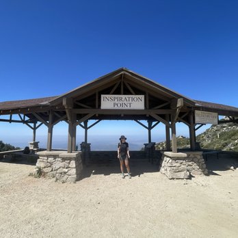
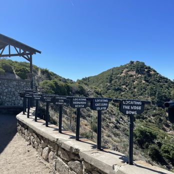
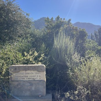
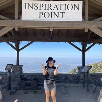


Updated review: I've been to Inspiration Point twice now, most recently after the great Los Angeles "blizzard" of early 2023. And how super intense and cool (figuratively and literally) it was! Total about 10mi from the top of Lake - Echo Mountain - Castle Canyon trail - Inspiration Point - Sam Merrill trail - Echo Mountain and back down to Lake. DEFINITELY a strenuous hike and would highly recommend hiking poles, sunscreen, water, and snacks! The view is incredible, especially with tons of fresh snow everywhere. Hiked this early March 2023 and the Castle Canyon trail leading off from Echo Mountain (a decent hike in its own right) is pretty challenging, if not a bit brutal in some areas: slippery snow, downed trees and bushes blocking the path, and a heavy incline. Again, highly recommend poles. Once at Inspiration Point the view is phenomenal. The Pacific Ocean, Palos Verdes, Catalina Island, and even Anaheim and Irvine are all visible from the top, and downtown LA too of course. Lots of picnic benches and photo-op-worthy view finders for major Southern California sites. Gorgeous San Gabriel mountains in the background. The Sam Merrill trail leading down the backside of the mountain (and then curving back around to the south/west) is much more tame (but still a bit precarious with 2+ feet of snow) and very sun-exposed all the way back to Echo Mountain. All in all probably one of the more butt-kicking Los Angeles hike. Takes about 4-5hrs round trip depending on your pace. read more
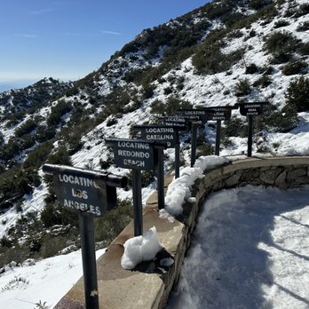
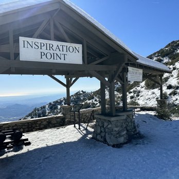
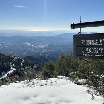

To reach inspiration point from Castle Canyon trail you'll have to hike up to Echo Mountain. The common route up to Echo Mountain is starting from the Cobb Estate and taking the Sam Merrill trail up to Echo Mountain. Once you reach the junction near echo mountain you'll see the sign for Castle Canyon to Inspiration Point, there's also a continuing trail for Sam Merrill that goes up to the Mt. Lowe railway road that will also get you to inspiration point. It's a mile longer that Castle Canyon but the climb is less steep, and you can just take Castle Canyon back down. Depending which way you go once you reach Echo Mountain round trip this hike can be between 10 and 11 & 1/2 miles. This is a pretty challenging hike parts of Castle Canyon are better to navigate through with trek poles. A majority of the trail isn't covered so bring a hat and sunscreen along with you. read more
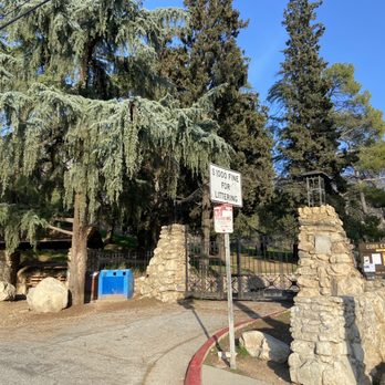
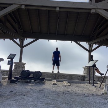
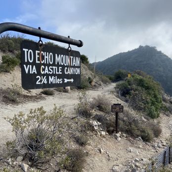
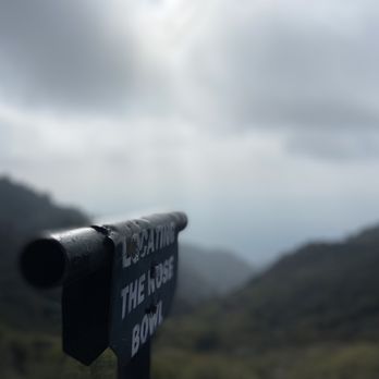


This was a hard hike but so worth it! We got lost and tried to get back on trail so we took some steep inclines. I do this hike every year, and I feel it's always hard no matter how in shape or out of shape I am! Bring lots of water and snacks! You'll need it! It took us 4 hours round trip! read more




8 years ago
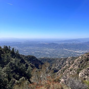
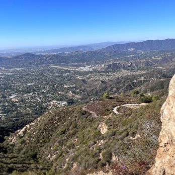
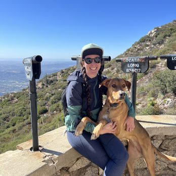
*BRING FOOD/SNACKS, WATER, PREPARE FOR A LONG AND EXHAUSTING HIKE* Wow, this is likely the longest hike I have done so far. It was a 6 hour round trip for us, including breaks in between. Bring snacks, a couple bottles of water, and any other hiking necessities. First, we started at Cobb Estate, where street parking is available. We got a bit lost and took a wrong path, but a nice lady showed us the right path to Echo Mountain, which is the half-way mark. We took a break at Echo Mountain to enjoy the scenery and to rest. The historic ruins make up the surrounding area. It is crazy to think that there used to be a hotel and railway up here in the early 20th century. The final stretch to Inspiration Point via Castle Canyon is 2.5 miles from Echo Mountain. The Castle Canyon trail is even more incline intensive and with an increasingly narrow path. It gets more and more steep, so take breaks as needed, because we certainly did. The path up was empty, however, we did run into people who were on the way down. The hike was so tiring that I felt so much happiness when Inspiration Point was in my sight. I did a final sprint to it because I was so glad to finally reach our destination and end the torturous hike. Needless to say, I was completely burned out. The views at Inspiration Point are breathtaking! You can clearly see the Los Angeles skyline and the telescopes also point to the direction of the other cities such as Santa Monica, Glendale, and Torrance to name a few. We took the Sam Merrill trail back down at the suggestion of a local. The path was wide and much more easier. However, it felt much longer, but I guess that's the trade for a much safer path down. It would seem that going back down on the Castle Canyon trial would have been much more dangerous and challenging. The long hike definitely burned me out, I was so glad it was finally over when I returned to Cobb Estate lol. It is extremely challenging and difficult. The steep incline is no joke and is extremely tiring on the legs. We were famished by the end of the hike, I couldn't wait to finally get some food into my belly. I thought the first path to Echo Mountain was difficult, but the Castle Canyon trail really took it up a notch. I would hike it again, but not for a while, I think I need more time to rest. I'd also like to give a shout out to the locals, they were very friendly and were happy to help guide us to Inspiration Point! read more



5 years ago
Awesome 4 hour hike if you have a steady pace. 10.5 miles round trip. Castle Canyon pretty steep. But the view at the end totally with it. Be careful as it heats up the snakes come out. Saw a baby rattle snake coming down Sam Merrill Trail on the way back. read more

9 years ago
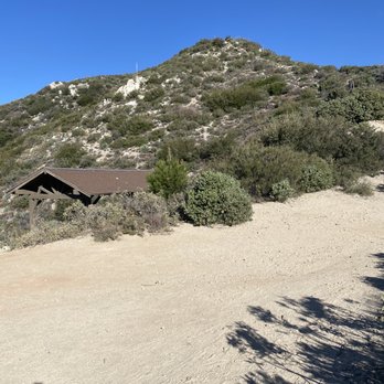
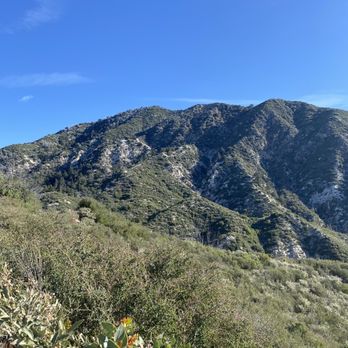
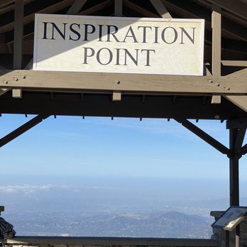
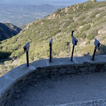
This is one of my favorite hikes in SoCal. The distance and difficulty is beyond a stroll in nature and the destination is unique. The hike is 9.6 miles round trip (same trail going in and coming out) with approximately 4,000 ft elevation gain. Tips for a successful hike: - park in the neighborhoods after 6am - start early! my group started at 6:15am and finished around 10:40am missing the blistering SoCal heat - bring 1L of water per person (1/2L for medium size dog) - bring snacks Enjoy! read more
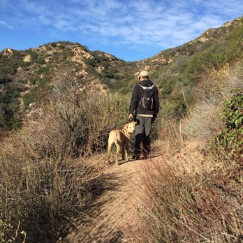
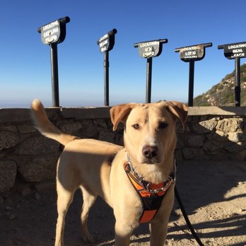
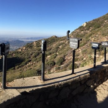

Would I come back? Definitely! Level of difficulty: Depending on your fitness level. To me this trail was moderate. Length and time of completion: 14 miles, finished in 4 hours. My friend and I came on Sunday morning and there was plenty of parking outside the gate. We started at the Cobb Estate gate and made our way up the junction before going to the old hotel that used to be there. After taking a short break at the hotel we made our way back to the junction before entering this ambiguous path that leads you to inspiration point. The first thing I noticed about the trail was that it was pretty narrow and had a lot of loose rocks. I would recommend bringing trail/hiking shoes to avoid any injuries. The trail is not clearly marked but as long as you keep on going up you should be fine. Once you reach the top you will see the lookout and a sigh that says Inspiration Point. There are a couple of benches and telescope looking things that you can take pictures with. Once we were done admiring the scenery and taking in the fresh air, we made our way down the mountain. We decided to take the fire road/bike trail back down because we did not want to deal with the loose rocks. The descend back down was pretty shaded and runnable if you want to do some trail running. Took us 1.5 hours to get back down since we ran parts of the trail. I give this a moderate level of difficulty since it is a long trail. Other than the loose rocks and the 4000 ft elevation I saw quite a few people running up and down this trail. I will definitely come back to run this trail when I get a chance to. This would be a good trail to run as I train for my other Spartan and OCR events. read more
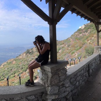



5 years ago
What a neat hike! Parking in the neighborhood, there's no paid parking. Be respectful of the residents. Apparently there was a resort here so there are plenty of old ruins to check out. I recommend starting early, it gets pretty hot throughout the day. At least 2 L of water. Bring some snacks for the inspiration point. Castle canyon route is very steep, it's difficult. It hasn't been well maintained. It's a pretty difficult hike, 10 miles altogether but well worth it. I recommend this hike, I would come back in early spring before it gets too hot. read more
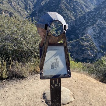
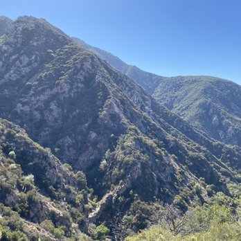
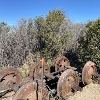
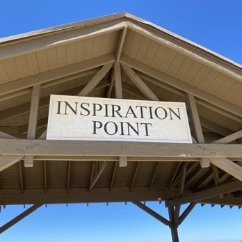

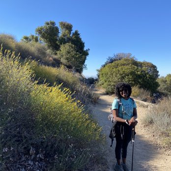


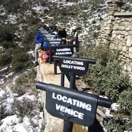
First hike and review of 2014!! Yay, 10+ miles COMPLETED! This was the longest and toughest hike I've been on. My legs were in PAIN. It's been 3 days and I'm still aching... It took us 5.5 hrs to complete =X Gotta take breaks here and there to snap pics to post on Yelp =P Trail: Switchbacks Galore! There's two trails that takes you up to Inspiration Point- Castle Canyon or Sam Merrill Trail. Take your pick: *Castle Canyon Trail: shorter, steep and rocky. *Sam Merrill Trail: longer and sandy. Both trails are NARROW...Don't look down! =/ We took the Castle Canyon trail on the hike up and Sam Merrill trail on the hike down. If you take the Sam Merrill trail, you will be able to see ruins of an observatory (or what's left of it). Inspiration Point is BEAUTIFUL! They have the "World Famous Telescope View"- stationary hollow pipes pointed at various locations (San Pedro, Rose Bowl, Catalina Island, Redondo Beach, LA, Silver lake, Pasadena, Ostrich Farm, Hollywood & Venice). There was also a curved pipe that located "Inspiration Point"...I thought that was funny =) Tables and benches are available for you to enjoy your light snack or take a quick nap...that's what I wanted to do because I was TIRED! Here's a little history for you: From 1917 to 1935, there was a little tourist tramway that connected Inspiration Point to Panorama Point overlooking Eaton Canyon called the "One Man and Mule Railway". In order to keep the dust off the passengers, Herbert the mule pushed the car rather than pulled it...Interesting! =) Tip #1: Stay on the trails! I decided to take a shortcut and got poked by a thorny plant, OUCH! Tip #2: Go in the AM (preferably before 8) Tip #3: Bring plenty of water and wear sunscreen. Tip #4: No restrooms so either HOLD it or squat/stand =P Parking: Street After this hike, I think I'm ready for Mt. Wilson. I can't wait! read more


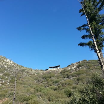

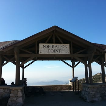


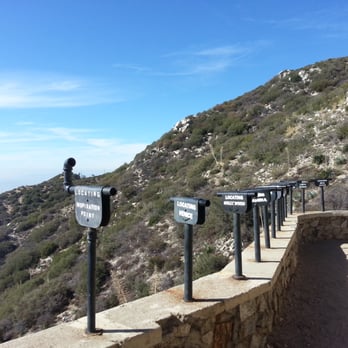


This hike had been on my list of hikes to do for the past few months, and we finally did it! Directions to trail: take the 210 freeway and get off at Lake Ave, and drive towards the mountains. It also pulls up on Google maps if you type in Cobb Estate Altadena, CA. Trail head is on the left, people just park on the street. Trails: You start up the paved driveway of the estate, then shortly you come to the beginning of San Merrill Trail on the right hand side, you don't go all the way to the end of the drive. San Merrill is a 2.5 mile trail that leads you up to Echo Mtn, once there you can go to the right and see the old hotel ruins. As for getting to Inspiration Point: There are two trails you can take, they both lead up to Inspiration Point. The entrance to both trails are near each other. We went up Castle Canyon Trail and came down San Merrill Trail. I'm glad we chose this route because going up Castle Canyon, you can spot Inspiration Point from a distance eventually, giving you motivation to keep hiking. You can do a full loop and go back down using the Merrill trail. If you are staring at the Inspiration Point sign, you go right down the road and a lil ways down you will spot the trail head to San Merrill, it's a bit forest-y looking. If you go back down San Merrill you will past a look out with a giant rock. Good spot for picture taking. So the trails we took were: 1) Sam Merrill Trail Head 2) Mt Lowe Railway Trail (aka Echo Mountain) 3) Castle Canyon Trail 4) Inspiration Point 5) San Merrill Trail Round trip roughly 10 miles. Fun urban hike! read more


One of my favorite hikes in LA for its strenuous trail and the beautiful sight at the top! Depending on which trail you choose, it can be 10 miles or 12.6 miles. At the midpoint stop at Echo Mountain, you can choose two ways to get to Inspiration Point - continue on Sam Merrell to hike 12.6 miles roundtrip or hike on Castle Canyon trail for 10 miles roundtrip to and from Inspiration Point. I've done both and the Castle Canyon trail is much easier and shorter than the Sam Merrell trail. The difference between the two trails is that Castle Canyon is a bit more steep and shorter in mileage compared to Sam Merrell. Castle Canyon trail is also more narrow than Sam Merrell where you can only one person in front of another. Sam Merrell trail is pretty wide enough for a car to drive on it. Last time I remember seeing a lot of bikers on Sam Merrell! For me personally, I preferred Castle Canyon because there was more tree shade and it felt more like a hike since it was rocky and steep whereas the Sam Merrell trail is a road for trucks to drive through and is a bit more exposed. There is parking on the street but just to let you know, if you plan on coming before 6am, try to park behind cars that are already parked. The street signs say that there isn't parking before 6am, so I don't know if you want to risk getting a parking ticket! Also, the trailhead is a little hard to tell (especially in the dark!) so when you get to a fork from the gate entrance, do not go to the left! It goes to a reservoir! Instead continue straight even though it looks like it's going downhill. It actually starts off a little down and then you start on your switchbacks! I missed this, TWICE. Just a little bit of advice for all you hikers! So if you haven't hiked this trail yet, I would definitely recommend it! My brother and I started hiking at 5am, stopped by Echo Mountain for some yodeling, got to Inspiration Point by 7am, and back to the car by 8:30am. Of course we were running downhill which is how we cut time off and workout pretty often (he's 6'1" and works out everyday and I love running marathons). In the summer where it gets pretty hot up there, bring lots of water and start early! Happy hiking yelpers! read more

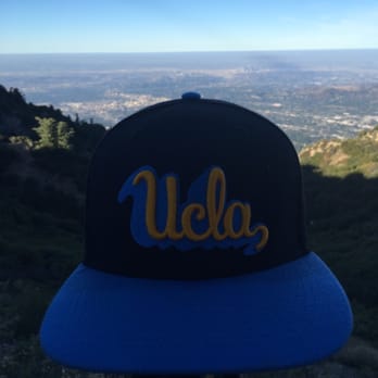

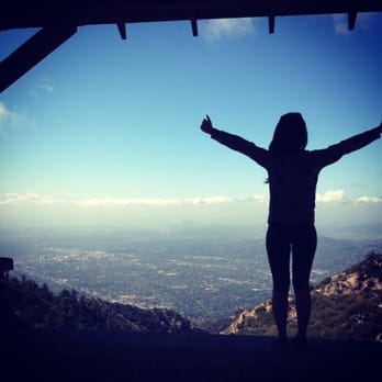
Second visit to Inspiration Point and from experience, the weather makes a HUGE difference. The hike ranges from 10-12 miles depending on the trails you take. It's 12.6 miles when you take Sam Merrill to castle canyon to Inspiration Point; and down from inspiration point using the Sam Merrill Trail. That's the best route to & from Inspiration Point. Castle canyon trail is roughly over 2 miles. However, the trail is steep. I don't recommend coming down it from Inspiration Point. What a beautiful trail, and considering it's 10-12 miles to complete; the trail can be taxing if it's hot. It's a 4-6 hour hike depending on breaks. This trail is do-able for newbie hikers. It can be mentally challenging, but worth every huff up. The paths up to Inspiration Point are isolated with less foot traffic. Venturing alone or at night can be scary. It's an eerie feeling going down at night, but it sure is beautiful. It's a fun day hike to go on with friends! Bring snacks, lunch/protein bar. It's 10-12 miles. You'll be hungry. Bring at least 2-4 liters of water depending on the weather. 3-4 liters in warmer temperatures and 1-2 liters in cooler temps. Stay safe, have fun, and be responsible! read more


Once we got to Echo Mountain, we were determined to go further to get to Inspiration Point. Apparently, there are two paths to take, the long way (which takes you on the Sam Merril Trail), or the shorter and steeper way which is Castle Canyon. We thought we were on the short trail, but almost found ourselves lost by going the Sam Merril trail. We hiked what seemed to be forever, and almost turned back because we thought we were lost. Thank God we didn't because we were only 1/4 mile from Inspiration Point without even knowing it. The trail is not welll marked once you are far up, but there is no other way to go, so it would be hard to get lost. We passed a sign for Sunset Point, which was a bonus and surprise for us. A lot of hiking reviews rate this as an easy hike, it is not. It is definitely moderate. My group of friends have been going out weekly for hikes, working up to this one. I'm glad we did. We left the trail head at 6am and made our way up to Echo Mountain. I would have been happy leaving at 5am because it gets HOT. Bring ample water, apples, nuts, a decent snack. We stopped at Echo Mountain and had our first unveiling of layers of clothing. We were already sweating. Hiking shoes or boots are a must. They grip the trail much better and don't slide like sneakers. Be prepared for lots of sun, so sunblock is an absolute must. Bring your phone or camera because the views are spectacular. The trail is clean and beautiful. A must for all locals to experience this hike. read more


12 years ago
What a great hike! Definitely one of my favorites in LA. Let me be clear about the difficulty of this hike. From the beginning of the trial to Echo Mountain (about 2.2 miles in, halfway to Inspirational Point), the difficulty is easy. You won't break too much sweat from it if you've been semi-active. Don't be fool and think that Echo Mountain is Inspirational Point because my friends and I almost did... from Echo Mountain, you can either take: 1) Sam Merrill (the left trial): sandier, barely any shades 2) Castle Canyon (the right trial): a lot steeper, shadier, more greens, cooler, more narrow Both trials will take you up to Inspirational Point as well as take you back down. I took Castle Canyon up and boy was it a great workout! I don't recommend it for beginners. One of my friends was having a hard time. But we all agreed the view from the top was worth it! We sat and ate our snacks, taking in the view of LA.. with its beauty and imperfections. Smog or not, I still love this city! We hiked the Sam Merrill (the wider trial with no sign to your left) back down. It was kind of hurting my knees though. 10 miles is a lot of hiking! I'm still a little sore after a few days. Reminders: - bring at least one large water bottle! - wear a jacket, it gets super cold in the shady area and at the top. - bring snacks to eat at the very top to enjoy the amazing view. - the hike will take at least 4-5 hours (10 miles) depending on your pace. read more

Date of hike: 2.27.2011 After resting a bit at Echo Mountain (http://www.yelp.com/biz/echo-mountain-via-the-sam-merrill-trail-altadena#hrid:f1g548F0gmmZJtaURSqwPg) we decided to hike up the *measly* extra two miles to Inspiration Point. With some of the trail being blocked by trees early on, I knew this trail was going to be an adventure. The temperature dropped even more and I was freezing because I didn't dress properly. Next time I'm bringing extra layers. Less than half a mile in the hike we started to see snow on the trail. Soon the trail was covered in snow/ice and I had to be really careful because I was only wearing my trail running shoes. I was definitely not prepared for this part of the hike. After some slipping, seeing some cool ice formations, and being pelted from the snow melting from the trees above us we reach the top and the view is amazing. I was freezing my a$$ off but it was worth it. The view of LA was amazing unfortunately it was a bit hazy so we couldn't see Catalina Island. To get to the bottom of the Echo Mountain trail head the hike was about 4.7 miles from Inspiration Point. This part was more challenging for me because of the shoes I was wearing. I had to be extra careful trying not to slip downhill. This hike including Echo Mountain was a little less than 10 miles and we completed it in about 5.5 hours including the breaks at the top of Echo Mountain and Inspiration Point. Next time I'll be more prepared gear wise. It would probably be nice to bring up a nice small lunch to enjoy at Inspiration Point as well. More pictures can be found here http://www.flickr.com/photos/lamb1028/sets/72157626176320358/ read more


This is half a review for Inspiration Point via Castle Canyon. If you want full reviews, skip this one. So, yes, I'm being honest. I attempted to ascend to Inspiration Point via the Castle Canyon trail and I aborted halfway through. I've had acrophobia (irrational fear of heights) since I was a kid. It wasn't until too long ago that standing on a chair or even walking down a flight of stairs stirred panic in me. I still suffer from this to an extent, but I've chosen to work on it and not let it stop me from living. Get what I mean? Moving on... I was initially supposed to meet up with a friend to hike up to IP, but I was running about 20 minutes late and she had a schedule to commit to. I wasn't able to catch up to her so we each hiked solo, about 20-30 minutes apart. I took the trail that leads up to Echo Mountain (switchback hell!). Once up near the ruins there are three trails to your left. The third one says "Inspiration Point". Take that one. I poured over every review over the last few days to see what I was going to be up against. I read repeatedly that it was a steep, narrow hike and that hiking shoes were recommended (check!). I had some adrenaline and didn't feel like stopping at the Echo Mountain ruins for snackage, so I proceeded to Inspiration Point. ::sigh:: The good: The good is VERY good. The trail is so desolate. It's lonely and you almost feel afraid of being so alone in the wilderness (well, I was, a little!) but it was so amazing. I mean, you look to the right and you see nothing but forest. You can see some views of the city and the ruins, but you just see NATURE. Even the birds chirping sound different. It's a very beautiful trail, I made it to the first running water, and it was so peaceful. On my way back I stopped there for lunch. It was peaceful and quiet, not like Sturtevant Falls or those other popular places. I did see a few people on my way back but not many. For the most part, I was completely alone. The NOT so good: This trail can become VERY narrow, and the trail for the most part is literally on the edge of the mountain. If you can look down, it's almost a straight drop at times. I kicked a rock out of my way at one point and I could hear it falling...and falling...and falling...and I realized one slip on this trail and that could be me. As for inclines, there weren't too many. I initially actually liked this trail more than Echo's trail. Except when it got narrow. Before I aborted my hike, I had 4 scares due to my fear of heights. I finally came to a spot where I couldn't do it alone, I needed someones help to pass it. I attempted to, kept telling myself "Mind over matter! Why stop now?!" But the acrophobia that's still in me somewhere paralyzed me. I turned back. Do I regret attempting this hike...not at all. Do I regret not finishing it? Somewhat. Now my friend gets bragging rights HAHA. I do regret not being able to see more of this beautiful trail. I read there was a cave and small waterfall. I can't wait for Frank S. to do this one! I know he'll complete it :) He's a hiking a beast. read more


One of my all time favorite scenic and most scariest hikes I ever been on. So we kind of have this love hate relationship. The hike to inspiration point is two miles up from echo mountain. Roughly, you'll be expecting to spend about 5 to 5 and half hours doing this whole hike. The trail to inspiration is not for beginners. It's more for the intermediate/advance hikers. Going to echo mountain is nothing compared to the castle canyon trail up to inspiration point. The trail become a single like trail up with more switchbacks and more insects. My friend that went with me on this trek, almost had a heart attack.... the bees and insects were buzzing around her.... hahaha. As for me, I get a bit scared of heights.... every time the hike gets narrow, my legs get shakey like jello... I tell myself all the time not to look down..... but eh I don't usually listen to my own advice. Once you get to the top, there is a lookout point where you can see different locations through some horoscopes. It looks better when the skies are clear. You can take a load off and have a picnic up there and recharge your batteries for long trek back down. Make sure you have good hiking shoes that have grip. I did it with running shoes, so I took a long time going down to make sure I don't trip and eat it! Lovely hike for any hiking enthusiasts and good for the legs and glutes. Next I'll take the the Sam Merrill Trail that leads to inspiration point, just to see how they differ from each other. Cheers and beeers ya'll! read more




o1.18.15 I survived!! Oh boy! I think this is the most intense I've gone to so far. And it is the one pt I have always wanted to go. Started early today (at 7:30am) and while my friends are resting at the Sam Merill trail, I decided to continue to the inspiration point. Thanks to my hiking buddies, music and water, I made it to the top! I was literally dying bc it was 99.9% inclines. It was so tiring! I guess I haven't gone hiking that long. The only tiring part was I could hardly lift my legs haha. But hey, I didn't give up. And I bumped into my friends (heading down) that told me I am almost there. I kept walking and walking, thinking to myself, "How does my friends define the word "almost"?" It seemed like forever to me. Another 5 mins later, a few hikers told me the same thing so I just kept on going and thinking more, "What do people really mean when they said "almost"!!??" Such a lie haha Note: Please be sure to bring water! I felt like I was going to faint for a few minutes. I had to drink my water immediately. And while heading back down, don't go too fast because you can easily twist your ankle or fall on your butt. I witnessed someone twisting his ankle because he was running down the trail. This one grandpa (he looked like he was older than my dad) was running down the trail too! While the other guy twisted his ankle, he waited for him. So I walked passed by him. Later he caught up and said to me, "You're doing good!" Ehhh...At that moment, all I was able to say was "Thank you." and smiled. I mean, a grandpa in his 70's telling me I'm doing good...should I feel ashame? Because I am so much younger, yet, hardly survived. Lol Awesome hike! I think I'm going to add it to my fav. :) read more

SPOILER If you've seen my previous hike reviews as much as I am for adventures and the art of getting lost, but sometimes I am on a time constraint. So here are some directions Directions: We parked close to the neighborhood and weren't charged for parking. The directions are self explanatory. Once you've hit Echo Mountain, that is basically the halfway mark but it does get steeper. Hiking Difficulty: Medium-Hard To Echo Mountain, it was pretty chill. However going up, the roads got narrow, steeper, and imbalanced. There is shade and benches once you've reached your point. Take as much pictures as you want. Once you head down it gets slightly easier. If you left early you shouldn't have a problem with the heat however if you didn't...good luck. Overall we finished in about 5 hours (factoring several breaks and wearing a 10 pound body suit). Overall: I enjoyed this hike, good people, random facts, and a good view. Despite suffering from heat exhaustion, I liked my experience. If I brought more water and didn't wear any body weights, then I definitely would have enjoyed this more. Advice: -Don't be shy to ask the neighbors for help. -Wear hiking boots and a hat to avoid the heat. -Once you have reached Echo Mountain, get ready for steeper and more narrow mountains. -Bring maybe 3-4 bottles of water. -Come early to beat the heat. -I wouldn't recommend this for kids, the roads can get narrow and it can get quite tiresome. -Check the forecast to ensure a clear view. read more




Omg this hike really got me. It's so long and tiring. After Echo Mountain, my friends and I decided to hike this trail. It was really rocky so be careful!! My friend and I kept slipping. It was pretty intense. We stopped and rested a few times but I kept pushing myself to reached the top. The trail seemed never ending. I swear I never sweat so much in my life. My shirt was drenched in sweat. It felt disgusting!! But hey, it was all worth it at the end. When I reached the top. I was so happy. Such an amazing view. Well besides the smoky air. Never in my life have I done such a long hike. It was my first time doing a 10 mile hike and it's nice to know that you achieved something with your friends. Love you girls. Whoo-hoo!! I love to experience new and exciting places. So glad to have experienced this hike. Make sure to bring plenty of water and/or Gatorade. Something to keep you hydrated!! Let's say about 3-4 drinks would be good. I brought 3 water bottles and I finished it all. Also don't forget snacks, sunscreen, chapstick, and sunglasses. That's important too! Going back down is way easier and faster than going up. Hiking up is a pain in the ass. But don't give up, I believe in you :) Something to keep in mind: "A good friend listens to your adventures. A bestfriend makes them with you" read more


11 years ago
Absolute beautiful trail. Strenuous for first time hikers all the way up to the summit so water & snacks are necessary. Took me a few hours (including breaks) to make it up here. Blood. Sweat. & Real Tears. My feet hurt at the thought of this hike... But worth it! Lots of history & beautiful landscape to see here. Will return soon! :) read more


8 years ago
Prior to this hike, the longest hike I've ever done was 7 miles. Even then, I was definitely not prepared for the pain that was this hike. Okay so the first 2.5 miles up to echo mountain was good. Easy peasy. Going up to the inspiration point from echo mountain is where it gets rough. My friend and I missed the castle canyon trail so we ended up taking the sam merrill trail up. It's a longer path than castle canyon and walking up towards inspiration point felt like forever. However, once we got to the inspiration point, the view was breathtaking. For sure one of my favorite views I've hiked to! Since the sam merrill trail felt too long, my friend and I decided to take the castle canyon trail back down. Lemme tell you, going back down was probably more challenging for me than going up. Probably because castle canyon is more narrow, steep, and rockier than sam merrill. So one slip and you can probably fall and die. Okay maybe I'm being too dramatic but it is a little more dangerous, especially when going downhill because it's easier to slip (I was also not wearing good hiking shoes). Also my problem with the castle canyon trail is that there were so many bees. They were unavoidable as the trail was so narrow and the bees were attracted to the white flowers that were literally located at every turn. If you don't mind bees, okay good for you. But not so good for me because bees terrify the heck out of me. Also we went at a terrible day and time. By the time we were going down, the sun was bright and blazing hot. Maybe skip this hike on hotter days or go at cooler times. Would I do this hike again? Probably because I like when I can't feel my legs the next day (kidding kidding). But I do like a challenge and this hike was definitely challenging. Now I can move on from my 7 mile hikes to 10 mile hikes. Hurray!! One thing I would change though if I did this hike again is that I would take castle canyon up and sam merrill down. read more



4 years ago

Inspiration pt. Was intense and not for beginners. Narrow walkway than most hikes, single file only, so 2 people cannot walk alongside each other lol. one slip and you could fall. Saw some bringing their dogs, not good for kids. Hike early because it takes couple of hours (about 2.5mi) to get to echo mt. And from echo mt. To inspiration another 2.5 miles, so a couple more hrs. Roundtrip: 10miles Warning: All uphill, incline, steep trail, no restroom Started just before 8am, completed just before 2pm. Great view, historical mountain, former resort and zoo. There is people going downhill constantly, runners, bikers, make room for them. Tips: Pack: plenty of water, snacks, sunscreen, napkin/hand sanitizer. Wear: shoes with good grips, my running shoes was not good enough for this hike IMO and bring a jacket. read more


8 years ago
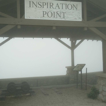
If anyone's every hiked/ran/traveled with me, you should know by now that when I say "Ok guys, seriously, we're almost there!" actually translates to 2+ miles or 30-60 minutes of trekking... Well played, amirite or amirite?! Real talk, I have no idea what I'm doing. I didn't choose the derp life, the derp life chose me! Hike this twice now in the past 6 months, and I may just have to add this hike on a bimonthly rotation! As many have recommended, it's best to hike up the Sam Merrill to Echo Mountain (2.5 miles, then at the junction take the Castle Canyon Trail to Inspiration point (2.1 miles). You're looking at 4.6 miles one-way uphill with a ton of switchbacks, so don't assume it's a straight shot upwards! TBH the Sam Merrell trail is super easy, and Castle Canyon is slightly moderate as long as you have some hiking shoes on to prevent slipping on loose rocks. Once you reach the Inspiration point lookout, check out Easter Rock! My friend, whom I mercilessly convinced to hike this with me, dubbed it the Rock of Thrones (or was it the Throne of Rocks?!). We ate our bananas and fruit snacks while sitting on top of it. 10/10 would do again. We took the Sam Merrell Train back down to the trailhead since it was easier on our knees, which added another 5 miles. Overall we probably hiked 10+ miles since we took a few detours (sorry, not sorry!) and the view was even better this time as the fog rolled out! 10/10 would hike this again real soon, probably solo because of how scenic and easily accessible this trail is. read more


9 years ago
Direction to Inspiration Point! Before I headed up, I thought I read enough reviews to prepare myself and not to get lost (since I always get lost on the trails I go for the first time..), but we went into wrong trails twice and luckily we met nice groups of people who told us it was the wrong way.. To make it short, once you park in the residential area near the north end up the Lake Ave, head up the trail about 2.5 mi until you see the sign for echo mountain and the trail splits up in two ways. Follow the sign for echo mtn to the right (0.8 mi) and you will see a few entances to other trails on your left (very easy to miss). Look for a very small sign that leads to inspiration point and follow that trail for another 2.5-3mi. Take a break at the echo mtn picnic area and take some nice photos and come back to continue on the second half of the trail. Our round trip was about 12 mi. Level of difficulty really depends on your fitness level but I would say moderate. The views are amazing and it's totally worth it! Good luck! read more




8 years ago
I start from the end if Lake Ave on Cobb Estate. The hike to Echo Mountain is fairly easy. You have to start early because it gets hot right away. It's a 2 1/2 mile hike uo there. Once you get up there, take a breather and drink your fluids (but not all!). You have another 2 mile hike up to Inspiration Point. Bring some snack because you will get hungry. Fruits, nuts, or boiled eggs and most importantly, water. That 2 mile hike is not easy. The trail is rocky and dangerous. Please bring a hiking stick to keep you steady and help with your balance. Coming back we took an alternative route which is a little easier on the knee but longer (additional 0.5 mile). Altogether it is a 10 mile hike read more


6 years ago
This trail has a beautiful top view but it's difficult for individuals that don't work out. Make sure you take water and snacks because it's a distance depending on what side of the mountain people start. read more
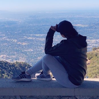
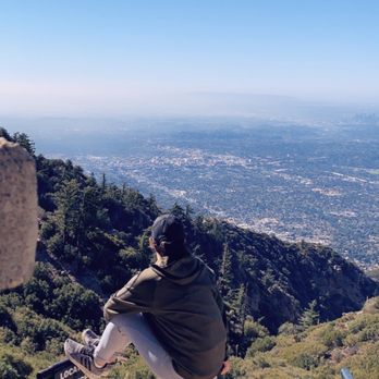
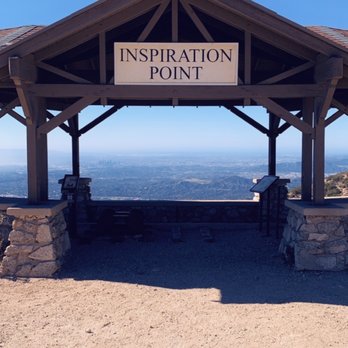

8 years ago
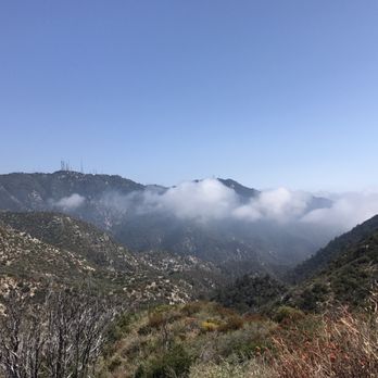
Been on this trail many times but I guess you forget things when you're having fun. So it's about time to post a review! I thoroughly enjoyed the Mt. Lowe trail with some buddies and it was roughly 3ish miles with a gradual incline. We went at around 8am so the weather was nice and cool. You would think going up a mountain side would get you sunburnt but surprisingly there was a lot more shade along the trail than most people would notice. Going up to the end of inspiration point is worth it. The view gets kind of empty if you go around 6am because of all the clouds that get in the way but the sense of accomplishment is just as rewarding The picture I took was on the trail of Mt. Lowe about two weeks ago. You can really tell where LA is. *Hint hint* it looks like Gotham City haha. read more


Beware of SNAKES. Went hiking on 8/01/2020 (yes during covid and seems like everyone was wearing masks) and I encountered a snake! It was maybe a quarter in diameter (not sure of length bc I only saw half it's body as it slithered away into the bushes) and gray in color with dark spots. I only I realized it was a snake after stepping past it and thought to myself, that's a weird looking stick in the ground. Right when I stepped over it, did a double take to look at the "twig," and realized what I've just done. I screamed "snake!" so loudly but it just slithered into the bushes down wards away from the trail. I don't know anything about snakes but it was very hot and that area was shaded so maybe the snake needed a cool place to rest. read more
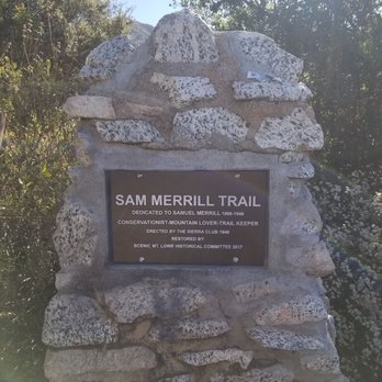


I have been coming here for a few years now, come back here every so often. It is one of the real straight forward trails, nothing much to it in terms of difficulty. It has a few small sections that will challenge any average joe but for the most part it is a consistent uphill. Looks like the rain has caused some erosion to the trail but looks like the park keepers have made fixes to it and recovered those parts of the trail. It is a good trail for even beginners I would say, but it would be smart to come to the trail with someone that has been to it before. There are a few small trails that have dead ends if you turn the wrong direction. I think longest trails are 7 miles total with return trip. Over all this place is a fun hike plus the reward (aside from healthy living) is getting to the top of the mountain and experiencing the history behind it. I wont give it away here, you will just have to hike it and find out. Enjoy! read more


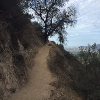

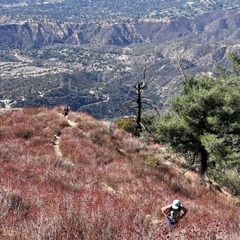
Did this hike two weeks ago, it's quite a joy. This is a great add-on to the Echo Mountain hike, especially if feel unsatisfied with the wide and crowded path up Echo Mtn. From the cutoff where Echo Mtn is, it is an additional two miles to the top, two miles back. The trail itself is narrow, single-file only. Starting out from Echo Mtn, the trail gently goes into the hill. Oak Trees and other vegetation offer plenty of shade, while you also pass a stunning vista point. Further in, there is a mini stream flowing down. Then around 1 mile in, the trail gets noticeably steeper and the path more narrow. It continues to switchback all the way to the top. There are two or three spots where one must negotiate some rocks to continue on, but nothing an average person can't handle. The hike was frustrating as it's hard to see the destination, but when the man-made vista point came to view, it gave our group the needed final burst of energy. The top of inspiration point offers covered benches. Stunning views of LA as welll as Mt Wilson in the back will greet the hiker. Unfortunately, it was a cloudy day, so my group saw was a sea of clouds where LA was . Several Flies also kept bugging at us as we tried to enjoy the view. The way back was similarly exciting as well, and it is easy to make up a lot of time going down hill. Overall, a great addition to the Echo Mtn hike, especially for those looking for a greater workout and a less crowded experience. I highly recommend. read more


8 years ago
One of my favorite hikes in LA. A good leg workout, especially on the Castle Canyon Trail to Inspiration Point. Go early if you want to escape the heat or later if you want to see the sunset. Bring plenty of water if you're hiking on a hot day because you'll need it. I usually bring about 2 liters of water with me. Great view at the top of inspiration point on a clear day. Sometimes, if you're lucky, you'll encounter some deer, chipmunks and squirrels on the trail. I've seen lizards too, but no snakes like other hikes I've been on. Parking is available around Lake Ave and E Loma Alta Dr. Note posted parking signs, e.g. no parking 8pm-6am, or 10pm-6am. read more


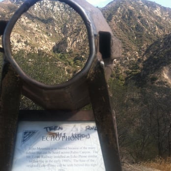
*TIP: BRING FOOD/SNACKS! TAKE YOUR TIME! Be cautious of runners and mountain bikers. There are a lot of switchbacks and narrow paths you come across along the way, and sometimes could be very open along the mountain side. Most of the time the trail would be nothing but rocks (combination of big and small) and no dirt for any grip. Make sure you wear appropriate hiking shoes with thick soles - the trails have a lot of big rocks that you can't avoid. Inspiration Point hike was a true wanderlust! It was definitely a long hike to the top, but the view of it was definitely worth it. This hike gave us the opportunity to see the remains of Echo Mountain! It was awesome learning about the historic information about the resort and crazy to think that there were still some grounds left from the year 1901. There is a part of the resort with a megaphone-like structure where you can shout into and actually hear the echo bounce back. Very cool! The hike to Echo Mountain was not too bad - there could be some narrow points along the trail and also not too strenuous and steep. A lot of people do take this trail and tend to stop here. Relaxing, in my opinion. The hike up to this point of destination is about 2.5 miles. Once you get to Echo Mountain, there is a different trail to Inspiration Point which is another 2.5 miles, give or take. This took a little longer because it gets really steep on the way to the top, but man oh man - the view and the atmosphere along the way was a true experience! You are surrounded by nothing but the mountain, trees, and pure nature. I loved it. The elevation increases as you hike up, so try to take breaks when needed and easy breaths. Also, be more cautious and careful because there are a lot of VERY narrow paths. Like I said, TAKE YOUR TIME! When we got to our destination, the view was AMAZING! It can get cloudy, but seeing the different telescopes pointing to different cities was really neat! There are benches available so you can relax or eat. It was all worth it! We took a different trail on the way back (Sam Merrill Trail I think?) which was not bad compared to the one we took going up. It is a lot easier going down, as always, but still a lot of switchback and rocks. The trail seemed endless because we were just so tired, but in the end I felt very accomplished. The hike was amazing, the view was breathtaking - overall, one of my favorite hikes! A must conquer! read more
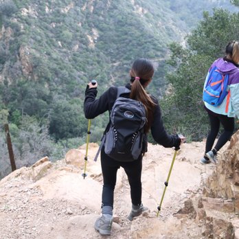

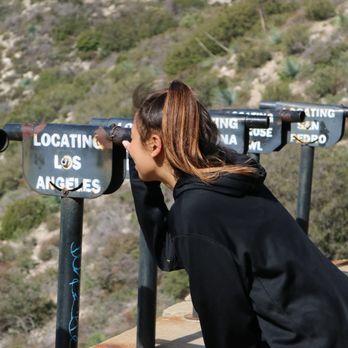


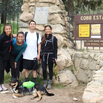


Definitely one of the longer/tougher hikes I've been on, but the view from the top makes it worth the journey! It's a steady uphill battle, so get ready to work those calves. And don't forget to bring PLENTY of water and some snacks too, since this hike takes a good number of hours. Bug spray wouldn't hurt either- my friends and I had them swarming all over us for a good part of the hike. My two friends and I came on a Thursday morning at 9am. We got back down at about 2:30pm (10ish miles round trip), although we did spend about an hour at the top just relaxing and enjoying some snacks. That being said, come EARLY since it's a long hike and you'll want the shade. Most of the way up we enjoyed the shade but it vanished at around 12 when we started making our way down. I would even recommend starting as early as 6-7am. If you follow the address on the Yelp page, it'll take you to the end of a street where you'll see a big gate. Park anywhere on the street and walk through the gate. You can't miss the trail. From here, the hike up to Inspiration uses 2 trails. PART 1: Sam Merrill Trail to Echo Mountain is about 2.5 miles. PART 2: Castle Canyon Trail to Inspiration Point is about another 2.5 miles. It's even more uphill than Sam Merrill Trail, and it also has some loose parts in the trail- be careful not to slip. What I really enjoyed about these trails is that there weren't too many people at all. We had the lookout point to ourselves for the whole hour we were there, so it was very relaxing and peaceful. read more


This hike of about 10 miles was very reminiscent of the Mt. Wilson Trail in Sierra Madre (http://www.yelp.com/biz/mt-wilson-trail-sierra-madre). I would actually call this hike the Mt. Wilson Trail "Lite"; you're climbing up the mountain in similar terrain, but this hike is shorter and much more manageable if you're only going up to Inspiration Point and coming back down. I was already familiar with the first portion of this hike, which is a 2.6 mile hike on the Sam Merrill Trail to Echo Mountain. Like many hikes on this side of the San Gabriel Mountains, it's a series of switchbacks. It took me an hour to reach Echo Mountain, but since I had already played with the echo phones and seen the ruins there, I continued on with my hike. At Echo Mountain, you have the choice to continue on the Sam Merrill Trail or to take Castle Canyon Trail. You can take both trails and you will end up at Inspiration Point, and later I was told by some hikers that the Castle Canyon is the shorter but steeper trail. I didn't think this trail was that difficult or steep, but that's probably because I've been on Mt. Wilson Trail a few times. Overall, the Castle Canyon Trail was a much more scenic hike than the initial hike to Echo Mountain. Despite similar distances, this half of the hike up took more time, but eventually I made it up to Inspiration Point. Even on a cloudy day, I was able to see out into ocean and spot Catalina Island. But I was pretty disappointed at the so called "World Famous Telescope View" because I was expecting telescopes with magnification and these ended up being just hollow pipes pointed towards the location indicated (http://www.yelp.com/biz_photos/inspiration-point-via-castle-canyon-altadena?select=tfyHwOyRLPe9hBlnjnElaA#mJJS4XlhrU5_4K9b_QNbhA). I hung out for a little, took pictures, and ate my meal bar then decided to head back down. For the hike back down, I decided to take the Sam Merrill Trail; I don't like to take the same trail on the hike back if I have a choice. The hike down this trail was actually very scenic of the open space where Castle Canyon was more closed space. This trail also has quite a bit of mountain bike traffic, even though you'd think it's a pretty dangerous place to bike. On the Castle Canyon side, you won't see any bikers because the trail is not suitable for bikes. You will run into more Mt. Lowe Railway ruins on the way down, like the ruins of an observatory just before reaching Echo Mountain and from there have to go through the tedious switchbacks again. This hike of just over 10 miles is perfect for those who want to train for Mt. Wilson Trail or can't start early enough to do a 15+ mile hike. If I have the opportunity to hike again here, I would come very early, and hike past Inspiration Point and up to Alpine Tavern and to the peak of Mt. Lowe. I am not sure of what the mileage is on that but I would guess it would rival the Mt. Wilson Trail hike. read more



15 years ago
A hiking trail for different levels. No matter which trail you decide to take, you can't miss the view of LA - downtown to the ocean- http://www.yelp.com/biz_photos/s_GfmRhYuVvcDwVk2bROiA?select=897TJIyAuDPgRUGpeaCx4g (picture not as clear due to the LA smog :-P) There are a couple different trails you can choose from, though maps do not clearly state where you'll end up. If you want to stick to the eas(ier) route, stay put on the big wide hiking trail. BUT, if you want adventure and want to get lost for a little bit. You may want to follow some of the smaller, hidden trails that will absolutely get you lost. + Great for cooler weather. I can imagine the sun uncomfortably beaming during the summer season + Trails seem to split into two major ways, UP = view & DOWN = creek/stream + Bring water. Don't stay thirsty, stay hydrated, my friends Due to trying to get from one large mountain to another (apparently impossible) and taking alternative trails, we took a 3 1/2 hour non-stop hike, not to mention getting lost. Well, that was indeed my workout for the entire year. Time to stuff myself again, Happy holidays :D read more


Page 1 of 5
More info about Inspiration Point via Castle Canyon
Cobb Estate
Lake Ave & E Loma Alta Dr
Altadena, CA 91001
Directions
Hours
Outdoor Amenities
Inspiration Point via Castle Canyon Reviews in Other Languages
Ask the Community - Inspiration Point via Castle Canyon
Are there snakes on this trail?
I personally have not seen any snakes on this trail although there are signs posted to watch out for snakes. I think it also depends on the season because snakes are cold-blooded
Review Highlights - Inspiration Point via Castle Canyon
You might also consider




















Why does Yelp recommend reviews?
9 reviews that are not currently recommended
The reviews below are not factored into the business's overall star rating.

13 years ago

10 years ago

12 years ago

13 years ago
15 years ago

10 years ago
5 years ago

4 years ago

15 years ago
Inspiration Point via Castle Canyon - parks - Updated September 2026
Best of Altadena
People found Inspiration Point via Castle Canyon by searching for…
Scenic Night View in Altadena, CA
Beautiful Views in Altadena, CA
River Swimming in Altadena, CA
Places to Take Pictures in Altadena, CA
Lookout Points in Altadena, CA
Free Snow Play in Altadena, CA
Scenic Overlook in Altadena, CA
Stairs Workout in Altadena, CA
Waterfall Hike in Altadena, CA
Running Trails in Altadena, CA
Trending Searches in Altadena, CA
Apple Orchards near Inspiration Point via Castle Canyon
Apple Picking near Inspiration Point via Castle Canyon
Archery near Inspiration Point via Castle Canyon
Barbershop near Inspiration Point via Castle Canyon
Baseball Fields near Inspiration Point via Castle Canyon
Blow Dry Bar near Inspiration Point via Castle Canyon
Caves near Inspiration Point via Castle Canyon
Cliff Jumping near Inspiration Point via Castle Canyon
Consignment Shops near Inspiration Point via Castle Canyon
Corn Maze near Inspiration Point via Castle Canyon
Dog Friendly Things To Do near Inspiration Point via Castle Canyon
Dog Parks near Inspiration Point via Castle Canyon
Dog Swimming near Inspiration Point via Castle Canyon
Dress Shops near Inspiration Point via Castle Canyon
Eyebrow Threading near Inspiration Point via Castle Canyon
Eyelash Extensions near Inspiration Point via Castle Canyon
Hiking near Inspiration Point via Castle Canyon
Indoor Places To Take Pictures near Inspiration Point via Castle Canyon
Kids Birthday Party near Inspiration Point via Castle Canyon
Makeup Artists near Inspiration Point via Castle Canyon
Off Road Trails near Inspiration Point via Castle Canyon
Parks near Inspiration Point via Castle Canyon
Photo Spots near Inspiration Point via Castle Canyon
Picnic Areas near Inspiration Point via Castle Canyon
Places To Take Pictures near Inspiration Point via Castle Canyon
Playgrounds near Inspiration Point via Castle Canyon
Private Schools near Inspiration Point via Castle Canyon
Public Running Track near Inspiration Point via Castle Canyon
Public Shower near Inspiration Point via Castle Canyon
River Swimming near Inspiration Point via Castle Canyon
Rock Quarry near Inspiration Point via Castle Canyon
Scenic Overlook near Inspiration Point via Castle Canyon
Sunrise View near Inspiration Point via Castle Canyon
Browse Nearby
BEST of Altadena, California Coffee near Inspiration Point via Castle Canyon
BEST of Altadena, California Things to Do near Inspiration Point via Castle Canyon
BEST of Altadena, California Restaurants near Inspiration Point via Castle Canyon
BEST of Altadena, California Hiking near Inspiration Point via Castle Canyon
BEST of Altadena, California Breakfast near Inspiration Point via Castle Canyon
BEST of Altadena, California Waterfalls near Inspiration Point via Castle Canyon
BEST of Altadena, California Campgrounds near Inspiration Point via Castle Canyon
Browse Brands
Related Searches in Altadena, CA
Best Dog Hiking Trails Around Altadena, California
Best Fishing Locations and Guides in Altadena, California
Best Nature Trails for Hiking in Altadena, California
Best Off Leash Dog Parks in Altadena, California
Best Parks for Parties and Events in Altadena, California
Best Places for Horseback Riding in Altadena, California
Best Water Parks for Kids in Altadena, California
Check Out Great Playgrounds in Altadena, California
Check Out Off Road Trails in Altadena, California
Discover Baseball Fields Around Altadena, California
Discover Dog Friendly Trails to Explore in Altadena, California
Discover Easy Hiking Trails Near Altadena, California
Discover Fun Toddler Parks in Altadena, California for Your Little One
Discover Kid Friendly Hiking Trails in Altadena, California
Discover Lakes & Ponds to Explore in Altadena, California
Discover Popular Bike Trails in Altadena, California
Discover Scenic Mountain Bike Trails Near Altadena, California
Discover Soccer Fields in Altadena, California Near You
Discover Top Nature Parks to Visit in Altadena, California
Discover Top State Parks to Visit in Altadena, California
Discover Walking Parks in Altadena, California Near You
Discover a Hiking Trail in Altadena, California
Discover the Best Kids Park Spots in Altadena, California
Discover the Best Night Hike Trails in Altadena, California
Dog-Friendly Hikes With Dogs in Altadena, California
Enjoy Camping Adventures Around Altadena, California
Enjoy Kayaking Adventures in Altadena, California
Enjoy Off Leash Dog Hikes in Altadena, California
Enjoy Scenic Places to Walk in Altadena, California
Enjoy Tent Camping Spots Around Altadena, California
Enjoy a Beautiful Waterfall Hike in Altadena, California
Enjoy the Best Picnic Spots and Ideas in Altadena, California
Enjoy the Best Walking Path in Altadena, California
Enjoy the Best Walking Trails in Altadena, California
Explore Beautiful Parks and Green Spaces in Altadena, California
Explore Easy Hikes Perfect for All in Altadena, California
Explore Free Picnic Areas Around Altadena, California
Explore Fun Activities to Do in Altadena, California
Explore Parks With Pull Up Bars in Altadena, California
Explore Picnic Parks Near Altadena, California
Explore Popular Campgrounds Near Altadena, California
Explore Popular Dog Walking Trails in Altadena, California
Explore Popular Kids Parks Throughout Altadena, California
Explore Popular Picnic Areas Around Altadena, California
Explore Popular RV Parks Around Altadena, California
Explore Scenic Lakes to Visit in Altadena, California
Explore Top Dog Parks in Altadena, California Near You


