Sawyer Camp Trail Photos


You might also consider


More like Sawyer Camp Trail
Recommended Reviews - Sawyer Camp Trail
Start your review...


Reviews With Photos


Really nice paved trail that my boyfriend brought me to so that we can enjoy a nice walk together. It was a beautiful sunny spring day, and the sunlight glittered on the water like diamonds. I'm not a big hiker, so I appreciate that this was mostly flat and paved, and we could go at a leisurely pace. Lots of people on their bikes come here too. Very comfortable hike. Just make sure you use the restroom before coming here.


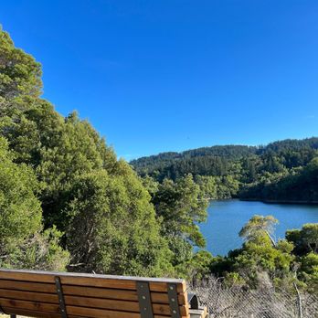
Sawyer camp south trailhead: yay there are shaded areas along the trail because there are so many trees! Feels good when you're walking for a while and you go in and out of shade, it's a natural cool down to regulate your temperature. Especially when there's just a small breeze it's wonderful The best view is at the beginning of the trailhead. If you just want to check out the view then just got the first mile worth. Then turn around. After that you don't see the reservoir as much, it's mainly covered by trees. Restrooms and trash/recycle bins along the way Mile markers are helpful


Nice, paved and mostly exposed to the sun. Nice views of the reservoir. On weekends / holidays expect an increase in bikes, motorized boards and people. Good for families, but if you're looking for a "hike" versus a "walk", this is not for you. Given there's so many other cool hiking trails, I won't be back to this one.


Beautifully paved trail right by the reservoir. I like to run and walk on this trail. There are a couple restrooms with hand sanitizer, but no water fountains. I've encountered deer and rabbits on this trail. Some spots of shade and wonderful views of the water. Parking is available near the trailhead and on the side of the road. I love seeing all the active people and families enjoying the serenity.


Rain or shine, sawyer camp trail is beautiful. Ever since I discovered this trail, it's made my time in the bay so much more pleasant. I love the long flat running trail by the beautiful reservoir and the lush greenery. There are views of the water, secluded portions with big trees shading you and even bathrooms and water fountains throughout. Parking can be busy, but you can just park along the street. This is my all time favorite running trail in the bay and I would highly recommend it!


This area remains a favorite for me. Well-used paved smooth trails and views of Crystal Springs are relaxing. It's the end of August and the area is so dry, poison oak is bright red and mosquitoes and lizards are out in abundance. Bring water for the walk! There are bathrooms and benches available along this path (at the trail head and in the middle). Mile markers are helpful along the trail. Enjoy the fresh air and lake views. Parking is easy on weekdays ... and easier in the morning, it can get crowded on weekends and around 4 - 6 pm.


Great area for walking in a safe area, surrounded by beautiful views! Restrooms available at start and at certain miles. Very clean!
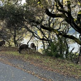

Not more than 10 minutes from downtown San Mateo is this beautiful trail along the water I've always seen driving down 280 freeway. It was such a pleasant view while I was doing a light run. Parking is available but gets busy. I went on a Wednesday around 9am and when I left around 10am it was pretty full! Notes: completely paved path so running after a rainy day isn't too bad. No pets and there is a restroom at the beginning and maybe around 0.5 mile mark. San Mateo residents are so lucky to have this trail. I look forward to my next visit here.
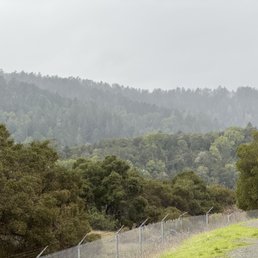

This is such a nice casual trail for if you're just looking for some fresh air and nice views. Even with all the rain when I was here, it was still quite a beautiful area to go for a stroll. I highly recommend it if you find yourself in the area. There is a nice paved trail, gorgeous greenery, and of course the reservoir itself. Makes for a nice relaxing walk, and some great photos!


Great hiking trail, part of it was shut down due to damage. Really beautiful sights to see (water), lots of wildlife, we saw two deer and a baby dawn. Nice to hike out on a sunny day and several park benches around. This place also has monuments built by a civil engineer commemorated at the end of the path near the parking lot. Harder to find parking.


North of Hwy 92 exit on 280. Long paved trail along Crystal Springs Reservoir. Beautiful walk, joggers and bikers love it too. Weekends are more crowded with more bikes and runners mixed in with families and strollers. Looks mysterious when foggy. Nice breeze off the water most days. Brink water, and a hat. Benches along the trail for a rest. Watch out- poison oak along trail.


Beautiful park and trail along the reservoir. Great place for a long walk, run , people are bike riding. Everything is quiet and it's a good place to get away from the city for a while. There are some limited parking spaces and the rest are along the road. All free. There are some restrooms along the path.


I can't really walk uphill for a long period of time because of a leg injury I got long ago. I was looking for a light hike and this was it! It was most certainly a beautiful and sunny day for a walk. If you walk on the trail, it goes about 6 mile or so. There are a lot of cyclists on the trail too. It faces the beautiful Crystal Springs. And if you don't know what Crystal Springs is, then you're sleeping on this one. It is so beautiful as you walk by this large body of water that almost looks blue. There is some wild life to observe around here; I ran into a family of wild turkeys trying to cross the trail. It was very cute. I also saw a hawk in the trees, some resemblance of a large bird that could take me out without much effort. There are signs to avoid rattle snake.


I was on my way to an estate sale and needed a bathroom quick, so I clicked the closest restroom on Apple maps and it brought me here. Thanks to that app, I found this place and since I was already there I take a short walk, and it ended up being a nice surprise. The trail was really clean with some nice views along the way. It's paved, so it's an easy place for a walk or a bike ride without having to worry about rough terrain. There were plenty of people out enjoying it as well. There's a good amount of parking along the main road, which made it easy to stop by. read more


13 days ago

It's a long walk, on concrete, very shaded, and next to a beautiful reservoir where we get all our clean drinking water (after passing the reservoir, you basically only see trees). The main con is that you have to turn back since there's no loop (about 6 miles one-way), so you have to figure out where your stopping point is, otherwise the trail spans across multiple cities (north entrance in Millbrae, southern entrance in San Mateo). No pets allowed. There are restrooms at the beginning of the trail, and in the middle after going a good amount of distance. There were a lot of wildlife to be seen, like random families of deer, lizards, turkey couples, and even turkey vultures. In some puddles along the path, there were newly-hatched tadpoles. If you want a peaceful, quiet, long and shaded walk or bike ride, this is a solid choice. You will run into other groups along the way, as it is a popular and well-maintained trail. Sawyer Camp Trail's purpose is pretty niche, though, as I'd much prefer a path that loops or an option for elevated terrain. read more


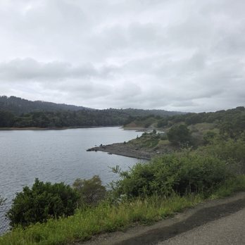
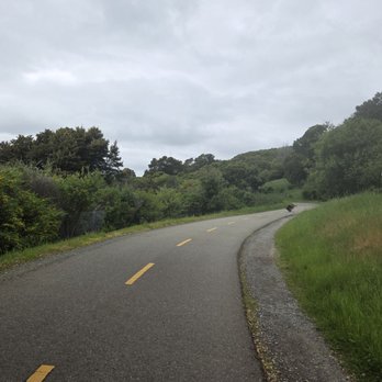


Really nice paved trail that my boyfriend brought me to so that we can enjoy a nice walk together. It was a beautiful sunny spring day, and the sunlight glittered on the water like diamonds. I'm not a big hiker, so I appreciate that this was mostly flat and paved, and we could go at a leisurely pace. Lots of people on their bikes come here too. Very comfortable hike. Just make sure you use the restroom before coming here. read more


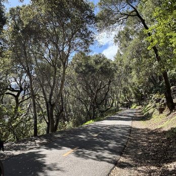


Sawyer camp south trailhead: yay there are shaded areas along the trail because there are so many trees! Feels good when you're walking for a while and you go in and out of shade, it's a natural cool down to regulate your temperature. Especially when there's just a small breeze it's wonderful The best view is at the beginning of the trailhead. If you just want to check out the view then just got the first mile worth. Then turn around. After that you don't see the reservoir as much, it's mainly covered by trees. Restrooms and trash/recycle bins along the way Mile markers are helpful read more

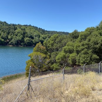

3 months ago

22 days ago

Nice, paved and mostly exposed to the sun. Nice views of the reservoir. On weekends / holidays expect an increase in bikes, motorized boards and people. Good for families, but if you're looking for a "hike" versus a "walk", this is not for you. Given there's so many other cool hiking trails, I won't be back to this one. read more


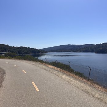

Beautifully paved trail right by the reservoir. I like to run and walk on this trail. There are a couple restrooms with hand sanitizer, but no water fountains. I've encountered deer and rabbits on this trail. Some spots of shade and wonderful views of the water. Parking is available near the trailhead and on the side of the road. I love seeing all the active people and families enjoying the serenity. read more

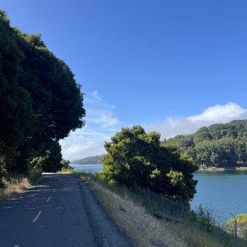


2 years ago
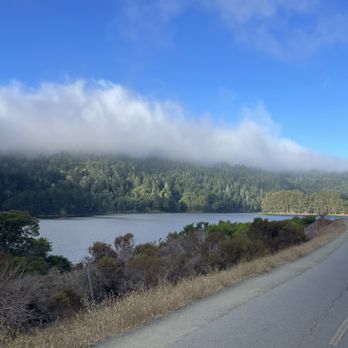
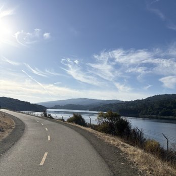
Rain or shine, sawyer camp trail is beautiful. Ever since I discovered this trail, it's made my time in the bay so much more pleasant. I love the long flat running trail by the beautiful reservoir and the lush greenery. There are views of the water, secluded portions with big trees shading you and even bathrooms and water fountains throughout. Parking can be busy, but you can just park along the street. This is my all time favorite running trail in the bay and I would highly recommend it! read more




3 years ago
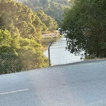
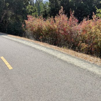
This area remains a favorite for me. Well-used paved smooth trails and views of Crystal Springs are relaxing. It's the end of August and the area is so dry, poison oak is bright red and mosquitoes and lizards are out in abundance. Bring water for the walk! There are bathrooms and benches available along this path (at the trail head and in the middle). Mile markers are helpful along the trail. Enjoy the fresh air and lake views. Parking is easy on weekdays ... and easier in the morning, it can get crowded on weekends and around 4 - 6 pm. read more





1 year ago
Great area for walking in a safe area, surrounded by beautiful views! Restrooms available at start and at certain miles. Very clean! read more


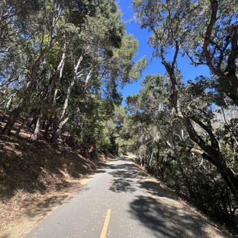


Not more than 10 minutes from downtown San Mateo is this beautiful trail along the water I've always seen driving down 280 freeway. It was such a pleasant view while I was doing a light run. Parking is available but gets busy. I went on a Wednesday around 9am and when I left around 10am it was pretty full! Notes: completely paved path so running after a rainy day isn't too bad. No pets and there is a restroom at the beginning and maybe around 0.5 mile mark. San Mateo residents are so lucky to have this trail. I look forward to my next visit here. read more
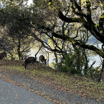


This is such a nice casual trail for if you're just looking for some fresh air and nice views. Even with all the rain when I was here, it was still quite a beautiful area to go for a stroll. I highly recommend it if you find yourself in the area. There is a nice paved trail, gorgeous greenery, and of course the reservoir itself. Makes for a nice relaxing walk, and some great photos! read more
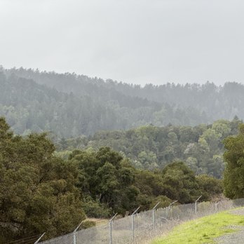

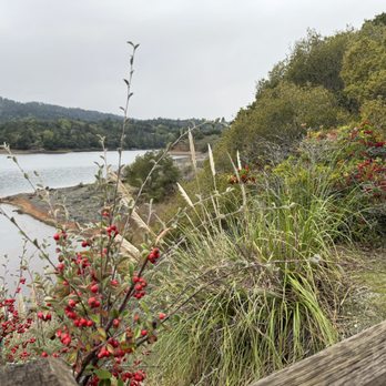


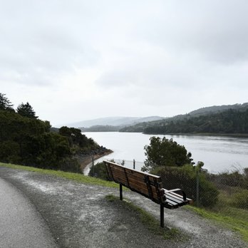

Great hiking trail, part of it was shut down due to damage. Really beautiful sights to see (water), lots of wildlife, we saw two deer and a baby dawn. Nice to hike out on a sunny day and several park benches around. This place also has monuments built by a civil engineer commemorated at the end of the path near the parking lot. Harder to find parking. read more


2 years ago
North of Hwy 92 exit on 280. Long paved trail along Crystal Springs Reservoir. Beautiful walk, joggers and bikers love it too. Weekends are more crowded with more bikes and runners mixed in with families and strollers. Looks mysterious when foggy. Nice breeze off the water most days. Brink water, and a hat. Benches along the trail for a rest. Watch out- poison oak along trail. read more


Beautiful park and trail along the reservoir. Great place for a long walk, run , people are bike riding. Everything is quiet and it's a good place to get away from the city for a while. There are some limited parking spaces and the rest are along the road. All free. There are some restrooms along the path. read more

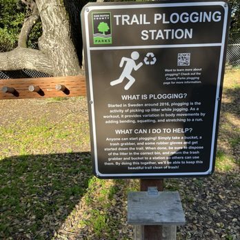

I can't really walk uphill for a long period of time because of a leg injury I got long ago. I was looking for a light hike and this was it! It was most certainly a beautiful and sunny day for a walk. If you walk on the trail, it goes about 6 mile or so. There are a lot of cyclists on the trail too. It faces the beautiful Crystal Springs. And if you don't know what Crystal Springs is, then you're sleeping on this one. It is so beautiful as you walk by this large body of water that almost looks blue. There is some wild life to observe around here; I ran into a family of wild turkeys trying to cross the trail. It was very cute. I also saw a hawk in the trees, some resemblance of a large bird that could take me out without much effort. There are signs to avoid rattle snake. read more


1 year ago

2 years ago
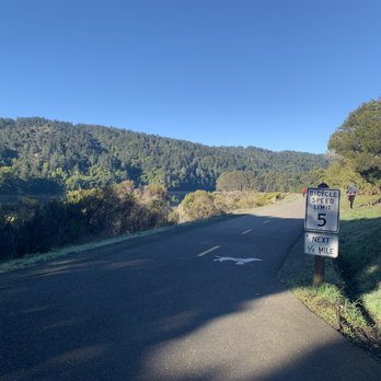
Sawyer Camp Trail is a 6 mile trail in San Mateo County near the San Mateo Highlands. The path is paved in asphalt and is used by walkers, joggers and cyclists. Dogs are not permitted on the trail. The tail is marked in on posts every 1/2 mile. There are restrooms and benches along the way. Sawyer Camp is an easy trail perfect for kids. From the trail Crystal Springs Reservoir is on your left, you will see ducks, turkeys, deer and birds. At 3.5 miles you will reach the Jepson Laurel area. The Jepson Laurel is established as being over 600 years old and the largest Laurel in California. read more


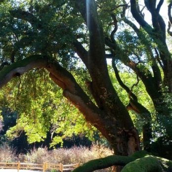
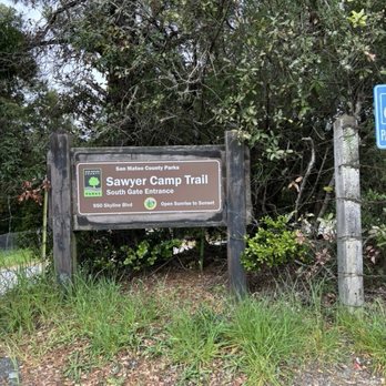


During our visit we found out that the latter half of the trail was close for some maintenance. Even thought this was the case, it was an extremely pleasant hike due to the magnificent view of the water. At the start of the trail, there is not a lot of coverage, but after about .5 mi. you'll enter a small grove of trees. Insects might be a bit pestering, so if this annoys you, some light bug spray should help. There are many benches on the way if you need to rest or would like to take in the nature experience. Last, parking is not difficult but you may be forced to do street parking. Be sure to take valuables with you, because smash and grabs do happen here. read more


1 year ago

What a beautiful place! It's a short drive from San Mateo and totally worth it as you completely escape from all the hustle and bustle. Parking is not that bad but you may have to park further away from the trail if you come during the popular times on the weekends. Please note no dogs, which is a bummer but understandable as it can get really busy with all the bikers. Its super peaceful and relaxing: I saw wild turkeys, and deer multiple times while I was there. read more


3 years ago
I have been here a handful of times with family. My sister lives near by. We always drive to the closest end to her which is literally next to a freeway exit. We park under the overpass which is limited but we always manage to find parking. There are two points, Hillcrest Blvd (North), and the other is on Crystal Springs Road and Skyline Blvd (South) with plenty more parking. There are shaded spots, benches to take a break, curves on the roads, and a lot of hills so be prepared. Once you walk further into the trail you won't hear the freeway traffic which is nice. There is a large body of water you can look at which is also great for pictures. There were many people walking, biking and running on these trails, it's very popular. There is a bathroom in the north end and a pay phone if you need it lol it's always nice to go and enjoy nature. read more


Sawyer Camp Trail has been sitting on top of my to-do list for a while now. It was nice and sunny today so I decided to go out for a walk. Initially I thought it was just a small trail next to the reservoir but I thought wrong. First mile in was a piece of cake, but as I kept walking and walking, the trail never seemed to stop.... I was that annoying kid who kept asking "Are we there yet?" Pulled out the map and sheeshhh.. we were barely half way through the trail. Eventually I reached the 3 mile mark and turned back. All together it was a 6 mile walk in the hot sun. But it was all worth. Overall, I'm glad I bookmarked this place. The view of the reservoir was beautiful! The pavement was nice and smooth. Bikers were mindful. Bugs and baby lizards(?) here and there. Only sad part was no dogs allowed. Street parking can be a little difficult. Next time I'll be back with a bike or skates. 04.11.2021 | Sunday 12:45pm read more


5 years ago
A decent trail for walking, running, or biking along the water. As of 12/31/21, it is open up to the 3.5 mile mark due to flooding beyond that point. It was paved and pretty flat (up to 60 ft elevation gain per Strava). You may encounter some deer along the trail! It gets very busy on weekends in the late morning and afternoon. There are restrooms and trash cans sprinkled throughout the trail. Personally not a fan of the trail for long runs due to the winded parts. I also don't enjoy how there are so many flies in the summer. Parking usually isn't an issue. It is a quick walk to the front gate, which marks the trailhead. read more


A 2021 goal of mine is to explore 2-3 new trails a month, which led me to this entrance of the Sawyer Camp Trail. My rating is actually more of a 3.5, but it really depends on what time/day you go. A Saturday afternoon, never again lol The trail itself is all-paved, with multiple benches throughout the hike. You'll get a lot of nice waterfront views, but TBH, the hike was pretty boring. There's little to no elevation and not very challenging if you are looking to get that heartrate up. If you a beginner runner like myself, this trail is nice and easy to navigate your way through since it's so flat. No dogs allowed, which is a good thing here because with all the folks packing this trail and bikes going by, it would be too dangerous for the 4-legged family member. If you are looking to social distance, this is not the best hike. I'm normally a morning hiker, but decided to do a late afternoon walk here. The parking lot and the off-street parking surrounding the entrance on a Saturday was JAM-PACKED. Although majority of people were wearing masks, the trails are just to packed to be enjoyable. The trails are too narrow to stay socially distant from other walkers, while at the same time trying to give ample space for bikers to whiz by. The amount of times I almost got hit by bikers going full speed kept me on my toes the entire time lol This hike is perfect if you are looking for something super easy to get steps in while also soaking up nature. I'd recommend heading to the Millbrae entrance to this hike where it's typically less crowded. I'd avoid this spot on the weekends but I think this hike would be perfect mid-week, when not a lot of ppl are out on the trail. read more


6 years ago
Go here! What a beautiful 6 mile scenic trail. But leave your dog at home, unfortunately this hike is not dog friendly. I came here on a Saturday morning with a 9am meet up with friends at the Sawyer camp trail entrance. I would suggest allowing yourself 15 min to find parking. If the parking is full, you may have to walk 1/2 a mile down to walk to the entrance, parking was pretty full, street only. Upon entry there is a bathroom and signs enforcing masks. When I went everyone social distanced and many kept there masks on. The roads are paved and wide, perfect for a nice walk, run or bike ride. We did about 5 miles (2.5 and turned around to do the rest) total. I would highly recommend coming here. read more



6 years ago
Trying to stay fit during COVID has been a real challenge, with all the gyms and many parks (and their parking lots) closed to the public. Fortunately for me, there are some open spaces like Sawyer Camp Trail that are open to the public. Sawyer Camp Trail has ample street parking at the North trailhead near Hillcrest Blvd. My friend and I chose Sawyer Camp Trail since it was rated as an "easy" hike on All Trails. Prior to COVID, I was much more physically active and can handle strenuous, hilly hikes. Given that we were a little out of shape now, the trail was a little more strenuous (at some points) than we anticipated. The hike is mostly flat, but there are areas of the trail that are inclined/hilly. So if you're out of shape due to the quarantine/COVID, make sure to take it easy! Despite the fairly strenuous parts of the hike, it was still very enjoyable. The trail runs parallel to the freeway, but remarkably, the trail is very quiet. As such, I was able to appreciate the tranquil serenity of the Crystal Springs reservoir and admire the majesty of the Jepsen Laurel tree (which is over 600 years old!). All in all, it took us about 3 or so hours round trip from the North trailhead to the Jepsen Laurel tree, with a few rest breaks in between. I enjoyed my hiking experience here, and hope to come back...although I will need to do a little training beforehand. read more


I met up with my friend to do some walking here back in August. Parking is along the road which is not too bad; it was a short walk from where I parked to the entrance of the park. The trail is paved with slight inclines, declines, and flats. It's perfect for runners, cyclists, and skaters. There's a mix of shaded areas and non-shaded ones. I like the big lake at this park. We saw a family of deer during our visit. Cute! read more


Sawyer Camp Trail is beautiful and the lake is amazingly calm. The trail is partially shaded & it's about 6 miles long from what I heard. We didn't get to walk too far because it got hot way too fast on a Friday early morning. We tried going on a weekday to avoid the crowd, but it was crowded anyway. There was a lot of signs that said to wear face mask, but the problem with this was, not everyone really follows it. There was a lot of joggers, bikers, and groups of people who did not wear a mask and with the pandemic still on the rise, I did not feel safe. Also the trail had a fence on both sides so I felt confined without any place to go trying to dodge others without mask. I feel everyone should just do their part to help flatten the curve. Please don't be selfish. At least be considerate where you walk. So there you have it folks. It looks like I won't be coming back for a while. read more


2 years ago

Nicely paved trail with a beautiful lake view, highly recommend! Trail is shared among bikers, runners, as well as people who just want to get some steps in. Most people if not all were wearing masks when I went. Trail was spacious enough that it didn't feel packed with people. The trail is just a straight road with no forks, so it's impossible to get lost. I got about 6 miles total going out and back (not a loop), but could have done a lot further. Parking along the street only. I went around 8am Saturday morning and it was already full. Had to park further down and walked a short distance towards the trail entrance. read more


Beautiful, green area with a gorgeous lake view in the initial mile of the "hike". Parking was relatively easy - just followed other cars parked alongside the road. Wanted to fine a new trail and found this thru Yelp. I should've looked into it more as this is a flat land hiking trail - probably better suited for running or biking. Nonetheless we had a nice walk/mini jog about 4 miles in and 4 miles back. Lots of shade and the first 2 miles had pretty decent views. Nothing too exciting afterward, and pretty boring after an hour. Would come again if I wanted a jog vs a hike, but probably not worth the 25 min drive for me. read more


5 years ago

6 years ago
As COVID continues, my need for longer trails continue. After eating a heavy lunch nearby, we decided to go on a leisurely family stroll to walk off the food babies in our bellies. Usually I start at the other end of the trail in Burlingame at Hillcrest. At this end on a sunny Saturday afternoon, parking was crowded along Skyline Blvd and families of all kinds were everywhere -- most wearing masks. We even saw several families of deer foraging. As many reviewers have noted, this southern end of the trail is much more flat in comparison to the northern end. Most people stay around the first two miles of the trail and then eventually turn around, so you will begin to see less and less people as you get towards the middle of the trail. It is very possible to complete a round trip 12 mile walk in 4 hours though. Besides the bathrooms at both entrances, there are two more bathrooms spread out along the trail. Do note that they're nonflushable portapotty type of bathrooms. The middle portion of the trail can get hot so dress appropriately depending on your heat tolerance. Terrain wise it's paved with fairly flat to small inclines until you get to the last mile going northbound towards Hillcrest. read more

1 year ago
Page 1 of 12
More info about Sawyer Camp Trail
Crystal Springs Rd & Skyline Blvd
San Mateo, CA 94401
Directions
Visit Website
http://parks.smcgov.org/sawyer-camp-segment
Hours
Indoor Amenities
Outdoor Amenities
Ask the Community - Sawyer Camp Trail
Is it open now?
Is sure is open. I'm not aware of an opening time, but I would guess sunrise to sunset.
What time does this trail open in the morning?
Is this park still open?
No, the parking area is coned off. The gate to get in is locked.
Review Highlights - Sawyer Camp Trail
You might also consider
















Why does Yelp recommend reviews?
31 reviews that are not currently recommended
The reviews below are not factored into the business's overall star rating.

11 years ago

17 years ago

7 years ago

11 years ago

1 year ago
3 years ago

17 years ago
12 years ago

13 years ago

15 years ago

16 years ago
17 years ago

17 years ago

15 years ago
11 years ago

7 years ago

3 years ago
14 years ago
11 years ago
Sawyer Camp Trail - hiking - Updated September 2026
Best of San Mateo
People found Sawyer Camp Trail by searching for…
Hiking Trails in San Mateo, CA
Waterfall Hike in San Mateo, CA
Walking Trails in San Mateo, CA
Beautiful Views in San Mateo, CA
Dog Friendly Hiking Trails in San Mateo, CA
Places to Take Pictures in San Mateo, CA
Dog Friendly Beaches in San Mateo, CA
Redwood Trees in San Mateo, CA
Trending Searches in San Mateo, CA
Antiques near Sawyer Camp Trail
Apple Orchards near Sawyer Camp Trail
Apple Picking near Sawyer Camp Trail
Barbershop near Sawyer Camp Trail
Bike Shop near Sawyer Camp Trail
Casinos near Sawyer Camp Trail
Cliff Jumping near Sawyer Camp Trail
Consignment Shops near Sawyer Camp Trail
Cruising Spots near Sawyer Camp Trail
Dog Friendly Things To Do near Sawyer Camp Trail
Estheticians near Sawyer Camp Trail
Eyebrow Threading near Sawyer Camp Trail
Eyelash Extensions near Sawyer Camp Trail
Furniture Stores near Sawyer Camp Trail
Kids Birthday Party near Sawyer Camp Trail
Makeup Artists near Sawyer Camp Trail
Mattresses near Sawyer Camp Trail
Outdoor Activities near Sawyer Camp Trail
Picnic Areas near Sawyer Camp Trail
Public Shower near Sawyer Camp Trail
River Swimming near Sawyer Camp Trail
Rock Quarry near Sawyer Camp Trail
Scenic Overlook near Sawyer Camp Trail
Star Gazing near Sawyer Camp Trail
Sunrise View near Sawyer Camp Trail
Trading Card Shops near Sawyer Camp Trail
Browse Articles
Browse Nearby
BEST of San Mateo, California Coffee near Sawyer Camp Trail
BEST of San Mateo, California Restaurants near Sawyer Camp Trail
BEST of San Mateo, California Things to Do near Sawyer Camp Trail
BEST of San Mateo, California Walking Trails near Sawyer Camp Trail
BEST of San Mateo, California Breakfast near Sawyer Camp Trail
BEST of San Mateo, California Parks near Sawyer Camp Trail
BEST of San Mateo, California Campgrounds near Sawyer Camp Trail
Browse Brands
Related Searches in San Mateo, CA
Affordable Kayak Rental Services in San Mateo, California
Best Dog Hiking Trails Around San Mateo, California
Best Fishing Locations and Guides in San Mateo, California
Best Nature Trails for Hiking in San Mateo, California
Best Places for Horseback Riding in San Mateo, California
Best Sightseeing Experiences Available in San Mateo, California
Check Out Off Road Trails in San Mateo, California
Discover Dog Friendly Trails to Explore in San Mateo, California
Discover Easy Hiking Trails Near San Mateo, California
Discover Kid Friendly Hiking Trails in San Mateo, California
Discover Popular Bike Trails in San Mateo, California
Discover Walking Parks in San Mateo, California Near You
Discover a Hiking Trail in San Mateo, California
Discover the Best Night Hike Trails in San Mateo, California
Dog-Friendly Hikes With Dogs in San Mateo, California
Enjoy Camping Adventures Around San Mateo, California
Enjoy Kayaking Adventures in San Mateo, California
Enjoy Off Leash Dog Hikes in San Mateo, California
Enjoy Scenic Places to Walk in San Mateo, California
Enjoy a Beautiful Waterfall Hike in San Mateo, California
Enjoy the Best Walking Path in San Mateo, California
Enjoy the Best Walking Trails in San Mateo, California
Explore Beautiful Parks and Green Spaces in San Mateo, California
Explore Easy Hikes Perfect for All in San Mateo, California
Explore Fun Activities to Do in San Mateo, California
Explore Popular Campgrounds Near San Mateo, California
Explore Popular Dog Walking Trails in San Mateo, California
Explore Top Dog Parks in San Mateo, California Near You
Explore the Best Beach Spots in San Mateo, California
Family Friendly Hiking With Kids in San Mateo, California
Find Beautiful Views in San Mateo, California
Find Cozy Camping Cabins in San Mateo, California
Find Top Dog Friendly Parks to Visit in San Mateo, California
Find Top-Rated Waterfalls in San Mateo, California Now
Find the Best Parks for Picnics in San Mateo, California
Hiking Trails With Waterfalls in San Mateo, California
Off Leash Dog Hiking Trails in San Mateo, California
Popular Outdoor Activities to Try in San Mateo, California
Popular Picnic Spots to Visit in San Mateo, California
Popular Waterfall Hiking Trails in San Mateo, California
Safe River Swimming Areas in San Mateo, California
Safe and Fun Parks for Kids in San Mateo, California
Top Hiking Trails to Explore in San Mateo, California
Top Playgrounds for Kids to Enjoy in San Mateo, California
Top Running Trails to Explore in San Mateo, California
Top Swimming Lakes to Enjoy in San Mateo, California
Top Swimming Spots and Pools in San Mateo, California
Top-Rated Camping Sites in San Mateo, California


