Crystal Springs Regional Trail Photos


You might also consider


More like Crystal Springs Regional Trail
Recommended Reviews - Crystal Springs Regional Trail
Start your review...


Reviews With Photos


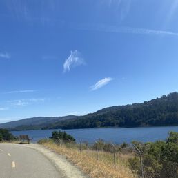

My go-to food coma recovery trail. Easy, pleasant, good view and many animal companions. Came here after a big and late lunch. Easy to find parking. Saw some deer, a big turkey family, condors, butterflies, dragonflies, loads of birds and some lizard party going on. Trail is currently cut short to 1.5 mile. Super easy to finish, all paved and almost flat. Good view at the water reservoir. Easy for kids as well.


Brilliant trail with well paved roads and splendid views of the Crystal Springs Reservoir perfect for walking, running, skating/rollerblading, bicycling and horseback riding. The Crystal Springs Regional Trail is a planned 17.5-mile trail that, when finished, will extend from San Bruno to Woodside. 15.3 miles of the trail are now complete. It provides an alternative recreational route to the 1,210-mile Juan Bautista DeAnza National Historic Trail. Stolen from: https://parks.smcgov.org/crystal-springs-regional-trail The two northern segments are wide, flat, paved trails winding around the eastern shore of San Andreas Lake and the Lower Crystal Springs Reservoir, while the southern segment is a skinnier dirt trail that follows Cañada Road and the Upper Crystal Springs Reservoir. Link to a detailed map: https://parks.smcgov.org/sites/parks.smcgov.org/files/CrystalSpringsTrailMap-Nov2018-FINAL-web-formatted.pdf?v=1.1


There's apparently an extension of the Crystal Springs trail in San Mateo that goes southbound. It's far less crowded, almost like not too many people know about this extension. It's only about a mile long though and there's a porta-potty bathroom along the way. This part is great for bicyclists. Too bad it's so short. If you have little kids who need a safe place to ride their bikes, this would be a better spot than at the more crowded entrance. https://goo.gl/maps/UH9sNeHeC8tSTDUp8 37°31'33.4"N 122°21'38.9"W


It's a very nice walking trail. When I came here the trail was partially closed so I wasn't able to walk too far but the scenery is very beautiful. There's a lot of trees and nice views of the reservoir plus you might get to see some of the wildlife that live in the area. I recommend coming here if you want a relaxing walk or if you like biking.


Nice place but a lot of the lake views are obscured by trees. You can only see the lake very well towards the beginning of the walk or if you go through the bridge. It would be much more enjoyable if you bike instead of walking, as it is quite a long walk. It gets quite busy on the weekends and parking can be difficult to find. Overall, a nice place, you can see a lot of families here with scooters, bikes, and rollerblades. Don't forget to bring your helmet if you're biking.


Amazing easy hiking trail! We just discovered this trail recently and plan to come back weekly. Love the shady trail and expect to encounter deers and birds on the way. Family friendly but be careful of the bikers behind. It gets pretty crowded in the afternoon, plan to come earlier for parking spots...


Beautiful trail that is paved and easy walk is well trafficked by pediatrics and bikers. Benches and picnic tables throughout the trail. The trail is wide which is great with how many people are out and to stick with COVID precautions. Mile markers along the way and also some restrooms that are near the beginning and end of the trail. I was happily surprised that the restrooms were fairly clean. I only wish parking was better so recommend starting early if going on a weekend. I hope to visit again soon and check out more trails.


The road is completely paved all the way through - perfect for leisure walkers, runners, and bicyclists. The road is also open to equestrians, but I've only ever seen horses once during my many trips here. You can't deviate from the path either because the trail is fenced in by barbed wire...but I would say most of it is for your safety (steep drops) and for hunting/gaming prevention. There is almost always wildlife ever present here which makes it pretty neat. Deer gather in herds. But there are also birds/waterfowl, beetles, slugs (esp. after a rain) and lizards. I've seen gophers too. The trail is about 6 miles long, I've never actually seen the other end...still working towards it. Just keep hydrated, but not so much that you'll have to use the restrooms. It's a glorified port-a-potty...haven't used it, but have definitely smelled it from afar.
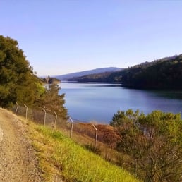

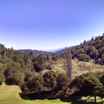
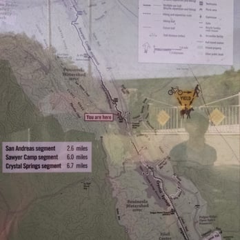
If you're looking for at least a somewhat strenuous hike, this isn't for you. My friends and I like at least pretty hardcore hikes with over 100 feet in elevation change (I tracked this on Strava and that was the actual total elevation change). We did get good mileage, 12 miles round trip along the entire Sawyer Camp segment, from the Crystal Springs entrance to the San Andreas Lake. There's even more mileage to be covered on either side of those segments. Also, it's a paved trail so there are lot of strollers, bikers, and families with kids. Not very isolated; it can get a bit crowded here. Despite that, we did get a parking spot not far from the entrance around 11:30am or noon on a Saturday, which I was surprised about. A lot of the open spots seemed to be people who'd come earlier in the morning and had already finished their hike. Also, the entire trail is completely fenced off with barbed wire on either side (about 10-20 feet off the trail). So while you do get to enjoy a pretty good view, there's no off-roading or getting near the reservoir. It's a fairly exposed trail so make sure to bring protection from the sun! most of the walking along the reservoirs aren't covered, but most of the segment between the two reservoirs is. Some nice views: http://www.yelp.com/biz_photos/crystal-springs-walking-trail-san-bruno?select=EBwonTbnP_P6pII-7F9iOA#aEO6ISRD9DTjR9BAEhG4cg http://www.yelp.com/biz_photos/crystal-springs-walking-trail-san-bruno?select=EBwonTbnP_P6pII-7F9iOA#EBwonTbnP_P6pII-7F9iOA http://www.yelp.com/biz_photos/crystal-springs-walking-trail-san-bruno?select=EBwonTbnP_P6pII-7F9iOA#XmfUs_OPGUK6koqhrgeM1g Trail map; http://www.yelp.com/biz_photos/crystal-springs-walking-trail-san-bruno?select=EBwonTbnP_P6pII-7F9iOA#9LJBv8DKzyJMdeEhm4x6HA


Amazing place that offers a peaceful escape with a nice and easy walk for anyone who wants to be outside. The trail is highly accessible and dedicated bike lanes make it safe and convenient for cyclists and pedestrians. It's beautiful and has great views of the water. read more



3 years ago
My go-to food coma recovery trail. Easy, pleasant, good view and many animal companions. Came here after a big and late lunch. Easy to find parking. Saw some deer, a big turkey family, condors, butterflies, dragonflies, loads of birds and some lizard party going on. Trail is currently cut short to 1.5 mile. Super easy to finish, all paved and almost flat. Good view at the water reservoir. Easy for kids as well. read more


5 years ago
Brilliant trail with well paved roads and splendid views of the Crystal Springs Reservoir perfect for walking, running, skating/rollerblading, bicycling and horseback riding. The Crystal Springs Regional Trail is a planned 17.5-mile trail that, when finished, will extend from San Bruno to Woodside. 15.3 miles of the trail are now complete. It provides an alternative recreational route to the 1,210-mile Juan Bautista DeAnza National Historic Trail. Stolen from: https://parks.smcgov.org/crystal-springs-regional-trail The two northern segments are wide, flat, paved trails winding around the eastern shore of San Andreas Lake and the Lower Crystal Springs Reservoir, while the southern segment is a skinnier dirt trail that follows Cañada Road and the Upper Crystal Springs Reservoir. Link to a detailed map: https://parks.smcgov.org/sites/parks.smcgov.org/files/CrystalSpringsTrailMap-Nov2018-FINAL-web-formatted.pdf?v=1.1 read more


6 years ago
There's apparently an extension of the Crystal Springs trail in San Mateo that goes southbound. It's far less crowded, almost like not too many people know about this extension. It's only about a mile long though and there's a porta-potty bathroom along the way. This part is great for bicyclists. Too bad it's so short. If you have little kids who need a safe place to ride their bikes, this would be a better spot than at the more crowded entrance. https://goo.gl/maps/UH9sNeHeC8tSTDUp8 37°31'33.4"N 122°21'38.9"W read more


2 years ago
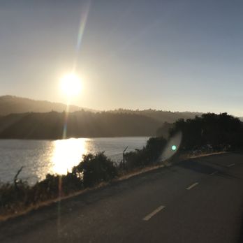
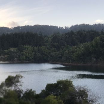
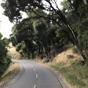
It's a very nice walking trail. When I came here the trail was partially closed so I wasn't able to walk too far but the scenery is very beautiful. There's a lot of trees and nice views of the reservoir plus you might get to see some of the wildlife that live in the area. I recommend coming here if you want a relaxing walk or if you like biking. read more



6 years ago
Nice place but a lot of the lake views are obscured by trees. You can only see the lake very well towards the beginning of the walk or if you go through the bridge. It would be much more enjoyable if you bike instead of walking, as it is quite a long walk. It gets quite busy on the weekends and parking can be difficult to find. Overall, a nice place, you can see a lot of families here with scooters, bikes, and rollerblades. Don't forget to bring your helmet if you're biking. read more


6 years ago
Amazing easy hiking trail! We just discovered this trail recently and plan to come back weekly. Love the shady trail and expect to encounter deers and birds on the way. Family friendly but be careful of the bikers behind. It gets pretty crowded in the afternoon, plan to come earlier for parking spots... read more


Beautiful trail that is paved and easy walk is well trafficked by pediatrics and bikers. Benches and picnic tables throughout the trail. The trail is wide which is great with how many people are out and to stick with COVID precautions. Mile markers along the way and also some restrooms that are near the beginning and end of the trail. I was happily surprised that the restrooms were fairly clean. I only wish parking was better so recommend starting early if going on a weekend. I hope to visit again soon and check out more trails. read more


4 years ago

3 years ago

2 years ago

The road is completely paved all the way through - perfect for leisure walkers, runners, and bicyclists. The road is also open to equestrians, but I've only ever seen horses once during my many trips here. You can't deviate from the path either because the trail is fenced in by barbed wire...but I would say most of it is for your safety (steep drops) and for hunting/gaming prevention. There is almost always wildlife ever present here which makes it pretty neat. Deer gather in herds. But there are also birds/waterfowl, beetles, slugs (esp. after a rain) and lizards. I've seen gophers too. The trail is about 6 miles long, I've never actually seen the other end...still working towards it. Just keep hydrated, but not so much that you'll have to use the restrooms. It's a glorified port-a-potty...haven't used it, but have definitely smelled it from afar. read more


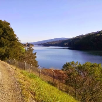
If you're looking for at least a somewhat strenuous hike, this isn't for you. My friends and I like at least pretty hardcore hikes with over 100 feet in elevation change (I tracked this on Strava and that was the actual total elevation change). We did get good mileage, 12 miles round trip along the entire Sawyer Camp segment, from the Crystal Springs entrance to the San Andreas Lake. There's even more mileage to be covered on either side of those segments. Also, it's a paved trail so there are lot of strollers, bikers, and families with kids. Not very isolated; it can get a bit crowded here. Despite that, we did get a parking spot not far from the entrance around 11:30am or noon on a Saturday, which I was surprised about. A lot of the open spots seemed to be people who'd come earlier in the morning and had already finished their hike. Also, the entire trail is completely fenced off with barbed wire on either side (about 10-20 feet off the trail). So while you do get to enjoy a pretty good view, there's no off-roading or getting near the reservoir. It's a fairly exposed trail so make sure to bring protection from the sun! most of the walking along the reservoirs aren't covered, but most of the segment between the two reservoirs is. Some nice views: http://www.yelp.com/biz_photos/crystal-springs-walking-trail-san-bruno?select=EBwonTbnP_P6pII-7F9iOA#aEO6ISRD9DTjR9BAEhG4cg http://www.yelp.com/biz_photos/crystal-springs-walking-trail-san-bruno?select=EBwonTbnP_P6pII-7F9iOA#EBwonTbnP_P6pII-7F9iOA http://www.yelp.com/biz_photos/crystal-springs-walking-trail-san-bruno?select=EBwonTbnP_P6pII-7F9iOA#XmfUs_OPGUK6koqhrgeM1g Trail map; http://www.yelp.com/biz_photos/crystal-springs-walking-trail-san-bruno?select=EBwonTbnP_P6pII-7F9iOA#9LJBv8DKzyJMdeEhm4x6HA read more


4 years ago

5 years ago

I had spring fever with the beautiful weather this past Friday evening (3/10) after all the rain we have had! I also happened to have my bike on my car, so this girl took herself on a spontaneous solo bike ride at Crystal Springs. It was so so fun! It was probably that fun because I was excited that the sun was out and it was warm, but also because I had been eyeing this trail from Skyline for a while and was wondering where it went. The first time checking out a place is always exciting. You can park in the dirt parking lot that is at San Bruno and Skyline across the gas station. When you get in the entrance to the Crystal Springs trail, the paved part is not very long - it took me about 15 minutes one way. At the end of the paved part of the trail, it turns into a dirt walking trail, and the sign says no bikes. :( So I turned around there. The view here is absolutely gorgeous, there were deer grazing right beyond the fence. There are a lot of walkers and runners here, so I did have to navigate around them. That slowed me a bit, but I did need a reason to go slower, hahaha. Such a fabulous spot! read more


I felt like after doing the San Bruno Park, this was a breeze. As the name Crystal Springs Walking Trail sounds, it is definitely great for walking as the paths are pretty straight forward. It's a very popular trail so you have all sorts of people. Bikers are certainly welcomed as they probably constitute half of the consensus. The Crystal Springs comprises of three trails: San Andreas (2.6 miles), Sawyer Camp (6.0 miles) and Crystal Springs (6.7 miles). It's a one way trail so you're looking at 30.6 miles round trip. What I did: San Andreas. Begins at Skyline Blvd and then follows the San Andreas Lake + Straightforward and pretty easy for anyone + Exposed to the sun a lot so sun screen is probably a great idea + Great view of the lake + Easy parking + Data reception! Hooray, I have music :) - Some parts are not as paved as well + 'sketchy' but still very safe! -- It was crowded, little too crowded than I'd like -- Why does it have to be one way?!?!? Makes it boring to have to go back the same path you began :P Although more likes than dislikes, this trail just wasn't my cup of tea. I like more of the adventurous and challenging ones and this was just a trail. read more



15 years ago
5 years ago

6 years ago

14 years ago
I've always driven passed this place on the 35, but I just recently made the journey behind the fence! I wished I had chosen to do so sooner. I was a regular at the Sawyer Camp Trail, but little did I know that the Crystal Springs Trail led to Sawyer Camp. I've never trekked the entire 16+ miles (approximately), but it is a challenge I'm up for. I love this trail because of it's natural setting, despite being alongside Skyline Blvd. and 280. It's never crowded when I go, but not empty either. I read about the review with the coyote (lol!), so I'm thankful I haven't encountered that. All I've seen as of yet are lizards, birds and bugs. What I like is that I can enjoy a good jog without being run over by bicyclists. Don't beat me up out there bikers...but at Sawyer Camp, bikers were brutal. Also, while I do enjoy the undisturbed setting, jogging on a paved trail is easier on my soles. Though the up and down hill climbs still make for a daring run. So far, due to pinched timing, I've only been able to do the 2.7 mile jog (5.4 round trip). However, any exercise is good exercise to me. read more


5 years ago
12 years ago
This is one of my favorite trails for hiking/biking/running. It's 7 miles one way, paved the whole way through, and completely surrounded by nature. You're sure to see deer among the wildlife and there's a nice view of the lake - a good way to connect with nature and escape for a while. read more


10 years ago

9 years ago
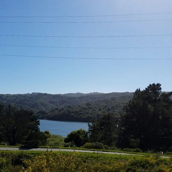
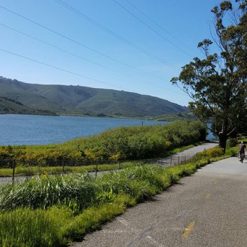
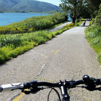
I like this trail a lot. A hike with ups and downs ups and downs, with a breathtaking water view, surrounded by lots of trees and hills. A breeze during a hike or bike ride is so niiicee! Definitely will come back several times in the future. read more


7 years ago
A really beautiful and easy hiking. Nice views! I saw a deer as well! Pathway is paved and easy to walk in. You can come with kids and strollers. Family friendly. read more


5 years ago

8 years ago


12 years ago
If your looking to go on a hike or just for the outdoors this a nice little gem, not to far from local scenery great climate changes amazing conversations with nature. A spot where you can absorb Mother Nature at her finest, get to know ones inner self unplugged from the reality. To get into the zone and focus only on the surroundings I front of you instead of the distractions of life. To take time and give yourself some alone time to be in zen. read more

Page 1 of 2
More info about Crystal Springs Regional Trail
Ask the Community - Crystal Springs Regional Trail
Is Fishing allowed here?
Where to park if you cane for walking?
Just outside the gate,there is handicap parking but it gets full
Review Highlights - Crystal Springs Regional Trail
You might also consider










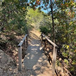

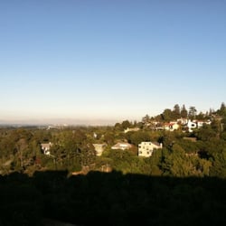

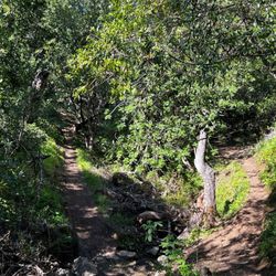
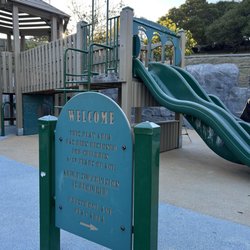















Crystal Springs Regional Trail - hiking - Updated August 2026
Best of Burlingame
People found Crystal Springs Regional Trail by searching for…
Hiking Trails in Burlingame, CA
Walking Trails in Burlingame, CA
Dog Friendly Hiking Trails in Burlingame, CA
Beautiful Views in Burlingame, CA
Running Trails in Burlingame, CA
Stroller Friendly Hikes in Burlingame, CA
Picnic Spots in Burlingame, CA
Sunrise View in Burlingame, CA
Dog Friendly Parks in Burlingame, CA
Watch Sunset in Burlingame, CA
Secret Spots in Burlingame, CA
Swimming Lakes in Burlingame, CA
Places to Take Pictures in Burlingame, CA
Hiking With Kids in Burlingame, CA
Redwood Trees in Burlingame, CA
Trending Searches in Burlingame, CA
Blueberry Picking near Crystal Springs Regional Trail
Cinema near Crystal Springs Regional Trail
Cliff Jumping near Crystal Springs Regional Trail
Cruising Spots near Crystal Springs Regional Trail
Day Trips near Crystal Springs Regional Trail
Dog Friendly Things To Do near Crystal Springs Regional Trail
Flower Fields near Crystal Springs Regional Trail
Indoor Mini Golf near Crystal Springs Regional Trail
Jet Ski Rental near Crystal Springs Regional Trail
Kayak Rental near Crystal Springs Regional Trail
Kids Activities Indoor near Crystal Springs Regional Trail
Lakes near Crystal Springs Regional Trail
Outdoor Activities near Crystal Springs Regional Trail
Parks near Crystal Springs Regional Trail
Peach Picking near Crystal Springs Regional Trail
Picnic Areas near Crystal Springs Regional Trail
Rainy Day Activities near Crystal Springs Regional Trail
River Swimming near Crystal Springs Regional Trail
Rock Quarry near Crystal Springs Regional Trail
Scenic Night View near Crystal Springs Regional Trail
Scenic Overlook near Crystal Springs Regional Trail
Shopping Malls near Crystal Springs Regional Trail
Sports Card Shops near Crystal Springs Regional Trail
Sunrise View near Crystal Springs Regional Trail
Things To Do On A Rainy Day near Crystal Springs Regional Trail
Trading Card Shops near Crystal Springs Regional Trail
Used Book Stores near Crystal Springs Regional Trail
Watch Sunset near Crystal Springs Regional Trail
Waterfalls And Swimming Holes near Crystal Springs Regional Trail
Browse Articles
Browse Nearby
BEST of Burlingame, California Coffee near Crystal Springs Regional Trail
BEST of Burlingame, California Restaurants near Crystal Springs Regional Trail
BEST of Burlingame, California Things to Do near Crystal Springs Regional Trail
BEST of Burlingame, California Walking Trails near Crystal Springs Regional Trail
BEST of Burlingame, California Parks near Crystal Springs Regional Trail
BEST of Burlingame, California Breakfast near Crystal Springs Regional Trail
BEST of Burlingame, California Campgrounds near Crystal Springs Regional Trail
BEST of Burlingame, California Motel near Crystal Springs Regional Trail
BEST of Burlingame, California Taxis near Crystal Springs Regional Trail
Browse Brands
Related Searches in Burlingame, CA
Affordable Kayak Rental Services in Burlingame, California
Best Dog Hiking Trails Around Burlingame, California
Best Fishing Locations and Guides in Burlingame, California
Best Nature Trails for Hiking in Burlingame, California
Best Places for Horseback Riding in Burlingame, California
Best Sightseeing Experiences Available in Burlingame, California
Check Out Off Road Trails in Burlingame, California
Discover Dog Friendly Trails to Explore in Burlingame, California
Discover Easy Hiking Trails Near Burlingame, California
Discover Kid Friendly Hiking Trails in Burlingame, California
Discover Popular Bike Trails in Burlingame, California
Discover Walking Parks in Burlingame, California Near You
Discover a Hiking Trail in Burlingame, California
Discover the Best Night Hike Trails in Burlingame, California
Dog-Friendly Hikes With Dogs in Burlingame, California
Enjoy Camping Adventures Around Burlingame, California
Enjoy Kayaking Adventures in Burlingame, California
Enjoy Off Leash Dog Hikes in Burlingame, California
Enjoy Scenic Places to Walk in Burlingame, California
Enjoy a Beautiful Waterfall Hike in Burlingame, California
Enjoy the Best Walking Path in Burlingame, California
Enjoy the Best Walking Trails in Burlingame, California
Explore Beautiful Parks and Green Spaces in Burlingame, California
Explore Easy Hikes Perfect for All in Burlingame, California
Explore Fun Activities to Do in Burlingame, California
Explore Popular Campgrounds Near Burlingame, California
Explore Popular Dog Walking Trails in Burlingame, California
Explore Top Dog Parks in Burlingame, California Near You
Explore the Best Beach Spots in Burlingame, California
Family Friendly Hiking With Kids in Burlingame, California
Find Beautiful Views in Burlingame, California
Find Cozy Camping Cabins in Burlingame, California
Find Top Dog Friendly Parks to Visit in Burlingame, California
Find Top-Rated Waterfalls in Burlingame, California Now
Find the Best Parks for Picnics in Burlingame, California
Find the Best Playgrounds to Visit in Burlingame, California
Hiking Trails With Waterfalls in Burlingame, California
Off Leash Dog Hiking Trails in Burlingame, California
Popular Outdoor Activities to Try in Burlingame, California
Popular Picnic Spots to Visit in Burlingame, California
Popular Waterfall Hiking Trails in Burlingame, California
Safe River Swimming Areas in Burlingame, California
Safe and Fun Parks for Kids in Burlingame, California
Top Hiking Trails to Explore in Burlingame, California
Top Playgrounds for Kids to Enjoy in Burlingame, California
Top Running Trails to Explore in Burlingame, California
Top Swimming Lakes to Enjoy in Burlingame, California
Top Swimming Spots and Pools in Burlingame, California
Walk Dog Friendly Hiking Trails in Burlingame, California
Walk the Best Paved Walking Trails in Burlingame, California


