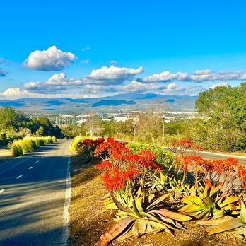
Shady Canyon Trail Photos


You might also consider


More like Shady Canyon Trail
Recommended Reviews - Shady Canyon Trail
Start your review...


Reviews With Photos


Nice 7 mile hike, with great views and choices of dirt or paved paths. This trail is next to the Quail Hill Community and their trail as well. The trail includes a lake, so well maintained walk ways and a lot of people if you don't like to walk alone. The paved road is used mostly for bikes but the community shares, just remember to be courteous and make spaces for the bikes to pass.


My husband and I are always exploring family friendly hikes in OC and came across this one after seeing Quail Loop was closed due to the recent rains. Although this trail is called Shady Canyon, it really doesn't have any shade. This is an out and back hike and started at the Quail Loop parking lot in the Quail Hill neighborhood with an immediate incline up a dirt walking trail with a paved bike path next to it. It was fairly busy compared to many of the Friday hikes we have done in the area passing people every 5 minutes or so, some were groups of walkers, some family or pro hikers, and groups of bicyclists. PRO TIP: Sunscreen and a hat for shade is very recommended for this hike even in the winter. There are beautiful views of the golf course which has a small lake and a very cute bridge that you cross along the trail. Overall it's just over 7 miles out and back and follows along some residential communities and parks. Loved how green everything was from the recent rainy weather.


These are walking/jogging/biking trails, so don't come thinking you find any level of "hiking" here. Park at the bottom on either side of the road near the Quail Hill plaza (bathrooms in both parking lots), and make your way up. It's very pretty in general with all the manicured greenery and golf courses down the way, but it's also very plastic, as is most of south OC. Come here for a stroll, an easy meandering with your less hyperactive dog, or if you're recovering from some mild lower extremity injury. You'll be safe here. When it rains, parts of the dirt path can be slippery so walk on the pavement if you like but be sure to keep eyes and ears open for bicycles. All in all, an easy 6mile round trip walk to kill a couple hours. Grab a coffee from Starbucks or Mag's before you head up, then when you get back down, grab a bite at Nalu's or Sharky's or a smoothie at Nekter (or whatever it is in the corner by the shipping office). Have a nice walk. =)


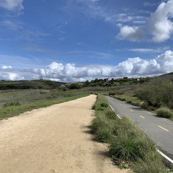
The trail was pave all the way. You can walk as far as you like until the end to Culver. It's about 7.8 miles total. But we walked about 4 miles. The beginning of the trail was steep. There are a lot of people walking as well as biking. This trail is more crowded then some of the other trail I have been on.


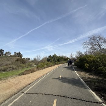
I would recommend this trail for any first time hikers. It's more of a walk but it does have a hill or two when you feel a bit of the incline. There's always people walking and bikers so you'll be fine doing it alone. Everyone is friendly and it's a bonus when you see their doggies. I recommend to bring you dogs! (MAKE SURE YOU KNOW HOW TO HANDLE YOUR PETS) and please clean up after yourself or your pet. After this trail my dog is ready to pass out and nap for a bit. She's always so excited to come but it definitely gets her tired.


First things first...do not use the address marker that's provided on Yelp. You'll end up at the front gates of some random gated neighborhood. Park at the Quail Hill community park or the Turtle Rock community park. Either one will get you onto the trail, I parked at the Turtle Rock community park. If you park there, there's a sign with arrows pointing out where the trailhead is. So this trail isn't a loop, if you start at turtle rock you'll end up at quail hill, and vice versa. To get from one point to another is a little over 2 miles, so round trip would be between 4-5 miles. Bear in mind that there's barely any shade on this trail, I went early on a Saturday morning while it was relatively cool. It started getting warm around 10, and it wasn't even 70 degrees yet, but it was super sunny. The trail has both paved and dirt sections. It's great for runners, bikers, walkers and it's very dog friendly. There's a slight incline but it's honestly not difficult at all. On a scale of 1-10, with 1 being literally a walk in the park and 10 being, I almost died it was so bad, I would rate this like a 3. Also keep in mind, if you're looking for a place within the city to get away and be alone on a hike or whatever. Keep looking, this is not the place. I got here at 8:30 on a Saturday, and already there were quite a few people. My dog really seemed to enjoy herself. So if you want to take your dog on a nice and easy walk, this is a good place. The trails are pretty wide too. However, I have to say, please pick up after you dog. I saw more dog poop on the trail than I would have liked to see. Seriously people, pick up after your dogs. Nobody wants to step on that or bike over it. I also didn't see any spiders or snakes. Apparently you run the risk of running into some on this trail.


NOTE: You may recognize this as my Quail Hill Trailhead review. That is correct. I mistakenly wrote this review for the wrong trail and am now editing that one to reflect the correct trail. This review was, in fact, for the Shady Canyon Trail. "My grandmother started walking five miles a day when she was sixty. She's ninety-seven now, and we don't know where the heck she is." --Ellen DeGeneres This trail will kick your butt without you even knowing it. How so? It's just such a pretty journey with gorgeous views that you just instinctively keep on truckin' even more so than if you were on city sidewalks. The gravel path does make it a bit easier on your joints. Another great feature is that there is a separate, but parallel paved course for cyclists. Everyone can enjoy this trail without getting in each others way! Keep in mind, however, that this hike is not for beginners. The first mile is entirely an uphill trudge. The gravel trail does make it a bit easier on your feet: http://www.yelp.com/biz_photos/shady-canyon-trail-irvine?select=4l5Yzb1oXGdPxFh6ICNDHw#wLZC_-LiwdibvstYqlXA1w Just as you think you're done with the uphill trek, you round the corner to find HOLY SMOKES MORE UPHILL terrain! http://www.yelp.com/biz_photos/shady-canyon-trail-irvine?select=4l5Yzb1oXGdPxFh6ICNDHw#ctPDi7Tr41BFjd_Yv6cu4A So, just as you are cussing up a storm because your legs and derriere are on fire, just turn your butt around and check out your accomplishments: http://www.yelp.com/biz_photos/shady-canyon-trail-irvine?select=4l5Yzb1oXGdPxFh6ICNDHw#-ueGi-FmfoRIt1K9f1VhoQ The rest of the trail meanders through smaller hills, bridges, and creeks: http://www.yelp.com/biz_photos/shady-canyon-trail-irvine?select=4l5Yzb1oXGdPxFh6ICNDHw#kOjTduFP4KfCsPH1CZLilQ http://www.yelp.com/biz_photos/shady-canyon-trail-irvine?select=4l5Yzb1oXGdPxFh6ICNDHw#vBlXZveou1EstHBx8ah6Xg You will pass lovely flowering cacti and gorgeous rock formations. http://www.yelp.com/biz_photos/shady-canyon-trail-irvine?select=4l5Yzb1oXGdPxFh6ICNDHw#dXGi1CFjq-2aPqGgUZdHjQ http://www.yelp.com/biz_photos/shady-canyon-trail-irvine?select=4l5Yzb1oXGdPxFh6ICNDHw#Wwnoc83gsa5QUJOO-F3wCQ If you take the Quail Hill Trailhead, it merges into the Shady Canyon Trail, which in turn runs into the Turtle Rock Community Center. Going ALL THE WAY back and forth will be around 6.5 miles. Had to subtract one star for lack of bathrooms! There is community park about two thirds down the trail, but since it is a private community, the restrooms are only accessible to those with a key. This hike isn't pleasant without a bottle of water, so you'll have to hold it until you either get to Turtle Rock, or back down to the Quail Hill park at the beginning.


Really nice views in the middle of the city. Great for walking or biking. There is an uphill part in the beginning but its not that bad, although some of the bikers looked like they were struggling a little. There is not a lot of shade on this trail. Make sure to bring a lot of water if you go the whole way, it's not a loop, you'll have to turn around once you get to the Boomer Canyon trail head. (I have a dog with me and dogs are not allowed on that trail) I think I over-worked my dog though, so make sure to bring enough water for your bud as well! We will definetly be back on this trail once I work the dog up to it more. Like other reviewers mentioned its not a difficult trail, just LONG.


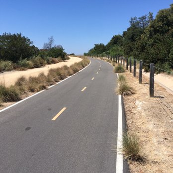
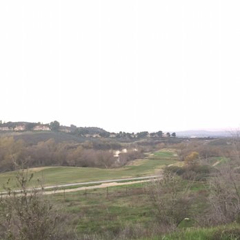
One of my favorite trails (so far) in OC. Great for both cyclists and foot climbers!! I love the hill climb that begins at the base of Quail Hill park. Great leg workout. The rest of the train winds through Shady Canyon and features both a two-lane paved bike road, and a dirt trail directly on the right. Views-the views are pretty on any day you can see the golf course below, lake, Shady Canyon homes, Turtle Ridge, the Irvine great park, and the 405 freeway. This trail is open from sunrise to sunset, is the most crowded 8-11am, and the restroom in the parking lot is clean.


Nothing shady about this trail, had such a pleasurable walk this morning at Shady Canyon. The trail seems to stretch forever. I was only able to do a mile before turning around, but can't wait to come back for a longer walk. I did not realize it had as much elevation as it did, because the walk itself feels easy (262 elevation gain for 2 miles). Lots of greenery, plants, and scenery to enjoy along the way. It is both paved and dirt, and I saw both walkers and runners. Shady Canyon is connected with Quail Hill, and also there is a park across which leads to another trail. The possibilities are endless, and all so enjoyable. Great place to get those miles in. read more


Shady Canyon Trail is an out-and-back 7.8 mile trail in Irvine. It starts from Quail Hill Loop, passes the Shady Canyon and Turtle Rock neighborhoods, and ends when you hit Culver Drive. There was some but not much incline throughout and is a good walking, jogging, or biking trail. There is some parking at the Quail Hill Loop but most people seem to park at the Quail Hill Community Center next to the park. We walked through the trail and although we didn't go all the way, it wasn't a difficult hike. read more


8 months ago

6 months ago

Nice 7 mile hike, with great views and choices of dirt or paved paths. This trail is next to the Quail Hill Community and their trail as well. The trail includes a lake, so well maintained walk ways and a lot of people if you don't like to walk alone. The paved road is used mostly for bikes but the community shares, just remember to be courteous and make spaces for the bikes to pass. read more


5 years ago

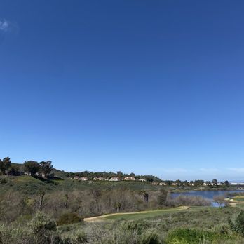
My husband and I are always exploring family friendly hikes in OC and came across this one after seeing Quail Loop was closed due to the recent rains. Although this trail is called Shady Canyon, it really doesn't have any shade. This is an out and back hike and started at the Quail Loop parking lot in the Quail Hill neighborhood with an immediate incline up a dirt walking trail with a paved bike path next to it. It was fairly busy compared to many of the Friday hikes we have done in the area passing people every 5 minutes or so, some were groups of walkers, some family or pro hikers, and groups of bicyclists. PRO TIP: Sunscreen and a hat for shade is very recommended for this hike even in the winter. There are beautiful views of the golf course which has a small lake and a very cute bridge that you cross along the trail. Overall it's just over 7 miles out and back and follows along some residential communities and parks. Loved how green everything was from the recent rainy weather. read more


These are walking/jogging/biking trails, so don't come thinking you find any level of "hiking" here. Park at the bottom on either side of the road near the Quail Hill plaza (bathrooms in both parking lots), and make your way up. It's very pretty in general with all the manicured greenery and golf courses down the way, but it's also very plastic, as is most of south OC. Come here for a stroll, an easy meandering with your less hyperactive dog, or if you're recovering from some mild lower extremity injury. You'll be safe here. When it rains, parts of the dirt path can be slippery so walk on the pavement if you like but be sure to keep eyes and ears open for bicycles. All in all, an easy 6mile round trip walk to kill a couple hours. Grab a coffee from Starbucks or Mag's before you head up, then when you get back down, grab a bite at Nalu's or Sharky's or a smoothie at Nekter (or whatever it is in the corner by the shipping office). Have a nice walk. =) read more




The trail was pave all the way. You can walk as far as you like until the end to Culver. It's about 7.8 miles total. But we walked about 4 miles. The beginning of the trail was steep. There are a lot of people walking as well as biking. This trail is more crowded then some of the other trail I have been on. read more




4 years ago
I would recommend this trail for any first time hikers. It's more of a walk but it does have a hill or two when you feel a bit of the incline. There's always people walking and bikers so you'll be fine doing it alone. Everyone is friendly and it's a bonus when you see their doggies. I recommend to bring you dogs! (MAKE SURE YOU KNOW HOW TO HANDLE YOUR PETS) and please clean up after yourself or your pet. After this trail my dog is ready to pass out and nap for a bit. She's always so excited to come but it definitely gets her tired. read more




5 years ago
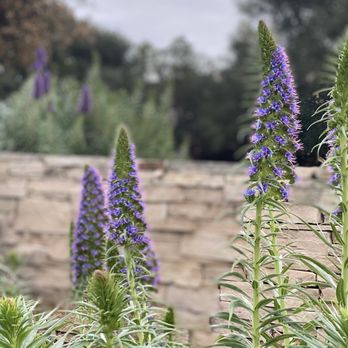
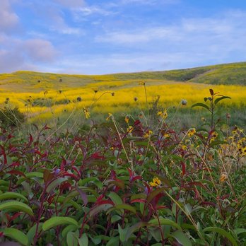
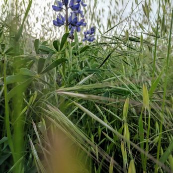
Nice trail with beautiful scenery of wildflower in April 2021. Picture perfect. It is easy hike and dogs are allowed. read more



9 years ago
First things first...do not use the address marker that's provided on Yelp. You'll end up at the front gates of some random gated neighborhood. Park at the Quail Hill community park or the Turtle Rock community park. Either one will get you onto the trail, I parked at the Turtle Rock community park. If you park there, there's a sign with arrows pointing out where the trailhead is. So this trail isn't a loop, if you start at turtle rock you'll end up at quail hill, and vice versa. To get from one point to another is a little over 2 miles, so round trip would be between 4-5 miles. Bear in mind that there's barely any shade on this trail, I went early on a Saturday morning while it was relatively cool. It started getting warm around 10, and it wasn't even 70 degrees yet, but it was super sunny. The trail has both paved and dirt sections. It's great for runners, bikers, walkers and it's very dog friendly. There's a slight incline but it's honestly not difficult at all. On a scale of 1-10, with 1 being literally a walk in the park and 10 being, I almost died it was so bad, I would rate this like a 3. Also keep in mind, if you're looking for a place within the city to get away and be alone on a hike or whatever. Keep looking, this is not the place. I got here at 8:30 on a Saturday, and already there were quite a few people. My dog really seemed to enjoy herself. So if you want to take your dog on a nice and easy walk, this is a good place. The trails are pretty wide too. However, I have to say, please pick up after you dog. I saw more dog poop on the trail than I would have liked to see. Seriously people, pick up after your dogs. Nobody wants to step on that or bike over it. I also didn't see any spiders or snakes. Apparently you run the risk of running into some on this trail. read more


3 years ago

4 years ago

7 years ago

NOTE: You may recognize this as my Quail Hill Trailhead review. That is correct. I mistakenly wrote this review for the wrong trail and am now editing that one to reflect the correct trail. This review was, in fact, for the Shady Canyon Trail. "My grandmother started walking five miles a day when she was sixty. She's ninety-seven now, and we don't know where the heck she is." --Ellen DeGeneres This trail will kick your butt without you even knowing it. How so? It's just such a pretty journey with gorgeous views that you just instinctively keep on truckin' even more so than if you were on city sidewalks. The gravel path does make it a bit easier on your joints. Another great feature is that there is a separate, but parallel paved course for cyclists. Everyone can enjoy this trail without getting in each others way! Keep in mind, however, that this hike is not for beginners. The first mile is entirely an uphill trudge. The gravel trail does make it a bit easier on your feet: http://www.yelp.com/biz_photos/shady-canyon-trail-irvine?select=4l5Yzb1oXGdPxFh6ICNDHw#wLZC_-LiwdibvstYqlXA1w Just as you think you're done with the uphill trek, you round the corner to find HOLY SMOKES MORE UPHILL terrain! http://www.yelp.com/biz_photos/shady-canyon-trail-irvine?select=4l5Yzb1oXGdPxFh6ICNDHw#ctPDi7Tr41BFjd_Yv6cu4A So, just as you are cussing up a storm because your legs and derriere are on fire, just turn your butt around and check out your accomplishments: http://www.yelp.com/biz_photos/shady-canyon-trail-irvine?select=4l5Yzb1oXGdPxFh6ICNDHw#-ueGi-FmfoRIt1K9f1VhoQ The rest of the trail meanders through smaller hills, bridges, and creeks: http://www.yelp.com/biz_photos/shady-canyon-trail-irvine?select=4l5Yzb1oXGdPxFh6ICNDHw#kOjTduFP4KfCsPH1CZLilQ http://www.yelp.com/biz_photos/shady-canyon-trail-irvine?select=4l5Yzb1oXGdPxFh6ICNDHw#vBlXZveou1EstHBx8ah6Xg You will pass lovely flowering cacti and gorgeous rock formations. http://www.yelp.com/biz_photos/shady-canyon-trail-irvine?select=4l5Yzb1oXGdPxFh6ICNDHw#dXGi1CFjq-2aPqGgUZdHjQ http://www.yelp.com/biz_photos/shady-canyon-trail-irvine?select=4l5Yzb1oXGdPxFh6ICNDHw#Wwnoc83gsa5QUJOO-F3wCQ If you take the Quail Hill Trailhead, it merges into the Shady Canyon Trail, which in turn runs into the Turtle Rock Community Center. Going ALL THE WAY back and forth will be around 6.5 miles. Had to subtract one star for lack of bathrooms! There is community park about two thirds down the trail, but since it is a private community, the restrooms are only accessible to those with a key. This hike isn't pleasant without a bottle of water, so you'll have to hold it until you either get to Turtle Rock, or back down to the Quail Hill park at the beginning. read more




13 years ago

11 years ago
Really nice views in the middle of the city. Great for walking or biking. There is an uphill part in the beginning but its not that bad, although some of the bikers looked like they were struggling a little. There is not a lot of shade on this trail. Make sure to bring a lot of water if you go the whole way, it's not a loop, you'll have to turn around once you get to the Boomer Canyon trail head. (I have a dog with me and dogs are not allowed on that trail) I think I over-worked my dog though, so make sure to bring enough water for your bud as well! We will definetly be back on this trail once I work the dog up to it more. Like other reviewers mentioned its not a difficult trail, just LONG. read more


12 years ago
One of my favorite trails (so far) in OC. Great for both cyclists and foot climbers!! I love the hill climb that begins at the base of Quail Hill park. Great leg workout. The rest of the train winds through Shady Canyon and features both a two-lane paved bike road, and a dirt trail directly on the right. Views-the views are pretty on any day you can see the golf course below, lake, Shady Canyon homes, Turtle Ridge, the Irvine great park, and the 405 freeway. This trail is open from sunrise to sunset, is the most crowded 8-11am, and the restroom in the parking lot is clean. read more


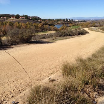
Nice incline starting from quail hill trailhead. I have never completed the loop. The furthest I've hiked is 45 minutes then turned back around. I think next time I will go all the way around. It's really nice to see so many people hiking and being so friendly. I love the outdoors! This trail so close to home makes me appreciate living in Irvine more and more each day! read more


4 years ago


9 years ago
This is my go-to-trail when I need a medium level hike. I take Shady Canyon all the way to Bommer Canyon and back. It's about a 5-6 mile loop. Great scenery and it's very quiet and enjoyable if you need to get away. No snakes thus far!!!! read more



7 years ago
The Bommer Canyon trail hits an amazing view of the ocean! I was lucky enough to go when everything was lush and green, so I got to see some wildlife as well. read more



10 years ago
Great place for a weekday or weekend hike! The path has a gradual incline so it's not strenuous at all. Part of the trail is paved for cyclists, but there's also a dirt path if you're wearing hiking shoes. Wishing I lived closer to Irvine because of the many great trail paths in the area! read more


10 years ago

11 years ago
Who doesn't love the outdoors? For those lucky enough to call this home it's a wonderful area to walk, hike, run and mountain bike. But for the love of God pick your dogs crap up! This isn't your personal backyard to fertilize with your dogs crap. I'm tried of having to play hopscotch over mounds of $hit on the ground. If you're not responsible enough to bring a doggy back then at least have them go in bushes. read more


12 years ago

12 years ago

11 years ago
These trails are just for running or walking or riding your bike these trails would take you all the way to Turtle Rock these trails are dangerous there's a lot of rattlesnakes and spiders you got to be very careful other than that it's beautiful quiet and relaxing read more


11 years ago
Beautiful day for a beautiful hike. Great excerise. Great trail. The view is gorgeous over looking the city. Easy hike. Very friendly people hiking, walking, running, and biking along the trails. Enjoy! read more


8 years ago

9 years ago

10 years ago

10 years ago

12 years ago
10 years ago
More info about Shady Canyon Trail
34 Shady Canyon Dr
Irvine, CA 92603
Directions
Hours
Indoor Amenities
Outdoor Amenities
Ask the Community - Shady Canyon Trail
Review Highlights - Shady Canyon Trail
You might also consider




















Why does Yelp recommend reviews?
5 reviews that are not currently recommended
The reviews below are not factored into the business's overall star rating.

3 years ago

3 years ago

13 years ago
6 years ago
12 years ago
Shady Canyon Trail - hiking - Updated September 2026
Best of Irvine
People found Shady Canyon Trail by searching for…
Trending Searches in Irvine, CA
Apple Orchards near Shady Canyon Trail
Apple Picking near Shady Canyon Trail
Barbers near Shady Canyon Trail
Bike Shop near Shady Canyon Trail
Bird Sanctuary near Shady Canyon Trail
Casinos near Shady Canyon Trail
Cliff Jumping near Shady Canyon Trail
Consignment Shops near Shady Canyon Trail
Cruising Spots near Shady Canyon Trail
Dog Friendly Things To Do near Shady Canyon Trail
Dog Swimming near Shady Canyon Trail
Ear Piercing near Shady Canyon Trail
Eyebrow Threading near Shady Canyon Trail
Hair Braiding near Shady Canyon Trail
Hiking near Shady Canyon Trail
Kids Haircut near Shady Canyon Trail
Picnic Areas near Shady Canyon Trail
Preschools near Shady Canyon Trail
Private Schools near Shady Canyon Trail
Public Golf Courses near Shady Canyon Trail
Public Shower near Shady Canyon Trail
Rock Quarry near Shady Canyon Trail
Scenic Night View near Shady Canyon Trail
Scenic Overlook near Shady Canyon Trail
Star Gazing near Shady Canyon Trail
Sunrise View near Shady Canyon Trail
Trading Card Shops near Shady Canyon Trail
Browse Articles
Browse Nearby
BEST of Irvine, California Coffee near Shady Canyon Trail
BEST of Irvine, California Restaurants near Shady Canyon Trail
BEST of Irvine, California Things to Do near Shady Canyon Trail
BEST of Irvine, California Breakfast near Shady Canyon Trail
BEST of Irvine, California Walking Trails near Shady Canyon Trail
BEST of Irvine, California Parks near Shady Canyon Trail
BEST of Irvine, California Campgrounds near Shady Canyon Trail
BEST of Irvine, California Sightseeing near Shady Canyon Trail
Browse Brands
Related Searches in Irvine, CA
Affordable Kayak Rental Services in Irvine, California
Best Dog Hiking Trails Around Irvine, California
Best Fishing Locations and Guides in Irvine, California
Best Nature Trails for Hiking in Irvine, California
Best Places for Horseback Riding in Irvine, California
Check Out Off Road Trails in Irvine, California
Discover Dog Friendly Trails to Explore in Irvine, California
Discover Easy Hiking Trails Near Irvine, California
Discover Kid Friendly Hiking Trails in Irvine, California
Discover Popular Bike Trails in Irvine, California
Discover Scenic Mountain Bike Trails Near Irvine, California
Discover Walking Parks in Irvine, California Near You
Discover a Hiking Trail in Irvine, California
Discover the Best Night Hike Trails in Irvine, California
Dog-Friendly Hikes With Dogs in Irvine, California
Enjoy Camping Adventures Around Irvine, California
Enjoy Kayaking Adventures in Irvine, California
Enjoy Off Leash Dog Hikes in Irvine, California
Enjoy Scenic Places to Walk in Irvine, California
Enjoy Tent Camping Spots Around Irvine, California
Enjoy a Beautiful Waterfall Hike in Irvine, California
Enjoy the Best Walking Path in Irvine, California
Enjoy the Best Walking Trails in Irvine, California
Explore Beautiful Parks and Green Spaces in Irvine, California
Explore Easy Hikes Perfect for All in Irvine, California
Explore Popular Campgrounds Near Irvine, California
Explore Popular Dog Walking Trails in Irvine, California
Explore Top Dog Parks in Irvine, California Near You
Explore the Best Beach Spots in Irvine, California
Family Friendly Hiking With Kids in Irvine, California
Find Beautiful Views in Irvine, California
Find Parks and Recreation Activities in Irvine, California
Find Top Dog Friendly Parks to Visit in Irvine, California
Find the Best Parks for Picnics in Irvine, California
Find the Best Playgrounds to Visit in Irvine, California
Hiking Trails With Waterfalls in Irvine, California
Off Leash Dog Hiking Trails in Irvine, California
Popular Outdoor Activities to Try in Irvine, California
Popular Picnic Spots to Visit in Irvine, California
Popular Waterfall Hiking Trails in Irvine, California
Safe River Swimming Areas in Irvine, California
Safe and Fun Parks for Kids in Irvine, California
Top Hiking Trails to Explore in Irvine, California
Top Playgrounds for Kids to Enjoy in Irvine, California
Top Running Trails to Explore in Irvine, California
Top Swimming Lakes to Enjoy in Irvine, California
Top Swimming Spots and Pools in Irvine, California
Top-Rated Camping Sites in Irvine, California


