Hicks Canyon Regional Trail Photos


You might also consider


More like Hicks Canyon Regional Trail
Recommended Reviews - Hicks Canyon Regional Trail
Start your review...


Reviews With Photos
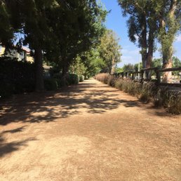

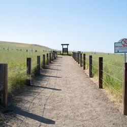
Nice walking/running trail. Not much of a "hike" as you are right up against homes and residential community the whole time. Aside from two steer under passes, the trail is flat. It's a nice trail for families with kids! If you begin the trail from Hicks Canyon Elementary and go to the end (Portola Pkwy) and back, the total distance is just over 4 miles. The trail goes under local streets so you can do complete 4 miles non-stop if you choose. There is both a paved walkway and an adjacent dirt path. The are plenty of walkers, a few bikers, and some joggers. Also, there are trees along the trail. The sun does shine through in various parts but you are not fully exposed to the sun for too long. As for parking, we went on Labor Day and there was still plenty of free parking (on the street in front of Hicks Canyon Elementary and Hicks Canyon Community Park). There are no restrooms along the trail but restrooms can be found at Hicks Canyon Community Park.


The best thing about Hicks Canyon Trail is that it's not too crowded (the times I've come) & it's safe. I come here for a nice brisk walk and sometimes a run alone & I never feel unsafe. Plus you feel like you're still out in nature with the birds chirping & beautiful tall trees. But always be cautious of your surroundings. I usually park at Hicks Canyon Park where the trail starts. In the morning parking is ample not sure during the busy times. Another interesting fact is that the trail is split. There's a paved path (cement) so even cyclists can come & a dirt path for those who need more of a real life hike feel.


This is a clean scenic residential trail. I'm jelly of the residents nearby! It takes me about 17 miles to get to this trail, but I would definitely come here often if I lived nearby. The trail has both paved and dirt roads following the residential community, which is a plus! I prefer the paved road as it is a pain to clean my shoes from the dirt every time. I don't think there are that many paved trails in OC either (that I could find). It's a flat trail, so it's good for jogging or running. I'm not sure if a lot of people know about this trail, but it's never crowded. I hope it stays that way though, because it's very relaxing and peaceful, especially during the sunset. There is more than enough places for parking at the community park.
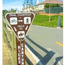

I ran on the Hicks Canyon Trail for the first time last weekend, and I really liked it! It's about 1.25 miles of paved and unpaved trails running parallel to each other. I ran on the unpaved, smooth gravel trail, which is a nice break for your legs from the hard pavement. The trail starts from Hicks Canyon Community Park at the corner of Culver and Viewpark in Irvine and goes east. I took the trail and connected with the trail along Jamboree and up to Cedar Grove Park and Peter's Canyon. One of my running buddies told me that by running on this trail, you can actually do almost an entire marathon's distance (26.2) all on dirt if you continue through Peter's Canyon to Irvine Regional Park. Orange County has a great trail system, so if you're a runner, cyclist, walker, or hiker, you have plenty of options. Get out there and enjoy!


Love this paved trail! My dog and I frequent it all the time! I love it better than the trail that leads to Peters Canyon. It's nice and there is spots of shade along the way!


Really nice outdoors, flat trail with two sides to it, dirt and paved. Lots of places for parking at the Hicks Canyon Regional Park (which is pretty much just a big soccer field). There's housing on both sides of the trail, so don't expect a total outdoors camping feeling. When you live in a city, you take what you can get. It's a long enough trail for Zulu and I to enjoy (several miles worth). On one end the trail ends, to what looks like construction across the street at Jeffrey St. At the other end of the trail, it merges into Peter Canyon Trail by the canal. We'll be back to this trail when we're looking for a lengthy yet easy walk, or as a supplement to Peters Canyon trail. You can get here also from the Jeffery open space trail.


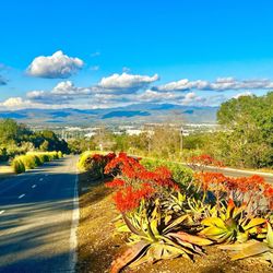
"No city should be too large for a man to walk out of in a morning." --Cyril Connolly Well... you're not leaving the city on this little Hicks Canyon Trail. Heck, you're not even leaving Irvine. This little trail doesn't even give you the feeling that you're remotely away from the city as it butts up against homes and back yards. BUT... it is a damn nice trail. And the cell phone reception is fabulous. A few stats about the trail: - About 3 miles up and back from Hicks Cyn Community Park to Portola Pkwy. - Very easy. 100 ft elevation change over 1.5 miles. - West end of trail actually connects with the Peter's Canyon trail network. WHAT'S SO GREAT ABOUT HICKS? 1. Like the Shady Canyon Trail, Hicks sports two well maintained paths, a two-laned bike path and a gravel path. http://www.yelp.com/biz_photos/hicks-canyon-regional-trail-irvine?select=KcR8089RokMOF6GrvWS15w#9jmLJwULOdNTnxyX2aL67Q 2. OMG LOTS OF SHADE. SHADE!!! It's such a precious commodity in this crazy heat. This trail is like an oasis compared to others. http://www.yelp.com/biz_photos/hicks-canyon-regional-trail-irvine?select=KcR8089RokMOF6GrvWS15w#KcR8089RokMOF6GrvWS15w 3. Several rows of super old eucalyptus trees line the path: http://www.yelp.com/biz_photos/hicks-canyon-regional-trail-irvine?select=KcR8089RokMOF6GrvWS15w#7cxl65qK8zChgBzccg0wBA 4. Nice airy, open tunnels take you under Culver Dr. and Yale Ave. so no stopping and waiting to cross a street! 5. Occasional benches and trash cans line the trail. 6. Very pet friendly. Saw lots of people walking their furry friends! 7. Convenient parking right up to the trail at Hicks Canyon Community Park! This is a great trail for runners and joggers who are training for 5K's. It is flat, smooth, and sufficiently shady! It's a great every-day trail to get some exercise on!


I absolutely love this trail. It is one of those trails that really grows on you. When I first ran this trail, I hated it. The reason why is because I ran it to train for my first half marathon. The trail looks flat enough, but when you are running up and down that trail 3+ times a run, you realize that the trail is harder on the way up. After checking my fitness tracker, I saw that it has a slight uphill. Well, not only did I learn how to run comfortably at a slight uphill, it prepared me well for my first half! While everyone was saying the slight uphill towards the end of the race was hard, I did not even notice it lol. Other than that, the trail itself is beautiful, serene, and spacious. It is about 1.6 miles up and down, but once you reach the top you can also venture out into the streets without hitting a stoplight for a while. Did not get bored running 13 miles, and it really helped me to become a better runner. There are always people walking, jogging and riding bikes, but never get in the way because the trail is spacious. Also, there are both paved and dirt paths, which makes it really nice. If you are looking for a place to have a nice stroll, jog or run, give this trail a try! read more


4 months ago
A strong 4.0 to 4.25 stars for this trailhead. Walking jogging running and biking... pet friendly- a straight trail from west to east. Either pavement or dirt access. Along the waythat has great scenic attributes and side short routes. Other trails nearby would be jeffery trail and the Cypress trail . The trail has a cumulative round trip of aroud 2 to 3 miles... along the way, you'll cross under a few street tunnels, run along interactive dirt trails and a few rest stops and the scenery is filled with manicured lawns clean pathways. This would be the south side entrance read more


growing up in this area, i've gone on this trail way too many times for me to count. it never gets old!!! there's both concrete or dirt pathways and depending on how long you want to walk for, the trail extends pretty far. if you're looking for restrooms, there's one at the hicks canyon park, citrusglen park, or eastwood (if you take that route). there's lights at night, and lots of people walk on it all the time so you feel very safe. it's very peaceful and i'm always so mentally refreshed afterwards read more


2 years ago


1 year ago

6 years ago

Nice walking/running trail. Not much of a "hike" as you are right up against homes and residential community the whole time. Aside from two steer under passes, the trail is flat. It's a nice trail for families with kids! If you begin the trail from Hicks Canyon Elementary and go to the end (Portola Pkwy) and back, the total distance is just over 4 miles. The trail goes under local streets so you can do complete 4 miles non-stop if you choose. There is both a paved walkway and an adjacent dirt path. The are plenty of walkers, a few bikers, and some joggers. Also, there are trees along the trail. The sun does shine through in various parts but you are not fully exposed to the sun for too long. As for parking, we went on Labor Day and there was still plenty of free parking (on the street in front of Hicks Canyon Elementary and Hicks Canyon Community Park). There are no restrooms along the trail but restrooms can be found at Hicks Canyon Community Park. read more
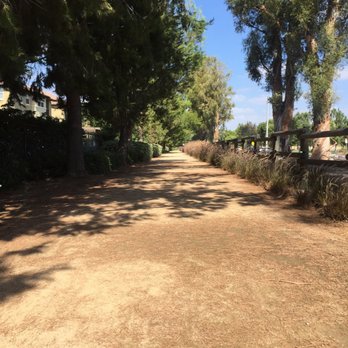


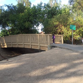

The best thing about Hicks Canyon Trail is that it's not too crowded (the times I've come) & it's safe. I come here for a nice brisk walk and sometimes a run alone & I never feel unsafe. Plus you feel like you're still out in nature with the birds chirping & beautiful tall trees. But always be cautious of your surroundings. I usually park at Hicks Canyon Park where the trail starts. In the morning parking is ample not sure during the busy times. Another interesting fact is that the trail is split. There's a paved path (cement) so even cyclists can come & a dirt path for those who need more of a real life hike feel. read more


2 years ago

8 years ago
This is a clean scenic residential trail. I'm jelly of the residents nearby! It takes me about 17 miles to get to this trail, but I would definitely come here often if I lived nearby. The trail has both paved and dirt roads following the residential community, which is a plus! I prefer the paved road as it is a pain to clean my shoes from the dirt every time. I don't think there are that many paved trails in OC either (that I could find). It's a flat trail, so it's good for jogging or running. I'm not sure if a lot of people know about this trail, but it's never crowded. I hope it stays that way though, because it's very relaxing and peaceful, especially during the sunset. There is more than enough places for parking at the community park. read more


8 years ago

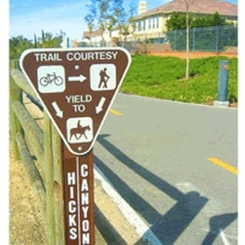
I ran on the Hicks Canyon Trail for the first time last weekend, and I really liked it! It's about 1.25 miles of paved and unpaved trails running parallel to each other. I ran on the unpaved, smooth gravel trail, which is a nice break for your legs from the hard pavement. The trail starts from Hicks Canyon Community Park at the corner of Culver and Viewpark in Irvine and goes east. I took the trail and connected with the trail along Jamboree and up to Cedar Grove Park and Peter's Canyon. One of my running buddies told me that by running on this trail, you can actually do almost an entire marathon's distance (26.2) all on dirt if you continue through Peter's Canyon to Irvine Regional Park. Orange County has a great trail system, so if you're a runner, cyclist, walker, or hiker, you have plenty of options. Get out there and enjoy! read more


10 years ago
Love this paved trail! My dog and I frequent it all the time! I love it better than the trail that leads to Peters Canyon. It's nice and there is spots of shade along the way! read more


6 years ago

10 years ago


11 years ago
Really nice outdoors, flat trail with two sides to it, dirt and paved. Lots of places for parking at the Hicks Canyon Regional Park (which is pretty much just a big soccer field). There's housing on both sides of the trail, so don't expect a total outdoors camping feeling. When you live in a city, you take what you can get. It's a long enough trail for Zulu and I to enjoy (several miles worth). On one end the trail ends, to what looks like construction across the street at Jeffrey St. At the other end of the trail, it merges into Peter Canyon Trail by the canal. We'll be back to this trail when we're looking for a lengthy yet easy walk, or as a supplement to Peters Canyon trail. You can get here also from the Jeffery open space trail. read more

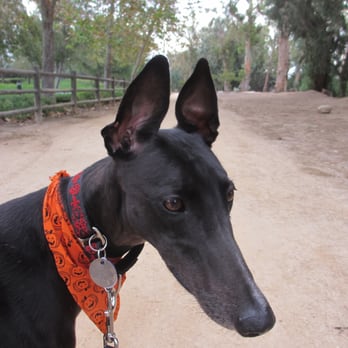

"No city should be too large for a man to walk out of in a morning." --Cyril Connolly Well... you're not leaving the city on this little Hicks Canyon Trail. Heck, you're not even leaving Irvine. This little trail doesn't even give you the feeling that you're remotely away from the city as it butts up against homes and back yards. BUT... it is a damn nice trail. And the cell phone reception is fabulous. A few stats about the trail: - About 3 miles up and back from Hicks Cyn Community Park to Portola Pkwy. - Very easy. 100 ft elevation change over 1.5 miles. - West end of trail actually connects with the Peter's Canyon trail network. WHAT'S SO GREAT ABOUT HICKS? 1. Like the Shady Canyon Trail, Hicks sports two well maintained paths, a two-laned bike path and a gravel path. http://www.yelp.com/biz_photos/hicks-canyon-regional-trail-irvine?select=KcR8089RokMOF6GrvWS15w#9jmLJwULOdNTnxyX2aL67Q 2. OMG LOTS OF SHADE. SHADE!!! It's such a precious commodity in this crazy heat. This trail is like an oasis compared to others. http://www.yelp.com/biz_photos/hicks-canyon-regional-trail-irvine?select=KcR8089RokMOF6GrvWS15w#KcR8089RokMOF6GrvWS15w 3. Several rows of super old eucalyptus trees line the path: http://www.yelp.com/biz_photos/hicks-canyon-regional-trail-irvine?select=KcR8089RokMOF6GrvWS15w#7cxl65qK8zChgBzccg0wBA 4. Nice airy, open tunnels take you under Culver Dr. and Yale Ave. so no stopping and waiting to cross a street! 5. Occasional benches and trash cans line the trail. 6. Very pet friendly. Saw lots of people walking their furry friends! 7. Convenient parking right up to the trail at Hicks Canyon Community Park! This is a great trail for runners and joggers who are training for 5K's. It is flat, smooth, and sufficiently shady! It's a great every-day trail to get some exercise on! read more


18 years ago
Peaceful, quiet and scenic. I'm starting to wonder if I run because I eat way too much and want to stay skinny or if I really do love running this trail. It's such a nice break from the city views I'm used to on the east coast. Sometimes at sunrise I'll see the little bunnies on the trail :) I hear the birds behind my shuffle's music. There are two options on the trail: paved or dirt road. I like to mix it up depending on how my knees feel that day. I recently sprained my ankle so I've been jogging the smooth pavement but the dirt road is fun and parallel to the pavement. There are bikers coming from both directions so it's common courtesy to just lean to the left or right side of the trail. Share the road :) the trail runs under the main roads like Culver and Yale which is awesome because you don't have to stop at lights! I hate jogging in place at lights. I feel like everyone is looking at me and wondering why is she jogging in place at the light. lol read more


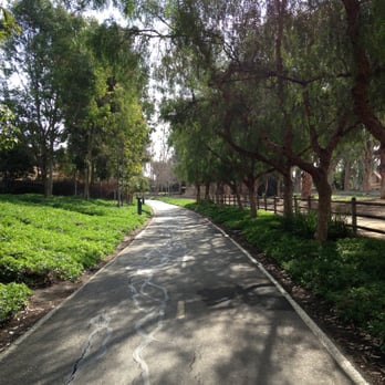
This is one of the few hiking trails I've been on in Irvine and I really like it here. You can park at Hicks Canyon Park and start your walk/run/bike workout from the parking lot. There's an underground tunnel that gets you started so you don't have to cross the street to get into the trail! There are two options for people to take: 1. paved and 2. unpaved (dirt). Although I normally like to go on paved trails, the option of having both is nice. Nice scenery as your going through..it's quite peaceful. I'm not exactly sure how long this trail is, but it's nothing too strenuous. read more


13 years ago

13 years ago
I did my first 5k here!! It's super pretty, lots of trees. I guess anywhere with lots of trees is pretty though. You're definitely not in the wilderness but get juuuuust enough trees to pretend that you are ;) this park is in between neighborhoods which was kind of confusing for me at first. I'd for sure come back to run! read more


12 years ago

13 years ago
In need of a real running trail... Not a jog around a soccer field or a walk on the other side of the baseball field. Besides that it's cool. Clean Restrooms++++ read more


11 years ago
Great trail for runners, walkers, bikers, and dogs - all around. It's short but a very nice trail! It passes through Culver to Yale to Jeffrey. read more
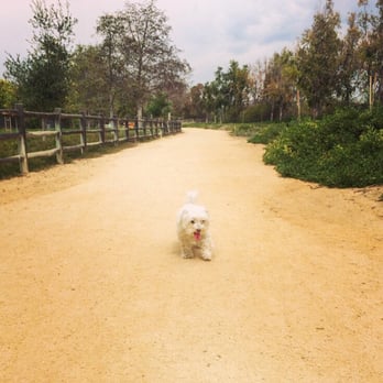

Beautiful morning trail to walk pets, go for a jog, or ride a bike. The breeze in the morning is pleasant and makes the trial much more calming along with all the maintained landscape. I've never gone at night but I assume it's lit. read more


13 years ago

9 years ago


14 years ago

10 years ago

Page 1 of 2
More info about Hicks Canyon Regional Trail
3864 Viewpark
Irvine, CA 92602
Directions
Hours
Outdoor Amenities
Ask the Community - Hicks Canyon Regional Trail
Review Highlights - Hicks Canyon Regional Trail
You might also consider




















Why does Yelp recommend reviews?
1 review that is not currently recommended
The reviews below are not factored into the business's overall star rating.

8 years ago


