Sliding Rock Falls Photos


You might also consider

More like Sliding Rock Falls
Recommended Reviews - Sliding Rock Falls
Start your review...


Reviews With Photos


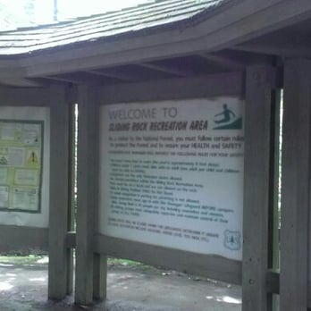
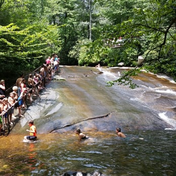
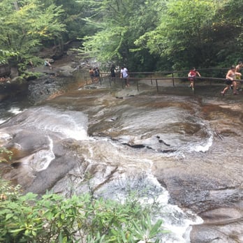
Sliding Rock is not to be missed!! It's a $4 per person charge whether to observe or slide down!! It opens in the Spring through fall. Just be sure to check out their website or call as this is where you will receive their most accurate info regarding openings or closings. I had checked the website prior to heading to Asheville and it said it will open this year on April 30, 2022. However, when we stopped by the Pisgah Visitor center I received some conflicting answers. I'm glad I went with my extinct to just check myself. (They were friendly at the Pisgah center but just saying you'll get more accurate info on the Sliding Rock website.) They have lifeguards on duty and a changing room with bathrooms and cubby holes. However, DON'T leave valuables there. The less you bring with you, the better. Or better yet, leave them in your car or with a friend who's observing. I would recommend wearing aqua shoes as the rocks can get slippery. Seriously, one fall and I can see broken bones, a concussion or death happening. Just be careful. While I didn't slide myself because of the above potentials, it looks like great fun!! I was happy just watching other people go down and it was relaxing just enjoying nature, slightly modified ;-) They have signs listing the nearest hospital in case anything happens and the exact location to tell the dispatcher. The signs also say if you cannot swim you cannot slide. As the 60 foot waterfall kicks you out into an 8 foot deep pool of 55 degree water. The distance to swim to land is not far, but I can imagine the water temperature is enough to give you a bit of a shock to the senses. The signs also say if you have to get rescued, you're cut off and cannot slide again. Fortunately when we went it was the day or day after of opening day and it wasn't crowded. But I can imagine it being a mad house when it gets warmer. There is a hand rail to the left if you're facing the waterfalls from the bottom. At the top of the rail are orange cones where to start scooting on your bottom. If you're going down the falls the path closest to you is the slow place to slide, in the middle a medium paced slide and the far left closer to the lifeguards. They ask you to side scoot on your bottom to where you want to slide because if you're standing, a gush of water can easily knock you off your feet or you can slip on your back and hit your head. NO ONE WANTS THAT. Please. Go out and have some fun!! Just be careful and cautious! Parking is available and a short walk down. There are several steps to negotiate but no ramp. Once you reach the end of the path it's all rocks to negotiate to slide down.


As many times as I have been to North Carolina and driven by Asheville, not once have I been to sliding rock. A visit was planned a couple of years ago, but it rained the whole time we were in the state. Since then I have been trying to get back up here and slide down that rock. My son has been a trooper this trip. Didn't complain at all on our long drive to Asheville and pretended to be a tour guide at the Biltmore. Today was about him having fun. He told me he wanted a place to play in the water. Tubing down around springs in Florida, we were prepared for the cool water temperatures. The out of water temperatures was what we needed to adjust to. It was a warm day and the water felt great while in it. Getting out, my body didn't warm up until I came home and took a warm shower. Maybe a change of clothes was needed. We both had our water shoes which I suggest as you walk over to the slide. My son's Keen's were great and he didn't fall/slip once. We don't need to talk about my non Keen shoes. We walked up to the top of the slide, were given instructions as this was our first visit, and down we went. So. Fun!!!! Three trips down the rock and I could have done that all day. There was a "turtle" side and a "hot tub" side according to my son. He did not enjoy the "hot tub" side because you went too fast and could get turned around on the slide. That didn't stop him from sliding over and over. I was able to get him to walk a little bit around the area and take in the scenery. There we saw small fish and he played where the water rushed over some rocks. The rocks are slippery. Please be careful. I fell, not hard or bad. My wrist will be bruised and swollen for a day or two though.


It's a bumpy, bruising ride over rocks into a very cold pool of water. If that sounds like fun, then don't miss Sliding Rock. I've been doing it since the early '50s when there were no lifeguards, and some of the restrictions that now exist didn't. But even with those rules and added safeguards, it's fun. And in the summer months, it can get very crowded with pretty lengthy lines waiting a slide. Still, those lines move quickly, partly because some people back out at the last minute. There are a couple of areas to watch the goings-on, and that's fun, too. We especially enjoy the screams when the sliders hit the water at the end. Before and after the summer months, there's no fee charged to slide, and there are no lifeguards. You're on your own, and though the parking area closes, we've seen folks there in December. Now that's a gutsy decision...


Yes, it's literally a massive Rock you slide down and what better way to spend time in the water ? This sliding rock was so much fun! The water is FREEZING! It's a great time in rain or shine. They have life guards at the top of the rock and at the bottom monitoring everyone to make sure this is a safe and fun experience for everyone. It's a perfect place to visit for families and even for a date. It was packed when we went but the line moves so fast to slide down the rock which is great!! A question I get most about this experience is how the rock itself was, and how safe. It's safe but you need to be smart and listen to the life guards because you could very easily get hurt, remember it's a slippery Rock. And certain sections of the rock are more rough than others and I have the marks on my butt to prove it. Make a half a day of it, have a picnic... enjoy the waterfalls within walking distance if this location. There are plenty. There is also a fee to pay to get inside the park!

$4 for unlimited entertainment?! Can't beat it. I recommend getting there right when it opens! We got there 15 minutes after and were able to get a close parking spot and it wasn't too crowded. We left around 11 and about that time it started getting crowded. There is someone at the top of the rock letting you know when it is your turn and there were three lifeguards on the side when we were there. There is a sign letting you know which side of the rock is slower vs faster. The slower side is obviously smoother but it's still a rock so scrapes and bruises come with the territory but nothing too bad. There were people of all ages participating. The restrooms were open and have changing rooms. We brought a bag down to the location; there was no designated space to put it, we just left it on the observers deck. I kept an eye on it but I felt it was safe. I normally don't wear clothes over my swim suits in the water but I did for this and I was glad I did! The water is very cold and the shorts helped protect more of my legs from scrapes. Everyone was dressed differently though so anything will fit right in. A lot of people had water shoes which would be helpful because you have to walk in water to get to the line and there are big rocks to climb over. Depending on what side you go down, the water at the bottom gets up to 8 feet deep.
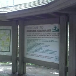

Visited Sliding Rock Waterfalls with Noel and Tony. We had Sammi with us so we couldn't go into the water. It looked like so much freaking fun. The water seemed to be rather deep when the people went down the slide and landed into the water. It looks like a nice swimming hole, but it was so busy. I bet it was fun before it became so full of tourist and day users. There is a small fee to slide, but it is so nice there. Nice and shaded. There is a large parking lot and that is where you pay the fee. Whether you actually slide or not, you pay the fee. This is off another website to give you more details to share: Sliding Rock is a 60' natural rock slide with a 6-7 foot deep pool at the base - perfect for you folks looking for a waterfall to slide down. The slide is a Forest Service recreation area with lifeguards and staff are on duty from Memorial Day week end through Labor Day. Beginning in May 2014, the fee to access the parking area will increase to $2 per person (from $1 per person). You can also buy a season pass for $25. Parking is somewhat limited, so go early if you can. It will be crowded on a summer week end. I think kids have to be a certain size to slide alone, but can sit on the lap of an adult. There are bathrooms which are open in season. For more info, call the US Forest Service at 828-877-3350. Directions: From the intersection of Hwys 64, 280 and 276 north near Brevard, drive north on Hwy 276 for 7.5 miles and turn left into the parking area and up to the booth where you pay. You'll see a 'US Fee Area' sign before the turn - there's also a sign before the turn if you are coming south on 276 from the Blue Ridge Parkway. I've seen people sliding off season, so I assume you can do it at any time at your own risk. The lines will be a lot shorter, but the water may be a little chillier. The water is cold in the summer also, but it feels great.


Should have gone sooner in my life! Yes, the line was long. But it moves fast! Yes, the water was really really cold! And the 8' deep water was maybe 10' deep now. Swim quickly to the exit rock so as not to get squished by the next drop behind you! Kids 6& under ride with an adult. And if you don't swim, you must wear flotation device. You can rent one for 6$ there. Life guards are on duty. But if you Don't want to go down the sliding rock.. there are shallow waters near by to wade in. Fun times to be had by all! A must for family trips and visiting company!


This king of swimming holes, located in the mountains of Transylvania County near Asheville, is a 60 foot natural water slide. Ride down a well-worn slab of rock that has been providing summertime entertainment long before water slides became standard fare. Sliding Rock is a 60 foot natural water slide that ends in a 8 foot deep pool of water. There are 2 observation platforms, and is staffed during the season. This is a heavily used recreation area, come early. Restrooms are open daily Memorial Day - Mid August. Cost is $2 pp or $25 annual pass. It is cash only so don't forget to bring cash there are not many (if any) ATM's or bizzes to stop along the way out here. Also, pro-tip - you don't just look at this rock YOU CAN ACTUALLY SLIDE DOWN IT! We found this spot in a photography book so we didn't realize it was actually highly trafficked and used for swimming. We forgot out swimsuits and had serious fomo. Pack a towel and an old bathing suit (maybe some water shoes) and mark this off your bucket list!


This review is strictly based on aesthetics as we came here in December. It was cold outside and even colder water. Plus it was closed for swimming for the winter. Like I am going to try that cold water. I have heard about this spot for some time and just wanted to check it out. Actually it looks pretty cool and understand why this is such a popular place to come in the summer. I overheard some people that were there and they said that even in the summer, the water is still pretty cold. Really cool place and from what I have seen, it would be a lot of fun.
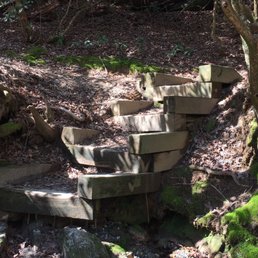

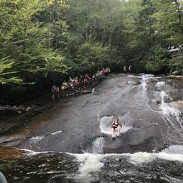

Another hidden gem in Pisgah National Forest is this place. To enter, you need to go through the gated entrance which is currently unmanned until the tourist season begins which I believe is coming up soon. Then it will be $5 per person, not car. It was nice watching people enjoy the water. read more


This site definitely did not disappoint! We enjoyed a wonderful afternoon with the family. I was surprised that my granddaughters were not afraid to go down the rock slide. I was the family photographer. I certainly had lots to photograph! There was ever a great rock to lean against for taking pictures. My suggestion is that you bring along a change of clothes, wet shoes, snacks, a camera, sunscreen and life jackets for the little ones. I forgot my wet shoes and my son forgot a change of clothes. There is a rest room where you can change clothes. There are also lifeguards until 5 PM. They stayed open after 5, but did not charge admission. When we return we will go later in the afternoon. The lines are shorter and after 5 you don't have to pay the $5 per person admission charge. I definitely will return when we visit the area again. We enjoyed a great time! read more


2 years ago
Swimming hole when the weather is warmer. $5 to pass the gate if there are lifeguard on duty. Natural water slide. Pool is 8ft deep. read more


Sliding Rock is not to be missed!! It's a $4 per person charge whether to observe or slide down!! It opens in the Spring through fall. Just be sure to check out their website or call as this is where you will receive their most accurate info regarding openings or closings. I had checked the website prior to heading to Asheville and it said it will open this year on April 30, 2022. However, when we stopped by the Pisgah Visitor center I received some conflicting answers. I'm glad I went with my extinct to just check myself. (They were friendly at the Pisgah center but just saying you'll get more accurate info on the Sliding Rock website.) They have lifeguards on duty and a changing room with bathrooms and cubby holes. However, DON'T leave valuables there. The less you bring with you, the better. Or better yet, leave them in your car or with a friend who's observing. I would recommend wearing aqua shoes as the rocks can get slippery. Seriously, one fall and I can see broken bones, a concussion or death happening. Just be careful. While I didn't slide myself because of the above potentials, it looks like great fun!! I was happy just watching other people go down and it was relaxing just enjoying nature, slightly modified ;-) They have signs listing the nearest hospital in case anything happens and the exact location to tell the dispatcher. The signs also say if you cannot swim you cannot slide. As the 60 foot waterfall kicks you out into an 8 foot deep pool of 55 degree water. The distance to swim to land is not far, but I can imagine the water temperature is enough to give you a bit of a shock to the senses. The signs also say if you have to get rescued, you're cut off and cannot slide again. Fortunately when we went it was the day or day after of opening day and it wasn't crowded. But I can imagine it being a mad house when it gets warmer. There is a hand rail to the left if you're facing the waterfalls from the bottom. At the top of the rail are orange cones where to start scooting on your bottom. If you're going down the falls the path closest to you is the slow place to slide, in the middle a medium paced slide and the far left closer to the lifeguards. They ask you to side scoot on your bottom to where you want to slide because if you're standing, a gush of water can easily knock you off your feet or you can slip on your back and hit your head. NO ONE WANTS THAT. Please. Go out and have some fun!! Just be careful and cautious! Parking is available and a short walk down. There are several steps to negotiate but no ramp. Once you reach the end of the path it's all rocks to negotiate to slide down. read more





2 years ago

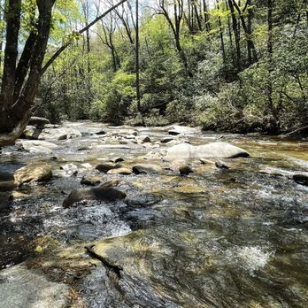
As many times as I have been to North Carolina and driven by Asheville, not once have I been to sliding rock. A visit was planned a couple of years ago, but it rained the whole time we were in the state. Since then I have been trying to get back up here and slide down that rock. My son has been a trooper this trip. Didn't complain at all on our long drive to Asheville and pretended to be a tour guide at the Biltmore. Today was about him having fun. He told me he wanted a place to play in the water. Tubing down around springs in Florida, we were prepared for the cool water temperatures. The out of water temperatures was what we needed to adjust to. It was a warm day and the water felt great while in it. Getting out, my body didn't warm up until I came home and took a warm shower. Maybe a change of clothes was needed. We both had our water shoes which I suggest as you walk over to the slide. My son's Keen's were great and he didn't fall/slip once. We don't need to talk about my non Keen shoes. We walked up to the top of the slide, were given instructions as this was our first visit, and down we went. So. Fun!!!! Three trips down the rock and I could have done that all day. There was a "turtle" side and a "hot tub" side according to my son. He did not enjoy the "hot tub" side because you went too fast and could get turned around on the slide. That didn't stop him from sliding over and over. I was able to get him to walk a little bit around the area and take in the scenery. There we saw small fish and he played where the water rushed over some rocks. The rocks are slippery. Please be careful. I fell, not hard or bad. My wrist will be bruised and swollen for a day or two though. read more


It's a bumpy, bruising ride over rocks into a very cold pool of water. If that sounds like fun, then don't miss Sliding Rock. I've been doing it since the early '50s when there were no lifeguards, and some of the restrictions that now exist didn't. But even with those rules and added safeguards, it's fun. And in the summer months, it can get very crowded with pretty lengthy lines waiting a slide. Still, those lines move quickly, partly because some people back out at the last minute. There are a couple of areas to watch the goings-on, and that's fun, too. We especially enjoy the screams when the sliders hit the water at the end. Before and after the summer months, there's no fee charged to slide, and there are no lifeguards. You're on your own, and though the parking area closes, we've seen folks there in December. Now that's a gutsy decision... read more


Yes, it's literally a massive Rock you slide down and what better way to spend time in the water ? This sliding rock was so much fun! The water is FREEZING! It's a great time in rain or shine. They have life guards at the top of the rock and at the bottom monitoring everyone to make sure this is a safe and fun experience for everyone. It's a perfect place to visit for families and even for a date. It was packed when we went but the line moves so fast to slide down the rock which is great!! A question I get most about this experience is how the rock itself was, and how safe. It's safe but you need to be smart and listen to the life guards because you could very easily get hurt, remember it's a slippery Rock. And certain sections of the rock are more rough than others and I have the marks on my butt to prove it. Make a half a day of it, have a picnic... enjoy the waterfalls within walking distance if this location. There are plenty. There is also a fee to pay to get inside the park! read more


4 years ago
$4 for unlimited entertainment?! Can't beat it. I recommend getting there right when it opens! We got there 15 minutes after and were able to get a close parking spot and it wasn't too crowded. We left around 11 and about that time it started getting crowded. There is someone at the top of the rock letting you know when it is your turn and there were three lifeguards on the side when we were there. There is a sign letting you know which side of the rock is slower vs faster. The slower side is obviously smoother but it's still a rock so scrapes and bruises come with the territory but nothing too bad. There were people of all ages participating. The restrooms were open and have changing rooms. We brought a bag down to the location; there was no designated space to put it, we just left it on the observers deck. I kept an eye on it but I felt it was safe. I normally don't wear clothes over my swim suits in the water but I did for this and I was glad I did! The water is very cold and the shorts helped protect more of my legs from scrapes. Everyone was dressed differently though so anything will fit right in. A lot of people had water shoes which would be helpful because you have to walk in water to get to the line and there are big rocks to climb over. Depending on what side you go down, the water at the bottom gets up to 8 feet deep. read more


10 years ago
Visited Sliding Rock Waterfalls with Noel and Tony. We had Sammi with us so we couldn't go into the water. It looked like so much freaking fun. The water seemed to be rather deep when the people went down the slide and landed into the water. It looks like a nice swimming hole, but it was so busy. I bet it was fun before it became so full of tourist and day users. There is a small fee to slide, but it is so nice there. Nice and shaded. There is a large parking lot and that is where you pay the fee. Whether you actually slide or not, you pay the fee. This is off another website to give you more details to share: Sliding Rock is a 60' natural rock slide with a 6-7 foot deep pool at the base - perfect for you folks looking for a waterfall to slide down. The slide is a Forest Service recreation area with lifeguards and staff are on duty from Memorial Day week end through Labor Day. Beginning in May 2014, the fee to access the parking area will increase to $2 per person (from $1 per person). You can also buy a season pass for $25. Parking is somewhat limited, so go early if you can. It will be crowded on a summer week end. I think kids have to be a certain size to slide alone, but can sit on the lap of an adult. There are bathrooms which are open in season. For more info, call the US Forest Service at 828-877-3350. Directions: From the intersection of Hwys 64, 280 and 276 north near Brevard, drive north on Hwy 276 for 7.5 miles and turn left into the parking area and up to the booth where you pay. You'll see a 'US Fee Area' sign before the turn - there's also a sign before the turn if you are coming south on 276 from the Blue Ridge Parkway. I've seen people sliding off season, so I assume you can do it at any time at your own risk. The lines will be a lot shorter, but the water may be a little chillier. The water is cold in the summer also, but it feels great. read more


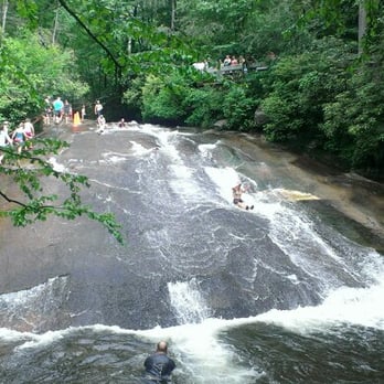


4 years ago

4 years ago

3 years ago

7 years ago
Should have gone sooner in my life! Yes, the line was long. But it moves fast! Yes, the water was really really cold! And the 8' deep water was maybe 10' deep now. Swim quickly to the exit rock so as not to get squished by the next drop behind you! Kids 6& under ride with an adult. And if you don't swim, you must wear flotation device. You can rent one for 6$ there. Life guards are on duty. But if you Don't want to go down the sliding rock.. there are shallow waters near by to wade in. Fun times to be had by all! A must for family trips and visiting company! read more


This king of swimming holes, located in the mountains of Transylvania County near Asheville, is a 60 foot natural water slide. Ride down a well-worn slab of rock that has been providing summertime entertainment long before water slides became standard fare. Sliding Rock is a 60 foot natural water slide that ends in a 8 foot deep pool of water. There are 2 observation platforms, and is staffed during the season. This is a heavily used recreation area, come early. Restrooms are open daily Memorial Day - Mid August. Cost is $2 pp or $25 annual pass. It is cash only so don't forget to bring cash there are not many (if any) ATM's or bizzes to stop along the way out here. Also, pro-tip - you don't just look at this rock YOU CAN ACTUALLY SLIDE DOWN IT! We found this spot in a photography book so we didn't realize it was actually highly trafficked and used for swimming. We forgot out swimsuits and had serious fomo. Pack a towel and an old bathing suit (maybe some water shoes) and mark this off your bucket list! read more


4 years ago

This review is strictly based on aesthetics as we came here in December. It was cold outside and even colder water. Plus it was closed for swimming for the winter. Like I am going to try that cold water. I have heard about this spot for some time and just wanted to check it out. Actually it looks pretty cool and understand why this is such a popular place to come in the summer. I overheard some people that were there and they said that even in the summer, the water is still pretty cold. Really cool place and from what I have seen, it would be a lot of fun. read more

3 years ago
3 years ago

7 years ago
We visited sliding rock in April so of course the water was too cold to go swimming but it was a great place to relax and listen to the water flowing! No one was there so we were all alone! If you come this way you should stop and check this place out. read more
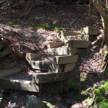


7 years ago
So much fun!! I went to sliding rock last fall and it was so much fun!! The water is pretty deep at the bottom and there are lifeguards which is nice. The mountain water is COLD (went in September). Long lines and bath house. Very popular swimming spot in the gorgeous mountains read more
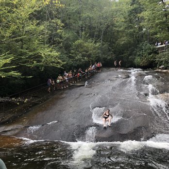


7 years ago
What an experience! My boys loved it. The water is crazy cold but it's worth it. Wear shorts to slide down the rock, new swimmers should wear a life vest because the water is so cold you forget to swim. It gets really busy so get there early. But even when the line gets long it moves quickly. read more


6 years ago
4 years ago

9 years ago

9 years ago
7 years ago

11 years ago
It is hard to find this place, especially with a GPS but well worth it! You have to come early or else the line gets quite long although it moves pretty fast! It is a lot of fun and safe for both kids and adults. The parking was horrendous though. The parking lot was small and filled quite quickly and they seem to have no way of tracking when vehicles left to know where there was empty parking. Most parking was down along the roadside a good walk (maybe a quarter to half a mile walk back up the road to the sliding rock entrance). The water is cold refreshing but takes your breath away even in July 90 degree weather. There is an admission fee to sliding rock. I believe it was $3/person. There is a deck observance area but it seems this is really the only place to relax outside of the water so everyone flocks to this area. read more


4 years ago

8 years ago
Sit up your hammock and enjoy the laughter of watching people slide into the freezing water! The water was a little deeper than expected, no fee required when we went, and it's about a 4 minute drive away from Looking Glass Falls! Pretty rad place read more

4 years ago

6 years ago

11 years ago

10 years ago


11 years ago
Absolutely loved it!! Amazing ride up and so worth it! Kids had a blast. Even with a really long line it moved pretty fast. Water was about 50 degrees and refreshing. My 4 children ages 6-10 all went on it and got to go down 4 times each within an hour. read more


10 years ago
As our first time going we really didn't know what to expect, it was super easy to get there from Asheville Highway, there are signs posted on how to get there. We went on a Saturday late in September, we were expecting it to be pretty busy (we looked it up online to give us an idea on what time to arrive and if they charged) we got there around 10 and there was only 1 other car. There was no one at the booth and was told that they were not charging and there would not be a lifeguard on duty. Water was cold but bare able, there are platforms so that people may stand and see people sliding. Unfortunately restrooms were closed and there is no picnic area. Around 11:30 - 12:00 it started to get crowded. Rocks are slippery and water shoes are highly recommended. read more


11 years ago
It's was amazing and fun! For all ages and sizes. We did a last minute trip and it was so worth it. I had a great time sliding and being a kid again! read more


Page 1 of 2
More info about Sliding Rock Falls
US-276
Pisgah Forest, NC 28768
Directions
Visit Website
http://www.fs.usda.gov/detail/nfsnc/news-events/?cid=STELPRDB5407876
Hours
Payment methods
Outdoor Amenities
Ask the Community - Sliding Rock Falls
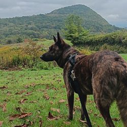
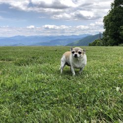
Are dogs welcome?
Yes sir! Very nice quiet place when we went in April while visiting the area.
Review Highlights - Sliding Rock Falls




















Why does Yelp recommend reviews?


Sliding Rock Falls - hiking - Updated July 2026
Best of Pisgah Forest
People found Sliding Rock Falls by searching for…
Water Parks in Pisgah Forest, NC
Swimming Holes in Pisgah Forest, NC
Playgrounds in Pisgah Forest, NC
Hiking Trails With Waterfalls in Pisgah Forest, NC
Things to Do in Pisgah Forest, NC
Secret Spots in Pisgah Forest, NC
Photo Spots in Pisgah Forest, NC
Places to Swim in Pisgah Forest, NC
River Swimming in Pisgah Forest, NC
Scenic Overlook in Pisgah Forest, NC
Places to Take Pictures in Pisgah Forest, NC
Public Pools in Pisgah Forest, NC
Off Road Trails in Pisgah Forest, NC
Fishing Spots in Pisgah Forest, NC
Lookout Points in Pisgah Forest, NC
State Parks Camping in Pisgah Forest, NC
Parks for Kids in Pisgah Forest, NC
Scenic Drive in Pisgah Forest, NC
Picnic Spots in Pisgah Forest, NC
Public Running Track in Pisgah Forest, NC


