1. Sonora Pass Resupply

    1. Sonora Pass Resupply

    0

    Coulterville, CA

    Cancel

    Open app

    Search

    Sonora Pass Resupply

    5.0 (2 reviews)
    Closed 9:00 am - 6:00 pm

    Sonora Pass Resupply Photos

    Recommended Reviews - Sonora Pass Resupply

    Your trust is our priority, so businesses can't pay to alter or remove their reviews. Learn more about reviews.
    Yelp app icon
    Browse more easily on the app
    Review Feed Illustration

    11 years ago

    Helpful 0
    Thanks 0
    Love this 0
    Oh no 0
    Photo of Fima G.
    11
    16
    1

    11 years ago

    Helpful 4
    Thanks 0
    Love this 5
    Oh no 0

    Ask the Community - Sonora Pass Resupply

    Verify this business for free

    Get access to customer & competitor insights.

    Verify this business

    Don Pedro Lake Vista Point

    Don Pedro Lake Vista Point

    5.0(2 reviews)
    8.0 mi

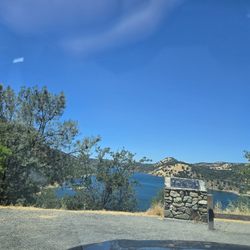
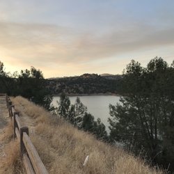
    Whenever I'm driving down CA-120, I always try to make it a point to stop at this vista point. The…read moreviews of Don Pedro Lake from this vista are just simply incredible! There's a large parking lot that seems to never be full when I come here, and plenty of places to take in the gorgeous views. You can also see the Jacksonville Bridge in the distance. There's a small hiking trail that will take you to the top of the hill. I've never had enough time to actually hike it all the way to the top, but the Jacksonville Bridge is clearly viewable from the trail. There's lots of dry brush depending on the time of season that you go and this trail doesn't seem to be maintained on a regular basis. Just be prepared to have a few pieces of the dry brush stick to your socks and clothes. At any given time, you'll see people kayaking and sailing their boats on the lake. This vista point doesn't grant actual access to the lake, but you can pay $10 (per standard vehicle) for full access at the nearby Moccasin Point Marina Recreation. This vista point is an excellent spot to catch a beautiful sunrise and sunset. I've usually come here on the way to and from Yosemite, so I've had the pleasure of seeing both. It's definitely worth a stop if you're passing through the area.

    Love this place. Spent a few hours here on the way to Yosemite. There are a lot more house boats…read morethan I remember, but it's been years since I've been here. I only wish there were more shade trees Great place to spend some time to unwind

    Photos
    Don Pedro Lake Vista Point - Near the parking lot

    Near the parking lot

    Don Pedro Lake Vista Point - The tail end of a sunset. So pretty!

    The tail end of a sunset. So pretty!

    Don Pedro Lake Vista Point

    See all

    Hite Cove Trail - 4.15.18

    Hite Cove Trail

    4.8(5 reviews)
    25.0 mi

    Beautiful trail just outside of Yosemite off of Highway 140 in El Portal. My husband and I hiked…read moreabout 2.5 miles of the trail mid June. The whole trail is 4.5 miles one way- about 9 miles round trip if you want to go all the way to Hite Cove. We wanted to go all the way to the end, however temperatures in the canyon rise fast during the summer and it was easily 100 degrees by noon. The trail follows up above the Merced River. There were a few times when you can get right down to the river. About 1.5-2 miles in, there is a section with rocks that looks like it is made for jumping in the river. The trail is entirely single track with some areas with steep drop offs. Make sure to pack plenty of water, sunscreen, and bug spray. There is very little shade and the trail is almost completely exposed. To find the trail, just look for the Red Bud Lodge and park right across the street. There is a sign that points just to the trailhead next to the lodge. I would recommend to come as early as possible if you are coming in the summertime.

    Considering that everything else in El Portal is some pee stained remnant from the Sears catalog,…read morewe didn't have high hopes for the 'trail' that came recommended. It's not that encouraging as you drive up either. Seems very average and nondescript. As it was our first night in the greater Yosemite area, we definitely wanted to get out and so we went for it. In retrospect, I would say it was one of the nicer hikes we went on. You walk high above the Merced River on a narrow trail amongst wild flowers and with a beautiful view of the mountains. The power of the river and the beauty of the land impressed all of us. It and easy/intermediate hike. One drawback is that it's not a loop. So you can go as long as you want (to the end even) and come back. We went and hour and turned around. Recommend.

    Photos
    Hite Cove Trail - 4.15.18

    4.15.18

    Hite Cove Trail - 4.15.18

    4.15.18

    Hite Cove Trail - 4.15.18

    See all

    4.15.18

    Lewis Creek Trail - trunk and tree

    Lewis Creek Trail

    4.7(51 reviews)
    44.7 mi

    We were staying in Oakhurst with some friends over the weekend. After spending a long day in…read moreYosemite Valley the previous day, I wanted to do some more hiking and found this trail less than 10 minutes away. I started at the trailhead near Corlieu Falls, went north towards Red Rock Falls. It was a beautiful hike with some varied terrain going slightly uphill for parts of it. The fall foliage was beautiful, and it was nice to hear the running water all along the way. There is occasional highway noise since this runs parallel to the main road, but I didn't mind it. Went at 730a and didn't see another person for about two hours. Red Rock Falls was peaceful and beautiful. I crossed the stream a bit clumsily and ended up with wet feet, but it was worth it for the photos. I made my way back. Corlieu Falls had a good amount of debris around it, including part of a bridge. Round trip was less than 4 miles, and I got back in time for brunch.

    A nice and easy walk but make sure to bring water and sunscreen because it gets HOT and there are a…read morelot of areas on this trail that are not shaded so you're just getting beat down by the hot sun. Unfortunately, we had two small kids with us in tow so we didn't make it too far on the trail but I hear there are some nice waterfalls as a visual treat if you finish the trail. The trail itself had some slopes and elevations but nothing too crazy. There isn't a lot of parking available in the designated lot - we were lucky to grab a spot as someone was leaving right when we pulled up, otherwise I don't know where one would park to easily get to the trail head.

    Photos
    Lewis Creek Trail - Red rock falls

    Red rock falls

    Lewis Creek Trail - Lewis creek trail

    Lewis creek trail

    Lewis Creek Trail - Corlieu falls

    See all

    Corlieu falls

    Chilnualna Falls Trail - Chilnualna Falls Trailhead, Yosemite National Park: 2026 Jul 29

    Chilnualna Falls Trail

    4.6(18 reviews)
    39.0 mi

    Chilnualna Falls Trailhead, Yosemite National Park: 2026 Jul 29 (4.75 of 5)…read more Chilnualna Falls: Strenuous but Worth the Pain (9.23 mi) Chilnualna Falls is my favourite hike in Yosemite. Even before you begin your hike, the sounds of rushing water welcome you. Stay awhile and enjoy the mist before you climb the rock steps. The climb up Chilnualna Falls is strenuous and steep, with continuous uphill climbing and several switchbacks. In some areas you'll hear the waterfall but not see one. If you feel like challenging yourself, continue climbing to the top. Every time I reach the top, I want to stay awhile -- maybe because I'm too tired to climb back down... but also because reaching the top of Chilnualna Falls is not mere accomplishment, it's an exhilarating feeling. You'd want to stay and enjoy the sounds of water rushing below you. The water sliding over granite drops 240-feet down and is a sight to behold. Wear comfortable hiking shoes and cotton socks. Dress in layers. Wear a hat and sunglasses. Tips and What to Bring: 1) Start early. Preferably before 6:30 am. 2) Bring plenty of water: More than you think you need. Dehydration sets in pretty quickly. 3) Pack emergency items just in case. 4) Pack a light lunch. 5) Rubbish bags (take out what you bring in) 6) Horn (to scare wild animals away) 7) Sunscreen

    This review is for Chilnualna Falls Trail which was a ~7.7 miles round trip that took ~6 hours to…read morecomplete in the snow. Chilnualna Falls Trail was located near the south entrance of Yosemite National Park; away from the busy Yosemite Valley. Lower Chilnualna Fall was a short ~0.2 miles and gets crowded at this particular spot. For the most part, the trail was a steady incline on dirt and rock with snow at higher elevations. In addition, there were a few downed trees over the trail. Overall, stunning views throughout this hike! There was a ~3 minute walk from the parking to the trailhead. Restrooms available at the parking area. Short video of the hike for those interested! https://youtu.be/jACscCHBcOg

    Photos
    Chilnualna Falls Trail - View from the trail

    View from the trail

    Chilnualna Falls Trail - 2025 Apr 29: Chilnualna Falls

    2025 Apr 29: Chilnualna Falls

    Chilnualna Falls Trail

    See all

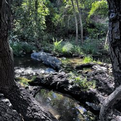
    Willow Creek Trail - Moss. This is near the part of the trail where you will go up the mountain and look for the sign that says "trail".

    Willow Creek Trail

    4.9(10 reviews)
    48.5 mi

    I wanted to leave a review because the beginning of this trail can be tricky. At least it was for…read moremy friend and I. I hiked this trail about 2 weeks ago (December 2025). You will park at a designated parking lot. The lot says you have to pay $10. There is an envelope and you write your license place number and name on it. It says to drop thr payment at a local store. I don't know if they check if you have paid or not. The trail head is not far from the parking lot. It will be to the left of you if you are facing away from the road. The trail is beautiful you start off along the river. You will hike along the trail for a short while then it dead ends and opens up to the road. You will cross the road and there is a sign that says trail, follow that trail. There is somewhat of a fork go to the left, you will cross a wooden "foot bridge". There is also a sign telling you to be careful on the slippery rocks. Then you follow the trail, it is easy to miss the turn off where the trail continues and goes up the mountain. At a point it goes up to the right and there will be another sign that says "trail". We missed it, and could not figure out where to go. Because the trail continues a long the river but then dead ends. We back tracked and realized there is another trail where we were supposed to turn and go up the mountain. It gets steep after you go up, but you get amazing views. It's worth the climb. This trail eventually dips back down and you are along the river again and get river access again.

    This experience was definitely one for the books. We took a dip in the natural spring water which…read morewas quite COLD. I'd say this hike was medium to difficult, but we were able to get over rocks, stumps, and loose gravel with sneakers. The temperature and the time of day were just too much to bare and we stopped whenever we'd come across a small body of water. The water streams were quite peaceful. The wind brushing again the trees and birds chirping was just magical.

    Photos
    Willow Creek Trail
    Willow Creek Trail
    Willow Creek Trail

    See all

    Sonora Pass Resupply - hiking - Updated September 2026
    Loading...
    Loading...
    Loading...