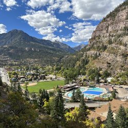
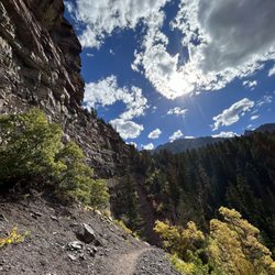
South Fork Colorado Photos


More like South Fork Colorado
Recommended Reviews - South Fork Colorado
Start your review...

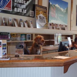
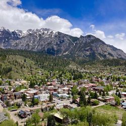
It is an absolute honor to give the first review and page created for the City of South Fork, Colorado. We road tripped to South Fork, CO as our first stop on our way to Durango, CO. My favorite small town, they have the best coffee and morning croissants by Rachel's Keep On Keepin On Coffee Stand! We hiked San Juan National Forest, enjoyed an overlook bypass view and met some really down to earth folk. The outdoor scenery is so surreal and such a blessing; what a blessing this life is. The Bruce Spruce Ranch is just on the other side: West Fork, CO. They have Horseback riding and the West Fork Campground, which has a very kind and welcoming campground host. My friend and I stayed in the Foot Hill Lodge and enjoyed such awesome service and we even spotted some deer. South Fork has some serious farm land and wonderful cows roaming free. I absolutely enjoy the memory we had in May of 2021. This town is truly a gift and spectacular at the very least. read more


More info about South Fork Colorado


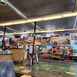


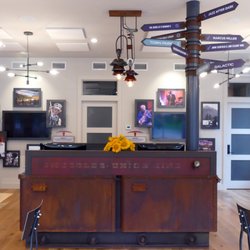


South Fork Colorado - visitorcenters - Updated June 2026
Best of South Fork
People found South Fork Colorado by searching for…
Sledding in South Fork, Colorado
Transportation in South Fork, Colorado
Museums in South Fork, Colorado
Casinos in South Fork, Colorado
Attractions in South Fork, Colorado
Lodging in South Fork, Colorado
Scenic Overlook in South Fork, Colorado
Travel Services in South Fork, Colorado
Rest Area in South Fork, Colorado
Scenic View in South Fork, Colorado
Scenic Drive in South Fork, Colorado
Dude Ranch in South Fork, Colorado
Picnic Areas in South Fork, Colorado
Stuff to Do in South Fork, Colorado
Rest Stops in South Fork, Colorado
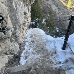
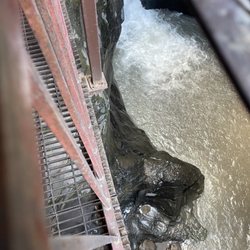
Bridge in South Fork, Colorado
Hotels & Travel in South Fork, Colorado
Outdoor in South Fork, Colorado
Nature Center in South Fork, Colorado
Driver Service in South Fork, Colorado
Trending Searches in South Fork, CO
Browse Articles
Browse Nearby
BEST of South Fork, Colorado Restaurants near South Fork Colorado
BEST of South Fork, Colorado Hotels near South Fork Colorado
BEST of South Fork, Colorado Things to Do near South Fork Colorado
BEST of South Fork, Colorado Hiking near South Fork Colorado
BEST of South Fork, Colorado Coffee near South Fork Colorado
BEST of South Fork, Colorado Star Gazing near South Fork Colorado
BEST of South Fork, Colorado Museums near South Fork Colorado
BEST of South Fork, Colorado Breakfast near South Fork Colorado
BEST of South Fork, Colorado Day Trips near South Fork Colorado
Browse Brands
Related Cost Guides
Related Searches in South Fork, CO
Best Lookout Points to Visit in South Fork, Colorado
Book a Guided Cave Tour in South Fork, Colorado Today
Check Out Off Road Trails in South Fork, Colorado
Discover Historic Sites and Places in South Fork, Colorado
Discover the Best Campground Spots in South Fork, Colorado
Enjoy the Best Walking Trails in South Fork, Colorado
Explore Scenic National Park Locations in South Fork, Colorado
Explore the Scenic River Walk in South Fork, Colorado
Find the Best Bridge Spots in South Fork, Colorado
Find the Best Scenic View Locations in South Fork, Colorado
Must-See Tourist Attractions Around South Fork, Colorado
Perfect Spots to Watch Sunset in South Fork, Colorado
Plan a Scenic Drive Route Near South Fork, Colorado
Popular Fishing Spots to Explore in South Fork, Colorado
Relax at Natural Hot Springs Near South Fork, Colorado
Top Running Trails to Explore in South Fork, Colorado