South Kaibab Trail Photos


You might also consider


More like South Kaibab Trail
Recommended Reviews - South Kaibab Trail
Start your review...


Reviews With Photos


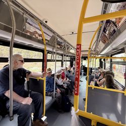
Two separate reviews for two trails here. No parking at the trailhead. Park at visitor center and take the eastbound Kaibab Rim (Orange) bus route to trailhead. 1. South Kaibab Trail To Cedar Ridge (~3.1 miles total, ~2 hours to complete). Extremely crowded. Easy decline all the way down to Cedar Ridge; tough incline all the way back to trailhead. Stunning views of the canyon! Short video of the hike: https://youtu.be/NZJ8rZJv8rY 2. Shoshone Point Trail Via South Kaibab Trailhead (~5.1 miles total, ~2.5 hours to complete). Due to the possibility of not finding any parking at Shoshone Point, we ended up starting from South Kaibab Trailhead. No other hikers were on the trail. This was partially a mule trail so there are poops along the way. Unfortunately, we did encounter some mules near the end; the stench and dust were a bit unbearable. Overall, beautiful views of the canyon along the way and at Shoshone Point! Short video of the hike: https://youtu.be/2LxW0fsrqFo For an easier hike out of the two, I would choose Shoshone Point. For a tougher hike with better views, I would choose Cedar Ridge hike.


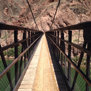
General Amazement! Even for non-religious, atheist, or in-between folks, the Grand Canyon is certainly somewhere you take a step back and thank someone out something for such a marvelous hole in the ground. I walked the South Rim and kept taking what seemed to be the same picture over and over again and was equally amazed at every single shot. Tears filled my eyes as I captured a panoramic view but then the 110°F wind quickly blow dried the tears away. It was a sign I needed to toughen up and make the trek down to the river. The Review: Ok. So this was my Grand Canyon entry point: S. Kaibab Trail Head on the South Rim. It's the less tourism centered entry point. No gift shops, no restaurants, no lodges. Just a parking lot and a very minimally maintained restroom. It actually seems like they (park officials) purposely detour guests from going to S. Kaibab at South Rim. But let me tell you... S. Kaibab is underrated. The only negatives are this trail seems to have less shade and the elevation loss/gain is a little steeper. But I would actually take the views, shorter distance, and scenery of S. Kaibab compared to other Grand Canyon trails. There is no potable water along the trail so hydrate and pack accordingly. Some trail hiking tips: 1. Hydrate, hidr8, high drate, hijrate!!! 2. Think electrolytes. Cramps & body fatigue are real. 3. Take your time. The competition is only you vs. yourself. Everybody's a winner. 4. If your physical fitness, stamina, health, aerobic capabilities are questionable, this hike isn't the place to answer it. Remember, going in the canyon is optional but getting out isn't. 5. Try not to hike alone. 6. Trekking poles are a plus. 7. GPS watch, activity tracker, etc. are great tools. 8. Pick spring or fall months to go unless 115°F and no shade is appealing to you. The checkpoints along the trail are: 1. Ooh Aah Point (IMO everywhere on the trail is Ooh Aah Point - so beautiful!) 2. Cedar Ridge 3. Skeleton Point (best view on the trail IMO, first view of the Colorado River as well) 4. Tipoff 5. Black Bridge Once you make it to Black Bridge, if you cross you make it to the Bright Angel Campground. If you don't cross, you meet up with the Bright Angel Trail where the Silver Bridge is located.


Not for the faint of heart is an understatement. As long as you train and are not afraid of heights, it's a quicker option than bright angel. There's a reason it features a curve dubbed the "skeleton point." The black bridge at the bottom is a welcome relief from all of the stairs, cliffs and turns. There's a moment of darkness before you emerge into the beauty of the emerald Colorado river. Tipoff rest house provides a bit of shade and there are two large non-potable water tanks, if you have a filter. Most do not make their way to the bottom of the canyon but they sure should.
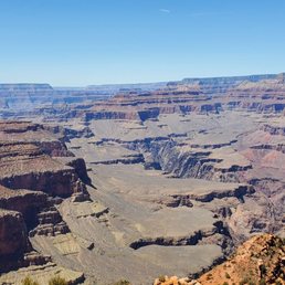

We took the East 64 road to Yaki Point, and the spectacular views of the Grand Canyon appeared. We parked along the road, and took the rim trail for about a mile which led to the starting point of the Kaibab Trail. Parking at this location is for employees only. Most visitors took the shuttle bus from the designated parking lots. There is a restroom and I suggest using it before you begin the trail. We began the descent down the trail, which provided awesome views and photo ops. Wearing suntan lotion, a hat, and supportive shoes with good traction is highly suggested. We started the trail at 1pm in May and the temperature was in the mid 70's. Some shade was found along the trail and provided for good rest stops. We knew the trail was 7 miles long and our intent was only to make it to Ooh Ahh Point, which is about a mile down. We also got the opportunity to see the mules headed up with supplies. Once you reach Ooh Ahh Point, take a moment to sit on the rocks to take it all in. Gorgeous views which also allows you to see the continuous path of the trail below. Heading back up can be strenuous. Especially, climbing the numerous steps. Take water breaks when needed. Totally worth experiencing, even if you just go the 1 mile.


I was having second thoughts doing another hike the day after Bright Angel, but I am so glad I did. The OOO Ahhh Point was all that. When you turn the bend it opens to a wide open vista. Picture-worthy. Both trails are great but if you can only do one in March this would be my preference. They are both steep, but this one had no icy patches. The initial descent is shady and the steepest then tapers. It does not have as much elevation gain as BA, but both have great views. Also, I saw elk and mountain goats near the trail. I parked at the Visitor Center and took the orange shuttle to the trailhead. Starting at 9:30 in shorts in the 60's. Coming back up around 10:30 it felt considerably warmer. If you choose to park at the trailhead, I only saw about 20 spots.
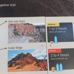

This trail is listed as one of the "easier" ones, but it is a challenge going up for sure. Initially said we were only going to the Ooh and Ahh point, but decided to go to Cedar Ridge. After ooh and ahh, the shade becomes limited to none. Getting out earlier is suggested as it will be cooler and fewer people (we got to the Grand Canyon about 6 and left the trail about 1230). Having water and snacks is suggested, and hiking sticks would be beneficial if you have them. I also suggest putting on sunscreen and a hat if possible if you tend to burn easily. I saw families complete this hike, so it's worth a try. If your children aren't the best listeners, I would encourage you going over safety before beginning so they are mindful of their foot placement There are bathrooms at Cedar Ridge checkpoint * No trash cans, you must take your trash with you ** no dogs on the trail


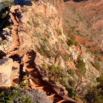
SEE ATTACHED PHOTOS. I finally visited the GRAND CANYON in Arizona, one of the 7 natural wonders of the world. I just have 5 of the 7 left to visit. I visited the Great Wall of China in Beijing, China back in October 2015. SOUTH KAIBAB TRAIL - My friend and I drove from Page, Arizona to the South Rim of the Grand Canyon. We had just left the Horseshoe Bend in Page and the drive to the Grand Canyon. The drive to the Grand Canyon South Rim took us about 2 hrs and 15 minutes from Page, AZ. If you are driving in from Flagstaff then the drive will take you 1hr and 15 minutes. Our rental house was actually in Flagstaff but that's besides the point. I visited this trail in September 2019. It is part of the Grand Canyon National Park. My friend and I hiked from the trail head (beginning) to the "Ooh-ahh Point" - that took about 45 minutes of mild walking. The way back took us about an hour because I really had to go to the bathroom (haha) and so that panic slowed me down. The whole hike from beginning to the "Ooh Ahh Point" is about 0.9 miles. The weather was really hot in September 2019 so I recommend you bring a hat and a big bottle of water. There were mules in sight within the first 15 minutes so that slowed us down. It was fun to watch the mules passing through because I've never seen that animal before which is a cross between a horse and a donkey. The beginning of the trail is easy because hikers will go downhill through switchbacks. Switchbacks are the zig-zag pattern of rock formations that you'll see at the beginning. Be careful not to slip here because there is no railing. Take your time at the switchbacks and enjoy the sights. Once you get through the switchbacks, you will be able to speed up more if you want since the path will be all clear land. I actually saw some runners speeding past me so that was cool. I love the OOH AHH POINT because the views there are breathtaking and the air is so fresh. In addition, hiking to this point is fairly easy. Take all your photos here then continue your hike by heading forward or going back to the starting point. Doing the whole hike past the "Ooh Ahh Point" is a total of about 7 miles so spending one day doing this is not recommended. GOING back is all UPHILL so be prepared to be tired. If you are fairly physically fit then you should have no problems. I really enjoyed my "short" hike within the South Kaibab Trail and I wish I could have spent more time at the Grand Canyon. I only spent about 3 hours inside the actual Canyon and another additional 1 hour at the National Park itself (between driving in the park and visiting the Visitor's center). **** - 158 total reviews in 2019 - 367 total overall Yelp reviews - Reviewed on 14 December 2019


This trail is not for the faint of heart. Lots of steep and narrow pathways with no railing but it does come with breathtaking scenery throughout. We had originally planned on making it to Ooh Aah point but I had my five year old with us so we knew that goal was very optimistic given there was some snow on the trail, making our goal a bit more difficult. About halfway there she started mentioning that she was tired so we quickly turned right around because there's no way I'm carrying a 40lb kid up those switchbacks. Three days later and every muscle from my waist down is sore. They have mules at top so really enjoyed petting them as well. Can't wait to come back and attempt to make it all the way to Cedar Ridge.
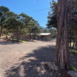

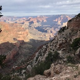

So I guess this is going to be a 2 part review spread over two trails but the South Kaibab Trail gets 15 stars/5 for sure. My day started at the Backcountry Information Center. The South Kaibab trailhead is closed to private vehicles so you need to take a shuttle bus over there. Since I would be ending my day at the Bright Angel trailhead, there is a shuttle bus leaving hourly from 4-7 AM that takes you from the Backcountry Information Center where you can park your car to the South Kaibab trailhead. Once I got to the trailhead it was time to hit the trail! And wow! The views of the canyon were just spectacular. I loved that the trail took you to different perspectives of the canyon from McNeill Butte to views of the Colorado River below. For not as avid hikers, I'd recommend walking 1.5 miles out to Cedar Ridge though the 0.9 mile trip to Ooh Aah Point is well worth it as well! Just remember that it takes twice the time to come up than to go down :) I continued down the entire trail to Phantom Ranch and enjoyed all of it. The views after the Tip-Off and once the Colorado River was in sight was my favorite part. I'll note that the South Kaibab trail is not shaded and there is no water along the trail so I would highly advised doing this trail super early or late and not coming up South Kaibab if you are at the bottom (unless you're crazy and want the challenge! And I was passed by multiple trail runners.....) A few tips if you're looking to do a rim to river to rim day hike like I did - Hiking Poles!! I usually don't use them but this is not your typical hike and you need to save your legs for the uphill climb in the afternoon -Bring electrolyte mix/tablets and drink often! This will keep you fresh and from being dehydrated. Also bring plenty of food and salty snacks and eat often. -It's cold when you start out but it will be warm and toasty when you get into the canyon so don't bring too many layers, I personally just decided to embrace the cold at the start -Pace yourself at the start - again it's a reverse hike so it's tempting to run down to the river but take it easy, enjoy the views. I personally forced myself to take a 5-10 minute break every hour and I think this helped a lot.


Favorite trail in the GCNP hands down. It offers the most amazing views. There is NO shade, and NO water available on this trail. Make sure you carry enough water and don't underestimate the heat. Start early on this trail. Headlamps are perfect for night/early morning hiking. I have hiked this trail in its entirety and continues up the North Kaibab trail. I have also hiked up this trail. I prefer hiking up South Kaibab over Bright Angel; yes it's shorter; that's because it's steeper. It's a lot of "unevenly spaced stairs" I used poles each time I've hiked this trail, I find them useful. Also, when hiking this trail you need to remember that going down is optional, going up is mandatory. This trail offers spectacular views, with less crowds due to its steepness and needing a shuttle to get to. 10/22/19- new PR for me down SK to PR & back up SK- 5 hours 27 minutes
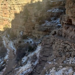

Such a nice casual hike down the canyon with some great views! It's not a difficult hike down - the path is pretty well maintained and guided. The way up can raise your heart rate a little especially due to the elevation change. I would recommend for families - kids too :) Came here on a friday at around 12. Its December so it was cold but the sun hit the path half of the time - the other half of the time you're in a shady area and it is cold ! :) I got lucky and saw the mules walking up the path. It was a cool sight to see:)


3 months ago

I have done Bright Angle Trial a couple of times in the past to the bottom of the Grand Canyon. South Kaibab is the other big trail into the Canyon. Over the summer, we camped at the rim and decided to hike South Kaibab a little ways early in the morning before it got too hot. We ended up hiking all the way to Skeleton Point and back. As it approached afternoon, it started to get a little warm. I ended drinking all the water in my CamelBak just before I got to the top. The temperature was climbing fast and I had to use my cooling towel to stay cool. I got to say that I really gained a lot of respect for this Canyon during this short summer hike that I did. The South Kaibab Trail is a 7 mile hiking trail in Grand Canyon National Park that leads to the Colorado River. I like this trail because you get 360-degree views of the canyon after you pass Skeleton Point. The trail is mostly shaded until you reach Ooh Aah Point. Then you are out in the open. Up next is Cedar Ridge at 1.5 miles and then Skeleton Point at 3 miles. After that is the Tipoff and Black Suspension Bridge as you are descending into the Canyon. There is no water on the trail until you get to the bottom of the canyon at Bright Angel Campground and Phantom Ranch. So bring plenty of it along with snacks, sunscreen, etc. The hike is 15 miles (24 km) roundtrip to Phantom Ranch and will take at least 2 days to complete. If you get to the beginning of the trail early enough, you can probably find parking in the parking lot or on the side of the road. But it fills up quick. Another option is to take the free shuttle to the trailhead from the South Rim Visitor's Center. Both water and restrooms are located at the beginning of the trail. The hike is usually a little busy with people to start off with, but many turn around after reaching Ooh Aah Point. It is also fairly steep with lots of switchbacks, so bring poles if you need them for assistance. Be prepared for a climb on the way back to the parking lot during that last mile. Also keep an eye out for Mules as they use this trail regularly. My recent hike was in June and I saw many people with little or no water. I also saw people with footwear that should not be worn on this trail. It blew me away how uneducated and naive people are about doing these hikes into the canyon. I understand lots of tourists come here, but people need to be a little more careful when hiking the Grand Canyon. Many of the deaths that occur every year in this Canyon can be avoided. On the day that I visited and hiked this trail, they reported several heat related incidents that evening and one death. South Kaibab Trail is a great hike. Enjoy, make a plan and be responsible. read more
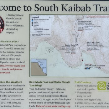


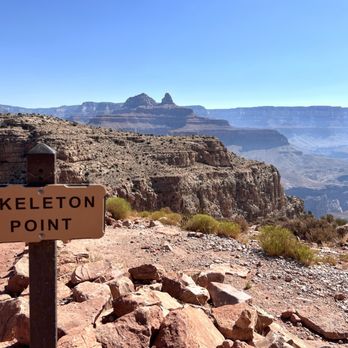

This is definitely a great choice of a hike for the lesser experienced hiker as well as the experienced one. I highly recommend getting to the trailhead EARLY to have the best experience. I took the hiker's express shuttle from the Visitor Center (There's no parking at the trailhead allowed), and got started by 5:30am. This was great in June because it was a decent temperature, and you still has some shade for he majority of the hike. Definitely bring enough water - I brought 5L with me, but I only ended up going to Cedar Ridge and back, so it was more than enough. But there's no water on the trail so be prepared especially if you're going past that point. I also highly recommend trekking poles. I found these esepcially useful for going down and preventing slipping. There were quite a few loose stones, and I felt more secure with the poles. You should also wear appropriate footwear. This is not a trail for flipflops or cowboy boots (both of which I saw on my hike back out of the canyon). The distance to Ooh Ahh point isn't significant, and I would not have been happy only going that far, so I am glad I went all the way to Cedar Ridge. Being out very early, I didn't encounter too many others, but the trail definitely thinned out after Ooh Ahh point. And it is worth it to go to Cedar Ridge if you're prepared. The views are spectacular. Coming back up takes effort, but if you take your time, most people will be fine. I saw a couple of rangers on this trail during the time I was out which gave me some reassurances about safety. And it really is a well-trafficked and maintained trail that you can feel comfortable hiking as a solo person. SUMMARY: Follow the guidelines of the park. Bring plenty of water. Go Early - I'd recommend 5:30 or earlier. Consider trekking poles. Wear suitable shoes. And enjoy the view! read more


2 years ago

Two separate reviews for two trails here. No parking at the trailhead. Park at visitor center and take the eastbound Kaibab Rim (Orange) bus route to trailhead. 1. South Kaibab Trail To Cedar Ridge (~3.1 miles total, ~2 hours to complete). Extremely crowded. Easy decline all the way down to Cedar Ridge; tough incline all the way back to trailhead. Stunning views of the canyon! Short video of the hike: https://youtu.be/NZJ8rZJv8rY 2. Shoshone Point Trail Via South Kaibab Trailhead (~5.1 miles total, ~2.5 hours to complete). Due to the possibility of not finding any parking at Shoshone Point, we ended up starting from South Kaibab Trailhead. No other hikers were on the trail. This was partially a mule trail so there are poops along the way. Unfortunately, we did encounter some mules near the end; the stench and dust were a bit unbearable. Overall, beautiful views of the canyon along the way and at Shoshone Point! Short video of the hike: https://youtu.be/2LxW0fsrqFo For an easier hike out of the two, I would choose Shoshone Point. For a tougher hike with better views, I would choose Cedar Ridge hike. read more


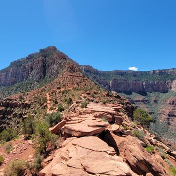
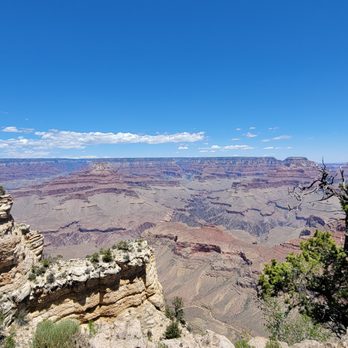


General Amazement! Even for non-religious, atheist, or in-between folks, the Grand Canyon is certainly somewhere you take a step back and thank someone out something for such a marvelous hole in the ground. I walked the South Rim and kept taking what seemed to be the same picture over and over again and was equally amazed at every single shot. Tears filled my eyes as I captured a panoramic view but then the 110°F wind quickly blow dried the tears away. It was a sign I needed to toughen up and make the trek down to the river. The Review: Ok. So this was my Grand Canyon entry point: S. Kaibab Trail Head on the South Rim. It's the less tourism centered entry point. No gift shops, no restaurants, no lodges. Just a parking lot and a very minimally maintained restroom. It actually seems like they (park officials) purposely detour guests from going to S. Kaibab at South Rim. But let me tell you... S. Kaibab is underrated. The only negatives are this trail seems to have less shade and the elevation loss/gain is a little steeper. But I would actually take the views, shorter distance, and scenery of S. Kaibab compared to other Grand Canyon trails. There is no potable water along the trail so hydrate and pack accordingly. Some trail hiking tips: 1. Hydrate, hidr8, high drate, hijrate!!! 2. Think electrolytes. Cramps & body fatigue are real. 3. Take your time. The competition is only you vs. yourself. Everybody's a winner. 4. If your physical fitness, stamina, health, aerobic capabilities are questionable, this hike isn't the place to answer it. Remember, going in the canyon is optional but getting out isn't. 5. Try not to hike alone. 6. Trekking poles are a plus. 7. GPS watch, activity tracker, etc. are great tools. 8. Pick spring or fall months to go unless 115°F and no shade is appealing to you. The checkpoints along the trail are: 1. Ooh Aah Point (IMO everywhere on the trail is Ooh Aah Point - so beautiful!) 2. Cedar Ridge 3. Skeleton Point (best view on the trail IMO, first view of the Colorado River as well) 4. Tipoff 5. Black Bridge Once you make it to Black Bridge, if you cross you make it to the Bright Angel Campground. If you don't cross, you meet up with the Bright Angel Trail where the Silver Bridge is located. read more

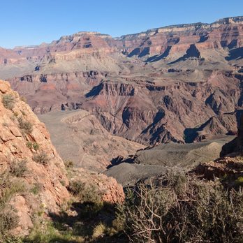

Not for the faint of heart is an understatement. As long as you train and are not afraid of heights, it's a quicker option than bright angel. There's a reason it features a curve dubbed the "skeleton point." The black bridge at the bottom is a welcome relief from all of the stairs, cliffs and turns. There's a moment of darkness before you emerge into the beauty of the emerald Colorado river. Tipoff rest house provides a bit of shade and there are two large non-potable water tanks, if you have a filter. Most do not make their way to the bottom of the canyon but they sure should. read more


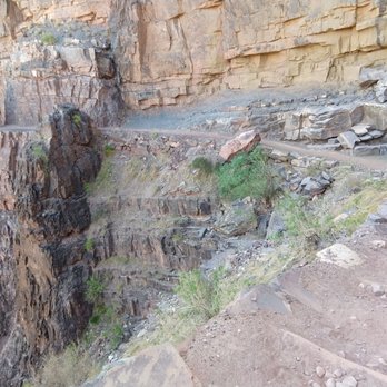


We took the East 64 road to Yaki Point, and the spectacular views of the Grand Canyon appeared. We parked along the road, and took the rim trail for about a mile which led to the starting point of the Kaibab Trail. Parking at this location is for employees only. Most visitors took the shuttle bus from the designated parking lots. There is a restroom and I suggest using it before you begin the trail. We began the descent down the trail, which provided awesome views and photo ops. Wearing suntan lotion, a hat, and supportive shoes with good traction is highly suggested. We started the trail at 1pm in May and the temperature was in the mid 70's. Some shade was found along the trail and provided for good rest stops. We knew the trail was 7 miles long and our intent was only to make it to Ooh Ahh Point, which is about a mile down. We also got the opportunity to see the mules headed up with supplies. Once you reach Ooh Ahh Point, take a moment to sit on the rocks to take it all in. Gorgeous views which also allows you to see the continuous path of the trail below. Heading back up can be strenuous. Especially, climbing the numerous steps. Take water breaks when needed. Totally worth experiencing, even if you just go the 1 mile. read more
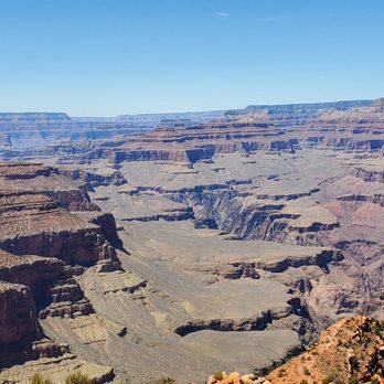

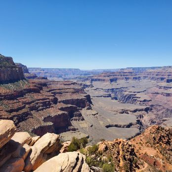


I was having second thoughts doing another hike the day after Bright Angel, but I am so glad I did. The OOO Ahhh Point was all that. When you turn the bend it opens to a wide open vista. Picture-worthy. Both trails are great but if you can only do one in March this would be my preference. They are both steep, but this one had no icy patches. The initial descent is shady and the steepest then tapers. It does not have as much elevation gain as BA, but both have great views. Also, I saw elk and mountain goats near the trail. I parked at the Visitor Center and took the orange shuttle to the trailhead. Starting at 9:30 in shorts in the 60's. Coming back up around 10:30 it felt considerably warmer. If you choose to park at the trailhead, I only saw about 20 spots. read more


This trail is listed as one of the "easier" ones, but it is a challenge going up for sure. Initially said we were only going to the Ooh and Ahh point, but decided to go to Cedar Ridge. After ooh and ahh, the shade becomes limited to none. Getting out earlier is suggested as it will be cooler and fewer people (we got to the Grand Canyon about 6 and left the trail about 1230). Having water and snacks is suggested, and hiking sticks would be beneficial if you have them. I also suggest putting on sunscreen and a hat if possible if you tend to burn easily. I saw families complete this hike, so it's worth a try. If your children aren't the best listeners, I would encourage you going over safety before beginning so they are mindful of their foot placement There are bathrooms at Cedar Ridge checkpoint * No trash cans, you must take your trash with you ** no dogs on the trail read more
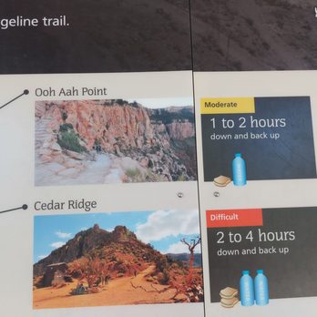

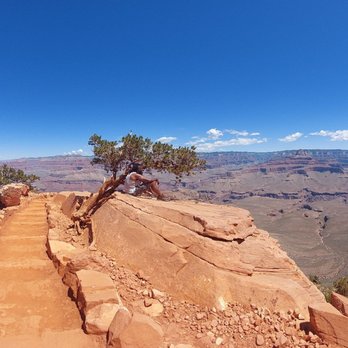
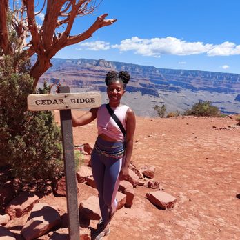

SEE ATTACHED PHOTOS. I finally visited the GRAND CANYON in Arizona, one of the 7 natural wonders of the world. I just have 5 of the 7 left to visit. I visited the Great Wall of China in Beijing, China back in October 2015. SOUTH KAIBAB TRAIL - My friend and I drove from Page, Arizona to the South Rim of the Grand Canyon. We had just left the Horseshoe Bend in Page and the drive to the Grand Canyon. The drive to the Grand Canyon South Rim took us about 2 hrs and 15 minutes from Page, AZ. If you are driving in from Flagstaff then the drive will take you 1hr and 15 minutes. Our rental house was actually in Flagstaff but that's besides the point. I visited this trail in September 2019. It is part of the Grand Canyon National Park. My friend and I hiked from the trail head (beginning) to the "Ooh-ahh Point" - that took about 45 minutes of mild walking. The way back took us about an hour because I really had to go to the bathroom (haha) and so that panic slowed me down. The whole hike from beginning to the "Ooh Ahh Point" is about 0.9 miles. The weather was really hot in September 2019 so I recommend you bring a hat and a big bottle of water. There were mules in sight within the first 15 minutes so that slowed us down. It was fun to watch the mules passing through because I've never seen that animal before which is a cross between a horse and a donkey. The beginning of the trail is easy because hikers will go downhill through switchbacks. Switchbacks are the zig-zag pattern of rock formations that you'll see at the beginning. Be careful not to slip here because there is no railing. Take your time at the switchbacks and enjoy the sights. Once you get through the switchbacks, you will be able to speed up more if you want since the path will be all clear land. I actually saw some runners speeding past me so that was cool. I love the OOH AHH POINT because the views there are breathtaking and the air is so fresh. In addition, hiking to this point is fairly easy. Take all your photos here then continue your hike by heading forward or going back to the starting point. Doing the whole hike past the "Ooh Ahh Point" is a total of about 7 miles so spending one day doing this is not recommended. GOING back is all UPHILL so be prepared to be tired. If you are fairly physically fit then you should have no problems. I really enjoyed my "short" hike within the South Kaibab Trail and I wish I could have spent more time at the Grand Canyon. I only spent about 3 hours inside the actual Canyon and another additional 1 hour at the National Park itself (between driving in the park and visiting the Visitor's center). **** - 158 total reviews in 2019 - 367 total overall Yelp reviews - Reviewed on 14 December 2019 read more




6 years ago
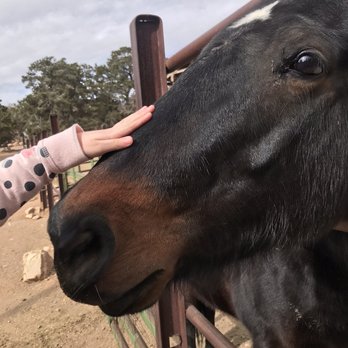
This trail is not for the faint of heart. Lots of steep and narrow pathways with no railing but it does come with breathtaking scenery throughout. We had originally planned on making it to Ooh Aah point but I had my five year old with us so we knew that goal was very optimistic given there was some snow on the trail, making our goal a bit more difficult. About halfway there she started mentioning that she was tired so we quickly turned right around because there's no way I'm carrying a 40lb kid up those switchbacks. Three days later and every muscle from my waist down is sore. They have mules at top so really enjoyed petting them as well. Can't wait to come back and attempt to make it all the way to Cedar Ridge. read more

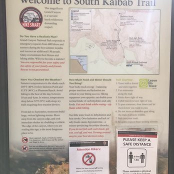

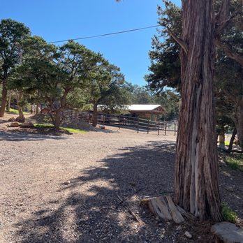

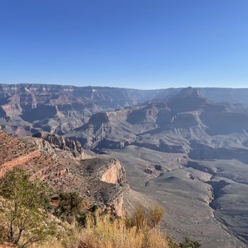


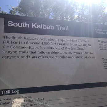
So I guess this is going to be a 2 part review spread over two trails but the South Kaibab Trail gets 15 stars/5 for sure. My day started at the Backcountry Information Center. The South Kaibab trailhead is closed to private vehicles so you need to take a shuttle bus over there. Since I would be ending my day at the Bright Angel trailhead, there is a shuttle bus leaving hourly from 4-7 AM that takes you from the Backcountry Information Center where you can park your car to the South Kaibab trailhead. Once I got to the trailhead it was time to hit the trail! And wow! The views of the canyon were just spectacular. I loved that the trail took you to different perspectives of the canyon from McNeill Butte to views of the Colorado River below. For not as avid hikers, I'd recommend walking 1.5 miles out to Cedar Ridge though the 0.9 mile trip to Ooh Aah Point is well worth it as well! Just remember that it takes twice the time to come up than to go down :) I continued down the entire trail to Phantom Ranch and enjoyed all of it. The views after the Tip-Off and once the Colorado River was in sight was my favorite part. I'll note that the South Kaibab trail is not shaded and there is no water along the trail so I would highly advised doing this trail super early or late and not coming up South Kaibab if you are at the bottom (unless you're crazy and want the challenge! And I was passed by multiple trail runners.....) A few tips if you're looking to do a rim to river to rim day hike like I did - Hiking Poles!! I usually don't use them but this is not your typical hike and you need to save your legs for the uphill climb in the afternoon -Bring electrolyte mix/tablets and drink often! This will keep you fresh and from being dehydrated. Also bring plenty of food and salty snacks and eat often. -It's cold when you start out but it will be warm and toasty when you get into the canyon so don't bring too many layers, I personally just decided to embrace the cold at the start -Pace yourself at the start - again it's a reverse hike so it's tempting to run down to the river but take it easy, enjoy the views. I personally forced myself to take a 5-10 minute break every hour and I think this helped a lot. read more




6 years ago
Great view and really scenic hike make sure to take water and remember if you go down you have to walk up I did make 300 feet and stopped I hate heights Probably the best hike in the canyon read more


Favorite trail in the GCNP hands down. It offers the most amazing views. There is NO shade, and NO water available on this trail. Make sure you carry enough water and don't underestimate the heat. Start early on this trail. Headlamps are perfect for night/early morning hiking. I have hiked this trail in its entirety and continues up the North Kaibab trail. I have also hiked up this trail. I prefer hiking up South Kaibab over Bright Angel; yes it's shorter; that's because it's steeper. It's a lot of "unevenly spaced stairs" I used poles each time I've hiked this trail, I find them useful. Also, when hiking this trail you need to remember that going down is optional, going up is mandatory. This trail offers spectacular views, with less crowds due to its steepness and needing a shuttle to get to. 10/22/19- new PR for me down SK to PR & back up SK- 5 hours 27 minutes read more


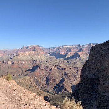


7 years ago
Such a nice casual hike down the canyon with some great views! It's not a difficult hike down - the path is pretty well maintained and guided. The way up can raise your heart rate a little especially due to the elevation change. I would recommend for families - kids too :) Came here on a friday at around 12. Its December so it was cold but the sun hit the path half of the time - the other half of the time you're in a shady area and it is cold ! :) I got lucky and saw the mules walking up the path. It was a cool sight to see:) read more
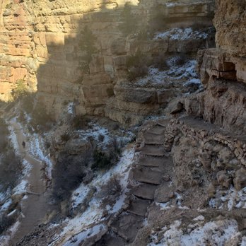


I'm not recommending that you do this, but my 14-year-old daughter and I (age 48) hiked to the bottom and back in one day on this trail. We had prepared well both physically and equipment-wise, and still it was very hard. I would not trade the memory of the experience for anything. Whether you experience a hundred yards or dip your toes in the river mid-hike, this is a trail well worth taking. read more


11 years ago
If you're planning on hiking here to the North Rim this one of two starting points (the other being Bright Angel trail). In my opinion the first leg of the trail of downward 7 miles is the toughest on the body. If you have bad knees or didn't know you have bad knees or in my case, feeling like you're going to anticipate an IT Band Syndrome on both legs, then you might think about training or wearing some leg/knee braces. You'll see a pit stop within the first 1.5 miles at Cedar Ridge. Mind you, these pit stops aren't a fresh breath of air....at all!! Go for another 1.5 miles to reach Skeleton Point. In 1.4 miles you'll be at Tip Off with another set of outhouse. Finally you'll reach Phantom Ranch in 2.6 miles. At Phantom Ranch there is a little store with tables inside and fresh AC. Here you can buy some postcards, send a message to your family and friends and have that mail carried by mules! You can buy a square packet that you can dip in water and expand into a souvenir shirt. You can also buy some suggested necessities for the remaining of your trail, and refill your water bladder. Picnic benches/tables are in front of the store to munch on food and repair your feet, if needed. Also, if you're not going to the North Rim, there is the Bright Angel Campground that will probably be booking ahead of time. There is the Bright Angel Trail to go back up. *Optional reading towards the North Kaibab Trailhead: Go another 7.2 miles and at some point towards the end of this leg you'll pass by Ribbon Falls which I heard was worth it. Unfortunately I was feeling an IT Band Syndrome early in my hike and was not able to check it out. After this there will be Cottonwood Campground which is where you can also refill on water and make a pit stop. In 1.4 miles there is the Pump House Ranger Station. Stop at Roaring Springs in less than a mile to refill on water and outhouses. Finally one last passing is the Supai Tunnel (super short tunnel) along with the outhouses and water refill. At last....1.7 miles left to the final destination. Was it worth it??? Yes!!! :) Although my knees were wobbly on the descend, and feeling IT Band Syndrome for both legs, I depended on KT tape, and hiking poles! Bring those poles because if you're feeling weak in the knees, this is your lifesaver!!!! Things I packed and used during this trip: 5-6 bars, 5 GU shots, a couple sandwiches, such as peanut butter and jelly sandwich and cold cut and cheese sandwich - if you like variety; salmon jerky (you will need some saltiness when you're sweating buckets out there); 2-3 cuties, and 100 oz water bladder. Electrolyte would be helpful too! Happy trails to you!! :) read more

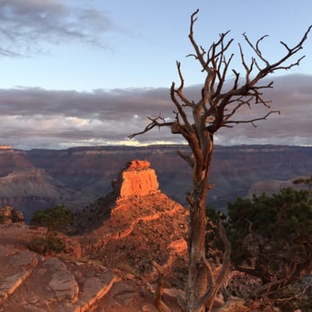


Your best option for a quick hike into the Grand Canyon from the South Rim. We're both somewhat experienced hikers, and on a fine late April weekend it took us 2 hours or so to hike the 3 miles round trip to Cedar Ridge and back, the perfect vantage point for experiencing the Canyon up close. Can't wait for next time, with more time, when for sure we'll descend further into the Canyon on South Kaibab Trail. read more


9 years ago

9 years ago
You can take the bus over from the visitor center to the start of the trail. My girlfriend and I hiked down to the black bridge and back in one day! There is a reason why they don't recommend it. If you don't hike vary often I would not attempt the almost 14 mike hike in one day. Really gauge your capabilities and always play it safe. Alright, with that out of the way, let's continue! The trail is well maintained. They regularly move stuff up and down the trail by mule. It's really easy to follow the trail and the checkpoint areas are spaced out very well. There are two bathrooms on the trail you can use. It's amazing the beauty the Grand Canyon holds. Such diversity. Hiking the trail you see the landscape drastically change. As you can imagine, it's much harder going up then down. Don't underestimate it. Take breaks regularly. read more

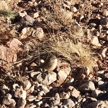
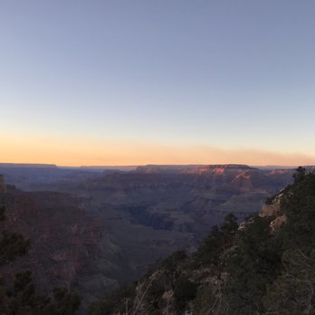

5 years ago
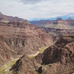
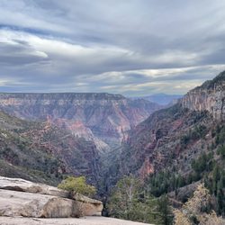
Worth it. Every view point is just... Fabulous. The whole trail is a couple hrs to and from the last view point, but there's a ton to stop at in between if you don't want to walk as far. These pictures were taken from a point about 30-45 minutes in. read more
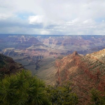

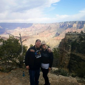


Hiking the Grand canyon was on my todo list after the first I visited.. So I came back a second time.. This is a great trail.. Lot of wild squirrels... They even come and sit on your lap if you feed them some nuts :-) We were supposed to start early in the morning but then by the time we go up it was like 9:00.. and by the time we started the hike down it was like 11:00 in the burning sun.. Would never do it again during that time of the day as it gets real hot when you go down.. We went about 1.5 miles to the half way point.. Cedar Bridge.. The trail is a bit steep.. Carry a lot of water.. I would suggest 4 or 5 bottles per person or even more.. The view were great the more you start to come down.. Saw some really cool birds during this hike.. read more


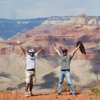


Trekking Poles, Crampons, or Micro spikes are a must, if you're hiking South Kaibab Trail in the winter. We visited this brave and adventurous trail in early February, and saw some wonderful mule rides along the way. Super life changing trail, connects pretty well with Bright Angel Trail. Its amazing views can be experienced at any time of the day, but I recommend the early morning; witnessing the sun rise with friends and family. I agree with Crystal A., that this trail is definitely not for the faint of heart; definitely had my shares of falling a lot because we didn't have the proper snow gear to hike. Considered one of the seven wonders of the world, this is a day hike from South Kaibab to Phantom Ranch for the best lemonade money can buy. The South Kaibab Trail is a 7.1 mile hiking trail in Grand Canyon National Park. The trail follows a ridge out to Skeleton Point allowing for 360-degree views of the canyon. It continues to the Colorado River to Phantom Ranch. Total elevation change is 4,780 feet. read more

6 years ago
We hiked South Kaibab to Ooh Aah Point. This was a tough hike but very doable. Lots of stairs so a walking stick would be helpful. There are also a lot of people so be patient as you hike out and back. The views are absolutely worth it though. read more
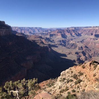


This is the perfect short but challenging hike! South Kaibab will take you down into the canyon for some awe-inspiring and unobstructed views. Get your camera ready for some perfect photo ops. The trail features a couple of different stopping points which are spaced out, so you can pick one based on how much time you have. The 3 main ones include Ooh Aah Point, Cedar Ridge, and Skeleton Point (in that order). If you're going with family or don't want anything too challenging, maybe just opt for Ooh Aah Point. Otherwise, continue on for more of a workout! We decided to take the trail to Cedar Ridge and then turn around. This was about a 3 mile round trip which took us about 3 hours, including breaks and picture-taking. What this hike lacks in mileage, it makes up for in elevation. The trail is almost all switchbacks. Going down is much easier than going back up, so make sure you save PLENTY of energy/water for your journey back. I consider myself in moderate shape and did just fine (besides sweating a TON). It's easy to get to the trail via a shuttle from the visitor center. And it's impossible to get lost on the trail as it's well-maintained and clearly marked. There's also a water refill station right at the trailhead. As with all hikes, it's best to start this one early! We went on a June morning and it was hot, but not unbearably so (maybe about 85-90 degrees). It wasn't too crowded either and it was easy to take beautiful pictures all throughout the hike. read more


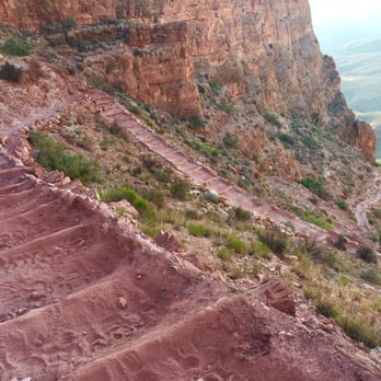
Grand Canyon Hike Part 1 of 2 Disclaimer: Hiking entails several potential dangers. Keep in mind that hiking in general calls for advanced planning and preparation. You must always do your research and be prepared for anything and everything that can happen because you are solely responsible for your actions. With that said, feel free to read on and again, prepare wisely, hike wisely, and enjoy! ***I DON'T RECOMMEND HIKING THE GRAND CANYON IN THE SUMMER AND I DON'T RECOMMEND DOING WHAT I DID. IT WAS A KILLER HIKE AND NEXT TIME I PLAN ON HIKING INTO THE CANYON, I'M DEFINITELY CAMPING.*** TIME: 3 hours from top of rim to Colorado River TOTAL DISTANCE: 7.4 miles WATER ACCESS: None on this trail. Pack plenty and don't forget your electrolytes! WHAT WAS HELPFUL: Walking sticks for the steep parts of the trail South Kaibab Trailhead to Cedar Ridge: 1.5 miles toilets Cedar Ridge to Skeleton Point: 1.5 miles no facilities Cedar Ridge to Tip Off: 1.4 miles toilets + emergency phone Tip Off to Bright Angel Camp Ground: 2.6 miles toilets + emergency phone + drinking H2O Bright Angel Camp Ground to Phantom Ranch: 0.4 miles toilets + emergency phone + drinking H2O + ranger station Although HIGHLY NOT ADVISED by the rangers, our plan was to hike down from the South Rim to Phantom Ranch and back up to the rim in one day. It was important we started super early to avoid hiking in super hot weather. We took the first shuttle that takes you from the Visitor Center to South Kaibab trail head, which leaves at 4:30 AM in the summer. I could be wrong, but I believe the trail head parking is only for overnight guests who signed up for passes. There are no watering spickets on South Kaibab. Keep in mind, it is the Grand Canyon and as you get deeper into the canyon, it gets hotter and hotter. NPS recommends drinking "one-half to one full quart of water or sports drink each and every hour you are hiking in the heat" and estimates it takes an hour to hike a mile. It took my partner and I a total of 3 hours to get from the South Kaibab Trailhead to Phantom Ranch. Once we got to Phantom Ranch, we used the bathrooms and had a large cup of iced lemonade. It was Minute Maid, but it tasted like the best lemonade ever! Do your research and don't forget to stop at Phantom Ranch! I'm not a morning person, but I've never felt so happy waking up at 3:30 AM. I would have preferred starting even earlier, but the first shuttle arrives at 4:30 AM. It wasn't completely dark once we started the hike, so we didn't need our flashlights; however, I still recommend bringing flashlights because it is possible you'll be in the canyon when it's dark. Sunrise at 5:30 AM was absolutely beautiful and breathtaking! It was the first time I had the opportunity to truly experience the beauty of the canyon without the large groups of tourists. In addition, the haze you see from the top seems to disappear and you get to see all of the layers of the canyon up close and personal. For these reasons, I really enjoyed this hike and I think it's one of the better trails to take down into the canyon. We expected it to get progressively hotter throughout the day and since there's no water on South Kaibab, we decided to take Bright Angel Trail back up to the South Rim. If you'd like to read more about our adventure going up the rim, please read my review for Bright Angel Trail! :) You can find lots of helpful information on the NPS website: http://www.nps.gov/grca/planyourvisit/hiking-faq.htm. read more

10 years ago
Ah yes, the rim less traveled. My group of 3 backpacked rim to rim overnight starting at the South Kaibab trailhead and ending at the Bright Angel trailhead. South Kaibab is a wonderful place to start your journey as it is less crowded. We started our descent at 5:30am before sunrise (in September). The only other groups of people that started with us were day hikers doing rim to rim. Watching the sunrise while descending into the canyon is a phenomenal experience; my pictures will not do it justice. 13 miles to Phantom Ranch from South Kaibab trailhead. Maybe the first 7 miles are the toughest on your knees as this is where most of the decline takes place by switchbacks. The rest of the way is ~1000 ft. gain/loss (hooray for your knees!), but then the heat takes over as there is minimal to no shade. When we went we had no issues with water supply. All spring spigots were open and flowing and there was plenty of water in the creeks. The trail is definitely doable as long as you pace yourself, take those breaks, snack along the way and hydrate! We saw people of many different levels of experience and physical ability doing this trail. Some people had to turn around as they were smart in paying attention to their limitations. Other people pushed on but just at a slower pace. Be sure on the way down you take advantage of every pit toilet you come across! You don't want to find yourself in a pickle needing to squat in brush. Also there isn't really anywhere for you to hide, if you know what I mean. I highly recommend taking a break at Rainbow Falls; a little oasis in the desert of green! If possible, take a shuttle to the trailhead. There is LIMITED parking. read more


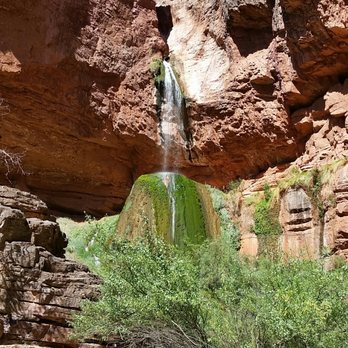

If you're with your family and want a short, but scenic hike, heading down the South Kaibab Trail to Ooh Aah Point is the way to go (just 1.8 miles roundtrip, but with an elevation change of 600 feet) . You'll get great views and it's not nearly as crowded as hiking down the Bright Angel Trail. Get to the trailhead by taking the shuttle bus from the Visitor Center (if you're starting out early in the morning from the Village you can take the Hiker's Express, otherwise you'll need to switch buses at the Visitor Center). Fill up on water by the bus stop as you won't find any water on the trail. In early April, we found a few patches of snow at the top of the trail along the switchbacks. As you continue to head on down you're met with changing views and a little bit of exposure to the ridge, but the trail is easily wide enough for people to pass and to always feel safe. Ooh Aah Point itself offers gorgeous views and plenty of space to sit down, drink some water, and grab a snack. The hike back up is obviously more time consuming, but even if you're not in the best shape you should be able to make it up without too much trouble. read more
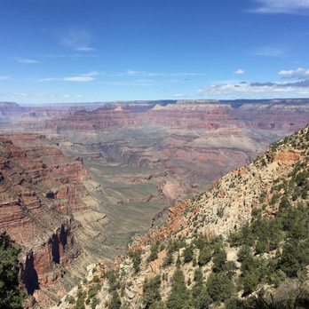
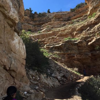

15 years ago
They SAY you're not supposed to hike down to the river and then back up to the rim of the Grand Canyon -- a 17 mile hike with 4,000 feet of elevation gain -- in one day. But I hate listening to the Man, so I did it anyway. And I'm glad I did! It's perfectly do-able by anyone in moderately good shape, provided you use basic common sense: 1. Don't do it in overly hot weather. 2. Bring plenty of water and food 3. Start early enough so that you finish by sunset 4. Don't veer off-trail or do anything stupid I've lived in the desert for over 10 years, so I'm used to the dry climate...but if you're not, drink A TON of water. It is more dehydrating than you think! Since I'm already a hardcore desert rat, and since I hiked this on 4/19/11 when the high temp was only 78 degrees or so, I only drank about one liter of water on the entire hike. Considering the nice weather, I almost certainly could have done the whole hike with no water at all, but as it was I only peed twice, and my pee was not clear...so I guess I was dehydrated after all. Mid-April weather at the Canyon can be dicey -- I've been there during April when it was freezing and snowy, and also when it was hot as balls. I just happened to be extremely lucky that the day I chose was not only PERFECT, but also fell during National Parks Week, which meant I got in for free and saved the $25 entrance fee! My sister and I spent the night in Williams (about one hour's drive away, the closest lodging we could find in the busy season). We left our car at the Visitor's Center and took a free shuttle bus to the trailhead for the South Kaibab trail, beginning our hike at 8:40am. They recommend using this trail to descend, because it is very steep and shadeless, but offers stunningly dramatic views. Then you can follow the Colorado River at the bottom for about two more miles and then hike back up the much shadier, less steep, but slightly longer Bright Angel Trail to the top. Also, there is no drinking water along the S. Kaibab trail, so it makes sense to take that down while you still have the water you brought with you. Bright Angel has water at regular intervals which you can use to refill your bottles. We started out wearing hoodies and shorts for the first hour or so, but after that it was bikini time! I hiked the rest of the way in a bikini, ballcap and Nike Cortez -- with plenty of sunblock, of course. This type of hiking attire was fine, although I unfortunately chose a Victoria's Secret "cheeky" bottom which gave everyone behind me a questionable view of the other Grand Canyon. The S. Kaibab is definitely steep and sunny, but very safe as long as you stay on the trail and don't go climbing around or shortcutting. We passed a couple of mule trains (no big deal, just step aside and let them pass), and had to sidestep a goodly amount of mule shit, but it was a beautiful, dramatic trail. My one bit of advice is to make sure your toenails are trimmed short before all this downhill hiking...your toes tend to jam up against the front of your shoes, and it can be mildly annoying. We reached the bottom after 2 hours and 40 minutes (we hiked fairly fast, with a little jogging thrown in, and no breaks, figuring to save time for the more difficult, uphill part of the hike). At the bottom, we crossed a bridge to the far side of the Canyon and hiked along to this little boat beach, with beautiful white sand, where we rested for about a half hour. My dad had just committed suicide, so I had made this little memorial box in his honor and I found a nice spot to leave it down there, and we had a little ceremony. Then we hiked about a mile along the bottom to the Phantom Ranch, where we stopped in the awesomely cool canteen for a lemonade, and to write some postcards, which they send up by mule train and mail out "From the Bottom of the Grand Canyon." The Ranch looks really cool, but in order to stay overnight there you have to book around 2 years in advance. Even just to get a camping permit down there is like a 6-month wait, which is part of why I wanted to go down & back in one day. Screw that planning jive -- I prefer to be more spontaneous! After resting, we started hiking up the Bright Angel trail at 1:20pm (read my review of that trail for more info on the second half of the hike). It took about 5.5 hours to ascend out of the Canyon to the Rim -- we finished just before sunset, at 6:45pm. We took the free shuttle bus back to our car at the Visitors' Center and drove back to our hotel in Williams. Verdict: a beautiful trail with breath-taking views of the Canyon and Colorado River. Recommended for downhill hiking only, as it is steep and shadeless! Depending on your level of fitness, allow 3-4 hours to finish this 6-mile trail. read more


This trail was one of my favorites during my Grand Canyon vacation! We spent two nights at the bottom of the Canyon (at Phantom Ranch), and South Kaibob was the trail we took on our descent. It's 7.3 miles from the South Rim to Phantom Ranch, making it shorter than Bright Angel. This also means it's steeper, which is why we chose this path on our way down. It wasn't at all strenuous for me, but the incline can definitely be a little rough on the knee joints. There's no water along the trail, but there are toilets at one stop along the way. The trail consists of lots of switchbacks and the most picturesque views you can imagine. I can't even remember how many photos we took on our way down, but we have some awesome wall art to prove we were there! One of the best parts of the trail, for me, was reaching the bridge that crosses the river. Why? Because that meant we had almost reached the bottom! It's not quite the same sense of accomplishment as hiking back up to the top (which we also did), but it's a pretty darn good feeling. For anyone heading to the bottom from the South Rim, I would absolutely recommend taking South Kaibab down. ...and now I wish I was back at the Grand Canyon! read more
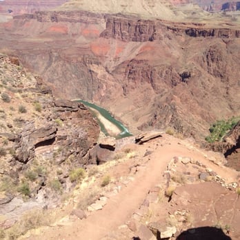


I hiked the South Rim for the first time this past weekend and it was as glorious as everyone said. Having only spent time on the North Rim, I was already biased towards the North Rim because it is quieter, more remote, and cooler (as in temperature, because it is at a higher elevation than the South Rim). The South Kaibab Trail is nice and offers spectacular views of the "Grand Hole in the Ground." Just over 7 miles long to the bottom of the canyon (and Phantom Ranch, at which point you must buy lemonade, beer, and/or food!), the trail is non-technical, but not for the weak-of-knees, as the downhill grade will challenge said knees. Bring hiking poles if you have them to help ease the weight off the knees. I'm in decent physical shape, so I didn't have a problem with the trail. If you are out of shape, don't hike the entire trail. It is easy to be seduced into hiking more distance than you plan, as the scenery is gorgeous....but going back UP to the trailhead is considerably more effort than going DOWN. Physics, ya know? :) There is NO water along the trail, unlike the Bright Angel Trail. Plan accordingly. Go and experience one of the "grandest" sights you will see! read more


7 years ago
We hiked this in late December. The trail was packed with snow and it was pretty icy. Managed to hike a couple miles or so without spikes for our hiking shoes, but it was pretty risky. Like 80% of the hikers were using spikes. Still beautiful regardless. The snow gives the Grand Canyon a totally different vibe. read more


7 years ago
DO YOU LIKE HAVING KNEES?! This trail was terrible. There were several areas with NO handrails that had falls over 2 feet one step off of the trail! My wife whined the ENTIRE time about the sun beating down on us. We came across no shaded benches the whole way down to the river. I mean.. WHAT DO I EVEN PAY TAXES FOR?! And we had no cell reception at all! It's 2019! 2019 and I can't check Facebook in this "grand" canyon?! Also we went ALL the way down to the water (which I don't recommend if you value your knees) and what was down there waiting for us? A restaurant? Maybe a snack shop? NOTHING! A stupid river that was too cold to even swim in!!! People giving this trail 5 stars obviously are not experienced hikers like I am. Stay away. Go to Zion where they at least have cell service. read more


15 years ago
Ooh aah, this trail was steep (http://www.yelp.com/biz_photos/-a3ez93MPtIcC30tbv-vNA?select=Mf5u7ZhdBx_T-JDed0NTIA )! I baby-stepped the s#&$ out of the first mile of this trail. It had nothing to do with the 12.2 mile hike the day before (http://www.yelp.com/biz/bright-angel-trail-grand-canyon#hrid:bylnaMN4GAVrBD3Cp9Vb7A/src:self ), this trail started scary. Due to time constraints with an early hotel checkout, I can only speak of the trail to Cedar Ridge (3 miles roundtrip, 1140 ft net elevation change). Until you reach Ooh Aah Point, it was pretty steep with a lot of switchbacks. Though the Ooh Aah Point wasn't marked, you'll know it when you get there http://www.yelp.com/biz_photos/-a3ez93MPtIcC30tbv-vNA?select=VtiiMOFwjrc7sI_R2NnEVA )--an amazing 360 view. The next mile to Cedar Ridge was fairly easy and the view was fabulous. My friend liked Ooh Aah Point more but I liked Cedar Ridge (http://www.yelp.com/biz_photos/-a3ez93MPtIcC30tbv-vNA?select=-YbJFTBFGOkeHtJurbmD_Q ). Anywhere you turned, the view was impressive. I felt infinitesimal in comparison. The obvious warning for this trail: It's steep and there's no point along the trail to refill water. If you're doing the 6 miles round-trip to Skeleton Point, make sure to bring plenty of water for the whole trip. Dehydration is a very real threat at the Grand Canyon. read more


Page 1 of 3
More info about South Kaibab Trail
Ask the Community - South Kaibab Trail
Review Highlights - South Kaibab Trail











Why does Yelp recommend reviews?
1 review that is not currently recommended
The reviews below are not factored into the business's overall star rating.

10 years ago
South Kaibab Trail - hiking - Updated August 2026
Best of Grand Canyon
People found South Kaibab Trail by searching for…
Swimming Holes in Grand Canyon, AZ
Things to Do in Grand Canyon, AZ
Campgrounds in Grand Canyon, AZ
Picnic Areas in Grand Canyon, AZ
Playgrounds in Grand Canyon, AZ
Attractions in Grand Canyon, AZ
Hiking Trails in Grand Canyon, AZ
Visitor Centers in Grand Canyon, AZ
Off Road Trails in Grand Canyon, AZ
Parks for Kids in Grand Canyon, AZ
Fishing Spots in Grand Canyon, AZ
River Swimming in Grand Canyon, AZ
Sunset View in Grand Canyon, AZ
Sand Dunes in Grand Canyon, AZ
Watch Sunset in Grand Canyon, AZ
Scenic Night View in Grand Canyon, AZ
Mountain Biking in Grand Canyon, AZ
Things to Do at Night in Grand Canyon, AZ
Browse Nearby
BEST of Grand Canyon, Arizona Coffee near South Kaibab Trail
BEST of Grand Canyon, Arizona Restaurants near South Kaibab Trail
BEST of Grand Canyon, Arizona Things to Do near South Kaibab Trail
BEST of Grand Canyon, Arizona Breakfast near South Kaibab Trail
BEST of Grand Canyon, Arizona Campgrounds near South Kaibab Trail


