Strawberry Peak Photos


You might also consider


More like Strawberry Peak
Recommended Reviews - Strawberry Peak
Start your review...


Reviews With Photos


This was the most challenging hike that Ramy and I have done together! We used the AllTrails app to find this hike but didn't download the layer before getting to the trail head (big mistake). It took us awhile to find the trailhead (across the street from the parking area) and we got lost a few times at the beginning. Eventually, we figured out that walking through the spiky bramble wasn't part of the fun and retraced our steps back to the trail. Once we figured that out, it was smooth-sailing for the rest of our eight-mile adventure! Overall, this was a challenging and fun hike. I would suggest bringing water and some kind of snack (there is some pretty steep elevation). The top was gorgeous! I've read that the namesake of this hike is the strawberries at the top, but there were no berries during our visit. Either way, I'd do this again! There wasn't a lot of foot-traffic and the trail is definitely a retreat from the city.


The parking lot area is at red box picnic area. There is a restroom at the lot. Remember to display your adventure pass when parking here. The start of strawberry peak trailhead is across Angeles Crest Hwy. You will see a sign stating "strawberry". It's a nice gradual incline. When you arrive at the first split. The fainted trail going right takes you to Mount Lawlor. You want to go left and continue on. But you can extend the hike to Mount Lawlor if you have more time. By the time you get to the second split in the trail. Going right will take you to strawberry meadows. You want to go left and up. There should be a sign stating strawberry peak. From here it's a steep hike up. You can use trekking poles, but not necessary if you pace yourself and carefully watch where your stepping. There are a couple of false peaks prior to strawberry peak. So make sure to continue on up. Eventually you will hike up and see a register box and some peak signs created for photo opt. It's a nice view all around. I would definitely do this hike again around winter time. You will hike back down the way you came up. This is roughly about 7.5 mile round trip. There is another route that starts at Colby Canyon to Strawberry Peak. As always, pack accordingly to the weather and have fun.


Forest Rte 2N24, Palmdale, CA 93550 or use the directions from the All Trails app to get the the Red Box parking lot. To start the trail you have to walk across Hwy 2. The first 2.5 miles are not too hard. The last mile to the peak gets steeper and more difficult. It is well-marked and you don't have to worry about getting lost. This is a strong 4 star hike and I could easily justify giving it a 5 as well. There are 2 starting points that I have tried to get to Strawberry Peak. Both trail heads are located along Hwy 2 about a half a mile apart. You can get to Strawberry peak via Colby Canyon or Red Box Canyon. Starting at Colby will be a slightly shorter route, but don't let that fool you since it is much harder due to it being steeper and more of a mountaineering route up to the peak. Now starting from Red Box is no walk in the park, but it is much less steep and there is no major bouldering to get to the top. via Red Box= 7.0 miles with a gain of about 1,800 ft elevation to reach 6,160 via Colby= 6.4 miles with over 2,600 ft of elevation gain to reach the same peak *Bottom line is if you want a serious adventure and to test yourself physically, start from Colby... I found the experience more enjoyable starting from Red Box...either way you will be rewarded with some amazing views!


With at least four places to reach the summit, we started at the Red Box Picnic Area which is the gentlest route at 7.0 miles roundtrip with a 1500' elevation gain. Red Box Picnic Area is located 14 miles north of the 210 on Angeles Crest Highway and had plenty of parking. Begin by crossing the road to the marked trailhead sign. The true hiker's trail is easy to follow as it goes around Mt. Lawlor with Mt. Wilson Observatory across the valley. Josephine Peak appears and then Strawberry Peak with view of Los Angeles and the Pacific Ocean in the distance. At 1.1 miles and 600' elevation gain is a marked junction that splits the trail up to Strawberry Peak or down to Strawberry Meadows. Although strawberries don't exist on the peak, the top has no extra manmade annoyances like communication towers or power lines. The hike is high enough to avoid engine noise from Angeles Crest Highway. An unexpected bonus, the recent rains and 50-degree day in Los Angeles meant icicles at the peak. Snow covered evergreen trees are common throughout the continent, but ice on Mediterranean plants was unique. The icicles cracked and popped when melting, rang tingling chimes when collapsing to the ground, and flickered like Christmas lights in the sun. If parking in the Angeles National Forest, a $5 Adventure Pass is needed or NPS Interagency annual pass must be displayed. Adventure Passes are conveniently sold at an office next to the picnic area.


This trail is amazing. We came 5/16/21 and it was raining and cold at the bottom of the mountain and driving up the mountain the fog was really thick and you could barely see the cars in front of you. We started at the redbox canyon trailhead. You need an adventure pass to park there. The little museum at the parking lot was selling passes as well as drinks and snacks. There is a primitive bathroom in the parking lot as well. Cross the street to the trailhead, there's a marker that says strawberry. The trail is beautiful and it was magical with the mist and fog rolling through. There is a point on the trail where it with three different trails. Take the small one that goes around the mountain. The other two are pretty steep inclines . We hiked up one of them and a bunch of hikers were coming down telling us its the wrong way. There were a lot of hikers that Sunday which we were grateful for because we actually got lost coming down the peak and would have gotten in trouble but we called out and another hiker helped us find our way back. The peak was really crowded and we couldn't see anything from there because of the thick fog. I was really glad i wore hiking shoes and brought trekking poles. They were a big help ascending and descending the peak. I think this trail would have been really challenging for us if it was hotter because it seemed pretty exposed (we were sweating so much in the cold) but we had a blast in the fog.


It's a nice long hike for sure, the view is breathtaking but we did not make it to the peak, only hiked 3 Miles up and down. There's lots of lizards roaming around, the obky time it gets intense is when walking up the peak but overall the hike was successful even though we were only half way.


I THINK I WAS FOLLOWED!! STATS: Distance: 9.5 miles Elevation Gain: 3400ft. Rating: Moderate Duration: 5-6 hours OUR ROUTE: With the loss of The Crew's great leader, a couple of us Minions have stepped up, taken the pole by the handle, planned, organized, and led hikes for fellow crew members, I am one of them. After consolidating cars as much as possible at the base of Angeles Crest Highway, drove up the windy road to Red Box Range Station and parked it. If choosing this path, take care getting to the trail head from the parking... ya gotta cross the street. From Red Box I led The Crew up to Strawberry Peak on the Strawberry Peak Trail. Although a few forks on trail, the trek is a pretty steady uphill climb. Once up and around a few bends, you'll be capable to see Strawberry Peak, which is pretty much just a big green hill. There is no red berry coloring, or waterfalls flowing like juices from a strawberry. In fact, the acclivity from the stem is a bit slick, it's not for the unsure footed or those afraid of heights, slippery inclines, or falling rocks. The summit of Strawberry Peak offers wonderful vistas of Los Angeles and the Pacific Ocean (although often obscured by smog). And to the north the High Desert and Tehachapi mountains are visible. It also offers a fantastic place to pull up a rock...errr, take a seat and replenish much needed nutrients. Hiking down Strawberry Peak is even more challenging than up, as gravity pushes from behind Mt. Lawlor Peak is just across the saddle, push of a bush, grab of some slabs away, but the 180 degree view is real and it's spectacular. Up and over Mt. Lawlor we went, which was a steeper grade than most are used to, so most trekked it at a snails pace. Fortunately, only a couple took little tumbles and hiked away with some minor Honor Badges of scrapes. BACKGROUND: Strawberry Peak - 6164 ft. located in the San Gabriel Mountains of Southern California. Only a little ride up Angeles Crest Highway (SR2) from the urban center of La Cañada. Being so close to the Los Angeles metropolitan area and offering such outstanding hiking opportunities, Strawberry is understandably very popular. Mt Lawlor - 5957 ft. - Named by the USFS in 1890 for Oscar Lawler, a prominent Los Angeles attorney interested in conservation (active ca. 1890-1930). The name is incorrectly spelled on both the USFS maps and USGS topos. Lawler was an active hiker in the San Gabriel's and had a lifelong affection for them. JUST ONE SEED: The Angeles Crest area is a popular spot for race car drivers (tsk, tsk, tsk) crotch rockets (again, tsk, tsk, tsk), cyclists (YIKES! Too scary for me), and both social and serious hikers. Best to help the environment and minimize occupying too many parking spots... carpool, carpool, carpool, and watch out for all of the above. This is supposedly the easiest route to Strawberry Peak. Idk, I think if it were all downhill, both ways, it'd be so much easier, but it isn't. Sure 3400ft over 9.5 miles doesn't seem all that bad, 350ish ft. per mile. However, it's so not that. This is not for the casual or novice hiker. POODLE DOG ALERT: Not an actual dog, rather a plant that for some can have a worse effect than poison oak (PO). Unlike PO, which produces an oil that's irritates many humans sink, PDs thick, spiky leaves of this purple-flowering bush have many hairs covered with a mix of phenolic compounds. These, invisible to the naked eye hairs get into the skin and cause allergic reactions, such as itching, redness of skin, blistering. Can take up to two weeks after being exposed before it shows itself. There will be some, mostly avoidable. DISCLAIMER: Hiking is not something that can be taken lightly. It can be life-threatening as you see and hear on the news, people die or get lost all time. Please, if you are going to hike, never go alone and prepare for the worst, hope for the best. Remember when going for a hike, no matter how short you think it may be, always be prepared. Carry at least two liters of water for every five miles (more if the weather is warm), protein bar, nuts, and electrolytes. Wear sturdy lug sole shoes and protective clothing. Some areas the weather can change quicker than a fireman can put on his gear. It is also very important, always always always let a family member or friend know where you are going and when you expect to be back. Lastly, have fun when you hike it up.


[ Trailhead ] -- Redbox Picnic Area -- From there, cross the street, making a slight right onto the white gravel/sand trail -- National Forest Service Adventure Pass Required ($5 per day or $30 for the year) [ Difficulty ] -- 6.5 ( what does this actually even mean though ) -- 7 miles round trip -- approx 2000 feet elevation gain [ Duration ] -- 3 hours round trip [ Size ] -- 4 guys, 1 girl [ Pack ] -- Trail Runners -- Carried 3 liters of water and light snacks -- Drank 1.5 liters round trip (the others drank 0.5 to 1.5 liters) [ Season ] -- Fall 2016 This is a great hike for those new to day hiking and want to challenge themselves. The hike is very gradual for the first 2.0 miles and all your elevation gain is on the saddle in the summit ascent. Very doable with great views of Mt. Wilson, Downtown LA, and the islands on a clear day!


hardest hike ever done! it's safe but this hike is moderate-difficult. had to climb rocks that were half my height, saw flying ants, snakes and countless of lizards. the hike teases you too (like muhahah you're there, sike, you're not there yet) as you have to cross many false peaks to get to this peak. going in july didn't help as it was scorching hot without shade. met a lot of people along the way who stopped midway and turned around. didn't think my friend and i'd make it to the top, but we did and it was v rewarding!!! if you want a good calf and buns workout kind of hike, this is it.


We started the hike around 9am on 12/3. The first 2 miles are very easy, then it's all uphill. We used the All Trails Map and we got to the peak with no problem. On our way back gets very slippery it's all downhill, be cautious and wear proper shoes. We saw two ladies falling multiple times and we ended up helping them. Take your time and go slow. We did it in almost 4hrs. It was 7.44 miles complete. Enjoy the trails and please leave no trace. read more

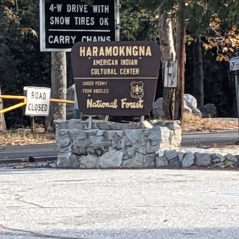

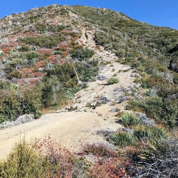

Red box gap picnic area parking lot on Hwy 2 is right across from the start of Strawberry trail. A few things to note, around 1.2 miles into the trail there will be a split without a sign indicating where the trails lead. Continue heading north (or to the right) to stay on Strawberry. Again around 2.5 miles there will be another split, closer to the left side going up you'll see the marker indicating Strawberry. The trail is relatively "easy" the first 2 .5 miles. The last mile to the peak is where the climbs start to kick it. There will be a few parts where you're climbing over rocks, and for a few moments it might seem like you may be off trail, but you'll be able to glance around and see if you're still on path. The closer you get to the peak you'll hit about 2 false peaks, but don't be discouraged the actual summit is close in distance, you just have a little more climbing to do. My picture don't to the peak much justice. While the views aren't as amazing as Cucamonga peak, you'll still have some nice views of the mountain range to the north and Downtown LA to the south west. So far out of the So Cal six peak challenge alternate peaks this one might be my favorite since the hike is a combination of a relaxed walk & some intense climbs. One last thing to note, the trail is on the outside of the mountain so there isn't too much shade from trees so make sure your properly prepared during the summer time. read more


Everything that needs to be said, has been, but here's my two cents. I hit Strawberry from Red Box 3-13-21 around 0800hrs. The parking lots were full already, had to find parking on the side of the highway. The entire area was covered in snow, which made things more challenging. Definitely regret not bringing my trekking poles and spikes. Moderate to difficult in my opinion because of the last mile climb. Ascending and descending rocks covered in snow was fun. I scarfed 3 protein bars and 1.5 liters of water. Fortunately everyone on the mountain was cool Saturday. Folks were quick to yield and offer encouragement! read more


3 years ago

This was the most challenging hike that Ramy and I have done together! We used the AllTrails app to find this hike but didn't download the layer before getting to the trail head (big mistake). It took us awhile to find the trailhead (across the street from the parking area) and we got lost a few times at the beginning. Eventually, we figured out that walking through the spiky bramble wasn't part of the fun and retraced our steps back to the trail. Once we figured that out, it was smooth-sailing for the rest of our eight-mile adventure! Overall, this was a challenging and fun hike. I would suggest bringing water and some kind of snack (there is some pretty steep elevation). The top was gorgeous! I've read that the namesake of this hike is the strawberries at the top, but there were no berries during our visit. Either way, I'd do this again! There wasn't a lot of foot-traffic and the trail is definitely a retreat from the city. read more


7 years ago
The parking lot area is at red box picnic area. There is a restroom at the lot. Remember to display your adventure pass when parking here. The start of strawberry peak trailhead is across Angeles Crest Hwy. You will see a sign stating "strawberry". It's a nice gradual incline. When you arrive at the first split. The fainted trail going right takes you to Mount Lawlor. You want to go left and continue on. But you can extend the hike to Mount Lawlor if you have more time. By the time you get to the second split in the trail. Going right will take you to strawberry meadows. You want to go left and up. There should be a sign stating strawberry peak. From here it's a steep hike up. You can use trekking poles, but not necessary if you pace yourself and carefully watch where your stepping. There are a couple of false peaks prior to strawberry peak. So make sure to continue on up. Eventually you will hike up and see a register box and some peak signs created for photo opt. It's a nice view all around. I would definitely do this hike again around winter time. You will hike back down the way you came up. This is roughly about 7.5 mile round trip. There is another route that starts at Colby Canyon to Strawberry Peak. As always, pack accordingly to the weather and have fun. read more


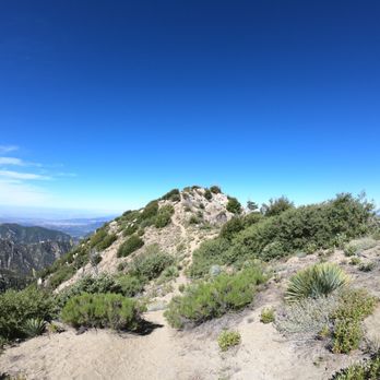


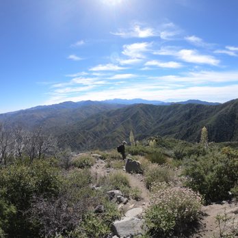


Forest Rte 2N24, Palmdale, CA 93550 or use the directions from the All Trails app to get the the Red Box parking lot. To start the trail you have to walk across Hwy 2. The first 2.5 miles are not too hard. The last mile to the peak gets steeper and more difficult. It is well-marked and you don't have to worry about getting lost. This is a strong 4 star hike and I could easily justify giving it a 5 as well. There are 2 starting points that I have tried to get to Strawberry Peak. Both trail heads are located along Hwy 2 about a half a mile apart. You can get to Strawberry peak via Colby Canyon or Red Box Canyon. Starting at Colby will be a slightly shorter route, but don't let that fool you since it is much harder due to it being steeper and more of a mountaineering route up to the peak. Now starting from Red Box is no walk in the park, but it is much less steep and there is no major bouldering to get to the top. via Red Box= 7.0 miles with a gain of about 1,800 ft elevation to reach 6,160 via Colby= 6.4 miles with over 2,600 ft of elevation gain to reach the same peak *Bottom line is if you want a serious adventure and to test yourself physically, start from Colby... I found the experience more enjoyable starting from Red Box...either way you will be rewarded with some amazing views! read more


8 years ago
With at least four places to reach the summit, we started at the Red Box Picnic Area which is the gentlest route at 7.0 miles roundtrip with a 1500' elevation gain. Red Box Picnic Area is located 14 miles north of the 210 on Angeles Crest Highway and had plenty of parking. Begin by crossing the road to the marked trailhead sign. The true hiker's trail is easy to follow as it goes around Mt. Lawlor with Mt. Wilson Observatory across the valley. Josephine Peak appears and then Strawberry Peak with view of Los Angeles and the Pacific Ocean in the distance. At 1.1 miles and 600' elevation gain is a marked junction that splits the trail up to Strawberry Peak or down to Strawberry Meadows. Although strawberries don't exist on the peak, the top has no extra manmade annoyances like communication towers or power lines. The hike is high enough to avoid engine noise from Angeles Crest Highway. An unexpected bonus, the recent rains and 50-degree day in Los Angeles meant icicles at the peak. Snow covered evergreen trees are common throughout the continent, but ice on Mediterranean plants was unique. The icicles cracked and popped when melting, rang tingling chimes when collapsing to the ground, and flickered like Christmas lights in the sun. If parking in the Angeles National Forest, a $5 Adventure Pass is needed or NPS Interagency annual pass must be displayed. Adventure Passes are conveniently sold at an office next to the picnic area. read more


This trail is amazing. We came 5/16/21 and it was raining and cold at the bottom of the mountain and driving up the mountain the fog was really thick and you could barely see the cars in front of you. We started at the redbox canyon trailhead. You need an adventure pass to park there. The little museum at the parking lot was selling passes as well as drinks and snacks. There is a primitive bathroom in the parking lot as well. Cross the street to the trailhead, there's a marker that says strawberry. The trail is beautiful and it was magical with the mist and fog rolling through. There is a point on the trail where it with three different trails. Take the small one that goes around the mountain. The other two are pretty steep inclines . We hiked up one of them and a bunch of hikers were coming down telling us its the wrong way. There were a lot of hikers that Sunday which we were grateful for because we actually got lost coming down the peak and would have gotten in trouble but we called out and another hiker helped us find our way back. The peak was really crowded and we couldn't see anything from there because of the thick fog. I was really glad i wore hiking shoes and brought trekking poles. They were a big help ascending and descending the peak. I think this trail would have been really challenging for us if it was hotter because it seemed pretty exposed (we were sweating so much in the cold) but we had a blast in the fog. read more


6 years ago
It's a nice long hike for sure, the view is breathtaking but we did not make it to the peak, only hiked 3 Miles up and down. There's lots of lizards roaming around, the obky time it gets intense is when walking up the peak but overall the hike was successful even though we were only half way. read more


11 years ago
I THINK I WAS FOLLOWED!! STATS: Distance: 9.5 miles Elevation Gain: 3400ft. Rating: Moderate Duration: 5-6 hours OUR ROUTE: With the loss of The Crew's great leader, a couple of us Minions have stepped up, taken the pole by the handle, planned, organized, and led hikes for fellow crew members, I am one of them. After consolidating cars as much as possible at the base of Angeles Crest Highway, drove up the windy road to Red Box Range Station and parked it. If choosing this path, take care getting to the trail head from the parking... ya gotta cross the street. From Red Box I led The Crew up to Strawberry Peak on the Strawberry Peak Trail. Although a few forks on trail, the trek is a pretty steady uphill climb. Once up and around a few bends, you'll be capable to see Strawberry Peak, which is pretty much just a big green hill. There is no red berry coloring, or waterfalls flowing like juices from a strawberry. In fact, the acclivity from the stem is a bit slick, it's not for the unsure footed or those afraid of heights, slippery inclines, or falling rocks. The summit of Strawberry Peak offers wonderful vistas of Los Angeles and the Pacific Ocean (although often obscured by smog). And to the north the High Desert and Tehachapi mountains are visible. It also offers a fantastic place to pull up a rock...errr, take a seat and replenish much needed nutrients. Hiking down Strawberry Peak is even more challenging than up, as gravity pushes from behind Mt. Lawlor Peak is just across the saddle, push of a bush, grab of some slabs away, but the 180 degree view is real and it's spectacular. Up and over Mt. Lawlor we went, which was a steeper grade than most are used to, so most trekked it at a snails pace. Fortunately, only a couple took little tumbles and hiked away with some minor Honor Badges of scrapes. BACKGROUND: Strawberry Peak - 6164 ft. located in the San Gabriel Mountains of Southern California. Only a little ride up Angeles Crest Highway (SR2) from the urban center of La Cañada. Being so close to the Los Angeles metropolitan area and offering such outstanding hiking opportunities, Strawberry is understandably very popular. Mt Lawlor - 5957 ft. - Named by the USFS in 1890 for Oscar Lawler, a prominent Los Angeles attorney interested in conservation (active ca. 1890-1930). The name is incorrectly spelled on both the USFS maps and USGS topos. Lawler was an active hiker in the San Gabriel's and had a lifelong affection for them. JUST ONE SEED: The Angeles Crest area is a popular spot for race car drivers (tsk, tsk, tsk) crotch rockets (again, tsk, tsk, tsk), cyclists (YIKES! Too scary for me), and both social and serious hikers. Best to help the environment and minimize occupying too many parking spots... carpool, carpool, carpool, and watch out for all of the above. This is supposedly the easiest route to Strawberry Peak. Idk, I think if it were all downhill, both ways, it'd be so much easier, but it isn't. Sure 3400ft over 9.5 miles doesn't seem all that bad, 350ish ft. per mile. However, it's so not that. This is not for the casual or novice hiker. POODLE DOG ALERT: Not an actual dog, rather a plant that for some can have a worse effect than poison oak (PO). Unlike PO, which produces an oil that's irritates many humans sink, PDs thick, spiky leaves of this purple-flowering bush have many hairs covered with a mix of phenolic compounds. These, invisible to the naked eye hairs get into the skin and cause allergic reactions, such as itching, redness of skin, blistering. Can take up to two weeks after being exposed before it shows itself. There will be some, mostly avoidable. DISCLAIMER: Hiking is not something that can be taken lightly. It can be life-threatening as you see and hear on the news, people die or get lost all time. Please, if you are going to hike, never go alone and prepare for the worst, hope for the best. Remember when going for a hike, no matter how short you think it may be, always be prepared. Carry at least two liters of water for every five miles (more if the weather is warm), protein bar, nuts, and electrolytes. Wear sturdy lug sole shoes and protective clothing. Some areas the weather can change quicker than a fireman can put on his gear. It is also very important, always always always let a family member or friend know where you are going and when you expect to be back. Lastly, have fun when you hike it up. read more


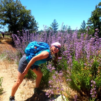

[ Trailhead ] -- Redbox Picnic Area -- From there, cross the street, making a slight right onto the white gravel/sand trail -- National Forest Service Adventure Pass Required ($5 per day or $30 for the year) [ Difficulty ] -- 6.5 ( what does this actually even mean though ) -- 7 miles round trip -- approx 2000 feet elevation gain [ Duration ] -- 3 hours round trip [ Size ] -- 4 guys, 1 girl [ Pack ] -- Trail Runners -- Carried 3 liters of water and light snacks -- Drank 1.5 liters round trip (the others drank 0.5 to 1.5 liters) [ Season ] -- Fall 2016 This is a great hike for those new to day hiking and want to challenge themselves. The hike is very gradual for the first 2.0 miles and all your elevation gain is on the saddle in the summit ascent. Very doable with great views of Mt. Wilson, Downtown LA, and the islands on a clear day! read more


5 years ago

9 years ago

6 years ago
hardest hike ever done! it's safe but this hike is moderate-difficult. had to climb rocks that were half my height, saw flying ants, snakes and countless of lizards. the hike teases you too (like muhahah you're there, sike, you're not there yet) as you have to cross many false peaks to get to this peak. going in july didn't help as it was scorching hot without shade. met a lot of people along the way who stopped midway and turned around. didn't think my friend and i'd make it to the top, but we did and it was v rewarding!!! if you want a good calf and buns workout kind of hike, this is it. read more


10 years ago
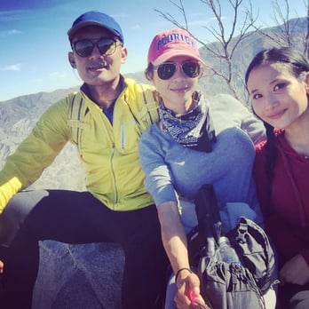
One of the best secluded mod-hard hikes in LA . It was forecasted that it would be scorching hot on 7/22/16, so we started our journey at around 0445 am, stopped and rested on the peak for an hour, back to the parking kot, at angeles crest highway by 1145. So roundtrip was 5 hours. I wouldnt recommend taking youngsters. Pack plenty of water, freeze them the night before, it will melt anyway and you will be happy to have ice cold agua. Bring battery PACKS for ur cell phone. Good hiking boots, hiking pole would help as well, and please pack ur self a nice hearty sandwhich. ....oh and download ALL TRAILS app!!! Trust me! You would thank me. read more



10 years ago

9 years ago
8 years ago
More info about Strawberry Peak
Strawberry Peak Reviews in Other Languages
Ask the Community - Strawberry Peak
How many miles to get to the top?
Is the sign for the elevation there I'm planning on going up on the 30 of June?
There is no elevation marker on there.
Review Highlights - Strawberry Peak
You might also consider















Strawberry Peak - hiking - Updated September 2026
Best of Los Angeles
People found Strawberry Peak by searching for…
Hiking Trails With Waterfalls in Los Angeles, CA
Flower Field in Los Angeles, CA
Secluded Spots in Los Angeles, CA
Make Out Spot in Los Angeles, CA
Meteor Shower in Los Angeles, CA
Gold Panning in Los Angeles, CA
Mountain Bike Trails in Los Angeles, CA
Sunrise View in Los Angeles, CA
National Parks in Los Angeles, CA
Dog Friendly Hiking Trails in Los Angeles, CA
Sunrise Hike in Los Angeles, CA
White Water Rafting in Los Angeles, CA
Waterfalls and Swimming Holes in Los Angeles, CA
Picnic Areas BBQ Pits in Los Angeles, CA
Redwood Trees in Los Angeles, CA
Beach Hiking Trails in Los Angeles, CA
Fall Colors in Los Angeles, CA
Hiking Club in Los Angeles, CA
Trending Searches in Los Angeles, CA
Apple Orchards near Strawberry Peak
Apple Picking near Strawberry Peak
Beautiful Views near Strawberry Peak
Bike Shop near Strawberry Peak
Bird Sanctuary near Strawberry Peak
Cliff Jumping near Strawberry Peak
Consignment Shops near Strawberry Peak
Cruising Spots near Strawberry Peak
Dog Friendly Things To Do near Strawberry Peak
Dog Friendly Trails near Strawberry Peak
Ear Piercing near Strawberry Peak
Eyebrow Threading near Strawberry Peak
Flower Fields near Strawberry Peak
Free Picnic Areas near Strawberry Peak
Hair Braiding near Strawberry Peak
Kids Haircut near Strawberry Peak
Lookout Points near Strawberry Peak
Mens Haircut near Strawberry Peak
Nature Trails near Strawberry Peak
Night Hike near Strawberry Peak
Off Road Trails near Strawberry Peak
Outdoor Activities near Strawberry Peak
Picnic Areas near Strawberry Peak
Picnic Spots near Strawberry Peak
Preschools near Strawberry Peak
Public Golf Courses near Strawberry Peak
River Swimming near Strawberry Peak
Rock Quarry near Strawberry Peak
Running Trails near Strawberry Peak
Scenic Night View near Strawberry Peak
Scenic Overlook near Strawberry Peak
Sunrise View near Strawberry Peak
Swimming Holes near Strawberry Peak
Trading Card Shops near Strawberry Peak
Used Furniture Stores near Strawberry Peak
Watch Sunset near Strawberry Peak
Browse Nearby
Browse Brands
Related Searches in Los Angeles, CA
Affordable Bike Repair Services in Los Angeles, California
Affordable Bike Tune Up Services in Los Angeles, California
Affordable Cheap Bike Tune Up Services in Los Angeles, California
Affordable Kayak Rental Services in Los Angeles, California
Best Dirt Bike Riding Spots in Los Angeles, California
Best Dog Hiking Trails Around Los Angeles, California
Best Electric Bike Rental Services in Los Angeles, California
Best Fishing Locations and Guides in Los Angeles, California
Best Nature Trails for Hiking in Los Angeles, California
Best Places for Horseback Riding in Los Angeles, California
Best Sledding Spots and Fun in Los Angeles, California
Check Out Off Road Trails in Los Angeles, California
Convenient Bike Sharing Programs in Los Angeles, California
Discover Dog Friendly Trails to Explore in Los Angeles, California
Discover Easy Hiking Trails Near Los Angeles, California
Discover Kid Friendly Hiking Trails in Los Angeles, California
Discover Popular Bike Tours in Los Angeles, California
Discover Popular Bike Trails in Los Angeles, California
Discover Scenic Bike Paths in Los Angeles, California
Discover Scenic Mountain Bike Trails Near Los Angeles, California
Discover Walking Parks in Los Angeles, California Near You
Discover a Hiking Trail in Los Angeles, California
Discover the Best Night Hike Trails in Los Angeles, California
Dog-Friendly Hikes With Dogs in Los Angeles, California
Enjoy Biking Adventures Around Los Angeles, California
Enjoy Camping Adventures Around Los Angeles, California
Enjoy Hiking Adventures in Los Angeles, California
Enjoy Kayaking Adventures in Los Angeles, California
Enjoy Off Leash Dog Hikes in Los Angeles, California
Enjoy Scenic Dirt Bike Trails Around Los Angeles, California
Enjoy Scenic Places to Walk in Los Angeles, California
Enjoy Tent Camping Spots Around Los Angeles, California
Enjoy a Beautiful Waterfall Hike in Los Angeles, California
Enjoy the Best Walking Path in Los Angeles, California
Enjoy the Best Walking Trails in Los Angeles, California
Exciting Snow Tubing Experiences in Los Angeles, California
Explore BMX Bike Shops Near Los Angeles, California
Explore Beautiful Parks and Green Spaces in Los Angeles, California
Explore Bike Rentals Throughout Los Angeles, California
Explore Cycling Stores in Los Angeles, California
Explore Easy Hikes Perfect for All in Los Angeles, California
Explore Electric Bikes Available in Los Angeles, California
Explore Fun Activities to Do in Los Angeles, California
Explore Popular Campgrounds Near Los Angeles, California
Explore Popular Dog Walking Trails in Los Angeles, California
Explore Popular Scenic Views Near Los Angeles, California


