
The Flume Trail Photos


You might also consider


More like The Flume Trail
Recommended Reviews - The Flume Trail
Start your review...


Reviews With Photos


Dog Owner Perspective Yes, this leads to Monkey Head Rock!!l PET FRIENDLY We did this trail twice. Once it was during Veteran Day holiday ( Nov) and the second time was July 4th weekend. What a different! I did not remember that it was strenuous. Apparently, the weather played a big part. It was really enjoyable back in Nov when the temperature was cooler. It was really hot and 1000X tougher in July. My Kokiatso was panting hard. We were hiking with new companies, so, I had to maintain a lady like image. But, whenever they did not see, I panted along with Kokiatso. Once you passed the "entrance fee box", watch out for a trail forks. To your left and really steep wass basically the short cut. If you take the right fork, get ready for slow and painful incline. We did the shortcut back in November and it was fine. We had 2 younger kids this July so, we went with the long way. It's about 1/2 a mile difference. Either way, once you see a very long log and rocks formation to you left, turn left and climb the hill (use google map if you have never been there). Kokiatso is off leashed trained, so, I was comfortable letting her walked on her own. Be prepared with water and feed it to your dog a little bit a time.


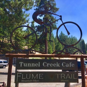
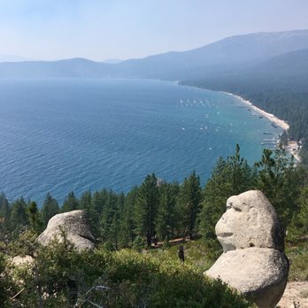
We went to the Monkey Rock (near Flume Trail or is part of the Flume Trail? I don't know). Start from the left side of Tunnel Creek Café, walk up the road, then along a dirt path (parallel to the Tahoe East Shore walking path), after around 12-15 minutes, it will fork off to two paths (left side is steeper but still easy, right side has one longer switchback), then the peak is on the top. Monkey Rock is off to the right side (if you are facing the Lake).
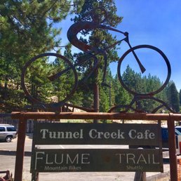

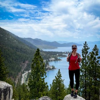
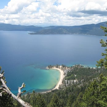
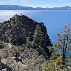
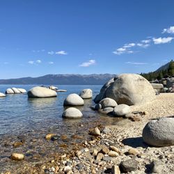
Flume Trail. Probably one of my most favorite hikes yet. It was very smokey when we started the hike, but the skies cleared up as we were making our way back. *Note* This review will also double as a brief instruction guide to Monkey Rock. As with many landmarks I believe a good portion of the experience is the adventure itself, followed by the reward of reaching that landmark! Certain landmarks shouldn't be geotagged, and that's my personal belief. Now, your starting point should be Tunnel Creek Cafe. The path itself is pretty linear; you'll pass a small shop where you can rent mountain bikes and eventually a self-pay toll to help maintain the hiking trail(s). I advise to just enjoy the views. Bikers will be occasionally passing by from both directions so just be weary of them. While looking out, the smoke was pretty heavy and Lake Tahoe looked more like an ocean without the mountain lines. Eventually the path will split. The most leftward path is known as "Death Hill". Don't let the name deter you; it is steep, but not too difficult. Take it from a guy that is out of shape. If hills aren't your thing, the right path is a more mellow choice. Both will eventually meet up to continue the trail. At this point, this is where the adventure really began for my room mate and I. We were only using Google images of Monkey Rock to see where it could be. I'll continue the guide, but in a nutshell, my room mate and I continued on the trail only to backtrack because we went too far. If Monkey Rock isn't your destination, continue onward on this trail for more spectacular views of the mountainsides that overlook the lake. Continuing with the guide, once Death Hill and the right path meet up, you will want to immediately venture off the path to the left. The instructions will become a bit vague, but use some Google Images to make the most sense of where Monkey Rock should be. You'll want to venture to a point where Monkey Rock will have a clearing that overlooks a cove/beach without any trees obstructing its view. You'll reach a couple of giant rock structures (I will provide pictures), and Monkey Rock should be to the right! Congratulations! You have found Monkey Rock! Take this time to enjoy Lake Tahoe. This should one of the clearest points since it overlooks the tree line. With our mission a success, we headed back down from where we came and we noticed that the skies had cleared up a bit! As I mentioned before, Flume Trail has become one of my most favorite hikes. The adventure of locating Monkey Rock was very rewarding. The views we experienced were breathtaking even with the smoke. The best part? There is the Tunnel Creek Cafe waiting for you at the bottom if you worked up an appetite or need some refreshments! Whether you're trying to find Monkey Rock yourself or wanting a beautiful adventure to experience, I highly recommend Flume Trail!
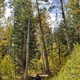

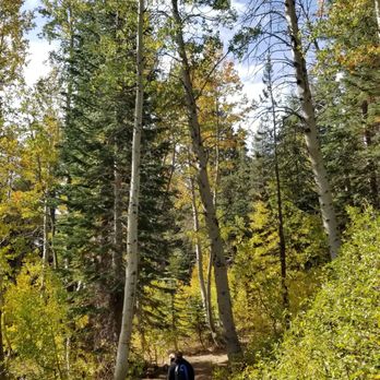
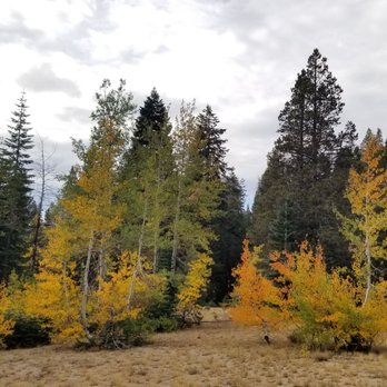
Looking to do some leaf peeping and get a hike in, my husband and I accomplished our mission possible today here at Incline Flume Trail. It's basically a flat trek that is very popular with mountain bikers as well as trail runners. There are narrow spots so be prepared to move to the side to let the bikers through. Gorgeous fall colors right now with the trees and you get views of Lake Tahoe, too. The trail goes for miles so you can just turn around whenever you've had your fill of nature. Leave no trace!


Epic. The tool would not let me post with a single word review so I am writing this filler. Nothing more to say than EPIC. See photos if that helps.


I can't describe the high I got at the top of the trail. When I got to Monkey Rock, I felt liberation as the world shelters in place. Swinging above Tahoe has to be one of the best feelings to date. The incline to get to the top had me gasping for air and a water break a few times, but it was worth every step. Ended up saving a dog on the way down and finishing with a mimosa at the cafe. If you are in Tahoe and want to feed your soul with a hike that all walks of life and shape can do, take your time and embrace the beauty of this hike- you won't be sorry.


One of our favorite hikes in Tahoe. Parking is easy and metered, there is a great restaurant at the trail head but they do not sell water. They do have a fountain,though. Do not park in their lot, you will be towed. The trailhead is easy to find and the trail is clean and well maintained. There is a fee box about .5 miles in, bring cash and hold on to your receipt, rangers do randomly check. Two trails to the top and one is very steep, it's also a scramble and the first left up the mountain side. Definitely a great work out to the top. The other is more like switchbacks but both take about the same time, give or take. If you're going to see Monkey Rock, it's not clearly visible. From the steep trail, when you arrive to the dividers at the top, make a sharp left and take it to the end. Look to your right and then down. If you're taking the other trail, you'll come upon the dividers straight ahead , keep going straight and then same directions as above. The top is beautiful with views of the lake and the famous Monkey Rock. Bring a hat, water and wear sunscreen, there is no shade. Enjoy!


Start by going to Monkey Rock which is an approx 1 mile steep incline hike that will take 30 minutes one way. We went the 2nd week of August and got really lucky with the weather being in the 70s. Mid morning hike was kind of hot but still very pleasant. You will eventually run into trail forks: Left very steep short cut or if you have smaller children, take the right fork that will get you there 5-10 minutes later but less steep. Once you get to the top, you will find the monkey rock on the right side. On our return back down we did take the steep hill and it was very manageable. Instead of going all the way back to the parking lot to start the east shore bike trail to Hidden beach, you can find side trails that takes you there in 5-10 minutes. Enjoy the scenery and play in the water. For both hikes, we spent approx. 3 hours total.


I'm not one of those turbo-charged mountain bikers willing to risk life and limb to do the entire Flume Trail. But I am one of those people who love the Flume Trail starting at THE END of the trail at the Incline Village side. If you come before or after the Tunnel Creek Cafe is open / closed, you're allowed to park in their lot (I asked the owner). Then start walking the trail from here, even if you go for just 30 minutes or so - what a great hike at sunset with the dog! The views are spectacular, it's dog friendly (at the start of the trail, doggie bags are even provided so NO EXCUSES; please pick up your dog's poop and for the love of god, don't just bag it and leave it on the side of the trail). The first 30 minutes or so is pretty easy and then it starts to climb. If you are hiking not biking the trail, I suggest coming very early or late in the day to avoid getting run over. One of my favorite things is grabbing a hot chocolate at the cafe on a mild Sunday winter morning and heading up the trail with my dog. It's why you live in Tahoe, people!


We rode the Flume Trail starting from Spooner Lake (7,000 ft). Spooner Lake State Park is off Rt 28, which is off Rt 50 on Nevada side. You'll need to pay the park entrance fee, but you can park your car and use the facilities, go to Trail head store and so on. The park is quite nice. As other yelpers noted, first off there is about 4-5 miles grinding up hills to the Marlette Lake (7,823 ft). In the beginning it is a slow climb but from the mid point on, the climb was pretty steep. I totally felt the thin air as I am used to ride around the bay area. At Marlette lake you can rest or even fish there (NV fishing license required). Ride around the south side of the Marlette lake and you are off to the single trail, what everyone says the "scary" but beautiful scenery ride for about 4.5 miles. It was a really clear day so we were able to see the other side of Lake Tahoe. Very beautiful but it IS scary especially when you are passing fellow bikers on this skinny trail. Some up and downs on this section, but no grinding hills like the beginning of the trail. When you get to the Twin Lakes area, you can rest a little to get ready for the steep but enjoyable down hill. If you have some strength left, the trail up to the Twin Lakes is only couple miles. In about 3 miles you'll get to the end of the trail and out of the State park, suddenly to the residential area. Continue on down the paved road, and on the left side there is the Tunnel Creek shuttle pick up station where you can haul your bike and ride back to the Spooner Lake. I am not that experienced rider, but I was able to manage completing this trail with my husband who is very experienced with mountain biking. Some areas are technical, there are many spots where you need to be careful not to slip off the cliff or wipe out or slip off rocks and sand. If you are not too experienced rider I'd recommend to ride with someone who have more experiences. Or you can also hike this trail and find out if you want to ride or not. I really enjoyed this trail as it was challenging but there's this great reward of the scenic view of the Lake Tahoe. You can ride/hike backwards from the way we've rode this trail. Park off the street at the shuttle station on Rt 28 and end at the Spooner Lake. I am not sure about the shuttle service from Spooner Lake to the Creek Station though... I am not sure which way is better or easier, but this trail is worth trying at least once.
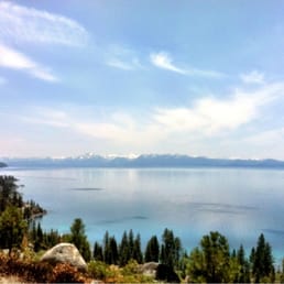

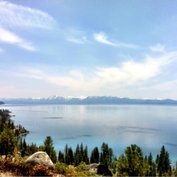
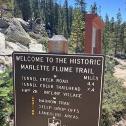
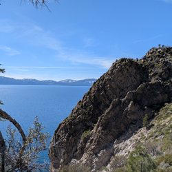
"This is beautiful..." I said, over... and over... and over again. If you got a penny for everytime I said the word "beautiful" while hiking this trail, you'd probably have at least $10. Pretty good if you ask me. HOW WE GOT THERE: We started the hike from Tunnel Creek Road in Incline Village. This is the opposite way that the bikers go. Set your Google maps GPS to Tunnel Creek Cafe. That's where the trail head is, and you can park your car along the freeway. THE TRAIL: For the first couple miles of the hike, you are actually going to be on Tunnel Creek Road, before you hit the actual Flume Trail. The trail is well-maintained, since this is a very popular mountain biking trail. There are some great vista spots on Tunnel Creek Road, but also constant incline, which may be difficult for your average out of shape joe. It will be a strenuous and great work out! We didn't even hike the whole flume trail; we went up slowly and steadily which took us about 3 and a half hours. We stopped at a random point (probably about 20-30 minutes after the start of the official Flume trail) and going back only took us about 1.5 hours. With that being said, watch out for super fast mountain bikers! I seriously admire their audacity, because there's definitely some sections of the trail that are super narrow, and just a wrong swivel of your tire can send you pummeling down the mountain. Just stand aside when you see/hear them coming in front of you, and everyone is always extremely cordial and grateful about it. If you're hiking the trail and not worried for your life, like I did, you can stop and enjoy the views. Oh my gosh... the views. are. breathtaking!! You can see the snow capped mountains in the distance, the beautiful and expansive Lake Tahoe with it's clear blue waters, and the dense, lush evergreens that will surround you. It was truly magical, and nothing on my camera captured the beauty that was on this trail. Bring water and some snacks for nourishment. This is hands down my favorite hiking trail of all time.


This review is for the Marlette Lake hiking trail. I parked at the Lake Tahoe-Nevada State Park - http://parks.nv.gov/parks/marlette-hobart-backcountry/. Parking was $10. Once there, you can do Spooner Lake or the Marlette Lake Trail or others. We did Marlette Lake hiking trail from the parking lot. It is about 5 miles each way. The trail itself is very smooth and well maintained, however be ready for some steady incline, nothing crazy but it definitely will work you out. It took us about 4 hours round trip with a steady pace, If you are a fast walker I would give it 3 hours. We made the mistake of not packing a lunch, pack a lunch and picnic when you get to the lake, you wont regret it. I posted some photos of the trail and the lake. Happy Hiking!

When you're brave enough to take on the strenuous 13 mile Flume Biking Trail, there will be two questions that will interchange in your mind. 1) Why did I agree to do this? 2) Is there anything more beautiful? The first 5 miles will be a steep, uphill battle with your body and mind. Your calves will burn, your lungs will shred, and every cell in your body will scream for oxygen. If you could make it past that, the majority of the ride will be downhill and ridiculously fun. My tips: 1)Rent your bikes at Spooner Summit for they're most affordable. 2)Conserve your water 3)Bring snacks, energy bars 4)Wear a hat 5)Bring sunscreen and sunglasses 6) Bring a camera because those views overlooking the lake and mountain are second to none 7) Biking along the mountain ledges is exciting, but can be frightening too since bikers are going in opposite ways 8) When you approach gravel or sand, SLOW DOWN. They can dangerously lead your bike off course and make you crash 9)Bring $10 cash to park your car 10) Be careful when you stop to take pictures. Bikers are behind you. ---- Conclusion: This trail is NOT for beginners. I couldn't help but feel some resentment towards the employees at Spooner Bike Rentals for saying that this trail could be done by anyone. I consider myself a fit male too and struggled mightily. My group and I finished in 4 hours. It'll require effort, persistence, and determination to complete, but once you get past the worst of it (5-6 miles in), You'll then be rewarded with some grandiose views that are awe-inspiring and gorgeous. I LOVED the downhill rides too--they were exhilarating. There are also premium spots for pictures, but be mindful of bikers behind you. Extra Notes: -Make sure to bring some snacks! -Shuttle is clean and offers water -I spotted one restroom on the trail and it was disgustingly filthy, beware.


This is a pretty good hike for everyone. I think it was rated moderate. It's just a short drive from State Line and there's signs as you get closer. Parking is ample and was $14 for 3-4 hours. The views are great once you get to the top. read more


6 years ago
Wow! That is all I can say. It was a fabulous bike ride and the views are incredible. A few words of caution. First, don't be fooled by the claim this is an easy trail. It's easy if you bike every week and spend some of that time climbing. The climb is difficult but totally worth the effort. We rented bikes at the flume store and made the mistake of not getting electric assist. Regardless, they were super helpful and totally worth the price of entry. Would I do it again? Yes, I'm fact I am thinking of getting an e-assist bike. Take a camera, water, and plan on a great time! Also, they provide a ride to the trail head which is convenient. The trail ends behind the shop and you are at your car. This makes finding parking an easy option! read more
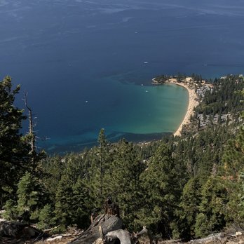

One of the most breathtaking and rewarding hikes I've been on to date! Park at the Tunnel Creek Cafe, get a bite to eat and drink, then get on your merry way! Start your hike behind the cafe and follow the trail! It's easy! Can't recall an easier hike than this?! The trail is an easy ascend for about a mile but we were only looking for the monkey statue. Once you get there, you have the most beautiful views of the lake! We hiked about three miles RT and it was worth the climb to get to see the monkey head! read more

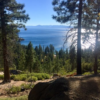


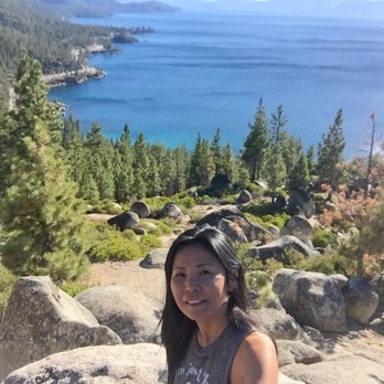

Dog Owner Perspective Yes, this leads to Monkey Head Rock!!l PET FRIENDLY We did this trail twice. Once it was during Veteran Day holiday ( Nov) and the second time was July 4th weekend. What a different! I did not remember that it was strenuous. Apparently, the weather played a big part. It was really enjoyable back in Nov when the temperature was cooler. It was really hot and 1000X tougher in July. My Kokiatso was panting hard. We were hiking with new companies, so, I had to maintain a lady like image. But, whenever they did not see, I panted along with Kokiatso. Once you passed the "entrance fee box", watch out for a trail forks. To your left and really steep wass basically the short cut. If you take the right fork, get ready for slow and painful incline. We did the shortcut back in November and it was fine. We had 2 younger kids this July so, we went with the long way. It's about 1/2 a mile difference. Either way, once you see a very long log and rocks formation to you left, turn left and climb the hill (use google map if you have never been there). Kokiatso is off leashed trained, so, I was comfortable letting her walked on her own. Be prepared with water and feed it to your dog a little bit a time. read more


4 years ago
We went to the Monkey Rock (near Flume Trail or is part of the Flume Trail? I don't know). Start from the left side of Tunnel Creek Café, walk up the road, then along a dirt path (parallel to the Tahoe East Shore walking path), after around 12-15 minutes, it will fork off to two paths (left side is steeper but still easy, right side has one longer switchback), then the peak is on the top. Monkey Rock is off to the right side (if you are facing the Lake). read more


Flume Trail. Probably one of my most favorite hikes yet. It was very smokey when we started the hike, but the skies cleared up as we were making our way back. *Note* This review will also double as a brief instruction guide to Monkey Rock. As with many landmarks I believe a good portion of the experience is the adventure itself, followed by the reward of reaching that landmark! Certain landmarks shouldn't be geotagged, and that's my personal belief. Now, your starting point should be Tunnel Creek Cafe. The path itself is pretty linear; you'll pass a small shop where you can rent mountain bikes and eventually a self-pay toll to help maintain the hiking trail(s). I advise to just enjoy the views. Bikers will be occasionally passing by from both directions so just be weary of them. While looking out, the smoke was pretty heavy and Lake Tahoe looked more like an ocean without the mountain lines. Eventually the path will split. The most leftward path is known as "Death Hill". Don't let the name deter you; it is steep, but not too difficult. Take it from a guy that is out of shape. If hills aren't your thing, the right path is a more mellow choice. Both will eventually meet up to continue the trail. At this point, this is where the adventure really began for my room mate and I. We were only using Google images of Monkey Rock to see where it could be. I'll continue the guide, but in a nutshell, my room mate and I continued on the trail only to backtrack because we went too far. If Monkey Rock isn't your destination, continue onward on this trail for more spectacular views of the mountainsides that overlook the lake. Continuing with the guide, once Death Hill and the right path meet up, you will want to immediately venture off the path to the left. The instructions will become a bit vague, but use some Google Images to make the most sense of where Monkey Rock should be. You'll want to venture to a point where Monkey Rock will have a clearing that overlooks a cove/beach without any trees obstructing its view. You'll reach a couple of giant rock structures (I will provide pictures), and Monkey Rock should be to the right! Congratulations! You have found Monkey Rock! Take this time to enjoy Lake Tahoe. This should one of the clearest points since it overlooks the tree line. With our mission a success, we headed back down from where we came and we noticed that the skies had cleared up a bit! As I mentioned before, Flume Trail has become one of my most favorite hikes. The adventure of locating Monkey Rock was very rewarding. The views we experienced were breathtaking even with the smoke. The best part? There is the Tunnel Creek Cafe waiting for you at the bottom if you worked up an appetite or need some refreshments! Whether you're trying to find Monkey Rock yourself or wanting a beautiful adventure to experience, I highly recommend Flume Trail! read more




Looking to do some leaf peeping and get a hike in, my husband and I accomplished our mission possible today here at Incline Flume Trail. It's basically a flat trek that is very popular with mountain bikers as well as trail runners. There are narrow spots so be prepared to move to the side to let the bikers through. Gorgeous fall colors right now with the trees and you get views of Lake Tahoe, too. The trail goes for miles so you can just turn around whenever you've had your fill of nature. Leave no trace! read more


2 years ago


6 years ago
I can't describe the high I got at the top of the trail. When I got to Monkey Rock, I felt liberation as the world shelters in place. Swinging above Tahoe has to be one of the best feelings to date. The incline to get to the top had me gasping for air and a water break a few times, but it was worth every step. Ended up saving a dog on the way down and finishing with a mimosa at the cafe. If you are in Tahoe and want to feed your soul with a hike that all walks of life and shape can do, take your time and embrace the beauty of this hike- you won't be sorry. read more


One of our favorite hikes in Tahoe. Parking is easy and metered, there is a great restaurant at the trail head but they do not sell water. They do have a fountain,though. Do not park in their lot, you will be towed. The trailhead is easy to find and the trail is clean and well maintained. There is a fee box about .5 miles in, bring cash and hold on to your receipt, rangers do randomly check. Two trails to the top and one is very steep, it's also a scramble and the first left up the mountain side. Definitely a great work out to the top. The other is more like switchbacks but both take about the same time, give or take. If you're going to see Monkey Rock, it's not clearly visible. From the steep trail, when you arrive to the dividers at the top, make a sharp left and take it to the end. Look to your right and then down. If you're taking the other trail, you'll come upon the dividers straight ahead , keep going straight and then same directions as above. The top is beautiful with views of the lake and the famous Monkey Rock. Bring a hat, water and wear sunscreen, there is no shade. Enjoy! read more


Start by going to Monkey Rock which is an approx 1 mile steep incline hike that will take 30 minutes one way. We went the 2nd week of August and got really lucky with the weather being in the 70s. Mid morning hike was kind of hot but still very pleasant. You will eventually run into trail forks: Left very steep short cut or if you have smaller children, take the right fork that will get you there 5-10 minutes later but less steep. Once you get to the top, you will find the monkey rock on the right side. On our return back down we did take the steep hill and it was very manageable. Instead of going all the way back to the parking lot to start the east shore bike trail to Hidden beach, you can find side trails that takes you there in 5-10 minutes. Enjoy the scenery and play in the water. For both hikes, we spent approx. 3 hours total. read more


I'm not one of those turbo-charged mountain bikers willing to risk life and limb to do the entire Flume Trail. But I am one of those people who love the Flume Trail starting at THE END of the trail at the Incline Village side. If you come before or after the Tunnel Creek Cafe is open / closed, you're allowed to park in their lot (I asked the owner). Then start walking the trail from here, even if you go for just 30 minutes or so - what a great hike at sunset with the dog! The views are spectacular, it's dog friendly (at the start of the trail, doggie bags are even provided so NO EXCUSES; please pick up your dog's poop and for the love of god, don't just bag it and leave it on the side of the trail). The first 30 minutes or so is pretty easy and then it starts to climb. If you are hiking not biking the trail, I suggest coming very early or late in the day to avoid getting run over. One of my favorite things is grabbing a hot chocolate at the cafe on a mild Sunday winter morning and heading up the trail with my dog. It's why you live in Tahoe, people! read more


We rode the Flume Trail starting from Spooner Lake (7,000 ft). Spooner Lake State Park is off Rt 28, which is off Rt 50 on Nevada side. You'll need to pay the park entrance fee, but you can park your car and use the facilities, go to Trail head store and so on. The park is quite nice. As other yelpers noted, first off there is about 4-5 miles grinding up hills to the Marlette Lake (7,823 ft). In the beginning it is a slow climb but from the mid point on, the climb was pretty steep. I totally felt the thin air as I am used to ride around the bay area. At Marlette lake you can rest or even fish there (NV fishing license required). Ride around the south side of the Marlette lake and you are off to the single trail, what everyone says the "scary" but beautiful scenery ride for about 4.5 miles. It was a really clear day so we were able to see the other side of Lake Tahoe. Very beautiful but it IS scary especially when you are passing fellow bikers on this skinny trail. Some up and downs on this section, but no grinding hills like the beginning of the trail. When you get to the Twin Lakes area, you can rest a little to get ready for the steep but enjoyable down hill. If you have some strength left, the trail up to the Twin Lakes is only couple miles. In about 3 miles you'll get to the end of the trail and out of the State park, suddenly to the residential area. Continue on down the paved road, and on the left side there is the Tunnel Creek shuttle pick up station where you can haul your bike and ride back to the Spooner Lake. I am not that experienced rider, but I was able to manage completing this trail with my husband who is very experienced with mountain biking. Some areas are technical, there are many spots where you need to be careful not to slip off the cliff or wipe out or slip off rocks and sand. If you are not too experienced rider I'd recommend to ride with someone who have more experiences. Or you can also hike this trail and find out if you want to ride or not. I really enjoyed this trail as it was challenging but there's this great reward of the scenic view of the Lake Tahoe. You can ride/hike backwards from the way we've rode this trail. Park off the street at the shuttle station on Rt 28 and end at the Spooner Lake. I am not sure about the shuttle service from Spooner Lake to the Creek Station though... I am not sure which way is better or easier, but this trail is worth trying at least once. read more




12 years ago
"This is beautiful..." I said, over... and over... and over again. If you got a penny for everytime I said the word "beautiful" while hiking this trail, you'd probably have at least $10. Pretty good if you ask me. HOW WE GOT THERE: We started the hike from Tunnel Creek Road in Incline Village. This is the opposite way that the bikers go. Set your Google maps GPS to Tunnel Creek Cafe. That's where the trail head is, and you can park your car along the freeway. THE TRAIL: For the first couple miles of the hike, you are actually going to be on Tunnel Creek Road, before you hit the actual Flume Trail. The trail is well-maintained, since this is a very popular mountain biking trail. There are some great vista spots on Tunnel Creek Road, but also constant incline, which may be difficult for your average out of shape joe. It will be a strenuous and great work out! We didn't even hike the whole flume trail; we went up slowly and steadily which took us about 3 and a half hours. We stopped at a random point (probably about 20-30 minutes after the start of the official Flume trail) and going back only took us about 1.5 hours. With that being said, watch out for super fast mountain bikers! I seriously admire their audacity, because there's definitely some sections of the trail that are super narrow, and just a wrong swivel of your tire can send you pummeling down the mountain. Just stand aside when you see/hear them coming in front of you, and everyone is always extremely cordial and grateful about it. If you're hiking the trail and not worried for your life, like I did, you can stop and enjoy the views. Oh my gosh... the views. are. breathtaking!! You can see the snow capped mountains in the distance, the beautiful and expansive Lake Tahoe with it's clear blue waters, and the dense, lush evergreens that will surround you. It was truly magical, and nothing on my camera captured the beauty that was on this trail. Bring water and some snacks for nourishment. This is hands down my favorite hiking trail of all time. read more

This review is for the Marlette Lake hiking trail. I parked at the Lake Tahoe-Nevada State Park - http://parks.nv.gov/parks/marlette-hobart-backcountry/. Parking was $10. Once there, you can do Spooner Lake or the Marlette Lake Trail or others. We did Marlette Lake hiking trail from the parking lot. It is about 5 miles each way. The trail itself is very smooth and well maintained, however be ready for some steady incline, nothing crazy but it definitely will work you out. It took us about 4 hours round trip with a steady pace, If you are a fast walker I would give it 3 hours. We made the mistake of not packing a lunch, pack a lunch and picnic when you get to the lake, you wont regret it. I posted some photos of the trail and the lake. Happy Hiking! read more


When you're brave enough to take on the strenuous 13 mile Flume Biking Trail, there will be two questions that will interchange in your mind. 1) Why did I agree to do this? 2) Is there anything more beautiful? The first 5 miles will be a steep, uphill battle with your body and mind. Your calves will burn, your lungs will shred, and every cell in your body will scream for oxygen. If you could make it past that, the majority of the ride will be downhill and ridiculously fun. My tips: 1)Rent your bikes at Spooner Summit for they're most affordable. 2)Conserve your water 3)Bring snacks, energy bars 4)Wear a hat 5)Bring sunscreen and sunglasses 6) Bring a camera because those views overlooking the lake and mountain are second to none 7) Biking along the mountain ledges is exciting, but can be frightening too since bikers are going in opposite ways 8) When you approach gravel or sand, SLOW DOWN. They can dangerously lead your bike off course and make you crash 9)Bring $10 cash to park your car 10) Be careful when you stop to take pictures. Bikers are behind you. ---- Conclusion: This trail is NOT for beginners. I couldn't help but feel some resentment towards the employees at Spooner Bike Rentals for saying that this trail could be done by anyone. I consider myself a fit male too and struggled mightily. My group and I finished in 4 hours. It'll require effort, persistence, and determination to complete, but once you get past the worst of it (5-6 miles in), You'll then be rewarded with some grandiose views that are awe-inspiring and gorgeous. I LOVED the downhill rides too--they were exhilarating. There are also premium spots for pictures, but be mindful of bikers behind you. Extra Notes: -Make sure to bring some snacks! -Shuttle is clean and offers water -I spotted one restroom on the trail and it was disgustingly filthy, beware. read more


17 years ago


14 years ago

11 years ago
Awesome trail with views to die for once the trail gets Lake front. I opted to hike instead of MTB, the entrance is right next to the tunnel Creek cafe. Most of the incline is on this road, according to my elevation app, the gain was around 1500' till you hit flume trail. I can't imagine how hard it would be to bike up tunnel Creek road. Flume trail is pretty much flat but super narrow in some places and if you're hiking always look behind you to let bikers pass through. The views of sand harbor is awesome from up there. read more


15 years ago

6 years ago
5 years ago

13 years ago
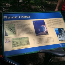
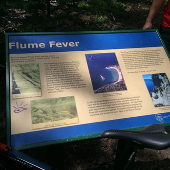
We hiked what I believe is the flume trail. But we didn't start in Glenbrook. We started at the tunnel creek cafe. This was one of the best hikes of my life! I've done many spectacular hikes all around the world. But this was by far one of the best. The hike was both challenging and rewarding with amazing views! We hiked about 3 miles each way. The way up was very challenging and steep! With look out stops along the way about every 1/8th to 1/4th mile. We saw some amazing views of the lake and mountains, beautiful tall pines, cedars, etc. and some beautiful manzanitas and some awesome huge boulders. My favorite part of the hike was seeing the Bigfoot rock. And my second favorite part was when we got up near the top where the trail was covered in snow. Because there were no more people on the trail and it felt like we had the whole world to ourselves!!! We came across an awesome sign that explained why it's called the flume trail. I really enjoyed this informative sign. It took us 2 hrs to hike up and only an hour to hike back. I am looking forward to doing more hikes around the Tahoe area!!! read more


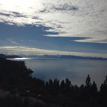


18 years ago

17 years ago

18 years ago

17 years ago
What can you say about this breathtakingly beautiful ride except that it's so worth the hard labor climbing from Spooner Lake to reach Marlette Lake! You will take in all the beauty of a pristine alpine lake and then enjoy the fun and exhilarating ride that awaits you as cruise down the single track of The Flume Trail that sits on the cliff overlooking the most beautiful views of Lake Tahoe. The trail by itself is very beautiful, boulders and evergreens surrounding you, even without the views of the lake. I would suggest you be careful on this trail as there are sandy patches in very precarious sections. A hard climb but then a goldmine of a ride! read more


12 years ago
This time around, the trail condition was optimum due to recent rain. The sandy section back to the cafe felt like concrete and climbing it going south to spooner was easier than my first time. May 24, 1015 read more
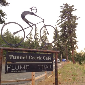

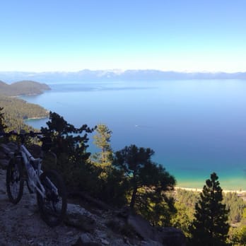


13 years ago

15 years ago

13 years ago
14 years ago

13 years ago
7 years ago
12 years ago
11 years ago
This is a gorgeous trail hiking or biking. I have biked this trail numerous times as I use to live in South Lake Tahoe. For Mt. Biking it IS a fairly long tough uphill start either direction unless you ride hills often. From Spooner Lake it is about 4 miles of 1000' of climbing, steepest the last 1/2 mile or 3 miles from Tunnel Creek Cafe climbing 1500'. BUT, the best and my favorite ride is to take the shuttle from Tunnel Creek Cafe in the morning to Tahoe Meadows near Mt. Rose, ride mostly downhill on the Tahoe Rim Trail(TRT), connect up to the Flume Trail, up towards Marlette lake, and either turn around and ride down Tunnel Creek or about a mile up hill to connect up to the somewhat steep Marlette Creek trail and finish on Hwy. 28 back to Tunnel Creek. The TRT Tahoe Meadows Trail is an intermediate MTB trail. It does have some 1-2 ft. rock drops but you can see them in plenty of time to dismount and walk if you want. I have done this on a hardtail mt. bike but it is much better with full suspension. Flume trail itself is a beginner's trail with 1 small section to walk due to a rock slide, and possibly another, skill-dependent, near Marlette Lake. It is narrow, has a steep dropoff to the lakeside, be careful--stop if you want to gawk. I would allow 4 to 8 hours for plenty of sightseeing and maybe lunch to do TRT through Flume and back to Tunnel Creek Cafe. You can get a great lunch and/or a cold beer if you want at the cafe. Lookup Flume Trail Bikes for all the shuttle and trail info, they rent some very nice, well maintained mountain bikes! read more


More info about The Flume Trail
Glenbrook, NV 89413
Directions
(775) 298-2501
Call Now
Visit Website
http://theflumetrail.com
Hours
Outdoor Amenities
Ask the Community - The Flume Trail
Review Highlights - The Flume Trail
You might also consider

















The Flume Trail - bikerentals - Updated September 2026
Best of Glenbrook
People found The Flume Trail by searching for…
Hiking Trails in Glenbrook, NV
Free Snow Play in Glenbrook, NV
Scenic Overlook in Glenbrook, NV
Places to Take Pictures in Glenbrook, NV
Mountain Biking in Glenbrook, NV
Running Trails in Glenbrook, NV
Dog Friendly Hiking Trails in Glenbrook, NV
Fishing Spots in Glenbrook, NV
Trending Searches in Glenbrook, NV
Apple Orchards near The Flume Trail
Apple Picking near The Flume Trail
Barbershop near The Flume Trail
Bike Shop near The Flume Trail
Bird Sanctuary near The Flume Trail
Cliff Jumping near The Flume Trail
Consignment Shops near The Flume Trail
Dog Friendly Things To Do near The Flume Trail
Dog Swimming near The Flume Trail
Ear Piercing near The Flume Trail
Eyebrow Threading near The Flume Trail
Eyelash Extensions near The Flume Trail
Furniture Stores near The Flume Trail
Kids Haircut near The Flume Trail
Lookout Points near The Flume Trail
Mattresses near The Flume Trail
Picnic Areas near The Flume Trail
Private Schools near The Flume Trail
Public Shower near The Flume Trail
Rock Quarry near The Flume Trail
Scenic Night View near The Flume Trail
Scenic Overlook near The Flume Trail
Star Gazing near The Flume Trail
Sunrise View near The Flume Trail
Browse Articles
Browse Nearby
BEST of Glenbrook, Nevada Restaurants near The Flume Trail
BEST of Glenbrook, Nevada Coffee near The Flume Trail
BEST of Glenbrook, Nevada Things to Do near The Flume Trail
BEST of Glenbrook, Nevada Breakfast near The Flume Trail
BEST of Glenbrook, Nevada Paddleboarding near The Flume Trail
BEST of Glenbrook, Nevada Airport Shuttles near The Flume Trail
BEST of Glenbrook, Nevada Horseback Riding near The Flume Trail
Browse Brands
Related Searches in Glenbrook, NV
Affordable Canoe Rental Options in Glenbrook, Nevada
Affordable Electric Bike Rentals in Glenbrook, Nevada
Affordable Electric Scooter Rental in Glenbrook, Nevada
Affordable Jet Ski Rental Options in Glenbrook, Nevada
Affordable Kayak Rental Services in Glenbrook, Nevada
Affordable Moped Rental Services in Glenbrook, Nevada
Affordable Motorcycle Rental Services in Glenbrook, Nevada
Affordable Paddle Board Rental in Glenbrook, Nevada
Affordable Road Bike Rental in Glenbrook, Nevada
Affordable Tandem Bike Rental in Glenbrook, Nevada
Best Dog Hiking Trails Around Glenbrook, Nevada
Best Ebike Stores and Rentals in Glenbrook, Nevada
Best Electric Bike Rental Services in Glenbrook, Nevada
Best Fishing Locations and Guides in Glenbrook, Nevada
Best Golf Cart Rentals Available in Glenbrook, Nevada
Best Places for Horseback Riding in Glenbrook, Nevada
Best Pontoon Boat Rentals Near Glenbrook, Nevada
Best Sightseeing Experiences Available in Glenbrook, Nevada
Best Ski Rental Deals and Shops in Glenbrook, Nevada
Best Snowboard Rental Services in Glenbrook, Nevada
Best Snowmobile Rental Deals Near Glenbrook, Nevada
Browse Used Bikes for Sale Around Glenbrook, Nevada
Check Out Off Road Trails in Glenbrook, Nevada
Dirt Bike Rental Services Available in Glenbrook, Nevada
Discover Dog Friendly Trails to Explore in Glenbrook, Nevada
Discover Easy Hiking Trails Near Glenbrook, Nevada
Discover Kid Friendly Hiking Trails in Glenbrook, Nevada
Discover Popular Bike Tours in Glenbrook, Nevada
Discover Popular Bike Trails in Glenbrook, Nevada
Discover Scenic Mountain Bike Trails Near Glenbrook, Nevada
Discover a Hiking Trail in Glenbrook, Nevada
Discover the Best Night Hike Trails in Glenbrook, Nevada
Dog-Friendly Hikes With Dogs in Glenbrook, Nevada
Easy Rent Bikes Rentals Available in Glenbrook, Nevada
Enjoy Biking Adventures Around Glenbrook, Nevada
Enjoy Camping Adventures Around Glenbrook, Nevada
Enjoy Kayaking Adventures in Glenbrook, Nevada
Enjoy Off Leash Dog Hikes in Glenbrook, Nevada
Enjoy Scenic Places to Walk in Glenbrook, Nevada
Enjoy Tent Camping Spots Around Glenbrook, Nevada
Enjoy a Beautiful Waterfall Hike in Glenbrook, Nevada
Enjoy the Best Picnic Spots and Ideas in Glenbrook, Nevada
Enjoy the Best Walking Path in Glenbrook, Nevada
Enjoy the Best Walking Trails in Glenbrook, Nevada
Experience Stunning Sunset Views in Glenbrook, Nevada
Explore Boat Rentals for Every Need in Glenbrook, Nevada
Explore Easy Hikes Perfect for All in Glenbrook, Nevada


