Thomas Rock Scenic Outlook Photos


You might also consider
More like Thomas Rock Scenic Outlook
Recommended Reviews - Thomas Rock Scenic Outlook
Start your review...

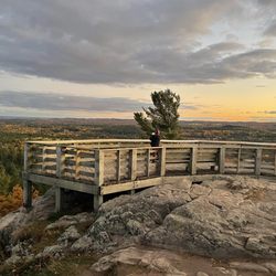
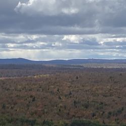
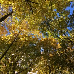
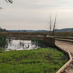
Not even a half mile loop (0.4 mi to be exact), this outlook is extremely friendly to all skill levels and a perfect place to stretch your legs, get a grant vantage point overlooking the Big Bay/Marquette, and a must-visit for when the fall foliage is at its peak in this area! Follow the signs and begin the loop on the left. The trail winds through forest and there will be a slight incline for a bit, but will soon even out, and you're basically at the peak at that point. The overlook area is well maintained, but basically fully exposed to the elements as you emerge from the trees, with railing and additional steps up to the top of the literal rock where you will be above most trees and you get a great view overlooking the bay. There are picnic tables at the top, so it's also a great place to have a little lunch or snack on a good day. Once you're ready to head down, continue to follow the path you took and the trail will soon begin its decline and before you know it, you're back in the parking lot where you started. There are cute little informational posts placed throughout the trail for you to read up on the wildlife and flora/fauna located on the trail. Total elevation gain on this trail is 50 feet, which I believe includes the steps up to the top of the rock, which is optional, but highly encouraged for the views. read more


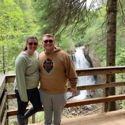
The trail is quick (I jogged the full loop while stopping for photos and viewing in about 10 minutes without shortcuts). There is a decent lookout, it reminded me of the mountain pass view by Copper Harbor, and if you run to the top of the stairs you will find a picnic table atop what I assume is Thomas' rock. There are some short, but sturdy, bridges and lots of flipping info signs all over the trail along with many chipmunks. I assume there are no bears there because the trash cans were all open tops. Yellow Dog falls are nearby also, but be prepared for an hour of dirt roads if you do that one. read more


5 years ago
More info about Thomas Rock Scenic Outlook
Thomas Rock Trl
Powell, MI 49808
Directions
Hours
Outdoor Amenities