Sugarloaf Mountain Scenic Overlook Photos
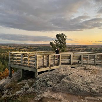



More like Sugarloaf Mountain Scenic Overlook
Recommended Reviews - Sugarloaf Mountain Scenic Overlook
Start your review...


Reviews With Photos


Beautiful hiking spot in the UP! The trails here are mountainous and challenging, definitely a more strenuous hike you'd want to be prepared for. I didn't have time to make it to the summit but hope to next time I visit. There are multiple parking lots and access points available. There is one 'developed' route and one undeveloped to get to the summit with. In the parking lot, there's a small sign with a map of the routes and background info on the trail. Beautiful spot for hiking, will definitely be back!


I was talking to a guy at my local dog park when he mentioned how amazing Marquette is because of Sugarloaf Mountain. We were already planning our trip for the UP, so we had to include this in our trip. Be prepared for a bit of a hike! There's a trail that you walk, and every now and then there is a set of stairs. The first two set of stairs has a long wooden walkway in between them. I counted a total of 15 sets of stairs, ranging in size. As you are walking, you will come up to a sign that has an easy route option. We tried to go that way but it seemed really confusing. All of the trees had blue ribbons on them. We decided to go up the stairs, and I am glad that we did. It lead to three different outlook sections. You could see everything. It was so beautiful and breathtaking. We had such a good time. I do have arthritis, and it was started to hurt from going up the stairs. Bring water and bug spray. A few people we ran into did not have bug spray, and they told us they were bit by a lot of mosquitos. We offered ours to them to use.


Could be a tough hike if you have mobility issues but beautiful and worth it! If you plan on going on a hot day bring water and be prepared to take breaks.
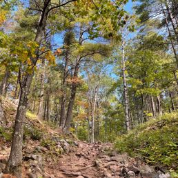

This was probably my favorite hike of my weekend in Marquette. It's only a bit outside of Marquette, I'd say max 15 minute drive, and is a good easy to moderate level short hike that is an easier option than the Hogback Mountain trail a few minutes up the road from here. It's definitely steep, around 200 feet of elevation (translates to about 20 flights of stairs), most of which is through climbing stairs, broke up with stretches of rocky uphill trails, so I'd say this isn't necessarily for all skill levels, but can definitely be doable even for beginners as long as you're willing and prepared with good shoes. I took my parents on this trail, who are older and don't do a lot of cardio, and they were definitely a bit sore the following day, but they still did it and the views at the top truly make it all worth it! There are two main ways you can do this mountain, there is a north and south parking lot. The south parking lot gets you a lot closer to the peak overlook, so if you want to mainly do the climb to the top and back down in the most efficient way, then park in the south parking lot and it's about half a mile at most to the top of Sugarloaf. If you want to do the loop trail, I'd recommend parking at the north parking lot - a smaller parking lot, but less trafficked because most park in the south one and only do the quick hike up to the top. From the north parking lot, you'd start the trail to the right, walk to the south parking lot area and join up with the trail here to the top. As you come down, you'll get to an intersection that directs you to an easy or difficult trail back down - both of these will take you back to the north parking lot and you'll complete your loop, which will ultimately total to about a mile and a half. Note: In general throughout the trail, anytime there is a set of stairs, which is often, especially if you're heading up and down from the overlook, the staircase is relatively narrow. While we're still in this pandemic and generally more aware of each individual's personal space, it's important to note that. I would say a lot of these stairs are narrow enough that I personally am not comfortable going on it when someone else is already on it coming towards me, rendering the staircases more one-way. No one is wearing a mask, which is to be expected, given that we're all outdoors, but with the high exertion, it does make me a bit nervous to know I'm breathing air directly expelled from people breathing hard in front of me and whatnot. With the stairs, it's not a big deal with them being one-way right now and people are very respectful of that. If someone sees you coming up the stairs, they'll often move to the side and wait for you to clear the stairs before heading down and vice versa. If anything, it allows you a little break to catch your breath before conquering another flight of stairs. But enough about the trail, let's discuss the OVERLOOK! In short, absolutely STUNNING! In long, this is one of the best overlooks I've ever been do. You can see a complete 360 from the top and the peak is so wide that there is so much room to walk around, different overlook balconies built in to give you different views and angles of the surrounding bay, and it's just absolutely wonderful! You can see all the way to Marquette, with Presque Isle Park and the NMU sports dome as prominent features, Hogback Mountain close by, and a long stretch of the Lake Superior shoreline. It's absolutely stunning and the vantage point is really second to none. Highly highly recommend Sugarloaf Mountain, especially on a good weather day! I hope you enjoy it as much as my family & I did! :)


Great hike for a beautiful view of the surrounding areas--would love to come back and see this in the fall!! My husband and I did the easy trail and we're glad we did. More than a hundred stairs and a slow incline make it challenging without being too difficult for city folks like us! The trail was clear and clean, and the view at the top absolutely worth the work! Plan an hour (more than enough time) and bring water! Also, there's no restroom here. It's easy to drive past this--and we did!--so Lee your eyes peeled!


This is a really nice hike, super close to town! It has a very nice upward grade from the start, so it's a great workout, and a perfect spot for some impromptu H.I.I.T. hill sprinting. You'll be alternating between catching your breath and breathtaking views : ) You can't top once you get to the top, and find your spot. If you're looking for good pictures, there's a lot. Once you're on top, there are quite a few lookouts, as well as a lot of opportunity for making your own lookout. The weather was perfect that day, but really cool how it would be perfectly calm one moment, then 30 mph winds the next. Incredible views all around, but especially towards the lake.


Great views and freedom to go on the rocks and really adventure around the area! My friend and I enjoyed climbing the rocks and going off the stairs in order to feel closer to nature and get som spectacular pictures! It's a quick walk and although the stairs were steep it's worth it for sure. Their were young kids loving the hike and seniors enjoying it as well! If you take it slow anyone can enjoy this beautiful scenery.


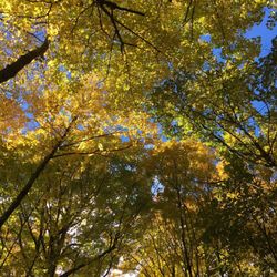
Great hike with easy and difficult paths to choose from and dog friendly trails. The views at the top are definitely worth the climb, which we have now made in three different seasons; Fall being our favorite. The parking lot is now paved so it's very nice and easily accessible from the main road (Hawley/Big Bay). Definitely bring a bottle of water with you and maybe even a light snack, as we sure needed it at the top. And for sure your camera or phone with a good camera if you've never been to the top. This is a lot easier to accomplish than Hog Back if you're short on time and energy. Even though it's marked "easy" the stairs can be steep and tiring at times, if you're not using to climbing several levels of stairs at a time or are recovering from a recent injury.


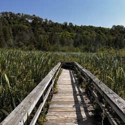
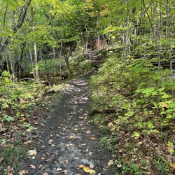
I occasionally travel to visit friends near Marquette, MI, usually in the fall. They're located right between Marquette and Big Bay, and we always try to make a day trip to explore while we're up there. One of those visits included a stop by Sugarloaf Mountain - which is about 1,000 ft tall and sits right alongside the Lake Superior shoreline just outside of Marquette. This was a great hike. We went up the difficult trail and down the easy one, just to see everything. Most of the hike up or down is in shaded woods, with mossy rock outcroppings all over the place. The undergrowth is lush and we saw a variety of small wildlife along our hike. Both trails do have some rock and tree roots sticking out of them, so regardless of which trail you take you will want to watch your step. In some areas they've built bridges to get over gullies, and in others you get a glimpse of the surrounding area through the trees. The whole time you can hear the water from the lake and the wind in the trees. It was lovely. We were pretty hot by the time we got to the summit. While this is a small mountain, the hike is steadily up, up, up. However, as you reach the top you rise above the canopy of the woods into an amazing 360 degree view for miles and miles. The breeze at the top was welcome, as were the observation decks and benches. We spent a decent amount of time at the top just enjoying the view around and down the mountainsides and out over the lake. The trip downhill was much faster, and taking a step back into the shady woods after our rest at the top was also very satisfying. Overall this was, for us, a short excursion that wasn't far from friends. It's definitely worth checking out if you're in the area.


As we are visiting Marquette for the very first time, it was mentioned that we really needed to go to the Lookout point at Sugarloaf so we ventured out here today on a Thursday morning hoping it wouldn't be too busy. It is a beautiful sunny day with a high expected of 74 by this afternoon so this morning's temperatures were perfect We ended up parking in the North parking lot in the ended up being a great spot because you had a nice level quiet walk in the woods before you hit your first left turn and the incline. So this is part of the easy hike, but it does contain about 300 steps all the way up to the top. If you park in the South parking lot, you can take the more difficult hike straight up the mountain and the stairs back down or whichever way you want to do it. All in all it was about 1 mile round-trip. read more




10 months ago
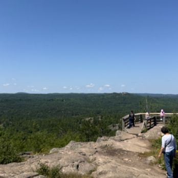
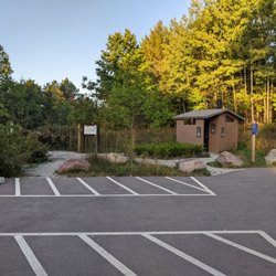
Such a great day! Easy to find, excellent free parking and pit toilet available. Choices on how strenuous you want to be on your way to the top. Gorgeous hike awaits! Walkable for all ages, enjoy canopies of trees, wooden stairs with handrails and informative signs along the way. Then you reach the top and it should take your breath away! So worth it! Various wood deck platforms, facing different directions provide safe viewing and unforgettable vistas! Trust me, it's special. read more



Beautiful hiking spot in the UP! The trails here are mountainous and challenging, definitely a more strenuous hike you'd want to be prepared for. I didn't have time to make it to the summit but hope to next time I visit. There are multiple parking lots and access points available. There is one 'developed' route and one undeveloped to get to the summit with. In the parking lot, there's a small sign with a map of the routes and background info on the trail. Beautiful spot for hiking, will definitely be back! read more


I was talking to a guy at my local dog park when he mentioned how amazing Marquette is because of Sugarloaf Mountain. We were already planning our trip for the UP, so we had to include this in our trip. Be prepared for a bit of a hike! There's a trail that you walk, and every now and then there is a set of stairs. The first two set of stairs has a long wooden walkway in between them. I counted a total of 15 sets of stairs, ranging in size. As you are walking, you will come up to a sign that has an easy route option. We tried to go that way but it seemed really confusing. All of the trees had blue ribbons on them. We decided to go up the stairs, and I am glad that we did. It lead to three different outlook sections. You could see everything. It was so beautiful and breathtaking. We had such a good time. I do have arthritis, and it was started to hurt from going up the stairs. Bring water and bug spray. A few people we ran into did not have bug spray, and they told us they were bit by a lot of mosquitos. We offered ours to them to use. read more


3 years ago
Could be a tough hike if you have mobility issues but beautiful and worth it! If you plan on going on a hot day bring water and be prepared to take breaks. read more


This was probably my favorite hike of my weekend in Marquette. It's only a bit outside of Marquette, I'd say max 15 minute drive, and is a good easy to moderate level short hike that is an easier option than the Hogback Mountain trail a few minutes up the road from here. It's definitely steep, around 200 feet of elevation (translates to about 20 flights of stairs), most of which is through climbing stairs, broke up with stretches of rocky uphill trails, so I'd say this isn't necessarily for all skill levels, but can definitely be doable even for beginners as long as you're willing and prepared with good shoes. I took my parents on this trail, who are older and don't do a lot of cardio, and they were definitely a bit sore the following day, but they still did it and the views at the top truly make it all worth it! There are two main ways you can do this mountain, there is a north and south parking lot. The south parking lot gets you a lot closer to the peak overlook, so if you want to mainly do the climb to the top and back down in the most efficient way, then park in the south parking lot and it's about half a mile at most to the top of Sugarloaf. If you want to do the loop trail, I'd recommend parking at the north parking lot - a smaller parking lot, but less trafficked because most park in the south one and only do the quick hike up to the top. From the north parking lot, you'd start the trail to the right, walk to the south parking lot area and join up with the trail here to the top. As you come down, you'll get to an intersection that directs you to an easy or difficult trail back down - both of these will take you back to the north parking lot and you'll complete your loop, which will ultimately total to about a mile and a half. Note: In general throughout the trail, anytime there is a set of stairs, which is often, especially if you're heading up and down from the overlook, the staircase is relatively narrow. While we're still in this pandemic and generally more aware of each individual's personal space, it's important to note that. I would say a lot of these stairs are narrow enough that I personally am not comfortable going on it when someone else is already on it coming towards me, rendering the staircases more one-way. No one is wearing a mask, which is to be expected, given that we're all outdoors, but with the high exertion, it does make me a bit nervous to know I'm breathing air directly expelled from people breathing hard in front of me and whatnot. With the stairs, it's not a big deal with them being one-way right now and people are very respectful of that. If someone sees you coming up the stairs, they'll often move to the side and wait for you to clear the stairs before heading down and vice versa. If anything, it allows you a little break to catch your breath before conquering another flight of stairs. But enough about the trail, let's discuss the OVERLOOK! In short, absolutely STUNNING! In long, this is one of the best overlooks I've ever been do. You can see a complete 360 from the top and the peak is so wide that there is so much room to walk around, different overlook balconies built in to give you different views and angles of the surrounding bay, and it's just absolutely wonderful! You can see all the way to Marquette, with Presque Isle Park and the NMU sports dome as prominent features, Hogback Mountain close by, and a long stretch of the Lake Superior shoreline. It's absolutely stunning and the vantage point is really second to none. Highly highly recommend Sugarloaf Mountain, especially on a good weather day! I hope you enjoy it as much as my family & I did! :) read more


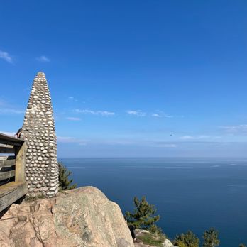


Great hike for a beautiful view of the surrounding areas--would love to come back and see this in the fall!! My husband and I did the easy trail and we're glad we did. More than a hundred stairs and a slow incline make it challenging without being too difficult for city folks like us! The trail was clear and clean, and the view at the top absolutely worth the work! Plan an hour (more than enough time) and bring water! Also, there's no restroom here. It's easy to drive past this--and we did!--so Lee your eyes peeled! read more


This is a really nice hike, super close to town! It has a very nice upward grade from the start, so it's a great workout, and a perfect spot for some impromptu H.I.I.T. hill sprinting. You'll be alternating between catching your breath and breathtaking views : ) You can't top once you get to the top, and find your spot. If you're looking for good pictures, there's a lot. Once you're on top, there are quite a few lookouts, as well as a lot of opportunity for making your own lookout. The weather was perfect that day, but really cool how it would be perfectly calm one moment, then 30 mph winds the next. Incredible views all around, but especially towards the lake. read more



7 years ago
Great views and freedom to go on the rocks and really adventure around the area! My friend and I enjoyed climbing the rocks and going off the stairs in order to feel closer to nature and get som spectacular pictures! It's a quick walk and although the stairs were steep it's worth it for sure. Their were young kids loving the hike and seniors enjoying it as well! If you take it slow anyone can enjoy this beautiful scenery. read more


3 years ago

Great hike with easy and difficult paths to choose from and dog friendly trails. The views at the top are definitely worth the climb, which we have now made in three different seasons; Fall being our favorite. The parking lot is now paved so it's very nice and easily accessible from the main road (Hawley/Big Bay). Definitely bring a bottle of water with you and maybe even a light snack, as we sure needed it at the top. And for sure your camera or phone with a good camera if you've never been to the top. This is a lot easier to accomplish than Hog Back if you're short on time and energy. Even though it's marked "easy" the stairs can be steep and tiring at times, if you're not using to climbing several levels of stairs at a time or are recovering from a recent injury. read more




I occasionally travel to visit friends near Marquette, MI, usually in the fall. They're located right between Marquette and Big Bay, and we always try to make a day trip to explore while we're up there. One of those visits included a stop by Sugarloaf Mountain - which is about 1,000 ft tall and sits right alongside the Lake Superior shoreline just outside of Marquette. This was a great hike. We went up the difficult trail and down the easy one, just to see everything. Most of the hike up or down is in shaded woods, with mossy rock outcroppings all over the place. The undergrowth is lush and we saw a variety of small wildlife along our hike. Both trails do have some rock and tree roots sticking out of them, so regardless of which trail you take you will want to watch your step. In some areas they've built bridges to get over gullies, and in others you get a glimpse of the surrounding area through the trees. The whole time you can hear the water from the lake and the wind in the trees. It was lovely. We were pretty hot by the time we got to the summit. While this is a small mountain, the hike is steadily up, up, up. However, as you reach the top you rise above the canopy of the woods into an amazing 360 degree view for miles and miles. The breeze at the top was welcome, as were the observation decks and benches. We spent a decent amount of time at the top just enjoying the view around and down the mountainsides and out over the lake. The trip downhill was much faster, and taking a step back into the shady woods after our rest at the top was also very satisfying. Overall this was, for us, a short excursion that wasn't far from friends. It's definitely worth checking out if you're in the area. read more


5 years ago
4 years ago

10 years ago
Definitely worth the hike!!! The view is beautiful from the top. We took the difficult trail on the way up and the easy trail on the way down. We seen lots of dogs and kids so those that want to bring everyone can. The water is a mystical blue. read more


11 years ago

10 years ago
More info about Sugarloaf Mountain Scenic Overlook
Ask the Community - Sugarloaf Mountain Scenic Overlook
Review Highlights - Sugarloaf Mountain Scenic Overlook

















Sugarloaf Mountain Scenic Overlook - hiking - Updated August 2026
Best of Marquette
People found Sugarloaf Mountain Scenic Overlook by searching for…
Hiking Trails in Marquette, MI
Fun Things to Do at Night in Marquette, MI
Natural Hot Springs in Marquette, MI
Free Campgrounds in Marquette, MI
Restaurants With a View in Marquette, MI
Off Road Trails in Marquette, MI
Swimming Lakes in Marquette, MI
Beautiful Views in Marquette, MI
Hikes With Dogs in Marquette, MI
Picnic Tables in Marquette, MI
Lookout Points in Marquette, MI
River Swimming in Marquette, MI
Romantic Views in Marquette, MI
Places to Walk Around in Marquette, MI
Trending Searches in Marquette, MI
Antiques near Sugarloaf Mountain Scenic Overlook
Barbershop For Men near Sugarloaf Mountain Scenic Overlook
Consignment Shops near Sugarloaf Mountain Scenic Overlook
Ear Piercing near Sugarloaf Mountain Scenic Overlook
Eyebrow Threading near Sugarloaf Mountain Scenic Overlook
Lakes near Sugarloaf Mountain Scenic Overlook
Mini Golf near Sugarloaf Mountain Scenic Overlook
Parks near Sugarloaf Mountain Scenic Overlook
Pedicure near Sugarloaf Mountain Scenic Overlook
Picnic Areas near Sugarloaf Mountain Scenic Overlook
Preschools near Sugarloaf Mountain Scenic Overlook
Shopping Malls near Sugarloaf Mountain Scenic Overlook
Sunrise View near Sugarloaf Mountain Scenic Overlook
Used Furniture Stores near Sugarloaf Mountain Scenic Overlook
Browse Articles
Browse Nearby
BEST of Marquette, Michigan Coffee near Sugarloaf Mountain Scenic Overlook
BEST of Marquette, Michigan Restaurants near Sugarloaf Mountain Scenic Overlook
BEST of Marquette, Michigan Breakfast near Sugarloaf Mountain Scenic Overlook
BEST of Marquette, Michigan Sledding near Sugarloaf Mountain Scenic Overlook
Browse Brands
Related Searches in Marquette, MI
Affordable Canoe Rental Options in Marquette, Michigan
Affordable Kayak Rental Services in Marquette, Michigan
Best Dog Hiking Trails Around Marquette, Michigan
Best Fishing Locations and Guides in Marquette, Michigan
Best Fun Things to Do in Marquette, Michigan
Check Out Off Road Trails in Marquette, Michigan
Discover Dog Friendly Trails to Explore in Marquette, Michigan
Discover Top Boat Tours in Marquette, Michigan for All Ages
Discover a Hiking Trail in Marquette, Michigan
Discover the Best Beaches in Marquette, Michigan
Discover the Best Night Hike Trails in Marquette, Michigan
Dog-Friendly Hikes With Dogs in Marquette, Michigan
Enjoy Camping Adventures Around Marquette, Michigan
Enjoy Kayaking Adventures in Marquette, Michigan
Enjoy the Best Walking Trails in Marquette, Michigan
Experience Stunning Sunset Views in Marquette, Michigan
Explore Beautiful Parks and Green Spaces in Marquette, Michigan
Explore Bike Rentals Throughout Marquette, Michigan
Explore Easy Hikes Perfect for All in Marquette, Michigan
Explore Fun Activities to Do in Marquette, Michigan
Explore Popular Boat Charters Near Marquette, Michigan
Explore Popular Campgrounds Near Marquette, Michigan
Explore Popular RV Parks Around Marquette, Michigan
Explore Scenic Lakes to Visit in Marquette, Michigan
Explore Secret Spots Worth Visiting in Marquette, Michigan
Explore the Best Beach Spots in Marquette, Michigan
Explore the Best Boating Spots in Marquette, Michigan
Family Friendly Hiking With Kids in Marquette, Michigan
Find Beautiful Views in Marquette, Michigan
Find Top-Rated Waterfalls in Marquette, Michigan Now
Find the Best Playgrounds to Visit in Marquette, Michigan
Locate a Public Shower Facility in Marquette, Michigan
Must-See Tourist Attractions Around Marquette, Michigan
Perfect Spots to Watch Sunset in Marquette, Michigan
Plan a Scenic Drive Route Near Marquette, Michigan
Popular Kids Activities in Marquette, Michigan
Popular Places to Take Pictures in Marquette, Michigan
Popular Things to Do in Marquette, Michigan
Top Fishing Charter Experiences in Marquette, Michigan
Top Hiking Trails to Explore in Marquette, Michigan
Top Playgrounds for Kids to Enjoy in Marquette, Michigan
Top RV Campgrounds to Visit in Marquette, Michigan
Top Swimming Lakes to Enjoy in Marquette, Michigan
Top Things to Do With Kids in Marquette, Michigan
Top-Rated Boat Rental Services in Marquette, Michigan
Top-Rated Camping Sites in Marquette, Michigan





