Thompson River Waterfalls Photos


More like Thompson River Waterfalls
Recommended Reviews - Thompson River Waterfalls
Start your review...



3 years ago
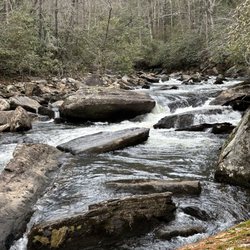
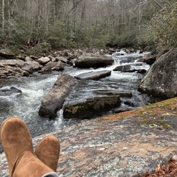
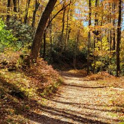
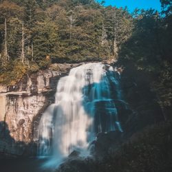
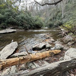
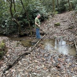
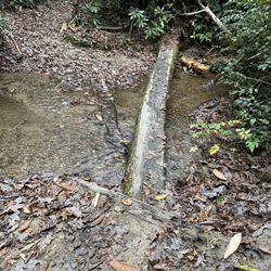
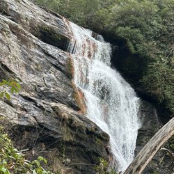
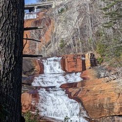
IF you want a challenging hike and are looking to score a bunch of amazing waterfalls on the SAME TRAIL, the Thompson River Waterfalls trail is your Huckleberry!!! Google maps has labeled the trailhead HIGH FALLS TRAIL HEAD just off Whitewater Road. As you turn onto Brewer Road, you will see a wide trail entrance on the corner. We parked along the side of the road near the entrance. There are multiple waterfalls along the trail as Thompson River makes its run down the mountain, dropping approx. 1,900 feet over 5 miles as it makes is way to beautiful Lake Jocassee. There are seven names waterfalls along the trail and 3 that absolutely should not be missed: HIGH FALLS, RICH FALLS & BIG FALLS aka THOMPSON FALLS. THE TRAIL The trail initially ascends about 60 feet but remains at a fairly consistent decline of about 500 feet along the entirety of the main trail. First up was REID FALLS at around .9 miles, but we decided to skip it. A split in the trail at around 1.1 miles leads to HIGH FALLS, a gorgeous 50 foot sliding ribbon waterfall. There really is no way to get an excellent picture of the falls without getting wet. The best vantage of the falls is across the river and a scramble over some large boulders to a beach like area. The pool in front of the falls is better than 6 feet deep, but most of the shallow areas were only ankle or calf deep. Back along the main trail we continued our descent down the mountain and next came to SIMON FALLS, which we also opted to skip. All of the falls (except High Falls) require a scramble downhill to view. Reid and Simon Falls have the least steep scrambles, but we wanted to conserve our legs for Big Falls, the steepest of the scrambles. We also bypassed Rich Falls around the 3.8 mile mark as we decided it would be best to see how we feel after tackling Big Falls. BIG FALLS Listen, however easy the trail seemed up until this point was about to SEVERELY change! The descent to the falls is about 535 feet in less that a quarter of a mile. IT IS VERY STEEP and some areas require sitting on your butt and sliding, other require holding on to low branches or roots and one area in particular requires mild vertical rock climbing. NOT KIDDING! But all of it is doable if you take your time and don't have any serious physical or health challenges. All of the MAIN trail is very easy to follow, but I would highly recommend downloading the ALLTRAILS map because it shows the exact entry points for the side trails to each of the falls. The side trail to Big Falls is easy to follow, but can be very faint in some areas. Once you make it down to the river, look for a side trail just before the final descent to the riverbank. It will lead you through a thicket of vegetation that leads to a boulder entrance to the falls. Navigate them as best you can to get to a great vantage point to view the falls. If you are not skilled at boulder hopping, this area will be very intimidating! But you MUST do it in order to view the Big Falls, which is not visible otherwise. NOTES / TIPS ~ Download ALLTRAILS MAP prior to your drive to the trailhead ~ There are 3 river crossings and yes you will get wet ~ Most of the falls require getting wet for best view ~ No restroom facilities at the trailhead ~ BRING PLENTY OF WATER & SNACKS FINAL THOUGHTS On our return, we were just too exhausted to attempt to see Rich Falls, so instead we used every ounce of energy we had remaining to make it back to the car. I was thoroughly exhausted. The 3.5 miles back seemed more like 10 and we'd run out of drinking water during our time at Big Falls. I recommend a minimum of five 16oz bottles to do this hike and more if you bring salty snacks. I'd also recommend you chug one bottle at the parking area before you begin. All in all this is an amazing trail full of gorgeous waterfalls. Big Falls easily has become one of my top 5 favorite southern waterfalls... but it is a beast of a hike! ALLTRAILS LINK: https://www.alltrails.com/explore/trail/us/north-carolina/thompson-river-waterfalls?mobileMap=false&ref=sidebar-static-map 2023 / 12 read more


A series of gorgeous waterfalls along beautiful Thompson River as it makes its way from the higher mountain elevations down to the Jocassee River. The trail offers a great experience for anyone at any hiking level. If you are like me and prefer more leisurely hikes, The first three waterfalls (Reid Branch, High Falls & Simon Falls) are fairly easy to reach. High Falls in particular is great for families with small children and has a wading pool of water at its base of different depths. There is even a small beach like area to relax and have a picnic. Just know you must get wet in order to reach the beach area, which also has the best view of the falls since High Falls kind of sits recessed into a little nook making it difficult to see in its entirety. But for those who are more like my husband and don't mind a more difficult hike, Rich Falls and Big Falls further downstream will give you plenty of challenge. Although I must say, my husband was sore several days after his hike and while he thought Big Falls was stunning, he was miserable on the return. He said the side trail to Big Falls was extremely steep and challenging, both on the way down and especially on the climb back out. It drained him completely at age 54 and he still had to endure a 3.5 mile hike back to the car running on empty. Knowing him he'll do it again! MEN... LOL Also near the parking area is a trail leading to White Owl Falls. A very short hike to a beautiful 20 foot waterfall. Walk west on Whitewater Road from the parking area and look for an opening with a pink ribbon tied to a tree branch about 900 feet from the trailhead. read more


More info about Thompson River Waterfalls
High Falls Trail Head
Sapphire, NC 28774
Directions
Hours
Outdoor Amenities













Why does Yelp recommend reviews?

Thompson River Waterfalls - hiking - Updated September 2026
Best of Sapphire
People found Thompson River Waterfalls by searching for…
Hiking Trails With Waterfalls in Sapphire, NC
Off Road Trails in Sapphire, NC
Places to Take Pictures in Sapphire, NC
Waterfalls and Swimming Holes in Sapphire, NC
Beautiful Views in Sapphire, NC
Running Trails in Sapphire, NC
Swimming Lakes in Sapphire, NC
Walking Trails in Sapphire, NC
Scenic Overlook in Sapphire, NC
Parks for Picnics in Sapphire, NC
Water Parks for Kids in Sapphire, NC
Browse Nearby
BEST of Sapphire, North Carolina Things to Do near Thompson River Waterfalls
BEST of Sapphire, North Carolina Coffee near Thompson River Waterfalls
BEST of Sapphire, North Carolina Parks near Thompson River Waterfalls
BEST of Sapphire, North Carolina Restaurants near Thompson River Waterfalls
BEST of Sapphire, North Carolina Campgrounds near Thompson River Waterfalls
BEST of Sapphire, North Carolina Waterfalls near Thompson River Waterfalls
BEST of Sapphire, North Carolina Ski Resorts near Thompson River Waterfalls
BEST of Sapphire, North Carolina Breakfast near Thompson River Waterfalls
BEST of Sapphire, North Carolina Snow Tubing near Thompson River Waterfalls


