Whiteside Mountain Trail Photos


You might also consider

More like Whiteside Mountain Trail
Recommended Reviews - Whiteside Mountain Trail
Start your review...


Reviews With Photos


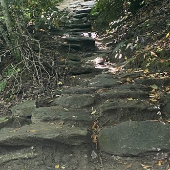
The ridge line of Whiteside forms the Eastern Continental Divide, at 4,930 feet. Half-a-billion years old, it's one of the oldest mountains in the world. We arrived at the trailhead for the Whiteside Mountain Trail around 11 am on a Thursday in late September, 2023. Managed by the US Forest Service (USDA), the parking lot has about 20? spaces; we got the last available slot. There's a kiosk to pay the $3 fee (free for national park pass holders), restrooms, and some signage about the area. The loop trail is 2.0 miles, with a total elevation gain of about 530'. If you hike up in a counter-clockwise direction, you'll quickly encounter a series of steps (both natural and man made) that are reputed to be strenuous, climbing 500' in half-a-mile. You'll reach the trail along the ridge, with many overlooks, faster and be able to return on a more gentle descent. As I have some balance issues, especially on trails with rocks and tree roots, we decided to go both up and down on the more gentle trail. As promised, the views on top were breathtaking! Unfortunately, we didn't see any Peregrine Falcons which were re-released in this area in 1986 and are reportedly thriving. We did, however, see a lot of wildflowers. The trail does have a lot of rocks (but no scrambling) and roots, and some "tall" step-ups. I'm happy that I wore hiking boots and brought along a hiking pole. Also, the trail is relatively easy to follow but would benefit from more signage. Also note that this is a popular trail, so you'll see a lot of other hikers. I'd love to return to see the area when autumn leaves are changing.


1.9 mile hike - it takes an average on 1.5 hours to finish or less. Do it counterclockwise for a hard estará and an easy descend. The best hike for best views in Highlands, NC


$3 parking by app making an account, or there's a credit card machine by the bathrooms. The trail goes up some steps then branches into the sides of the loop - left side is a steady incline up on a wide trail and then stairs narrow paths at time down, right side is stairs up and steady incline down. We thought after reaching the viewpoint that was it - but then were rewarded with several more overlooks. It's worth the hike, but parking was a mess.


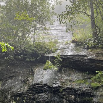
The trail was well marked easy to hike and beautiful. Rocks, trees, mini water falls, creeks abs lots to see along the way. The view at the end was cloudy and foggy but still worth the hike. I've seen it in a clear day and it is spectacular! A wonderful way to spend your day!


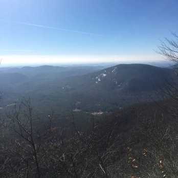
Great hiking trail between Cashiers and Highlands NC. Took about 2 hrs, first half of the hike is mostly uphill, but not a miserable climb. The last half is mostly small climbs and descents with flats in between with great views. Good for families. Parking lot is decent sized, but can get busy, so go early.


Want to hike a trail that you will feel in the morning? Whiteside Mountain is your Huckberry! THE EXPERIENCE From the parking area you will climb a set of earth & wooden steps just behind the information sign. Once you reach the top of the steps go left until you get to the split in the trail marked "more strenuous" with an arrow pointing right. I chose to take the easier path up the old gravel road on the left. It was already past sunset and I feared hiking the strenous trail would drain what little energy I had after a full day of sightseeing the Highlands, NC area. I didn't want to be on the trail after dark considering I didn't have a flashlight. If the trail guide is correct and this is a 2.5 mile loop, then approximately one mile of it is the gravel road portion of the trail. Consider it the "boring half because there is really nothing to see the entire way up until you come to an overlook @ the Northeast corner of the mountain. There are two different vantage points. One offers a partially obscure view due to vegetation, while the other gives a really clear view from a stone ledge. Nearby is an observation platform with an even better view. This begins your second and far more scenic half of the trail as you are literally walking along a 700 foot granite cliff. The density of the trees doesn't allow for much of a view o the left, however, there are nothing but views on the right until the final overlook. Below you is the face of the mountain that gives it the name Whiteside. Just like Stone Mountain in Georgia, Whiteside was once a massive molten rock that formed millions of years ago and sat below layers of earth. As with Stone Mountain, once it cooled heat and pressure pushed the rock closer to the surface and erosion of softer surrounding materials did the rest. The white face of the mountain is due to streaks of quartz and feldspar. I didn't count, but there must be at least 9 total overlooks along the cliff side of the trail, all with incredible views and a few that will make people who are are afraid of heights gasp in fear. One of the overlooks has a stone knoll you can climb for a scary, but excellent photo opportunity. It will look like you are on top of the world if taken at the right angle! I believe this was also the summit, because of some old markings in the stone and what seems to have once been a Geodetic Survey Marker that you normally find at the summit of any mountain. It was missing, so I couldn't tell for sure if that was the summit. After the last marker, the descent s fast and steep. This would have killed my legs had I ascended this way, so I was grateful I took the easier path! My hike time was fairly quick, and going this more difficult route would have probably added over 30 minutes to my hike. As it was, I started late and BARELY finished with a little sunlight remaining. TRAIL STATS Difficulty: Moderate Total Length: 2.5 mi Trail Tread Condition: Moderately Rough Climb: Hilly Lowest Elevation: 4410 ft Highest Elevation: 4930 ft Total Elevation Gain: 600 ft FINAL THOUGHTS I forgot to mention that just before you get to the summit, there is a huge fissure in one section of the cliff side that is large enough for a human to pass through. It leads you to a really scary natural stone ledge with almost a batman like view of the surrounding valley. This was truly one of the most spectacular hikes I've had the pleasure of experiencing. It was Fall, so the colorful views were breathtaking and I even got a GREAT shot of the sun as it disappeared for the evening. A must for avid hikers living anywhere within a few hours drive. 2016/129


Just a short drive from downtown Highlands, Whiteside Mountain offers some of the most spectacular views in western North Carolina. From the parking lot, take the gravel road to the summit, a relatively steep but easy 2-mile hike. Then follow the more challenging trail around the peak and back down toward the base. There are at least 8 different overlooks along the trail, each offering a more impressive view than the last. Both trails are moderately challenging, but well-maintained. Allow yourself at least 2 hours to make the round trip hike to the summit and enjoy the scenery. Highly recommended.


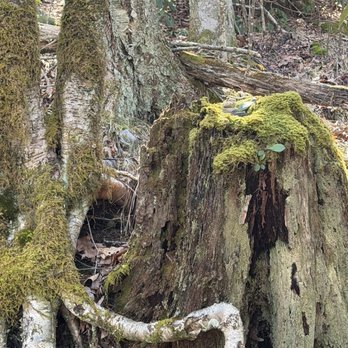
During busy times you may have problems finding parking (paid area) The trail starts off with a couple of flights of stairs. When you reach the top the left side is the "easier" side up to the top and the right side is more stone stairs that is a shorter distance, but tougher climb. We took the left side going up and down. There are large rock areas along the way, which might make it difficult if you have mobility problems. Otherwise, it was a bit wet on the path in places, but it had rained a good bit of the day before. The whole path is a light incline the entire way up, but an easy decline on the way down. There are no sitting areas along the path when you reached the top there are two overlooked areas. The better view is the one all the way to the right there is a sign, noting the continental divide on either side of White side Mountain very cool. It was definitely worth the hike. It took us about 30 minutes to get to the top. I saw people with dogs and children a lot. It is a very family friendly activity. read more




11 months ago
This might be my new favorite trail! The parking lot was very busy but we did not see many people on the trail. There are lots of look outs and the views are amazing! Bathrooms are pretty gross. read more

What an incredible place I drove to that was as breathtaking as visiting the nearby Smoky Mountains. Such a short trail that's reasonably easy to scale but the views are breath taking. It's worth the $3 fee honestly. Restrooms have no hand sanitizer sadly. Plenty of great information and history to be learned about the mountain. You can see right into Georgia too! Highly recommend visiting! read more


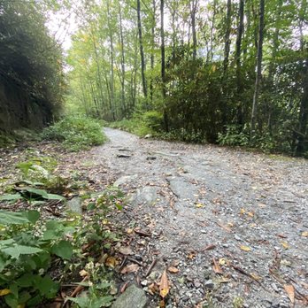
The ridge line of Whiteside forms the Eastern Continental Divide, at 4,930 feet. Half-a-billion years old, it's one of the oldest mountains in the world. We arrived at the trailhead for the Whiteside Mountain Trail around 11 am on a Thursday in late September, 2023. Managed by the US Forest Service (USDA), the parking lot has about 20? spaces; we got the last available slot. There's a kiosk to pay the $3 fee (free for national park pass holders), restrooms, and some signage about the area. The loop trail is 2.0 miles, with a total elevation gain of about 530'. If you hike up in a counter-clockwise direction, you'll quickly encounter a series of steps (both natural and man made) that are reputed to be strenuous, climbing 500' in half-a-mile. You'll reach the trail along the ridge, with many overlooks, faster and be able to return on a more gentle descent. As I have some balance issues, especially on trails with rocks and tree roots, we decided to go both up and down on the more gentle trail. As promised, the views on top were breathtaking! Unfortunately, we didn't see any Peregrine Falcons which were re-released in this area in 1986 and are reportedly thriving. We did, however, see a lot of wildflowers. The trail does have a lot of rocks (but no scrambling) and roots, and some "tall" step-ups. I'm happy that I wore hiking boots and brought along a hiking pole. Also, the trail is relatively easy to follow but would benefit from more signage. Also note that this is a popular trail, so you'll see a lot of other hikers. I'd love to return to see the area when autumn leaves are changing. read more






4 months ago


3 years ago
1.9 mile hike - it takes an average on 1.5 hours to finish or less. Do it counterclockwise for a hard estará and an easy descend. The best hike for best views in Highlands, NC read more


$3 parking by app making an account, or there's a credit card machine by the bathrooms. The trail goes up some steps then branches into the sides of the loop - left side is a steady incline up on a wide trail and then stairs narrow paths at time down, right side is stairs up and steady incline down. We thought after reaching the viewpoint that was it - but then were rewarded with several more overlooks. It's worth the hike, but parking was a mess. read more


4 years ago
The trail was well marked easy to hike and beautiful. Rocks, trees, mini water falls, creeks abs lots to see along the way. The view at the end was cloudy and foggy but still worth the hike. I've seen it in a clear day and it is spectacular! A wonderful way to spend your day! read more




5 years ago

Great hiking trail between Cashiers and Highlands NC. Took about 2 hrs, first half of the hike is mostly uphill, but not a miserable climb. The last half is mostly small climbs and descents with flats in between with great views. Good for families. Parking lot is decent sized, but can get busy, so go early. read more



6 years ago

10 years ago
Want to hike a trail that you will feel in the morning? Whiteside Mountain is your Huckberry! THE EXPERIENCE From the parking area you will climb a set of earth & wooden steps just behind the information sign. Once you reach the top of the steps go left until you get to the split in the trail marked "more strenuous" with an arrow pointing right. I chose to take the easier path up the old gravel road on the left. It was already past sunset and I feared hiking the strenous trail would drain what little energy I had after a full day of sightseeing the Highlands, NC area. I didn't want to be on the trail after dark considering I didn't have a flashlight. If the trail guide is correct and this is a 2.5 mile loop, then approximately one mile of it is the gravel road portion of the trail. Consider it the "boring half because there is really nothing to see the entire way up until you come to an overlook @ the Northeast corner of the mountain. There are two different vantage points. One offers a partially obscure view due to vegetation, while the other gives a really clear view from a stone ledge. Nearby is an observation platform with an even better view. This begins your second and far more scenic half of the trail as you are literally walking along a 700 foot granite cliff. The density of the trees doesn't allow for much of a view o the left, however, there are nothing but views on the right until the final overlook. Below you is the face of the mountain that gives it the name Whiteside. Just like Stone Mountain in Georgia, Whiteside was once a massive molten rock that formed millions of years ago and sat below layers of earth. As with Stone Mountain, once it cooled heat and pressure pushed the rock closer to the surface and erosion of softer surrounding materials did the rest. The white face of the mountain is due to streaks of quartz and feldspar. I didn't count, but there must be at least 9 total overlooks along the cliff side of the trail, all with incredible views and a few that will make people who are are afraid of heights gasp in fear. One of the overlooks has a stone knoll you can climb for a scary, but excellent photo opportunity. It will look like you are on top of the world if taken at the right angle! I believe this was also the summit, because of some old markings in the stone and what seems to have once been a Geodetic Survey Marker that you normally find at the summit of any mountain. It was missing, so I couldn't tell for sure if that was the summit. After the last marker, the descent s fast and steep. This would have killed my legs had I ascended this way, so I was grateful I took the easier path! My hike time was fairly quick, and going this more difficult route would have probably added over 30 minutes to my hike. As it was, I started late and BARELY finished with a little sunlight remaining. TRAIL STATS Difficulty: Moderate Total Length: 2.5 mi Trail Tread Condition: Moderately Rough Climb: Hilly Lowest Elevation: 4410 ft Highest Elevation: 4930 ft Total Elevation Gain: 600 ft FINAL THOUGHTS I forgot to mention that just before you get to the summit, there is a huge fissure in one section of the cliff side that is large enough for a human to pass through. It leads you to a really scary natural stone ledge with almost a batman like view of the surrounding valley. This was truly one of the most spectacular hikes I've had the pleasure of experiencing. It was Fall, so the colorful views were breathtaking and I even got a GREAT shot of the sun as it disappeared for the evening. A must for avid hikers living anywhere within a few hours drive. 2016/129 read more


6 years ago

6 years ago

Just a short drive from downtown Highlands, Whiteside Mountain offers some of the most spectacular views in western North Carolina. From the parking lot, take the gravel road to the summit, a relatively steep but easy 2-mile hike. Then follow the more challenging trail around the peak and back down toward the base. There are at least 8 different overlooks along the trail, each offering a more impressive view than the last. Both trails are moderately challenging, but well-maintained. Allow yourself at least 2 hours to make the round trip hike to the summit and enjoy the scenery. Highly recommended. read more


7 years ago

11 years ago
Yesterday, when I went to Whiteside Mountain, it was still covered in snow from about a week ago. This made the parking lot a little difficult to get in and out of because the ice/snow had only been been plowed off the roads and not the parking lot. Everyone was helping each other in and out by pushing cars when needed, which was a nice sight to see. The bathrooms are basically just porta-potties, which smell terrible. However, this can easily be avoided because Cashiers and Highlands are close, so you can use the restroom in one of those towns before you go to the trail. The trail itself is a loop trail about 2.5 miles long. I recommend going up the left side first because the incline is more gradual and less steep than the right side. For most of the trail, you will be walking along the edge of mountain side. There is a fence in most places so, you know, you don't fall to your death. It's an absolutely gorgeous view, and a pleasant hike. read more


9 years ago
10 years ago
More info about Whiteside Mountain Trail
Ask the Community - Whiteside Mountain Trail
Review Highlights - Whiteside Mountain Trail




























Whiteside Mountain Trail - hiking - Updated August 2026
Best of Highlands
People found Whiteside Mountain Trail by searching for…
Hiking Trails With Waterfalls in Highlands, NC
Scenic Overlook in Highlands, NC
Places to Take Pictures in Highlands, NC
Indoor Rock Climbing in Highlands, NC
Things to Do on a Rainy Day in Highlands, NC
Off Road Trails in Highlands, NC
Hiking With Kids in Highlands, NC
Beautiful Views in Highlands, NC
Walking Trails in Highlands, NC
Trending Searches in Highlands, NC
Barbershop For Men near Whiteside Mountain Trail
Bike Shop near Whiteside Mountain Trail
Charter Schools near Whiteside Mountain Trail
Cliff Jumping near Whiteside Mountain Trail
Consignment Shops near Whiteside Mountain Trail
Ear Piercing near Whiteside Mountain Trail
Elementary Schools near Whiteside Mountain Trail
Hair Braiding near Whiteside Mountain Trail
Kids Haircut near Whiteside Mountain Trail
Lakes near Whiteside Mountain Trail
Lookout Points near Whiteside Mountain Trail
Parks near Whiteside Mountain Trail
Pedicure near Whiteside Mountain Trail
Picnic Areas near Whiteside Mountain Trail
Preschools near Whiteside Mountain Trail
Public Golf Courses near Whiteside Mountain Trail
Rock Quarry near Whiteside Mountain Trail
Running Trails near Whiteside Mountain Trail
Scenic Overlook near Whiteside Mountain Trail
Sunrise View near Whiteside Mountain Trail
Swimming Holes near Whiteside Mountain Trail
Teen Clothing Stores near Whiteside Mountain Trail
Trading Card Shops near Whiteside Mountain Trail
Uniforms near Whiteside Mountain Trail
Browse Articles
Browse Nearby
BEST of Highlands, North Carolina Restaurants near Whiteside Mountain Trail
BEST of Highlands, North Carolina Things to Do near Whiteside Mountain Trail
BEST of Highlands, North Carolina Coffee near Whiteside Mountain Trail
BEST of Highlands, North Carolina Breakfast near Whiteside Mountain Trail
BEST of Highlands, North Carolina Shopping near Whiteside Mountain Trail
BEST of Highlands, North Carolina Wineries near Whiteside Mountain Trail
Browse Brands
Related Searches in Highlands, NC
Best Dog Hiking Trails Around Highlands, North Carolina
Best Fishing Locations and Guides in Highlands, North Carolina
Best Fun Things to Do in Highlands, North Carolina
Best Places for Horseback Riding in Highlands, North Carolina
Best Rock Climbing Gyms to Try in Highlands, North Carolina
Best Waterfalls and Swimming Holes in Highlands, North Carolina
Check Out Off Road Trails in Highlands, North Carolina
Discover Dance Studios Available in Highlands, North Carolina
Discover Dog Friendly Trails to Explore in Highlands, North Carolina
Discover Great Fitness Classes Available in Highlands, North Carolina
Discover Kids Indoor Play Area Venues in Highlands, North Carolina
Discover Outdoor Gym Facilities in Highlands, North Carolina
Discover Popular Bike Trails in Highlands, North Carolina
Discover Popular Ropes Course Options in Highlands, North Carolina
Discover Top Boat Tours in Highlands, North Carolina for All Ages
Discover Top Yoga Options and Studios in Highlands, North Carolina
Discover a Hiking Trail in Highlands, North Carolina
Discover the Best Night Hike Trails in Highlands, North Carolina
Dog-Friendly Hikes With Dogs in Highlands, North Carolina
Enjoy Camping Adventures Around Highlands, North Carolina
Enjoy Exciting Mountain Biking Adventures in Highlands, North Carolina
Enjoy Hiking Adventures in Highlands, North Carolina
Enjoy Kayaking Adventures in Highlands, North Carolina
Enjoy Off Leash Dog Hikes in Highlands, North Carolina
Enjoy Safe and Fun Bungee Jumping in Highlands, North Carolina
Enjoy Tent Camping Spots Around Highlands, North Carolina
Enjoy a Beautiful Waterfall Hike in Highlands, North Carolina
Enjoy the Best Walking Trails in Highlands, North Carolina
Experience Thrilling White Water Rafting in Highlands, North Carolina
Explore Beautiful Parks and Green Spaces in Highlands, North Carolina
Explore Easy Hikes Perfect for All in Highlands, North Carolina
Explore Fitness Centers and Gyms in Highlands, North Carolina
Explore Fun Activities to Do in Highlands, North Carolina
Explore Fun Challenge Courses in Highlands, North Carolina
Explore Martial Arts Options in Highlands, North Carolina
Explore Pilates Reformer Classes Available in Highlands, North Carolina
Explore Popular Campgrounds Near Highlands, North Carolina
Explore Popular Recreation Centers Around Highlands, North Carolina
Explore Summer Camps for All Ages in Highlands, North Carolina
Explore Top Gyms in Highlands, North Carolina Now
Explore Top Trampoline Parks in Highlands, North Carolina
Explore Top Water Parks in Highlands, North Carolina Today
Explore the Best Crossfit Gyms in Highlands, North Carolina
Explore the Best Rock Climbing Areas in Highlands, North Carolina
Explore the Best Swimming Holes Around Highlands, North Carolina
Family Friendly Hiking With Kids in Highlands, North Carolina


