Waʻahila Ridge State Recreation Area Photos


You might also consider


More like Waʻahila Ridge State Recreation Area
Recommended Reviews - Waʻahila Ridge State Recreation Area
Start your review...


Reviews With Photos


This is my 2nd visit to this state park. The parking lot was kind of full and some people with 3 young children walked on foot. We came here with our dog Sam who loves exploring. It is hard to believe that this place exists in St. Louis area. You think of this place as like Hawaii's Yosemite Park with no animals.


I found this hike upon looking at all trails for a dog friendly hike in Honolulu. The park has a large parking lot which is convenient compared to other hikes in Honolulu where you need to street park. The hike starts at a recreation area that has picnic tables and scenery perfect for having a outdoor lunch. We stayed on the main trail all the way to the top where it connected to the longer trail. The trail seemed pretty difficult for a beginner since it included muddy areas and times where you and your dog need to climb rocks. Even though I was dyingggg on the way there the view is a great reward.


Hiking through the Honolulu forest is truly an experience like no other. Everything from the lush greenery and the beautiful island views, to the smell of the forest is unlike anything that I've ever experienced while hiking in California. You can smell and feel the difference. It's that island glow surrounding you that just makes everything feel so different. I actually started on an off trail when I entered the park and ended up connecting to one of the main trails. I didn't take a car here, so I wasn't aware of where the mountain trail began until I had already hiked the other half of the park. The park itself is located high on a hill behind a small residential area. There's a small sign that says "Waahila Ridge" right before you come to a dead end. Make a left on this street, and you'll see the entrance sign. If you continue on the road past the sign, you'll pull up to a recreation area with benches, barbecue pits, and restrooms. Here, you'll also find parking and the beginning of the Mountain trail. Unfortunately, I didn't figure this out until after I had already hiked a few miles through the forest and by this time, I was already too tired to try to conquer the Mount Olympus Trail. If you asked me what trail I took... well, I wouldn't be able to answer that question. I was literally free for alling through the forest, but it was still a beautiful hike. Although it's shaded, it gets really warm up there so water is a must. There are many open spots with beautiful views of the Oahu hills and the Honolulu coastline. These trails are all dirt with large tree roots that have grown through the ground. Be careful passing by the wet spots because they are super muddy and slippery. Not gonna lie... I got a little scared when I was deep in the forest and couldn't find a manmade trail. Don't try and figure it out... just turn that ass back around and stay on the main trail where the other people are. It's not a super busy trail, but there were a few tents around where it looked like homeless people were living in some spots. If you stick to the main trail, it should be fine. And, I cannot cannot CANNOT forget; WEAR BUG REPELLENT! There weren't a ton of bugs around, but I got completely bit up by mosquitos! I usually always wear bug repellent when I'm hiking in the deep forest or near swampy terrains, but I was on vacation mode and completely forgot. The mosquitos here aren't as aggressive as Florida mosquitos, but you'll be itching like a heck a few days later. Come prepared! Also, there's a shoe wash near the restrooms at the recreation site. Wash your shoes before you leave. Not only for the purpose of clean shoes, but also so you don't track the soil from the forest back onto the Island habitat. They are really big on non-contamination here. Overall, it was a beautiful hike even though I didn't get a chance to hike up to Mount Olympus. I would love to return in the future to hike up to the mountain one day.


Near the top of St. Louis, and through a neighborhood of houses, you'll find one of the best hikes on the island. Ample parking, mostly shady hike, good scenic views, can't ask for much more. Definitely one of the "easier" hikes that allow you to go through different environments. Whether that's going down a slope, going through a pine forest, climbing rocks, you get a lot of great scenery in this short little hike. It connects to another hike if you're feeling adventurous but getting near the top and seeing a great view of Manoa was enough for me. I recommend going on this hike when it's dry because when it's wet, you can count of falling on your behind multiple times. The rocks and large tree vines are not very forgiving. But on a nice sunny day, it's an amazing hike!


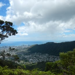
The Waahila Ridge State Recreation Park and hike was amazing! The entrance to the park is at the top of St. Louis Heights on Ruth St. There is a PARKING LOT inside the park with about 20-25 stalls. Restroom facilities are also available and are well-kept. This trail is connected to "Mount Olympus" whose trailhead begins after the 1.5 hours hike of the Waahila Ridge. As you ascend the ridge, you immediately see views on the right of Palolo valley and Manoa valley to your left. Eventually, you will reach a point where you overlook the greater Honolulu area out toward the back of Diamond Head/Kahala area and even all the way out toward the airport (you can see the runway). The terrain of this trail varied from lots of roots, to big, sturdy rocks. We were informed by the park groundskeeper that it can get muddy and a bit slippery when wet, so just be careful. As a person who goes to the gym about 3-4x per week, I felt this hike was easy overall. Good hike for adults. I would not recommend it for small children, elderly, or people with bad knees!


Very clean and well kept park with parking and restroom. The chickens rule the parking lot but the general hush of the place hits you at about the same time as the beauty of your surroundings. And that's just the parking lot. The roughly 4.5 miles (round trip) hiking trail is entertaining as you go being covered by gigantic and majestic trees to open air trails varying between steady incline/decline one smooth but narrow trails to climbing over/down rocks. Make no mistake, this is not a stroll in the park but well worth the effort in the landscape that you travel through but also the breathtaking views of Manoa Valley on one side and Paololo Valley on the other. At the end of the trail is a sign that warns you not to venture further. I ran into hikers who were returning from the forbidden trail (one on the left goes down and one on the right goes up - and these hikers were on the right side trail). They stated that if you continue on for another 1.5 miles, you'd get a clear view of Kaneohe. As I started late in the afternoon and my 75-year old Mom was with me (yeah, you heard that right), I didn't try the second trail. One day, however, I'll return and do the entire ridge. In any event, the total hike too a little under 4 hours but we stopped and tested along the way for Mom to catch a break or two. Also stopped to take a lot of pictures. Highly recommend this hike.

Ahhhh...fresh breezy air flowing through the magical bristles of a surprising pine tree populated ridge we just like to call, you know - that park in St. Louis! This recreation area and hike are a breath of fresh air from the many other parks on this island. I love coming here just to sit and relax on one of many tables or benches around the parking area. The park in general reminds me of when I used to go camping in the woods of California. I love the pine trees and sense of calm and serenity this place gives off. I have hiked the trail a couple times but never all the way through, yet. Honestly I just like to come up here to clear my mind and get away from the hustle and bustle. If you have never been here I suggest checking this place out for a nice change. It's beautiful!


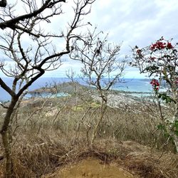
In 2020, a brush fire scorched below the parks parking lot, which opened up the area. The good part, a panoramic view from Hawaii Kai to Waipahu is visible for now. The sad part, the homeless lost their million dollar view with privacy.


When I was a little kid, I remembered coming here for hikes all the time with the cub scouts.........since then, I've been to this park many times as a kid (all the way up till high school), then all of a sudden..........I've been M.I.A. from this place. Why? Don't know.........I guess I just didn't have the desire to hike.....and got into other interest. Well, all that changed today, as I decided to take my (PIC) = Partner in Crime "Makana" with me to take a little stroll in the park. Waahila Ridge State Recreation Park is located at the top of St. Louis Heights. Very nice forest, nice clean air, cool breezes, and don't you love that forest tree smell? As you drive into the park, there is a paved parking lot to park your car. The park also has several picnic tables on the property, as well as covered picnic stations with BBQ pits so you can have picnic parties. The hike itself is not too hard, but can be difficult if you come up here after a heavy rain. Unfortunately for me, last night had pretty heavy rains up here, so when I was hiking along the trial, it got pretty muddy & slippery. I went as far as I possibly could with Makana today, then turned around and headed back to the starting point. Some of the things I like about this park........... 1. Beautiful views of Manoa Valley & Palolo Valley 2. Nice fresh air 3. Love the wild chickens (don't feed them!) 4. Love to see the various nice looking foliage 5. I like it that they had a place where you could clean off your hiking shoes 6. They have a restroom 7. They have lots of paved parking 8. I like it that they have covered picnic stations with BBQ pits 9. Park is clean, and let's keep it that way. Don't litter, and if you do bring a "pal" with you..........make sure you pick up his poop on the trail! 10. A nice quite place to relax & get away from the hustle & bustle. I'll come back here again on a dry day...........anyone wanna join me? :D


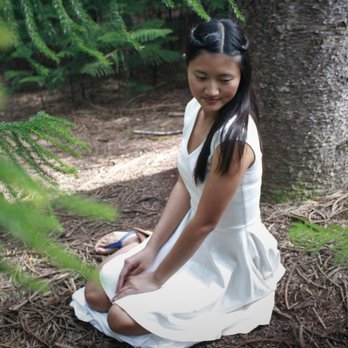
I haven't actually done the hike that's here, but I've had many photoshoots here. There's more than enough parking inside the lot, picnic tables galore, and clean bathrooms. The pathways are well-maintained and set inside a Norfolk pine forest-- super pretty. See the pictures I've uploaded for reference!
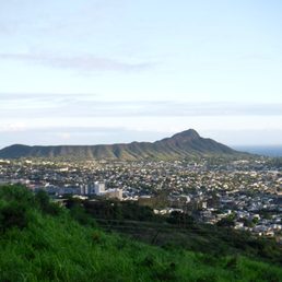

Beautiful park with pine trees above the sprawl of Honolulu! Great hiking trails both up and down from the park. I've hiked down, along the Kalaepohaku ridgeline, 3 or 4 times. And I've hiked up to Mt Olympus twice from here. Going down is an easy 1-1.5 hour out and back. Up and back to Mt Olympus is about 4-5 hours roundtrip. Steep and muddy near the top with a few super steep sections with ropes. Hope for overcast ABOVE the mountains for cooler temps, less sun, and clear views of Kaneohe. My first time to summit Mt Olympus we were hiking in clouds and saw nothing but grey. However, the second time we made it to the top the clouds parted and we were rewarded with stellar views all around! Awesome. Hiking down is a beginner trail following the mountain bike paths. Hiking up to Mt Olympus is an advanced intermediate level hike. Easily done but ensure good hiking shoes/boots, gloves, spikes, and lots of water.


A warm and sunny afternoon, we went hiking here. It is a really beautiful place. There is a hiking trail, picnic tables, bathroom, and parking lot. In the beginning of the hike, there are a bunch of trees and stumps. It's beautiful to take photo shoots here. The trail is easy to follow because there are pink bright markers. It seems there are 2 separate hikes. The beginning hike is around 45 minutes to an hour until you hit another sign in the middle of the trail that says Waahila Ridge. The beginning hike is easy...seems like kids are able to hike it. After the sign, it'll be a tougher and longer hike. I wanted to try out the longer hike, and it was quite difficult and steep. After an hour hiking that long trail there were other hikers coming back down. I asked them how long more to get to the top, they told me it was a long way. It was getting late and I was hella tired. So I decided to turn around. This whole trip that I technically didn't complete took around 3-4 hours round trip. The view is definitely really nice. Beautiful nature and trees. I would come back just to do a photo shoot.


Fantastic workout both ways - This hike was one I would actually feel pretty comfortable doing solo since it's well-marked and maintained and easy to follow. The most difficulty we had navigation-wise was getting our group to the park itself...several people tried to use their gps to reach the park which brought most people to Palolo and various other locations. The only thing you need to know is as you make your way up St. Louis (the road that runs next to City Mill off of Waialae), keep making right turns as long as they appear to go uphill... then make a left on Ruth. If you keep a decent pace, (our leader was a maniac!) you will be huffing and puffing in no time - I love hikes that make me work for it! There are quite a few grassy landings along the way where you can take a break and enjoy the view. http://www.yelp.com/biz_photos/nkkHUtoIK35_7KYrJ3szXQ?select=qtElyuXf4P8uAWPF7BHsWA#HnRrPxGm79DVx6GoZqOnjQ About an hour in, you'll reach a sign... http://www.yelp.com/biz_photos/nkkHUtoIK35_7KYrJ3szXQ?select=qtElyuXf4P8uAWPF7BHsWA#WHF7PQ6ndbiuI5gI8m9nZA It indicates left to Lower Wa'ahila (which I'm told will bring you into Manoa Valley) and right to continue up, where you'll eventually reach Mt. Olympus. http://www.yelp.com/biz_photos/nkkHUtoIK35_7KYrJ3szXQ?select=qtElyuXf4P8uAWPF7BHsWA#cwWhv9PIARq2IxhDNwg_Kw On this particular hike, we were witness to an proposal and popped a bottle of Moet near the summit - I highly suggest the same, gives you the warm and fuzzies almost all the way back :) http://www.yelp.com/biz_photos/nkkHUtoIK35_7KYrJ3szXQ?select=qtElyuXf4P8uAWPF7BHsWA#Yx3NtI33YYymupJJbM0OhQ

5 months ago
One of my favorite neighborhood trails. Very moderate, peaceful. Perfect place for a picnic. read more


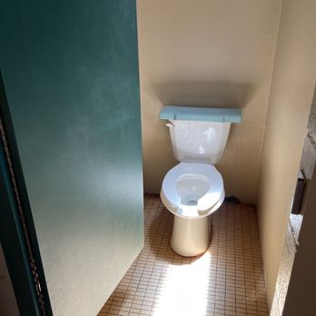
Wow this was a beautiful park to visit. A bit of a drive up st louis heights but once you get there it is definitely a site to see. With all the large trees it makes you feel like you're in the pacific north west but you're still in Hawaii. Parking- there is a nice size parking lot, nicely paved and ample parking for a holiday monday. At the end of the parking lot there is a small hill to drive up for 2 handicap stalls, but one has porta potties in it. Many shaded areas with picnic tables to sit on and enjoy lunch in the park. There are a lot of tress but if you go towards the edge you can get a view of Manoa valley without doing the hike Go up and towards the right paved path there is a bathroom that is quite clean. No soap so bring your own soap or wipes. Right out side there is a water spout and area to wash your shoes. At the trail beginning there is a spot to brush off your shoes. First time here and definitely would come back to visit and walk around. Enjoy! read more




4 years ago
On a recent long weekend, I got the pup ready and we headed out for a hike. I chose Wa'ahila Ridge Trail and was not disappointed with the experience and views. The entrance to the park is at the top of St Louis Heights, which is accessible from Waialae by driving up or taking the bus to the top. At the cul-du-sac, right left and go right in. The park area has a number of amenities including an ample parking lot, paved picnic table areas that are open to free use, and a remodeled restroom building. The picnic area has shaded views of Manoa Valley. There are also plenty of trash cans for use. This area is covered by tall Captain Cook pine trees, which are equally beautiful and cooling. Being up so high also gives great breezes even on the hottest days down below. For those hiking, the trailhead is at the top of the parking lot, clearly marked with a sign. I'd say this is a moderate trail as certain parts about a mile or two in require scrabbling on rocks. For those less inclined for this, it is still a beautiful trail for a half mile or so that all ages and difficulty levels can do together. A short distance in will bring you to a clearing with the power lines (the trail turns to the left), this area has great views of Manoa Valley, Palolo Valley, and Honolulu beyond although obscured by the power lines. For those going farther in, a number of places along the trail have spectacular views. The trail goes back and fort between open ridge line and shaded trees. Sunscreen, hats, and WATER are necessary on this one even if it doesn't feel hot. The trail is about 3 miles from the parking lot to the "end" where it meets another trail. It is illegal to take this one into the mountains as it is a protected watershed; you can turn left on the steep trail into Manoa Valley. For casual hikers, this in an in-and-out hike (turn around when you need to). There are also opportunities to see rare endemic plants, other flowers, and trees that aren't found at sea level. One note: pig hunting is allowed on Wednesdays and Sundays, including with hunting dogs off leash. It's best to avoid this trail all together on those days with dogs and children. Overall, I highly recommend this trail. It's incredible how such a beautiful walk is so close to the city. read more


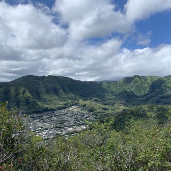


This is my 2nd visit to this state park. The parking lot was kind of full and some people with 3 young children walked on foot. We came here with our dog Sam who loves exploring. It is hard to believe that this place exists in St. Louis area. You think of this place as like Hawaii's Yosemite Park with no animals. read more

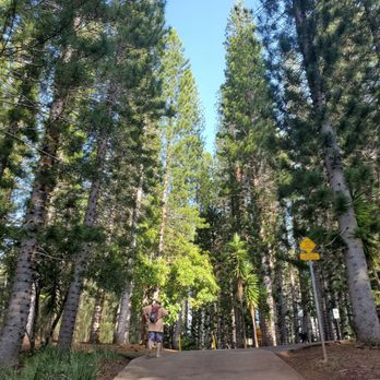
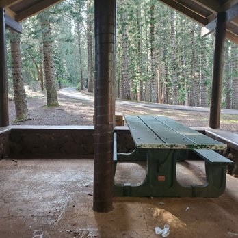


I found this hike upon looking at all trails for a dog friendly hike in Honolulu. The park has a large parking lot which is convenient compared to other hikes in Honolulu where you need to street park. The hike starts at a recreation area that has picnic tables and scenery perfect for having a outdoor lunch. We stayed on the main trail all the way to the top where it connected to the longer trail. The trail seemed pretty difficult for a beginner since it included muddy areas and times where you and your dog need to climb rocks. Even though I was dyingggg on the way there the view is a great reward. read more
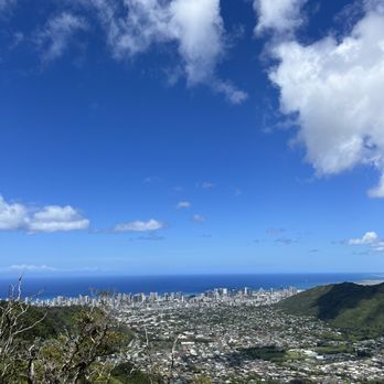


Hiking through the Honolulu forest is truly an experience like no other. Everything from the lush greenery and the beautiful island views, to the smell of the forest is unlike anything that I've ever experienced while hiking in California. You can smell and feel the difference. It's that island glow surrounding you that just makes everything feel so different. I actually started on an off trail when I entered the park and ended up connecting to one of the main trails. I didn't take a car here, so I wasn't aware of where the mountain trail began until I had already hiked the other half of the park. The park itself is located high on a hill behind a small residential area. There's a small sign that says "Waahila Ridge" right before you come to a dead end. Make a left on this street, and you'll see the entrance sign. If you continue on the road past the sign, you'll pull up to a recreation area with benches, barbecue pits, and restrooms. Here, you'll also find parking and the beginning of the Mountain trail. Unfortunately, I didn't figure this out until after I had already hiked a few miles through the forest and by this time, I was already too tired to try to conquer the Mount Olympus Trail. If you asked me what trail I took... well, I wouldn't be able to answer that question. I was literally free for alling through the forest, but it was still a beautiful hike. Although it's shaded, it gets really warm up there so water is a must. There are many open spots with beautiful views of the Oahu hills and the Honolulu coastline. These trails are all dirt with large tree roots that have grown through the ground. Be careful passing by the wet spots because they are super muddy and slippery. Not gonna lie... I got a little scared when I was deep in the forest and couldn't find a manmade trail. Don't try and figure it out... just turn that ass back around and stay on the main trail where the other people are. It's not a super busy trail, but there were a few tents around where it looked like homeless people were living in some spots. If you stick to the main trail, it should be fine. And, I cannot cannot CANNOT forget; WEAR BUG REPELLENT! There weren't a ton of bugs around, but I got completely bit up by mosquitos! I usually always wear bug repellent when I'm hiking in the deep forest or near swampy terrains, but I was on vacation mode and completely forgot. The mosquitos here aren't as aggressive as Florida mosquitos, but you'll be itching like a heck a few days later. Come prepared! Also, there's a shoe wash near the restrooms at the recreation site. Wash your shoes before you leave. Not only for the purpose of clean shoes, but also so you don't track the soil from the forest back onto the Island habitat. They are really big on non-contamination here. Overall, it was a beautiful hike even though I didn't get a chance to hike up to Mount Olympus. I would love to return in the future to hike up to the mountain one day. read more


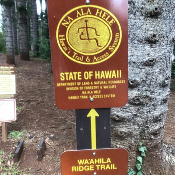
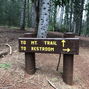


Near the top of St. Louis, and through a neighborhood of houses, you'll find one of the best hikes on the island. Ample parking, mostly shady hike, good scenic views, can't ask for much more. Definitely one of the "easier" hikes that allow you to go through different environments. Whether that's going down a slope, going through a pine forest, climbing rocks, you get a lot of great scenery in this short little hike. It connects to another hike if you're feeling adventurous but getting near the top and seeing a great view of Manoa was enough for me. I recommend going on this hike when it's dry because when it's wet, you can count of falling on your behind multiple times. The rocks and large tree vines are not very forgiving. But on a nice sunny day, it's an amazing hike! read more


The Waahila Ridge State Recreation Park and hike was amazing! The entrance to the park is at the top of St. Louis Heights on Ruth St. There is a PARKING LOT inside the park with about 20-25 stalls. Restroom facilities are also available and are well-kept. This trail is connected to "Mount Olympus" whose trailhead begins after the 1.5 hours hike of the Waahila Ridge. As you ascend the ridge, you immediately see views on the right of Palolo valley and Manoa valley to your left. Eventually, you will reach a point where you overlook the greater Honolulu area out toward the back of Diamond Head/Kahala area and even all the way out toward the airport (you can see the runway). The terrain of this trail varied from lots of roots, to big, sturdy rocks. We were informed by the park groundskeeper that it can get muddy and a bit slippery when wet, so just be careful. As a person who goes to the gym about 3-4x per week, I felt this hike was easy overall. Good hike for adults. I would not recommend it for small children, elderly, or people with bad knees! read more

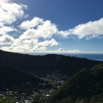


Very clean and well kept park with parking and restroom. The chickens rule the parking lot but the general hush of the place hits you at about the same time as the beauty of your surroundings. And that's just the parking lot. The roughly 4.5 miles (round trip) hiking trail is entertaining as you go being covered by gigantic and majestic trees to open air trails varying between steady incline/decline one smooth but narrow trails to climbing over/down rocks. Make no mistake, this is not a stroll in the park but well worth the effort in the landscape that you travel through but also the breathtaking views of Manoa Valley on one side and Paololo Valley on the other. At the end of the trail is a sign that warns you not to venture further. I ran into hikers who were returning from the forbidden trail (one on the left goes down and one on the right goes up - and these hikers were on the right side trail). They stated that if you continue on for another 1.5 miles, you'd get a clear view of Kaneohe. As I started late in the afternoon and my 75-year old Mom was with me (yeah, you heard that right), I didn't try the second trail. One day, however, I'll return and do the entire ridge. In any event, the total hike too a little under 4 hours but we stopped and tested along the way for Mom to catch a break or two. Also stopped to take a lot of pictures. Highly recommend this hike. read more

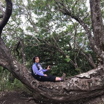
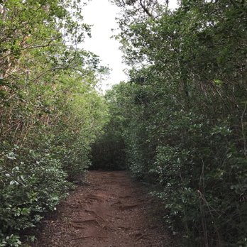
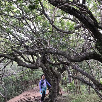


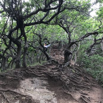
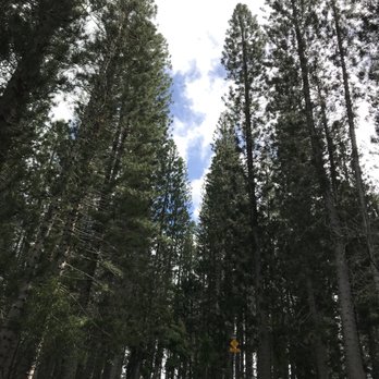


Ahhhh...fresh breezy air flowing through the magical bristles of a surprising pine tree populated ridge we just like to call, you know - that park in St. Louis! This recreation area and hike are a breath of fresh air from the many other parks on this island. I love coming here just to sit and relax on one of many tables or benches around the parking area. The park in general reminds me of when I used to go camping in the woods of California. I love the pine trees and sense of calm and serenity this place gives off. I have hiked the trail a couple times but never all the way through, yet. Honestly I just like to come up here to clear my mind and get away from the hustle and bustle. If you have never been here I suggest checking this place out for a nice change. It's beautiful! read more


In 2020, a brush fire scorched below the parks parking lot, which opened up the area. The good part, a panoramic view from Hawaii Kai to Waipahu is visible for now. The sad part, the homeless lost their million dollar view with privacy. read more


When I was a little kid, I remembered coming here for hikes all the time with the cub scouts.........since then, I've been to this park many times as a kid (all the way up till high school), then all of a sudden..........I've been M.I.A. from this place. Why? Don't know.........I guess I just didn't have the desire to hike.....and got into other interest. Well, all that changed today, as I decided to take my (PIC) = Partner in Crime "Makana" with me to take a little stroll in the park. Waahila Ridge State Recreation Park is located at the top of St. Louis Heights. Very nice forest, nice clean air, cool breezes, and don't you love that forest tree smell? As you drive into the park, there is a paved parking lot to park your car. The park also has several picnic tables on the property, as well as covered picnic stations with BBQ pits so you can have picnic parties. The hike itself is not too hard, but can be difficult if you come up here after a heavy rain. Unfortunately for me, last night had pretty heavy rains up here, so when I was hiking along the trial, it got pretty muddy & slippery. I went as far as I possibly could with Makana today, then turned around and headed back to the starting point. Some of the things I like about this park........... 1. Beautiful views of Manoa Valley & Palolo Valley 2. Nice fresh air 3. Love the wild chickens (don't feed them!) 4. Love to see the various nice looking foliage 5. I like it that they had a place where you could clean off your hiking shoes 6. They have a restroom 7. They have lots of paved parking 8. I like it that they have covered picnic stations with BBQ pits 9. Park is clean, and let's keep it that way. Don't litter, and if you do bring a "pal" with you..........make sure you pick up his poop on the trail! 10. A nice quite place to relax & get away from the hustle & bustle. I'll come back here again on a dry day...........anyone wanna join me? :D read more





7 years ago
I haven't actually done the hike that's here, but I've had many photoshoots here. There's more than enough parking inside the lot, picnic tables galore, and clean bathrooms. The pathways are well-maintained and set inside a Norfolk pine forest-- super pretty. See the pictures I've uploaded for reference! read more




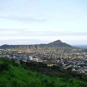
Beautiful park with pine trees above the sprawl of Honolulu! Great hiking trails both up and down from the park. I've hiked down, along the Kalaepohaku ridgeline, 3 or 4 times. And I've hiked up to Mt Olympus twice from here. Going down is an easy 1-1.5 hour out and back. Up and back to Mt Olympus is about 4-5 hours roundtrip. Steep and muddy near the top with a few super steep sections with ropes. Hope for overcast ABOVE the mountains for cooler temps, less sun, and clear views of Kaneohe. My first time to summit Mt Olympus we were hiking in clouds and saw nothing but grey. However, the second time we made it to the top the clouds parted and we were rewarded with stellar views all around! Awesome. Hiking down is a beginner trail following the mountain bike paths. Hiking up to Mt Olympus is an advanced intermediate level hike. Easily done but ensure good hiking shoes/boots, gloves, spikes, and lots of water. read more


A warm and sunny afternoon, we went hiking here. It is a really beautiful place. There is a hiking trail, picnic tables, bathroom, and parking lot. In the beginning of the hike, there are a bunch of trees and stumps. It's beautiful to take photo shoots here. The trail is easy to follow because there are pink bright markers. It seems there are 2 separate hikes. The beginning hike is around 45 minutes to an hour until you hit another sign in the middle of the trail that says Waahila Ridge. The beginning hike is easy...seems like kids are able to hike it. After the sign, it'll be a tougher and longer hike. I wanted to try out the longer hike, and it was quite difficult and steep. After an hour hiking that long trail there were other hikers coming back down. I asked them how long more to get to the top, they told me it was a long way. It was getting late and I was hella tired. So I decided to turn around. This whole trip that I technically didn't complete took around 3-4 hours round trip. The view is definitely really nice. Beautiful nature and trees. I would come back just to do a photo shoot. read more


8 years ago

Fantastic workout both ways - This hike was one I would actually feel pretty comfortable doing solo since it's well-marked and maintained and easy to follow. The most difficulty we had navigation-wise was getting our group to the park itself...several people tried to use their gps to reach the park which brought most people to Palolo and various other locations. The only thing you need to know is as you make your way up St. Louis (the road that runs next to City Mill off of Waialae), keep making right turns as long as they appear to go uphill... then make a left on Ruth. If you keep a decent pace, (our leader was a maniac!) you will be huffing and puffing in no time - I love hikes that make me work for it! There are quite a few grassy landings along the way where you can take a break and enjoy the view. http://www.yelp.com/biz_photos/nkkHUtoIK35_7KYrJ3szXQ?select=qtElyuXf4P8uAWPF7BHsWA#HnRrPxGm79DVx6GoZqOnjQ About an hour in, you'll reach a sign... http://www.yelp.com/biz_photos/nkkHUtoIK35_7KYrJ3szXQ?select=qtElyuXf4P8uAWPF7BHsWA#WHF7PQ6ndbiuI5gI8m9nZA It indicates left to Lower Wa'ahila (which I'm told will bring you into Manoa Valley) and right to continue up, where you'll eventually reach Mt. Olympus. http://www.yelp.com/biz_photos/nkkHUtoIK35_7KYrJ3szXQ?select=qtElyuXf4P8uAWPF7BHsWA#cwWhv9PIARq2IxhDNwg_Kw On this particular hike, we were witness to an proposal and popped a bottle of Moet near the summit - I highly suggest the same, gives you the warm and fuzzies almost all the way back :) http://www.yelp.com/biz_photos/nkkHUtoIK35_7KYrJ3szXQ?select=qtElyuXf4P8uAWPF7BHsWA#Yx3NtI33YYymupJJbM0OhQ read more


It's been a while since I last wrote about my hiking adventures. True, I've missed a few weeks here and there, so my hike a week streak has been broken, but I've still got a couple hikes that I've been on recently that are still waiting for my procrastinating butt to write about them. Here goes! Wa'ahila Ridge is located at the top of St. Louis Heights, and leads the way to the part of the Ko'olau range nicknamed Mount Olympus. The trail head is located in the State park at the top of the hill. There is also another way you can access this trail from Manoa Valley behind the old Chinese cemetery. It's called the Kolowalu trail, and connects with the short and simple Pu'u Pia trail. For this days purpose we started at St. Louis Heights instead of switch-backing up from the valley. The beginning of the hike was simple enough. A gradual incline until we hit a point where we came to a sign that directed to continue to the trail on the left side. There was also a group coming from that way, and there was a guy in a security guard uniform with them. For a second we thought that this hike had a security presence patrolling the trail. How weird would that be? Just follow the signs, and you'll be alright (until it says the trail ends, but I'll get to that later). There are a series on inclines and declines along the way. Cook Pines and strawberry guava grow along the trail in many places. As we were making our way along the path we realized that unlike many other ridge hikes where it's pretty much an incline all the way in, and a decline all the way out we were going to have to do the series of inclines and declines both ways. At least it wasn't a boring hike. As we trudged along we would stop every now and then and turn around to see what kind of view we had our backs to. Manoa Valley, Tantalus, Downtown: http://www.yelp.com/biz_photos/nkkHUtoIK35_7KYrJ3szXQ?select=3_Huj7hDr6mgKODm3n5Cqw#qtElyuXf4P8uAWPF7BHsWA Like many other ridge trails there are some native plants growing along the trail once you get past the invasives that are crowding out the place. 'Ohia blossom: http://www.yelp.com/biz_photos/nkkHUtoIK35_7KYrJ3szXQ?select=3_Huj7hDr6mgKODm3n5Cqw#bGaUZxi_6kJ6BD5hSgVkxg Eventually you're going to come across this sign: http://www.yelp.com/biz_photos/nkkHUtoIK35_7KYrJ3szXQ?select=3_Huj7hDr6mgKODm3n5Cqw#SoK17OButJDMrEPIJY898g If you heed the sign and go to the left you'll be on the Kolowalu Trail and end up in Manoa Valley as mentioned earlier. Unless you've got a car parked down there, or are willing to hike back up out of the valley, I'd recommend not going this way. As you can see from the picture my friends ignored end of trail sign. I guess that was the end of the "Lower Wa'ahila Ridge Trail", and beyond that sign must be the "Upper Wa'ahila Ridge Trail"? Well, no matter what they call it, it's the way to Mount Olympus. The hike up to this point wasn't very tough at all, but soon after this point the way started to get a little more challenging. There were sections of the trail where there was rope tied to trees to help hikers scale the steep muddy inclines. By this point I had put my camera away, so I could focus on the hike. Sorry, no pictures of this part of the adventure. However, when we finally made it to the peak of Mount Olympus I was able to pull out my camera, and take a couple of shots. Windward Side: That's the three peaks of Mt. Olomana at center-right, and Kaneohe Bay off in the distance on the left side. http://www.yelp.com/biz_photos/nkkHUtoIK35_7KYrJ3szXQ?select=3_Huj7hDr6mgKODm3n5Cqw#t1i_B7EFhAlAIFND0uTcmg Town Side: Looking out over Palolo Valley with Diamond Head crater in the distance. http://www.yelp.com/biz_photos/nkkHUtoIK35_7KYrJ3szXQ?select=3_Huj7hDr6mgKODm3n5Cqw#jxHZUfw5mE3nrzjkK5NspQ The way out was challenging in a different way. Going up a steep muddy incline using a rope is one thing, but going back down that section requires a different set of skills. I don't know if it was the slightly hazy weather, or that I was out of shape from skipping a couple weekend hikes, but this trail kicked my butt. We did make it all the way to Mount Olympus, and back, but I was completely exhausted before we made it all the way out, and I had run out of water too. Where did all those three liters go?? Sweated back out! In all the hike was about a five-six mile round trip, and took us somewhere between four and five hours to complete (counting time spent resting, taking pictures, and admiring the views). Parking up there can get a little tight because there's only a couple dozen stalls, and people like to picnic and walk around in the park. ***31 Yelps: 2/31*** read more
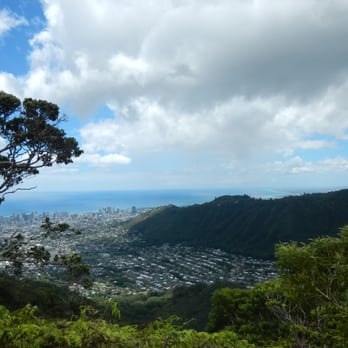


Looking for hike in St. Louis Heights? This is the perfect place to go. The hike is very mountainous so prepare to get a little dirty and muddy. The beginning of the hike doesn't start until you go about 1/4 mile into the woods. You'll see the start with a little sign with a hiker and arrow. Once you pass the start sign, the slope down is a little slippery and if it rained the day before, slightly muddy! So shoes are a necessity! Close to half way in, there's a cool look out point of Palolo valley on the right side of the hike. Beautiful scenery!! A MUST stop & take picture moment. Towards the end of the hike there's another look out point where you can see all of Honolulu! All of Waikiki and the city. Its breath taking and worth the hour hike in. The end of the hike is this green patch of flat land that if you pass, will enter into Mt. Olympus. For those that are willing to spend 8+ hours hiking, continue on and may the force be with you!! All else, that is the turn around point to come back down the mountain. Need to know: Shoes & water are a MUST Good for Dogs 1.40 hr round trip Hike is not a loop, so same way going in and out Bring a camera!!! read more


12 years ago
Another gem of a hike and probably the best overall ridge hike near urban Honolulu. If you live in town or are a visitor staying close by in Waikiki this is a trail that you definitely should not miss! The trail starts at the Wa'ahila Ridge State Recreation Area at the top of Saint Louis Heights. While others have explained the directions in detail in other reviews, I typically just enter Ruth Place into Waze or Google Maps and let the apps work their magic. Unlike some other ridge hikes such as Kuliouou or Mariner's Ridge where you have to find street parking, this trail has an ample dedicated parking lot for those hiking, picnicking, or otherwise enjoying the recreation area. Hiking Wa'ahila is like entering another world. Only minutes away from the urban sprawl of Honolulu you find yourself in a Narnia-like wilderness surrounded by huge Cook Pines and birdsong. The trail itself is easy to follow and very well-maintained due to both heavy use and the efforts of volunteers who routinely groom the trail. Following the trail mauka you will find yourself on the ridgeline between Mānoa and Pālolo Valleys. The view from up here is AMAZING; on a nice day you can see not only Diamond Head and urban Honolulu but the entire south shore of Oahu from Koko Head to Barbers Point. As you ascend the trail, there are numerous flat grassy areas which make excellent spots to soak up the view while grabbing a drink or snack. As you continue your climb toward the Ko'olau summit you will reach a junction with the Kolowalu Trail which descends to your left into Mānoa Valley. A sign here states something to the effect of "End of Maintained Trail" but do not let that deter you from continuing the hike all the way to the top. The trail is actually in decent shape beyond the junction and while there are some sections at the top that can be slippery and require the use of ropes, it is definitely not difficult! At the top you reach a peak called Mt Olympus with panoramic views of Windward Oahu; it's definitely worth the effort! read more


12 years ago
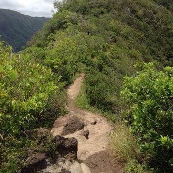
We did this hike yesterday...as a mistake. It was an adventure, for sure. We had been planning on taking a Saturday hike all week. Problem was, we didn't know where to go. There were several contenders, but then it rained Friday night, which, er, put a damper on things (no pun intended). My husband declared that he didn't want to get muddy, so I started Googling and Yelping places to go. Well...if you've been on this trail, I guess you can say that I didn't do my research very well. We wound up at Wa'ahila around 12 in the afternoon. Do not input it into your GPS as "Wa'ahila." It will take you up into some peoples' private driveways. Quickly, Yelp came to the rescue - a previous review said to GPS "Ruth Place" instead. Worked like a charm, and took us right to the park. Parking was ample. There were picnic areas and restrooms for convenience. The park area was super nice, clean, and tranquil. We got started almost right away - and almost immediately realized that we had made a mistake. Oh well, no turning back now, right? The initial climb to the trail was SO MUDDY. We were slipping and sliding around, struggling to get up the hill. We had already driven all this way, though - so we figured we might as well stick it through. My second mistake was reading that the hike was only 1.4 miles round trip. LOL NOPE. Let me debunk that myth right now - IT ISN'T. Our Fitbit and GPS monitors calculated us at 4.54 miles from the start of the trail to the end and back. Now, under the guise that it WAS only 1.4 miles...I suggested that we keep going since the end must be near. Famous last words. The mud was so deep and thick, it made our trek to the first lookout pretty difficult. We didn't realize that the trail looped around to the same point - we followed the first sign with the arrow and found ourselves at the lookout. Now, leaving the lookout, we went right back down and found the first sign we had followed. If you want the easy way to the lookout, go straight. If you want the longer way (and harder if it's muddy), follow the arrow and loop around. Our confusion of where to proceed was due to the fact that the trail that actually leads you to the RIDGE part of the hike is not necessarily marked very well. We were looking for trail markers, but there were none. The only way we knew to go DOWN was because a group came up behind us and we had to ask them. I honestly started to think that the lookout was where the trail ended. Nope, wrong again. We hiked down, over a huge section of exposed roots. They were still slippery due to the rain, which made it difficult. The hike continued, we started to encounter some rocky terrain, but nothing like what we were going to have to face. I started to whine about how hard it was this early on. If only I knew. And now, a brief history on me, the hiker - which will help you determine to take it or leave it when it comes to my review - I have a severely deviated septum, so breathing is often hard for me. (Pending surgery.) I am short (5'1"), so my leg span is nearly non-existent. I lack upper body strength. And prior to this hike, the only two hikes we had been on were the Makapu'u Lighthouse Trail and Diamond Head. This trail was no comparison. The trail quickly turned into a rock climbing adventure. A lot of the reviews on here mention "ropes" which are supposed to make the trail easier. I am here to burst your bubble and tell you that there are NO ROPES on this trail to assist. Maybe there were in the past, but there are NO LONGER. The entire trail is comprised of ups and downs over roots, rocks, under trees, over fallen logs. Many parts of the hike required butt-scooting, holding onto tree trunks for dear life, etc. DO NOT do this hike if you are faint at heart, do not have good hand-eye coordination, or if you cannot keep your hands free (aka don't bring little ones. This doesn't seem like a kid-friendly path.) There are many narrow sections where if you fall, you are going to drop off the side of a mountain. Literally. Dogs are allowed, and we saw a few, but they are supposed to be leashed at all times. I'm not sure how this is even possible - one of the dogs we encountered was leashed, and caused it's owner to fall several times because she couldn't use her hands to keep her balance or to hold onto tree trunks for assistance. They turned around early on. My thighs were trembling with each step I took, my muscles were so tired. I would NOT recommend doing this hike if it has recently rained or is supposed to rain unless you are an advanced hiker. As soon as we reached the end of the trail, it started pouring. We decided to turn around and not proceed to Mt. Olympus. The trail got even worse than before. Going back was SO hard - we fell several times and I pinched a nerve in my shoulder climbing back up the rocks in the path. We didn't get back to the car until almost 5 pm. It was very different than what we are used to. Despite it's difficulty, we DID have fun! read more



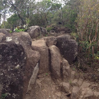


14 years ago
This is one of our favorite regular hike trails. We usually take time to enjoy the breeze and forest sound- takes about 2 hours round trip. Instead of going straight up the bare hill, you could enjoy the pine tree shades on the right side, behind the picnic shack. Cardiovascular pump up -medium to high. After "end of trail" to the right, is the entry to the Mt. Olympus. Expect mud and super hills. Parking: nicely paved. Someday very busy. Toilet: Decent. I don't go there after rain unless you want to be muddy. Super slick. YELP 365 - 328/365 read more

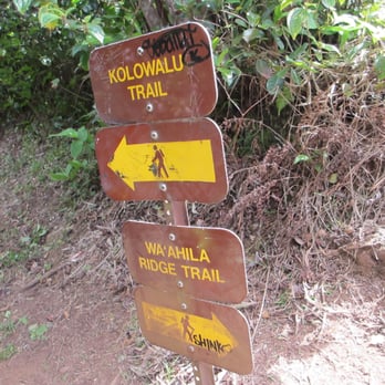

While the trail itself is clear and well maintained, the trees along the trail needs some clearing for optimal views. We saw lots of people with dogs and bikes despite the signs saying both were prohibited. The hike itself is pretty easy if you're in decent shape. Hell, my Baby Daddy did it and he NEVER works out We saw a few people with young kids and even wearing babies but I wouldn't recommend it as there are some parts that require climbing. Views on the drive up are amazing! There is a free parking lot but it can fill up. Plenty of tables and chairs as well as picnic sites to relax at afterwards. read more
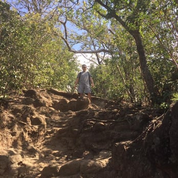



12 years ago
I'm a first timer on this hike. The views were amazing despite all the mud and shoe tight pathways with cliffs on both side. The parking lot was full when I got there at 9 AM so I had to park on the side of the road. This hike is about 5.60 miles to and from that's if you go all the way to the top where you can see down the Windard side of the island. I personally enjoyed the rope climbing. What you should pack: Water, bug spray, clothes and shoes that you don't mind getting dirty. A walking stick will come in handy with the narrow pathways and the mud. BEFORE DOING THIS HIKE: Please check the weather! and be prepared and watch out of the ferns they DO SCRATCH! I'm looking forward to doing this hike again. read more


I love this hike. So serene and peaceful. Good for picnics too. Has covered pavilions with benches so you can go in any weather. It's good for sunny hot days where you can't normally hike from the heat. It has constant shade which I totally love. The views are really pretty too! read more

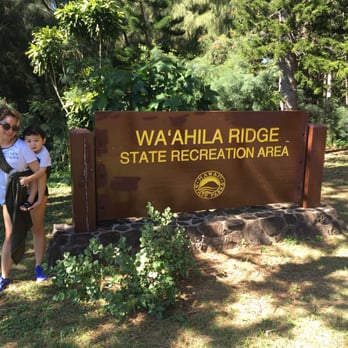

11 years ago
This is a great hike with awesome views of Diamond Head, Waikiki and Manoa Valley. Not a difficult hike but you will have a few up and down areas over some rocks but definitely not bad. Park your car in the parking lot and head straight onto the trail. The trail is fairly well marked with ribbon. There is a section that has a small sign that says trail and and arrow pointing to the left. I didn't take it but on the way out realized it takes you around the rock area so makes it a little easier for you. Oh well, next time. The trail continues with some up and down areas and through a mostly shady forest. You can stop once you reach the fork in the road with signs Kolowalu Trail to the left and Waahila Ridge Trail to the right. You will also see a sign that states the trail past that point is not maintained, so be careful and prepared. Beginners may want to turn around at this point. I took the Wa'ahila Ridge Trail to the top which is a little more challenging and requires some more climbing over rocks and steep sections with the use of ropes that are already out there on the trail. You can also use the tree roots as handles to help you get up and down those more challenging areas. It really is not too bad just be prepared for it. Just before you reach the top you will find a large grassy area which is a great place to have lunch and take in the views but continue on to the top for sure. The trail will get extremely muddy in certain areas and can be dangerous if you were to continue up the the ridgeline, so don't go after a hard rain. The hike took me about 4 hours total and I stopped a lot to set up my tripod and take photos. Tips - Take plenty of water, trail snacks and some type of camera to capture the awesome views. Also, best to wear some shoes that have some grip on the soles. Take your time, be safe and enjoy. Aloha read more


I have a lot of great things to say about this hike but I'll keep it short and sweet! - There is ample parking at the trailhead as well as restrooms (with toilet paper!). - While I wouldn't consider this trail easy, it is baby-wearer and keiki friendly. (I wore my 9-month-old and hiked with a group of other baby-wearers) - Good hiking shoes come in handy. Some steep/slippery areas. Take your time going down and "climbing" up and and down the rocky areas. Considering wearing pants to avoid scraping legs on the rocky areas. - Outstanding views at the "top." I didn't hike this all the way to Mt. Olympus (? I think that's where it goes...) but I hiked to the popular lookout point... about 2.5 miles in. There's a nice place here to stop and have a snack/take photos/refuel. Don't forget the water and sunblock on this one - Happy Hiking! read more

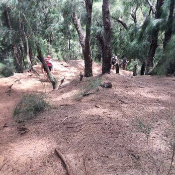

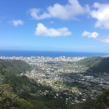


Have yet to do the hike but the last time I was up here I brought my mom and surprisingly she said that she has never been up to this ridge and she was tickled. She said it was like being on a neighbor island. So I showed her the views or manoa valley and town, the guaiwi (sp?) was not in season so we didnt get to take some. Of course we took some pictures and watched an 2 cute girls dressed up as indians i guess and one guy dressed up as a cowboy do a photo shoot. I will go back with mom when her knees feel better and along with the wife we will do the hike. read more


11 years ago
Really fun hike and cool park! I only walked to the end of the Waahila Ridge Hike (about 1.5 miles in) and I really enjoyed it. Part of what makes this hike so nice is the different types of terrain. There's exposed rock, sliding down tree roots, covered semi-muddy spots. You won't get bored and you won't just be going up-up-up until you reach a peak. It's a fairly easy hike, good for kids and dogs too. I'm a pretty bog baby when it comes to difficult hikes, and I really enjoyed this one. It can get muddy if theres been rain, so I would go on a sunny day. We went in October and there was some fruit on the trees and ground, which got a little stinky. I have a feeling in the coming couple of weeks this might be one stinky hike! The park is really nice too, there are plenty of picnic tables (covered and uncovered), a decent amount of parking, but the road in/out is a little narrow. Be careful. read more


This is a really enjoyable hike. Beautiful views of Manoa and Palolo valleys. I'd say it's a moderate hike. Some portions are steep while others are flat. There are two clearings where you can get gorgeous views of Waikiki. My doggy had a lot of fun and even found a piglet to chase (thank goodness mama pig didn't kill him!). I'll have to go again when the strawberry guava are in season. Those berries are quite yummy! read more

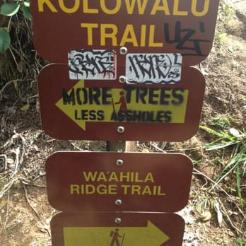

11 years ago

1st of all, coming off a cold and having been on lockdown for a week, it was time for some outdoors. I was even told how "pasty" I look. Lol. Anyways, mapquests will tell you to park in the street and walk in. There IS parking in the park. Mind you, it's a very narrow, one lane road to get in. 2ndly, although it did not rain the night before, the path was extremely wet, muddly and sloshy. Like you walk in the mud and your foot sinks in til it's almost covered. Pigs fester in the area and you. An smell pig feces on certain parts of the trail. Since I dont have a very keen sense of smell, I did not smell it. But, my honey did. We walked about half an hour and turned around. The mud slows you down and there are some very steep areas. Although it was very green, very beautiful and fairly desolate, it was not the most scenic or easiest hike. The restroom area has a water spigot that you can wash your hiking shoes with (and states so). There were about 3 picnic pavilions available as well. Each has a grill and water access. This would be great for parties although it lacks enough parking, and the pavilion's are out of the way from the parking lot. But it is beautiful. We went on a Tuesday and finished around 12pm and few people were there. I'm glad I tried it though, as I would never have imagined a hike up there existed. read more

Page 1 of 3
More info about Waʻahila Ridge State Recreation Area
St Louis Heights Dr
Honolulu, HI 96822
Directions
Visit Website
http://dlnr.hawaii.gov
Hours
Indoor Amenities
Outdoor Amenities
Ask the Community - Waʻahila Ridge State Recreation Area
Anyone encounter a homeless man who lives in a tan van? He talked to us across the parking lot and kept coming closer. Then he pulled out a pocket knife to pick up trash about 10 feet away from us. Totally freaked me out and we left.
Several homeless people live on side trails enjoying a million dollar view for free. This has been going on for a while. C&C hasn't addressed this issue. I called 911. I would recommend you call 911. More people call better for safe park use.
Is there a place to swim along this hike?
They have a water park section but it was not open till the weather warms up. The kids can get wet but not total 🏊♂️ swim.
Review Highlights - Waʻahila Ridge State Recreation Area
You might also consider



















Why does Yelp recommend reviews?
2 reviews that are not currently recommended
The reviews below are not factored into the business's overall star rating.

14 years ago

12 years ago
Waʻahila Ridge State Recreation Area - hiking - Updated September 2026
Best of Honolulu
People found Waʻahila Ridge State Recreation Area by searching for…
Dog Friendly Beaches in Honolulu, HI
Waterfall Hike in Honolulu, HI
Dog Friendly Hiking Trails in Honolulu, HI
Scenic Night View in Honolulu, HI
Camping Cabins in Honolulu, HI
Dog Friendly Things to Do in Honolulu, HI
Secluded Spots in Honolulu, HI
Beach BBQ Pits in Honolulu, HI
Park With BBQ Pits in Honolulu, HI
Free Things to Do in Honolulu, HI
Walking Groups in Honolulu, HI
Trending Searches in Honolulu, HI
Apple Orchards near Waʻahila Ridge State Recreation Area
Apple Picking near Waʻahila Ridge State Recreation Area
Archery near Waʻahila Ridge State Recreation Area
Barbershop near Waʻahila Ridge State Recreation Area
Blow Dry Bar near Waʻahila Ridge State Recreation Area
Caves near Waʻahila Ridge State Recreation Area
Cliff Jumping near Waʻahila Ridge State Recreation Area
Consignment Shops near Waʻahila Ridge State Recreation Area
Corn Maze near Waʻahila Ridge State Recreation Area
Dog Friendly Things To Do near Waʻahila Ridge State Recreation Area
Dog Swimming near Waʻahila Ridge State Recreation Area
Eyebrow Threading near Waʻahila Ridge State Recreation Area
Eyelash Extensions near Waʻahila Ridge State Recreation Area
Hiking near Waʻahila Ridge State Recreation Area
Kids Birthday Party near Waʻahila Ridge State Recreation Area
Makeup Artists near Waʻahila Ridge State Recreation Area
Mens Suits near Waʻahila Ridge State Recreation Area
Off Road Trails near Waʻahila Ridge State Recreation Area
Parks near Waʻahila Ridge State Recreation Area
Photo Spots near Waʻahila Ridge State Recreation Area
Picnic Areas near Waʻahila Ridge State Recreation Area
Places To Take Pictures near Waʻahila Ridge State Recreation Area
Private Schools near Waʻahila Ridge State Recreation Area
Public Shower near Waʻahila Ridge State Recreation Area
Rock Quarry near Waʻahila Ridge State Recreation Area
Scenic Night View near Waʻahila Ridge State Recreation Area
Scenic Overlook near Waʻahila Ridge State Recreation Area
Browse Articles
Browse Nearby
BEST of Honolulu, Hawaii Coffee near Waʻahila Ridge State Recreation Area
BEST of Honolulu, Hawaii Things to Do near Waʻahila Ridge State Recreation Area
BEST of Honolulu, Hawaii Restaurants near Waʻahila Ridge State Recreation Area
BEST of Honolulu, Hawaii Parks near Waʻahila Ridge State Recreation Area
BEST of Honolulu, Hawaii Breakfast near Waʻahila Ridge State Recreation Area
BEST of Honolulu, Hawaii Walking Trails near Waʻahila Ridge State Recreation Area
BEST of Honolulu, Hawaii Campgrounds near Waʻahila Ridge State Recreation Area
BEST of Honolulu, Hawaii Sightseeing near Waʻahila Ridge State Recreation Area
BEST of Honolulu, Hawaii Airport near Waʻahila Ridge State Recreation Area
Browse Brands
Related Searches in Honolulu, HI
Best Dog Hiking Trails Around Honolulu, Hawaii
Best Fishing Locations and Guides in Honolulu, Hawaii
Best Nature Trails for Hiking in Honolulu, Hawaii
Best Places for Horseback Riding in Honolulu, Hawaii
Best Sightseeing Experiences Available in Honolulu, Hawaii
Best Waterfalls and Swimming Holes in Honolulu, Hawaii
Discover Dog Friendly Trails to Explore in Honolulu, Hawaii
Discover Easy Hiking Trails Near Honolulu, Hawaii
Discover Kid Friendly Hiking Trails in Honolulu, Hawaii
Discover Popular Bike Trails in Honolulu, Hawaii
Discover Scenic Mountain Bike Trails Near Honolulu, Hawaii
Discover Top Nature Parks to Visit in Honolulu, Hawaii
Discover Walking Parks in Honolulu, Hawaii Near You
Discover a Hiking Trail in Honolulu, Hawaii
Discover the Best Night Hike Trails in Honolulu, Hawaii
Dog-Friendly Hikes With Dogs in Honolulu, Hawaii
Enjoy Camping Adventures Around Honolulu, Hawaii
Enjoy Kayaking Adventures in Honolulu, Hawaii
Enjoy Off Leash Dog Hikes in Honolulu, Hawaii
Enjoy Tent Camping Spots Around Honolulu, Hawaii
Enjoy a Beautiful Waterfall Hike in Honolulu, Hawaii
Enjoy the Best Walking Path in Honolulu, Hawaii
Enjoy the Best Walking Trails in Honolulu, Hawaii
Explore Easy Hikes Perfect for All in Honolulu, Hawaii
Explore Fun Activities to Do in Honolulu, Hawaii
Explore Popular Campgrounds Near Honolulu, Hawaii
Explore Popular State Park Destinations in Honolulu, Hawaii
Explore Top Dog Parks in Honolulu, Hawaii Near You
Explore the Best Beach Spots in Honolulu, Hawaii
Family Friendly Hiking With Kids in Honolulu, Hawaii
Find Cozy Camping Cabins in Honolulu, Hawaii
Find Popular Ziplining Spots Around Honolulu, Hawaii
Find Top Dog Friendly Parks to Visit in Honolulu, Hawaii
Find Top-Rated Waterfalls in Honolulu, Hawaii Now
Find the Best Parks for Picnics in Honolulu, Hawaii
Hiking Trails With Waterfalls in Honolulu, Hawaii
Off Leash Dog Hiking Trails in Honolulu, Hawaii
Picnic Areas With BBQ Pits Available in Honolulu, Hawaii
Popular Outdoor Activities to Try in Honolulu, Hawaii
Popular Picnic Spots to Visit in Honolulu, Hawaii
Popular Waterfall Hiking Trails in Honolulu, Hawaii
Safe and Fun Parks for Kids in Honolulu, Hawaii
Top Hiking Trails to Explore in Honolulu, Hawaii
Top Playgrounds for Kids to Enjoy in Honolulu, Hawaii
Top Running Trails to Explore in Honolulu, Hawaii
Top Swimming Spots and Pools in Honolulu, Hawaii
Top Things to Do With Kids in Honolulu, Hawaii
Top-Rated Camping Sites in Honolulu, Hawaii


