Cancel

    Open app

    Search

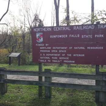
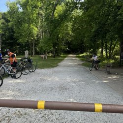
    White Hall Station - NCR Trail

    4.0 (4 reviews)

    White Hall Station - NCR Trail Photos

    You might also consider

    More like White Hall Station - NCR Trail

    Recommended Reviews - White Hall Station - NCR Trail

    Your trust is our priority, so businesses can't pay to alter or remove their reviews. Learn more about reviews.
    Yelp app icon
    Browse more easily on the app
    Review Feed Illustration

    3 years ago

    Helpful 0
    Thanks 0
    Love this 0
    Oh no 0

    7 years ago

    Helpful 0
    Thanks 0
    Love this 0
    Oh no 0

    6 years ago

    Helpful 0
    Thanks 0
    Love this 0
    Oh no 0
    Photo of Justin W.
    9
    522
    9043

    6 years ago

    Helpful 0
    Thanks 0
    Love this 0
    Oh no 0

    Verify this business for free

    People searched for Hiking 598 times last month within 15 miles of this business.

    Verify this business

    Kilgore Falls - The waterfall!

    Kilgore Falls

    4.0(41 reviews)
    11.8 mi

    Kilgore is a lovely place for an easy to moderate hiking trail. It's open daily but you need a…read morepermit on the weekends from Memorial day to Labor Day I believe. To get to the waterfall you have to walk a path that's about 10-15 minutes. You will have to climb over some rocks in the water in your travels, but once you get to the waterfall you will absolutely love it. *Please note* Wear comfortable shoes because there are some areas that could be potentially dangerous if you don't take your time.

    [Coronavirus review] This is a small site auxiliary to Rocks…read moreState Park. Notably, the parking lot requires an advance reservation on peak dates, and this policy has been expanded to cover more dates due to the pandemic lockdown pushing people to spend their days outdoors. The trail is a short loop to the falls. Great Falls this isn't, but it's significant enough to generate a nice spray. A rather upset-looking fish flopped down shallow water as I approached. Upstream of the falls was a challenge. Few fords were viable, perhaps owing to heavy rain, and signs suggesting the area was blocked off were ignored by expeditions looking for better crossings. I made it across the stream and back, but I did get a little wet. The scenery isn't worth a long drive on its own, but paired with the other local park sites, it makes for good viewing, and in particular this space with its parking limitations can't get too crowded.

    Photos
    Kilgore Falls
    Kilgore Falls
    Kilgore Falls

    See all

    Torrey C Brown Trail

    Torrey C Brown Trail

    4.8(8 reviews)
    8.5 mi

    What a breathtaking scenic view you get while walking this trail. The trail is maintained really…read morewell, I didn't see any trash, and there is spacious walking space between you, bikes, runners, and other walkers. You also get some great views of birds and the water. The trail is so long, it just keeps going on and on. Where I parked was a little small, and I could see the parking lot getting too full if you don't get to the park early enough. Regardless, this was a relaxing trail to walk on and I will 100% take it again soon.

    Torrey Brown Trail (Ashland, MD to Mason Dixon Line [PA])…read more We ride segments of this trail with some regularity. This trip on Labor Day was from Whitehall to Mason Dixon Line (approx.9 miles, 18+ out & back). We were going to park at Monkton Station and have a longer ride, but holiday brought out everyone, and their brother, sister, cousin, college friends, camp counselors, army buddies, ...etc! So we navigated to the Whitehall stop. One feature of this trail is the many trailheads as options. The ride out climbs (4% max) to the PA line, it does, especially at the end feel a bit taxing, in a good way. We were on our Cannondale Topstone gravel bikes (37mm tires). The surface is consistent well packed limestone/ fine gravel. The ride back towards Whitehall is mostly a coasting excercise. The "crowd" offered all level of rider, walker, dog walker, jogger, stroller ladies, etc. so it wasn't as serene as this segment can usually be. For the most part, except on the busiest days at Torrey Brown (across 20+ mile stretch) can be quite private away from the trailheads. Good day, nice weather, great ride.

    Photos
    Torrey C Brown Trail
    Torrey C Brown Trail
    Torrey C Brown Trail

    See all

    The Serpentine Barrens - geological wonderland; basically a 'desert' region in SouthEast PA

    The Serpentine Barrens

    4.0(2 reviews)
    29.8 mi

    Half decent scenic route. 4/10 in terms of difficulty-…read moretrail is pretty good workout for uphill and downhill 2/10 for trail management. The trails at certain points were extremely overgrown and poorly marked. Lucky there is cell reception and I could use it to navigate correctly. But certain areas are way too overgrown resulting prime tick habitats to the point where certain grass areas I can physically SEE ticks sitting on grass overlapping the trail.

    Here's the official description: "Located along a 20-mile stretch of the Maryland-Pennsylvania…read moreborder, the State Line Serpentine Barrens, the largest occurrence of Serpentine Barrens in the eastern United States, contains some of the last major remnants of serpentine grassland and savanna in eastern North America. " But what this means to you and me is that its just a fantastic; eerie; unearthly natural environment to go seek out and hike in. Of especial interest to horticulturalists and wildlife biologists; students; geologists, arborists, sylviculturalists, ecologists--sure. It is all that. But just in general --a fun and free place to roam around if you're simply an outdoors enthusiast. There is no one here; its deserted; and filled with all sorts of strange trees, shrubs, flowers, grasses, and lichens. You can really get your nature on; a really 1-on-1 experience.

    Photos
    The Serpentine Barrens - Everything growing here is stunted in height to approx 3/4 scale

    Everything growing here is stunted in height to approx 3/4 scale

    The Serpentine Barrens - The State Line Serpentine Barrens -- from one of their websites

    The State Line Serpentine Barrens -- from one of their websites

    The Serpentine Barrens - May not immediately be apparent to the naked eye but all the vegetation is geared for arid desert conditions

    See all

    May not immediately be apparent to the naked eye but all the vegetation is geared for arid desert conditions

    Appalachian Trail

    Appalachian Trail

    3.9(9 reviews)
    44.5 mi

    Awesome trails that are well marked and we'll maintained. Don't get confused with Annapolis Rock…read morebeing down near Annapolis, MD and don't get confused over the Washington Monument that's out here too - we're in Myersville haha. Seriously my current favorite stretch of trails in the state of Maryland, you have the option of going to either vista(we did both when we were out there and added a few miles on another trail) and both views are awesome. Be prepared for some good elevation climb, I clocked our highest gain of being 1800 feet - felt hard core. Just doing either one of the trails will be a good trek and not overwhelming for any novice hiker. Doing both might be a bit much for those not well versed in walking for really long periods of time. Dog friendly, but please leash your creatures. All it takes is one friendly unleashed dog to run up to a not friendly leashed dog and then everyone's trail experience is ruined. We finished just shy of 15 miles for our day, and felt great! Annapolis Rock is the steeper climb albeit shorter at around 2.2 miles out then 2.2 miles back(4.4 mile hike). Washington Monument is an easier trail though it's a bit longer and around 3.5 miles out then 3.5 back. Highly recommend, super easy to find with the parking strip right off the road!

    I'm so glad to finally be able to write a review on this place. It was so hard to find for me. But…read moreit was totally worth the trouble. It was an amazing hike. The right amount of hard work and great view The actual address for the trail head to Annapolis Rock from Maryland is 11142-11150 Baltimore National Pike Myersville MD 21773

    Photos
    Appalachian Trail
    Appalachian Trail
    Appalachian Trail

    See all

    Lake Frank

    Lake Frank

    4.3(15 reviews)
    44.3 mi

    Located in the Derwood/Rockville area of Moco!…read more My alumni association recently did a hike here but I missed it so I decided to explore this trail on my own. I visited on an early Sunday morning. I parked off Avery Road and there were a few cars already there. The change of scenery was nice. I enjoyed the scenic and peaceful views!

    This is a lovely park, with plenty of hiking options and the feel of being in deep woods while…read moreactually located in the middle of town (Rockville). The lake itself is gorgeous, and always so picturesque.... I have hiked the Lakeside Trail a few times, which is about three miles and mostly wooded, with two creek crossings (one easy, the other more difficult, requiring stepping on stones that could be slippery or even, at times, underwater). The first time we hiked the trail we did get lost as we skipped the difficult creek crossing and ended up going straight, and almost right back out of park...so bring water to drink and wear (or bring) a pair of shoes that can handle the creek water (it's not safe to swim--so I'm assuming, or wade around--in). UPDATE: Part of the Lakeside Trail has construction going on around it (near the easier stream crossing) and last time we encountered it we decided to turn around rather than trying to get around the mess...but there are other parts of the trail to explore, including hiking along the path that' intersects with Rock Creek Trail (or you can go around the other end of the Lakeside Trail, close to the Avery Park entrance...) Usually when we're here we don't do the entire trail, anyway, but turn around at various points, depending upon how long we want to walk. Although the park does get busy on weekends (and it can be difficult to get a parking spot at the Avery Park lot) the further along the trails you go the less people you'll encounter. Weekdays are also pretty peaceful. I look forward to visiting the Meadowside Nature Center when it reopens--this is located at the other park entrance at Muncaster Mill Road.

    Photos
    Lake Frank
    Lake Frank
    Lake Frank

    See all

    White Hall Station - NCR Trail - hiking - Updated July 2026

    Loading...
    Loading...
    Loading...