Alder Trail Camps Photos
 - Hiking Near Me - Davenport, California")
 - Hiking Near Me - Davenport, California")
 - Hiking Near Me - Davenport, California")
 - Hiking Near Me - Davenport, California")
You might also consider
More like Alder Trail Camps
Recommended Reviews - Alder Trail Camps
Start your review...

12 years ago
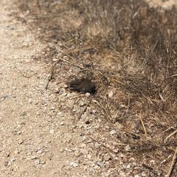
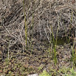
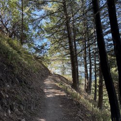
Scenery: Forrest, Redwoods, Creek Difficulty: Easy Distance: 1.0 mile Elevation Gain: Pretty Level Duration: Route Type: In and Out Good for Kids: Yes Strollers: Yes Bikes: Yes Pets: Fees: Parking $10 My family & I recently went on an easy backpacking trip here with Stroller Hikes (http://strollerhikes.com/). To get here, drive towards Waddle Beach. Across the street from Waddle Beach, enter through the iron gate and drive down the road. You will then pass a small ranger office, park at the day use parking. Parking is $10. We started our hike at the Skyline to the Sea Trail. There were two trails, one for hikers, the other for horses, bicycles, and handicapped. We hiked the road trail, to your right, since we had the jogging stroller. The trail was very easy to follow and well maintained with lots of signs. In addition, you are mostly exposed to the sun until you get closer to camp, where you will be under some shade. On the trail, you will pass a ranch/home on your right, cross over a bridge, and pass another bridge on your left. You will finally see a sign that reads, Alder Camp. Follow the sign and you've reach the campsite. This is a very easy backpacking trip to hike with kids. Our group had about 8 kids, 4 of them were 2 years old and under. I especially liked how the campsite was next to a creek. The kids were able to play/swim in the water. We were also able to hike with the kids since the trail near the camp was easy enough for the kids. In addition, the campsite had trashcans & non flush toilet. Tips: Backpacking stoves only Bring a rope to tie your food on the tree read more
 - Hiking Near Me - Davenport, California")
 - Hiking Near Me - Davenport, California")
 - Hiking Near Me - Davenport, California")
 - Hiking Near Me - Davenport, California")
 - Hiking Near Me - Davenport, California")
 - Hiking Near Me - Davenport, California")


More info about Alder Trail Camps
You might also consider


Alder Trail Camps - hiking - Updated June 2026
Best of Davenport
People found Alder Trail Camps by searching for…
Beaches in Davenport, California
Campgrounds in Davenport, California
Hiking Trails in Davenport, California
Sand Dunes in Davenport, California
Redwood Trees in Davenport, California
Parks in Davenport, California
Tide Pool in Davenport, California
Hammock Park in Davenport, California
Waterfall Hike in Davenport, California
Fishing Spots in Davenport, California
Tent Camping in Davenport, California
Things to Do With Kids in Davenport, California
Camping Sites in Davenport, California
Canyoneering in Davenport, California
Hiking Groups in Davenport, California
Picnic Areas in Davenport, California
Beaches for Kids in Davenport, California
Waterfall in Davenport, California
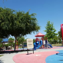
Playgrounds in Davenport, California
Places to Stay in Davenport, California
Hiking With Kids in Davenport, California
Secluded Spots in Davenport, California
Trending Searches in Davenport, CA
Bait And Tackle Shop near Alder Trail Camps
Black Owned Nail Salons near Alder Trail Camps
Boat Rental near Alder Trail Camps
Cliff Jumping near Alder Trail Camps
Day Trips near Alder Trail Camps
Dog Friendly Trails near Alder Trail Camps
Fishing Spots near Alder Trail Camps
Jet Ski Rental near Alder Trail Camps
Kayak Rental near Alder Trail Camps
Lakes & Ponds near Alder Trail Camps
Outdoor Activities near Alder Trail Camps
Pick Your Own Farms near Alder Trail Camps
Places To Walk Around near Alder Trail Camps
Public Shower near Alder Trail Camps
River Swimming near Alder Trail Camps
Rock Quarry near Alder Trail Camps
Scenic Night View near Alder Trail Camps
Scenic Overlook near Alder Trail Camps
Secluded Spots near Alder Trail Camps
Soccer Store near Alder Trail Camps
Splash Pad near Alder Trail Camps
Strawberry Picking near Alder Trail Camps
Sunrise View near Alder Trail Camps
Swimming Holes near Alder Trail Camps
Swimming Lakes near Alder Trail Camps
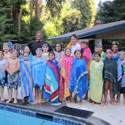
Swimming Pools near Alder Trail Camps
Watch Sunset near Alder Trail Camps
Browse Articles
Browse Nearby
BEST of Davenport, California Restaurants near Alder Trail Camps
BEST of Davenport, California Coffee near Alder Trail Camps
BEST of Davenport, California Things to Do near Alder Trail Camps
BEST of Davenport, California Beaches near Alder Trail Camps
BEST of Davenport, California Breakfast near Alder Trail Camps
BEST of Davenport, California Wineries near Alder Trail Camps
Browse Brands
Related Searches in Davenport, CA
Affordable Kayak Rental Services in Davenport, California
Best Fishing Locations and Guides in Davenport, California
Best Nature Trails for Hiking in Davenport, California
Best Places for Horseback Riding in Davenport, California
Best Waterfalls and Swimming Holes in Davenport, California
Check Out Off Road Trails in Davenport, California
Discover Dog Friendly Trails to Explore in Davenport, California
Discover Scenic Waterfall Spots in Davenport, California
Discover a Hiking Trail in Davenport, California
Discover the Best Night Hike Trails in Davenport, California
Discover the Best Running Track in Davenport, California
Dog-Friendly Hikes With Dogs in Davenport, California
Enjoy Camping Adventures Around Davenport, California
Enjoy Exciting Mountain Biking Adventures in Davenport, California
Enjoy Tent Camping Spots Around Davenport, California
Enjoy the Best Walking Path in Davenport, California
Enjoy the Best Walking Trails in Davenport, California
Exciting Cliff Jumping Spots in Davenport, California
Experience Thrilling White Water Rafting in Davenport, California
Explore Beautiful Parks and Green Spaces in Davenport, California
Explore Fun Activities to Do in Davenport, California
Explore Popular Campgrounds Near Davenport, California
Explore Scenic Lakes to Visit in Davenport, California
Explore Top Dog Parks in Davenport, California Near You
Explore the Best Beach Spots in Davenport, California
Explore the Best Swimming Holes Around Davenport, California
Family Friendly Hiking With Kids in Davenport, California
Find Beautiful Views in Davenport, California
Find Parks and Recreation Activities in Davenport, California
Find Popular Ziplining Spots Around Davenport, California
Find the Best Parks for Picnics in Davenport, California
Find the Best Playgrounds to Visit in Davenport, California
Great Places to Walk in Davenport, California
Hike the Popular Waterfall Trail in Davenport, California
Hiking Trails With Waterfalls in Davenport, California
Off Leash Dog Hiking Trails in Davenport, California
Picnic Areas With BBQ Pits Available in Davenport, California
Plan a Scenic Drive Route Near Davenport, California
Popular Outdoor Activities to Try in Davenport, California
Popular Picnic Spots to Visit in Davenport, California
Popular Things to Do in Davenport, California
Safe River Swimming Areas in Davenport, California
Safe and Fun Parks for Kids in Davenport, California
Top Climbing Spots and Gyms in Davenport, California
Top Paddleboarding Activities in Davenport, California
Top Swimming Lakes to Enjoy in Davenport, California
Top Swimming Spots and Pools in Davenport, California
Top Things to Do With Kids in Davenport, California
People who viewed Alder Trail Camps also viewed
Antonelli Pond
2 reviews
Wilder Ranch State Park
303 reviews
Moore Creek Preserve
4 reviews
Seascape Park
19 reviews
Bethany Curve Walkway
1 review
University Terrace Park
16 reviews
Hestwood County Park
1 review
Watsonville Wetlands
1 review
Summit backpacking Adventures
5 reviews
Cotoni-Coast Dairies National Monument
8 reviews