Alstrom Point Photos


You might also consider


More like Alstrom Point
Recommended Reviews - Alstrom Point
Start your review...


Reviews With Photos
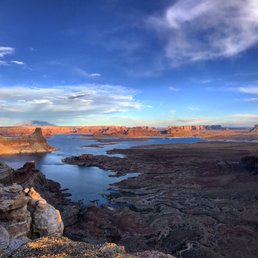

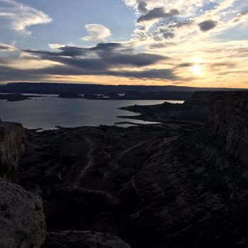
This is one of those places I'm hesitant to review, as to keep it one of those "hidden gems" of America. Thankfully, it's such a grueling journey to get to this overlook, I'm not too worried about blowing up this spot. I'm very fortunate in that I get to travel for work. I always try and make the most of those opportunities, by finding local excursions and such, wherever I am. In doing so, I've encountered some of the most breathtaking views/vistas in the US; Alstrom Point is easily in the top 5. As I mentioned, it isn't an easy task to get to Alstrom Point. The address listed, is basically just the cross street that leads to the drive up to AP. The actual address is (37.0589° N, 111.3647° W) but you'd do best to not follow your GPS, and go to the website for detailed directions. I tried to use my GPS, as it was basically the same as the web's directions, but it lead me to some areas that were unpassable, and I had to turn around and backtrack. The drive is recommended for 4wd (or high clearance vehicle) but is accessible to 2wd up to a point (3 miles from the top). Having said that, I did the entire thing in my rental KIA Soul (a wannabe SUV), but I grew up in the country off-roading and such, and there were still times where I had to move rocks to fill holes/gaps, turn around and back track; I also bottomed out as well as being uncertain as to whether I'd get stuck- so probably best to follow instructions. The drive from Big Water to the Point is long, at about 23 miles to the 2wd stop, and then another 3 to the top. For the most part, the road is not maintained, so you're lucky to average even 20mph for the trip; expect to give yourself a good 1.5 hours, just for the one-way drive up. But the drive up has incredible beauty in and of itself, with numerous stops worth taking in and photographing. Once you get to the peak, there are numerous vantages. You can see a huge portion of Lake Powell, Gunsight Butte, as well as Warm Creek Bay. The views are absolutely spectacular! I came to watch sunset, but made sure to leave before it got too dark, as the unmarked (only small cairns mark the last little bit) road is difficult to follow.


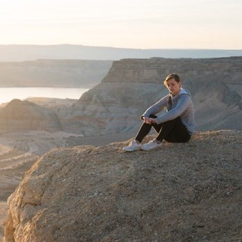
Like Chris. G, I, too, am hesitant to review this place as I don't want it to be overrun, but I also doubt that many people will make the trek out in droves--and, yes, a trek it is. We journeyed out here a few weeks back in our Jeep Renegade on what would be our first time really using it in an off-road situation. We didn't get stuck at all, even though we don't know how to off-road very well, but there were a few sketchy parts so just be careful when you get to the part where high clearance 4WD is recommended because the warnings are serious. Once we got out to the views the path becomes pretty poorly visible so we didn't know exactly where we wanted to go, but we found a good spot where a fire had been previously and chose that as our campsite. It was awesome. Check out the photos if you don't believe me!! Also, we got there when there was plenty of daylight and left when there was plenty of daylight so we wouldn't have to worry about driving around next to cliffs and tons of slickrock in the dark. read more


8 years ago
One of the best views I've ever seen! The long, grueling trek in our Subaru Forester was totally worth it, and took us far away from the crowds. Even on Labor Day weekend, we saw maybe 6 other cars the whole time. A four-wheel drive, high-clearance vehicle is strongly recommended. There are plenty of campsites with fire rings, but keep in mind there are no other campsite amenities. The landscape on the ride there was other-worldly, but the views of Lake Powell were just jaw-dropping. We got there in time for sunset views, then woke up to the best morning cloud porn of our lives. We were also lucky enough to watch not one, but two Sunday night fireworks displays going off on the lake below. Highly recommend for all you outdoorsy, adventurous folk! read more


6 years ago


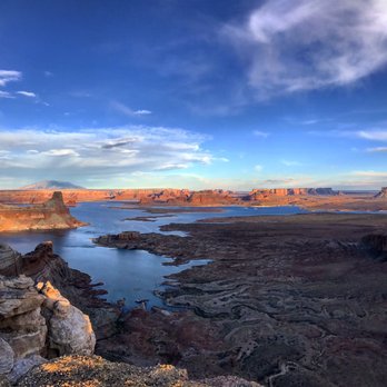
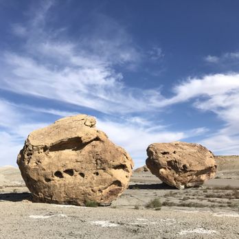
This is one of those places I'm hesitant to review, as to keep it one of those "hidden gems" of America. Thankfully, it's such a grueling journey to get to this overlook, I'm not too worried about blowing up this spot. I'm very fortunate in that I get to travel for work. I always try and make the most of those opportunities, by finding local excursions and such, wherever I am. In doing so, I've encountered some of the most breathtaking views/vistas in the US; Alstrom Point is easily in the top 5. As I mentioned, it isn't an easy task to get to Alstrom Point. The address listed, is basically just the cross street that leads to the drive up to AP. The actual address is (37.0589° N, 111.3647° W) but you'd do best to not follow your GPS, and go to the website for detailed directions. I tried to use my GPS, as it was basically the same as the web's directions, but it lead me to some areas that were unpassable, and I had to turn around and backtrack. The drive is recommended for 4wd (or high clearance vehicle) but is accessible to 2wd up to a point (3 miles from the top). Having said that, I did the entire thing in my rental KIA Soul (a wannabe SUV), but I grew up in the country off-roading and such, and there were still times where I had to move rocks to fill holes/gaps, turn around and back track; I also bottomed out as well as being uncertain as to whether I'd get stuck- so probably best to follow instructions. The drive from Big Water to the Point is long, at about 23 miles to the 2wd stop, and then another 3 to the top. For the most part, the road is not maintained, so you're lucky to average even 20mph for the trip; expect to give yourself a good 1.5 hours, just for the one-way drive up. But the drive up has incredible beauty in and of itself, with numerous stops worth taking in and photographing. Once you get to the peak, there are numerous vantages. You can see a huge portion of Lake Powell, Gunsight Butte, as well as Warm Creek Bay. The views are absolutely spectacular! I came to watch sunset, but made sure to leave before it got too dark, as the unmarked (only small cairns mark the last little bit) road is difficult to follow. read more




8 years ago
ReWow... breathtaking. The road is unpaved, and will take an hour or more to travel before coming close to Alstrom Point. However the entire road there was so beautiful and unique! My partner and I road our motorcycles there, and I can't be more happy with our adventure! We didn't know what to expect, but I felt that altogether, we found our own personal *grand canyon. Keep this a special place read more


More info about Alstrom Point
Ethan Allen
Big Water, UT 84741
Directions
Visit Website
http://alstrompoint.com
Hours
Outdoor Amenities






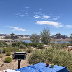

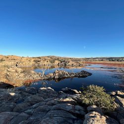






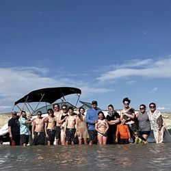


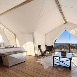
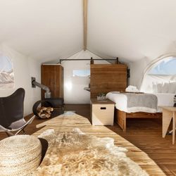


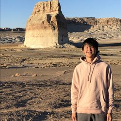


Alstrom Point - hiking - Updated August 2026
Best of Big Water
People found Alstrom Point by searching for…
Trending Searches in Big Water, UT
Browse Articles
Browse Nearby
BEST of Big Water, Utah Restaurants near Alstrom Point
BEST of Big Water, Utah Coffee near Alstrom Point
BEST of Big Water, Utah Things to Do near Alstrom Point
BEST of Big Water, Utah Horseback Riding near Alstrom Point
BEST of Big Water, Utah Photo Spots near Alstrom Point
BEST of Big Water, Utah Campgrounds near Alstrom Point
BEST of Big Water, Utah Breakfast near Alstrom Point
Browse Brands
Related Searches in Big Water, UT
Affordable Jet Ski Rental Options in Big Water, Utah
Best Boat Launch Spots in Big Water, Utah
Best Dog Hiking Trails Around Big Water, Utah
Best Fishing Locations and Guides in Big Water, Utah
Best Nature Trails for Hiking in Big Water, Utah
Best Parks for Parties and Events in Big Water, Utah
Best Places for Horseback Riding in Big Water, Utah
Best Water Parks for Kids in Big Water, Utah
Best Waterfalls and Swimming Holes in Big Water, Utah
Check Out Great Playgrounds in Big Water, Utah
Check Out Off Road Trails in Big Water, Utah
Discover Dog Friendly Trails to Explore in Big Water, Utah
Discover Lakes & Ponds to Explore in Big Water, Utah
Discover Popular Bike Trails in Big Water, Utah
Discover Popular Photo Spots in Big Water, Utah
Discover Top Nature Parks to Visit in Big Water, Utah
Discover a Hiking Trail in Big Water, Utah
Discover the Best Night Hike Trails in Big Water, Utah
Dog-Friendly Hikes With Dogs in Big Water, Utah
Enjoy Camping Adventures Around Big Water, Utah
Enjoy Hiking Adventures in Big Water, Utah
Enjoy Off Leash Dog Hikes in Big Water, Utah
Enjoy Tent Camping Spots Around Big Water, Utah
Enjoy the Best Picnic Spots and Ideas in Big Water, Utah
Enjoy the Best Walking Trails in Big Water, Utah
Experience Stunning Sunset Views in Big Water, Utah
Explore Beautiful Parks and Green Spaces in Big Water, Utah
Explore Easy Hikes Perfect for All in Big Water, Utah
Explore Free Picnic Areas Around Big Water, Utah
Explore Parks With Lakes to Visit in Big Water, Utah
Explore Picnic Parks Near Big Water, Utah
Explore Popular Boat Charters Near Big Water, Utah
Explore Popular Campgrounds Near Big Water, Utah
Explore Popular Picnic Areas Around Big Water, Utah
Explore Popular RV Parks Around Big Water, Utah
Explore Popular Scenic Overlook Points in Big Water, Utah
Explore Popular Scenic Views Near Big Water, Utah
Explore Scenic Lakes to Visit in Big Water, Utah
Explore Secret Spots Worth Visiting in Big Water, Utah
Explore the Best Boating Spots in Big Water, Utah
Explore the Best Swimming Holes Around Big Water, Utah
Family Friendly Hiking With Kids in Big Water, Utah
Find Beautiful Views in Big Water, Utah
Find Exciting Tours to Take in Big Water, Utah
Find Parks and Recreation Activities in Big Water, Utah
Find Top Dog Friendly Parks to Visit in Big Water, Utah
Find Top-Rated Waterfalls in Big Water, Utah Now


