1. Barker Valley

    1. Barker Valley

    0

    Warner Springs, CA

    Cancel

    Open app

    Search

    Barker Valley

    5.0 (2 reviews)

    Barker Valley Photos
    You might also consider

    Recommended Reviews - Barker Valley

    Your trust is our priority, so businesses can't pay to alter or remove their reviews. Learn more about reviews.
    Yelp app icon
    Browse more easily on the app
    Review Feed Illustration
    Photo of Malia G.
    136
    12
    6

    15 years ago

    Helpful 4
    Thanks 0
    Love this 0
    Oh no 0
    Photo of Jeff T.
    0
    16
    10

    11 years ago

    Helpful 1
    Thanks 0
    Love this 0
    Oh no 0

    You might also consider
    Verify this business for free

    People searched for Hiking 162 times last month within 15 miles of this business.

    Verify this business

    Eagle Rock Hike - Spring 2019

    Eagle Rock Hike

    4.7(56 reviews)
    2.3 mi

    One of my favorite hikes in San Diego county- this one has it all!!! Perfect length, challenging…read morebut not TOO hard and the scenery OMG. I've included photos in my review from several trips to Eagle Rock over the years. You start out in a lovely shaded area by a stream, most of the incline is through a chaparral forest with manzanitas and blooming cactus, the last bit is a rolling prairie. The pinnacle of the hike is a huge rock formation that looks exactly like an eagle. I try to do this hike every year in the spring. Tons of flowers and gorgeous rolling grassy hills. This year we had a freakishly hot March and everything bloomed early and then got fried. It was still gorgeous though! We started early when it was still chilly and finished as the heat of the day was coming on. Be sure you keep an eye on the weather. It can get dangerously hot. I recommend a ton of water, hats and sunscreen. On the way home be sure to stop for Julian Pie in San Ysabel!

    I had read about this random rock formation shaped like the profile of an eagle when I first…read morestarted doing San Diego County hikes. We tackled this 6.4 mile out-and-back trail in Warner Springs on a recent weekend. It seemed like most of the hikers were completing the journey when we arrived after lunch as they were returning towards the trailhead off Highway 79. You can park along both sides of the road on the shoulder, but don't pull into the fire station lot adjacent to the trailhead. The Eagle Rock Hike is actually a segment of the larger Pacific Crest National Scenic Trail (PCT). The PCT spans over 2,500 miles and runs through California, Oregon, and Washington from the Mexican border to the Canadian border. The first half of the outbound portion was rather flat and ran next to a creek that was still flowing with a good amount of water from the March rainfall. There was plenty of shade from the trees in that area. Once you emerged from that section, the path veered into a valley with a few curves and gentle slopes. The landscape looked nothing like what you would expect in San Diego. It resembled the Great Plains with grasses and weeds along with hills and mountains off in the distance. This continued until you could see a set of rocks appearing what seemed to be the middle of nowhere. The approach was from the south side which was the rear of the formation. The view from the north definitely resembled an eagle about to spread its wings. Only one other group of hikers was present when we reached Eagle Rock. You can climb up the back side to the top where you end up next to the eagle's head. Think of photo opportunities like at Potato Chip Rock but without the wait. According to a hiking app, there was an elevation change of several hundred feet. It wasn't noticeable because of the gradual sloping. The round trip took just under three hours. The only real drawback was the lack of shade in the meadows. It was windy during our visit which dropped the temperature by at least 10 degrees in that portion. At the peak of summer, the heat and dry air can make this five-star inland trek less comfortable. PS: Not only is this trail not crowded, but it's very kid and pet friendly.

    Photos
    Eagle Rock Hike - Spring 2021 bloom

    Spring 2021 bloom

    Eagle Rock Hike - Spring 2019

    Spring 2019

    Eagle Rock Hike - Spring 2021 bloom

    See all

    Spring 2021 bloom

    Hot Springs Mountain

    Hot Springs Mountain

    4.6(9 reviews)
    4.5 mi

    My review is solely based on my hiking experience and not for the campground or other things here…read more I came here to summit Hot Springs Mountain as it's part of the San Diego Six Pack of Peaks challenge. Apparently it's the highest peak in San Diego as well. A fee of $10 is required. The trailhead is easy to find, just a little ways down after you pass the gate where the police vehicles are. The road is unpaved but is in fairly good condition, with no ruts or anything. Once you get to the restrooms the trailhead parking is to the left of it. There aren't really designated spots, you just need to park off of the road. The first 2 or so miles are in direct sunlight, and this is also where most of the elevation gain is. Once you get closer to the halfway point (around 2.4 miles) it's smooth sailing from there with just rolling hills and plateaus. You know you're almost there once you see the old lookout tower and reach the sign that points to the summit. Continue on this smaller trail and you'll reach the ladder and ropes to the summit. The summit can only fit a few people safely. I'm terrified of heights and sketchy things but still managed to do it. There are lots of bugs flying around on this trail. Other than that the trail is mainly a wide, well-maintained fire road. There's some forested areas you'll walk through, but nothing special. Good hike to get some elevation gain (2,200'+)! In total it took me 2 hours and 49 minutes (hiked up, ran down).

    You need to pay $10 for parking, either online or at the booth. The attendant on 2/4/24 was very…read morefriendly and informative regarding the hike conditions. The hike itself it roughly 10 miles round trip. Once you are past the first 2 miles, steady up, you will enjoy views in all directions and a beautiful walk through a forest. Snow was about 1-3 inches and melting fast. Trail is in a great condition, well marked. The fire tower is one of the oldest one, needs work so think twice before climbing it. The peak is a huge boulder to the right after following narrow paths for few hundred feet. If you feel adventurous you can climb the ladder to the top. From there you will have a nice view of the tower and neighboring peaks. Took me about 4 hours to complete.

    Photos
    Hot Springs Mountain
    Hot Springs Mountain
    Hot Springs Mountain

    See all

    Cedar Creek Falls - Cedar Creek Falls

    Cedar Creek Falls

    4.4(358 reviews)
    19.5 mi

    If you are a San Diego hiker and haven't done this hike- WHAT ARE YOU WAITING FOR???…read more And for those of you who see these photos and think damn I need to go do that, please be aware of the temperature because it is dangerously hot down there at lower temperatures than in other areas. The hike goes down into a canyon and the heat settles down there. Even if it's not as hot as you think coming up can be extremely dangerous. Every year I hear about somebody dying from heat stroke on that hike so don't take it lightly. I always check the weather on the actual trail using the AllTrails app. I saw that the weather out there was max 65° that day and I was like hell yeah. The hike really isn't that difficult, 3 miles down and then 3 miles back up. Lots of nice switchbacks, and there are a few sun shelters for shade. The views are gorgeous all along the trail. I've done this hike, probably 20 times over the years. It's the best in the spring and in the fall. In the winter it's way too cold. The reward for this hike is the gorgeous rock bowl and waterfall that the locals call Devils Punchbowl. This past Thursday when we did this hike, there were a lot of young folks at the Punchbowl when we got there. Some of the guys were climbing up and jumping into the water. I would not recommend it, even if the waterfall is still flowing that water is not safe to swim in. In the fall, the waterfall doesn't flow anymore after being dried out over the brutal summer, but the trees at the bottom of the canyon turn a beautiful gold color. One of the few places in San Diego you can actually experience fall.

    Great trail! Well-marked path down to and back up from the falls. Gorgeous water feature!read more

    Photos
    Cedar Creek Falls - Cloud porn in the beginning of our hike!

    Cloud porn in the beginning of our hike!

    Cedar Creek Falls - Awesome day with one of my best girlfriends

    Awesome day with one of my best girlfriends

    Cedar Creek Falls - Morning frost

    See all

    Morning frost

    Oak Grove Trail to High Point

    Oak Grove Trail to High Point

    4.7(3 reviews)
    11.4 mi

    Happy 4th! This was my last hike needed to complete my San Diego Six Pack of Peaks challenge. I…read morearrived around 5:00AM this morning and took a power nap before starting the trail at 5:30AM. There was no else in the parking lot except for me. It was pretty chilly, mid to upper 50s, but luckily I was wearing my long sleeve base layer. It quickly warmed up by 6:30AM. From 0.5mi to about 1.9mi, you will ascend around 1,400'. It's tiring, for sure. It's also easy to lose your footing not only because of the grade, but also because of the sandy/rocky terrain (be careful on the way back!). After that incline it becomes less severe and more gradual. I had bug spray on and only encountered a few gnats around mile 4.5 or 5. The last stretch to the lookout tower is not bad at all. I made it there in less than 2 hours 30 minutes and was the only hiker around. The volunteer in the tower was very nice and even asked if I was good on water. The view is OK, nothing special to see except for the observatories in the distance. The descent was very easy, literally downhill all the way with the exception of 2 or 3 mild inclines. I ran most of it until I got to the start of the last two miles. Walk carefully.. I lost my footing and ended up spraining my ankle pretty bad. I had to walk my last two miles on my freshly sprained ankle. On the way down I only bumped into two people hiking together, that's all! In total, it took me 4 hours 19 minutes to hit the summit and get back to the parking lot. I consumed a liter of water up, and a liter of water down. I did not bring trekking poles. Not a bad hike to get the blood flowing!

    My friend and I did this hike this past Saturday (10/17/20…read more Parking- there is free parking across from the campground near the Oak Grove fire station write off Hwy 79...we read that you needed an Adventure Parking Pass so we brought ours that we purchased at Big 5 Trail- the hardest part is the 2nd mile where the gain is around 1,000 ft and rocky; the rest of the trail is a steady incline and large portions of smooth fire road surface; there isn't a lot of shade so make sure to start early during warmer months...we started at 6 (we had about a 1.5 hr drive coming from the LA/OC area) and finished at noon and the last hour of the hike was not pleasant due to the total hike being around 13.5 miles and since it is an out and back trail the 2nd to last mile on the return is a steep decline with rock conditions; I liked that we saw less than 20 people total and half of them were in 4x4s and motorocycles; I was using my AllTrails app but we still made a couple wrong turns...there are some signs but not at every juncture; we ran a couple miles on the way down and finished in just under 6hrs but if you are going to hike it all I would suggest planning on it taking 7-8 hrs to complete Peak- the top elevation is about 6,100 ft and you gain about 3,500 feet of total elevation; there are benches at the top which were nice to rest and grab a bite to eat; there is a large, working fire lookout tower, a sign, and some good views of the surrounding area Distance- around 13.5 miles (out and back trail) Duration- 6 hours (we jogged a couple miles Difficulty- hard mainly due to the 2nd mile and just the overall length of almost 14 miles

    Photos
    Oak Grove Trail to High Point - You have to get a pic at the top, right?

    You have to get a pic at the top, right?

    Oak Grove Trail to High Point - Some shady areas...not many

    Some shady areas...not many

    Oak Grove Trail to High Point - Me, at the Summit.

    See all

    Me, at the Summit.

    The Pacific Crest Trail - Views of Mt Baden-Powell from the trail!

    The Pacific Crest Trail

    4.8(6 reviews)
    21.8 mi

    I always get really excited when I find a piece of the PCT lol! The PCT (or Pacific Crest Trail) is…read morepart of the coveted "Triple Crown of Hiking" title that very few hikers have achieved. The Triple Crown consists of the PCT, the Appalachian Trail and the Continental Divide Trail - the three longest north-to-south trails in the US. And to earn the title, you must do all three in their entirety! Now I know I'll never achieve that - and I'm well aware I won't ever even achieve doing just one of these - but I still get giddy doing a piece of them! So far I've done pieces of the PCT and the Appalachian- so two down, one to go haha! The PCT is 2653 miles long and runs from just south of Campo, California next to the border with Mexico all the way up to a spot on the Canada-US border. It passes through 25 national forests and 7 national parks! You can find pieces of it all over SoCal - too many spots to name here but if you look it up on Wiki it lists them all! Some of the more notable locations are at places like Vasquez Rocks, Anza-Borrego Desert State Park, Crystal Lake, and Big Bear. But my personal fave is just past the Blue Ridge Trail in Wrightwood (pictured in all my photos). Once you complete the Blue Ridge Trail, you'll find the PCT just past the campground - keep on it for another 1 - 1.5 miles and BOOM - you're hit with some incredible views of the back of the San Gabriel Mountains and some of its more iconic peaks such as San Antonio Peak and Mount Baden-Powell. I highly recommend using AllTrails and download the trail map bc signal is spotty here and you'll need it bc the PCT isn't obvious even though you'll find the iconic signs for photo ops in some spots. It does add another 1 to 1.5 miles to the hike and another 300+ feet in elevation gain to the already 1000+ feet of the Blue Ridge Trail. But you'll be over 8100 feet in the air at the top with amazing views and even lots of birds and wildflowers in September!! You may even get snow as far as into late April! This part of the PCT crosses the Blue Ridge Truck Trail - so you can actually drive up to this spot but it's not paved and is rocky and very bumpy so be aware. The hiking trail is well maintained. And the campground at the top has vault toilets (but no potable water). If you tie it in with the Blue Ridge Trail, you're looking at a total of 3 miles in and an elevation gain of over 1380+ feet (one way) - so 6 miles total. But it makes for a great morning - gorgeous views, tons of birds, hardly any other hikers during the week, lots of peace and quiet! One of my fave trails in the area! If you do this route, I'd call it a moderate and somewhat technical hike - definitely not for beginners. If you do it in the snow, it's hard and very technical (I've done both). But if you drive up and just do this tiny part of the PCT by itself it's pretty easy.

    Nice place to hike. Never made it to the top, its a 3 mile hike. Beautiful views. The trail is…read morekinda narrow, but i love hiking up there w my dog!

    Photos
    The Pacific Crest Trail - Views of the San Gabriel Mountains from the trail!

    Views of the San Gabriel Mountains from the trail!

    The Pacific Crest Trail - Views of Mt Baden-Powell from the trail!

    Views of Mt Baden-Powell from the trail!

    The Pacific Crest Trail - Views of Mt Baden-Powell from the trail!

    See all

    Views of Mt Baden-Powell from the trail!

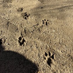
    Volcan Mountain Preserve - Mountain Lion tracks

    Volcan Mountain Preserve

    4.6(87 reviews)
    12.1 mi

    We tackled Volcan Mountain Trail with an eight-year-old, so we didn't make it the full way but it…read morewas such a nice experience. We also brought along our dog as it is a dog friendly trail as long as your dog is on a leash. The trail starts out pretty steep, but it's well-marked with clear paths throughout. One thing I really loved was all the signage explaining local plant life and animal tracks so it made the hike feel educational and engaging. My kiddo was really into looking at the different animal paw prints. This trail is great for hiking enthusiasts and beginners alike but just know your limits and pace yourself if you're newer to hiking. I would definitely say if it's sunny to make sure you bring plenty of water with you, but there are a lot of shady spots on this trail so that is a nice change from the hikes that are closer to coastal San Diego.

    It's a good hike to pair with a trip to Julian. My husband and I picked up sandwiches in town for a…read morepicnic on the trail. Parked next to the road and knew we were in the right place because of all the other cars. We made our hike a loop as we went up the mountain, taking the 5 Oaks Trail, and then came down using the Vulcan Mountain preserve trail. The 5 Oaks Trail has more of a view. There are a few seats to stop, sit (catch your breath) and enjoy the view. Sadly, we haven't had rain so it wasn't as green as I'm sure it would be on a normal January. Nevertheless, a great hike to work off all the apple pie you eat in Julian.

    Photos
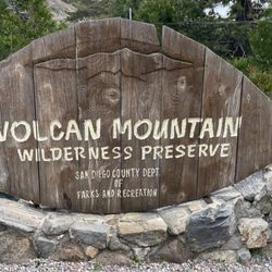
    Volcan Mountain Preserve - Sign at the trailhead

    Sign at the trailhead

    Volcan Mountain Preserve
    Volcan Mountain Preserve

    See all

    Lake Henshaw Resort - Inside a studio cabin

    Lake Henshaw Resort

    2.9(31 reviews)
    8.0 mi

    Lake Henshaw is one of those beautifully protected areas where visitors can still get an idea how…read morewild California actually was hundreds or even thousands of years ago. That is because 43,000 acres of land are protected. Vista Irrigation District began its water resourcing here in 1923. The area celebrated the arrival of the first water from Lake Henshaw on February 27, 1926. Following the arrival of water, crops of all kinds were planted in increasing numbers, and the Vista area became known as the "Avocado Capital of the World," with six avocado packing houses in the area. During this time Henshaw was operating under the San Diego Water Company, however in June, 1946, after several years of negotiations, Vista Irrigation District purchased them. Included in the purchase was the 43,000 acre Warner Ranch, a former Spanish Land Grant, which includes Henshaw Dam and Lake Henshaw. Purchase of these facilities was purely economic, in that it was a result of a search for cheaper water for the District. However, Lake Henshaw was not always a lake but instead was part of Quechla, also known as the San Luis Rey River. The river begins in the Cleveland National Forest and runs mostly along Highway 76, spitting out into the ocean in the town Oceanside. Historically, this river has provided water for Indigenous bands of both the Kumeyaay and Luiseño tribes, which include the Rincon, La Jolla, Pauma, Pala, and San Pasqual people. When the bands were forced onto reservations as a result of the Mission Indian Relief Act, they were intentionally put in areas with access to water so they could grow crops. Almost as soon as the reservations were formed, the government entered into a contract with William G. Henshaw. Henshaw wanted to build a storage dam and reservoir at Warner's Ranch on the Upper Quechla, with the intent of diverting river water for further irrigation. In protest of the dam's construction, local Indians went to court to contest the legality of the contract. The United States Government ruled in favor of Henshaw, and a dam to hold back approximately 200,000 acre feet of water was built. The water went from Lake Henshaw to Lake Wohlford, then flowed into Dixon Lake (which interestingly is filled with imported water) Those two sources are mixed at a water treatment facility next to the lake and then taken by flume to the people of Vista and Escondido. Not soon after it was noticed that during episodes of severe drought, the water would hardly flow through the reservations and their wells would dry up. In 1950 46 Indian bands, including the Rincon, La Jolla, Pauma, Pala, and San Pasqual, initiated proceedings in the Indian Claims Commission which would pay damages to the Indians from the government for failure to protect their land and water rights. In addition to damages, the Indians asked for access to Quechla's water so they could develop their own lands agriculturally. It was Senator Alan Cranston that introduced Senate Bill 1507 which provided for settlement of Indigenous claims against the U.S. Government and the City of Escondido. Unfortunately the bill never made it off the Senate floor. The continued fight for their water rights took 50 years to come to justice but finally they drank in victory. In 1967, Robert Pelcyger was a newly minted lawyer who knew little about the rights of Native Americans and even less about water rights. Then he met Patty Durro, a young woman from the Rincon Band of Luiseno Indians in northern San Diego County who was determined to reclaim her tribe's share of the San Luis Rey River. She changed his life and the fortunes of five North County tribes that had been robbed of the water they had been promised by the government. But, it took Pelcyger 50 years to right the wrong. In May 2017, there was a settlement agreed upon. The San Luis Rey Indian Water Rights Settlement Act now guarantees the 5 bands equal annual access to more than 5 billion gallons of Colorado River water. Should they not need all of the water, the agreement is that they must sell the excess water back to the cities of Vista and Escondido at market rates. Sadly, most of the elders that were originally fighting for the water rights never got to witness the feat. But it was never about instant gratification, instead, it was about creating better living situations for the future generations. Today, the lake stays around 40% capacity due to it being on a fault line, but is home to people killing algae (absolutely no swimming permitted), amazing fly fishing and many amazing raptors including a mated pair of Bald Eagles.

    What an absolute hole. We stopped by to check it out for future camping.. not on your life. Trash…read moreeverywhere.. broken fire pits.. port potties.. and we used the toilet where the showers are.. they haven't been clean since lord knows when .. beyond nasty.. stopped up toilet.. used hygiene items loaded the trash as well as used toilet paper.. haz mat should be called.. the toilet haven't been cleaned since who knows when .. Which leads to flies. Think the worst pit toilet in a national park .. the place is run down.. not clean.. looks like it hasn't been updated for years.. you pass a selection of old trailers.. trailer park that is a hot mess. I swear you could live your own horror movie you ever seen staying here.

    Photos
    Lake Henshaw Resort
    Lake Henshaw Resort
    Lake Henshaw Resort

    See all

    Barker Valley - hiking - Updated September 2026

    Loading...
    Loading...
    Loading...