Hot Springs Mountain Photos



You might also consider


More like Hot Springs Mountain
Recommended Reviews - Hot Springs Mountain
Start your review...



6 years ago


4 years ago
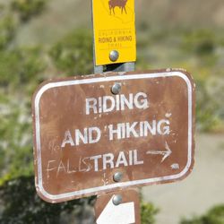
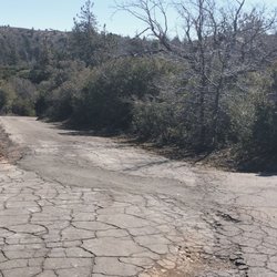
My review is solely based on my hiking experience and not for the campground or other things here. I came here to summit Hot Springs Mountain as it's part of the San Diego Six Pack of Peaks challenge. Apparently it's the highest peak in San Diego as well. A fee of $10 is required. The trailhead is easy to find, just a little ways down after you pass the gate where the police vehicles are. The road is unpaved but is in fairly good condition, with no ruts or anything. Once you get to the restrooms the trailhead parking is to the left of it. There aren't really designated spots, you just need to park off of the road. The first 2 or so miles are in direct sunlight, and this is also where most of the elevation gain is. Once you get closer to the halfway point (around 2.4 miles) it's smooth sailing from there with just rolling hills and plateaus. You know you're almost there once you see the old lookout tower and reach the sign that points to the summit. Continue on this smaller trail and you'll reach the ladder and ropes to the summit. The summit can only fit a few people safely. I'm terrified of heights and sketchy things but still managed to do it. There are lots of bugs flying around on this trail. Other than that the trail is mainly a wide, well-maintained fire road. There's some forested areas you'll walk through, but nothing special. Good hike to get some elevation gain (2,200'+)! In total it took me 2 hours and 49 minutes (hiked up, ran down). read more


2 years ago
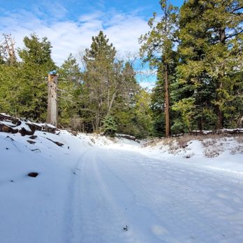
You need to pay $10 for parking, either online or at the booth. The attendant on 2/4/24 was very friendly and informative regarding the hike conditions. The hike itself it roughly 10 miles round trip. Once you are past the first 2 miles, steady up, you will enjoy views in all directions and a beautiful walk through a forest. Snow was about 1-3 inches and melting fast. Trail is in a great condition, well marked. The fire tower is one of the oldest one, needs work so think twice before climbing it. The peak is a huge boulder to the right after following narrow paths for few hundred feet. If you feel adventurous you can climb the ladder to the top. From there you will have a nice view of the tower and neighboring peaks. Took me about 4 hours to complete. read more




4 years ago
7 years ago
Great hike. Moderate. At an easy pace it took our group 5 hours and 30 minutes including ample breaks on the trail and the top. The distance is perhaps close to 8-9 miles round trip if climbing from the campground parking lot. The entrance fee is 10$ per person ( not per vehicle as we initially thought ). The officer at the gate was friendly and willingly gave us a map of the trails when asked. We parked at the campground parking lot. The easy way to recognize this as you drive from the entrance is to look for the portapotty on your left. The portapotty is the only restroom facility available. Once parked, look for a gated entry with a board named "Sukat Road" on the same side of the parking lot. It is same as Rough Road. Start here and keep walking along the road avoiding any insignificant paths forking out. You should hit the only fork with clear signs to "Lookout Tower". You should reach this fork in around 2 - 2.5 hours even at a moderate pace. The lookout tower is another 30-45 minutes from this fork. The climb to the fork is a bit strenous, and then it eases out from the fork to the lookout tower. The views are beautiful, especially on a clear day. The only problem we had in Oct was flies swarming us for almost the entire hike. read more


4 years ago

8 years ago
8 years ago

9 years ago
More info about Hot Springs Mountain
2300 Camino San Ignacio Rd
Los Coyotes Indian Reservation
Warner Springs, CA 92086
Directions
(760) 782-0711
Call Now
Hours
Indoor Amenities
Outdoor Amenities
Ask the Community - Hot Springs Mountain
You might also consider














Why does Yelp recommend reviews?
1 review that is not currently recommended
The reviews below are not factored into the business's overall star rating.
8 years ago
Hot Springs Mountain - hiking - Updated July 2026
Best of Warner Springs
People found Hot Springs Mountain by searching for…
Hot Springs in Warner Springs, California
Campgrounds in Warner Springs, California
Things to Do in Warner Springs, California
Parks in Warner Springs, California
Camping Sites in Warner Springs, California
Dog Friendly Hiking Trails in Warner Springs, California
Hiking Trails in Warner Springs, California
Off Road Trails in Warner Springs, California
Scenic Drive in Warner Springs, California
Scenic View in Warner Springs, California
Waterfall Hike in Warner Springs, California
Shaded Hike in Warner Springs, California
Lookout Points in Warner Springs, California
Abandoned in Warner Springs, California
Camping Cabins in Warner Springs, California
Hikes With Dogs in Warner Springs, California
Tent Camping in Warner Springs, California
Dog Friendly Parks in Warner Springs, California
Easy Hikes in Warner Springs, California
Trail in Warner Springs, California
Off Leash Dog Hikes in Warner Springs, California
Swimming Lakes in Warner Springs, California
Browse Brands
Browse Articles
People who viewed Hot Springs Mountain also viewed

Palomar Mountain State Park
91 reviews

Volcan Mountain Preserve
87 reviews

Borrego-Palm Canyon Campground & Trail
45 reviews

Borrego Palm Canyon Trail
4 reviews

Anza-Borrego Desert State Park
286 reviews

Lake Henshaw Resort
29 reviews

Oak Grove Trail to High Point
3 reviews

Dixon Lake
117 reviews

Jess Martin County Park
4 reviews

Alcoholic Pass
3 reviews