Cancel

    Open app

    Search

    Oak Grove Trail to High Point

    4.7 (3 reviews)

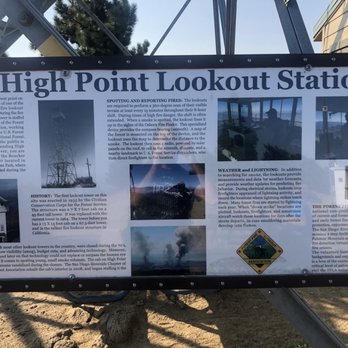
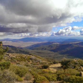
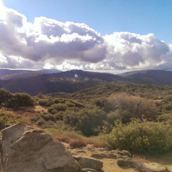
    Oak Grove Trail to High Point Photos

    You might also consider

    More like Oak Grove Trail to High Point
    Recommended Reviews - Oak Grove Trail to High Point
    Your trust is our priority, so businesses can't pay to alter or remove their reviews. Learn more about reviews.
    Yelp app icon
    Browse more easily on the app
    Review Feed Illustration

    4 years ago

    Helpful 9
    Thanks 0
    Love this 6
    Oh no 0

    6 years ago

    Helpful 9
    Thanks 0
    Love this 7
    Oh no 0

    12 years ago

    Helpful 5
    Thanks 0
    Love this 5
    Oh no 0

    You might also consider

    Verify this business for free

    People searched for Hiking 169 times last month within 15 miles of this business.

    Verify this business

    Cedar Creek Falls - Cedar Creek Falls

    Cedar Creek Falls

    4.4(358 reviews)
    26.7 mi

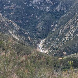
    If you are a San Diego hiker and haven't done this hike- WHAT ARE YOU WAITING FOR???…read more And for those of you who see these photos and think damn I need to go do that, please be aware of the temperature because it is dangerously hot down there at lower temperatures than in other areas. The hike goes down into a canyon and the heat settles down there. Even if it's not as hot as you think coming up can be extremely dangerous. Every year I hear about somebody dying from heat stroke on that hike so don't take it lightly. I always check the weather on the actual trail using the AllTrails app. I saw that the weather out there was max 65° that day and I was like hell yeah. The hike really isn't that difficult, 3 miles down and then 3 miles back up. Lots of nice switchbacks, and there are a few sun shelters for shade. The views are gorgeous all along the trail. I've done this hike, probably 20 times over the years. It's the best in the spring and in the fall. In the winter it's way too cold. The reward for this hike is the gorgeous rock bowl and waterfall that the locals call Devils Punchbowl. This past Thursday when we did this hike, there were a lot of young folks at the Punchbowl when we got there. Some of the guys were climbing up and jumping into the water. I would not recommend it, even if the waterfall is still flowing that water is not safe to swim in. In the fall, the waterfall doesn't flow anymore after being dried out over the brutal summer, but the trees at the bottom of the canyon turn a beautiful gold color. One of the few places in San Diego you can actually experience fall.

    Great trail! Well-marked path down to and back up from the falls. Gorgeous water feature!read more

    Photos
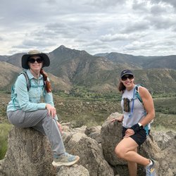
    Cedar Creek Falls - Cloud porn in the beginning of our hike!

    Cloud porn in the beginning of our hike!

    Cedar Creek Falls - Awesome day with one of my best girlfriends

    Awesome day with one of my best girlfriends

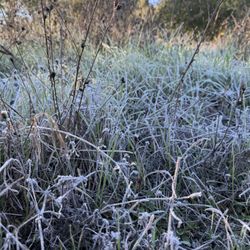
    Cedar Creek Falls - Morning frost

    See all

    Morning frost

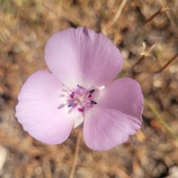
    Palomar Mountain State Park - Mariposa lily

    Palomar Mountain State Park

    4.4(91 reviews)
    7.4 mi

    A beautiful state park and such amazing campgrounds. There are a few campground options, but during…read moremy recent visit, we stayed at the Doane Valley Campground. It was very easy to book ahead online and pay for our daily parking pass once we checked-in. The campsite itself is tucked into the forest, very high up on Palomar Mountain. We found it easy to park our one SUV at our campsite and pitch our tents. The sites do have water, tables, and food boxes. The bathrooms were kept quite nice and tidy. We were all very impressed with the simple but clean and well maintained facilities. We did do a dog friendly hike that starts in the Doane Valley Campground and it's about 4 miles round trip. We had a lovely hike with a decent amount of incline along with beautiful weather. They also have a lovely stop/view area at the beginning of the campgrounds with picnic tables. Palomar mountain is great for camping, hiking, a nice Sunday cruise up the mountain for the beauty, etc. Cell phone service is spotty up there so make sure to either download your map ahead of time or use satellite service.

    WARNING Do not…read moreattempt to drive on Nate Harrison Road unless your vehicle can handle off-road conditions. It is not paved and has many dangerous sections for cars not equipped for them. Take 76 and S Grade Road instead. Phone reception is limited on the mountain. I strongly suggest downloading maps before you visit. The park headquarters is quite small and it doesn't seem like it is continually staffed. Make sure you have plenty of fuel. Bring lots of water. Keep in mind that it may be hotter on the mountain than the temperature at sea level. We didn't see any potable water during a recent visit. As long as you're well-prepared, you will enjoy this beautiful park. Have fun and stay safe.

    Photos
    Palomar Mountain State Park
    Palomar Mountain State Park
    Palomar Mountain State Park

    See all

    Hellhole Canyon County Preserve - Flowers are just starting to come out along the sides of the trail

    Hellhole Canyon County Preserve

    4.5(22 reviews)
    12.8 mi

    One of my favorite late winter early spring hikes in San Diego. If you time it just right, you will…read moresee the most gorgeous flowers all over the trail. I was a little bit early this spring, the flowers are just starting to come out! My guess is two weeks from now it's going to pop. You do not want to come out here and hike in the summer, it's got the name Hellhole Canyon for a reason. It gets dangerously hot and there is no guarantee that anyone's going to rescue you. You can put together a monster hike in this canyon. I've done it twice over 10 miles with an ass blaster of a climb. But today I did the shorter loop which is 5.25 miles. It's got everything, views, climbing and descending and varied terrain! We rarely see anybody out here but today we actually passed three small groups on the trail. You can tell that a lot of people use the trails also with horses because we saw some horse poop and in the distance we could hear horse whinnies- so cute!!! Another bonus is at this trailhead. There are two pit toilets that are the nicest pit toilets I have ever been in. The people that maintain this canyon do an excellent job. They are always clean, stocked with toilet paper and have hand sanitizer. I will 100% be back to this trail, possibly in two weeks! If you're going to do it, I highly recommend downloading the AllTrails app and following the trail as marked. No way you'll get lost.

    Super sweet hike for me and my pups. Pretty steep but gorgeous when the weather is right!read more

    Photos
    Hellhole Canyon County Preserve - The smells so good and is starting to bloom all along the trail

    The smells so good and is starting to bloom all along the trail

    Hellhole Canyon County Preserve - It's hiking season in San Diego!

    It's hiking season in San Diego!

    Hellhole Canyon County Preserve - Have you ever seen a tree potato???

    See all

    Have you ever seen a tree potato???

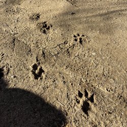
    Volcan Mountain Preserve - Mountain Lion tracks

    Volcan Mountain Preserve

    4.6(87 reviews)
    22.3 mi

    We tackled Volcan Mountain Trail with an eight-year-old, so we didn't make it the full way but it…read morewas such a nice experience. We also brought along our dog as it is a dog friendly trail as long as your dog is on a leash. The trail starts out pretty steep, but it's well-marked with clear paths throughout. One thing I really loved was all the signage explaining local plant life and animal tracks so it made the hike feel educational and engaging. My kiddo was really into looking at the different animal paw prints. This trail is great for hiking enthusiasts and beginners alike but just know your limits and pace yourself if you're newer to hiking. I would definitely say if it's sunny to make sure you bring plenty of water with you, but there are a lot of shady spots on this trail so that is a nice change from the hikes that are closer to coastal San Diego.

    It's a good hike to pair with a trip to Julian. My husband and I picked up sandwiches in town for a…read morepicnic on the trail. Parked next to the road and knew we were in the right place because of all the other cars. We made our hike a loop as we went up the mountain, taking the 5 Oaks Trail, and then came down using the Vulcan Mountain preserve trail. The 5 Oaks Trail has more of a view. There are a few seats to stop, sit (catch your breath) and enjoy the view. Sadly, we haven't had rain so it wasn't as green as I'm sure it would be on a normal January. Nevertheless, a great hike to work off all the apple pie you eat in Julian.

    Photos
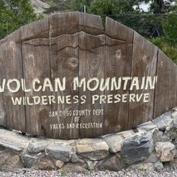
    Volcan Mountain Preserve - Sign at the trailhead

    Sign at the trailhead

    Volcan Mountain Preserve
    Volcan Mountain Preserve

    See all

    Lost Creek Canyon Ranch - Fringe the goat, one of many ranch animals you'll meet.

    Lost Creek Canyon Ranch

    5.0(10 reviews)
    38.7 mi

    I visited Lost Creek Canyon Ranch with a group of friends and my six year old son. I was not sure…read morewhat to expect, but my goodness, our experience was incredible. This ranch is absolutely breathtaking and the rich history Linda shared with us was fascinating. I could've spent days exploring the area! I was a little nervous that my six year old would get restless as he was the only child in our group. Linda did an amazing job of finding ways to include him and even gave him a little activity bag to keep him busy while my group did yoga. The thoughtful ways she made him feel special and included really made the day for us. We really enjoyed meeting all of the animals- I know this was by far the best part for my son. I appreciated that my son was allowed to interact with the animals and was taught how to do so in a way that prioritized his safety and the safety and well-being of the animals. I can't say enough about our experience. Lost Creek Canyon Ranch will be a go to for me whenever I have visitors in town and I look forward to going back. Thank you to Linda and her team for such a wonderful experience!

    Fantastic experience. Linda, the owner, gave us a fabulous tour. We saw the ranch animals, mountain…read morescenery, the historic buildings, and their citrus grove. Linda shared stories of the ranch's history and explained the water system still in use where water can run uphill! Linda was friendly and happy to answer questions. We got to pick as much citrus as we wanted to take home and were even given a couple dozen fresh farm eggs. A beautiful place and a fun tour if you want to do something a bit different and still be a short drive from downtown Palm Springs.

    Photos
    Lost Creek Canyon Ranch - Pinta, our silkie fainting goat, is such a ham.

    Pinta, our silkie fainting goat, is such a ham.

    Lost Creek Canyon Ranch - Nothing better than fall on the ranch.

    Nothing better than fall on the ranch.

    Lost Creek Canyon Ranch - There are beautiful buildings all around the ranch

    See all

    There are beautiful buildings all around the ranch

    Hot Springs Mountain

    Hot Springs Mountain

    4.6(9 reviews)
    15.8 mi

    5 Stars for 5 reasons. 1. It's the highest Peak in San Diego…read moreCounty. 2. For being a beast the first two miles, which if done in heat would be brutal with no shade at all. The remaining 3 miles to the peak are a nice mix of rolling sections. (10 round-trip) 3. Beautiful scenically the entire way. 4. Easy to access with the exception that you drive way the hell out there, but it's a beautiful and easy drive coming from Poway. The $10 fee to get in is well within reason for use of the well maintained trail and parking. 5. The views are gorgeous at the top!!!! I'm an avid hiker and was disappointed in myself that I had not yet done this Awesome Hike until today. Highly recommend and I hope you enjoy it as much as we did. By the way, there's an adorable dog that we learned from the ranger/officer at the gate, lives at the campsite. Please bring a little something to leave out. PS. Dogs are allowed freely. My two fur babies did it with no problems, but bring water as there was snow at the top but no water sources that we saw anywhere.

    My review is solely based on my hiking experience and not for the campground or other things here…read more I came here to summit Hot Springs Mountain as it's part of the San Diego Six Pack of Peaks challenge. Apparently it's the highest peak in San Diego as well. A fee of $10 is required. The trailhead is easy to find, just a little ways down after you pass the gate where the police vehicles are. The road is unpaved but is in fairly good condition, with no ruts or anything. Once you get to the restrooms the trailhead parking is to the left of it. There aren't really designated spots, you just need to park off of the road. The first 2 or so miles are in direct sunlight, and this is also where most of the elevation gain is. Once you get closer to the halfway point (around 2.4 miles) it's smooth sailing from there with just rolling hills and plateaus. You know you're almost there once you see the old lookout tower and reach the sign that points to the summit. Continue on this smaller trail and you'll reach the ladder and ropes to the summit. The summit can only fit a few people safely. I'm terrified of heights and sketchy things but still managed to do it. There are lots of bugs flying around on this trail. Other than that the trail is mainly a wide, well-maintained fire road. There's some forested areas you'll walk through, but nothing special. Good hike to get some elevation gain (2,200'+)! In total it took me 2 hours and 49 minutes (hiked up, ran down).

    Photos
    Hot Springs Mountain
    Hot Springs Mountain
    Hot Springs Mountain

    See all

    Oak Grove Trail to High Point - hiking - Updated July 2026

    Loading...
    Loading...
    Loading...