Cancel

    Open app

    Search

    Benson City of

    3.0 (3 reviews)

    Benson City of Photos

    Recommended Reviews - Benson City of

    Your trust is our priority, so businesses can't pay to alter or remove their reviews. Learn more about reviews.
    Yelp app icon
    Browse more easily on the app
    Review Feed Illustration
    Photo of Janet B.
    90
    560
    1044

    1 year ago

    Helpful 0
    Thanks 0
    Love this 0
    Oh no 0

    2 months ago

    Helpful 0
    Thanks 0
    Love this 0
    Oh no 0
    Photo of Lizzie B.
    43
    1401
    9478

    5 years ago

    Helpful 2
    Thanks 1
    Love this 1
    Oh no 0

    Verify this business for free

    Get access to customer & competitor insights.

    Verify this business

    Kartchner Caverns State Park

    Kartchner Caverns State Park

    4.5(324 reviews)
    9.8 mi

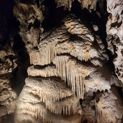
    First rule of the cave.. no pictures lol. Hence, no pictures are attached. They say it's because of…read moreaccidents reported from people not paying attention. Also, basically nothing is allowed in the cave. They had lockers that takes quarters but as far as I saw, no machine, you have to exchange with cash soooo prepare ahead. Leaving things in the car felt some what okay but not my favorite. I would appreciate if they had more security. They say they are not government funded so everything comes from public support. This was such a cool experience. You can tell the amount of work and detail they've put into the cave and preserving it. Truly different than other caves I've been to. There are two different parts of the cave you can choose from. If you can't do both my preference was the big room tour. I felt there was more to it, more things to see. Also, (sorry parents) perhaps the age limit made it more enjoyable too. Our tour guide Charles was INCREDIBLE. We did both tours back to back 0945 big room tour and 12 rotunda. Timing was perfect. Enough time to use the restroom and eat a snack. We brought our snacks, their cafe was closed. It would be an enjoyable experience to eat a packed lunch outside not sure if it's 100% allowed. Beginning of April was a GORGEOUS day. There's a McDonald about 12 min away. The big room tour is a man made/marked out, well paved easy walk/route. If you're worried about endurance or handiaccesible, it seems very accessible. The rotunda seemed a bit more incline but still well paved. You can wear white shoes and you wouldn't get dirty lol. I don't recommend open toes shoes/sandals because the Floor is very moist/wet. BOOK AHEAD. At least 2 weeks ahead to get the slots you want. If you're by yourself then a lot easier. It sells out quickly Restrooms were very clean and plentiful. As you wait for your tour guide before taking the tram to the cave there are another set of restrooms so that's appreciated. They want you to get there 30 min before. There really wasn't anything much to do ahead, it's just a simple check in. They have a mini museum that's nice to look around. You can get some good pictures outside prior or after the tour. Are both caves a must see, my bf says yes. I'm in between. If I would go back I would choose the big room tour again but that also has limited time opening due to the bats. As an AZ local or visiting this is a very enjoyable spot

    Largest wheelchair accessible cave in North America? Yes please. My review of the tour is incapable…read moreof describing the magnitude of what you'll experience. You see structures that are a million years old. You see rock layers millions of years old. Everything about this experience forced me to reflect on my place in the universe. That there has been a near infinite amount of history before me and there will be a near infinite amount of history after me. So I need to stop worrying and enjoy the majesty of this beautiful cave.

    Photos
    Kartchner Caverns State Park
    Kartchner Caverns State Park
    Kartchner Caverns State Park

    See all

    Saguaro National Park

    Saguaro National Park

    4.6(287 reviews)
    29.4 mi

    Another amazing drive through National Park. With the…read moreshutdown we were surprised to be able to drive thru. Just the drive was open. Desert beauty... huge cactuses and the variety of plants. Worth every minute that we were able to walk around the open areas. Saw no wildlife but plenty of footprints and scat. Will be back to be able to access more areas in the future.

    In any season but winter, I'd advise visiting early in the day to avoid the heat…read more We drove about 3o minutes from our hotel in Tucson to visit Saguaro NP. We stopped first at the visitors' center. We had a park pass, but otherwise here was where we'd have paid our fee. We checked in with the help desk to ask about short hikes. I admire the rangers for probably answering the same question a hundred times a day, 5 days a week. There is a loop road within a mile or two of the VC. It is unpaved, but it has 2 nice short hikes along the way. However, you should note: while 80% of the loop is 2-way traffic, the other 20% is NOT! Hence, unless you want to do more than a single pass around the loop, you should enter at the end nearest the VC and proceed CCW around the loop to the other end. We did 2 hikes here. The Signal Hill trail is on the side of the loop furthest from the VC. The Valley View trail is on the leg closer to the VC (but after the point where the road becomes 1-way). The Signal Hill trail is short. It descends from the parking lot down to a wash and then up around a hill. At the base you can see some rocks displaying petroglyphs. When you get to the top, you are quite close to several rocks with large carvings (spiral circles, etc.). There was adequate parking divided into a lower and upper lot. It may get crowded at other times, but when we visited (early) there were spots available. The Valley View trail is a bit longer but is mostly level. It winds through cactuses for a while until it ends at a point which overlooks the land to the west. You get a huge vista from this point, though on the day we went there was a lot of dust in the air which cut down on the view. Parking here was limited, but people just parked along the (1-way) road after the lot filled up. That could add a bit of extra hiking. Neither of these hikes is that strenuous. We spent a bit over 2 hours here, but it would have been a bit shorter if we'd started the loop at the correct end.

    Photos
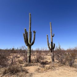
    Saguaro National Park - Cristate saguaro

    Cristate saguaro

    Saguaro National Park
    Saguaro National Park

    See all

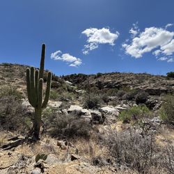
    Douglas Springs Trailhead - Saguaro National Park - The view of the trail.

    Douglas Springs Trailhead - Saguaro National Park

    4.9(20 reviews)
    29.1 mi

    What a glorious way to enjoy a spring day in the Sonoran desert…read more I hiked to Ernie's falls which was not flowing but had some trickling swimming holes and to Bridal Wreath falls which was flowing slightly. The views all around were glorious and the trail was well maintained. I only saw a few other people out there. Since I got there right around noon there were a few parking spots available. Such an easy trail to access, right off speedway. The sunset was incredible!

    ERNIE FALLS Take…read moreSpeedway east til it ends and you'll find a conglomerate of trails at the Douglas Spring trailhead that venture all around the area, up Mica mountain and towards Tanque Verde Falls. It's separate of Tanque verde falls area, just a quick note to that. Amongst several trails is this one that leads to Ernie Falls (seen on slide 10) which is currently a small trickle of water from recent rains. While there were smaller pools hiking in, then larger less stagnant ones at the fall area, my thought on this is that it's typically dry without consistent rain fall or snow melt. The hike itself is 6+ miles total, an in and out trail and fairly easy uphill hike inward getting to 1220ft in elevation. Coming back out is, as you can imagine, is downhill with leveling stretches. This is definitely family friendly. I got the experience of passing by several families that had quite young kids and even elderly folk. I would say this area is high traffic with limited parking at the trail head and more along the road. This is an exposed hike with no coverage, bring nourishment like power / energy providing snacks and water. Every week I get out and explore the trails, at least twice a week. For years I have been loving exploring new areas and this one is new to me so I'll be finding myself out here more. Hope to see you on the trails enjoying the act of presence and being.

    Photos
    Douglas Springs Trailhead - Saguaro National Park
    Douglas Springs Trailhead - Saguaro National Park - Wildlife ....

    Wildlife ....

    Douglas Springs Trailhead - Saguaro National Park

    See all

    Murray Springs Clovis Site - Informative sign

    Murray Springs Clovis Site

    4.0(1 review)
    28.7 mi

    This site is the oldest dig site in North America. It proves that people lived and hunted here…read moreover 12,000 year ago. It's a place to come to to see the area once inhabited by hunter-gatherers. There are no bones here, just signs to read and a place to stroll through to get away from the city. This interpretive dirt trail is under a mile long. Dogs are allowed here but must be leashed. The trail is not ADA friendly because it requires one to walk down and up steps and walk across a wash. Heavy monsoons have damaged the steps several times in the 18 years I have been here. Managed by the Bureau of Land Management (BLM), this is a free site to enjoy, but be aware that in the summer months it can get overgrown and very hot. The mesquite trees along the trail provide only little shade. It takes about 30 minutes to an hour to read all the signs and walk the loop. It's an exposed trail best done in cooler, overcast weather as there is no shade and no water. However, if you feel like exploring the area and have a dog, walk into the wash going northeast and you will hit the actual Murray Springs. It is not on the trail. Or just stay on the access trail that takes you to the San Pedro Riparian National Conservation Area (SPRNCA) trail, marked with iron wrought poles. The area closes at dusk so be aware of that. The San Pedro river area is popular with illegal border crossers because of the water, and you may find their trash along the trail, along with dog poop left by dog walkers. Be careful when in the area at dawn and dusk not only for illegals, but for coyotes, javelina, and snakes. There is a restroom with pit toilets in the big parking area. Horses and bikes are allowed on the access trail to the SPRNCA trail, but are not allowed on the short interpretive loop trail.

    Photos
    Murray Springs Clovis Site - Warning signs

    Warning signs

    Murray Springs Clovis Site - Trail goes across wash

    Trail goes across wash

    Murray Springs Clovis Site - Watch out for right turn to the site near start of trail. Trail to the left takes you to the SPRNCA trail 1.7 miles.

    See all

    Watch out for right turn to the site near start of trail. Trail to the left takes you to the SPRNCA trail 1.7 miles.

    Rancho Del Lago Dog Park - The double gated entry area with the nice gravel and hard dirt

    Rancho Del Lago Dog Park

    3.0(1 review)
    24.7 mi

    First and foremost it is a dog park to some degree. When you realize it is surrounded by half a…read moremillion dollar homes, you also understand that they only put the dog park here as a selling feature of the developer. This is very popular in Texas except they have very nice parks in the new developments with trees and grass and all kinds of other stuff that dogs hate. Here are the kept all that stuff out of the park and basically they have ground that feels like concrete but looks like dirt and they've thrown some rocks down on it because we know how dogs love stepping on rocks. There is no shade in the dog park, there is no water in the dog park, there is no trash can in the dog park, there are no poop bags in the dog park except one someone has kindly tied on to the fence. They have a fire hydrant and a plastic tube for the dogs to go through and something for them to jump through. Now outside the dog park they have a nice shaded structure with a nice water fountain and a trash can? Which means you have to leave the dog park to go throw the poop away? So anyway after a little over 2,000 dog park visits all across the country, this was a bit of a disappointment for me and young lady

    Photos
    Rancho Del Lago Dog Park - The step on water fountain that is actually outside the dog park?

    The step on water fountain that is actually outside the dog park?

    Rancho Del Lago Dog Park - Surrounded by half million dollar homes? Maybe that's why they cheaped on the dog park

    Surrounded by half million dollar homes? Maybe that's why they cheaped on the dog park

    Rancho Del Lago Dog Park - A fire hydrant and a couple other agility items and the hard deck with the rocks on it?

    See all

    A fire hydrant and a couple other agility items and the hard deck with the rocks on it?

    Benson City of - parks - Updated August 2026

    Loading...
    Loading...
    Loading...